
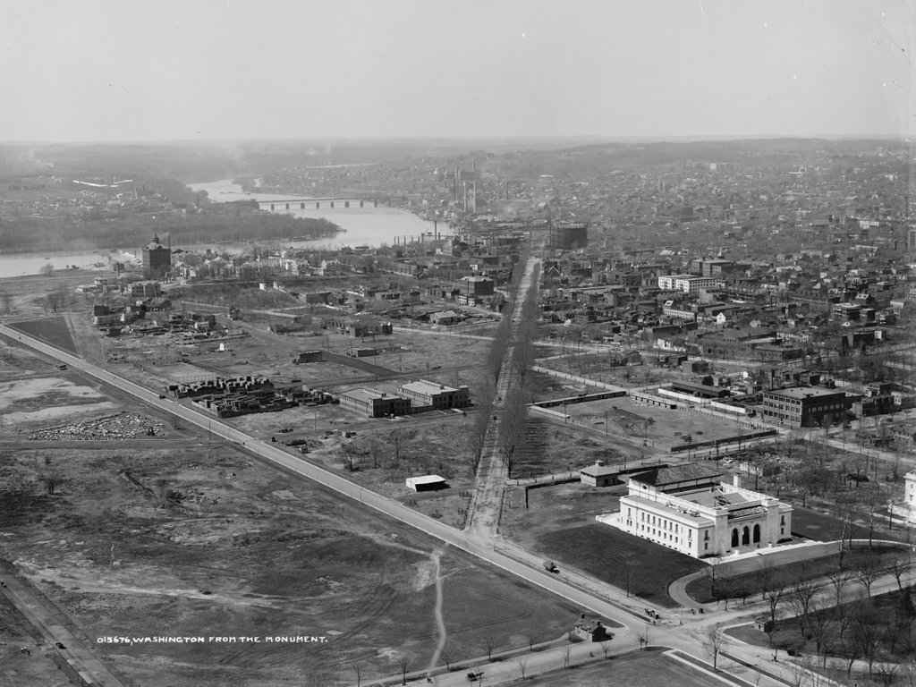
The view from the top of the Washington Monument, taken between 1906 and 1915. Image courtesy of the Library of Congress, Detroit Publishing Company Collection.
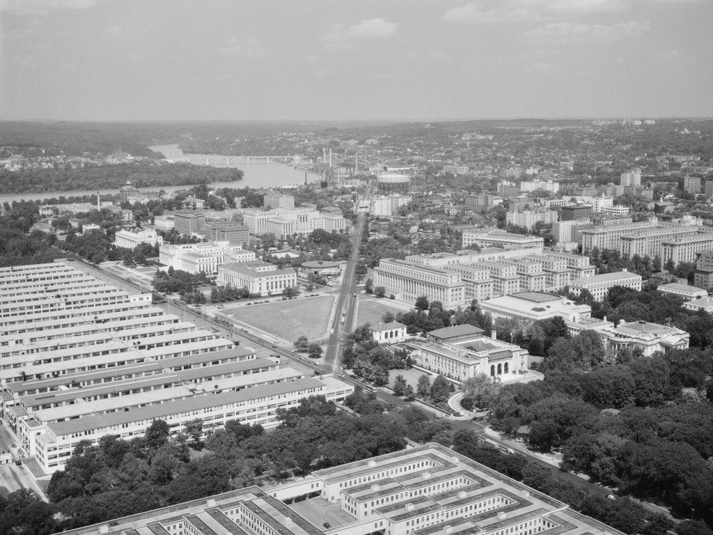
The scene in 1945. Image courtesy of the Library of Congress, FSA/OWI Collection.
The same view in 2021:
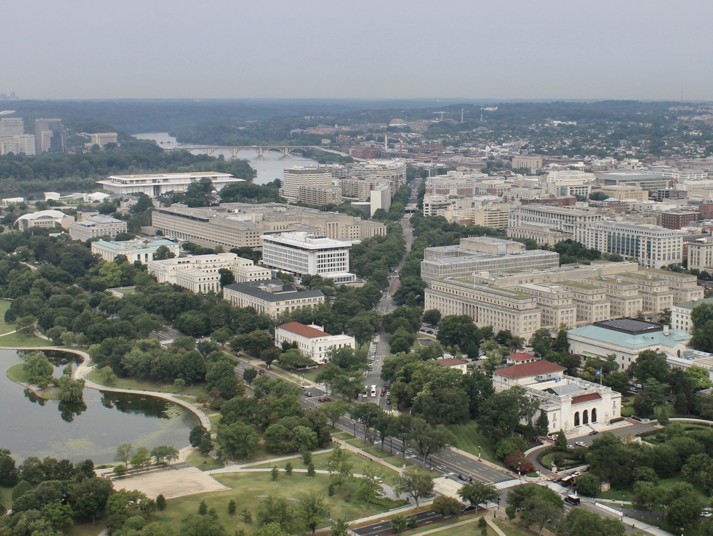
All three of these photos are taken looking almost directly down Virginia Ave., but other than the street network, not much remains from the early 1900s photo. As least two buildings are identifiable in both that photo and the 2021 scene: the white building in the lower right, and the building to the right of it (which is barely visible in the first photo). They are the Organization of American States and the Daughters of the American Revolution buildings, respectively.
Otherwise, the area looks remarkably sparse in the first photo, primarily because most of the land in the foreground did not exist before the 1880s, when the Potomac River was dredged, and the dredged material used to fill in this area to address flooding issues. The Constitution Gardens, visible in the lower left of the 2021 photo, would not exist for another 70 years. Shortly after the first photo was taken, the Navy built temporary offices during World War I. These “temporary” offices, which are shown in the 1945 photo, lasted into the 1970s, when they were demolished to create the pond and parkland visible today.