Custom House Tower, Boston

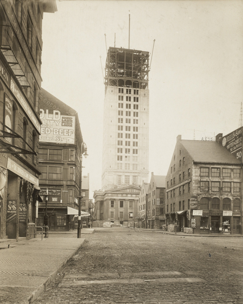
The Custom House Tower in Boston, as seen from Quincy Market during its construction, around 1913-1915. Image courtesy of the Boston Public Library.

833_1913-1915c bpl

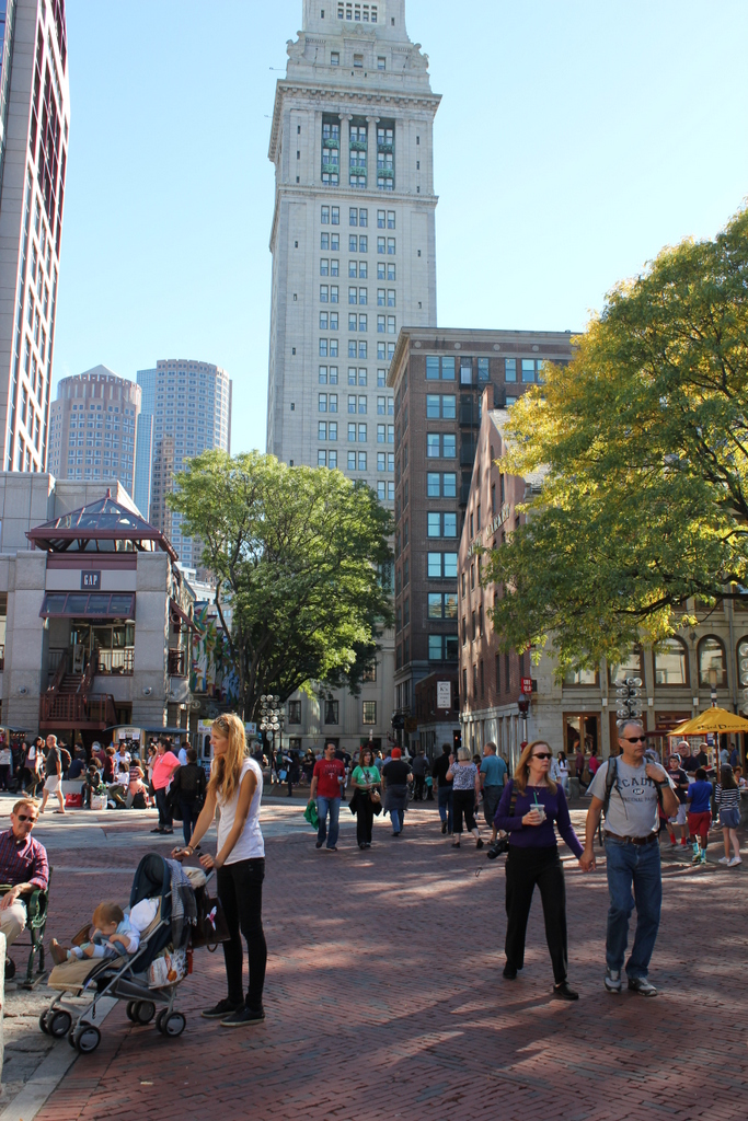
The scene in 2015:

833_2015
As explained in this earlier post, Boston’s Custom House was built in 1849, with a convenient location near Long Wharf that easily allowed officials to inspect incoming cargoes. Boston’s role as major seaport grew over the years, though, and by the early 1900s it was necessary to expand it. Rather than demolishing the old building, though, they simply added a 32-story skyscraper on top of it. At the time, Boston had a 125 foot limit on skyscrapers in the city, but as a federal building the Custom House Tower was exempt. At 496 feet tall, it was nearly four times the maximum height, and it dominated the Boston skyline for many years, as this early 1930s view of the city shows.

The c.1913-1915 photo above shows the building during its construction, with the original 1849 structure clearly visible at its base. It would remain the tallest building in the city until the completion of the Prudential Tower nearly 50 years later, and it would be used by US Customs until 1986 when they moved into the Thomas P. O’Neill, Jr. Federal Building. After a long period of vacancy, the historic tower is now a Marriott Hotel, and it is part of the Custom House District on the National Register of Historic Places.

Beacon Hill Reservoir, Boston

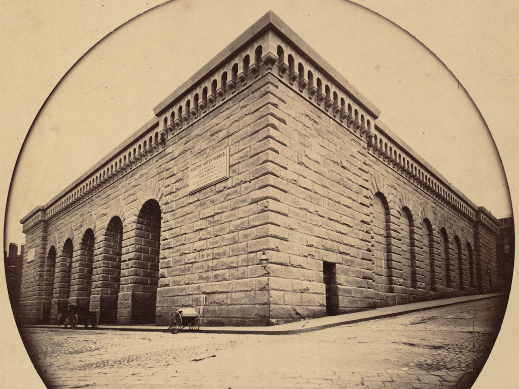
The reservoir atop Beacon Hill in Boston, around 1860. Image taken by Josiah Johnson Hawes, courtesy of the Boston Public Library.

828_1860 bpl

The scene in 2015:

828_2015
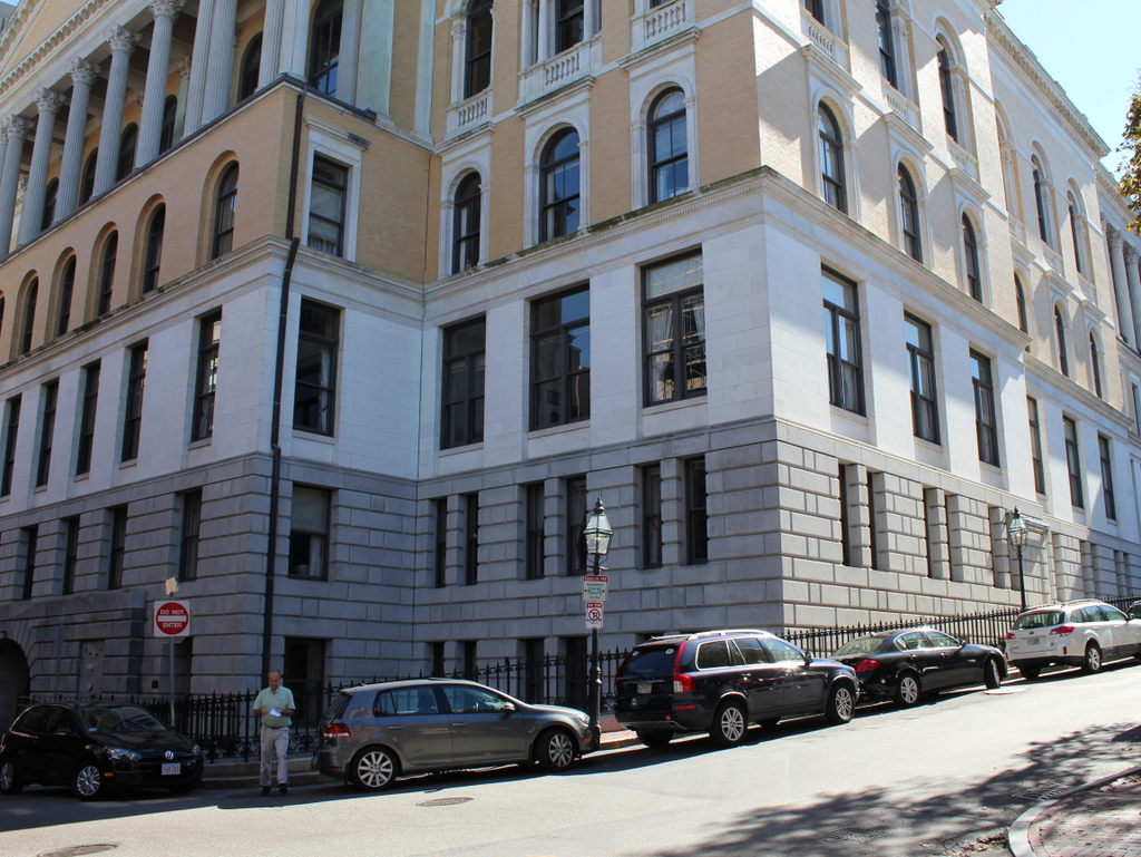
Long before the Wachusett and Quabbin Reservoirs, Boston’s municipal water supply was Lake Cochituate, a reservoir in Natick, Framingham, and Wayland. The project began in 1845, and it included not only creating the artificial lake, but also building a 14-mile long aqueduct that fed this stone reservoir atop Beacon Hill, just behind the Massachusetts State House. From here, the water was distributed throughout the city, using the hill’s elevation to carry the water downhill through the pipes. It occupied the majority of the block between Hancock, Derne, Temple, and Mt. Vernon Streets, and it had a capacity of over 2.6 million gallons.

The structure’s cornerstone laying ceremony in 1847 included a time capsule, which contained several publications and two silver plates, perhaps in the hope that, like the great Roman aqueducts in Europe, this public water supply structure would last for thousands of years. However, as it turned out, it lasted for less than 40. It closed by about 1880, and around three years later it was demolished to build a large expansion of the Massachusetts State House, which now occupies the site where this reservoir once stood.

Main Street, Lee, Mass

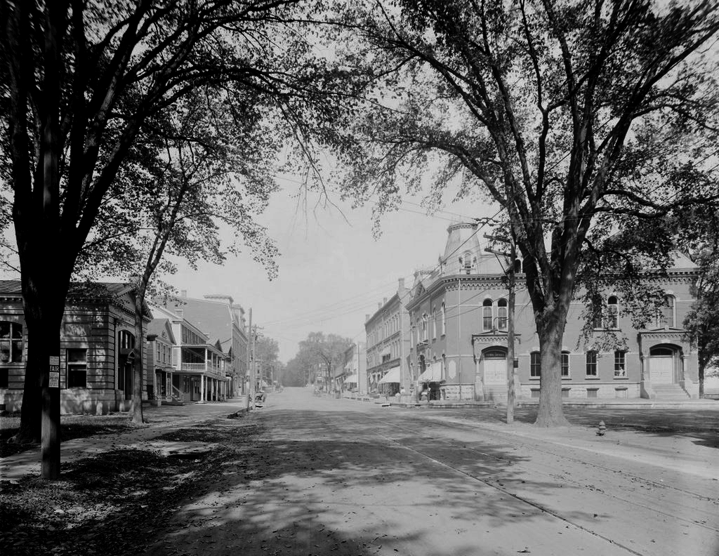
Looking north on Main Street from near Park Street in Lee, in 1911. Image courtesy of the Library of Congress, Detroit Publishing Company Collection.


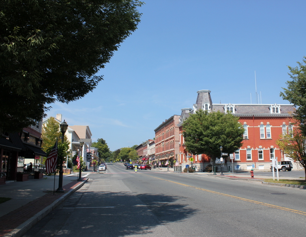
Main Street in 2015:

785_2015
The town of Lee is situated in the Berkshires region of Western Massachusetts, and in the 19th century it was a small but prominent industrial town. At its peak, the town had several dozen paper mills and several marble quarries, and the town’s prosperity was reflected in its downtown area here along Main Street. Most of the buildings in this scene date to the mid to late 19th century, including the historic Memorial Town Hall to the right. It was completed in 1874, and has housed the town offices ever since. Through the years, it has also taken on a variety of other uses, including a post office, Grand Army of the Republic hall, barber shop, movie theater, district court, and police station. In 1965, singer Arlo Guthrie faced littering charges in the courtroom here, an incident which later inspired his famous song “Alice’s Restaurant.” Today, in addition to the town offices, it is also the town police station, and although it has undergone renovations in 1912 and in 1990-1991, its exterior has remained well preserved for over 140 years.

Just beyond the Memorial Town Hall is the Baird and Benton Block, a three story commercial building that was built in 1875 by paper manufacturers Prentiss Baird and Charles and James Benton. It originally had a mansard roof like the neighboring Town Hall, but the roof was destroyed in a fire in the late 1800s. Aside from renovations to the first floor storefronts, the building’s appearance is similar to what it looked like in 1911, but the upper two floors were vacant from the 1950s until a renovation in 2012 that converted it into classroom and office space.

Most of the other commercial building in the scene date from the second half of the 19th century, but the oldest is the Morgan House, the wood-frame building with the two story porch on the left side of Main Street. It was built in 1817 by William Porter as a house, and in 1867 it was purchased by Edward Morgan, who enlarged the original building and turned it into the Morgan House inn. Over the years, its guests have included Ulysses S. Grant, Grover Cleveland, John F. Kennedy, and George Bernard Shaw, and today it is still operated as an inn and restaurant.

Overall, the only significant change to this scene is the Park Building, located on the far left where the Lee Savings Bank building stood in the 1911 photo. It was built just a few years later in 1914, and it is one of the newest buildings along this section of Main Street. The entire area is now part of the Lower Main Street Historic District on the National Register of Historic Places, and it is an excellent surviving example of a historic 19th century New England town center.

Post Office, Monson, Mass

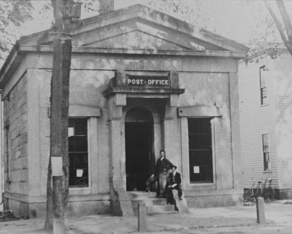
The post office at the corner of Main and State Streets in Monson, around 1893. Image courtesy of the Monson Free Library.

751_1893c mfl

The scene in 2015:

751_2015
The building in the first photo was built in 1855 for the recently-established Monson National Bank.  In 1872, Monson Savings Bank was also created, and the two companies shared the same counter, tellers, and vault within this small building until 1893, when a larger one was completed just a short walk down Main Street from here.  That same year, the nearby Central Block, which housed the post office, was destroyed in a fire, so the post office was moved to the recently-vacated bank building.  It later moved back to the Central Block location when a new building was completed on the site.

I don’t know exactly when it was demolished, but it would have been sometime before 1925, when the original Monson High School was built here.  The school building was converted into the town offices in the early 1990s, but it sustained heavy damage in the une 1, 2011 tornado, and it was demolished in 2013.  A new town office building, seen to the right in the 015 photo, was completed earlier in the year.

John Brown’s Fort, Harpers Ferry, West Virginia

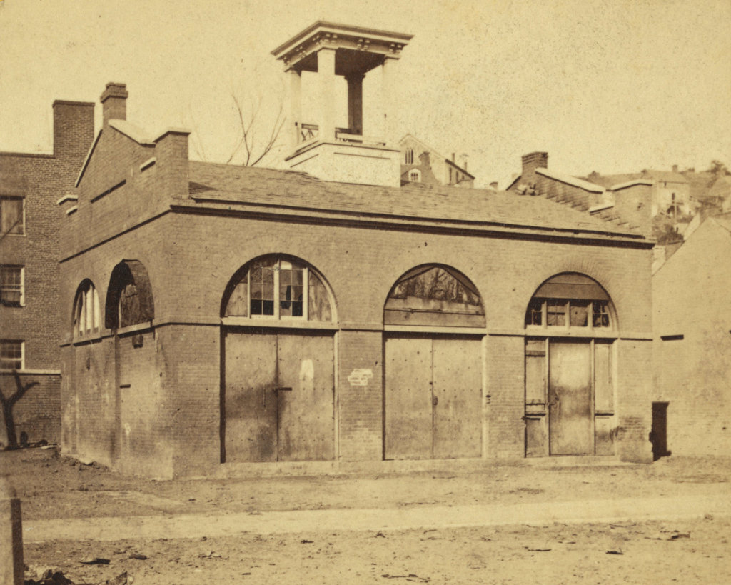
The fire engine house at the Harpers Ferry Armory, more commonly referred to as “John Brown’s Fort,” as seen around 1860. Image courtesy of the Library of Congress, Civil War Collection.

732_1860c loc

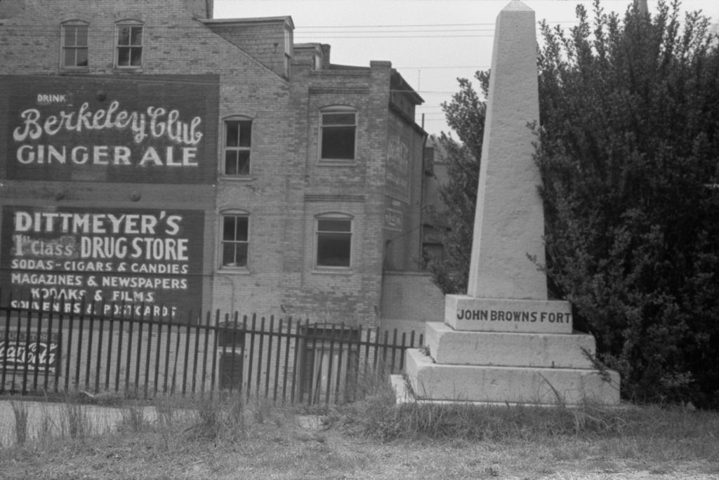
The same view in May 1939. Image courtesy of the Library of Congress, FSA/OWI Collection.

732_1939-05 loc

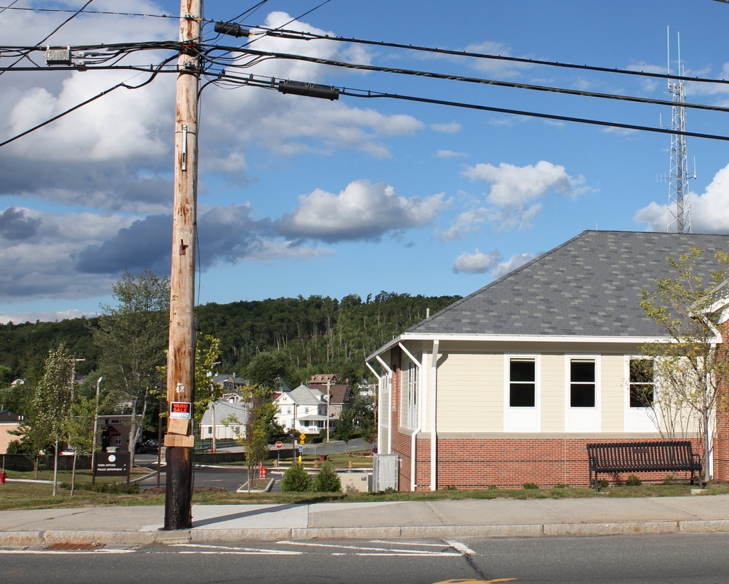
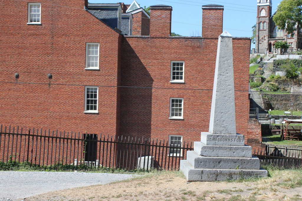
The scene in 2015:

732_2015 loc
This small, seemingly nondescript building was built in 1848 at the entrance to the Harpers Ferry Armory, and was used as a guard house and fire engine house.  Normally, such a building would not be the subject of an 1860s stereocard, but it gained widespread fame just a few years earlier, due to its role in John Brown’s raid on the armory.

On October 16, 1859, northern abolitionist John Brown led a group of 22 men who attempted to take the armory and start a slave rebellion. They succeeded in taking the armory, and took a number of Harpers Ferry citizens hostage, but the plan quickly unraveled and they ended up barricading themselves in this building, surrounded by local militiamen and other armed townspeople.  Eventually, Colonel Robert E. Lee, still fighting in the US Army at the time, led a detachment of Marines, who succeeded in taking the building and capturing John Brown and most of his men.

To many northern abolitionists, John Brown was a hero, but to southern slaveowners he was a dangerous radical and a criminal. He was executed on December 2 in nearby Charles Town, but the failed raid helped to set the Civil War in motion a little over a year later.  The first photo was probably taken within three years of the raid, and in it the building still bears some of the scars from the fight.

Unlike most of the armory buildings, this one actually survived the war, and over time it became a tourist attraction and a symbol of the abolitionist movement. However, many residents feared that it would become a major draw for African-Americans to visit the town, so they were looking for ways to get rid of it.  Finally, in 1891 the owners decided to dismantle the fort and reassemble it at the World’s Columbian Exposition in Chicago.  It was a colossal failure at the exposition, though; the move cost $60,000, and just 11 people paid the 50 cent admission fee to view the fort.

The fort underwent further dismantlings and reconstructions, before eventually moving to its present-day site about 150 feet to the right of here.  However, it doesn’t have much real historic value, because of the number of times it has been reconstructed and the amount of original materials that has been lost over time.

After the fort was moved from here, the Baltimore & Ohio Railroad built new railroad embankments through the site of the fort, so today it is at a substantially higher elevation than it was in the first photo.  The monument, seen in the last two photos, was added by the railroad and marks the original location.

Harpers Ferry, West Virginia (2)

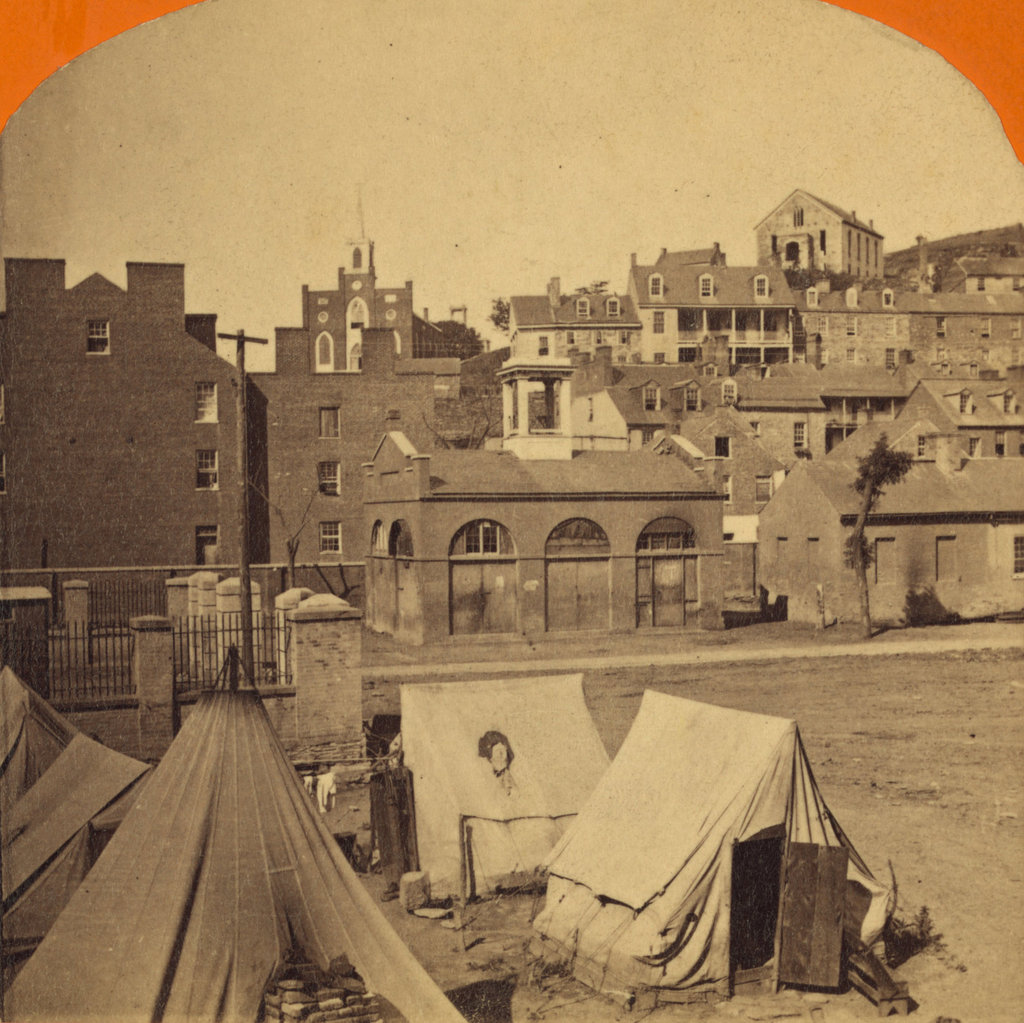
The town of Harpers Ferry, photographed around 1862. Image courtesy of the Library of Congress, Civil War Collection.
731_1860c loc

The view in 2015:

731_2015 loc
These two views of Harpers Ferry are remarkably similar, considering how much damage the small town sustained during the Civil War.  The Library of Congress estimates that this photo was taken around 1860, which seems a little too early.  This photo is half of a stereocard from a series called “War Views,” and since the war didn’t start until 1861, it seems unlikely that it was taken before then.  Instead, it was probably taken around 1862; the tents in the foreground were part of a “contraband camp” that the Union army established on the grounds of the former armory in March 1862 to house escaped slaves from the Confederacy.

A number of notable buildings are visible here, with the most prominent being the Armory fire engine house, better known as “John Brown’s Fort,” seen in the center of the photo and explained in more detail in this post.  To the left of the “fort” is the Gerard Bond Wager Building, a three and a half story brick building that was completed in 1838.  Prior to the Civil War it was used as a grocery and dry goods store, and it is still standing today and is operated by the National Park Service as a museum.

Beyond the Gerard Bond Wager Building is St. Peter’s Roman Catholic Church, which was built in 1833 and is still standing today, although with some extensive alterations.  It survived the Civil War, but it was renovated in 1896 to bring its exterior in line with the then-popular Neo-Gothic architectural style.  The original brick walls were replaced with granite, the steeple was removed, and a new asymmetrical facade was built with a taller steeple on the left side.

Another church in the original scene was St. John’s Episcopal Church, seen on the top of the hill to the right.  It was built in 1852 and sustained damage during the war, eventually being repaired in 1882.  However, it was subsequently abandoned in 1896, and today the picturesque ruins are still there, although they are hidden from view by the trees in the 2015 photo.

The last of the prominent historic buildings in these two photos are the four in a row next to each other, seen just below St. John’s Episcopal Church.  All four are still standing today, and the left-most of these is the Harper House, which is the oldest surviving building in the lower town.  It was completed in 1782 by Robert Harper, the town founder who not coincidentally operated a ferry here.  He died the same year it was completed, and it was later used as a tavern, a private residence, and by the start of the Civil War as a tenement house, accommodating up to four families.  To the right of the Harper House is Marmion Hall, which was completed in 1833, and the last two buildings to the right were built in the 1840s as the Marmion Tenant Houses.  These last two were, prior to the war, rented out to armory workers, who were just a short downhill walk away from their jobs.

Today, railroad tracks cover much of the former armory site, and nearly all traces of the historic site are long gone.  However, the town that grew up here because of the armory is, for the most part, preserved in its pre-1860s appearance.  Much of the lower town is now part of the Harpers Ferry National Historical Park, and is run by the National Park Service.