Springfield Street and Casino Avenue, Chicopee, Mass

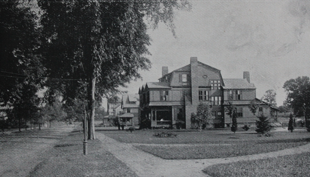
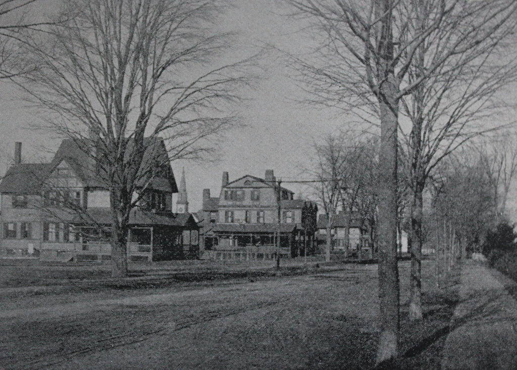
Looking north on Springfield Street from the corner of Casino Avenue in Chicopee, around 1892. Image from Picturesque Hampden (1892).
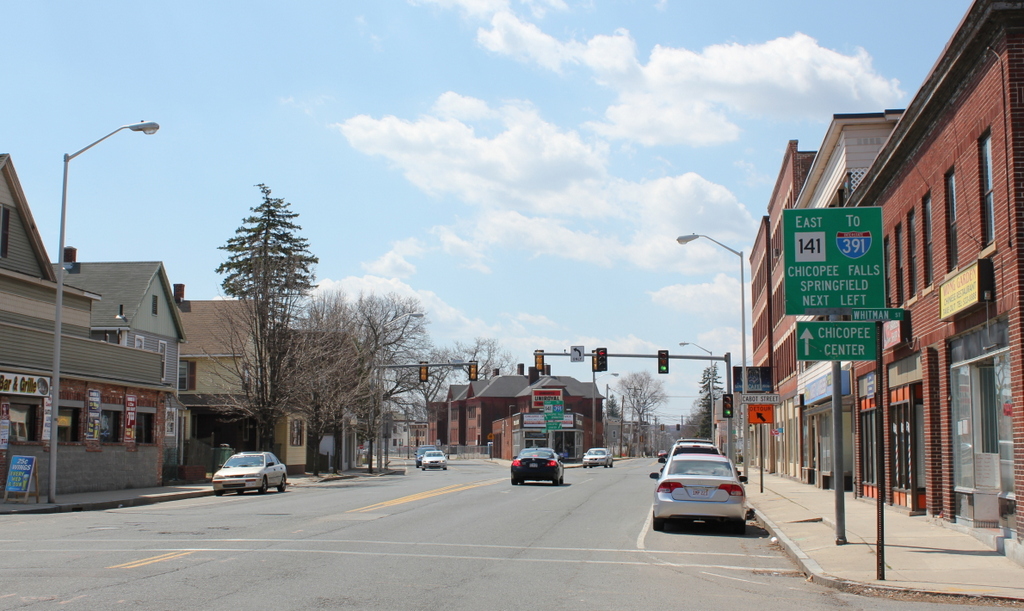
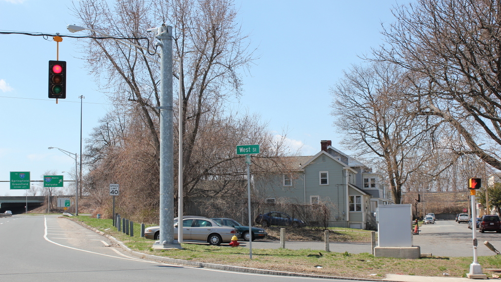
The scene in 2017:

These views show the same scene as the ones in the previous post, just from the opposite angle. As mentioned in that post, this section of Chicopee was developed in the late 19th century by Frank E. Tuttle and James L. Humphrey, with Tuttle living in the large house in the center of the photo. This house was built in 1888, and most of the other ones in this area date to around the same time. Development was still ongoing when the first photo was taken in the early 1890s, and several more homes would be built in this scene by the early 20th century.

The Queen Anne-style house on the left was built in 1885, and was the home of William W. McClench, an attorney who served as the second mayor of Chicopee in 1892. He had been the unsuccessful Democratic candidate in the city’s first mayoral race, but in the next election he was nominated by both political parties and was unanimously elected mayor. In 1893, he returned to his law practice, forming a partnership with Frederick H. Gillett, a Congressman who later went on to serve as Speaker of the House from 1919 to 1925.

William McClench and his wife Katherine had three children: Marion, Cora, and Donald, and they lived here in this house until 1900, when they moved to a house on Sumner Avenue in Springfield. In 1898, William had become the general counsel for the Springfield-based Massachusetts Mutual Life Insurance Company, and he would later become second vice president and, in 1908, the president of the company.

Much has changed here in the 125 years since the first photo was taken, and the neighborhood is now the home of Elms College, which is located just out of view on the right side of the photo. Both of the houses from the first photo are still standing, although both have had significant exterior alterations. The Tuttle house has been the Grisé Funeral Home since the 1920s, and now has a cupola, artificial siding, and changes to some of the porches. The McClench house also has modern siding, along with an enclosed porch, and most of its original Queen Anne-style details are now gone. However, despite these changes, both houses are now part of the Springfield Street Historic District, which was added to the National Register of Historic Places in 1991.

Springfield Street and Stearns Terrace, Chicopee, Mass

Looking south on Springfield Street from the corner of Stearns Terrace in Chicopee, around 1892. Image from Picturesque Hampden (1892).

The scene in 2017:

Until the late 19th century, this section of Chicopee was primarily farmland, with little development to the south of South Street and Fairfield Avenue. However, this began to change by the 1880s, as Chicopee grew into a major manufacturing center. This particular area, located just south of the city center between Springfield and Hampden Streets, was developed by Frank E. Tuttle and James L. Humphrey, who built a number of upscale homes on a 50-acre parcel that had once been the farm of Veranus Chapin. The development was named Veranus in his honor, and consisted of gently-curving side streets, as well as an elm-lined Springfield Street, as seen here.

The house in the center of the photo was Frank Tuttle’s own home, and was built in 1888 on the west side of Springfield Street. Originally from Chicopee, Tuttle had moved to Springfield with his parents when he was a teenager, and he spent his early adulthood working as a bookkeeper for Howard & Brothers, a railroad supply company. He later went into business for himself, forming a partnership with John Olmstead. They dealt in cotton waste, using excess material from cotton mills to produce items such as felt mattresses, carpet linings, floor mops, comforters, and a variety of other consumer products. Their company was originally located in Springfield, but in 1887 they moved to a new facility here in Chicopee, next to the land that he and Humphrey would develop.

Frank Tuttle’s first wife was Mary C. Stearns, whose father, George M. Stearns, was a politician and lawyer who, from 1886 to 1887, served as the United States Attorney for the District of Massachusetts. They were married in 1876, and had two children, one of whom died in infancy. Mary died in 1883, and two years later Frank remarried to Sarah F. Knapp. He and Sarah did not have any children together, but they lived here in this house with Emily, Frank’s daughter from his first marriage, who was about 10 years old when this house was built.

Frank lived here in this house until his death in 1913, and within a few years Sarah and Emily moved to Boston. However, Sarah later returned to western Massachusetts, living in Springfield until her death in 1947. In the meantime, this house was sold to Charles C. Abbey, a businessman who owned the Springfield Coal and Wood Company. Along with this, he was the president of the Chicopee Falls Wheel Company and the Chicopee Co-Operative Bank, and he was also a director of the Chicopee Street Railway. Charles lived here with his wife Emily and her elderly mother, Mary Lombard, until his death in 1919 at the age of 66. Emily’s father had died in 1865 while serving in the Civil War, and her mother died in 1920, at the age of 89.

Emily moved out of this house soon after her mother’s death, and by the late 1920s the house had become the Grisé Funeral Home. At some point over the years, the house saw some changes, including an addition of a cupola, some alterations of the second-story porch, and modern siding. However, it is still in use as the Grisé Funeral Home, and it is part of the Springfield Street Historic District on the National Register of Historic Places.

The surrounding neighborhood has also undergone some significant changes since the first photo was taken. Most of the homes that Tuttle and Humphrey built in the late 19th century are still standing, but there are also a few more recent homes, including the one on the right side of the photo, which was built in 1926. The elm trees that once lined Springfield Street are long gone, presumably lost to Dutch Elm Disease in the mid-20th century. However, the name of the trees lives on with The College of Our Lady of the Elms, better known as Elms College, which is located directly across the street from here on the left side of the photo.

Willimansett Y, Chicopee Mass

The “Y” intersection of Chicopee Street and Meadow Street in the Chicopee village of Willimansett, around 1917. Image courtesy of the Chicopee Public Library, Russ H. Gilbert Photographic Collection.

491_1917c chicopeepubliclib

The “Y” in 2015:

491_2015

In the early 20th century, the city of Chicopee experienced a large population growth, much of which was made up of Polish and French Canadian immigrants.  Each group settled in particular neighborhoods, and Willimansett became home for many French-Canadian immigrants, including my great-great-grandparents, who lived a block away from here in the 1920s.  From here, workers could commute a short distance by trolley to either the Holyoke mills across the river, or the mills along the Chicopee River a few miles to the south.

This intersection of Chicopee and Meadow Streets became known as the “Y”, so-named because of the angle at which the streets merge.  This is the primary commercial center of Willimansett, but in the early 1900s it was still fairly undeveloped.  The commercial blocks on the right weren’t there yet, nor were the houses to the left.  The only prominent building that appears in both photos is the Chapin School, which can be seen in the distance in the middle of the fork.  It opened in 1898, and had several additions put on as Willimansett grew in population.  Today it is vacant, but it is currently planned to be converted into apartments for veterans.

Probably the most interesting thing about the “Y”, however, is something that does not appear in either photo.  In the 1930s, a grocery store opened here, called the Y Cash Market.  They are no longer in Willimansett, but the name lives on – today the company is Big Y, one of the largest grocery store chains in New England.

Center Street, Chicopee

Center Street in Chicopee, probably in 1918. Image courtesy of the Chicopee Public Library, Russ H. Gilbert Photographic Collection.

490_1918c chicopeepubliclib

Center Street in 2015:

490_2015


One of the busiest sections of road in Chicopee is completely void of traffic in the 1918 scene, but it wasn’t necessarily because people lacked cars.  At this point, cars were becoming more common among the middle class, but this became a problem during World War I.  Because of the war demand for fuel, the federal government implemented programs to help reduce fuel use.  One of these plans was “gasless Sundays,” when people were encouraged to avoid driving on Sundays, thus saving a substantial amount of gasoline.  I don’t know how effective it was overall, but evidently it worked in Chicopee – the first photo was taken during one of these “gasless Sundays,” and sidewalks are full of people, with nary a car in sight.

The only real change in these two views, other than the presence of automobiles, is the building on the far left.  This building at the corner of Center and Exchange Streets was replaced by the Starzyk Building in 1921.  Otherwise, the other buildings are still there: the Spalding factory in the distance, the 1871 Chicopee City Hall to the right, and the old 1911 Chicopee Public Library building.

Starzyk Building, Chicopee Mass

The Starzyk Building at the corner of Center Street and Exchange Street in Chicopee, around 1921. Image courtesy of the Chicopee Public Library, Russ H. Gilbert Photographic Collection.

489_1921c chicopeepubliclib

The building in 2015:

489_2015

The Starzyk Building has been a prominent building in downtown Chicopee for nearly a century, and the first photo was taken right around the time that the original building was completed.  It was owned by Paul Peter Starzyk, a Polish immigrant who came to Chicopee in the early 1890s and worked in the mills of Dwight Manufacturing Company, the same place where social reformer Lewis Wickes Hine would later document child labor conditions in the early 1900s.  Starzyk didn’t work in the mills for too long, though, because he later went into business for himself, selling men’s clothing.  His business was successful enough that he was able to build this building in 1921, and a year later he expanded it on the right-hand side.  The first photo was taken before this wing was added.  Today, the storefront windows have been altered, but otherwise its exterior appearance hasn’t changed much.  It is still used for retail and office space, and is still one of the main commercial buildings in downtown Chicopee.

Solin’s Market, Chicopee Mass

Solin’s Market, at the corner of Center and West Streets in Chicopee around 1919. Image courtesy of the Chicopee Public Library, Russ H. Gilbert Photographic Collection.

488_1919c chicopeepubliclib

The location in 2015:

488_2015

This grocery store was owned by Michael Solin, and was established in the early 1900s to serve the growing Polish community in Chicopee.  I can’t read all of the writing on the windows, but it appears that some of the purchases that could be made here included sugar for 7 cents a pound, butter for 35 cents a pound, eggs for 28 cents a dozen, and milk for 11 cents a quart.  “Fresh shoulders” are also apparently available, although no price is given, so perhaps the market price varied from day to day.  These seem like great buys, but of course wages were also much lower back in 1919.  In 2015 dollars, the sugar would cost $0.95, the butter would be $4.75, the eggs $3.80, and the milk $1.49 (for a quart, so a gallon would be $5.96).  All of these are comparable to or higher than prices today, so the deals weren’t as great as they appear at first glance.

But, just as buying milk for 11 cents a quart is a thing of the past, so is the building that once housed Solin’s Market.  I don’t know when it was demolished, but the property was probably needed to widen Center Street and make room for the I-391 on-ramp.  The street to the right, Abbey Street, is now closed off to traffic from this end, and some of the houses on that street are probably the only things left from the 1919 photo.