Tremont Street Trolleys, Boston

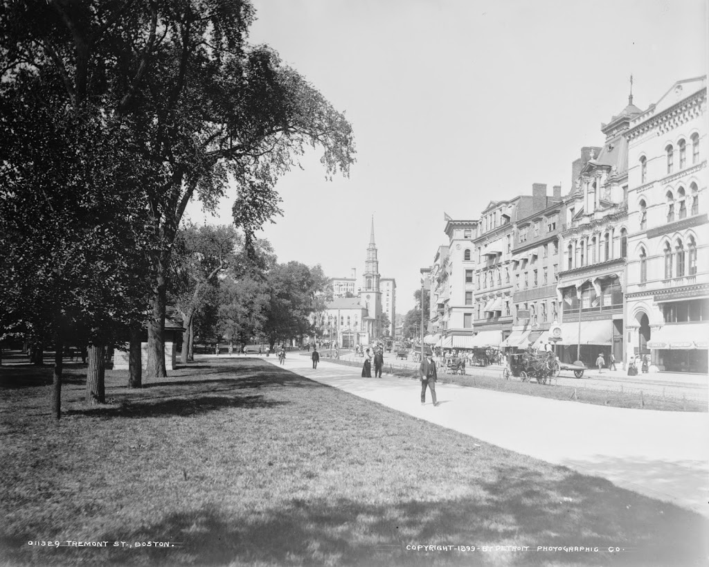
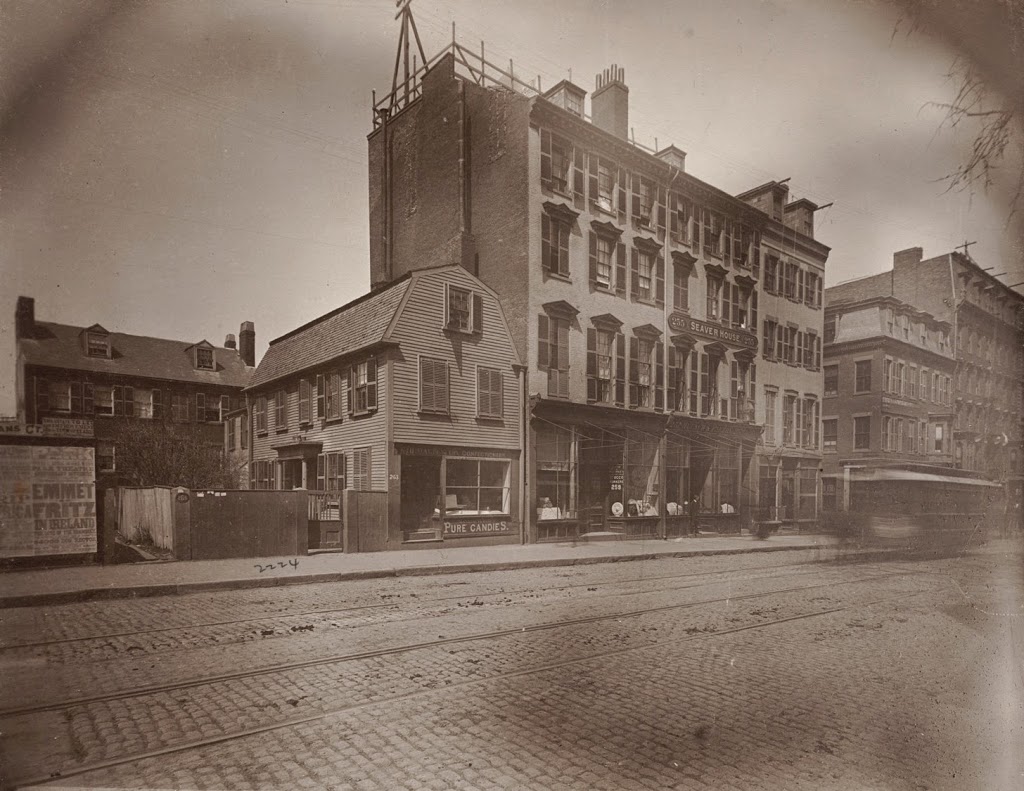
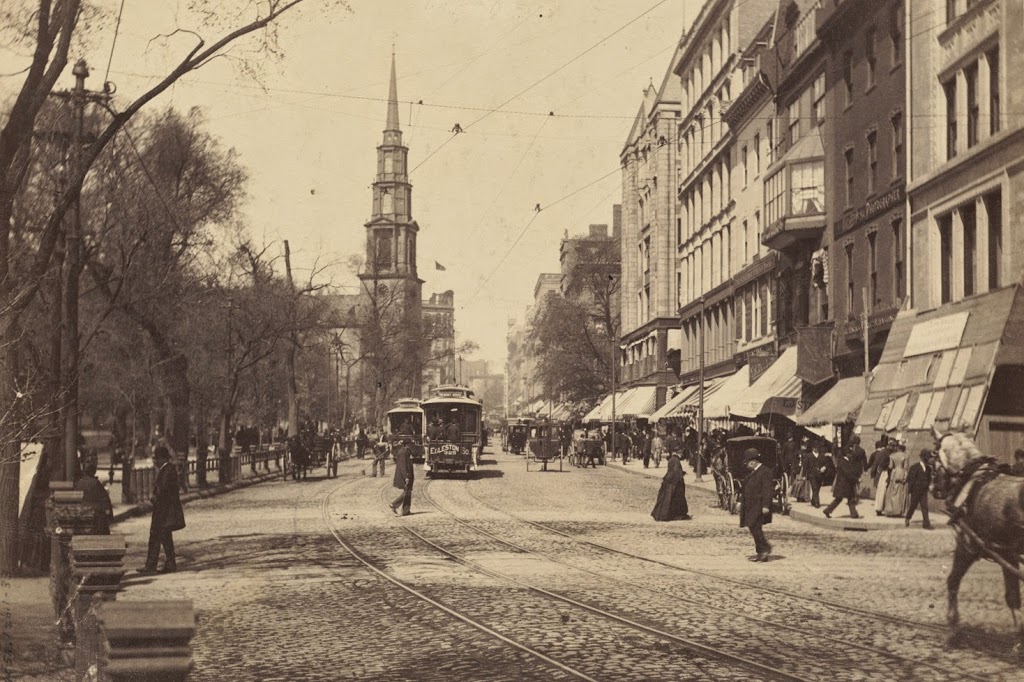
Looking up Tremont Street toward Park Street Church in Boston, in 1895. Photo courtesy of Boston Public Library.

335_1895-2Bbpl

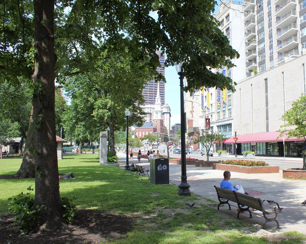
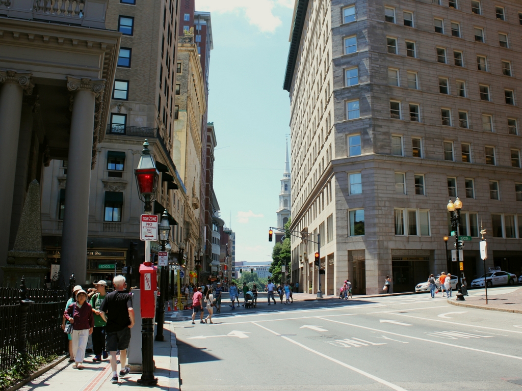
Tremont Street in 2014:

335_2014

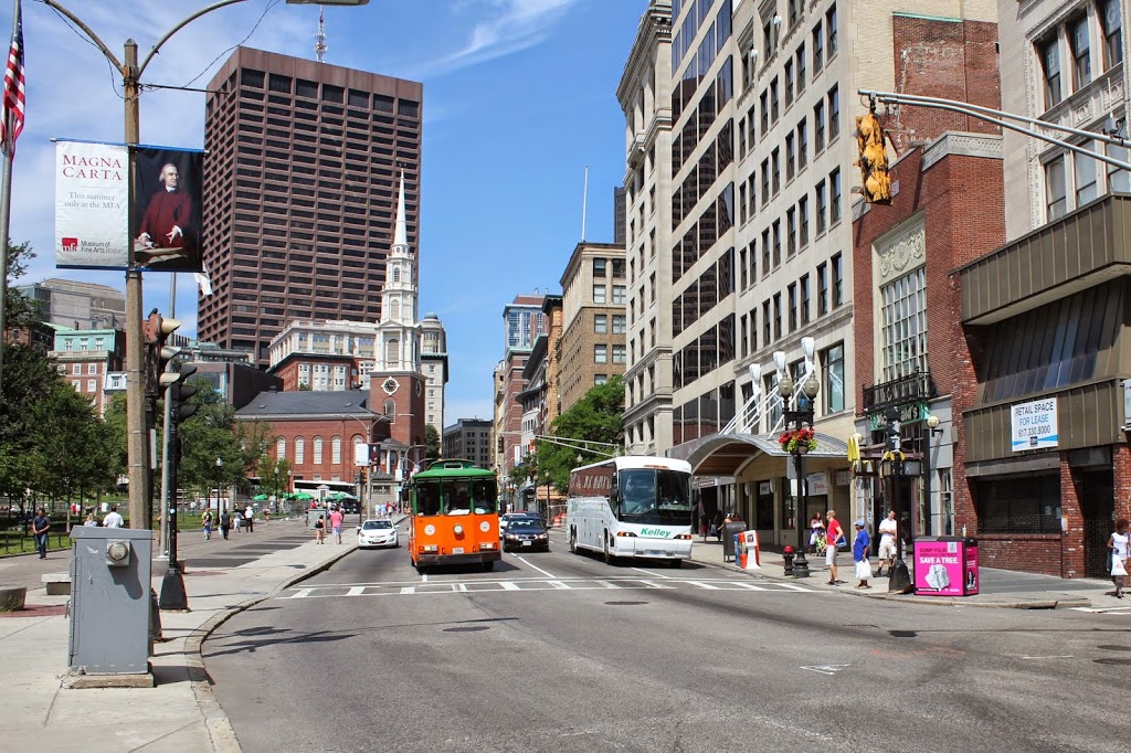
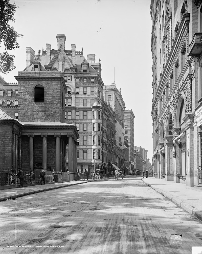
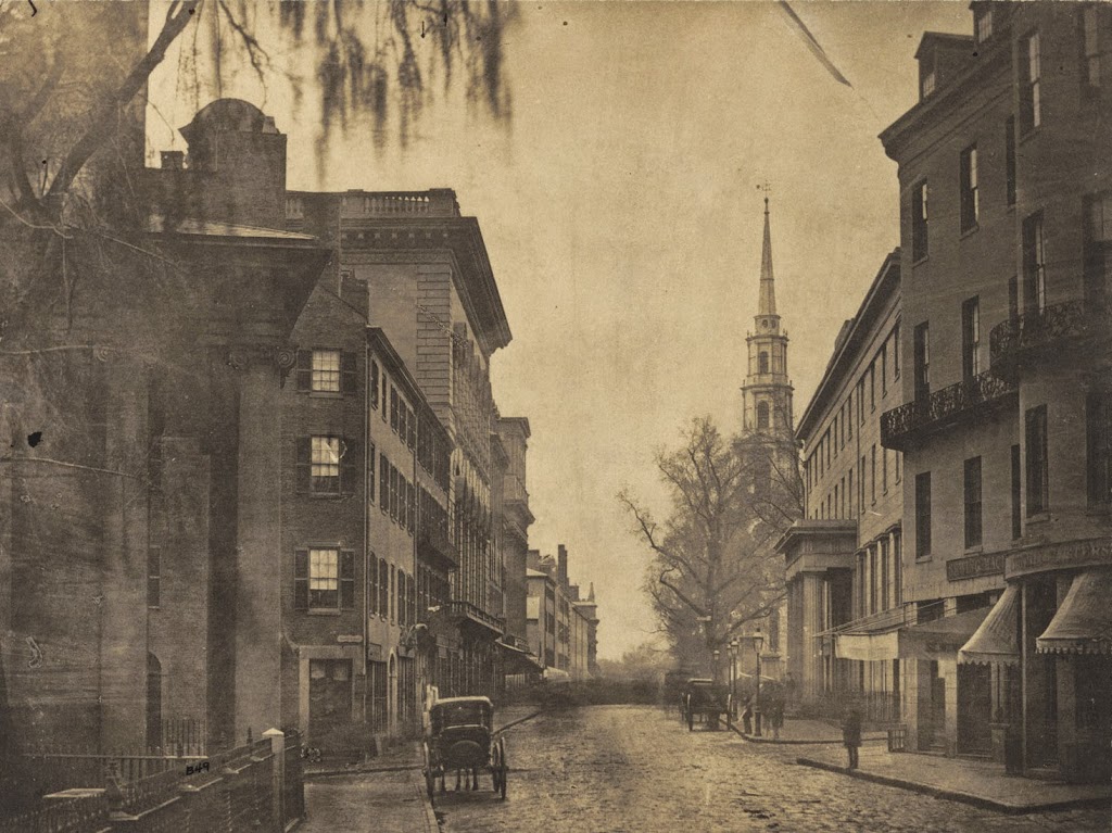
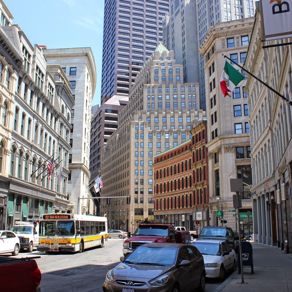
These photos were taken from almost the same spot as the ones in this post and this post, but the first one here shows Tremont Street as it appeared before the construction of the Tremont Street Subway.  By the time the 1895 photo was taken, Tremont Street was becoming crowded with traffic, from pedestrians to carriages and even trolleys, as seen in the distance of the first photo.  Toalleviate the congestion, the trolley lines were put underground, making this the first subway in the country.  Today, Tremont Street is still a busy road, but trolleys such as the green and orange one in the 2014 photo are purely for tourism – the real trolleys still run underground through here on the MBTA Green Line.

Tremont Street Mall, Boston

Looking up Tremont Street toward Park Street along Boston Common, around 1899. Image courtesy of the Library of Congress, Detroit Publishing Company Collection.

334_1899c-2Bloc

The scene in 2014:

334_2014

Similar to the scenes in this post, these photos show the view looking along Boston Common toward Park Street Church.  Not much has changed on the Common, but this section of Tremont Street is very different from its appearance 115 years ago; high-rise buildings have long since replaced the old 4-5 story commercial buildings of the 19th century.  A few buildings are visible in the distance, though – in particular, Park Street Church, and also the Tremont Building behind it.

Tremont Street and King’s Chapel, Boston

Looking south on Tremont Street in Boston, toward School Street, around 1906. Image courtesy of the Library of Congress, Detroit Publishing Company Collection.

331_1906c-2Bloc

The scene in 2021:

These photos were taken from right across the street from the ones in this post, although the “then” photo here was taken nearly 50 years after the one in the other post.  Aside from King’s Chapel, which predates the first photo by about 150 years, a few other buildings survive from the 1906 scene.  The most obvious one is the Tremont Temple, the third building on the left after King’s Chapel.  It was built in 1896 and continues to serve as a Baptist church.


Tremont Street, Boston

The view looking down Tremont Street from School Street, around 1860. Photo courtesy of Boston Public Library.

330_1860-2Bbpl

The same scene in 2014:

A lot has changed on this section of Tremont Street in the past century and a half, but a few constants remain. The front pillars of King’s Chapel are on the left-hand side, and the steeple of Park Street Church can be seen in the distance on the right. Another landmark in the first photo is the Tremont House, which can be seen from the opposite angle in this post. At the time of the 1860 photo, this was one of the best hotels in the city, and as mentioned in the post on the hotel, it had a number of prominent visitors throughout the 1800s.

Tremont Street has always been a major road in the city, but the first photo shows a very different scene. On the eve of the Civil War, it was a narrow dirt road with a few horse-drawn carriages. Within a few years, though, things would start to change, and by the end of the century this scene would be clogged with streetcars, which prompted the construction of the Tremont Street Subway, the first subway in the country. Today, this part of Tremont is located along the Freedom Trail, with a significant number of tourists walking along the sidewalk on a warm summer Saturday in the 2014 photo.


Seaver House, Boston

The Seaver House on the west side of Tremont Street across from Hollis Street, around 1882. Photo courtesy of Boston Public Library.

329_1800sc-2Bbpl

The scene in 2014:

329_2014

This view was taken from almost the same spot as the one in this post, which shows the scene before Tremont Street was widened.  Most of the buildings on Tremont Street in the 1882 photo above were built following the widening of the street, but none of them survive today. However, that doesn’t mean this neighborhood of Boston has completely changed.  It is part of Boston’s Theater District, a distinction that it held as far back as the 1800s.  In fact, the first photo is able to be dated to around 1882 based on the Fritz in Ireland playbill, which is posted on the wall on the far left-hand side of the first photo.  The wood-frame house in the left-center of the photo is the General Crane House, and was home to John Crane, a Boston Tea Party participant and Revolutionary War veteran.  By the time of the 1882 photo, it was home to the William Davis & Co. candy store.  Notice also the rails running through the cobblestone streets, and the blurred image of a horse-drawn trolley.  The trolleys would eventually be electrified and buried beneath Tremont Street in the late 1890s; today, the tunnel is still there, but it is no longer in service.

Franklin Street, Boston (2)

Looking down Franklin Street toward Arch Street from Hawley Street in Boston, around 1870. Photo courtesy of Boston Public Library.

327_1870c-2Bbpl

Franklin Street in 2014:

327_2014

Taken near the ones in this post, the first photo shows Franklin Street after the 1790s row-houses were demolished to make room for commercial development.  When the street was originally laid out, it included a landscaped terrace with a number of trees in the center of the road.  However, after the redevelopment, only a single tree remained, which is seen in the distance of the 1870 photo.  Within a couple years, however, the entire area would be destroyed in the Great Boston Fire of 1872, and the area was rebuilt again, with many of those buildings surviving today.