Franklin Street, Boston (1)

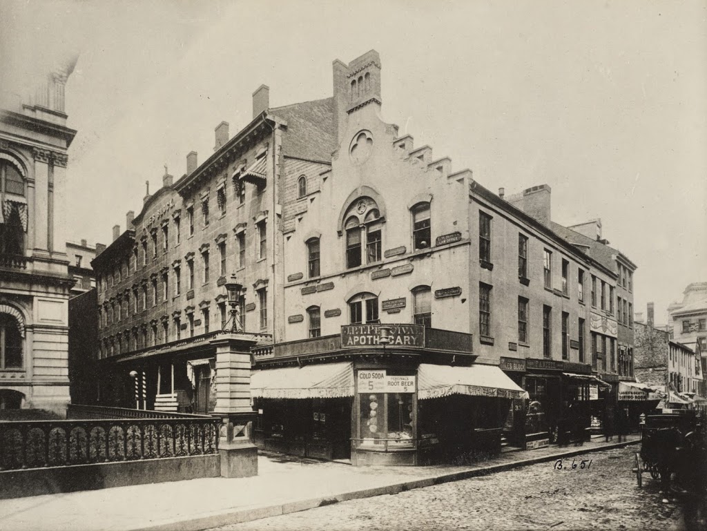
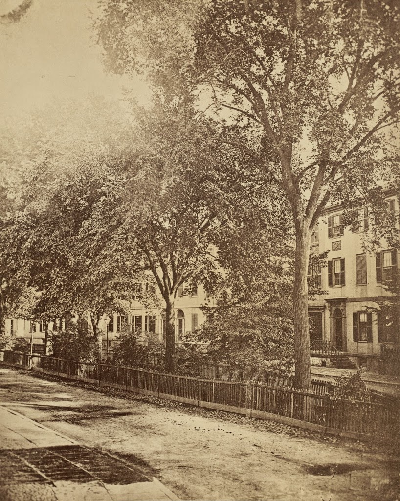
Looking down Franklin Street toward Arch Street from Hawley Street in Boston in 1858. Photo courtesy of Boston Public Library.

326_1858-2Bbpl

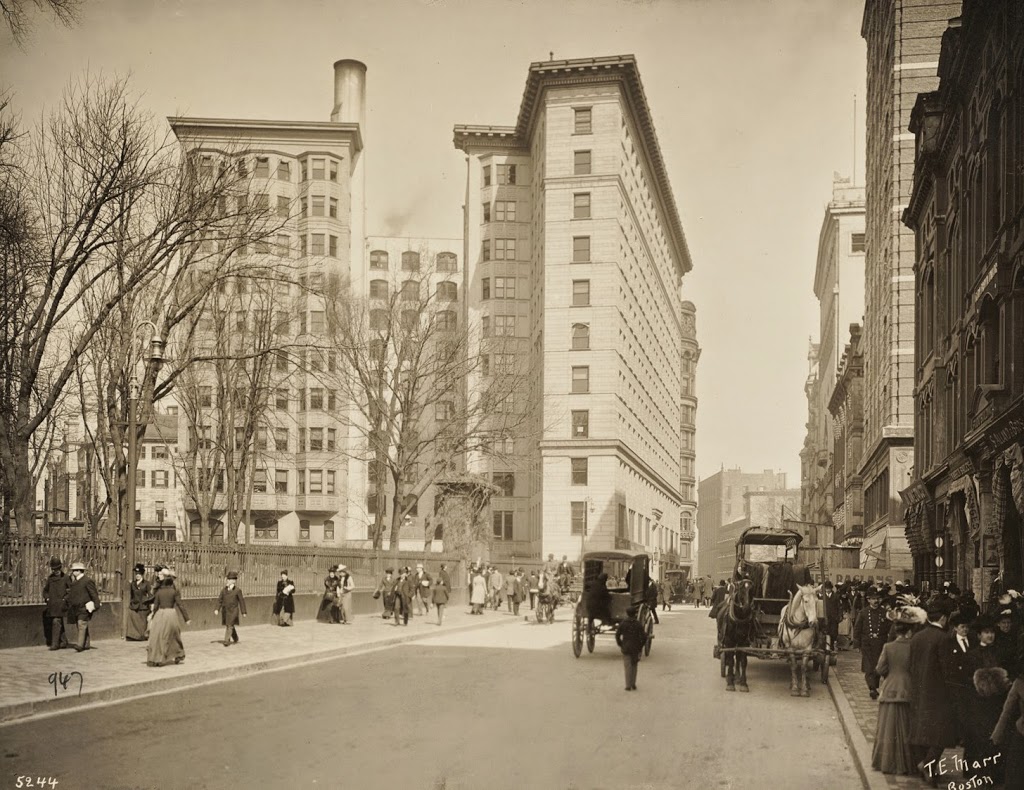
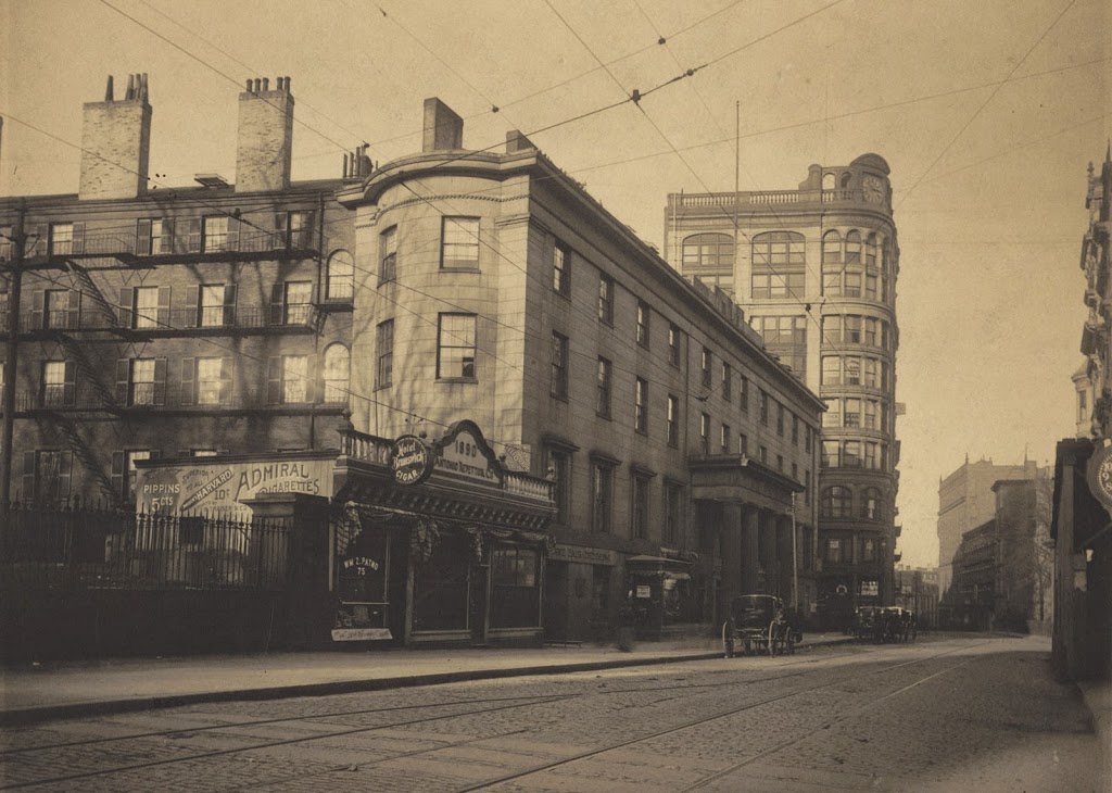
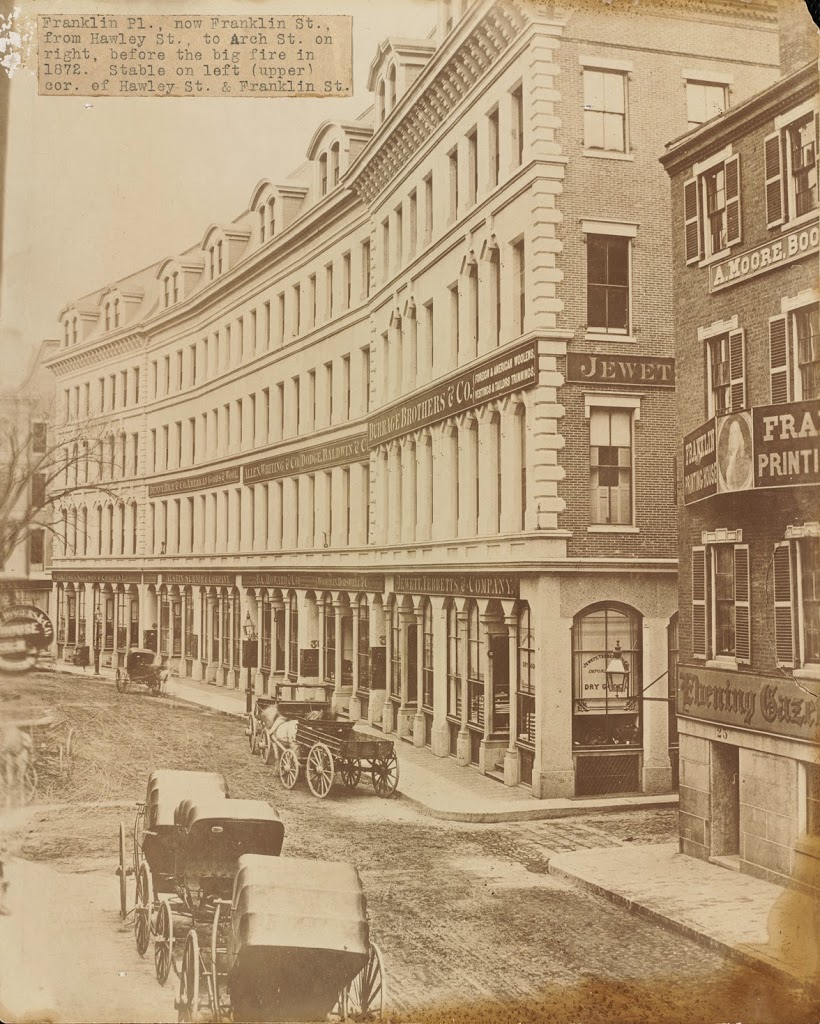
The same view down Franklin Street, between 1859 and 1872. Photo courtesy of Boston Public Library.

326_1850-1872c-2Bbpl

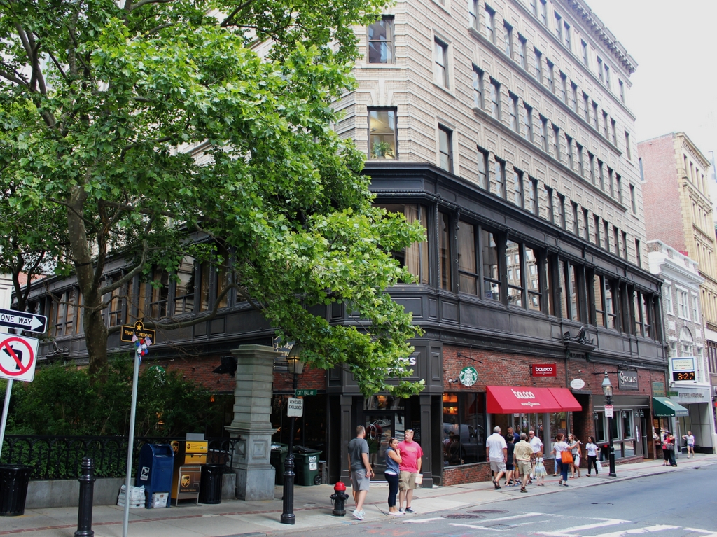
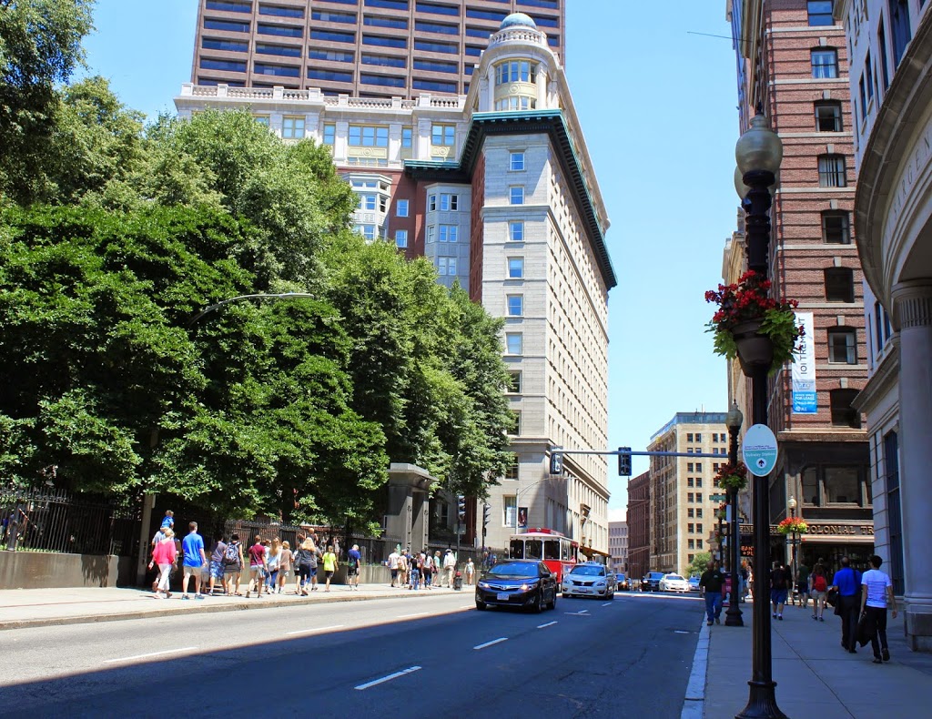
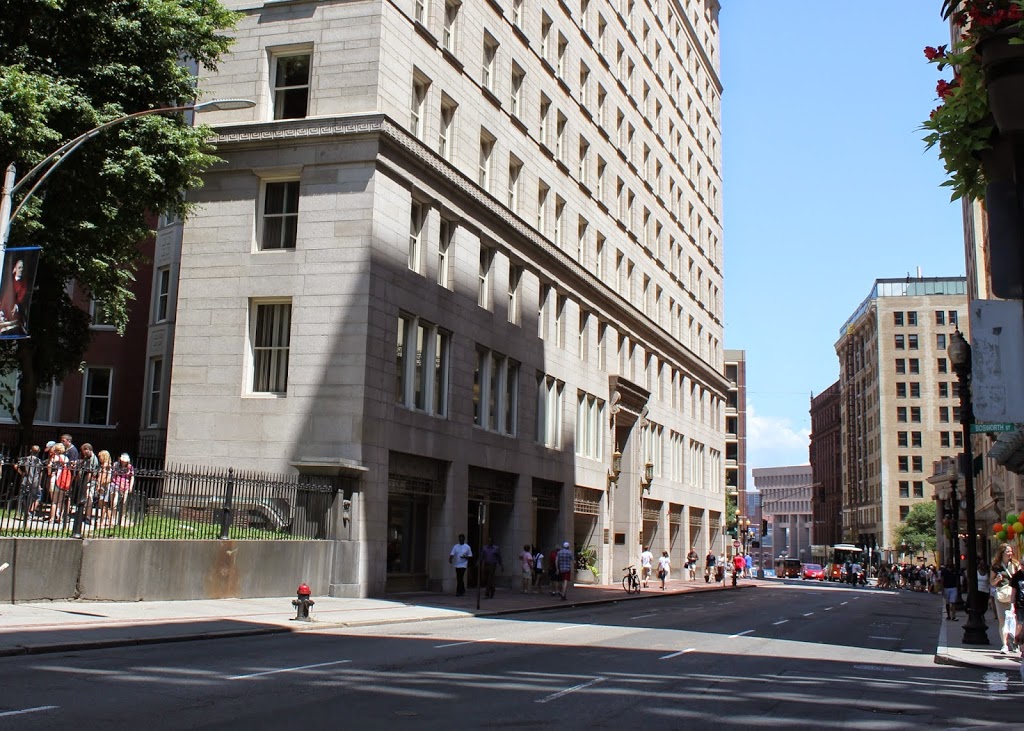
Franklin Street in 2014:

326_2014

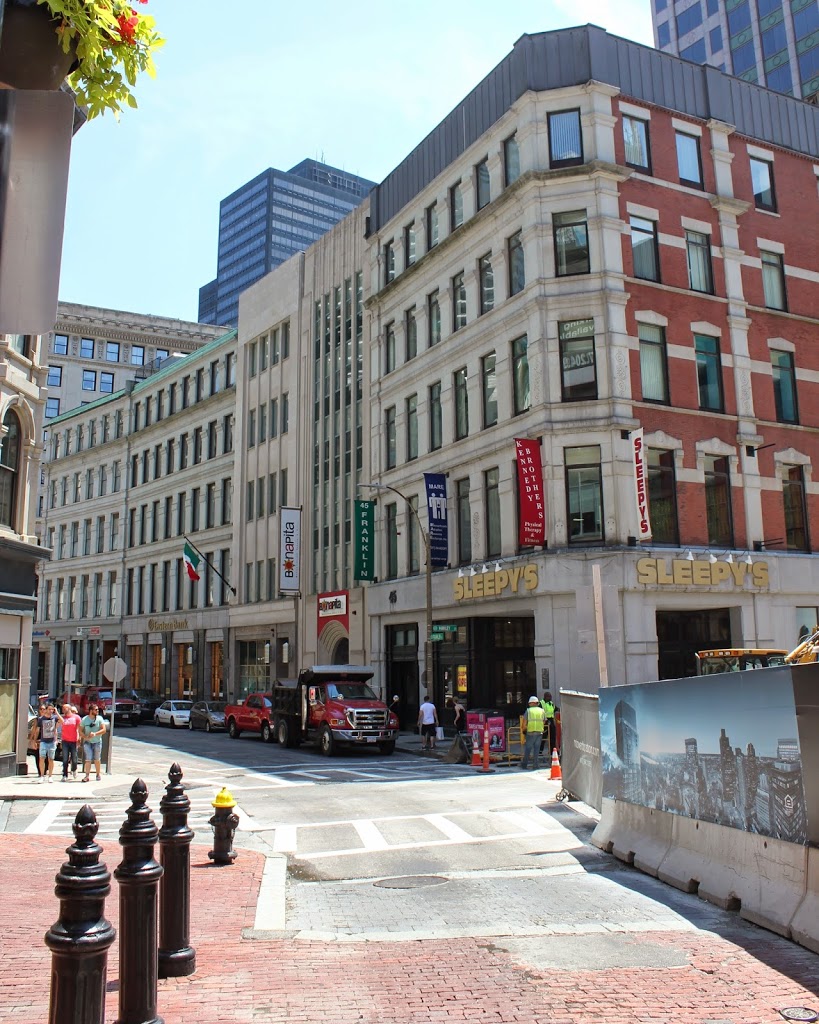
Franklin Street in Boston was originally laid out in the 1790s by noted architect Charles Bulfinch, and included row-houses on both sides of a sweeping curve, as seen in the first photo. Known as the Tontine Crescent, this was an upscale neighborhood in the first half of the 19th century, but by the 1850s the city was expanding commercially. The row-houses were demolished, and replaced with the commercial buildings in the second photo. These didn’t last too long, though – they were destroyed in the Great Boston Fire of 1872. Today, it is still a major commercial center, part of the Downtown Crossing shopping district, but many of the buildings that are still standing along Franklin Street were the ones constructed in 1873 in the immediate aftermath of the fire. In addition, the street still retains its distinctive curve that was laid out over 200 years ago.

Niles Building, Boston

The Niles Building at the corner of School Street and City Hall Avenue in Boston, in 1880. Photo courtesy of Boston Public Library.

323_1880-2Bbpl

The same scene in 2014:

When the first photo was taken, School Street was home to Boston’s City Hall, which is barely visible on the far left-hand side.  The building, which opened in 1865, is still there, although it no longer functions as the City Hall.  The buildings in the foreground of the 1880 photo, however, are long gone – the building in the present-day photo was built in 1915, so the older buildings were obviously demolished before then.  At least one other building does exist today from the original photo – the Old Corner Bookstore is seen in the distance on the extreme right of the photo.

Tremont Street, Boston

Looking up Tremont Street toward Beacon Street, with the Granary Burying Ground to the left, taken around 1910. Photo courtesy of Boston Public Library.

322_1910c-2Bbpl

The scene in 2014:

322_2014

This section of Tremont Street actually hasn’t changed much – the Granary Burying Ground is essentially the same, and a few of the buildings are still there, including the massive Tremont Building.  Built in 1895 on the site of the Tremont House hotel, the office building still looks much the same as it did over 100 years ago.

Tremont House, Boston

The Tremont House on Tremont Street in Boston, sometime in the 1890s. Photo courtesy of Boston Public Library.

1890s

The scene in 2014:

321_2014

The Tremont House in the first photo was built in 1829, and it holds a significant place in American history – it was the first hotel with running water and indoor plumbing. It opened to much fanfare, with mayor Josiah Quincy (of Quincy Market fame) presiding over the event. The guest list included a number of distinguished Bostonians, including Congressmen Daniel Webster and Edward Everett. Webster would go on to become one of the most influential men in 19th century America, and Everett also went on to bigger and better things, serving as governor, ambassador, senator, and Secretary of State. He gave a speech at the ceremony, and some 34 years later he would be the keynote speaker at another event – the dedication of the national cemetery at Gettysburg, although his two hour speech was overshadowed by President Lincoln’s two minute remarks.

The building stood at the corner of Tremont and Beacon Streets until 1895, and during its existence it had a number of notable guests, including Charles Dickens, Ralph Waldo Emerson, Alexis de Tocqueville, and President Andrew Jackson. It was also where, in 1848, Abraham Lincoln, at the time a virtually unknown Illinois Congressman, stayed during a visit to Boston. Coincidentally, years later John Wilkes Booth would also stay at the hotel, not long before he assassinated Lincoln.

Hull Street, Boston

Children keep cool next to a block of ice on Hull Street in Boston’s North End, sometime in the 1930s. Photo courtesy of Boston Public Library, Leslie Jones Collection.

320_1930c-2Bbpl

Hull Street in 2014:

320_2014

Not much has changed on Hull Street in the past 80 years – the neighborhood has become wealthier, but it remains predominantly Italian-American, as it was when the 1930s photo was taken.  At least some of the children in the photo were probably either Italian or Jewish, and it is likely that some of them have children or grandchildren who live in the area.  In fact, some of them might still be alive today, and who knows – perhaps one of them lives here on Hull Street, where they can now sit in air conditioned homes to stay cool, instead of hovering around a block of ice.  Everything else is the same, from the houses to the left, to the Copp’s Hill Burying Ground on the right, and the apartment building beyond it.  In fact, the curb stones are probably the same ones that the ice cart rested against.

Faneuil Hall and Dock Square, Boston (2)

Faneuil Hall, taken from Dock Square in Boston in 1930. Photo courtesy of Boston Public Library, Leslie Jones Collection.

318_1930-2Bbpl

The scene in 2014:

318_2014

Similar to the scene in the photos in this post, this view shows Faneuil Hall as the one constant in an otherwise very different scene.  It was probably the oldest building in the 1930 photo by at least 100 years, but 84 years later it has outlasted all of the other buildings, many of which were taken down during various urban renewal projects in the 1950s and 1960s, including the construction of the Central Artery.