Great Boston Fire (2)

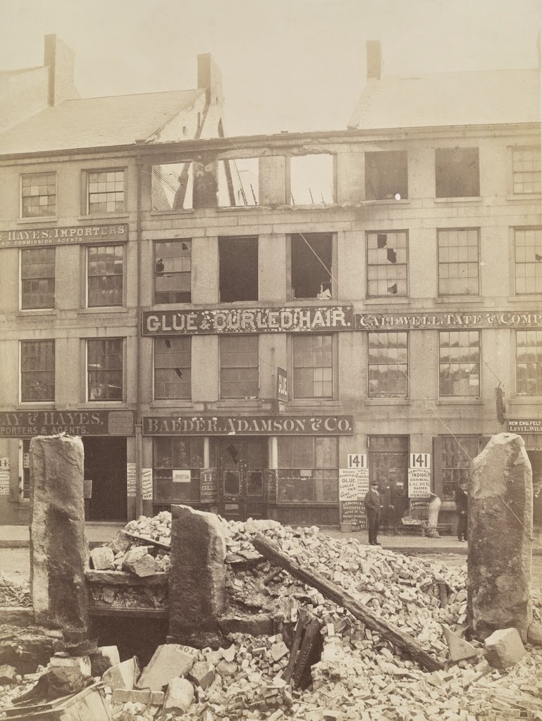
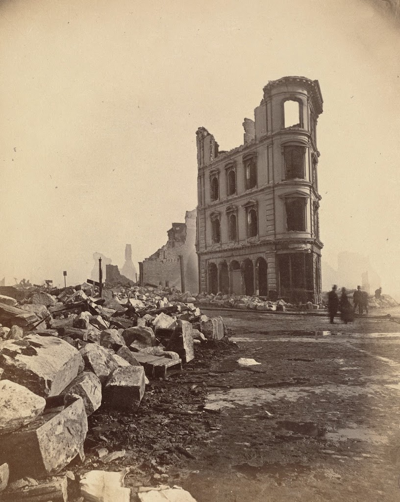
Facing south at the corner of High Street (to the left) and Summer Street (to the right), following the Great Boston Fire of 1872.  Photo courtesy of Boston Public Library.
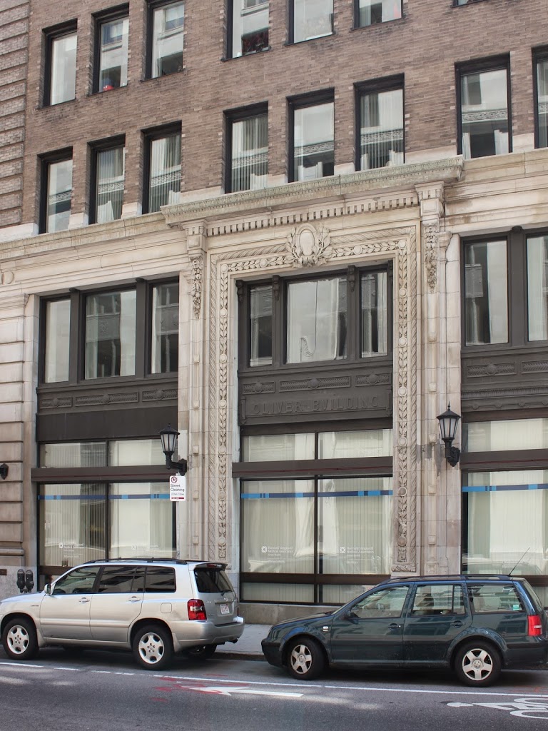
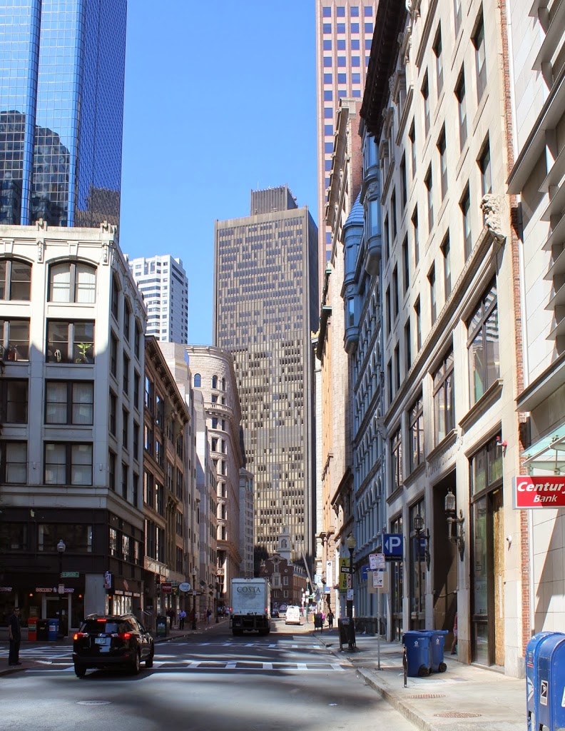
290_1872-2Bbpl

The scene in 2014:

290_2014

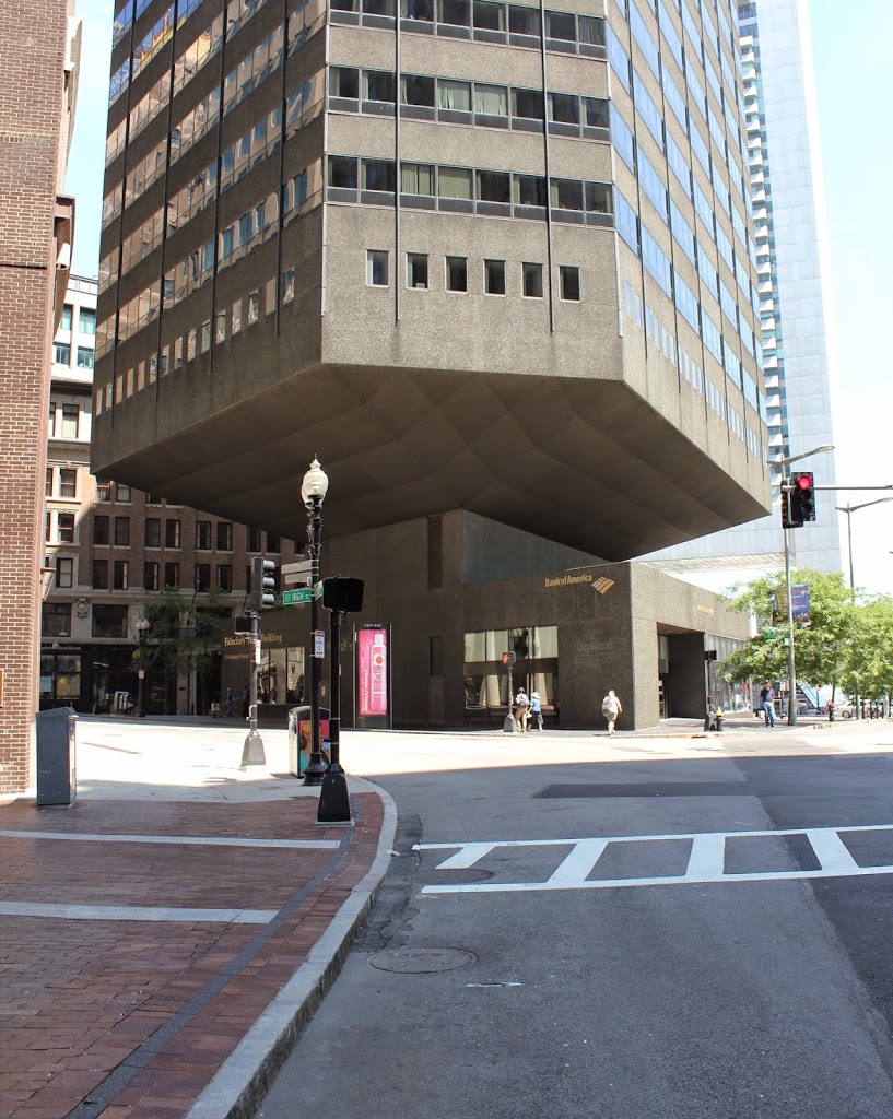
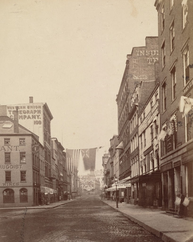
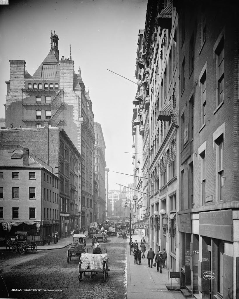
The Great Boston Fire of 1872 was one of the most devastating urban fires in American history, and this photo shows the scene near the epicenter on Summer Street.  The fire began just a few blocks behind the photographer, leaving very little standing in the southern part of downtown Boston.  The city recovered, though, and today this location is part of Boston’s financial district.  However, while the buildings were rebuilt, Boston’s convoluted street network remained unchanged.  Unlike many other major cities in America, and unlike even some other sections of Boston, downtown Boston does not have a regular street grid.  The result is small, non-rectangular building lots like this one, a triangle bounded by Summer, High, and Federal Streets.  In the 1970s, however, architects got creative and built the Fiduciary Trust Building, a hexagonally-shaped building that appears to be precariously balanced atop a much smaller base.

Great Boston Fire (1)

Fire-damaged building on Milk Street, between Batterymarch and Oliver Streets, following the Great Boston Fire of 1872. Photo courtesy of Boston Public Library.

289_1872-2Bbpl

The scene in 2014:

289_2014

Only a year after the far more well-known fire in Chicago, Boston suffered a similarly disastrous fire of its own.  It devastated much of the southern part of Boston’s downtown, reaching all the way up to Milk Street, where this photo was taken.  The building in the 1872 photo advertises “glue, curled hair, and sandpaper” which seems like an odd combination to today’s readers.  But, “curled hair” in this case referred not to a hairstyle but to some sort of industrial product made with animal hair.  As to its specific use, I am not sure, but today neither the buildings nor the glue, curled hair, and sandpaper industry are still at this location.  Today, the building at the site is identified above the ground floor windows as the Oliver Building, and was built in 1903, suggesting that at least one other building occupied this spot after the 1872 photo was taken.

Hotel Boylston, Boston

The Hotel Boylston, at the southeast corner of Tremont and Boylston Streets in Boston, sometime in the 1870s.  Photo courtesy of Boston Public Library.

285_1870-1879c-2Bbpl

The scene today:

285_2014

Like the Hotel Pelham right across Tremont Street, the Hotel Boylston was built as a residential building, with the term “hotel” at the time referring to what we would today call an apartment building.  It was at a prominent location, at the corner of Boylston and Tremont Streets, at the southeast corner of Boston Common.  However, it was demolished in the 1890s and replaced with the Hotel Touraine building, which still stands today.

Edmund Hartt House, Boston

The Edmund Hartt House on Hull Street in Boston, sometime in the 1800s. Photo courtesy of Boston Public Library.

Houses

The scene in 2014:

The house in the first photo was built sometime in the 1700s; I have seen three different accounts that give three different dates.  Regardless, it is best known as the home of Edmund Hartt, a shipbuilder whose yard constructed some of the US Navy’s first ships.  Most significantly, his yard was one of the six around the country chosen to build the first Congressional-authorized naval ships.  Completed in the late 1790s, five of the six ships are long gone, but Hartt’s work – the USS Constitution – is still around, just across the harbor from the place where his house once stood.  His house was probably demolished sometime in the first decade of the 20th century, but his gravesite can still be visited, directly across the street at Copps Hill Burying Ground.


Ebenezer Hancock House, Boston

The Ebenezer Hancock House in Boston’s Blackstone Block, before 1886. Photo courtesy of Boston Public Library.

269_1800sc-bpl

The scene in 2014:

269_2014

Boston’s Blackstone Block is in an odd location; the collection of historic 18th and 19th century buildings and narrow, 16th century alleys sits as sort of a time capsule, surrounded by modern development.  On one side is the Government Center area, where street scenes like this were demolished wholesale and replaced with concrete monoliths and open paved areas, and on the other side is the Central Artery, where the elevated highway was originally built in the 1950s before being put underground as part of the Big Dig.

However, the Blackstone Block appears virtually unchanged in over 125 years.  A few notable landmarks are visible in these photos, including the Ebenezer Hancock House in the center.  In the 19th century, it was home to William H. Learnard’s shoe store, who operated out of the building from the 1820s until 1886.  He wasn’t the only person to own a shoe store here, though.  The building functioned as a shoe store from 1798 until 1963, and is today used for offices.  Originally, though, it was a house, and was built around 1767 and later owned by Ebenezer Hancock, the brother of John Hancock.

Also of note in this photo is the Boston Stone, seen in the background, embedded in the wall of the building to the left of the Ebenezer Hancock House.  Supposedly, this stone, which actually predates the circa 1835 building, was once used as the zero milestone for Boston, but this doesn’t appear to be likely.  The building, though, is probably the one thing that has changed the most since the first photo was taken.  At some point in the mid 20th century, the building was trimmed down to just three stories.  Today, it has all of its floors again, but this is a recent addition; photos in this post, from the other side of the building, show that the extra stories weren’t there in 2011.

State Street, Boston

The view looking up State Street from Chatham Street, in 1875. Photo courtesy of Boston Public Library.

253_1875-bpl

The same view, around 1905. Photo courtesy of Library of Congress, Detroit Publishing Company Collection.

253_1905c-loc

State Street in 2014:

253_2014

These three views show the progression of high-rise buildings in Boston’s Financial District, with the 1875 photo showing mostly 4-5 story brick buildings, followed by taller buildings in the turn-of-the-century photo, and finally the modern steel and glass skyscrapers in the 2014 photo.  One constant in all of the photos, though, is the Old State House, which predates even the first photo by over 150 years (consider that – in the 1875 photo, the building was closer in time to the present day than to the year it was built).  It’s remarkable to be able to see it in all three photos, though, because the views clearly show the colonial-era building steadily becoming dwarfed by its surroundings.

Another building (possibly the only other one) visible in all three photos is the Western Union Telegraph Company building (the one with the company’s name painted on the side in the photo).  It was brand-new in the 1875 photo, having been built approximately a year earlier, and it stood out among its neighbors.  Today, it’s still there, although extensively modified and barely noticeable, and is probably the shortest building on either side of State Street in this view.