Augustus Saint-Gaudens House, Cornish, New Hampshire

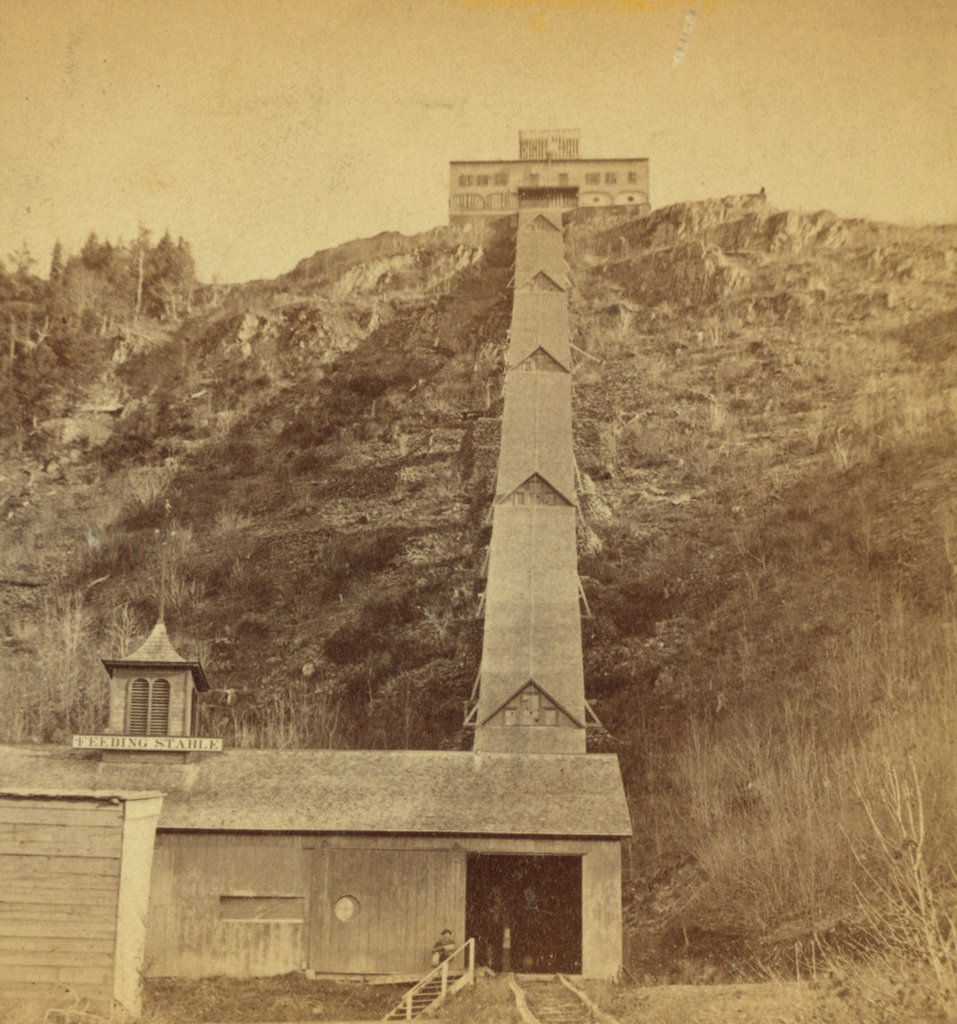
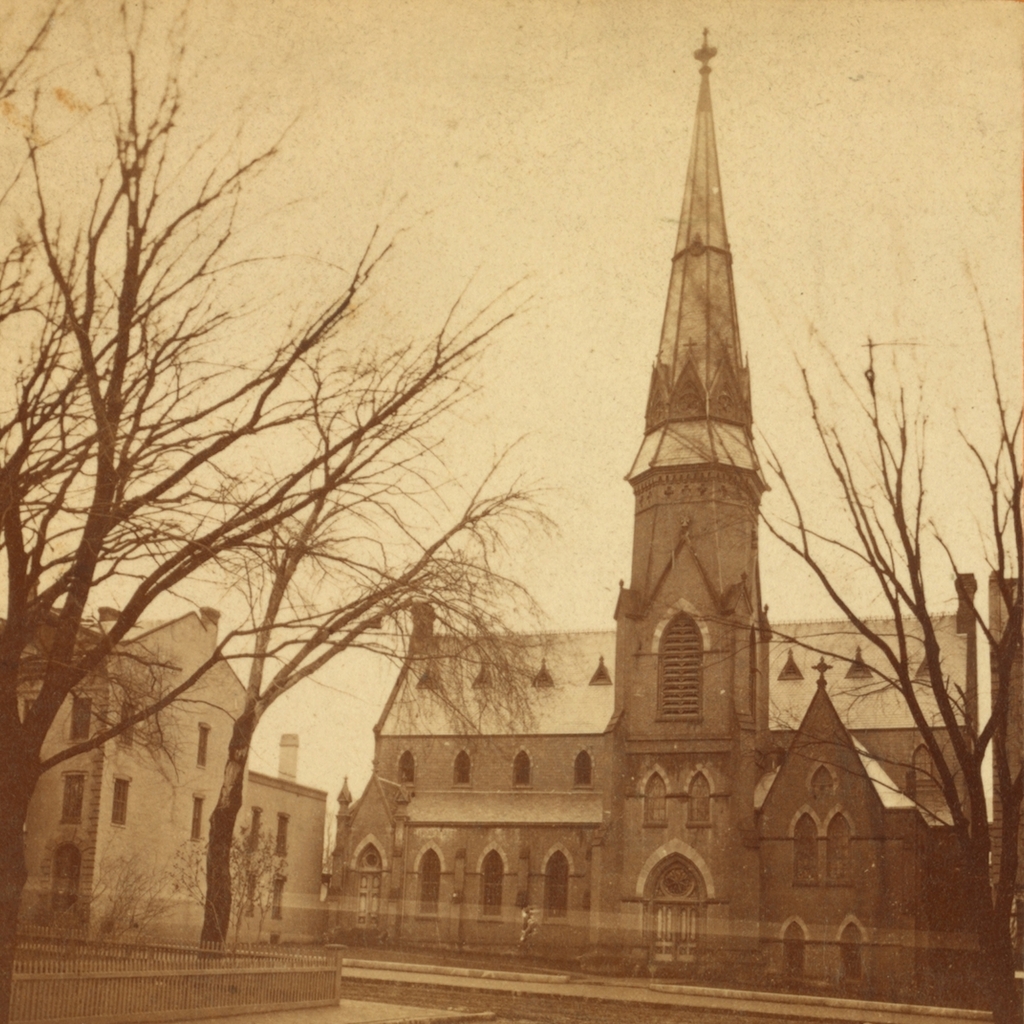
The home of Augustus Saint-Gaudens in Cornish, around 1885. Image from The Reminiscences of Augustus Saint-Gaudens, Volume 1 (1913).
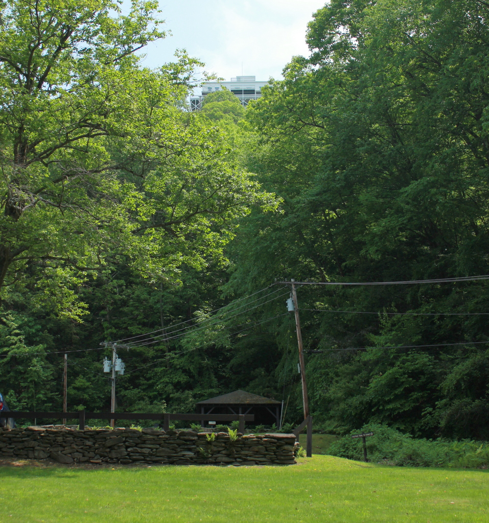
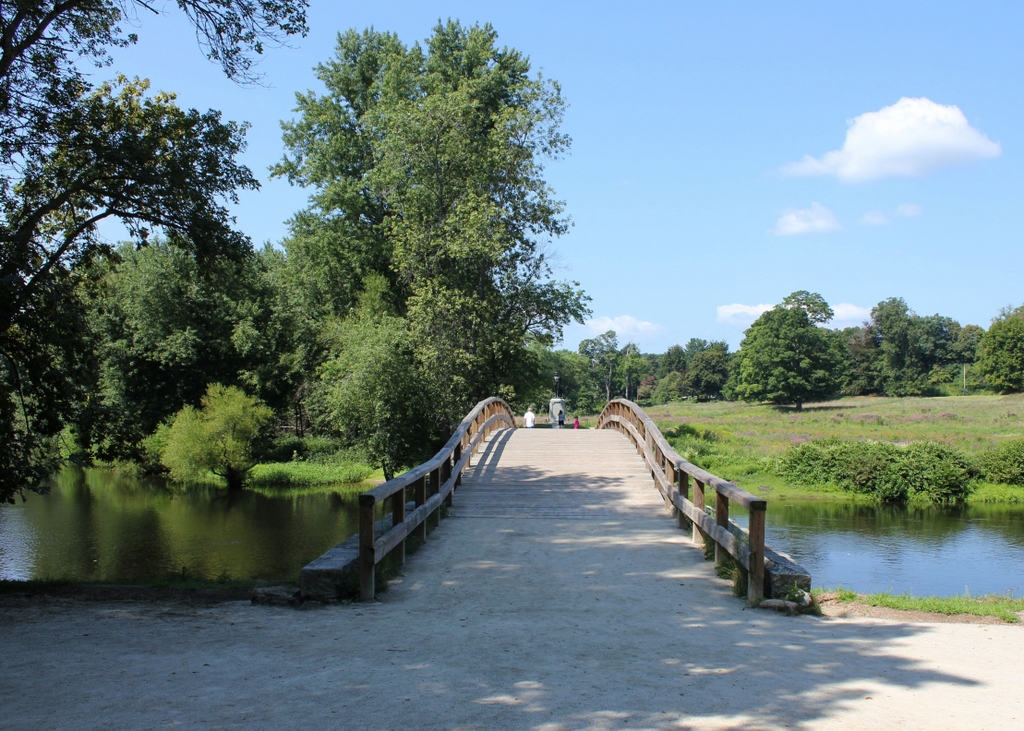
The scene in 2019:

Augustus Saint-Gaudens was one of the most prominent sculptors in American history, with a body of work that includes many important public monuments, along with the designs for several United States coins. Born in Ireland to an Irish mother and French father, Saint-Gaudens came to America in 1848 when he was six months old, and he subsequently grew up in New York City. Then, in the late 1860s he studied at the École des Beaux-Arts in Paris, and by the mid-1870s he had established himself as a successful sculptor.

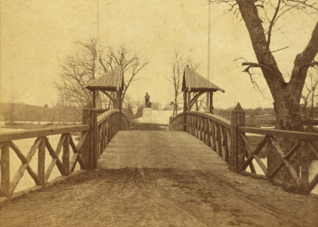
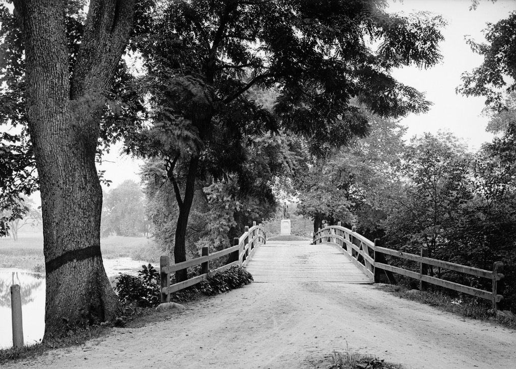
It was a good time to be a sculptor in the United States at the time, given the large number of Civil War monuments that were being built around the country. Many of Saint-Gaudens’s most celebrated works were created in honor of Union heroes from the war, including statues of David G. Farragut, John A. Logan, Robert Gould Shaw and the 54th Massachusetts Regiment, William T. Sherman, and Abraham Lincoln. In addition to these statues, his other major works included Diana for Madison Square Garden, The Puritan in Springfield, Massachusetts, and the Adams Memorial in Washington, D.C. Near the end of his life, Saint-Gaudens was also commissioned to redesign American coinage, and he supplied designs for new $10 and $20 coins before his death in 1907.

In 1885, in the midst of his career, Saint-Gaudens came to Cornish for the summer, at the suggestion of his friend Charles Cotesworth Beaman. A prominent attorney, Beaman owned several farms in Cornish, including this property, which was known as Huggins’ Folly. Saint-Gaudens and his rented it for the summer, and the first photo was taken on the front lawn at some point during the summer. In the photo, Augustus Saint-Gaudens himself is kneeling in the lower right corner. Standing in the foreground is his wife Augusta, and further to the left is their son Homer, who would have been about five years old at the time. Just to the left of Homer is Saint-Gaudens’s assistant Frederick William MacMonnies, and furthest to the left is his younger brother Louis Saint-Gaudens. Both of these men would become accomplished sculptors in their own right, and MacMonnies also had a successful career as a painter.

The Saint-Gaudens family would return here to Cornish for subsequent summers, and in 1891 he purchased the property from Beaman for $2,500 plus a bronze bust. He renamed it Aspet, after his father’s birthplace in France, and over the years he made a number of improvements, including landscaping the grounds and constructing studios and other outbuildings. As part of the landscaping, a honey locust was planted just to the right of the front steps, probably around 1886. This tree is still here, and now towers over the house in the center of the 2019 photo. Saint-Gaudens also made alterations to the main house, some of which are visible in this scene, including piazzas on either side of the house, a dormer window above the front door, and stepped parapets to replace the earlier sloped ones.

Saint-Gaudens moved into this house year-round in 1900, and he lived here until his death in 1907. This period marked the heyday of the Cornish Art Colony, which flourished in large part because of Saint Gaudens’s influence. During this time, dozens of prominent artists and other public figures spent summers in Cornish and the surrounding towns. Even Woodrow Wilson spent time in Cornish during his presidency, leasing the home of novelist Winston Churchill. The importance of the art colony steadily diminished after Saint-Gaudens’s death, but the town would continue to see prominent residents over the course of the 20th century, including writer J. D. Salinger, who died in Cornish in 2010.

In the meantime, this property remained in the Saint-Gaudens family until 1921, when Augusta transferred it to the Augustus Saint-Gaudens Memorial, an organization that she had established two years earlier. It was designated as a National Historic Landmark in 1962, and then in 1964 it became the Saint-Gaudens National Historical Park, with the National Park Service acquiring the property a year later. It has remained open to the public ever since, and it features landscaped grounds and gardens, walking trails, several galleries, and one of Saint-Gaudens’s studio buildings. The main house, shown here in this scene, is also open for tours, and its appearance remains much the same as it did when Saint-Gaudens lived here more than a century ago.

Mount Holyoke Summit House and Inclined Railway, Hadley, Massachusetts

The inclined railway leading up to the Summit House on Mount Holyoke, around 1867 to 1885. Image courtesy of the New York Public Library.

The scene in 2019:

As discussed in the previous post, the summit of Mount Holyoke was the site of one of the first mountaintop hotels in the United States. At just 935 feet in elevation, it is not a particularly tall mountain, yet it rises high above the surrounding landscape in the otherwise low, flat Connecticut River valley. It is part of the Holyoke Range, a narrow ridgeline that runs east to west for about eight miles. This, in turn, is a sub-range within the much longer Metacomet Ridge, a traprock ridge that extends from Long Island Sound in Connecticut to just south of the Massachusetts-Vermont border.

Mount Holyoke is not the highest peak in the Holyoke Range, as it stands nearly 200 feet lower than Mount Norwottuck. However, it forms the western end of the ridge, with the Connecticut River passing through a narrow gap between Mount Holyoke and the Mount Tom Range. This prominent location makes it a major landmark for travelers in the river valley, and it also means that the summit has nearly 360-degree views of the surrounding landscape.

The combination of dramatic views and proximity to large large population centers made Mount Holyoke a popular destination in the 19th century, and the first building at the summit was built in 1821. In the spirit of a traditional barn raising, it was built with the help of nearly 200 townspeople who climbed to the summit to lend a hand. Consuming, as one 19th century account described it, “a little water with a good deal of brandy in it,” the group completed the summit house in just two days. It was a modest structure, measuring just 18 by 24 feet, but it was dedicated with much fanfare, including a speech by Northampton native and U. S. Senator Elijah H. Mills.

This first building was soon joined by a rival establishment nearby, but the two buildings were consolidated under the same ownership in 1825. The business operated here for several more decades, and during this time the view from the top of the mountain was made famous by Thomas Cole’s 1836 painting The Oxbow, long regarded as a masterpiece of 19th century American landscapes.

However, despite the mountain’s growing popularity, the accommodations at the summit remained primitive until mid-century. This began to change in 1849, when Northampton bookbinder John French and his wife Frances purchased the property. They soon began making improvements, most significantly a new hotel at the summit, which was completed in 1851. It was named the Prospect House, and it had two stories, with a dining room, sitting room, and office on the first floor, and six guest rooms on the second floor. Above the second floor was a cupola, which was equipped with a telescope. The hotel was later expanded several times, but this original 1851 structure still survives as part of the present-day building.

In addition to constructing a more substantial building, French also improved access to the summit. Prior to his ownership, it was relatively easy to reach the spot where these two photos were taken, whether on foot or by carriage. In terms of elevation, this spot is more than halfway up the mountain, but from here the slope becomes significantly steeper, as is made particularly evident in the first photo. The only options for visitors during the first half of the 19th century were either to take the long, winding, narrow carriage road to the summit, or hike the short but steep path up the mountainside, gaining over 350 feet in elevation in just 600 horizontal feet.

Neither option was ideal for most visitors, and the situation also made it difficult for French to bring supplies up the mountain. Even water had to be either carted or carried up to the summit, requiring him to sell it for around three to five cents per glass, or about $1.00 to $1.50 today. However, in 1854 he solved both problems with the construction of an inclined railway. It began here at this spot, next to French’s residence, which was known as the Halfway House, and it rose to the top of the mountain. It was originally powered by a stationary horse here at the base, although in 1856 French switched to steam power. The railway itself was rebuilt several times, but it had largely assumed its final form by 1867, as shown in the first photo. By then, the railway had two tracks, was completely enclosed, and brought its passengers directly into the basement of the hotel.

In the meantime, the hotel also grew, with the first major addition coming in 1861, when it was expanded to ten rooms. Then, in 1871 French sold the property to South Hadley businessman John Dwight. However, John and Frances French remained here to manage the hotel, and they continued in that role until their deaths in the 1890s. Then, the hotel was expanded even further in 1894, with the addition of a large wing on the south side of the building. This increased the hotel’s capacity to 40 guests, along with a dining room that could seat 200 people.

By then, the hotel had several local competitors on the nearby Mount Tom Range, with the Eyrie House atop Mount Nonotuck, and the Summit House on Mount Tom. However, both of these were plagued by fires, which was a constant danger for wood-frame buildings on isolated mountaintops. The Eyrie House, built in 1861 and later expanded, burned in 1901, and the same fire also destroyed the partially-built structure of what would have been a new hotel. The Summit House on Mount Tom faced similar problems, with the original 1897 one burning in 1900, and its replacement suffering the same fate in 1929.

However, although older than the other nearby summit houses and built of similar materials, the hotel here on Mount Holyoke managed to avoid catastrophic fires. It faced different challenges, though, most significantly the declining popularity of mountaintop hotels in general. John Dwight died in 1903, the property was subsequently acquired by a group of prominent locals, including Holyoke silk manufacturer Joseph Skinner. The new owners made significant improvements, including electricity and modern plumbing. The railway was also electrified, and the first automobile road to the summit opened in 1908.

Skinner would ultimately acquire full ownership of the hotel, and he continued to modernize it throughout the early 20th century. It continued to face challenges though, particularly with the onset of the Great Depression, but the hotel was ultimately closed after the September 1938 hurricane. The older section of the building survived, but the storm destroyed the large 1894 addition. A year later Skinner donated the property to the state, and it became the Joseph Allen Skinner State Park.

Both the hotel and the inclined railway deteriorated after the park was established, and much of the roof over the railway was destroyed in a heavy snowstorm in 1948. The remains of the railway were removed in 1965, and the hotel itself was also threatened with demolition around this time. Despite many years of neglect, though, the building was ultimately restored in the 1980s, and it is now a museum.

Today, nearly all of the historic 19th century mountaintop hotels in the northeast are gone, most having been lost to fire, neglect, or both. However, the Summit House on Mount Holyoke is still standing as one of the few surviving examples. This scene has changed considerably since the first photo was taken around 150 years ago, including the loss of the railway and the significant tree growth on the previously bare slopes, but the Summit House is still visible from this spot.

Mount Holyoke Halfway House, Hadley, Mass

The Halfway House on the northern slope of Mount Holyoke in Hadley, around 1867-1885. Image courtesy of the New York Public Library.

The scene in 2021:


For the past two centuries, the view from the top of Mount Holyoke has been one of the most celebrated mountaintop scenes in New England. Although only 935 feet above sea level, the traprock mountain rises abruptly from the low valley floor, providing nearly 360-degree views of the Connecticut River and the surrounding countryside. As a result, the mountain has drawn countless visitors over the years, and its view has been the subject of many works of art, including one of the most iconic American landscape paintings, Thomas Cole’s The Oxbow.

During the Romantic era of the early 19th century, a new emphasis on nature helped to spur interest in landscapes and scenery. Mountains, which had previously been regarded as impediments to travel, became destinations in their own right, leading to a proliferation of mountaintop hotels, particularly here in the northeast. Among the first of these was a small cabin that was built at the summit of Mount Holyoke in 1821. A second, rival structure was built a few years later, but it would be another three decades before a real hotel was built at the summit.

In 1849, Northampton bookbinder John French and his wife Frances purchased the property at the summit, and soon began construction on a new, more substantial structure. Completed in 1851 and named the Prospect House, the hotel was two stories in height, with a dining room, sitting room, and office on the first floor, and six guest rooms on the second floor.

French originally intended to live in the hotel year-round, but the windswept summit proved too cold and isolated in the winter, so in 1852 he and his family moved into a house on the northern slope of the mountain, shown here in the upper right side of both photos. It was known as the Halfway House, and in terms of elevation it is just over halfway from the valley floor to the summit. However, beyond here the climb becomes significantly more difficult. Up to this point, it is a steady but moderate ascent, but after the Halfway House the most direct route to the summit is up a steep slope, gaining over 350 feet in elevation in just 600 feet.

When the Prospect House opened, the only way up to the hotel from the Halway House was either by riding along a winding, narrow carriage road, or by climbing the short but steep path to the summit. Not only was this challenging for visitors to reach the hotel, but it also made it difficult for French to bring supplies. With no springs anywhere near the summit, water was a particularly scarce commodity, as it all had to be carted or carried up these same routes. As a result, visitors were charged for the water that they drank, paying between three and five cents per glass, or about $1 to $1.50 today. In addition, other liquid refreshments sold for considerably higher on the mountain than elsewhere.

In order to solve these problems, in 1854 French built an incline railway from here at the Halfway House to the summit. It was originally powered by a stationary horse, but two years later French replaced it with a steam engine. The entire railway was 600 feet in length, and by the late 1860s it was completely enclosed by a wooden shed. These two photos were taken from around the spot where the railway began, and from here it brought visitors directly into the basement of the Prospect House, allowing them to reach the hotel without even stepping outside.

John French expanded the hotel in 1861, and in 1867 he added a second track to the railway. Throughout this time, he and Frances resided at the Halfway House. The 1870 census shows them here with their 21-year-old daughter Frances. At the time, they also had three employees who lived here with them, including a clerk, a domestic servant, and a teenager who was listed as a “boy of all work.” The census listed the value of French’s real estate at $20,000, plus a personal estate valued at $8,000, for a total net worth equivalent to around $575,000 today.

French ultimately sold the hotel a year later in 1871 to South Hadley businessman John Dwight. However, Dwight retained John and Frances to manage the hotel, and they continued to live here in this house. The 1880 census lists them here along with a number of employees, including a telegraph operator, two cooks, a waiter, and an engineer. However, it seems unlikely that they would have all lived together in this small house, so they may have lived in other nearby buildings, or perhaps even in the hotel itself.

John French lived here until his death in 1891, and Frances until she died in 1899. By then, the hotel had been expanded even further. with an 1894 addition that gave the building a capacity of 40 guests. However, despite this growth the hotel entered a decline in the early 20th century. It was eventually acquired by wealthy Holyoke silk manufacturer Joseph Skinner in 1915, and he set about modernizing the building. Despite these improvements, though, the the heyday of mountaintop hotels had passed, and the Great Depression further compounded the problem. Then, the 1938 hurricane caused substantial damage to the hotel, requiring the demolition of the 1894 addition.

Skinner ultimately donated the hotel and its property to the state in 1939, with the land becoming the Joseph Allen Skinner State Park. However, the state showed little interest in the buildings on the property, which were largely neglected for many years. The inclined railway was last used in the early 1940s, and it was badly damaged after the roof of the shed collapsed in a heavy snowstorm in 1948. The remains of the railway were ultimately removed in 1965, and the hotel itself was also nearly demolished in the second half of the 20th century. However, it was instead restored, and it now serves as a museum.

Today, despite the loss of the railway, the Halfway House itself is still standing. It has been enlarged since the first photo was taken, with the addition of a second story above the rear part of the building, but otherwise it is still recognizable from its 19th century appearance. Although there are no longer any overnight accommodations at the summit, Mount Holyoke remains a popular destination. Most visitors still pass by the Halfway House on their way up the mountain, either by way of the auto road on the left side of the scene, or the hiking trail that crosses the road here before ascending steep slope to the summit.

State Street Baptist Church, Springfield, Mass

The State Street Baptist Church, at the corner of State and Dwight Streets in Springfield, around the 1870s or 1880s. Image courtesy of the New York Public Library.

The scene in 2019:

The State Street Baptist Church, also known as the Second Baptist Church, was established in 1864 as an offshoot of the First Baptist Church. A year later, the church began construction of a new building here on State Street, and it was completed in 1867. It featured an ornate High Victorian Gothic exterior, which was designed by Boston architect Sheperd S. Woodcock, and it was constructed at a cost of just over $41,000, including purchasing the property.

The building was formally dedicated on December 18, 1867, in a ceremony that included a number of local and regional Baptist clergymen. C. D. W. Bridgman, of the Emmanuel Baptist Church in Albany, preached the sermon, and other speakers included Rufus K. Bellamy of Chicopee, whose son Edward Bellamy later became a famous novelist. The church was filled to capacity for the occasion, and it was followed by a social gathering attended by members of the city’s two Baptist congregations, along with about a hundred guests from out of town. Then, the evening was marked by a second ceremony, which included a sermon preached by Justin D. Fulton of the Union Temple Church in Boston.

At the time, the pastor of the church was Albert K. Potter, an 1859 graduate of Brown University who spent five years at a church in South Berwick, Maine before coming to Springfield in 1865. He served here at the State Street Baptist Church for 18 years, before leaving for a church in Boston. The second pastor, who came here in 1884, was 25-year-old William Faunce. Like his predecessor, he was a Brown graduate, but he only remained at this church for five years, before becoming the pastor of the Fifth Avenue Baptist Church in New York. There, his most famous parishioner was John D. Rockefeller, who was already well on his way to becoming the richest man in the world. Faunce subsequently became president of Brown University, serving from 1899 to 1929. After his death in 1930, the school’s Rockefeller Hall was, at the request of the Rockefeller family, renamed Faunce House in his honor.

In the meantime, Springfield’s various Baptist churches underwent a series of mergers during the early 20th century. First Baptist, which had relocated to a new building on State Street around 1888, united with Highland Baptist around 1907, becoming the First Highland Baptist Church. The new congregation worshiped in the Highland Baptist building at the corner of State and Stebbins Streets, and in 1920 the State Street Baptist Church similarly merged, vacating their old building here on the lower part of State Street.

By this point, downtown Springfield had grown considerably since this building was completed more than 50 years earlier, and this area was now valuable commercial real estate. So, the old church building was ultimately demolished in 1927, and it was replaced the Arcade Theater, a 1,200-seat cinema that opened in 1931. This theater was located here until 1971, and it was demolished a year later in order to open a new road connecting Dwight Street to Maple Street, as shown in the present-day photo.

Railroad Station, Bellows Falls, Vermont

The railroad station on Depot Street in Bellows Falls, around the late 1800s. Image courtesy of the Rockingham Free Public Library.

The scene in 2018:

The village of Bellows Falls, which is located within the town of Rockingham, developed into an important transportation crossroads during the late 18th century. Here, the Connecticut River drops 52 feet as it passes through a narrow gorge. This was an impediment to river navigation, requiring a canal here to bypass the falls, but the width of the gorge also made it an idea spot for a bridge. For most of the 18th century, there were no bridges over the Connecticut River at any point along its 400-mile course, but the first opened here at Bellows Falls in 1785. This made it easier to travel between Vermont and New Hampshire, and it was an important link on the trade routes from Boston to Montreal.

With the development of railroads during the first half of the 19th century, Bellows Falls became the junction of several different railroads. The first to arrive were the Sullivan County Railroad and the Cheshire Railroad, which opened in 1849. At the time, though, there was no railroad bridge across the river, so passengers bound for Bellows Falls had to disembark across the river in Walpole, New Hampshire and cross the covered bridge on foot. Later in 1849, the Rutland and Burlington Railroad was opened to Bellows Falls, followed in 1851 by the Vermont Valley Railroad.

The first railroad station here in Bellows Falls was built on this site, on a triangular plot of land just south of where the four railroads converge. The railroads formed an “X” here, with the Vermont Valley Railroad heading southwest, on the far left side of the scene; the Cheshire Railroad heading southeast, on the far right side; the Sullivan County Railroad to the northeast; and the Rutland and Burlington Railroad to the northwest. This original station was used for a few years, but around 1852 it was replaced by a more substantial brick building, which is shown here in the center of the first photo.

Over the years, these various small railroads were eventually consolidated into much larger ones through a series of mergers and leases. By the 1870s, all but the Cheshire Railroad were controlled by the Central Vermont Railroad, although the Central Vermont subsequently leased the Sullivan County and Vermont Valley to the Boston & Maine Railroad by the early 1880s, and ended its own lease on the Rutland Railroad in 1896. Then, in 1900, the Boston & Maine acquired the Cheshire, which gave them control over most of the rail traffic in Bellows Falls. However, the Central Vermont retained trackage rights through Bellows Falls, and continued to operate trains here.

At some point around the turn of the 20th century, the railroad station was evidently remodeled, as period postcards show it with a very different roof than the one in the first photo. However, the old station remained in use until 1921, when it was destroyed by a fire on a cold December night. The fire started in the restaurant kitchen, and within a half hour the building was gone, thanks in part to the interior wood paneling that helped to fuel the flames. In addition, the responding firefighters had to contend with sub-zero temperatures and 60-mile-per-hour winds. One of the nearby hydrants was completely frozen, and by the time they were able to get water flowing from another hydrant it was of little use; there was no saving the station at that point, and, in any case, the strong winds only blew the water back toward the firefighters.

The present-day railroad station was completed on the same site in 1923, although it is a much more modest building than its predecessor, with only one story topped by a very low roof. It continued to be used by passengers throughout the next few decades, but inter-city rail travel saw a steep decline across the country after World War II. With more travelers preferring automobiles or airplanes, railroads steadily shrank their passenger service. The last privately-run passenger train that stopped here in Bellows Falls was the Montrealer, which ceased in 1966. However, the service was subsequently revived after Amtrak was created, and the Montrealer returned to Bellows Falls again in 1972.

Today, nearly a century after this building opened, it remains in use as a railroad station, although there is far less passenger traffic than there had been here in the 1920s. The Montrealer was eventually replaced by Amtrak’s Vermonter, which runs one northbound and one southbound train each day between St. Albans, Vermont and Washington, D.C. These two daily trains are the extent of passenger rail service in Bellows Falls today, but the historic station still stands here as reminder of the village’s railroad legacy. Another historic building here is the Railway Express Agency building, on the far right side of the scene. Built around 1880, it is the only surviving building from the first photo, and both it and the railroad station are now part of the Bellows Falls Downtown Historic District, which was added to the National Register of Historic Places in 1982.

Old North Bridge, Concord, Mass (3)

Looking west across the Old North Bridge over the Concord River in Concord, around 1875-1885. Image courtesy of the New York Public Library.

The scene around 1900-1909. Image courtesy of the Library of Congress, Detroit Publishing Company Collection.

The scene in 2018:

As discussed in more detail in an earlier post, the Old North Bridge over the Concord River was the site of the Battle of Concord at the beginning of the American Revolution. It occurred on April 19, 1775, only a few hours after the opening shots of the war in nearby Lexington, and it was the first American victory of the war, resulting in the British abandoning their search for colonial munitions and returning to Boston.

Because of its historical significance, the battlefield is now marked with two monuments. On the east side of the river, directly behind the spot where this photo was taken, is a granite obelisk dedicated in 1837, and on the west side of the bridge is the statue The Minute Man, visible in the distance of all three photos. This statue was the work of prominent sculptor Daniel Chester French, and it was dedicated on the 100th anniversary of the battle on April 19, 1775, in a ceremony that included dignitaries such as President Ulysses S. Grant.

Aside from the monuments, the most significant landmark here on the battlefield is the bridge. The original one was removed in 1788, and from 1793 to 1875 there was no bridge on this site after the roads were rerouted. However, as part of the centennial celebrations of 1875, a new one was built around the same time that the statue was installed. This bridge, shown here in the first photo, bore no resemblance to the original one. It was designed by noted architect William R. Emerson, and it featured a rustic Victorian-style design, with cedar logs for railings and two half-arbors at the middle of the bridge.

The centennial bridge was ultimately destroyed in a storm in 1888, and it was replaced by a simpler yet sturdier wooden bridge, as shown in the second photo. It was similar to, although not identical to, the original bridge here at this spot, and it stood here until it too was destroyed in 1909. Its replacement, built later in 1909, lasted until 1955, when it sustained serious damage in a flood. The current bridge was completed the following year, and it was designed to be a replica of the original colonial-era bridge.

In 1975, this bridge became a focal point for the bicentennial celebrations here in Concord. As was the case a century earlier, the event included a visit from the president, with Gerald Ford speaking from a platform here at the eastern end of the bridge, which was located just out of view on the right side of the scene. Since then, very little has changed here. The battlefield has been well-maintained in its 1775 appearance, and today the site probably looks more like it did on the day of the battle than in either of the two earlier photos. Much of this is due to the efforts of the National Park Service, which has administered the battlefield since 1959, when the bridge and the surrounding area became a part of the Minute Man National Historical Park.