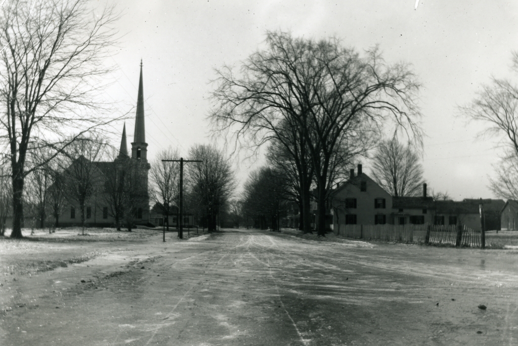
Main Street, Wilbraham Mass

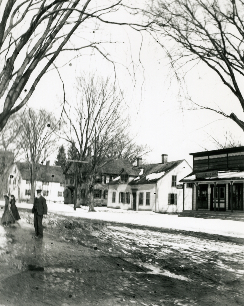
Looking north on Main Street from Springfield Street, probably around 1900. Image courtesy of the Wilbraham Public Library.

554_1900c wpl

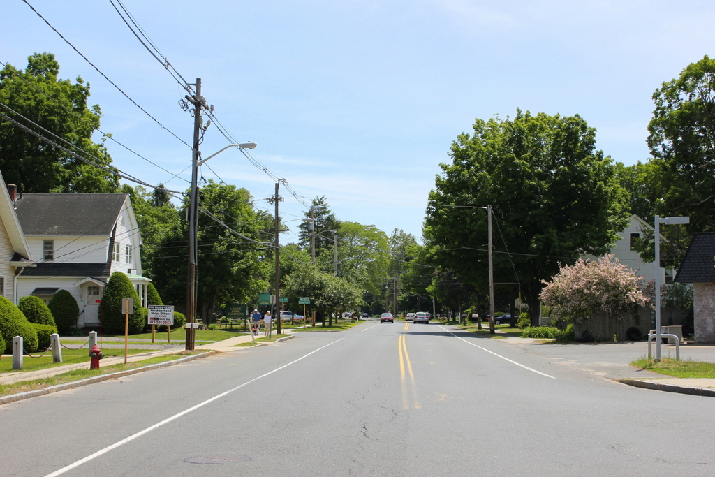
Main Street in 2015:

554_2015 wpl
This scene along Main Street in the center of Wilbraham hasn’t changed much in the past century or so.  At least one of the buildings from the first photo is gone, and Main Street is now paved, but overall the center of Wilbraham retains much of its 19th and early 20th century character.  The first photo shows several historic buildings that survive today.  On the far left is the steeple of the Memorial Chapel, built in 1870 and now part of the Wilbraham & Monson Academy campus.  In front of it is the 1793 Old Methodist Meeting House, and in the left-center of both photos is the 1836 Rev. John W. Hardy House.  The house in the right-center of the first photo is no longer there, and the store on the far right looks like the one in the present-day scene, but there are some differences.  Either it is a completely different building today, or it has been expanded, because it appears to be much close to the Hardy house than in the first view.

First Congregational Church, Wilbraham Mass (2)

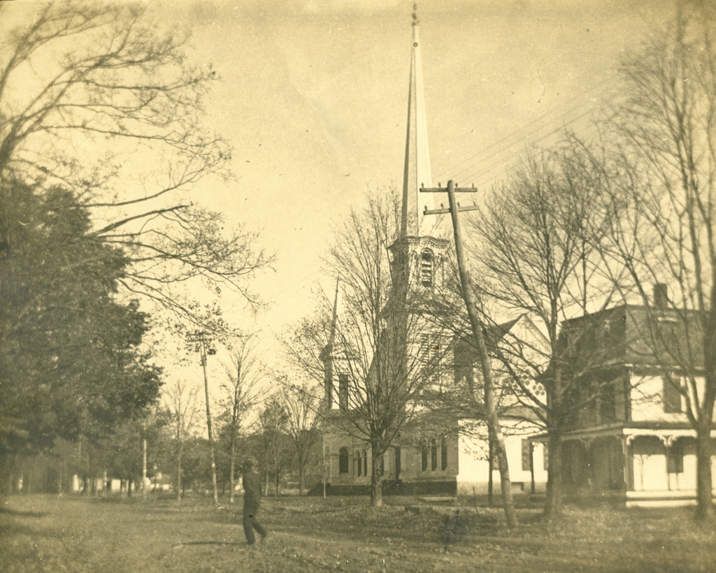
Looking north on Main Street in Wilbraham, with the First Congregational Church in the center, taken around 1900-1911. Image courtesy of the Wilbraham Public Library.

552_1900-1911 wpl

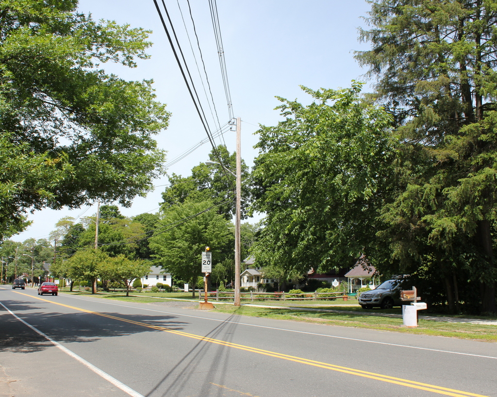
Main Street in 2015:

552_2015
Taken from a similar angle as the ones in this post, these photos show some of the changes on Main Street in Wilbraham over the past century.  I don’t have an exact date for this photo, but it was taken sometime between 1896, when the Allis House just beyond the church burned down, and 1911, when the church itself burned.  Today, the site of the church is now Gazebo Park, and the house in the right foreground is also gone, although many similar historic houses still exist on Main Street.

First Congregational Church, Wilbraham Mass (1)

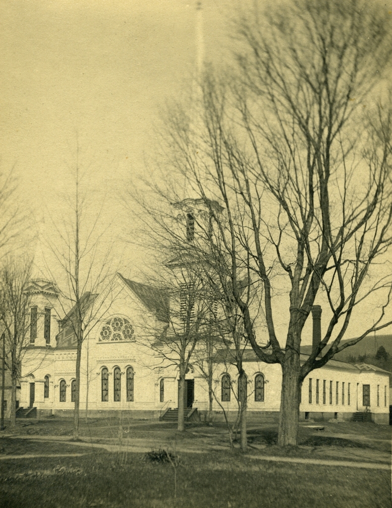
The First Congregational Church on Main Street in Wilbraham, probably around 1900. Image courtesy of the Wilbraham Public Library.
551_1900c wpl

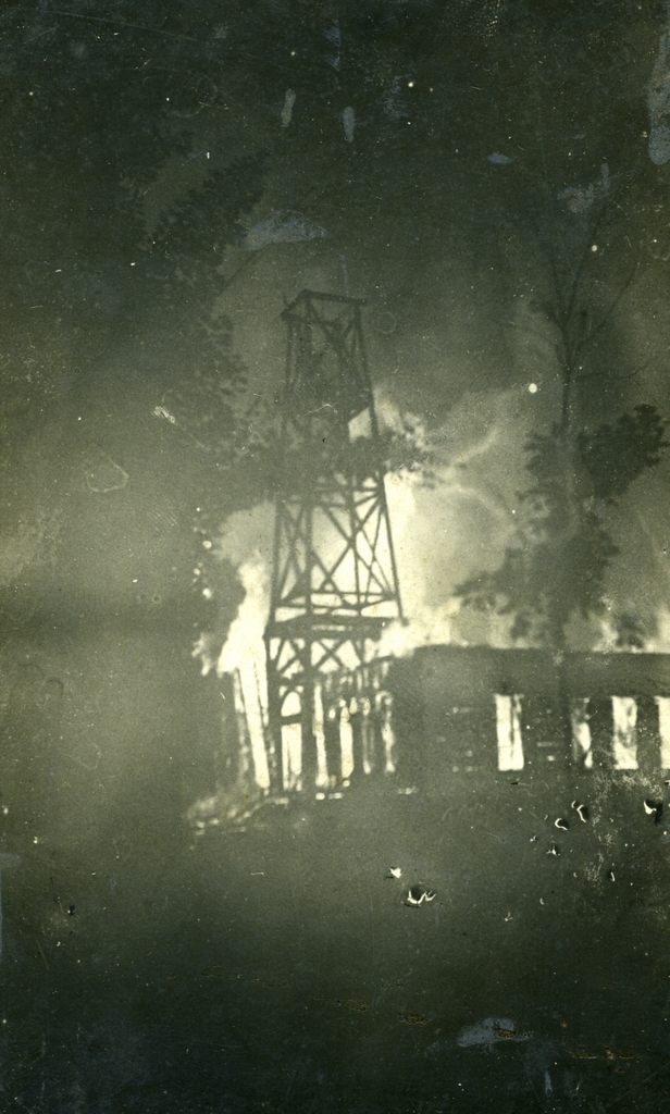
The church on fire after being struck by lightning on July 5, 1911. Image courtesy of the Wilbraham Public Library.
551_1911 wpl

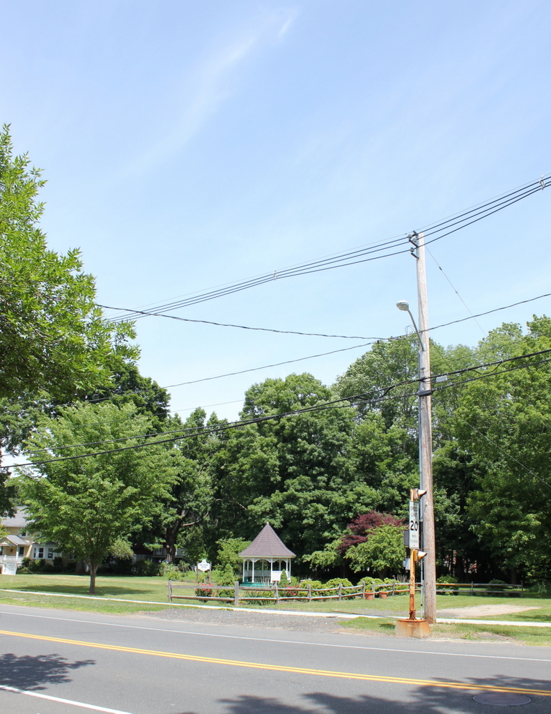
The site of the church in 2015:

551_2015 wpl
In many New England towns, one of the main features of the town center is a historic 19th century Congregational church, usually painted white and complete with a tall steeple.  However, that isn’t the case in Wilbraham, in part because of a series of fires that destroyed the first three meetinghouses that were located on this site.  The First Congregational  Church in Wilbraham was established in 1741 as an offshoot of the Springfield church.  As was the case in many other towns, however, the location of the meeting house became a major political issue.  In the days before automobiles, it was particularly advantageous to live near the meeting house, and in Wilbraham the settlers in both the northern part of town (present-day Wilbraham) and the southern part (present-day Hampden) wanted a meeting house location that was convenient for them.  Eventually, a compromise was reached and the meeting house was built on Wigwam Hill, halfway up a mountain in a sparsely-populated location that presumably only worked because it was equally inconvenient to everyone.

Eventually, however, it began to make sense to have a meeting house in the center of town, so in 1794 the church moved to this location on Main Street.  It wasn’t just the congregation that moved, though.  In true Yankee frugality, the building itself was moved down the mountain and over to this site, where it stood until 1857, when a new church building was completed.  The old meeting house was moved and used as a stable until 1877, when both generations of Wilbraham churches were destroyed in a fire.

The third meeting house, which is shown in the first photo here, was completed in 1878 and was used until 1911, for reasons that the second photo makes very clear.  On July 5, 1911, the steeple was struck by lightning, and the resulting fire consumed the entire church.  I don’t know how long it had been burning by the time the photograph was taken, but it is a ghostly image, with the skeletal remains of the steeple silhouetted against the flames in the background.

Following the fire, the church merged with the Methodist church to form the Wilbraham United Church.  They alternated between the rebuilt church at this site and the Methodist church next to the Wilbraham Academy campus until 1935, when the church here became their full-time home.  However, the congregation began to outgrow that building, so a fifth-generation Wilbraham church was built a short distance away in 1958; this building is still in use today.  The 1911 church was demolished in 1962, and today the site of the first four Congregational churches in Wilbraham is now a public park.
Main Street, Wilbraham Mass

Looking south on Main Street from the corner of Springfield Street in 1903. Image courtesy of the Wilbraham Public Library.

548_1903 wpl

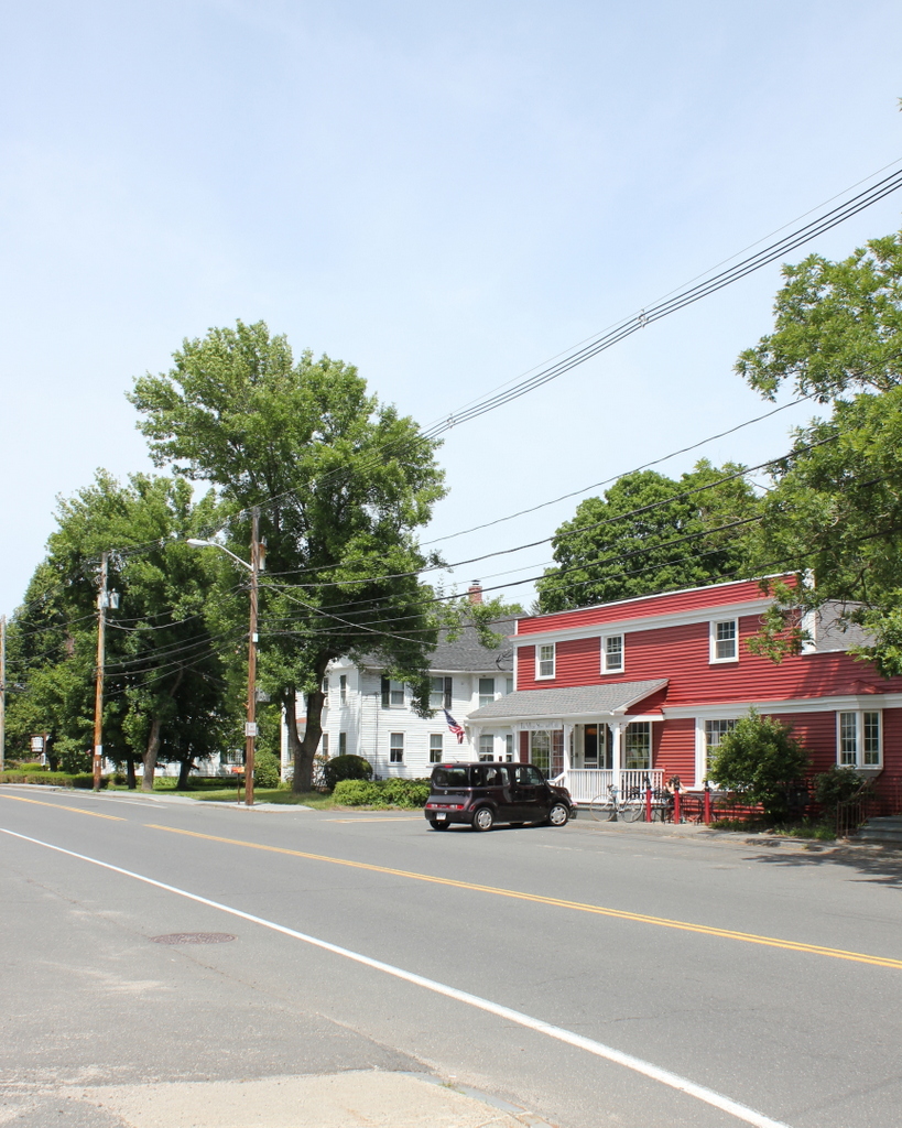
Main Street in 2015:

548_2015
In the past 112 years, Wilbraham has seen significant population growth, but overall its downtown area has retained the small-town feel that it had when the first photo was taken. At the turn of the 20th century, the town’s population was actually in decline, having lost about 25% of its population between 1850 and 1900.  Like many other New England towns, its soil wasn’t particularly well-suited for large-scale farming, and while other cities and towns were industrializing in the 19th century, Wilbraham lacked suitable rivers for any significant industrial development.

It wasn’t until the second half of the 20th century the population started to grow dramatically, with former farmland being developed into residential neighborhoods.  Today, Wilbraham is an affluent suburb of Springfield, and its town center doesn’t look much different from 100 or even 200 years ago, with most of the buildings along Main Street dating to the 18th or 19th centuries.  One such house is the Isaac Brewer House, visible on the right-hand side of both photos.  It was built around 1748, and is one of the oldest houses in the town.  Across the street, however, the old First Congregational Church is gone; it burned in 1911, and today Gazebo Park occupies the spot where the church once stood.

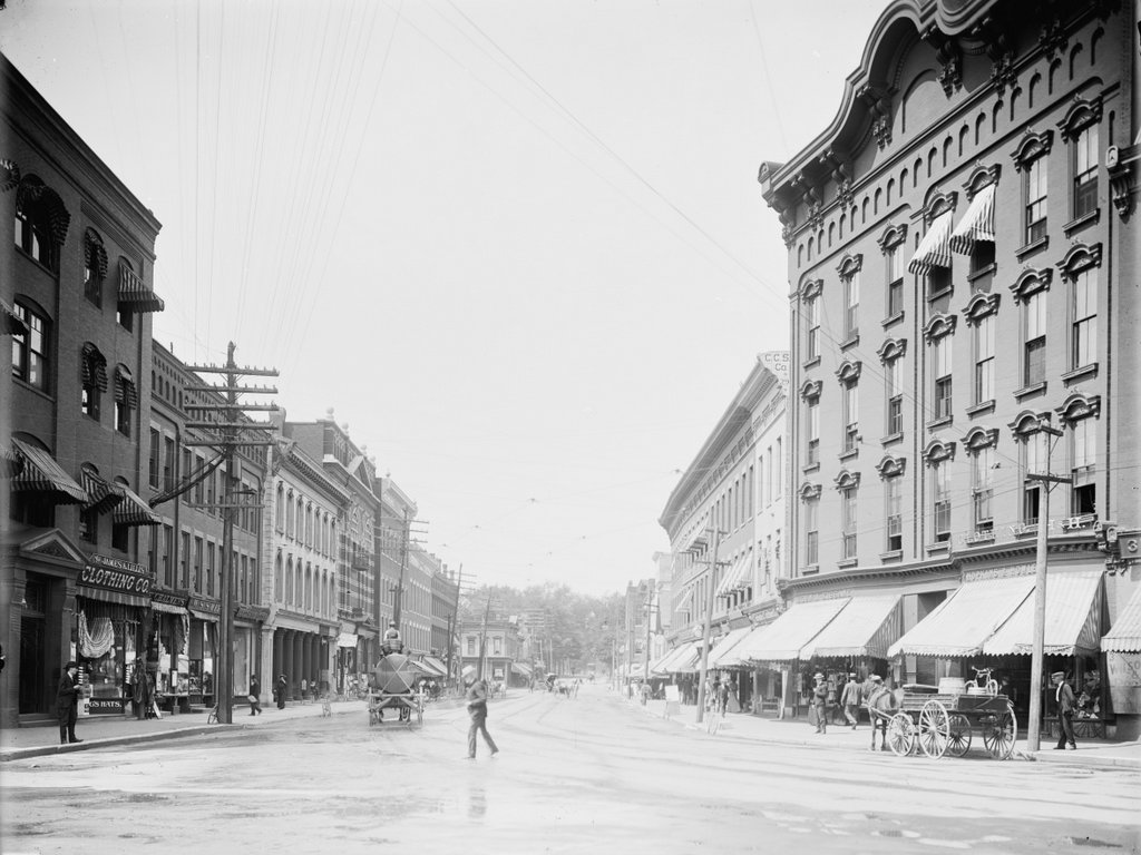
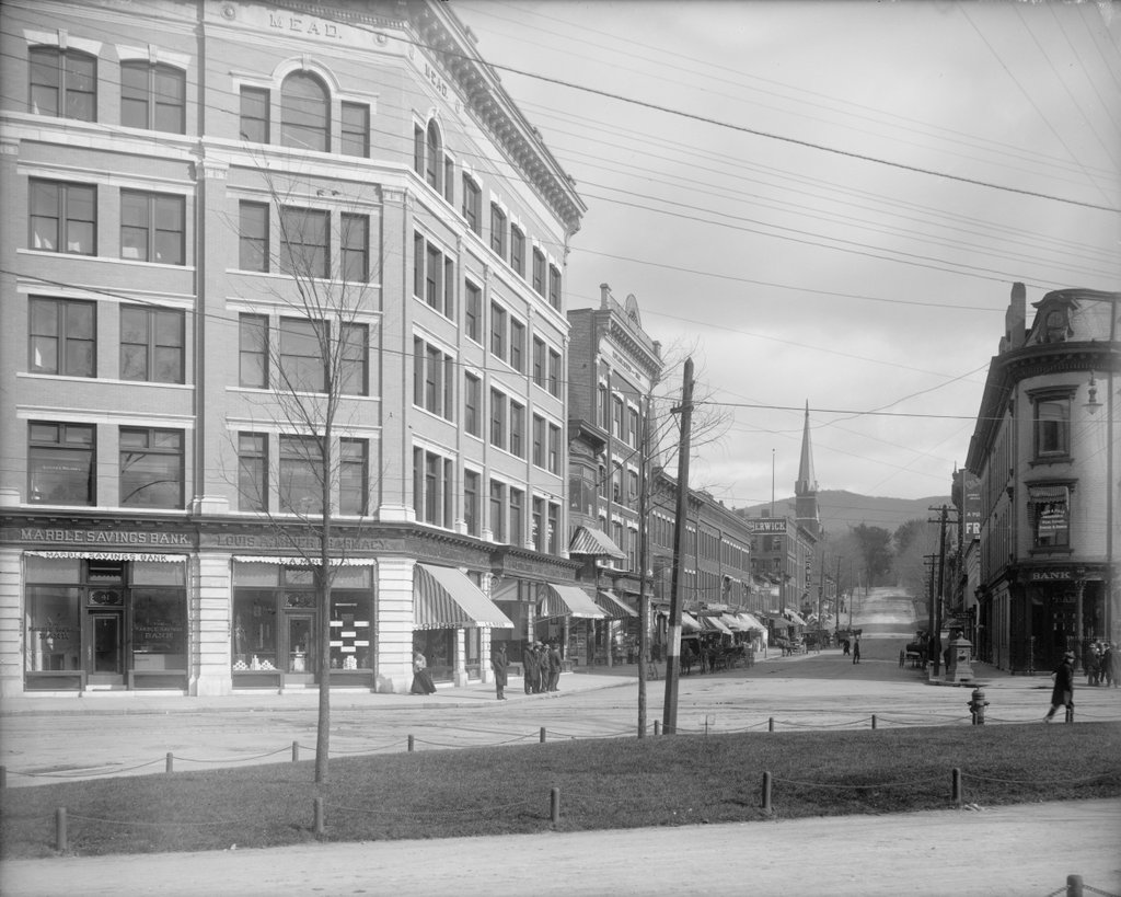
Merchants Row, Rutland Vermont

Looking north on Merchants Row from Center Street in Rutland, around 1904. Image courtesy of the Library of Congress, Detroit Publishing Company collection.

539_1904c loc

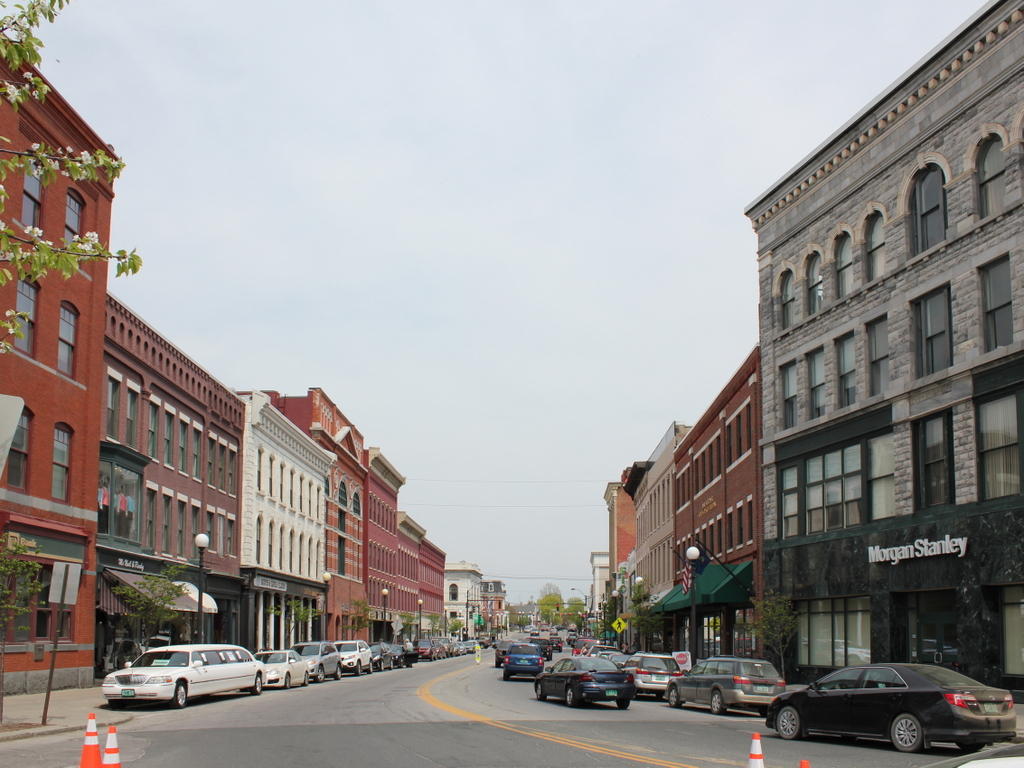
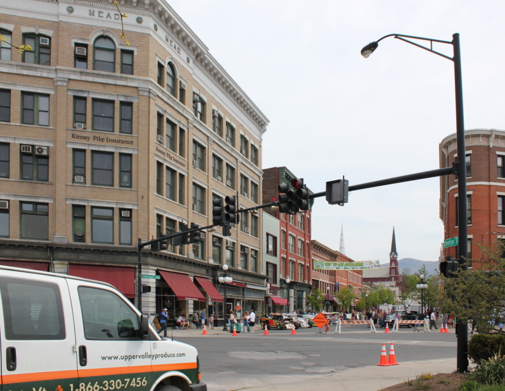
Merchants Row in 2015:

539_2015

Aside from a conspicuous lack of horse-drawn carriages in the 2015 scene, this view of Merchants Row hasn’t changed a whole lot in the past 111 years.  The only prominent building from 1904 that doesn’t survive today is the one on the far right, which was destroyed along with several other buildings in the 1906 fire.  Following the fire, the current building was built on the site.  Otherwise, all of the other buildings are still around today, although some have been altered.  The left side of the street is particularly well-preserved, with many of the buildings dating to the 1860s.  The oldest of these is probably the Ripley Bank Building, which was built before 1864.  Just beyond it is the ornate facade of the Rutland Opera House, which was built in 1881 after the original burned in 1875.  Today the entire area here is part of the Rutland Downtown Historic District on the National Register of Historic Places.

Center Street, Rutland Vermont (2)

Another view looking east on Center Street from Merchants Row in Rutland, taken around 1907-1920. Image courtesy of the Library of Congress, Detroit Publishing Company collection.

538_1905-1920c loc

Center Street in 2015:

538_2015
These photos were taken from nearly the same location as the ones in this post, but the historic photo here shows the north side of Center Street as it appeared in the years following the 1906 fire that destroyed most of the left-hand side of this scene.  Since the first photo was taken, though, not much has changed.  Some of the buildings have been altered, such as the Rutland Savings Bank building on the far right, but otherwise all of the prominent buildings from the early 20th century are still there today, including the Mead Building on the left, which is situated at the corner of Center Street and Merchants Row and replaced the earlier Bates House Hotel that had been destroyed in the fire.  Today, the entire area is part of the Rutland Downtown Historic District on the National Register of Historic Places.