Boylston Street from Gloucester Street, Boston

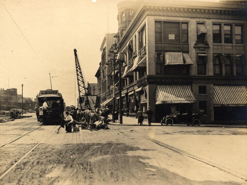
Looking west on Boylston Street from the corner of Gloucester Street, on August 6, 1912.  Image courtesy of the City of Boston Archives.

667_1912-08-06 coba

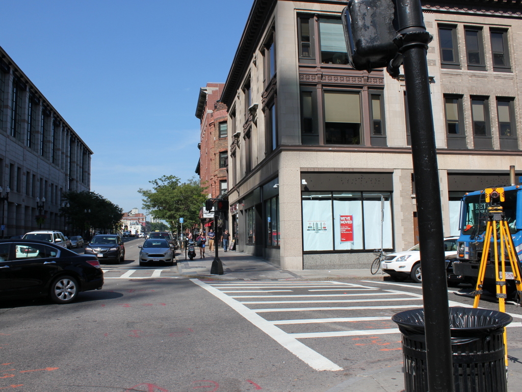
Boylston Street in 2015:

667_2015
The first photo here appears to be documenting the early stages of the work on the Boylston Street Subway, today’s Green Line of the MBTA.  Prior to 1912, the present-day Green Line was only underground from North Station to Arlington, emerging onto Boylston Street at the Boston Public Garden, as seen in this post.  From there, it ran through the Back Bay in the center of Boylston Street, as seen here.  Because of increasing congestion, though, the trolley line was moved underground in 1914.  The new tunnel ran from Arlington Street to Kenmore Square, where it came to the surface in the median of Commonwealth Avenue just east of the square.  I’m not entirely sure what the workers are doing here, but they appear to be doing some sort of excavation on the tunnel – notice the planks in the otherwise dirt road, which probably cover the work that was being done.  In the meantime, the trolleys needed to continue running, so the 1912 scene shows a Reservoir-bound car (today’s “C” Line) passing through the construction area.

Today, Green Line trains still run under this spot in the tunnel that the 1912 workers were building, and on the surface not much has changed on the right-hand side.  Along the mile-long stretch of Boylston Street in the Back Bay, the north side of the street is primarily late 19th and early 20th century low-rise construction, while the south side is almost entirely new.  This contrast can be seen here, as nearly all of the buildings from 1912 are still standing on the right, including the three-story commercial building in the foreground.  It was built in 1905, and in the first photo the corner storefront is occupied by The Henley-Kimball Company, a car dealership that sold Hudson cars.  It was one of many car dealerships along Boylston Street; an awning further down the street advertises for Chalmers, and there are also window signs for Stutz Motor Company and Michelin Tires.

The left (south) side of Boylston Street, however, is significantly different.  In 1912, there were no buildings here; instead, this area was the site of a large rail yard for the Boston & Albany Railroad.  The yard took up the south side of Boylston for three blocks, from Exeter Street to Hereford Street, but over time the land became too valuable to simply use for a rail yard.  The Massachusetts Turnpike now runs through the site of the former yard, and a number of buildings have been built on top of it, including the Hines Convention Center, which can be seen on the far left of the 2015 photo.

Ladder 15/Engine 33 Firehouse, Boston

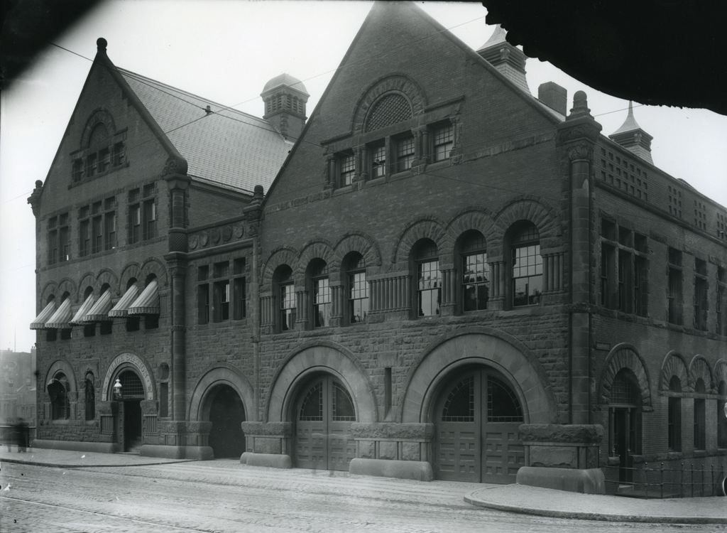
The firehouse at the corner of Boylston and Hereford Streets in Boston, on October 27, 1911. Image courtesy of the City of Boston Archives.

666_1911-10-27 coba

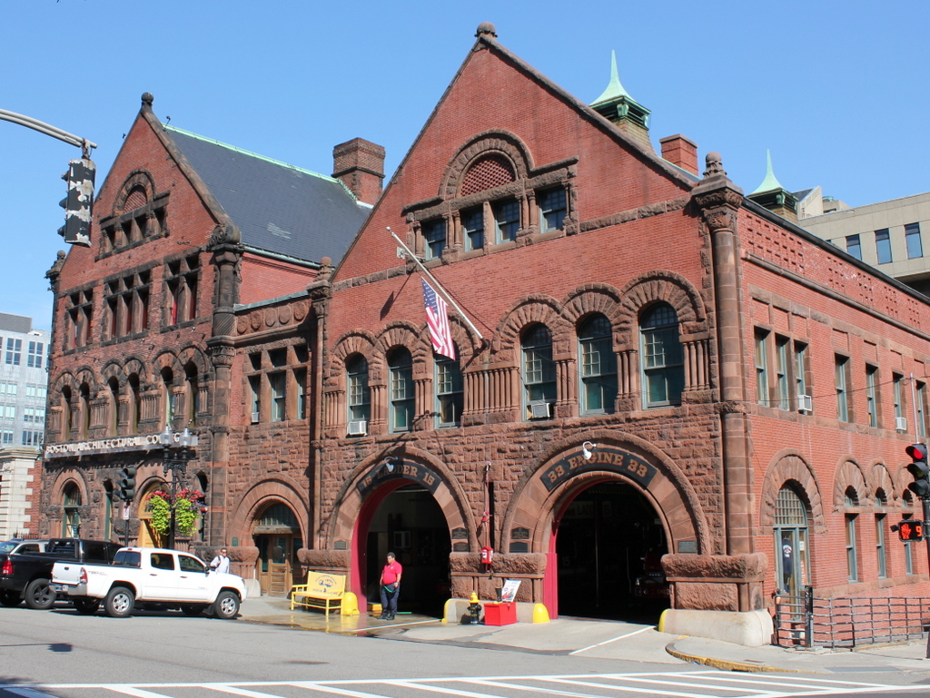
The building in 2015:

666_2015
This structure is made up of two connected buildings: the Ladder 15/Engine 33 firehouse to the right, and the Boston Police Station 16 on the left.  Both were completed in the mid 1880s, on land that had just recently been filled in the city’s Back Bay neighborhood.  It was designed by Arthur H. Vinal, based on the Richardsonian Romanesque style that was popular in the late 1800s, especially in the Back Bay.

Today, the buildings still stand with few changes to the exterior.  The building to the right is still an active fire station; Engine 33 can barely be seen in the shadows of the 2015 photo, and a fireman is standing in front of the Ladder 15 door.  However, the former police station to the left has changed occupants a few times.  It was used by the Boston Police Department until the early 1970s, and from 1973 until 2006 it was the home of the Institute of Contemporary Art.  Since then, it has been used by the Boston Architectural College.

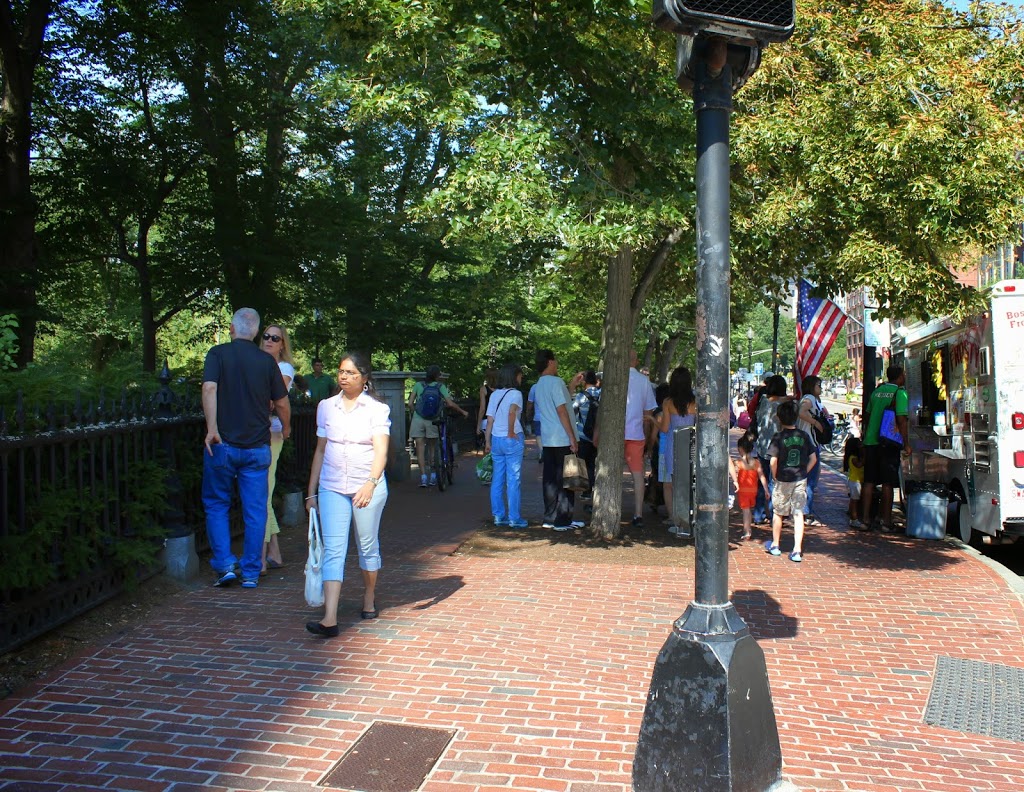
Public Garden Incline, Boston (2)

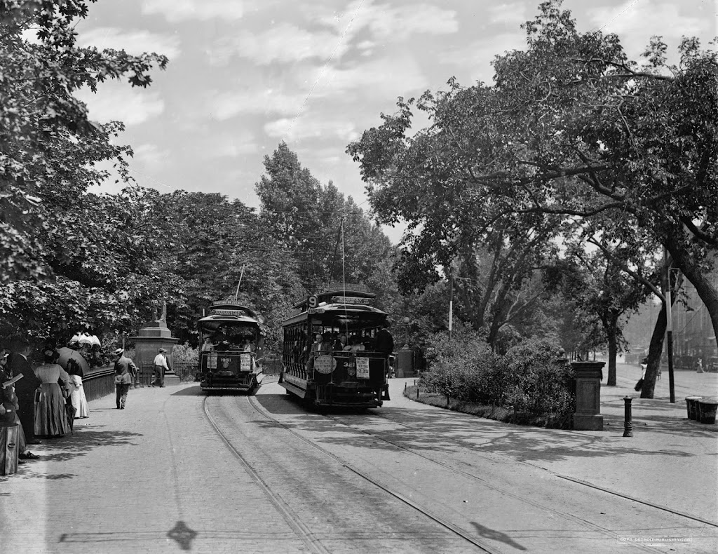
Trolleys at the Public Garden Incline at the corner of Boylston and Arlington Streets in Boston, around 1910-1911. Image courtesy of the Library of Congress, Detroit Publishing Company Collection.

338_1910-1920-2Bloc

The scene in 2014:

338_2014

These were taken from near the location of the photos in this post, showing trolleys entering and emerging from the Tremont Street Subway onto Boylston Street.  The car on the right-hand side is returning from Brookline Village, and the one on the left is heading toward Huntington Avenue, along the modern-day E Branch of the Green Line.  This car is particularly intriguing, because one of the flyers on the front reads “Baseball to-day American League Huntington Avenue,” The exact date of this photo isn’t clear, and the Library of Congress estimates that it was taken between 1910 and 1920, but this little flyer indicates that it couldn’t have been any later than 1911, the last year that the Red Sox played at Huntington Avenue before moving to Fenway Park.  Many of the people on the trolley are probably fans heading to the game, and will likely see future Red Sox legends such Smoky Joe Wood, Tris Speaker, and Harry Hooper.  Today, Red Sox fans still travel along this route to get to the game, although the incline that the trolleys once emerged from has been closed for a century, and no evidence remains on the surface that it ever existed.

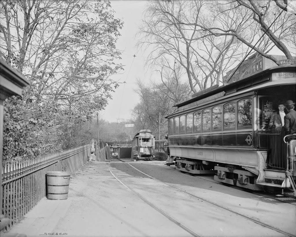
Public Garden Incline, Boston (1)

Trolleys entering and exiting the Tremont Street Subway at its southern end at the Boston Public Garden, around 1904. Image courtesy of the Library of Congress, Detroit Publishing Company Collection.

337_1904c-2Bloc

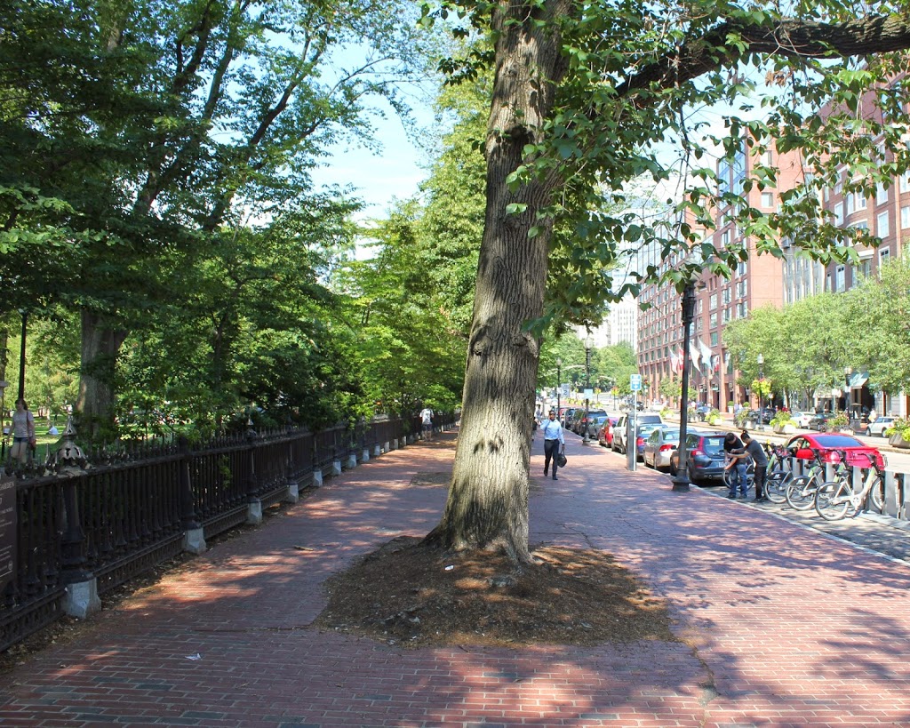
The scene in 2014:

337_2014

When the Tremont Street Subway opened in 1897 as the first subway in the country, trolleys ran underground from downtown all the way until the corner of Arlington and Boylston, where the tracks emerged here and continued along Boylston Street to points west.  The three cars in the first photo represent three different routes, with the one on the far right returning from Newton, the one ahead of it coming from Roxbury, and the one in distance is heading toward Huntington Avenue.  Today’s Green Line still has four different branches, all that is left of what was once a much larger streetcar system.  The subway portal itself closed in 1914, when the subway was extended under Boylston Street to Kenmore, and no evidence remains on the surface to suggest that trolleys once emerged here from underground.

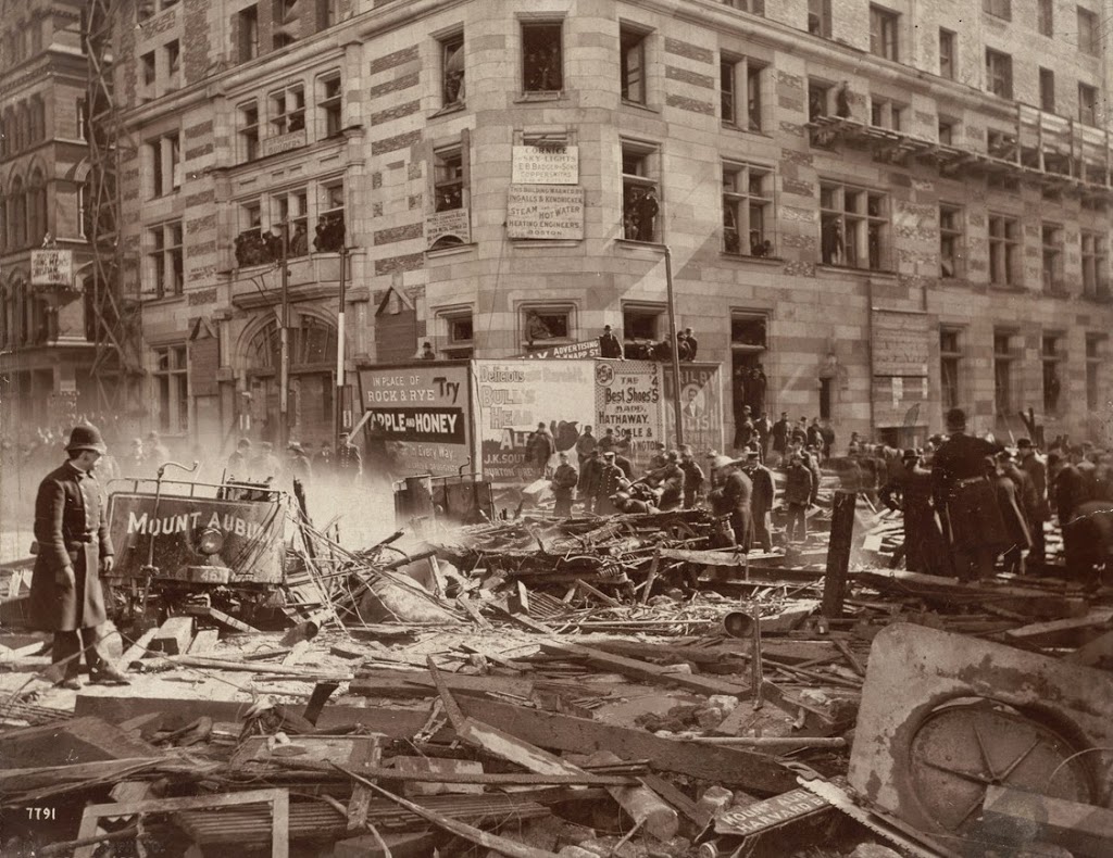
Explosion, Corner of Tremont and Boylston Streets, Boston

An explosion at the corner of Tremont and Boylston during the construction of the Tremont Street Subway on March 4, 1897.  Photo courtesy of Boston Public Library.

319_1897-03-04-2Bbpl

The scene in 2014:

319_2014

The corner of Boylston and Tremont is the location of a sharp 90 degree curve on the Green Line, where the underground tracks turn off of Boylston and onto Tremont.  In 1897, however, this was still under construction.  During this time, one of the gas lines at the intersection began leaking.  The escaped gas accumulated in the empty space underground, until a horse-drawn streetcar, the one marked “Mount Auburn” in the photo, ignited the gas as it passed above ground.  The explosion killed ten people and caused significant damage to the surrounding buildings, including the Hotel Touraine, which was still under construction in the first photo and stands to this day.  The subway itself would go on to open on September 1, and the location of the explosion became the Boylston station.

Masonic Temple, Boston

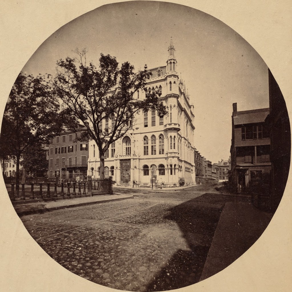
The Masonic Temple at the corner of Boylston and Tremont Streets, facing east on Boylston in the late 1860s. Photo courtesy of Boston Public Library.

303_1864-2Bbpl

The scene in 2014:

303_2014

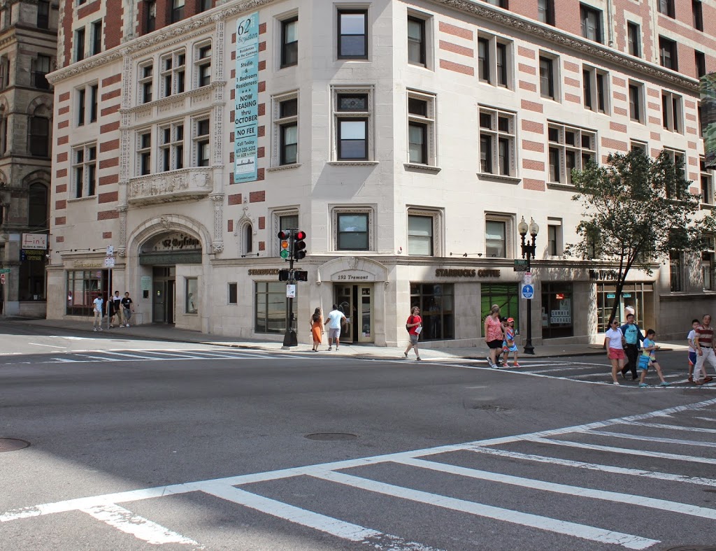
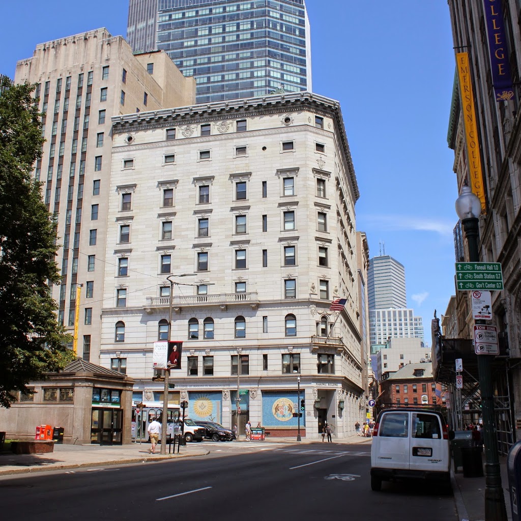
According to the Boston Public Library, the first photo was taken in 1864, which is unlikely considering the building in the photo wasn’t built until 1867. This site at the corner of Boylston and Tremont Streets has been home to the Grand Lodge of Massachusetts since 1859, starting with the Winthrop House, which burned in 1864. It was replaced with the building in the first photo in 1867, and this building likewise burned, in 1895. The present-day building was completed in 1899, and has been home to the lodge ever since.

A number of other changes have taken place here, with most of the 4-5 story residential and commercial buildings being replaced over the years by successively taller structures. Today, only one building from the first photo still survives – the 1850 Liberty Tree Building a block down Boylston Street, seen in the 2014 photo directly behind the white van. Another significant change is the Boylston station, seen on the left of the 2014 photo, which opened on Boston Common in 1897 as one of the first two subway stations in the United States.