Brooklyn Bridge Construction

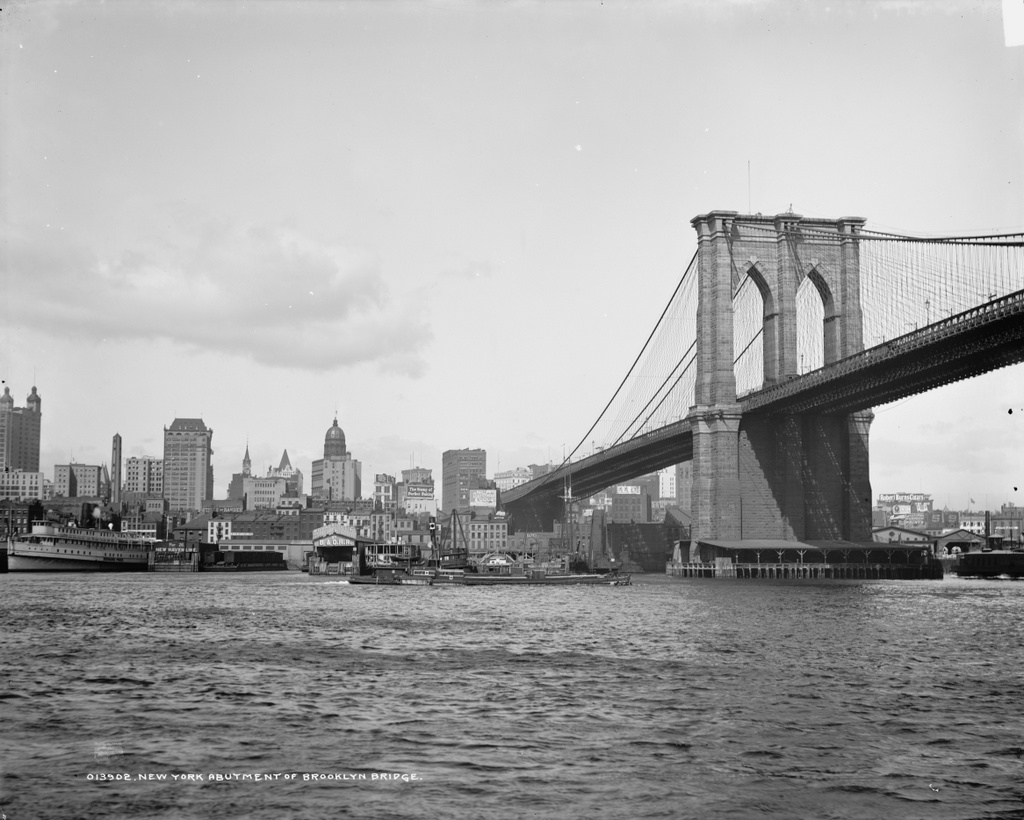
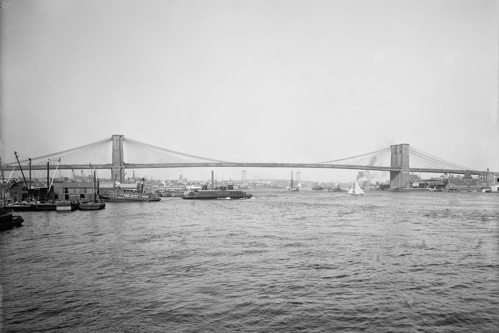
The Brooklyn Bridge, before the construction of the walkway, probably taken around 1880. Photo courtesy of the New York Public Library.
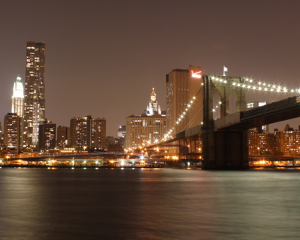
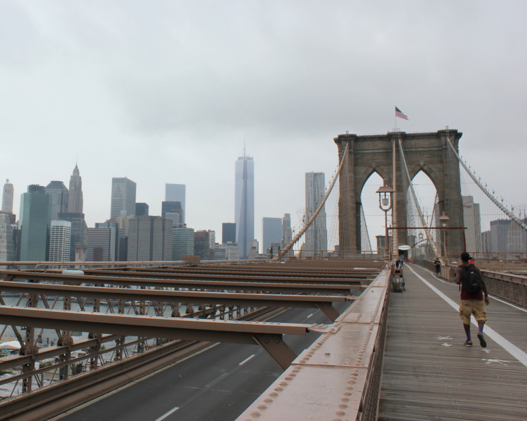
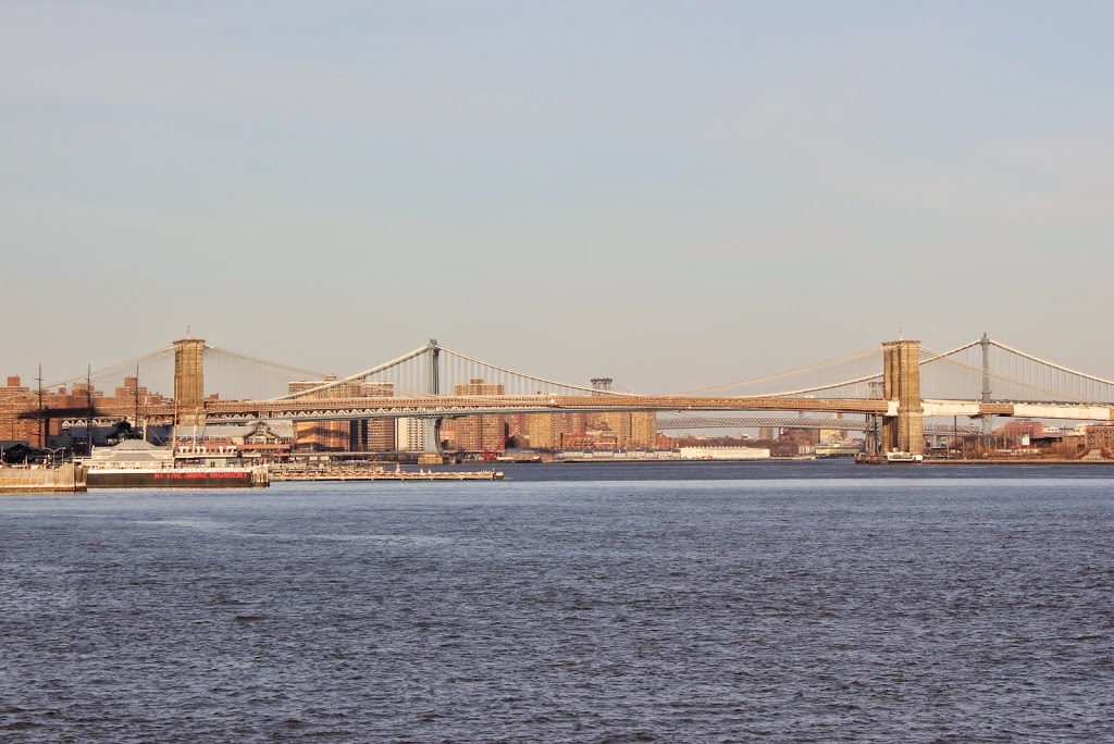
449_1880c nypl

The scene in 2013:

449_2013

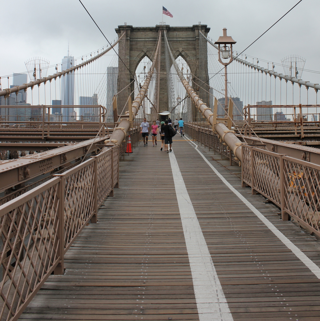
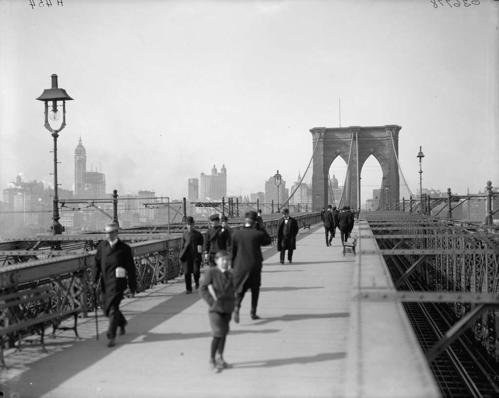
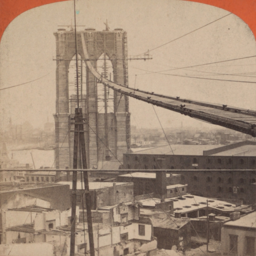
The Brooklyn Bridge opened in 1883, but before the roadway could be built, the towers were connected by a narrow walkway.  Although intended for the workers, it was also open to the public, and was a popular destination, to the point where bridge management had to start issuing passes in order to cross.  Of course, this was in the days before OSHA regulations and other safety measures, but it actually wasn’t as dangerous as it looks.  Some publicity-seeking daredevils even jumped off of it and into the East River, with varying success rates.  Upon completion of the bridge, the present-day walkway opened, which can be seen around the turn of the last century in this post.  Thankfully, modern-day bridge pedestrians need not balance themselves on a narrow catwalk, nor ascend and descend the two 272-foot tall bridge towers in order to cross the river.

South Street Docks, New York City

The view looking north along the South Street docks along the East River around 1900, with the Brooklyn Bridge in the background. Image courtesy of the Library of Congress, Detroit Publishing Company Collection.

175_1900c-loc.tif

The scene in 2014:

175_2014

There isn’t much left to remind visitors of the bustling seaport that lower Manhattan once was, and South Street itself, which was teeming with activity in 1900, is now a quiet street underneath the elevated FDR Drive (named after a person who, when the first photo was taken, was just starting his studies at Harvard).

The first photo shows the docks of the New York and Cuba Mail Steamship Company, also known as the Ward Line. They went out of business in 1954, and their docks are now home to the South Street Seaport, which owns a number of historic ships, including the Peking, the 1911 sailing ship visible in the second photo. The only actual structure from the 1900 photo that still exists today is the Brooklyn Bridge, seen in the background of both photos.

Manhattan Waterfront from Brooklyn Bridge

The view of Lower Manhattan, looking south from the Brooklyn Bridge, around 1901. Image courtesy of the Library of Congress, Detroit Publishing Company Collection.

128_1901c loc

The view from the Brooklyn Bridge in 2013:

128_2013

Manhattan’s waterfront is quite different today from 100 years ago. Once a major transportation hub, today the FDR Drive along the waterfront is a major transportation corridor, instead of the East River that it runs parallel to. In the foreground of the first photo are the piers for the New Haven Line, a steamship company that operated ferries between Manhattan and New Haven, with railroad connections to points north. The closest steamship is the SS Robert Peck, which was built in 1892 as the flagship of the line. In 1943, it was transferred to the Navy, and served as floating barracks for part of World War II.

Manhattan and Brooklyn Bridge

The view of Manhattan and the Brooklyn Bridge from Brooklyn, around 1900. Image courtesy of the Library of Congress, Detroit Publishing Company Collection.

126_1900c loc

The view in 2013:

126_2013

The scene in 2023:

The difference is like night and day.  Cheesy puns aside though, there is quite a difference in the Manhattan skyline between the two photos, over 100 years apart.  The Brooklyn Bridge is still there, but otherwise, as far as I can tell, none of the buildings in the first photo are visible in the second.  At least one of them – the tall Park Row Building at the far left of the first photo – still exists today, but I don’t think it can be seen from here.

April 2023 Update: I have added an updated photo, showing the scene during the daytime.

Brooklyn Bridge Promenade

The view along the Brooklyn Bridge Promenade, looking toward Manhattan, between 1908 and 1920. Image courtesy of the Library of Congress, Detroit Publishing Company Collection.

125_1908-1920 loc

The same view in 2013:

125_2013

The angle here isn’t exact, since they were taken from different sides of the walkway, but both photos show the same view of the Brooklyn Bridge and of the Manhattan skyline.  The first photo is interesting, because although the subject of the photo is the bridge, the background shows three different buildings that were, at one point, the tallest in the world:

1. New York World Building: The tallest from 1890 to 1894, demolished in 1955 to expand the approaches for the Brooklyn Bridge.  The dome of the building is barely visible under the left-hand arch of the bridge tower.

2. Park Row Building:  Held the record from 1899 to 1901, and the building still exists, although it’s not visible in the 2013 photo.  It can be seen in the first photo, near the center, with the two towers on top.

3. Singer Building: Held the record from 1908 to 1909, and was demolished in 1968.  It is readily visible on the far left of the first photo, and its location today is marked by One Liberty Plaza, the large black rectangle at the base of the new World Trade Center building.

Brooklyn Bridge, New York

The Brooklyn Bridge from the south, as it appeared around 1904. The towers of the Williamsburg Bridge are barely visible in the distance. Image courtesy of the Library of Congress, Detroit Publishing Company Collection.

016_1904c-2Bloc

The same view in February, 2012:

016_2012

The Brooklyn Bridge hasn’t changed much in the past 108 years, but its surroundings have.  In addition to the Manhattan Bridge behind it, the skyline of the Lower East Side has also substantially changed, with high-rises covering much of the shoreline in this area.