Aftermath of the Halifax Explosion (3)

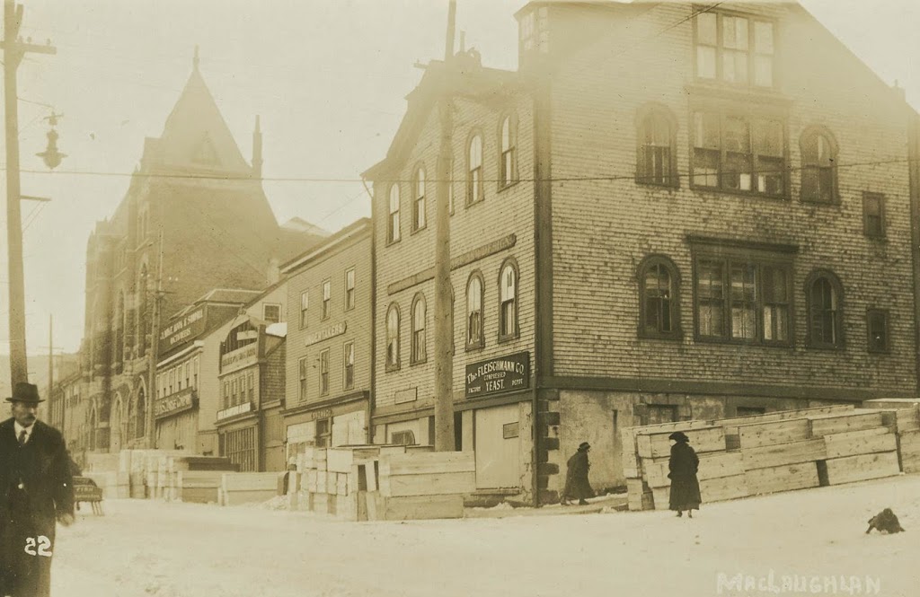
Looking down Argyle Street from George Street in downtown Halifax, Nova Scotia, in December 1917. Photo courtesy of the Nova Scotia Archives.
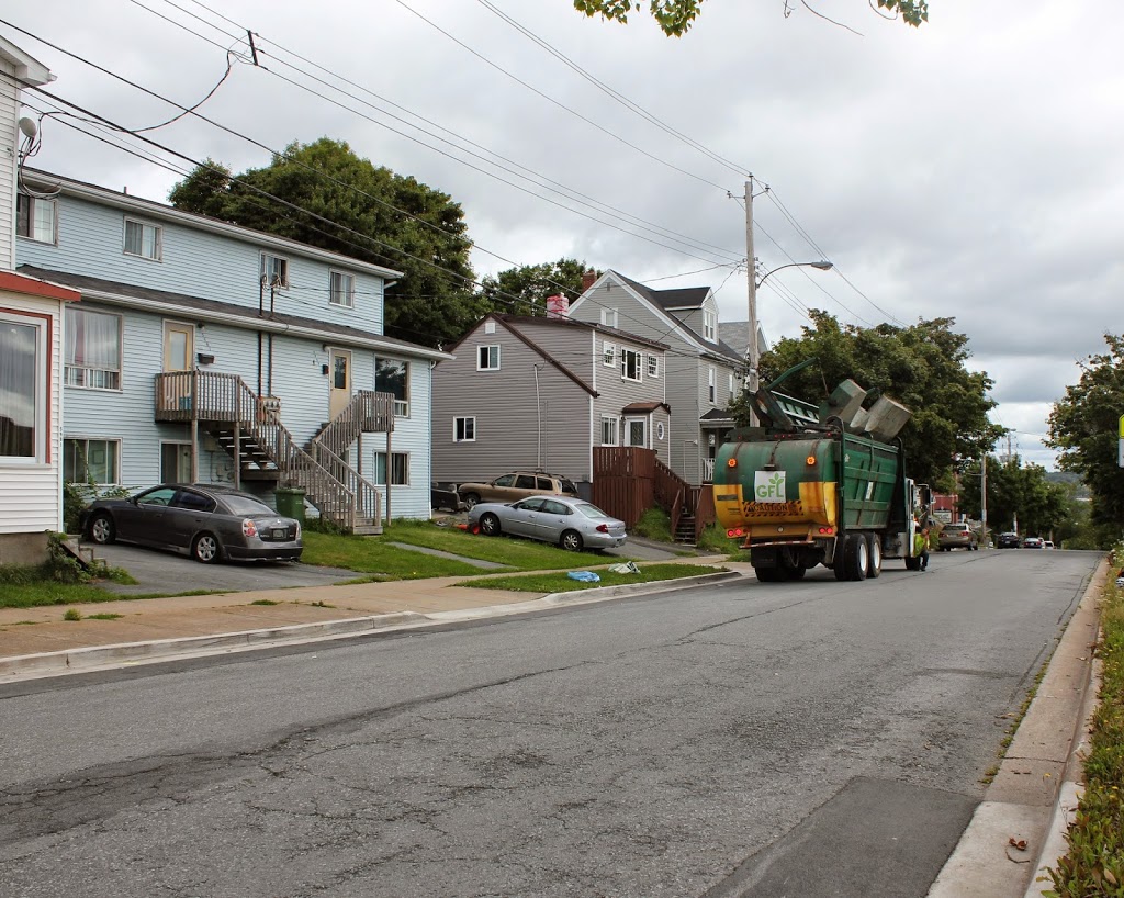
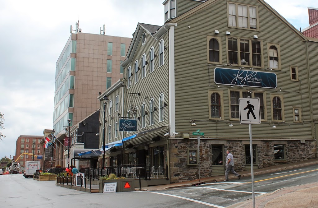
357_1917-2Bnsarchives

The scene in 2014:

357_2014

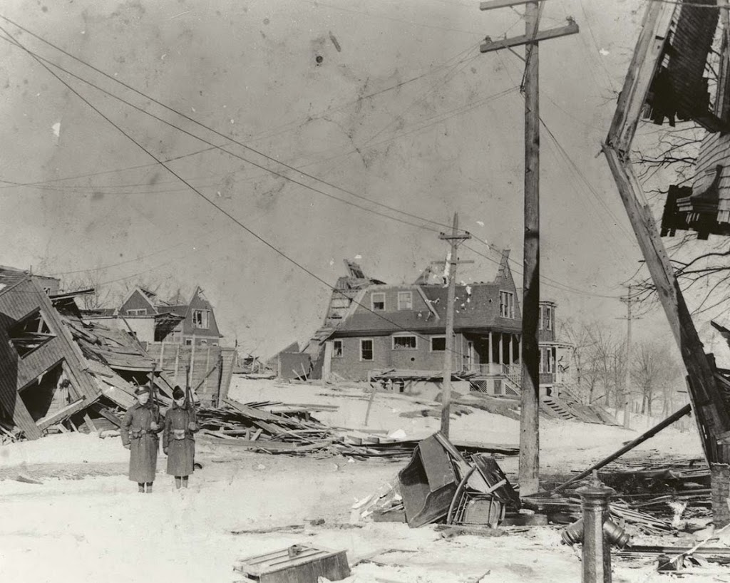
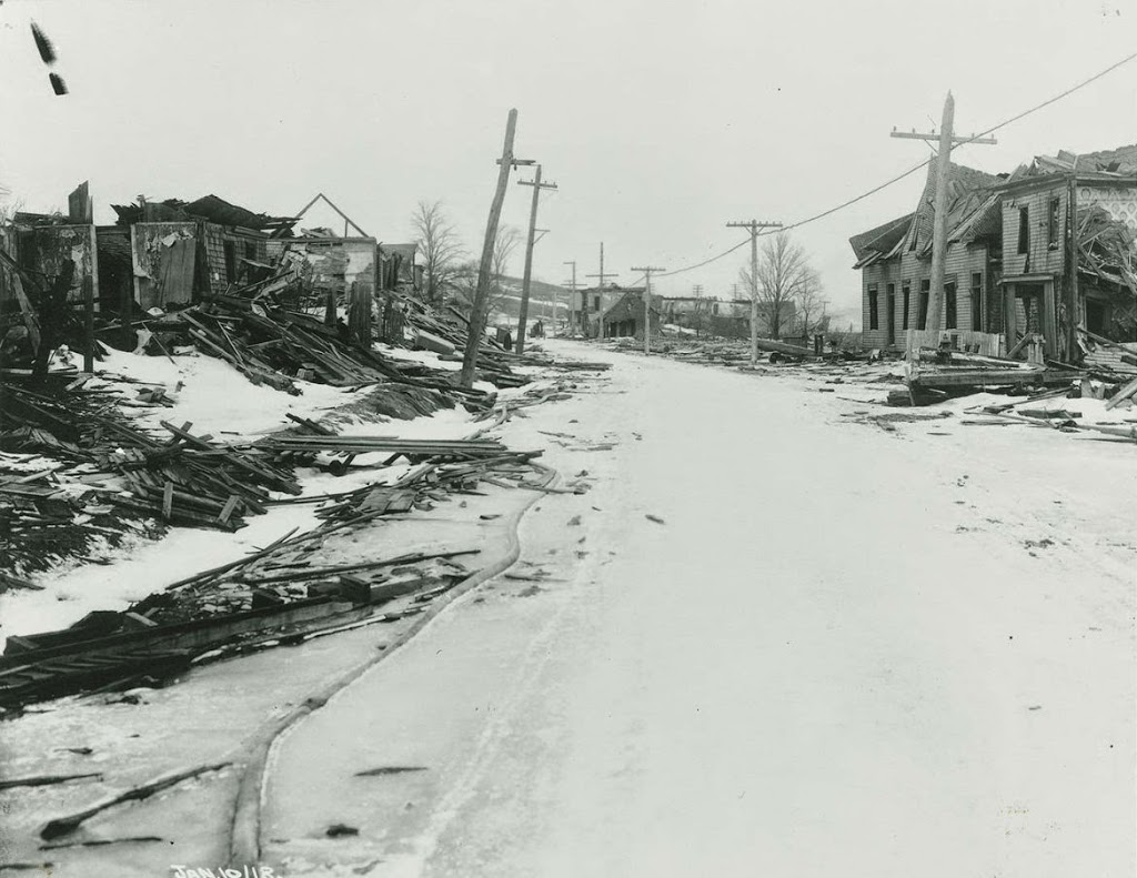
Out of the photos that I’ve posted about the Halifax Explosion, this is the only one that doesn’t show an area affected by the blast.  However, what the 1917 photo does show is far more powerful.  At first glance, nothing seems out of the ordinary, except for the stacks of wooden boxes on the street.  Except they’re not just wooden boxes; the sign on the second building from the right reads “Undertakers,” and the coffins outside were just a sampling of what was needed for the approximately 2,000 victims of the disaster.

Incidentally, this wasn’t the first time that the building dealt with a major tragedy – just five years earlier the recovery operation for the bodies of Titanic victims was operated out of the city, as it was the closest major port to the disaster.  During that time, the mortuary here was used to care for the remains of some of the victims, including John Jacob Astor and Charles M. Hayes.

Today, the building is still there, and is nearly 200 years old; it was built in 1817 and has served a variety of uses ever since.  Today, it is home to the Five Fishermen, which is perhaps the only fine dining restaurant in the world that advertises the fact that its facilities were once used as a mortuary.  (if you don’t believe me, check out their website – they even have the same 1917 photo there)

Aftermath of the Halifax Explosion (2)

Looking east down Kaye Street from Gottingen Street in Halifax, Nova Scotia, in December 1917 or early 1918, following the Halifax Explosion. Photo courtesy of the Nova Scotia Archives.

355_1917-2Bnsarchives

The scene in 2014:

355_2014

This neighborhood is located just up the hill from the epicenter of the Halifax Explosion, and its appearance is typical of what much of this part of the city looked like after the disaster. Here, two soldiers are standing guard to keep looters out – residents needed a pass in order to gain entry to the affected areas. Today, the neighborhood is entirely reconstructed, with no sign of the disaster that hit here almost 97 years ago.

Aftermath of the Halifax Explosion (1)

Looking north on Campbell Road (today Barrington Street) in Halifax, Nova Scotia, on January 10, 1918, following the Halifax Explosion. Photo courtesy of the Nova Scotia Archives.

354_1917-2Bnsarchives

Barrington Street in 2014:

354_2014

These photos were taken just north of the intersection of Barrington and Rector Streets, and they show the scene near the epicenter of the Halifax Explosion, not far up the road from where the photos in this post and this post were taken prior to the explosion.

The disaster occurred after an ammunition ship was involved in a collision and caught fire. The ship was abandoned and drifted over to the Halifax shoreline, where it exploded, damaging or destroying over 12,000 buildings and killing nearly 2,000 people. The disaster was further complicated by secondary fires, caused by overturned stoves, and to make matters worse a blizzard dropped 16 inches of snow the next day, hampering the rescue effort and delaying much needed supplies from reaching the city.

Today, no trace of the explosion remains – nor does any trace of the neighborhood that was once located here. However, the disaster is not forgotten, especially by residents of Nova Scotia. Every year, Nova Scotia sends a Christmas tree to Boston, where it is displayed at the Prudential Center, in recognition of the contributions that Massachusetts made to the relief efforts in the immediate aftermath of the disaster.

Barrington Street, Halifax, Nova Scotia (2)

Another scene on Campbell Road (today’s Barrington Street) in Halifax, Nova Scotia, before the 1917 Halifax Explosion. Photo courtesy of the Nova Scotia Archives.

Canada

The scene in 2014:

353_2014

The first photo is undated, but the absolute earliest date would be 1888, although it is probably a little later than that, perhaps around 1900.  A few clues give it away, with one being fairly obvious: the Coca Cola advertisement on the side of the building.  Coca Cola was established in 1886, but it is unlikely that it would have made its way to Canada so quickly.  Perhaps less obvious of a clue is the bicycle leaning against the mailbox; this now-ubiquitous style of bicycle, known as the “safety bicycle” – because it was safer than a penny farthing – was not developed until the late 1880s.  Finally, the reference to “Kodaks” in the drugstore sign indicates that it must be 1888 or later, and probably later.  Kodak was founded in 1888, but the sign seems to indicate that people were already familiar with it by then, which suggests a somewhat later date.

These photos were taken from almost the same spot as the ones in this post, just from a slightly different angle, at the corner of Barrington and Young Streets.  As mentioned in the other post, this entire area would be leveled by the 1917 Halifax Explosion, and today the scene looks entirely different.  In the distance is the Angus L. MacDonald Bridge, one of two that cross the Narrows of Halifax Harbour, the same area where the explosion occurred.

Barrington Street, Halifax, Nova Scotia (1)

The view looking south on Campbell Road (today Barrington Street) sometime before the 1917 Halifax Explosion. Photo courtesy of the Nova Scotia Archives.

352_1860-1917-2Bnsarchives

The scene in 2014:

352_2014

It’s not in New England, but Halifax has historically had close ties with New England, particularly in the aftermath of the Halifax Explosion, when an ammunition ship exploded in the harbor on December 6, 1917, leveling much of the city and killing several thousand people.  This section of road was right near ground zero, and the buildings in the first photo, if they were still standing before the explosion, were certainly not standing afterward.  The first photo was probably taken around 1900, in what was at the time a mix of residential and commercial uses.  Today, the waterfront (left) side of the road is primarily industrial, with some commercial development to the right.  Overall, the c.1900 scene is entirely unrecognizable today.