Kenmore Square Bus, Boston

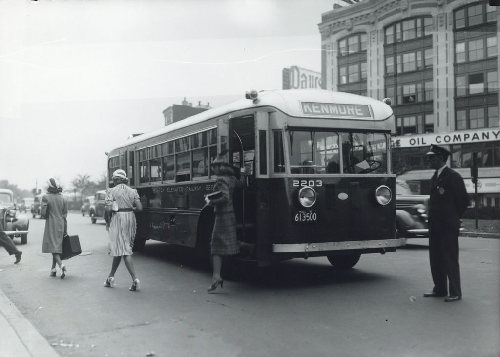
Passengers getting off of a bus at Kenmore Square, sometime in the 1940s and probably before 1947.  Image courtesy of the City of Boston Archives.

664_1940sc coba

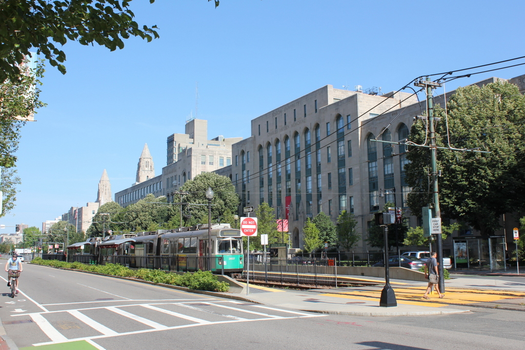
The same location in 2015:

664_2015
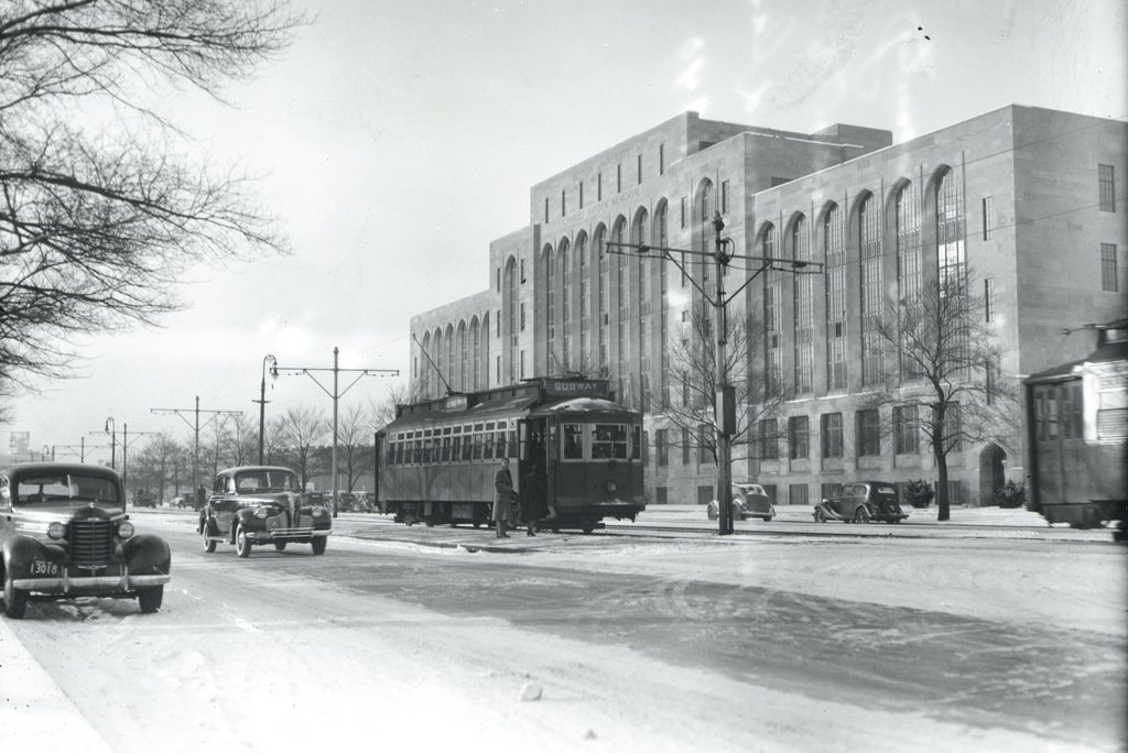
For all that has changed in the past 70 years, not much is different between these two photos.  Many of the buildings in Kenmore Square are still there today, including the Peerless Motor Company Building in the background on the right.  It was completed in 1911 as the New England headquarters of the Peerless Motor Company, an early luxury car brand that was in business until 1931.  The building was used for offices, showrooms, and garage space for the company, but by the time the first photo was taken, Peerless had been gone for over a decade.  Today, the exterior of the building is essentially the same as it was when it was built over a century ago, and it is used as Boston University’s bookstore.  It isn’t visible in the photo, but this is also the building that has the famous Citgo sign that can be seen beyond the Green Monster at Fenway Park.

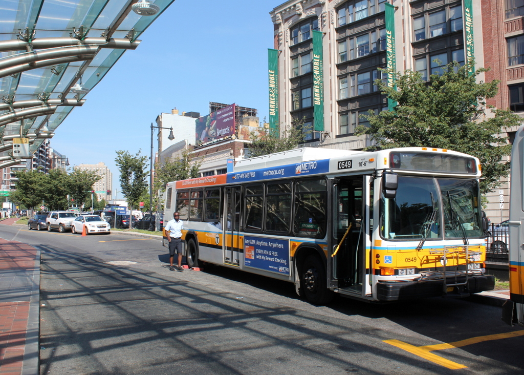
The most obvious change from the 1940s photo is the bus.  Not only are bus styles different today, but so is the company that operates the city’s buses.  The side of the bus reads “Boston Elevated Railway,” which was the company that ran Boston’s subways, streetcars, and buses until 1947.  With increased competition from automobiles, the company was no longer profitable, so its operations were sold to the Metropolitan Transit Authority, which later became today’s MBTA.  As seen in the 2015 photo, Kenmore Square is still a major transportation hub, and the median of Commonwealth Avenue has a reserved lane for buses next to the bus shelter, which also offers access to the Green Line station directly underneath here.

Boston University East, Boston

The Boston University East MBTA station on Commonwealth Avenue, around 1939. Image courtesy of the City of Boston Archives.

663_1930sc coba

The scene in 2015:

663_2015
The first photo shows passengers boarding a Boston Elevated Railway trolley at the Boston University East station, in front of the Charles Hayden Memorial Building at Boston University.  It appears to be a Type 4 trolley, which was found on Boston’s many streetcar lines from 1911 until 1950.  Most of those lines have long since been converted into buses, but the line along Commonwealth Avenue is still in use, as the MBTA “B” branch of the Green Line.

The Charles Hayden Memorial Building in the background of both photos was completed in 1939, and it provides an earliest possible date for the photo, which the City of Boston Archives estimated as being in the 1930s.  The building was the first to be built on BU’s Charles River Campus, and just over two years after it opened the United States entered World War II, postponing other construction projects on the campus.  The other buildings along this section of Commonwealth Avenue would not be completed until 1948, but today this area between the Massachusetts Turnpike to the south and the Charles River to the north has become the school’s main campus.

Public Garden Incline, Boston (2)

Trolleys at the Public Garden Incline at the corner of Boylston and Arlington Streets in Boston, around 1910-1911. Image courtesy of the Library of Congress, Detroit Publishing Company Collection.

338_1910-1920-2Bloc

The scene in 2014:

338_2014

These were taken from near the location of the photos in this post, showing trolleys entering and emerging from the Tremont Street Subway onto Boylston Street.  The car on the right-hand side is returning from Brookline Village, and the one on the left is heading toward Huntington Avenue, along the modern-day E Branch of the Green Line.  This car is particularly intriguing, because one of the flyers on the front reads “Baseball to-day American League Huntington Avenue,” The exact date of this photo isn’t clear, and the Library of Congress estimates that it was taken between 1910 and 1920, but this little flyer indicates that it couldn’t have been any later than 1911, the last year that the Red Sox played at Huntington Avenue before moving to Fenway Park.  Many of the people on the trolley are probably fans heading to the game, and will likely see future Red Sox legends such Smoky Joe Wood, Tris Speaker, and Harry Hooper.  Today, Red Sox fans still travel along this route to get to the game, although the incline that the trolleys once emerged from has been closed for a century, and no evidence remains on the surface that it ever existed.

Public Garden Incline, Boston (1)

Trolleys entering and exiting the Tremont Street Subway at its southern end at the Boston Public Garden, around 1904. Image courtesy of the Library of Congress, Detroit Publishing Company Collection.

337_1904c-2Bloc

The scene in 2014:

337_2014

When the Tremont Street Subway opened in 1897 as the first subway in the country, trolleys ran underground from downtown all the way until the corner of Arlington and Boylston, where the tracks emerged here and continued along Boylston Street to points west.  The three cars in the first photo represent three different routes, with the one on the far right returning from Newton, the one ahead of it coming from Roxbury, and the one in distance is heading toward Huntington Avenue.  Today’s Green Line still has four different branches, all that is left of what was once a much larger streetcar system.  The subway portal itself closed in 1914, when the subway was extended under Boylston Street to Kenmore, and no evidence remains on the surface to suggest that trolleys once emerged here from underground.

Park Street Station, Boston

Tremont Street during construction of the Park Street subway station in 1897. Photo courtesy of Boston Public Library.

336_1897-2Bbpl

Park Street Station after completion, taken in 1906. Photo courtesy of Boston Public Library.

336_1906-2Bbpl

Park Street Station in 2014:

336_2014

As mentioned in previous posts, the Tremont Street Subway (today’s MBTA Green Line) was the first subway in the country, and Park Street was one of the first two stations, along with Boylston.  The station opened in 1897, and helped to relieve congestion on Tremont Street by removing the trolleys from the surface, as seen in the first photo.  Today, the station is still there, as is Park Street Church behind it.

See this post and this post for a few photos of the interior of the station.

Park Street Station, Boston

The entrances to the Park Street station, taken from in front of Park Street Church, around 1900. Image courtesy of the Library of Congress, Detroit Publishing Company Collection.

260_1900c-loc

The scene in 2014:

260_2014

The entrances to the subway are still there, as is Boston Common, but the background is very different, with the skyline of Boston’s Back Bay rising above the trees on Boston Common.  Boston’s two tallest buildings can be seen here: the John Hancock Tower, which is in the center of the photo, and the Prudential Center, barely visible to the right of the John Hancock Tower.  The Freedom Trail passes through this intersection, with the brick path echoing the cobblestone rows that once crossed Park Street.