City Hall, Halifax, Nova Scotia

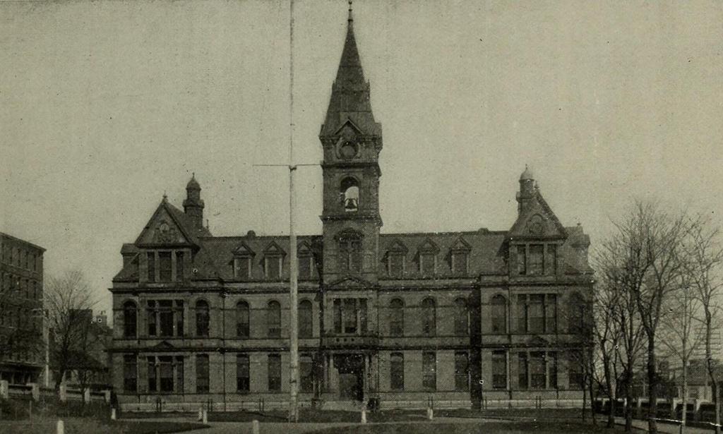
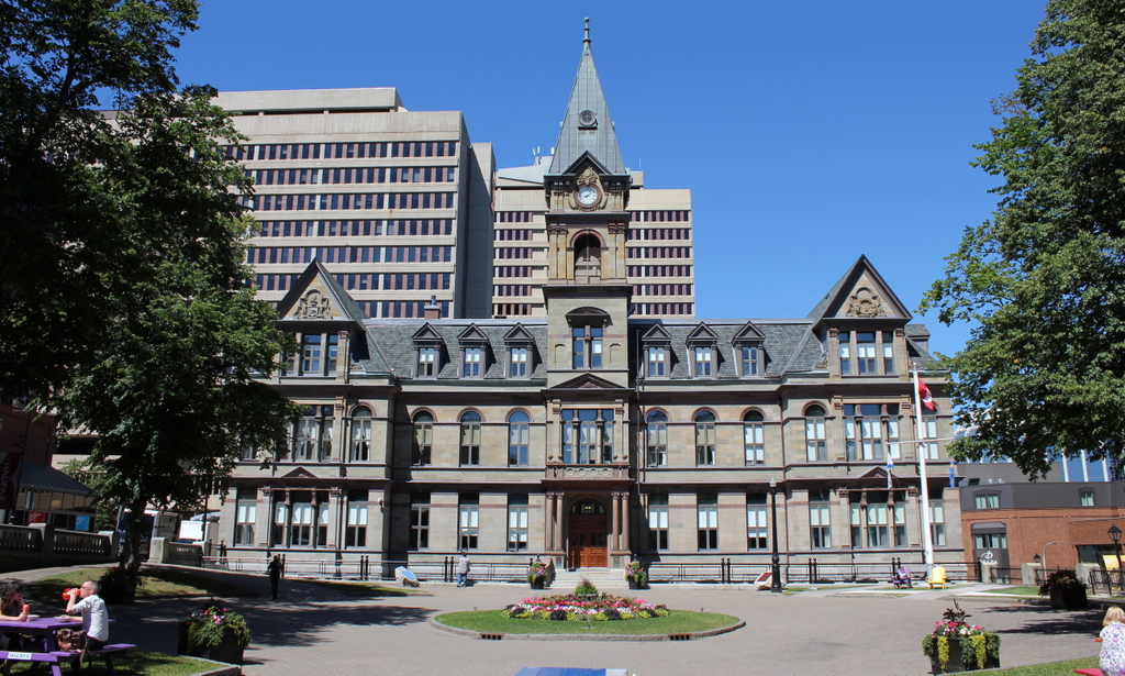
Halifax City Hall, seen from the Grand Parade around 1899. Image from Souvenir, One Hundred and Fiftieth Anniversary, City of Halifax (1899).

1057_1899c-souvenir150halifax

The building in 2016:

1057_2016
As mentioned in the previous post, Halifax is the largest city in Canada’s Maritime provinces, and has had close ties to New England over the years. The heart of downtown Halifax has long centered around the Grand Parade here, a city square located between Barrington and Argyle Streets. On the south side of the square is St. Paul’s Church, the oldest building in the city, and on the north side is City Hall, seen here. It was completed in 1890, with an architectural design that is based on the Second Empire style, which had been particularly popular a couple of decades earlier.

The building sustained some damage in the 1917 Halifax Explosion, but unlike the northern part of the city, the downtown area was largely spared serious damage. Today, the building remains essentially the same as it did in the 1890s view, and is listed as a National Historic Site of Canada. Its jurisdiction has significantly expanded over the years, though, In 1996, all of the existing cities and towns in Halifax County were consolidated into the Halifax Regional Municipality. This essentially extended the Halifax city limits to include over 2,100 square miles of land, more than double the land area of Rhode Island, but the old City Hall remains in use as the seat of the municipal government, over 125 years after its completion.

View from Citadel Hill, Halifax, Nova Scotia

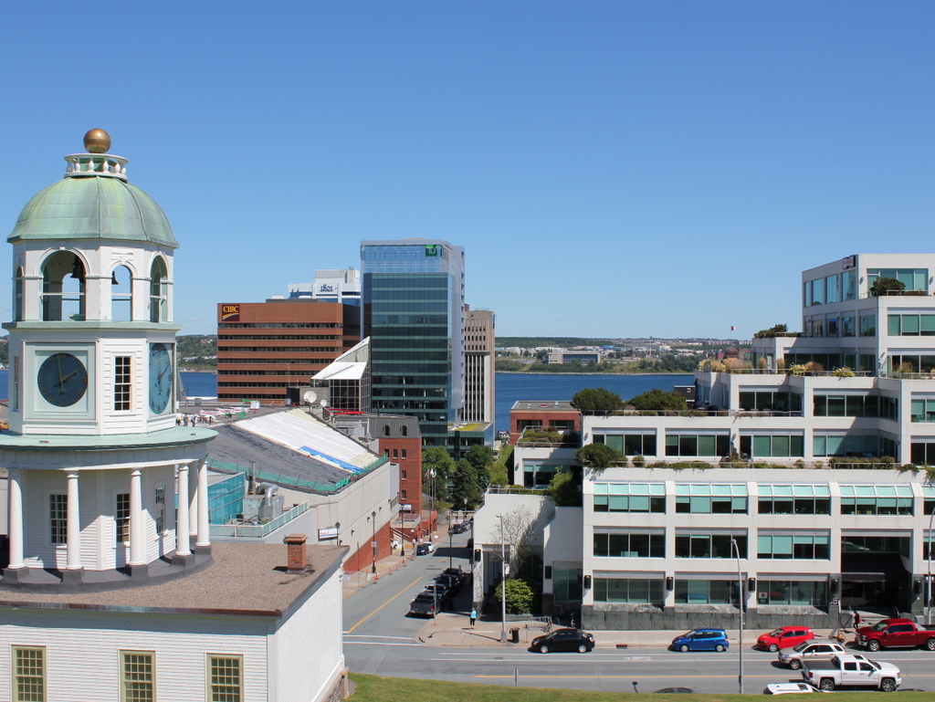
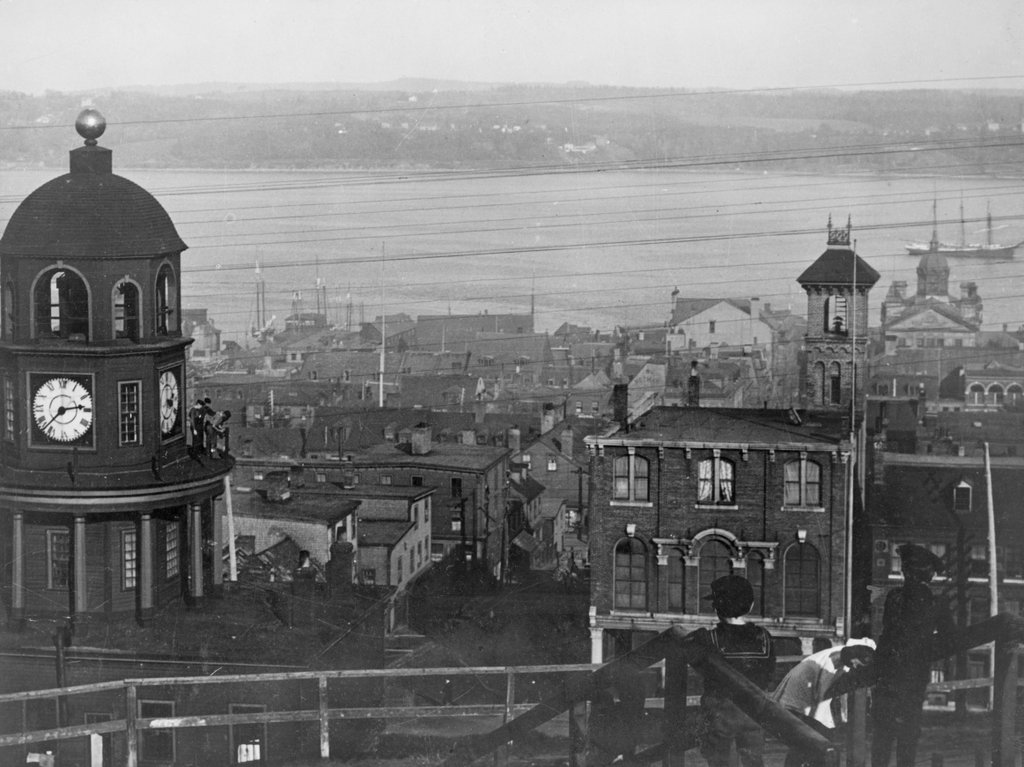
The view looking east toward downtown Halifax from Citadel Hill, around 1900-1917. Image courtesy of the Library of Congress.
1056_1900-1917c-loc

The view in 2016:

1056_2016
It isn’t in New England, or even in the United States, but Halifax has long had close ties with New England, especially Boston. It is the closest major North American port to Europe, and as such it is the last stop for outgoing ships from Boston, and the first for incoming ships. This scene here shows part of the city’s massive harbor, which has been of strategic importance over the years. After the British occupation of Boston ended in 1776, their fleet took refuge here in Halifax while preparing for an assault on New York City, and many years later the harbor was used as a gathering place for eastbound Atlantic convoys in both world wars.

Through all of this, the strategically-valuable harbor has been protected by Fort George, a series of fortifications atop Citadel Hill. The hill stands just west of downtown Halifax, offering sweeping views of the city and harbor, and making it the ideal location for a fort to command the harbor and its approaches. The photos here were taken near the top of the hill, near the outer walls of the fort. On the left is one of Halifax’s oldest landmarks, the Town Clock, which was built at the foot of the hill. It faces down Carmichael Street, which leads to the Grand Parade three blocks down the hill, where City Hall and St. Paul’s Anglican Church are located.

The date of the first photo is somewhat unclear, but it was taken sometime soon before 1917, when Halifax experienced one of the deadliest disasters in history. Known as the Halifax Explosion, it occurred on December 6, 1917, when the harbor was filled with ships heading to and from Europe during World War I. Two such ships were the Norwegian SS Imo, which collided with French ammunition ship SS Mont-Blanc. The latter caught fire, and after about 20 minutes its cargo of high explosives detonated.

The Mont-Blanc was essentially vaporized, and the blast wave leveled much of the northern part of the city, to the left and out of view in the photos here. A few earlier posts, here and here, show scenes from the aftermath of the explosion, which killed nearly 2,000 people, injured around 9,000 others, and damaged or destroyed around 12,000 houses. The main commercial center of Halifax, seen in this view from Citadel Hill, escaped serious damage. Essentially every window in the city was shattered by the explosion, but most of the buildings in the first photo would have survived the disaster.

Despite being spared from serious damage, there is very little that is still recognizable from the first photo a century later. There are a number of 19th century buildings scattered throughout this section of the city, but the only one that is readily visible in both photos is the clock tower itself, which remains a prominent city landmark.

Today, Halifax remains an important port. It is the largest city in Canada’s Maritime provinces, and its downtown has been built up with skyscrapers, partially obscuring the view of the harbor from Citadel Hill. The shoreline across the harbor in Dartmouth has also changed dramatically in the past 100 years. In 1911, the community had a population of just over 5,000, but today it has over 67,000 people, and is a major suburb of Halifax as well as a commercial center in its own right.
Aftermath of the Halifax Explosion (3)

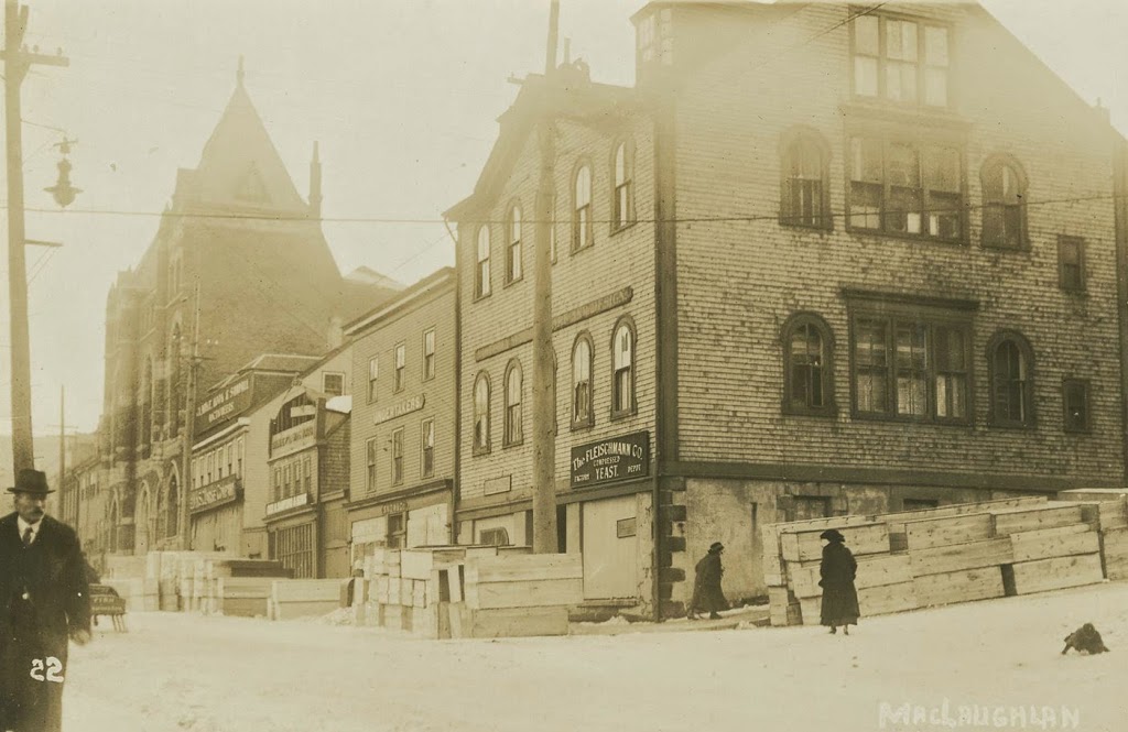
Looking down Argyle Street from George Street in downtown Halifax, Nova Scotia, in December 1917. Photo courtesy of the Nova Scotia Archives.

357_1917-2Bnsarchives

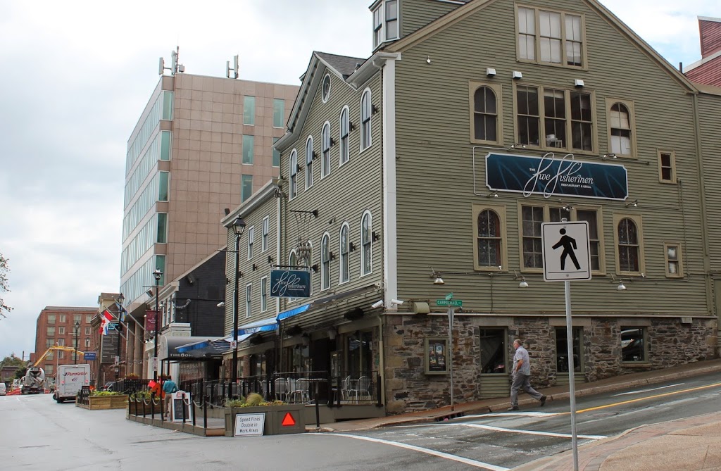
The scene in 2014:

357_2014

Out of the photos that I’ve posted about the Halifax Explosion, this is the only one that doesn’t show an area affected by the blast.  However, what the 1917 photo does show is far more powerful.  At first glance, nothing seems out of the ordinary, except for the stacks of wooden boxes on the street.  Except they’re not just wooden boxes; the sign on the second building from the right reads “Undertakers,” and the coffins outside were just a sampling of what was needed for the approximately 2,000 victims of the disaster.

Incidentally, this wasn’t the first time that the building dealt with a major tragedy – just five years earlier the recovery operation for the bodies of Titanic victims was operated out of the city, as it was the closest major port to the disaster.  During that time, the mortuary here was used to care for the remains of some of the victims, including John Jacob Astor and Charles M. Hayes.

Today, the building is still there, and is nearly 200 years old; it was built in 1817 and has served a variety of uses ever since.  Today, it is home to the Five Fishermen, which is perhaps the only fine dining restaurant in the world that advertises the fact that its facilities were once used as a mortuary.  (if you don’t believe me, check out their website – they even have the same 1917 photo there)

Aftermath of the Halifax Explosion (2)

Looking east down Kaye Street from Gottingen Street in Halifax, Nova Scotia, in December 1917 or early 1918, following the Halifax Explosion. Photo courtesy of the Nova Scotia Archives.

355_1917-2Bnsarchives

The scene in 2014:

355_2014

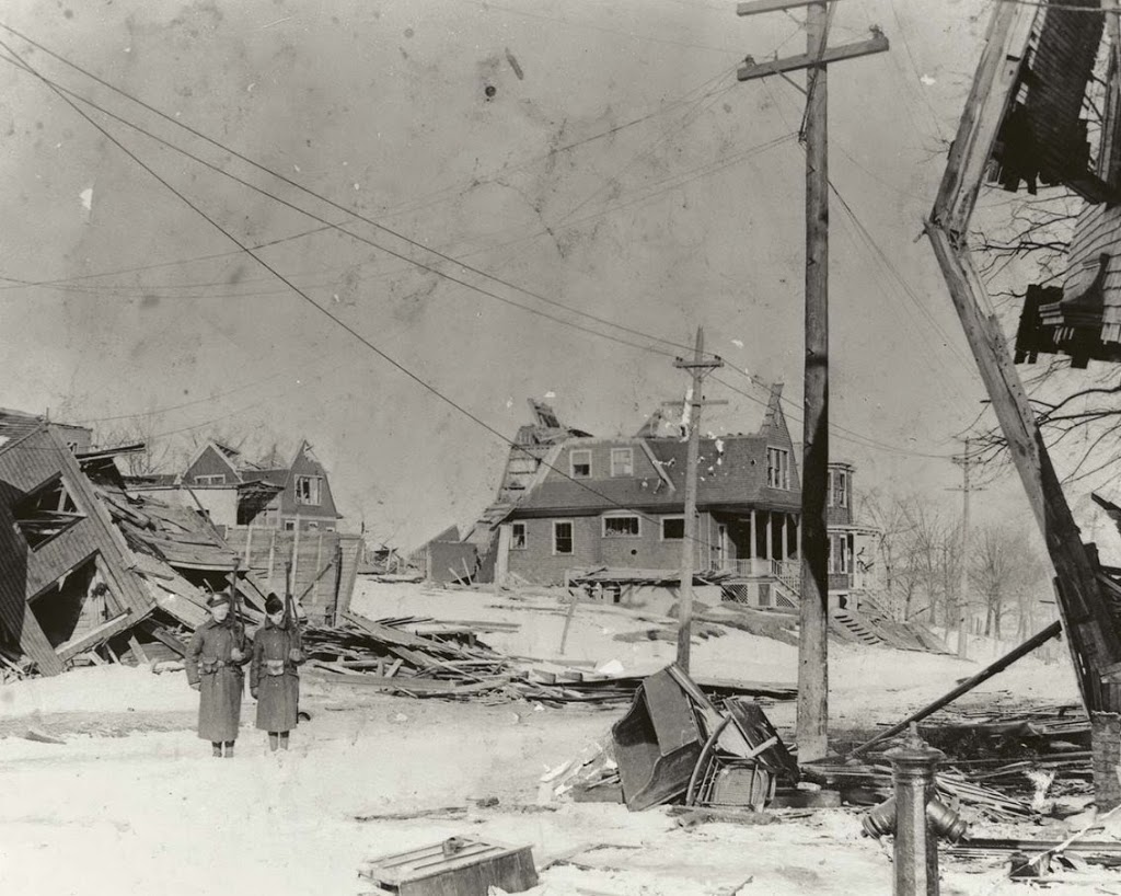
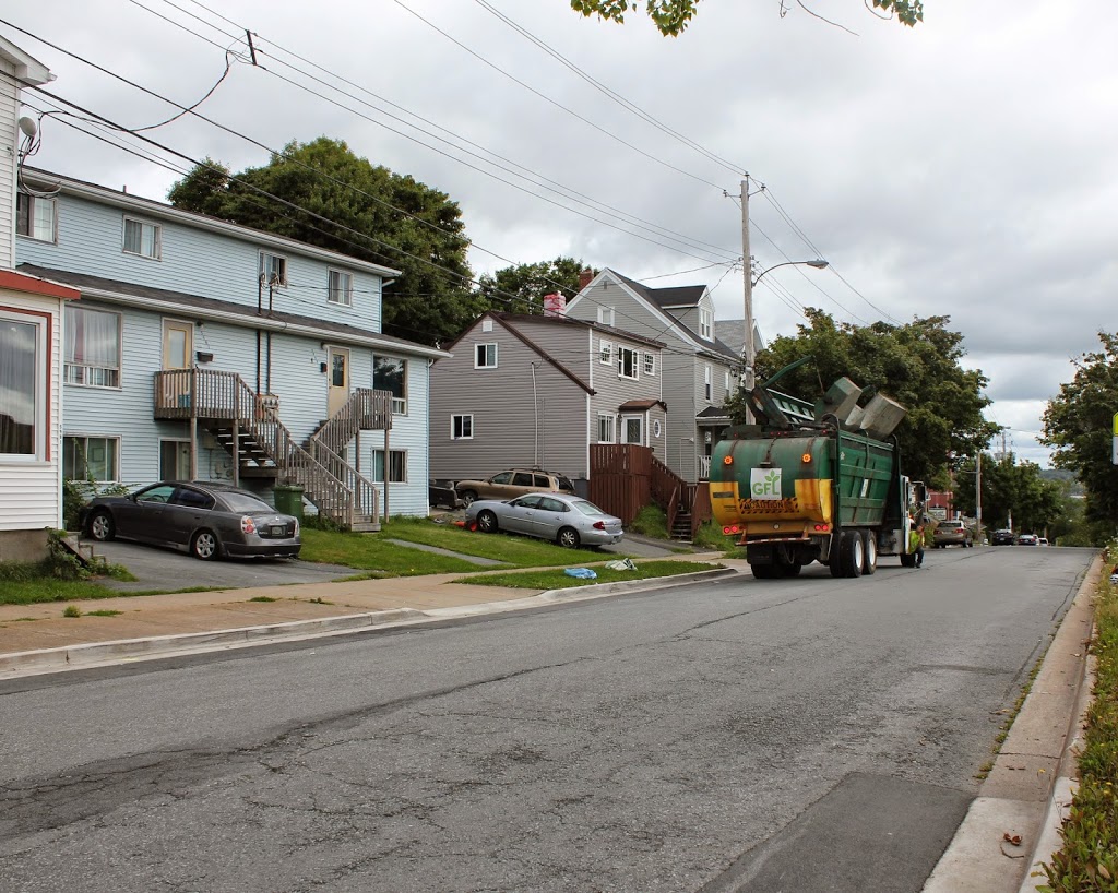
This neighborhood is located just up the hill from the epicenter of the Halifax Explosion, and its appearance is typical of what much of this part of the city looked like after the disaster. Here, two soldiers are standing guard to keep looters out – residents needed a pass in order to gain entry to the affected areas. Today, the neighborhood is entirely reconstructed, with no sign of the disaster that hit here almost 97 years ago.

Aftermath of the Halifax Explosion (1)

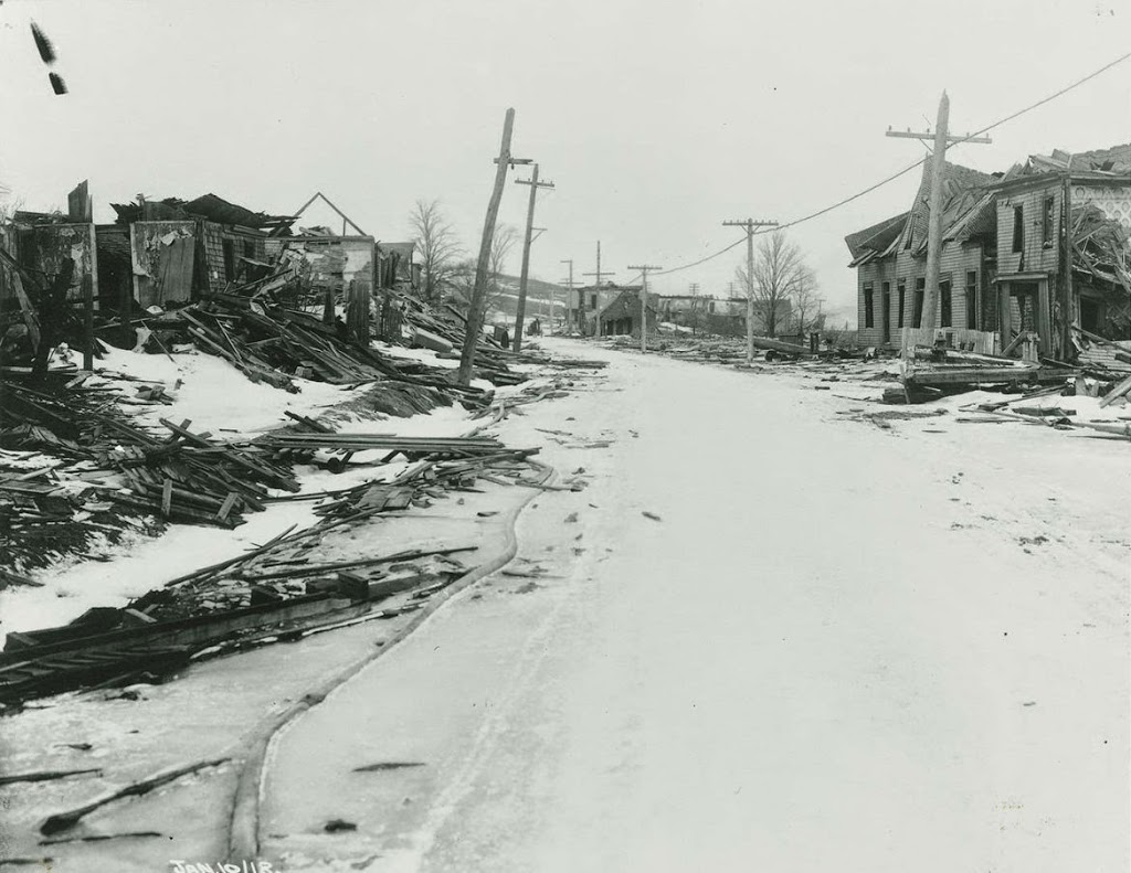
Looking north on Campbell Road (today Barrington Street) in Halifax, Nova Scotia, on January 10, 1918, following the Halifax Explosion. Photo courtesy of the Nova Scotia Archives.

354_1917-2Bnsarchives

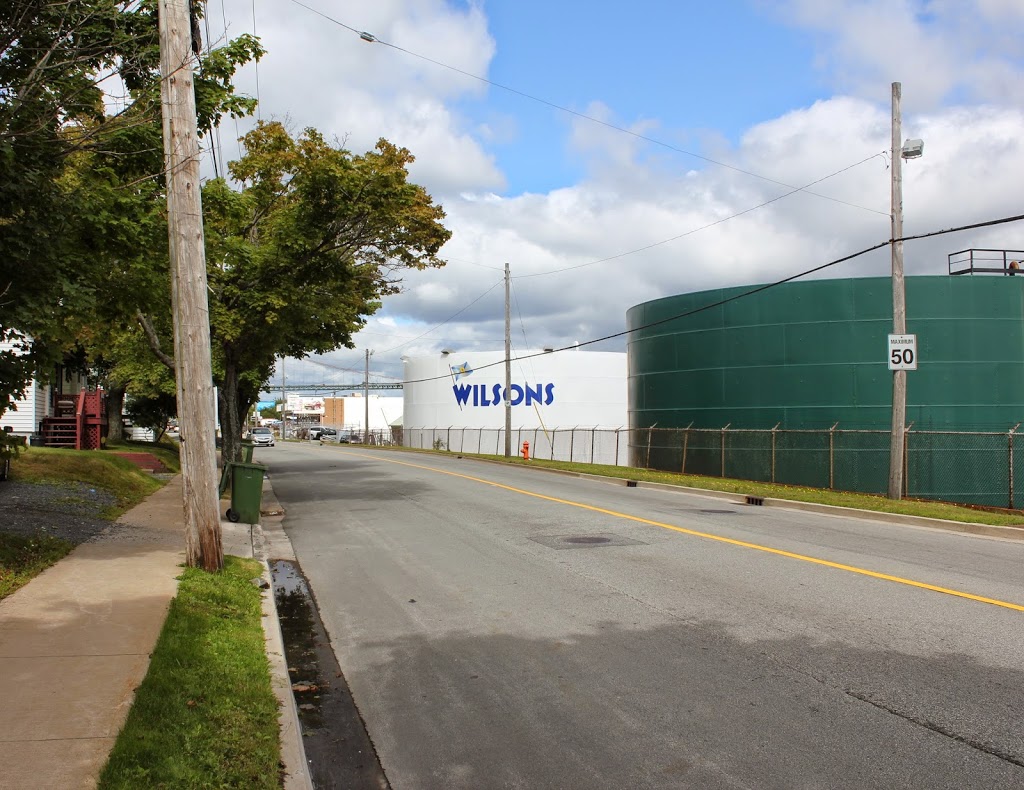
Barrington Street in 2014:

354_2014

These photos were taken just north of the intersection of Barrington and Rector Streets, and they show the scene near the epicenter of the Halifax Explosion, not far up the road from where the photos in this post and this post were taken prior to the explosion.

The disaster occurred after an ammunition ship was involved in a collision and caught fire. The ship was abandoned and drifted over to the Halifax shoreline, where it exploded, damaging or destroying over 12,000 buildings and killing nearly 2,000 people. The disaster was further complicated by secondary fires, caused by overturned stoves, and to make matters worse a blizzard dropped 16 inches of snow the next day, hampering the rescue effort and delaying much needed supplies from reaching the city.

Today, no trace of the explosion remains – nor does any trace of the neighborhood that was once located here. However, the disaster is not forgotten, especially by residents of Nova Scotia. Every year, Nova Scotia sends a Christmas tree to Boston, where it is displayed at the Prudential Center, in recognition of the contributions that Massachusetts made to the relief efforts in the immediate aftermath of the disaster.

Barrington Street, Halifax, Nova Scotia (2)

Another scene on Campbell Road (today’s Barrington Street) in Halifax, Nova Scotia, before the 1917 Halifax Explosion. Photo courtesy of the Nova Scotia Archives.

Canada

The scene in 2014:

353_2014

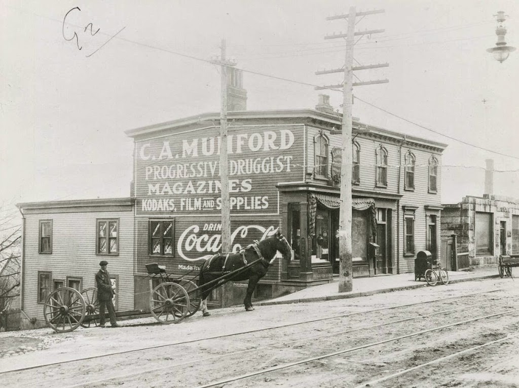
The first photo is undated, but the absolute earliest date would be 1888, although it is probably a little later than that, perhaps around 1900.  A few clues give it away, with one being fairly obvious: the Coca Cola advertisement on the side of the building.  Coca Cola was established in 1886, but it is unlikely that it would have made its way to Canada so quickly.  Perhaps less obvious of a clue is the bicycle leaning against the mailbox; this now-ubiquitous style of bicycle, known as the “safety bicycle” – because it was safer than a penny farthing – was not developed until the late 1880s.  Finally, the reference to “Kodaks” in the drugstore sign indicates that it must be 1888 or later, and probably later.  Kodak was founded in 1888, but the sign seems to indicate that people were already familiar with it by then, which suggests a somewhat later date.

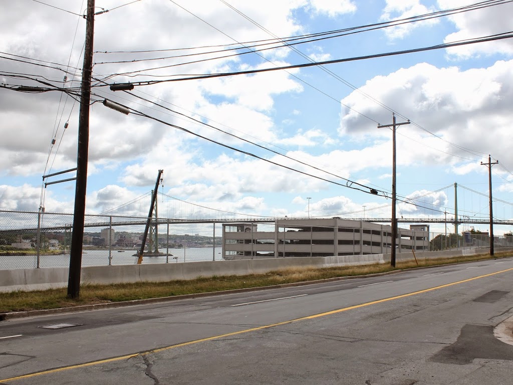
These photos were taken from almost the same spot as the ones in this post, just from a slightly different angle, at the corner of Barrington and Young Streets.  As mentioned in the other post, this entire area would be leveled by the 1917 Halifax Explosion, and today the scene looks entirely different.  In the distance is the Angus L. MacDonald Bridge, one of two that cross the Narrows of Halifax Harbour, the same area where the explosion occurred.