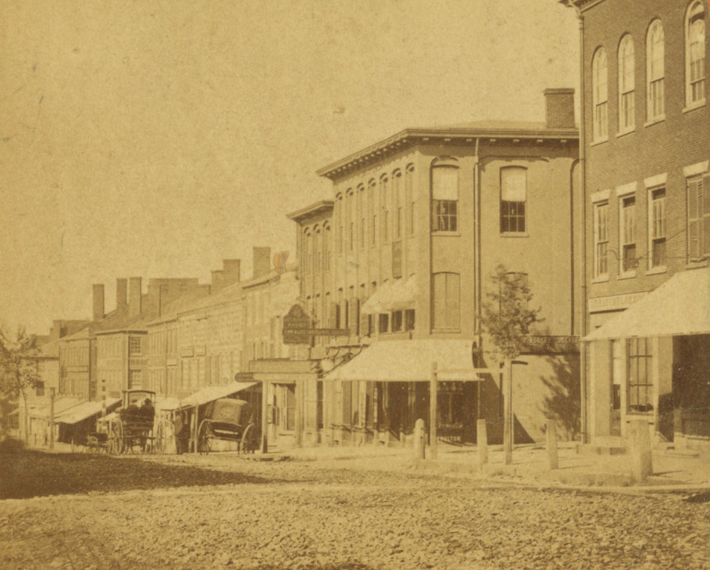
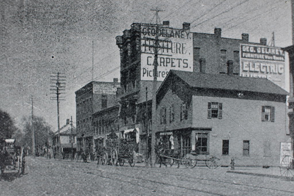
The view looking north on Main Street from the corner of Liberty Street (modern-day Frank B. Murray Street) in Springfield, around 1892. Image from Picturesque Hampden (1892).
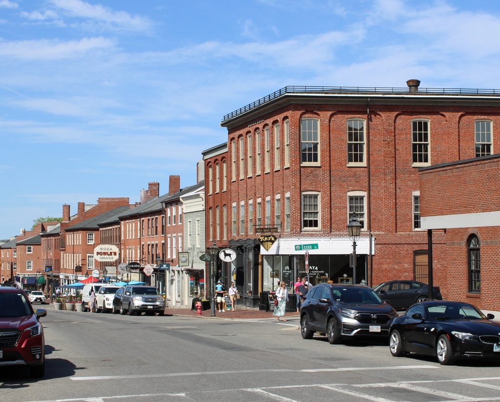
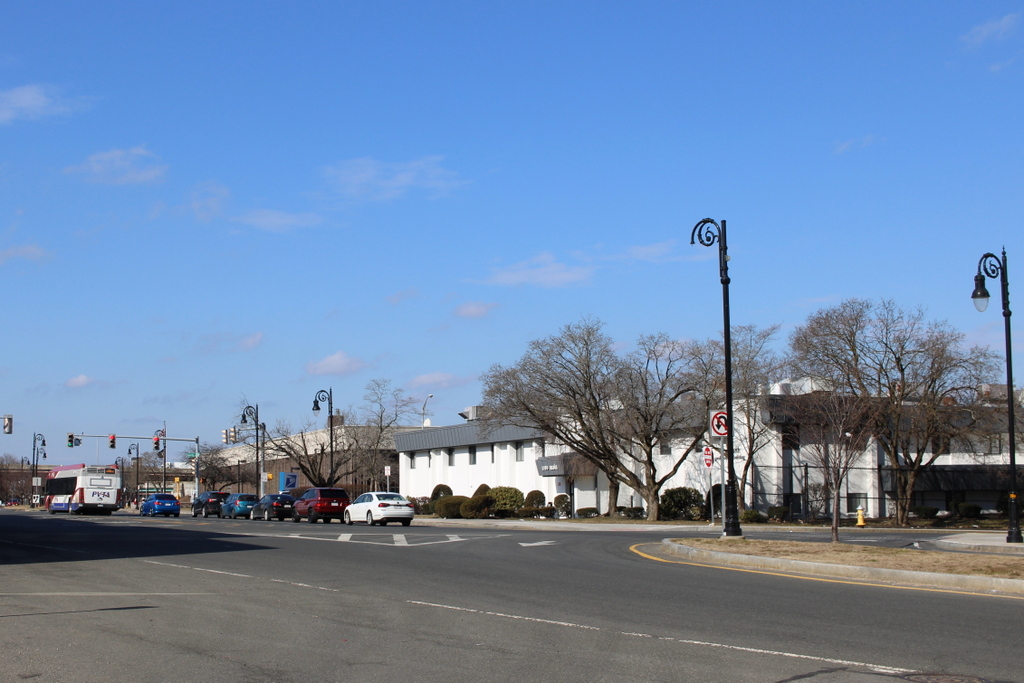
The same scene in 2024:
These two photos show the view of Main Street from just north of the modern-day railroad arch, facing toward the North End. The scene in the top photo includes a mix of older wood-frame buildings, along with newer and larger brick commercial blocks. The largest of these was the furniture store of George Delaney, which has the large painted signs on the side of it in the top photo. According to an 1889 newspaper advertisement in the Springfield Republican, Delaney was a “Dealer in carpets, chamber suits, parlor sets, all kinds of furniture, stoves, ranges, etc., for cash or easy payments.”
The wooden building in the foreground at the corner was evidently demolished by 1920, because the city atlas shows a brick one in its place. Likewise, the two story building beyond the Delaney building was also gone by 1920. Both the Delaney building and the three-story brick building farther in the distance were still standing in the late 1930s, but everything here would ultimately be demolished by the early 1960s as part of a large-scale urban renewal project that leveled almost everything north of the railroad arch and south of Memorial Square.
Today, this scene includes a medical office building in the foreground on the right, and the main Springfield post office farther in the distance. The 1960s urban renewal project also included eliminating, rerouting, or renaming some of the streets in the area. The old Liberty Street became Frank B. Murray Street, and Ferry Street—which is located a block farther in the distance—became the new Liberty Street.