Thoreau’s Cove, Walden Pond, Concord, Mass

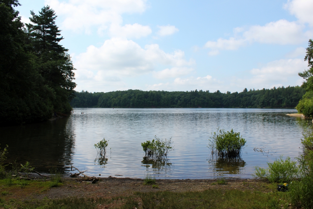
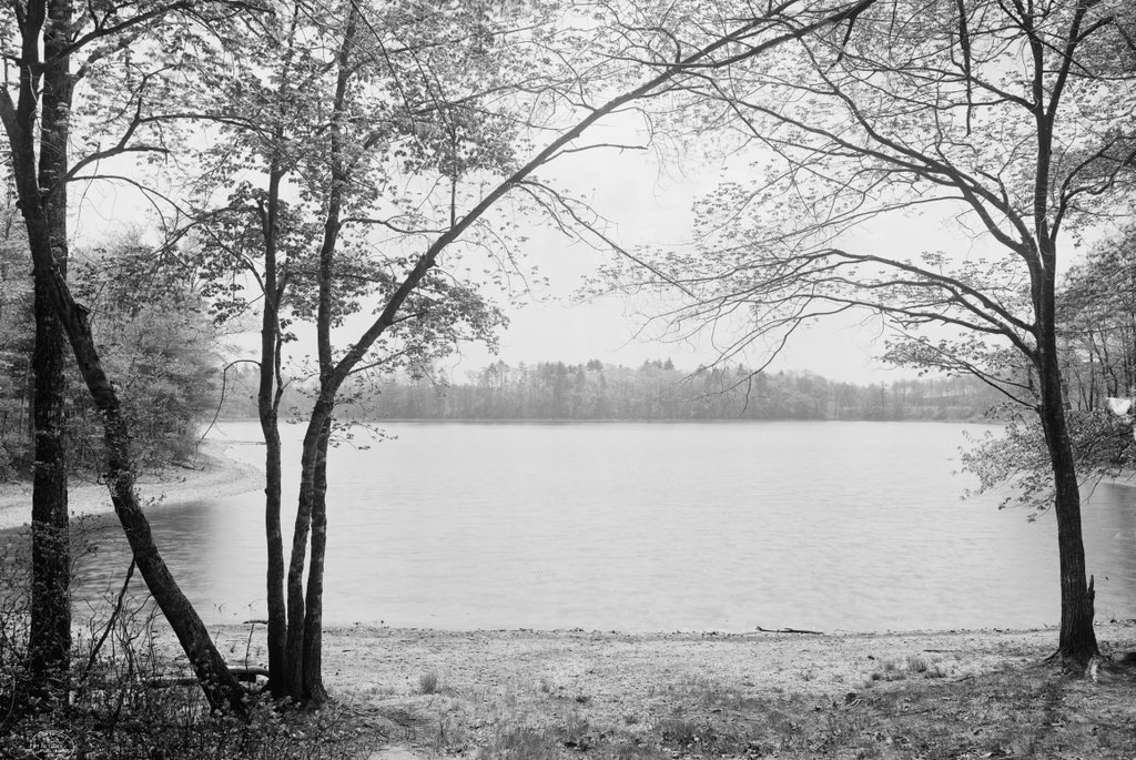
The view looking south from the northern shore of Walden Pond, around 1908. Image courtesy of the Library of Congress, Detroit Publishing Company Collection.

The scene in 2020:

Walden Pond is one of many glacially-formed kettle ponds scattered throughout the landscape of eastern Massachusetts. Despite its relatively small size, it is notable for being the deepest natural pond or lake in the state, with a maximum depth of 103 feet. However, it is best remembered for having been the subject of Henry David Thoreau’s 1854 book Walden. In this book, Thoreau describes the two years, two months, and two days that he spent living in a small cabin near the shore of the pond, from July 1845 to September 1847. His cabin was located about 200 feet behind where this photo was taken, just to the north of this cove, which is now known as Thoreau’s Cove.

Writing in Walden, Thoreau outlined his reasons for living here at Walden Pond, explaining how, “I went to the woods because I wished to live deliberately, to front only the essential facts of life, and see if I could not learn what it had to teach, and not, when I came to die, discover that I had not lived.” With this minimalistic approach, he constructed a one-room cabin that measured 10 feet by 15 feet, and had a chimney and fireplace at one end. It cost him a total of $28.12 to construct, mostly using recycled materials, and it was located on land owned by his mentor, fellow Transcendentalist writer Ralph Waldo Emerson. He furnished the cabin with only the basic necessities, such as a bed, a table, a desk, and three chairs.

Although Thoreau’s time here at Walden Pond is often portrayed as him living off the land in solitude, it was hardly a wilderness experience for him. The pond is just a mile and a half south of the center of Concord, and the Fitchburg Railroad ran along the western shore of the pond, a quarter mile from Thoreau’s cabin. Far from living in solitude, he frequently entertained visitors at his cabin, and he remarked in his book that he had more visitors during this period than any other time in his life. And, despite conducting an experiment in self-sufficiency, he was not above traveling into town for a home-cooked meal, or occasionally having his mother clean his dirty laundry.

Throughout the book, Thoreau frequently makes observations about the natural environment around the pond, including occasional laments about the changes that humans have made to the landscape. He contrasts the “thick and lofty pine and oak woods” of his younger years with the subsequent deforestation along the shores of the pond, and he criticizes the arrival of the railroad, describing it as a “devilish Iron Horse, whose ear-rending neigh is heard throughout the town.” However, despite such intrusions, Thoreau was confident in the unchanging nature of the pond, writing:

Nevertheless, of all the characters I have known, perhaps Walden wears best, and best preserves its purity. Many men have been likened to it, but few deserve that honor. Though the woodchoppers have laid bare first this shore and then that, and the Irish have built their sties by it, and the railroad has infringed on its border, and the ice-men have skimmed it once, it is itself unchanged, the same water which my youthful eyes fell on; all the change is in me. It has not acquired one permanent wrinkle after all its ripples. It is perennially young, and I may stand and see a swallow dip apparently to pick an insect from its surface as of yore.

Although Thoreau was  the only person living along the shores of the pond at the time, he was hardly the only one to understand the value of its natural resources. He often interacted with fishermen on the pond, and in one chapter he also provided a lengthy description of the ice harvesting that occurred here on Walden Pond. At the time, naturally-produced ice was the only way to preserve perishable foods, and Boston merchant Frederic Tudor enjoyed a near monopoly on the trade, sending ships filled with New England ice to destinations as far away as India. Thoreau observed this work, likely from this vantage point here on the shore in front of his cabin, and drew parallels between the methods used for ice harvesting and farming:

In the winter of ’46–7 there came a hundred men of Hyperborean extraction swoop down on to our pond one morning, with many car-loads of ungainly-looking farming tools, sleds, ploughs, drill-barrows, turf-knives, spades, saws, rakes, and each man was armed with a double-pointed pike-staff. . .

To speak literally, a hundred Irishmen, with Yankee overseers, came from Cambridge every day to get out the ice. They divided it into cakes by methods too well known to require description, and these, being sledded to the shore, were rapidly hauled off on to an ice platform, and raised by grappling irons and block and tackle, worked by horses, on to a stack, as surely as so many barrels of flour, and there placed evenly side by side, and row upon row, as if they formed the solid base of an obelisk designed to pierce the clouds. They told me that in a good day they could get out a thousand tons, which was the yield of about one acre. . . .

Thus for sixteen days I saw from my window a hundred men at work like busy husbandmen, with teams and horses and apparently all the implements of farming, such a picture as we see on the first page of the almanac; and as often as I looked out I was reminded of the fable of the lark and the reapers, or the parable of the sower, and the like; and now they are all gone, and in thirty days more, probably, I shall look from the same window on the pure sea-green Walden water there, reflecting the clouds and the trees, and sending up its evaporations in solitude, and no traces will appear that a man has ever stood there. Perhaps I shall hear a solitary loon laugh as he dives and plumes himself, or shall see a lonely fisher in his boat, like a floating leaf, beholding his form reflected in the waves, where lately a hundred men securely labored.

Thoreau then concluded his description of the ice harvest with an observation about how interconnected the world had become, thanks to innovations such as trans-oceanic ice shipments:

Thus it appears that the sweltering inhabitants of Charleston and New Orleans, of Madras and Bombay and Calcutta, drink at my well. . . . The pure Walden water is mingled with the sacred water of the Ganges. With favoring winds it is wafted past the site of the fabulous islands of Atlantis and the Hesperides, makes the periplus of Hanno, and, floating by Ternate and Tidore and the mouth of the Persian Gulf, melts in the tropic gales of the Indian seas, and is landed in ports of which Alexander only heard the names.

Near the end of the book, Thoreau explained his reasons for leaving Walden Pond in September 1847, citing a need to move on to the next phase of his life. He then described the path that he had followed from his cabin to the shore of the pond, using it as a metaphor for the tendency of humans to fall into conformity and consistency in their behaviors and ways of thinking:

It is remarkable how easily and insensibly we fall into a particular route, and make a beaten track for ourselves. I had not lived there a week before my feet wore a path from my door to the pond-side; and though it is five or six years since I trod it, it is still quite distinct. It is true, I fear that others may have fallen into it, and so helped to keep it open. The surface of the earth is soft and impressible by the feet of men; and so with the paths which the mind travels. How worn and dusty, then, must be the highways of the world, how deep the ruts of tradition and conformity!

The exact route of Thoreau’s well-trod footpath is left to some speculation, but it seems unlikely that it would have led to this particular section of shoreline here in these photos. Despite being the closest part of the pond to his cabin, this spot offers only limited views, and the shallow, muddy water here would have made it a poor choice for bathing or collecting drinking water. In his 2018 book The Guide to Walden Pond, author Robert M. Thorson theorizes that Thoreau’s path ran along the western side of the cove, ending at the sandy beach on the far right side of the scene. From there, Thoreau could have observed the entire pond, and he would not have had to wade through the mud and weeds here at the northern end of the cove.

After Thoreau left Walden Pond, Ralph Waldo Emerson sold the cabin to his gardener, who in turn sold it to farmers who moved it to a different location in Concord. It was used for grain storage before being dismantled in 1868. As a result, the $28 cabin ultimately outlived its famous resident, as Thoreau died of tuberculosis in 1862 at the age of 44.

Over the next few decades, Thoreau’s assertion about Walden Pond preserving its purity would certainly be put to the test. The cool, clear waters of the pond drew visitors here in increasing numbers during the late 19th century, and in 1866the Fitchburg Railroad opened an amusement park and picnic ground on the western shore of the pond. Known as the Walden Lake Grove Excursion Park, it had its own stop on the railroad, and it remained here until 1902, when it burned down.

The first photo was taken several years later, around 1908. By this point, recreation on the pond had shifted to the eastern side, along present-day Route 126. During the early 20th century that section of shoreline was turned into a large, sandy beach, and in 1917 bathhouses were constructed there to accommodate visitors. Five years later, the Emerson family, along with several other landowners around the pond, donated about 80 acres to the state, and the land became the Walden Pond State Reservation.

Over the next few decades, the number of visitors to Walden Pond would continue to increase. Automobiles made it easier than ever to access the pond, and by 1935 it had nearly half a million visitors over the course of the summer, including about 25,000 on busy weekend days. The result was a struggle between conservation and recreation here at the pond, which culminated in a late 1950s proposal to “improve” much of the land around the pond with amenities such as a new parking lot. However, these plans were ultimately halted by a Superior Court judge who ruled that they violated the stipulations of the 1922 donations.

Today, more than 110 years after the first photo was taken and nearly 175 years after Thoreau moved out of his cabin, Walden Pond remains a popular destination. The parking area fills up quickly on hot summer days, and the shores of the pond are often crowded with beachgoers, swimmers, and anglers, along with the occasional literary tourist making a pilgrimage to the site of Thoreau’s cabin. For the most part, a visit to the pond today is far removed from the experience that Thoreau had here in the 1840s, and as one New York Times writer put it, “there are more selfies than there is self-reliance.”

However, the woods along the shoreline do a remarkably good job at hiding the number of visitors. The second photo was taken on a very busy July morning, yet there is surprisingly little evidence of it in the photo, save for a few swimmers far off in the distance. Overall, the landscape from the northern end of Thoreau’s Cove is not dramatically different from what he would have seen here, and if he saw it today he would likely stand by his claim that “it has not acquired one permanent wrinkle after all its ripples.”

Five Mile Point Light, New Haven, Connecticut

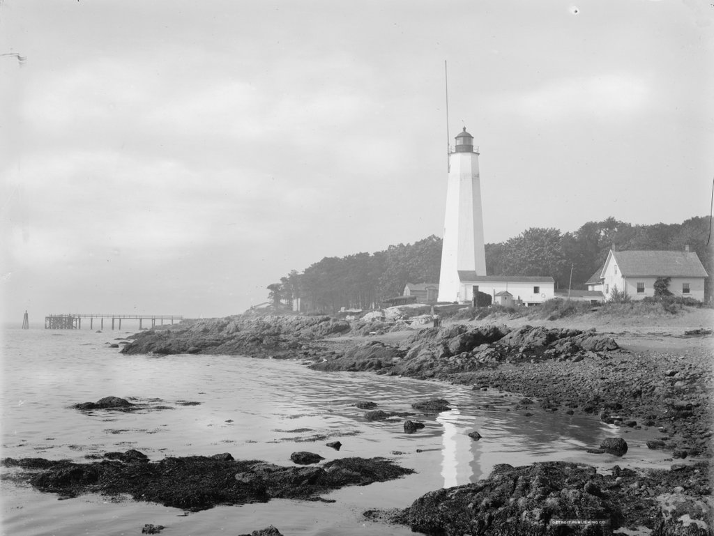
The Five Mile Point Light at the entrance to New Haven Harbor, around 1900. Image courtesy of the Library of Congress, Detroit Publishing Company Collection.

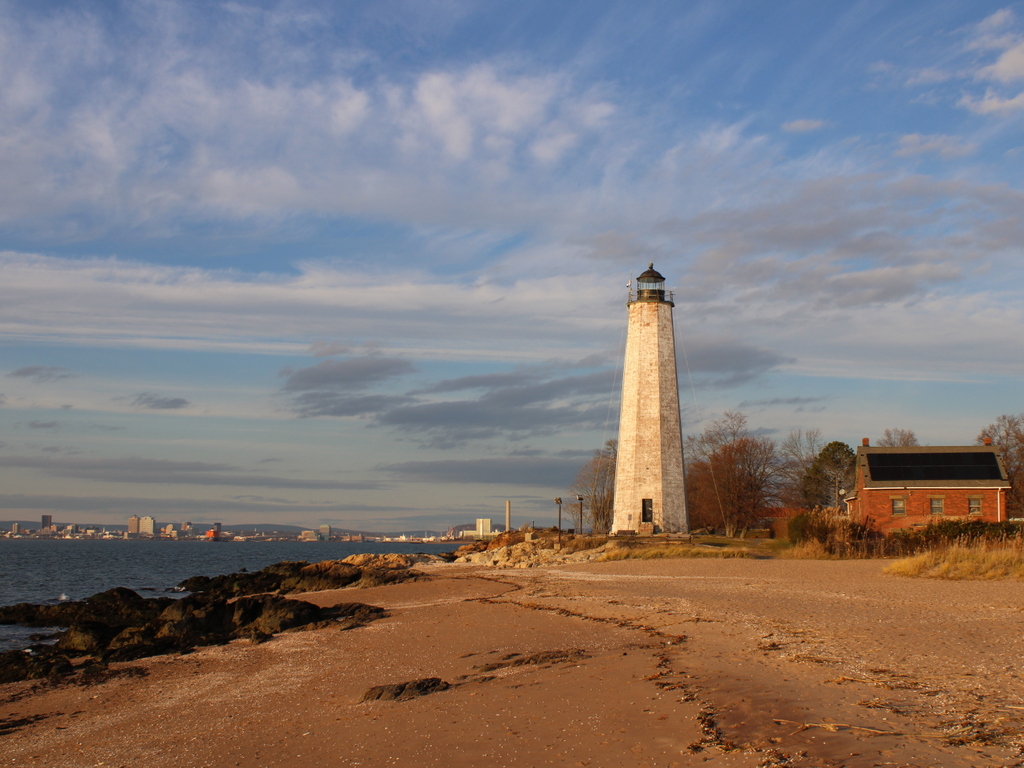
The scene in 2021:

New Haven Harbor has been marked by a lighthouse since 1805, when the first one was constructed here on this site at the southeast edge of the harbor. It was commonly known as Five Mile Point Light, because of its distance from downtown New Haven. The original tower was 30 feet tall and built of wood, but by the late 1830s both it and the keeper’s house were badly deteriorated. Both buildings were replaced in 1847, and the new lighthouse was substantially larger than the older one. As shown in these two photos, it is octagonal in shape and constructed of local brownstone, and it stands 80 feet above the ground. Its design is very similar to many of the other early 19th century lighthouses in Connecticut, including New London Harbor Light, Lynde Point Light, Black Rock Harbor Light, and Falkner Island Light.

The new lighthouse was constructed by local builder Marcus Bassett, and the work evidently progressed quickly. Congress appropriated funds for it on March 3, 1847, and it was nearly completed by September, when an article appeared in the New Haven Journal, praising the new lighthouse:

New-Haven harbor during easterly storms, is the refuge of an immense number of craft, but its entrance from the east has always been difficult, if not dangerous, because the light-house cannot be seen until near the rocks upon which it stands. The government erected a new house for the keeper recently, but the new light-house, which is nearly ready for use, is the object of special admiration. Standing but a few rods from the old one, it rises in towering majesty by its side, and now may be seen in every direction where the other was wholly concealed. It will be of immense benefit to New-Haven harbor and also add to the security of the navigation of the Sound.

As was the case with most other American lighthouses of the era, Five Mile Point Light was maintained by a keeper who resided here on the property. Lighthouse keepers were primarily responsible for lighting and extinguishing the lantern, but other routine duties included maintenance and repairs to the buildings and equipment. However, because of their locations at hazardous points along shipping routes, keepers were also occasionally called upon to assist sailors in distress. Here at Five Mile Point, keeper Merritt Thompson, who served from 1853 to 1860, was often involved in such rescues, with his 1884 obituary noting that “when he was keeper of the lighthouse it was his good fortune to be instrumental in saving lives on a number of occasions when boats would be upset in the harbor,” and that “many stories are told of his daring and humanity in emergencies calling for personal risk and quick action.” 

The 1860 census shows Thompson living here at the lighthouse with his wife Julia and their six children, who ranged in age from 11 months to 14 years. However, he was subsequently dismissed from the post, and went on to work as a harbor pilot here in New Haven. An 1861 letter to the editor, published in the Columbian Register, suggested that this was a political move, and that he was replaced by a Republican partisan because of Abraham Lincoln’s electoral victory in 1860. The writer questioned the qualifications of any replacement, and observed that “the removal has caused a burst of indignation among all our citizens,” and concluded the letter with some sarcasm, saying “I trust none of our citizens will allow themselves to be capsized in the vicinity of the light house, for the next four years.”

The new lighthouse keeper was Elizur Thompson, who was not related to his predecessor. Despite this anonymous writer’s doubts about his abilities, he go on to serve here for many years, first as a keeper and later as an employee of the United States Signal Service. His family also helped maintain the lighthouse, including his wife Elizabeth and two of their sons, each of whom received assistant keeper salaries at various times over the years. He was dismissed in 1867 by the Andrew Johnson administration, for reasons that were evidently as political as his initial appointment had been, but he was subsequently reappointed in 1869, after Republican Ulysses S. Grant became president.

During the 1870 census, Elizur and Elizabeth were 61 and 59 respectively, and they lived here at the lighthouse with their 24-year-old son George and their 18-year-old daughter Ella. However, Elizabeth died a year later, and in 1877 Elizur remarried to Ellen Pierce, a widow who was about 30 years younger than him. She had a son, Burton, from her first marriage, and he was 13 years old and living with them during the 1880 census.

In the meantime, in 1873 the federal government began construction of Southwest Ledge Light, located on a rocky ledge about a mile offshore from here. Because this new lighthouse was much closer to the main shipping channel, it rendered Five Mile Point Light obsolete, and the light was deactivated after Southwest Ledge was completed in 1877. Elizur Thompson was then appointed as the first keeper of the new lighthouse, and his son Henry became the assistant keeper. He remained there for four more years, until his retirement in 1881, and Henry then became the main keeper of Southwest Ledge.

Following his retirement, Elizur and Ellen returned to the old Five Mile Point Light, where he was allowed to live, rent-free, for the rest of his life. During this time, he worked for the United States Signal Service, displaying flags from the old lighthouse to provide weather reports for passing merchant vessels. Both Elizur and Ellen faced health scars in the mid-1880s, beginning with a head injury that the elderly Elizur suffered in 1884, when he slipped and hit the back of his head on a rock while trying to launch a boat here on the beach. Then, in June 1885 Ellen underwent major surgery in New York to remove a large tumor. Newspaper reports described her as being in critical condition and doubted whether she would survive, but she ultimately recovered and returned to New Haven in early August.

Elizur carried out his duties here at the lighthouse until his death in 1897, when he was 87 years old. Ellen had taken over these responsibilities during his final illness, and after his death she was formally appointed as his successor. As described in the Morning Journal and Courier following her appointment, the signal station “has been a great boon to the sailors, since it has warned them of impending storms and furnished them the opportunity to come within the shelter of the harbor.” The article described how the weather reports arrived in downtown New Haven and were then telephoned to the lighthouse, where Ellen would hoist the appropriate flags. The article then concluded by remarking that “the task is anything but an easy one for a woman, especially in stormy weather.” She would retain this post until her death in 1901, at the age of 60.

The first photo was taken around 1900. Assuming this date is accurate, Ellen Thompson would have still been living and working here, and the tall pole atop the lighthouse was likely where she hoisted the flags. The photo also shows the keeper’s house on the right side, connected to the lighthouse by an enclosed wooden walkway. On the other side of the lighthouse, in the center of the photo, are four Civil War-era Rodman cannons that were installed here during the Spanish-American War in 1898. These obsolete guns were evidently more for show than anything else, and were likely more effective at reassuring locals than at dissuading Spanish warships. In any case, these guns were never tested in combat during the short-lived war, and within a few years they were removed and incorporated into several different local Civil War memorials.

No longer necessary for either navigational aids or civil defense measures, this area around the old lighthouse subsequently became an amusement park, known as Lighthouse Point Park. Like many other early 20th century amusement parks, it was developed by a local trolley company as a way of increasing ridership on otherwise quiet weekend trolleys. The park featured attractions such as a carousel, along with a beach and fields for athletic events. Even prominent baseball stars such as Babe Ruth and Ty Cobb made appearances here at Lighthouse Point and participated in exhibition games.

The amusement park was subsequently acquired by the city, but it began to decline after the 1920s, and most of the park buildings were demolished by the mid-20th century. The site has continued to be used as a public park, though, and it continues to be a popular destination for its beach and for other recreational activities, including its restored carousel. However, the most prominent landmark here at the park continues to be the historic lighthouse. Despite not having been used as a lighthouse for nearly 150 years, both the tower and the keeper’s house are still standing, with few major changes since the first photo was taken, aside from the loss of the covered walkway.

Cliff Walk, Newport, Rhode Island

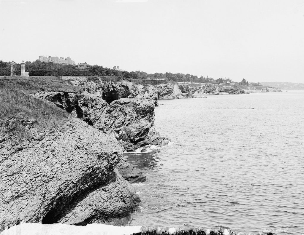
Looking north on the Cliff Walk from Ochre Point at The Breakers in Newport, around 1900-1906. Image courtesy of the Library of Congress, Detroit Publishing Company Collection.

The scene in 2017:

One of Newport’s most popular attractions is the 3.5-mile Cliff Walk, a trail that runs along the rocky cliffs on the southeastern side of Newport. It is famous for both the scenic beauty of the Atlantic coastline, as well as the architectural grandeur of the Gilded Age mansions on the opposite side, but its origins were far more practical than recreational. Much to the chagrin of millionaire property owners who would come several centuries later, the legal concept behind the Cliff Walk came in 1663, when King Charles II granted Rhode Island a charter that, among other rights, allowed all colonists to fish along the shoreline. This doctrine of publicly-accessible shores was later enshrined in the state constitution, and is still in effect today.

In the early years of Newport’s history, this right was of little significance here on the sparsely-settled southeastern shore, and there was not much to prevent people from walking along the cliffs if they felt so inclined. However, by the mid-19th century Newport was becoming a popular summer resort, and the right of people to walk along the cliffs soon came into conflict with the privacy and the property rights of the millionaires who built their summer homes here along the coast. As a result, many of the landowners built fences or hedges for privacy, making many of the mansions completely invisible from the trail.

The first photo was taken from the easternmost part of the trail, at Ochre Point behind The Breakers, the famous home of Cornelius Vanderbilt II. The gates in the distance on the left mark where the trail leaves the Vanderbilt property, and beyond the gates is the roof of Ochre Court, the home of prominent real estate developer Ogden Goelet. Like The Breakers, this house was designed by architect Richard Morris Hunt, and was the largest in Newport when it was completed in 1892, although it would soon be surpassed by The Breakers itself, which was completed in 1895. However, by the time the first photo was taken only about a decade later, both Vanderbilt and Goelet were dead, although the houses would remain in their families until well into the 20th century.

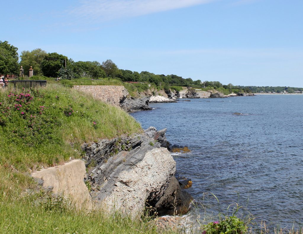
Today, more than a century after the first photo was taken, this landscape has remained remarkably unchanged. Although not visible in the 2017 photograph, both The Breakers and Ochre Court are still standing, as are many of the other Gilded Age mansions along the Cliff Walk. However, most of these are no longer privately owned, thanks to changing tastes and the incredible upkeep costs of these houses. What had been an extravagant symbols of wealth in the late 19th century had become expensive white elephants by the mid-20th century, and today The Breakers is a museum while Ochre Court is the administration building for Salve Regina University.

Lost New England Goes West: Santa Monica, California (2)

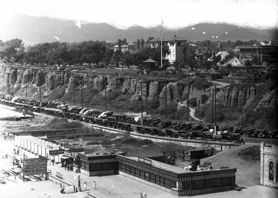
Another view looking north from the pier in Santa Monica, around 1910-1930. Image courtesy of the University of Southern California Libraries and the California Historical Society.

914_1910-1930c usc

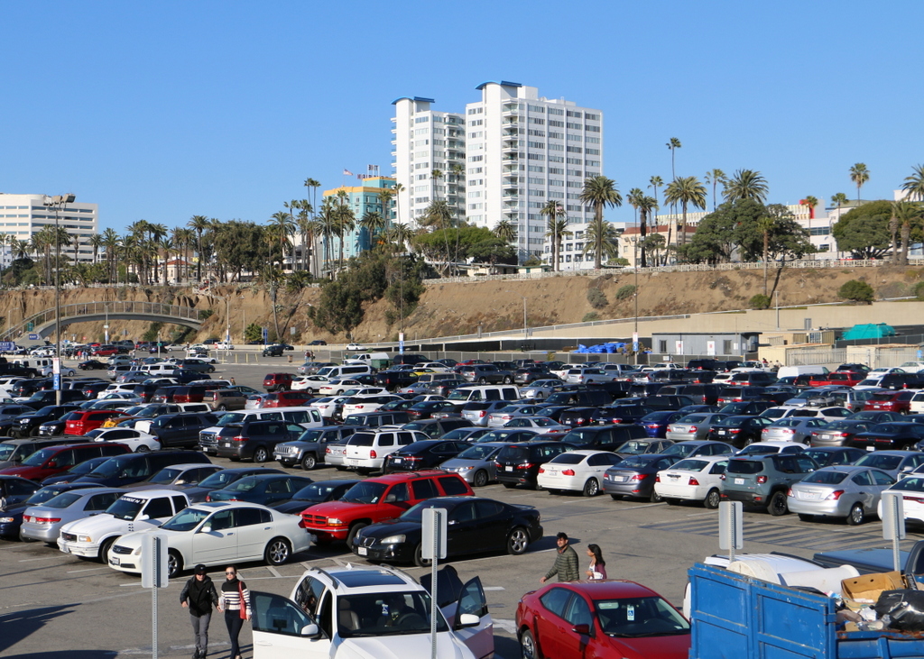
The view in 2015:

914_2015
Like the view in the previous post, these two photos show some of the changes that have happened along the beach in Santa Monica over the years. The most prominent building in the first photo here is the Windermere Hotel, visible in the upper center of the photo. It was built in 1909 and was demolished in 1962 to build Pacific Plaza, the tall apartment building that stands on the site today. Just to the left of it in the 2015 view is the Georgian Hotel, which was built in 1933 by the owners of the Windermere, probably only a few years after the first photo was taken.

This post is the last in a series of photos that I took in California this past winter. Click here to see the other posts in the “Lost New England Goes West” series.

Lost New England Goes West: Santa Monica, California (1)

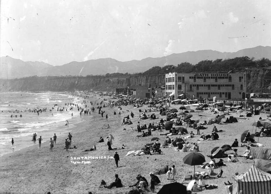
Looking north from the Santa Monica Pier in Santa Monica, California, around 1905. Image courtesy of the University of Southern California Libraries and the California Historical Society.

913_1905c usc

The view in 2015:

913_2015
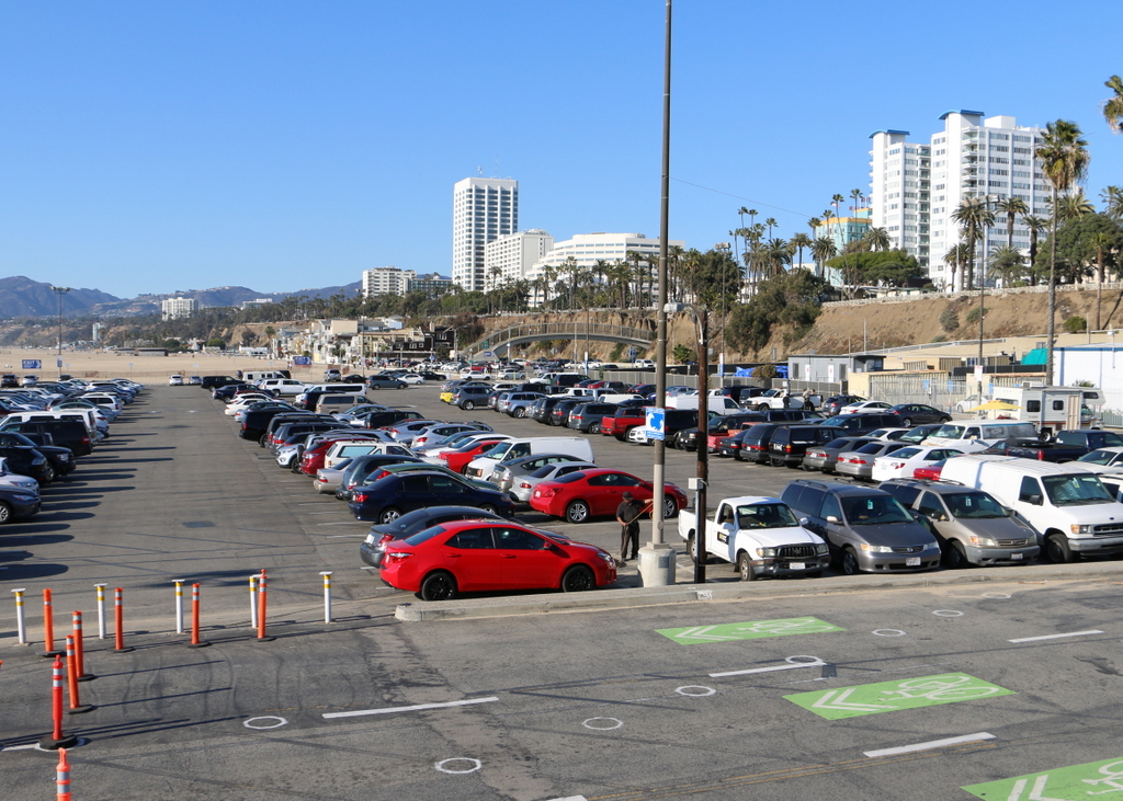
These views shows Santa Monica looking north from the pier along the Palisades, the steep cliffs separating the city from the beach below. When the first photo was taken over a century ago, Santa Monica had already become a popular beach resort.. At the time, the area above the Palisades was still sparsely developed, but there were number of amenities along the beach, including a bath house that offered visitors the option of swimming in a heated indoor pool rather than the relatively cool ocean. The beach was crowded on this particular day in 1905, with the attire of the visitors reflecting the styles of the time, including men in dark suits and straw hats, women in long white dresses, and swimmers dressed in nearly full-body bathing suits.

Today, not much is left from the original photo except for the Palisades. Even the beach itself has been extensively altered and widened, and a large parking lot now sits on this spot. In the distance, hidden from view, the Pacific Coast Highway now runs along the bottom of the Palisades, beneath the modern hotels and condominium buildings that now line Ocean Avenue on the top of the cliffs.

This post is part of a series of photos that I took in California this past winter. Click here to see the other posts in the “Lost New England Goes West” series.

Lost New England Goes West: Pismo Beach, California

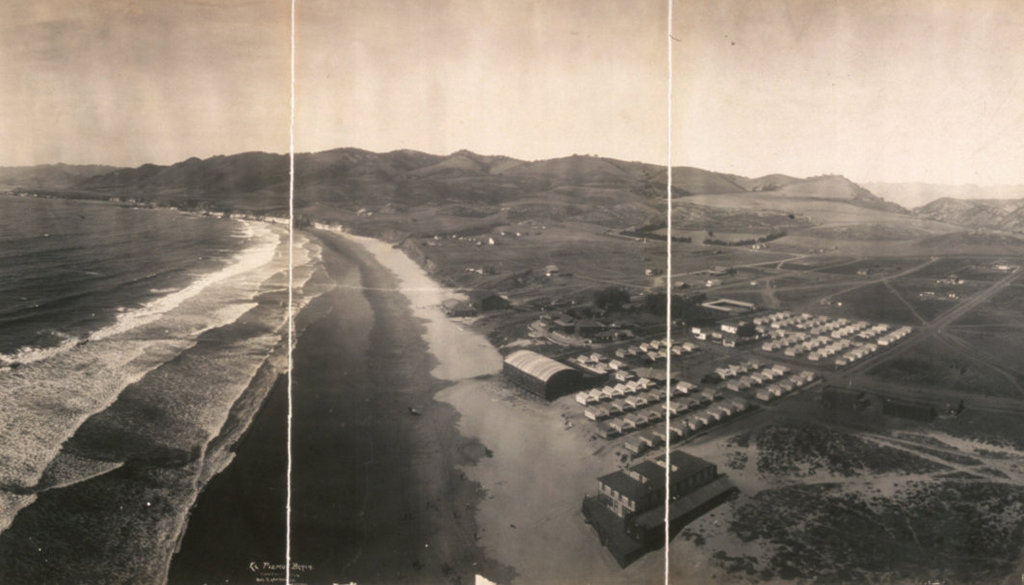
The view looking north along the shore at Pismo Beach, California, around 1906. Image courtesy of the Library of Congress, Panoramic Photographs Collection.

910_1906c loc

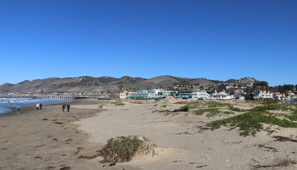
Pismo Beach in 2015:

910_2015

I couldn’t perfectly recreate the first photo, since it was taken a thousand feet or so in the air, but the second photo shows roughly the same view from the ground. The 1906 photo was taken by George R. Lawrence, an early pioneer of aerial photography. He developed what he called a “captive airship,” which was a kite-supported camera that could take pictures up to 2,000 feet in the air, all while being controlled remotely from the ground. In many ways, Lawrence’s invention was an early version of a drone, and like modern-day drones, it was seen as a potential surveillance tool for the military. However, it was also commercially valuable, as demonstrated by Lawrence’s most famous photo, which was taken in the aftermath of the 1906 San Francisco earthquake. He sold prints of this image for $125 each (over $3,000 today), earning around $15,000 from it, or close to $400,000 in 2016.

While he was in California, though, San Francisco wasn’t his only job. Hoping to promote tourism to their new resort, the El Pizmo Beach Company hired Lawrence to photograph Pismo Beach, especially their El Pizmo Inn in the lower right of the photo. The inn included the “Tent City,” which consisted of several block of tents that measured 14 feet by 18 feet and could be rented for $6 per week. Entertainment at the resort included the dance pavilion, which is the building in the lower center of the photo with the cylindrical-shaped roof.

In the 109 years between the two photographs, not much is left from the original image. The hills in the distance have not changed much,but Pismo Beach itself has become the resort city that the 1906 owners of the El Pismo Beach Company probably hoped it would be. In the years after the aerial photo was taken, the tent city continued to grow, attracting many visitors from San Francisco who sought warmer temperatures in the southern part of the state. By the early 1930s, most of the tents were replaced with more permanent cottages, and the dance pavilion burned down in 1945. There are few landmarks left to identify the original image, although, as a point of reference, the pier in the distance on the left side of the 2015 photo is at about the same spot where the dance pavilion once stood.

This post is part of a series of photos that I took in California this past winter. Click here to see the other posts in the “Lost New England Goes West” series.