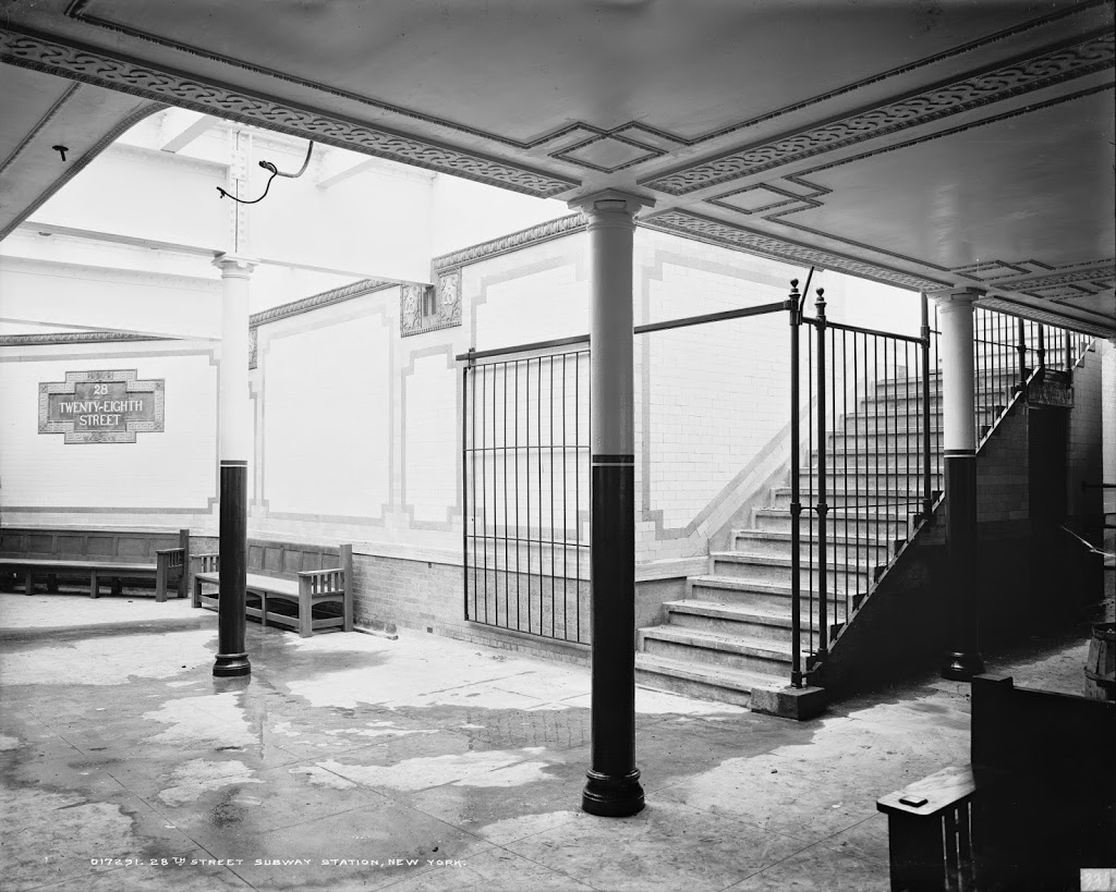
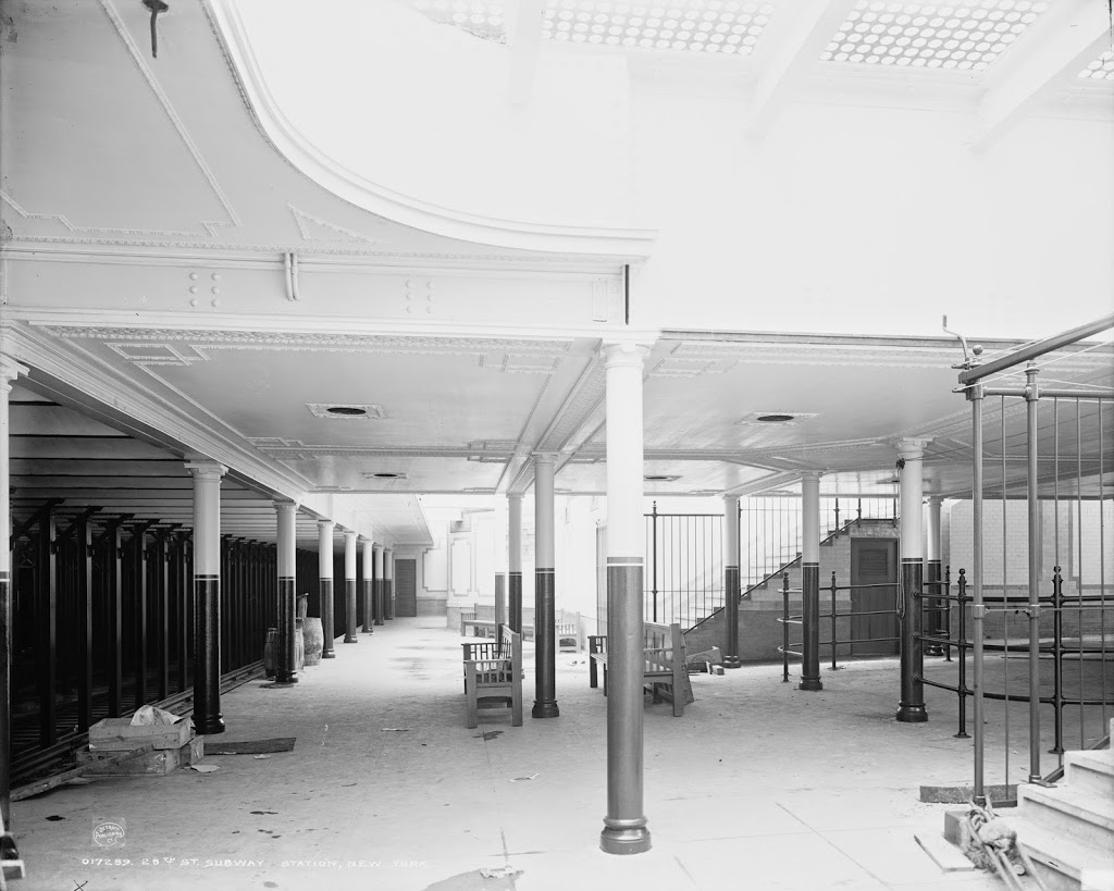
The 28th Street subway station on the Lexington Avenue line, around the time that it opened in 1904. Image courtesy of the Library of Congress, Detroit Publishing Company Collection.
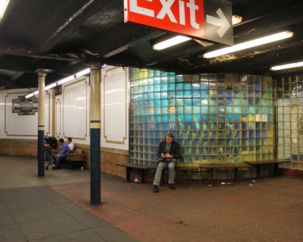
The station in 2014:
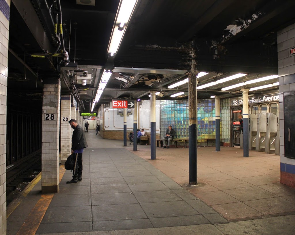
The 28th Street station on the Lexington Avenue Line was part of New York’s first subway line. The station opened on October 27, 1904, and the first photo was probably taken around that time. Notice the lack of turnstiles – when the subway first opened, employees would stand at the entrance (between the curved iron railings on the right-hand side) and collect fares. Also, the station originally had separate stairways for entering and exiting – exiting passengers didn’t need to pass back through the fare collection area. Overall, not much looks the same today, although the mosaics on the walls are still there. Otherwise, the changes seem to be for the worse, although I’m sure the present-day photo would look far better than a photo from the 1970s or 80s.
On a different note, I am fairly certain that these two photos show the same platform (uptown), but it is difficult to distinguish the two with any degree of certainty, so the 1904 photo could actually be of the downtown platform. Either way, they look almost identical, so a photo of either one would still accurately reflect the changes over the past 110 years.