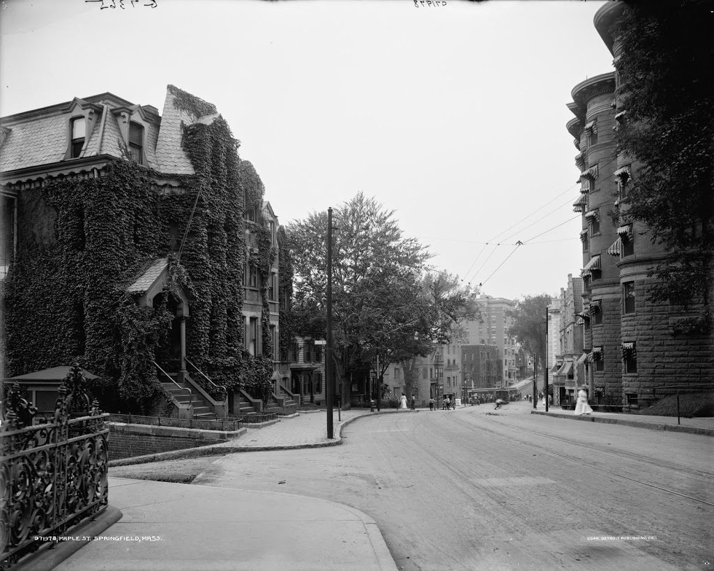
The view looking down Maple Street toward State Street, between 1905 and 1915. Image courtesy of the Library of Congress, Detroit Publishing Company Collection.
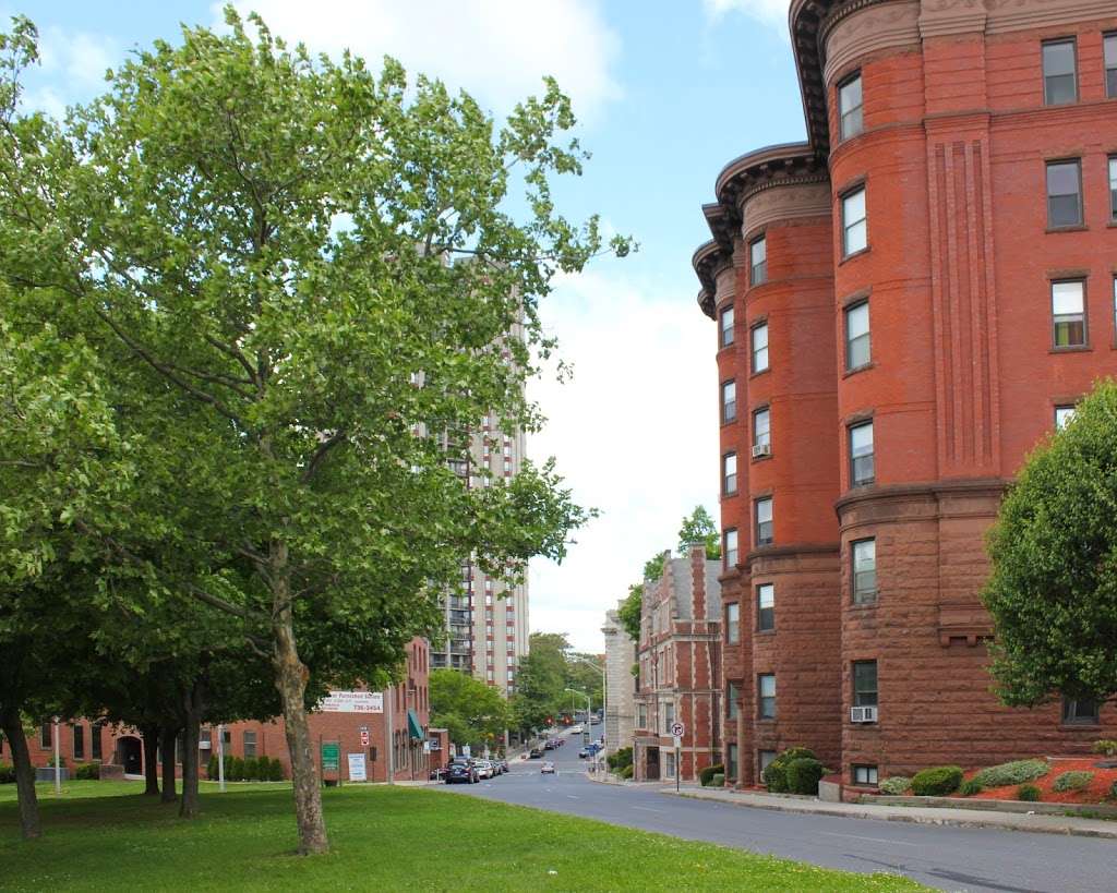
The same view in 2014:
If the street network seems a little different here, it’s because it is. When the first photo was taken, Maple Street and Chestnut Street (which are essentially the same road – they just switch names after crossing State Street) were together a major two-way, north-south road running along the top of the hill overlooking downtown. Dwight Street was, likewise, a major north-south road that ran from the North End until terminating at State Street. However, in 1972, Dwight Street was extended diagonally up the hill to meet Maple Street, and turned into a one-way street carrying southbound traffic. Maple/Chestnut, north of this intersection, then became a parallel, northbound one-way street. South of here (the opposite direction of this photo), Maple Street is still a two-way road.
In any case, this is part of the reason why the left-hand side of this photo looks so dramatically different from the 1905-15 photo; the houses and apartment buildings were later demolished to make room for the extended Dwight Street. The right-hand side of the street, however, remains essentially the same; the apartment building in the foreground is the most obvious, but there is also another building behind it, and the Springfield Fire and Marine Insurance Building barely visible at the corner of State and Maple.
The other major change between the two photos is the massive 34-story Chestnut Park apartment building, which was built between Dwight and Chestnut Streets on State Street. It is the third-tallest building in Springfield and the tallest residential building.


