Barrington Street, Halifax, Nova Scotia (1)

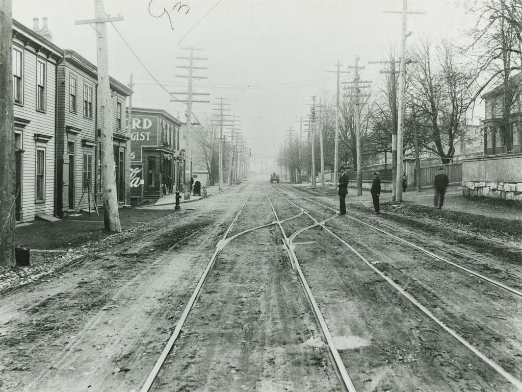
The view looking south on Campbell Road (today Barrington Street) sometime before the 1917 Halifax Explosion. Photo courtesy of the Nova Scotia Archives.

352_1860-1917-2Bnsarchives

The scene in 2014:

352_2014

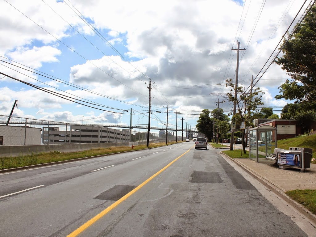
It’s not in New England, but Halifax has historically had close ties with New England, particularly in the aftermath of the Halifax Explosion, when an ammunition ship exploded in the harbor on December 6, 1917, leveling much of the city and killing several thousand people.  This section of road was right near ground zero, and the buildings in the first photo, if they were still standing before the explosion, were certainly not standing afterward.  The first photo was probably taken around 1900, in what was at the time a mix of residential and commercial uses.  Today, the waterfront (left) side of the road is primarily industrial, with some commercial development to the right.  Overall, the c.1900 scene is entirely unrecognizable today.

Vernon Advent Christian Church, Vernon, Vermont

The Vernon Advent Christian Church in Vernon, Vermont, around 1909. Photo from All About Northfield (1910)

351_1909c-2Ball-2Babout-2Bnorthfield

The church in 2014:

351_2014

The first photo shows the church and parsonage around the time that they were completed, on a site just north of the Massachusetts border (it’s really close – the photos were taken about 100 feet north of the border).  Over a century later, the congregation is still there, although the building has changed.  In the 1990s, the church was expanded and renovated, with the original sanctuary being converted into offices and other uses.  The parsonage, however, hasn’t changed much – its exterior is largely the same as it was in 1909, with the exception of the metal roof.

Brattleboro, Vermont (4)

Looking toward the Connecticut River from the corner of Main & Canal Streets in Brattleboro, Vermont, around 1917. Image courtesy of the Library of Congress.

350_1917c-2Bloc

The scene in 2014:

350_2014

On the right-hand side is Brattleboro’s Union Station, which was brand new when the first photo was taken; it opened in 1915. It was built along the Central Vermont Railway, which provided service north through Vermont to Montreal and south through Massachusetts and Connecticut to New London. Today the tracks through Brattleboro are operated by the New England Central Railroad, with Amtrak providing passenger service on their Vermonter route. In the distance in the 1917 photo is the 1878 railroad arch over the Whetstone Brook. It isn’t visible in the 2014 photo, but it is still there, and still carries the railroad over the brook.

The top photo is part of a panoramic view; the other parts can be viewed here:

Part 1
Part 2
Part 3

Brattleboro, Vermont (3)

Looking north from the corner of Main & Canal Streets in Brattleboro, Vermont, around 1917. Image courtesy of the Library of Congress.

349_1917c-2Bloc

The scene in 2014:

349_2014

Taken from across the street from the photos in this post, the 1917 scene shows some of the industrial development along the Whetstone Brook near its confluence with the Connecticut River just to the east (right) of this scene. Many of the buildings still exist, with the oldest one in this scene being the 1850 Van Doorn/Culver Block, in the foreground with the tall gabled roof.

The top photo is part of a panoramic view; the other parts can be viewed here:

Part 1
Part 2
Part 4

Brattleboro, Vermont (2)

Facing northwest from the corner of Main & Canal Streets in Brattleboro, Vermont, around 1917. Image courtesy of the Library of Congress.

Brattleboro

The scene in 2014:

348_2014

The building in the right-center of these two photos is the Wilder Building, which was built in 1875.  It is at the southern end of Main Street, and is directly adjacent to the Whetstone Brook.  In 2004, the top two floors of the building were heavily damaged by a fire, but the historic building was able to be restored, and today it continues to be used for mixed-use residential and commercial purposes.  Further up Main Street to the right is the 1936 Latchis Hotel, which replaced the three-story commercial building in the 1917 photo.  On the far right is the Barber Building, located at the corner of Main Street and Flat Street.  It was built in 1915, so it was brand new in the 1917 photo, and today it is home to Sam’s Outdoor Outfitters.

The top photo is part of a panoramic view; the other parts can be viewed here:

Part 1
Part 3
Part 4

Brattleboro, Vermont (1)

Brattleboro, Vermont, facing east from the corner of Main and Canal Streets around 1917. Image courtesy of the Library of Congress.

347_1917c-2Bloc

The scene in 2014:

347_2014

The 1917 photo provides an interesting contrast between old and new, with horse-drawn carriages making their way up and down Canal Street to the left, and modern automobiles parked in front of the Hoadley Hotel to the right.  All of the buildings are now gone, and today the site is home to the Brattleboro Food Co-op.

The top photo is part of a panoramic view; the other parts can be viewed here:

Part 2
Part 3
Part 4