Train Wreck, Holyoke, Massachusetts

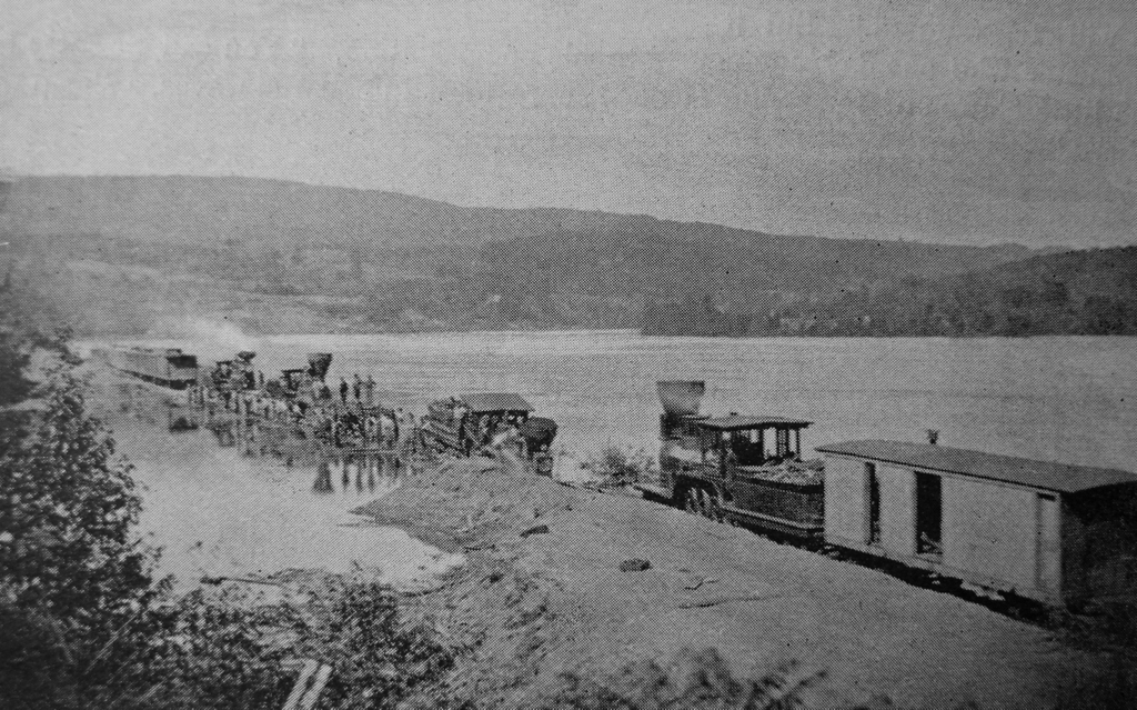
A train wreck at Jones Point in Holyoke, Massachusetts, probably on July 24, 1869. Image from Picturesque Hampden (1892).

The scene in 2025:

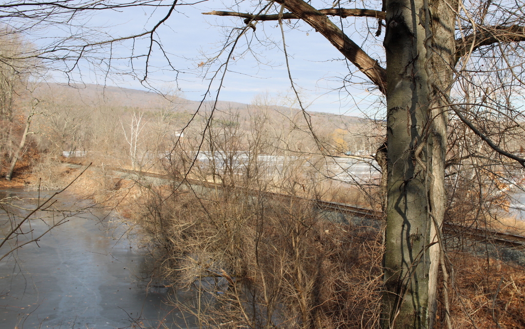
These two photos show a site on the west bank of the Connecticut River that is known as Jones Point. It is just north of the modern-day Jones Point Park, and historically this was the far northern edge of Holyoke, before the city annexed Mount Tom and the Smith’s Ferry neighborhood in 1909. As shown in these two photos, a railroad track runs along the riverbanks. Opened in 1845 as the Connecticut River Railroad, it linked Springfield to Northampton, and was later extended north to the Vermont border.

The top image is from the book Picturesque Hampden, which was published in 1892. It was accompanied by the caption “A Railroad Wreck at Jones’ Gap,” but it did not otherwise have any identifying information, such as the date or the circumstances of the wreck. However, it may have been the train wreck that occurred on July 24, 1869, when a southbound Connecticut River Railroad passenger train derailed, injuring three crew members. Newspaper accounts did not specifically identify Jones Point as the site of the accident, but it was described as having occurred about two miles north of Holyoke, which would place it in this section of the track.

Initial reports indicated that the train had derailed after striking a stone from a nearby quarry that had fallen onto the tracks. However, later accounts blamed the quarry’s own railroad, which crossed the main tracks here. The quarry’s tracks were set slightly higher than the mainline ones, supposedly causing the locomotive’s wheels to strike it and cause the derailment. Regardless of the cause, though, the accident could have been much worse. As it turned out, no lives were lost in the accident, and none of the passengers were injured.

The July 26, 1869 edition of the Springfield Republican provides a description of the wreck:

Saturday was an eventful day in railroad travel in this vicinity, two serious accidents occurring on the northern routes, one near home and another in Vermont. The former occurred in the morning to Conductor Fleming’s train from the north over the Connecticut River railroad, between Smith’s Ferry and Holyoke, at the cross track from the stone quarry leading down to the river. While running at full speed the engine was thrown from the track by a stone between the cross and main tracks, and ploughed along some three rods upon its side. The engineer, Henry H. Snow of Brattleboro had his right leg broken in two places, and his knee split open. Amos Mosher of Mitteneague, the fireman, was bruised in the back, and Frank Kingsley of South Vernon, forward brakeman, had his left ankle sprained. None of the passengers were injured, although the greatest alarm and consternation prevailed among them. A special train, with Drs Breck and Rice, with mattresses, etc., was immediately dispatched to the scene of the accident, and brought the injured persons to this city. Snow’s leg was set by Dr Breck, who accompanied him to Brattleboro, in the afternoon. The doctors do not regard the injuries of the fireman and brakeman as serious. Under all circumstances it seems almost miraculous that a large number of lives were not lost.

Richard Brown, Conductor Fleming’s trusty head brakeman, who was at his usual post on the rear car of the train, was unharmed. His first thoughts were for his brother brakeman, Kingsley. This man had showed remarkable coolness. The car platform was broken and fell from under his feet. He supported himself by hanging to the knob of the car door. Notwithstanding this precaution he was caught between the cars and severely jammed. In this condition Brown found him. “Dick,” said he, “if any one else is hurt worse than I am, help him first!” At this Brown went to the assistance of Engineer Snow, whom he found lying several rods distant. Harley, the well known newsboy on the train, experiences a severe tumbling. He turned a summersault in the aisle of one of the cars, but picked himself up with only a bruise on his head. The conductor was busy caring for his hurt assistants. The force on that train seem to each other like brothers, and they would almost die for each other.

The wreck above Holyoke was cleared from the track so as to let the afternoon train going north pass at 4 o’clock; but nothing further was done than simply to make room for trains to run by. It was a sad sight, the proud “iron horse.” “North Star,” slain and prostrated on its back; the smoke-stack lying at a distance, and its neck driven into the sand. On Sunday it was righted up and, just able to crawl, was led down and stabled in the repair shops of the road in this city, where it was visited during the early evening by many people. The tender and cars were also brought down. The platforms of the cars are badly smashed and the tender is a total wreck.

Based on this account, it appears that the top photo may have been taken on the day after the wreck, since the one in the photo is sitting upright. However, the locomotive appears to have its smokestack attached, which does not match the description in the newspaper, unless the smokestack was reattached when the locomotive was righted. So, while it seems likely that the top photo was taken of this particular wreck, it is hard to say this with certainty.

Several decades later, this site at Jones Point would be the location of another railroad accident, although this second one had deadlier consequences. It occurred on January 27, 1888, when a group of railroad workers were shoveling snow drifts off the track. They had cleared one track, and were working on the other track when a train passed through here on the cleared track without any warning. Heavy winds and drifting snow made visibility poor, and neither the engineer nor the workers could see each other until it was too late. Three of the workers were killed instantly, and a fourth was badly injured and died soon afterwards. Newspaper accounts do not give the precise location of this accident, but they indicate that it happened “at Jones’s cut, some two miles above Holyoke.”

Today, more than 150 years after the top photo was taken, not much has changed in this scene aside from the tree growth. The railroad is still here, and it carries freight trains along with Amtrak passenger trains, including the Vermonter to St. Albans and the Valley Flyer to Greenfield. The land here is now owned by the city of Holyoke, and it is part of Jones Point Park.

John Jack Gravestone, Concord, Massachusetts

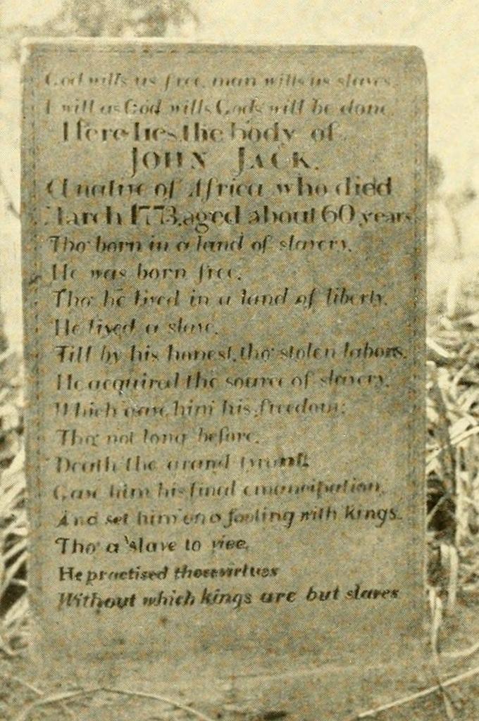
The gravestone of John Jack at Old Hill Burying Ground in Concord, around 1904. Image from The History of Concord, Massachusetts (1904).

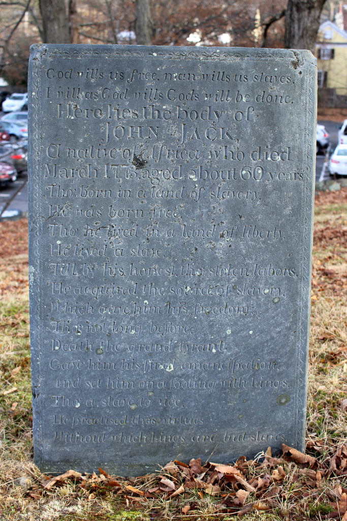
The gravestone in 2023:

It is rare to find surviving colonial-era gravestones for African Americans in New England. Although the region had a sizeable population of enslaved and free people of color during this time, most were buried in unmarked graves, often on the far edges of the town burial grounds. The few gravestones that do exist for enslaved people were apparently commissioned by the families that enslaved them, with inscriptions that often describe them as being their “servant.”

In this regard, the gravestone for John Jack is particularly unusual. Rather than simply identifying him as the servant of a master, the inscription tells the story of his enslavement and subsequent freedom, and in the process it delivers a striking rebuke of the institution of slavery. It reads:

God wills us free, man wills us slaves.
I will as God wills Gods will be done.
Here lies the body of
JOHN JACK.
A native of Africa who died
March 1773, aged about 60 years.
Tho’ born in a land of slavery,
He was born free.
Tho’ he lived in a land of liberty,
He lived a slave,
Till by his honest, tho’ stolen labors,
He acquired the source of slavery
Which gave him his freedom,
Tho’ not long before,
Death the grand tyrant
Gave him his final emancipation,
And set him on a footing with kings.
Tho’ a slave to vice,
He practised these virtues
Without which kings are but slaves.

As the epitaph indicates, John Jack was born in Africa, probably sometime around 1713. At some point he was kidnapped and sold into slavery, and by the 1750s he was in Concord, where he was enslaved to Benjamin Barron, a shoemaker. As an enslaved man, he did not have a surname. Instead, he was referred to in many historical records simply as Jack, or as Jack Negro. Barron died in 1754, and the inventory of his property included Jack, who was valued at 120 pounds, along with “One Negro maid named Vilot, being of no vallue.”

Jack later purchased his freedom, and by 1761 he had acquired enough wealth to become a landowner. That year, he purchased four acres from Benjamin’s daughter Susanna Barron, and he also purchased two more acres from another seller around the same time. He later bought another two and  half acres and built his house on it. According to the 1902 essay John Jack, the Slave and Daniel Bliss, the Tory by George Tolman, John Jack did a variety of work for local farmers, including assisting with haying and pig slaughtering, and he also supposed himself by repairing shoes, a skill that he had likely learned during his time in slavery.

He died in March 1773, and in his will he left his entire estate “to Violet, a negro woman, commonly called Violet Barnes, and now dwelling with Susanna Barron of said Concord.” However, it seems unclear whether she actually benefitted from this bequest. Because she was still enslaved, she could not own property on her own, and any property given to her would instead have belonged to her enslaver.

John Jack’s death occurred right around the time that Revolutionary sentiment was rapidly growing in and around Boston. Many prominent figures spoke of ideals such as freedom and liberty, but in many cases they were also slaveowners, including Concord’s own minister, the Rev. William Emerson, who enslaved at least four people. This irony was not lost on some people, including Concord lawyer Daniel Bliss, who held loyalist views despite being the brother in law of Rev. Emerson, who was an outspoken patriot.

Shortly after John Jack’s death, Bliss commissioned this gravestone for him, and likely wrote the famous epitaph himself. The epitaph features a series of antithetical statements that, among other things, declare slavery to be a violation of God’s will and a contradiction to the values that the patriot leaders were expressing. There is a considerable amount of irony, such as how he was born free “in a land of slavery” but lived as a slave “in a land of liberty.” The epitaph also alludes to the “source of slavery,” (i.e. money), and how acquiring it ultimately resulted in gaining his freedom. But, despite his former status as a slave, the epitaph mentions how death is the great equalizer, and how he is now both slaves and kings ultimately share the same fate.

It did not take long for this epitaph to become famous. Supposedly, several British soldiers stopped by the burying ground on a visit to Concord in March 1775, and they copied the epitaph and sent it back across the Atlantic, where it was republished in British newspapers. By the late 18th century, the text of the epitaph was being published on a regular basis in American newspapers, especially after Massachusetts became the first state to abolish slavery in the 1780s. For example, Boston’s Independent Chronicle and the Universal Advertiser published it in 1791 at the request of a customer, who described it as “greatly admired by the curious, for its ingenious and striking antithesis.” This would continue into the 19th century, especially as abolitionist sentiment grew in the north.

The original gravestone stood here for nearly 50 years, but it was destroyed sometime in the late 1810s, evidently in an act of vandalism. The May 27, 1819 issue of the Middlesex Gazette reported that “[t]he following lines were inscribed on a stone, which was in good preservation, about two years since. Some person, or persons, however, from evil disposition, no doubt, have entirely demolished it.” The broken remains of the original stone laid here for about a decade, until lawyer Rufus Hosmer of Stow started an effort to replace it with a new stone. He and other members of the Middlesex County Bar Association collected funds, and around 1830 commissioned a new stone, which bears the same inscription as the original one. This is the stone that stands here today, and it is the one that is also shown in the top photo around the turn of the 20th century.

By the 1830s, the abolitionist movement had grown strong in Concord and in other places throughout New England. The new gravestone became an important symbol for local abolitionists, and the gravesite was maintained by Mary Rice, who planted lilies here, cleaned lichen off the gravestone, and trimmed the grass around the stone. In his 1902 essay, George Tolman described her as:

[A] little old gentlewoman who lived hard by; quaint in dress and blunt of speech, and with the kindest heart that ever beat; eccentric to a marked degree even among the eccentric people that Concord has always been popularly considered to abound in. She was devoted to all the “reform” causes of the day, and particularly to the anti-slavery movement, and was an active and enthusiastic agent of the “Underground Railway,” an institution by the way, of which Concord was one of the principal station. Many a fugitive found refuge, and, if needed, concealment, in her cottage or from her scanty purse was furnished the means to help him onward toward a free country. To her the epitaph of John Jack had a meaning; it was more than a mere series of brilliant antitheses; it was a prophecy and a promise. The humble grave upon the hillside was a holy sepulchre; its nameless tenant was the prophet and Messiah of the gospel of freedom.

Today, nearly 200 years after the replacement stone was installed here, it remains in good condition. It is made of durable slate, and its inscription is still easily legible, although the lighting was not ideal in the bottom photo. It stands as an important reminder of the history of slavery in New England, and of the contradictions that many Americans dealt with in trying to reconcile the revolutionary-era ideals of freedom and liberty with the practice of slavery. At the end of his essay on the gravestone, George Tolman expressed this quite eloquently in contrasting the stone to the other famous monuments here in Concord:

In the public square at Concord stands a monument to the memory of her sons who, in the late civil war, gave up their lives in defence of the principle of national freedom and unity; by the side of her quiet river her noble Minute-man keeps his unceasing watch over the spot where her sons stood to defend the principle of national independence. Both of these monuments are typical of political, and, in a sense, local and restricted ideas, narrow principles touching merely institutions and policies. But earlier than either, over the grave of a nameless slave in her ancient burying ground, stands the plain gray slab of slate that typifies the far higher idea which is of the constitution of humanity itself,—the principle of individual personal liberty.

We look in vain in the writings of speeches of our patriot fathers for any enunciation of this principle, for any condemnation of slavery as a sin against the moral government of the world. That was reserved for the man they called a Tory,—the man who believed that personal freedom was the God-given birthright of humanity, and whose clear and intelligent vision pierced through the mists of future years to the glorious time when that birthright should be everywhere acknowledged.

Burial Hill Steps, Plymouth, Massachusetts

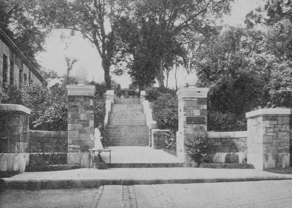
The steps leading up to Burial Hill in Plymouth, seen from School Street around 1921. Image from Illustrated Guide to Historic Plymouth Massachusetts (1921).

The scene in 2023:

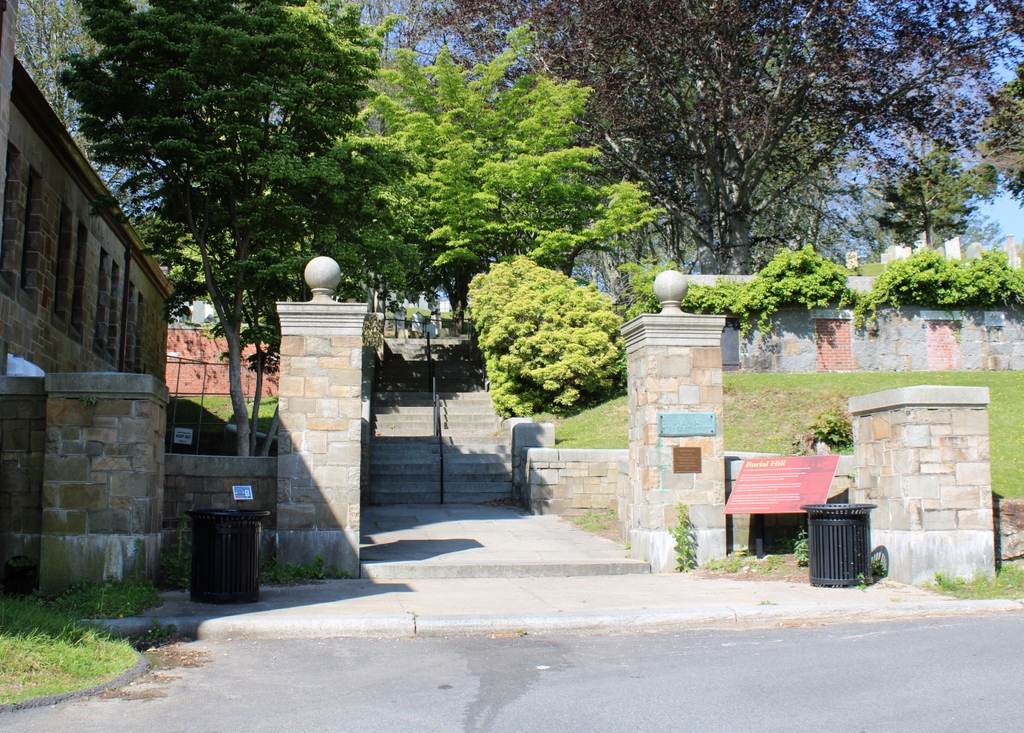
As explained in more detail in the previous posts, Burial Hill is an important historic site in Plymouth. It was here that the Mayflower Pilgrims built their first fortifications and meetinghouse, and later in the colonial period it became the town’s primary graveyard. It remained in use as a graveyard for many years, but by the late 19th century it had become an important tourist attraction, featuring historical markers and monuments to some of the Mayflower passengers. New paths were also constructed through the graveyard, including granite steps—shown here in these two photos—leading from the town center to the top of the hill.

Today, not much has changed here in this scene. Burial Hill remains a popular destination, both for its role in the early years of the colony, and also for its many 17th, 18th, and 19th century gravestones that stand on the hill. The steps, which were installed sometime around the late 1890s, are still here, and on the left side of both photos is the First Parish Church in Plymouth, which was constructed in 1899.

Burial Hill Watch Tower Site, Plymouth, Massachusetts

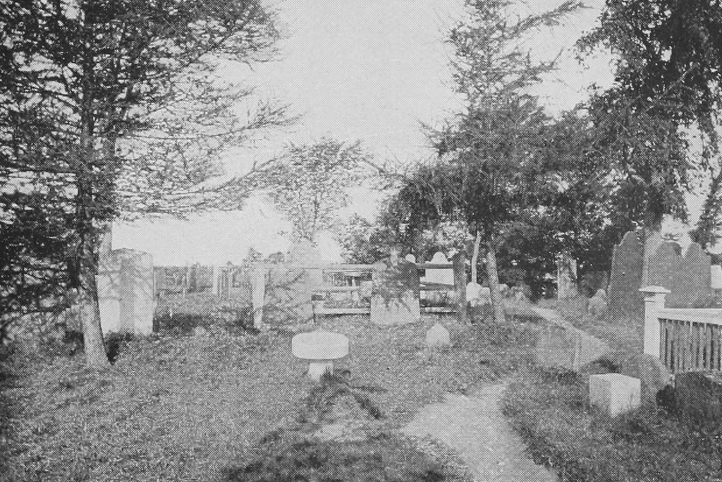
The site of the colonial-era watch tower on Burial Hill in Plymouth, around 1896. Image from Guide to Historic Plymouth (1896).

The scene in 2023:

As explained in several previous posts, Burial Hill in Plymouth was the site of a 17th century fort that was constructed in 1621 by settlers who had arrived on the Mayflower a year earlier. Over the years, the defensive works here on the hill were expanded, including a brick watch tower, which was built in 1643. However, these structures were no longer needed after the end of King Philip’s War, and they were subsequently dismantled.

By 1679, the hill was in use as a graveyard, and this would continue throughout the colonial period and into the 1800s. Over time, though, burial trends in New England shifted away from traditional colonial-era graveyards, with their rows of headstones that featured skulls and other grim reminders of death. Instead, ,mid-19th century New Englanders began to prefer more park-like landscaped cemeteries, which reflected changing societal views on death and mourning.

However, even as its use as an active graveyard decreased, Burial Hill became the site of renewed interest in the early history of the Plymouth colony. A number of monuments were added here to commemorate Mayflower passengers who may or may not have actually been buried here, and there were also markers installed to mark the locations of the 17th century fortifications that once stood on the hill.

The presumed site of the old fort is marked by one such monument, although the location of the marker appears to have been based on tradition rather than on archaeological evidence. However, the site of the 1643 watch tower is more firmly established, thanks to 19th century excavations that uncovered bricks and other remnants of the tower. The 1878 book Old Plymouth: A Guide to Its Localities and Objects of Interest provides an account of the watch tower and the discovery of its remains:

A little to the north of the site of the old fort, another tablet marks the place of the brick watch tower erected in 1643. The locality of this tower is still plainly discernible by the remains of the bricks discoloring the earth in the path, and the four stone posts set in the ground mark its corners. The brick foundation is still there, about a foot below the surface, and the old hearthstone on which the Pilgrims built their watch fires, still lies where they placed it on the southerly side of the enclosure. The location of the tower was discovered several years ago in digging a grave, when the sexton came upon the foundation.

The top photo was taken about 20 years after this description was written, and it shows the site of the 1643 watch tower. In the foreground is an oval marble marker, evidently the tablet that is mentioned in the description. In the lower right corner of the photo is a low granite post, one of the four that marked the corners of the tower. The other three posts would have also been here at the time, although they are not readily visible in the photo.

Today, more than 125 years after the top photo was taken, not much has changed here at this site. Most of the gravestones appear to still be here, although some have been encased in granite in an effort to better protect them. The granite posts are also still here, as is the oval marker that explains the history of the site. There does not appear to have been any archaeological work here in the intervening years, but presumably the original brick foundation and the hearthstone are still below the surface.

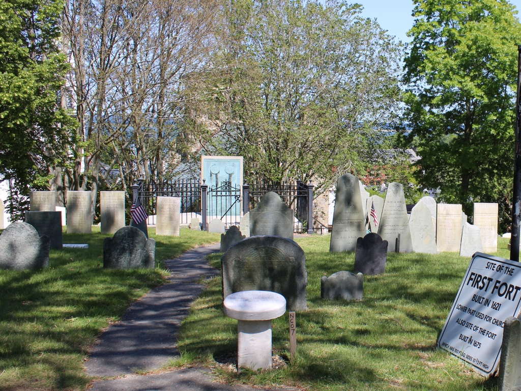
Burial Hill Fort Site, Plymouth, Massachusetts

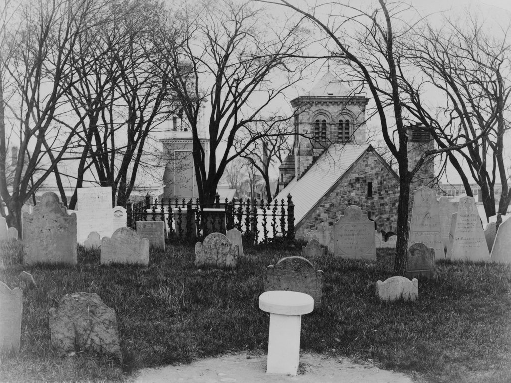
The site of the 17th century fort on Burial Hill in Plymouth, around 1916. Image courtesy of the Library of Congress.

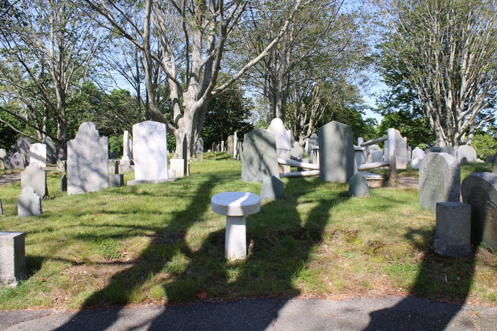
The site in 2023:

As explained in the previous post, Burial Hill was the primary graveyard for Plymouth throughout much of the colonial era. However, prior to its use as a graveyard, the hill was the site of a fort that the English settlers constructed in 1621. The hill is located directly to the west of the town center, and from here defenders had expansive views of the entire harbor. The original fort was reconstructed two years later with a larger structure, and over the years other defensive structures were built nearby, including a brick watchtower in 1643.

The fortifications here remained in use until 1676, when they were dismantled at the conclusion of King Philip’s War. By 1679, the hill had become a graveyard, and the earliest surviving stone here dates back to 1681. There would be many more burials here throughout the 18th and 19th centuries. In this particular scene, the older burials are generally closer to the foreground, while the more recent burials are further in the distance, and generally have larger gravestones, often made of marble.

By the late 19th century, Burial Hill had become more of a tourist destination than an active graveyard, and at some point around this time several white marble markers were installed at points of interest. Among these was the oval marker in the foreground of these two photos, which indicates the approximate site of the old fort. This would later be joined by a more substantial monument further in the distance, which can be seen in the second photo. This was installed here in 1921 to commemorate the fort, and it originally included two 16th century English cannons, although these were eventually removed in 1985 to protect them from weathering.

Today, aside from the 1921 monument, not much else has changed here in this scene. Some of the gravestones appear to have been moved around a bit, but most are still recognizable in both photos. Also visible in these photos are the two historic churches at the foot of Burial Hill. In the distance on the left is the Church of the Pilgrimage, which was built in 1840 and remodeled in 1898, and on the right is the First Parish Church, which was built in 1899.

Burial Hill Cannons, Plymouth, Massachusetts

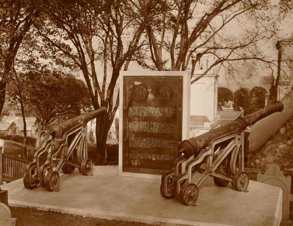
Cannons and a historical marker near the site of the Pilgrim fort on Burial Hill in Plymouth, in October 1921. Image courtesy of the Boston Public Library, Plymouth Tercentenary Photographs collection. Photographed by Edward P. McLaughlin.

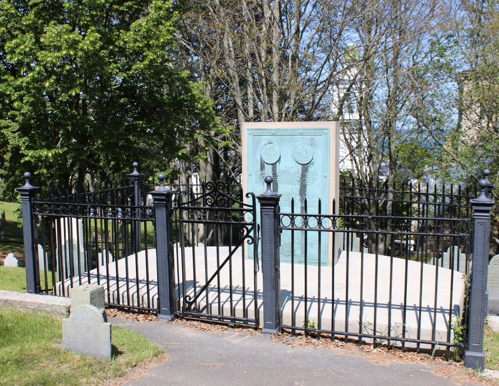
The scene in 2023:

These two photos show a monument on Burial Hill that was installed as part of the 300th anniversary celebration of the start of the Plymouth Colony. Burial Hill is located about a quarter mile west of Plymouth Harbor, and it rises about 120 feet above sea level. Prior to its use as a graveyard, the early Plymouth colonists constructed a fort here, since the elevated land provided expansive views of the town and the harbor.

The first fort here was built soon after their arrival in 1620, but a larger, more substantial one replaced it two years later. This second fort, which also served as the town’s meetinghouse, was located on the southeastern part of the hill, near the spot where these two photos were taken. Governor William Bradford described it in his journal Of Plymouth Plantation, writing:

This somer they builte a fort with good timber, both strong & comly, which was of good defence, made with a flate rofe & batllments, on which their ordnance were mounted, and wher they kepte constante watch, espetially in time of danger. It served them allso for a meeting house, and was fitted accordingly for that use. It was a great worke for them in this weaknes and time of wants; but ye deanger of ye time required it, and both ye continuall rumors of ye fears from ye Indeans hear, espetially ye Narigansets, and also ye hearing of that great massacre in Virginia, made all hands willing to despatch ye same.

The defenses here on the hill were subsequently expanded, including the construction of a brick watchtower in 1643. By 1676, though, it was no longer necessary following the end of King Philip’s War. The structures here were dismantled, and by 1679 the hill was in use as a graveyard. The oldest stone on the hill dates back to 1681, and the hill would continue to be used as an active burial ground throughout the colonial era and into the early 19th century.

By the late 19th century, the story of the Mayflower had become a key part of the country’s founding narrative, aided in part by popular depictions of the Pilgrims, such as Henry Wadsworth Longfellow’s poem, The Courtship of Myles Standish. This interest in Plymouth carried into the 20th century, eventually culminating with the tercentenary of 1920-1921.

It was during this tercentenary celebration that a new portico was constructed above Plymouth Rock, but there were also other monuments installed around Plymouth during this time, including one here on the site of the old fort, which is shown in these two photos. This monument was sponsored by the Ancient and Honorable Artillery Company of Massachusetts, and it originally featured two bronze cannons, which were donated by the British government. The bronze plaque between the cannons describes the history of both the site and the cannons, and it reads:

Brass cannon like these were named by Bradford and Winslow in the annals of Plymouth as mounted on the first fort, 1621, and were still in use in 1645 when the Ancient and Honorable Artillery Company of Massachusetts under its commander Major General Gibbons joined the Plymouth company under the command of Captain Myles Standish to fight against the Narragansett Indians.

These pieces are from the collection in the British National Artillery Museum. They were the only cannon of that period and of English manufacture in the collection “in consideration of the greatness of the occasion, the tercentenary celebration of the landing of the Pilgrims, and the good will of the English nation, the government, on behalf of the British people, have made this gift to the town of Plymouth, Massachusetts.”

On the right is a “minion” of the time of Mary, 1554, with a rose and the letters M.R. (Maria Regina) and is inscribed “John and Thomas Mayo, brethren, made this pece anno dni 1554.” On the left is a “Sakeret” of the time of Edward the Sixth with a shield and three lions passant inscribed “Thomas Owen made this pece for the ye’l of carnse vhan ser Peter Mevtas vas governor and captayn, anno dni 1550.”

They were transmitted through the Honourable Artillery Company of London, chartered 1537, and placed here by the Ancient and Honorable Artillery Company of Massachusetts, chartered 1638, and dedicated October the 4th, 1921.

The keynote speaker at the dedication event was William H. P. Faunce, the president of Brown University. He took the opportunity to advocate for stronger ties between Britain and the United States, and he also addressed some of the concerns that some Americans evidently had about British human rights violations. Faunce pointed out that, while many would point to British actions in Ireland and India, America was likewise guilty of injustices against other groups of people.

The cannons would remain here for over 60 years, but they were ultimately removed in 1985 to protect them from the effects of weathering. The one on the left was returned to Britain, and the one on the right is now on display at the Pilgrim Hall Museum here in Plymouth. Then, in 2020, the Ancient and Honorable Artillery Company donated a replica cannon to the town. It is intended to eventually be placed here on Burial Hill, but as of May 2023 it has not yet been installed.