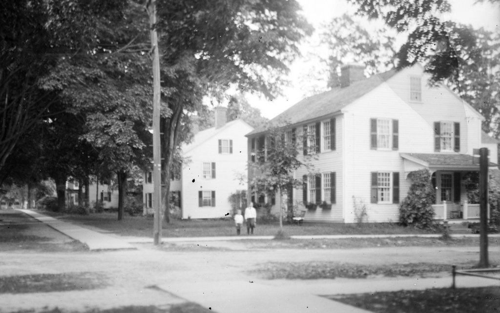
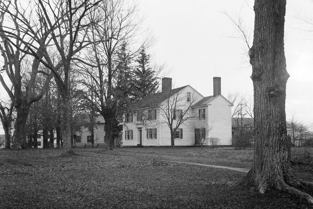
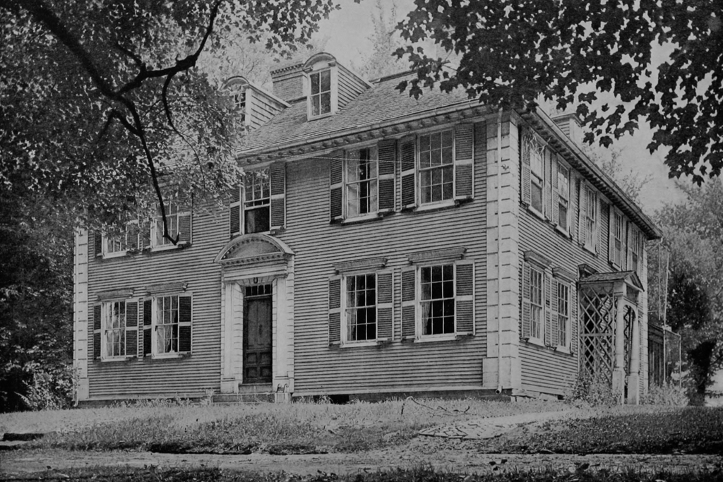
The house at the corner of Longmeadow Street and Emerson Road in Longmeadow, Massachusetts, in July 1925. Image courtesy of the Longmeadow Historical Society, Paesiello Emerson Collection.
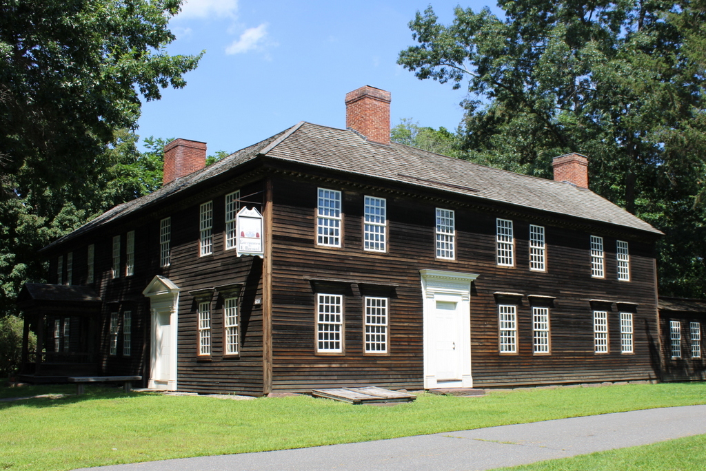
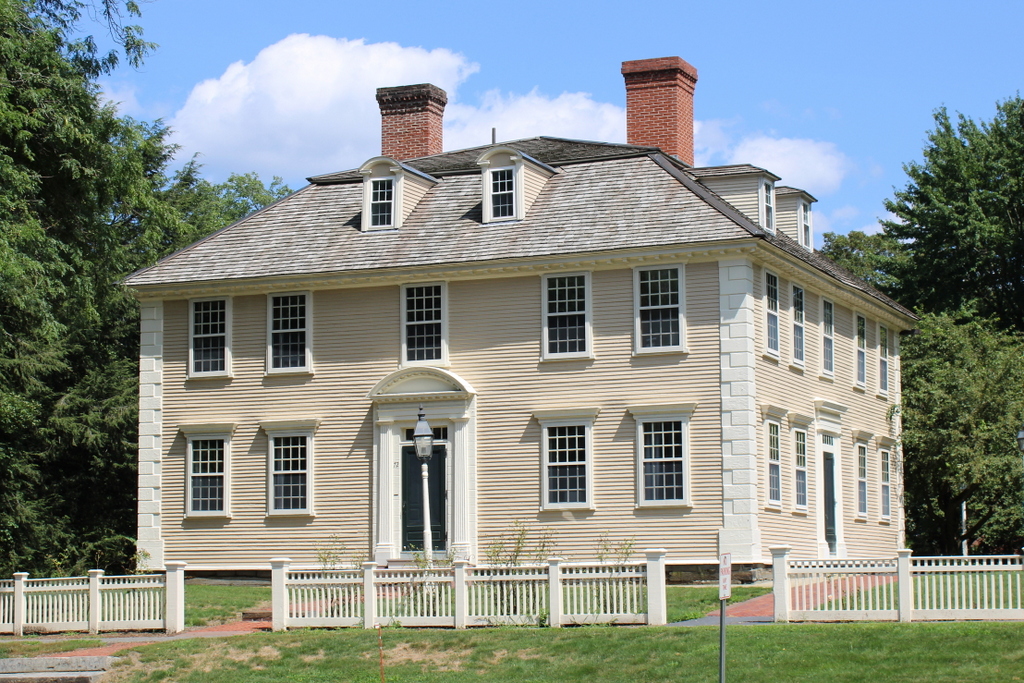
The house in 2024:
This house has been well documented here on Lost New England due in large part to the efforts of half siblings Paesiello and Annie Emerson, whose family owned this house in the late 1800s and early 1900s. Paesiello was an amateur photographer, and this historic colonial house was a frequent subject of his photographs. Likewise, Annie was the town historian, and she extensively researched the history of the house. Her narrative was a valuable resource for me when I was writing an earlier blog post, which includes a detailed history of the property. The Emersons also played an important role in preserving the house at a time when many other old Longmeadow houses were being demolished or moved to make way for new suburban developments.
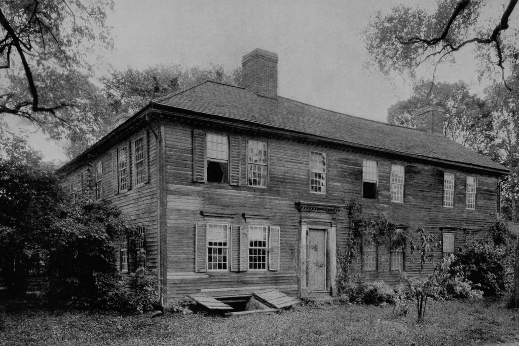
The recorded history of this property dates to the early 1700s, when Eliakim Cooley (1681–1758) built a house on this site, probably around the 1710s or 1720s. It was definitely here by 1728, when it was struck by lightning on May 19. The exact fate of this early house seems unclear, though, including whether it was destroyed by the lightning, and whether it was subsequently rebuilt. The exact construction date of the current house is also uncertain, although it appears to have been built by Eliakim’s son Josiah Cooley (1716–1778), probably sometime around 1760, although other sources have given the date as 1775. According to Annie Emerson’s research, it appears to have been built, at least in part, on the foundation of Eliakim Cooley’s early 1700s house.
When it was built, this house looked considerably different from its later appearance. It was a typical 18th century saltbox-style house, with four rooms on the first floor, two rooms on the front part of the second floor, and a long, sloping roof in the back, which gave the “saltbox” style its name. In the center of the house is a large chimney, which measures about 10 feet on each side on the first floor. The front doorway would have also been different from its current appearance, and the front windows would have had 12-over-12 sashes, rather than the 6-over-6 ones that are shown in these two photos.
Josiah Cooley’s son Josiah (1749–1824) subsequently inherited the house, and he lived here with his mother Experience Hale (1714–1798), his wife Abiel Bliss (1758–1830), and their children. Their daughter Lucy (1789–1869) was the next owner of the house, and she lived here with her husband Luther Colton (1787–1857) and their children.
It was during Lucy and Luther Colton’s ownership that the house underwent its most significant changes. Different sources give different dates, but this appears to have occurred between 1827 and 1835. This included raising the roof to create a full second floor, building a one-story addition on the back of the house, and building a two-story addition on the north side of the house, which can be seen on the right side of these two photos. This addition was built for Luther Woolworth Colton (1812–1851) and his wife Abigail Morris (1812–1848), who lived in it after their marriage in 1835.
Other alterations during this time included replacing the front doorway with a Greek Revival style doorway, and also replacing the older windows with newer, more fashionable 6-over-6 sashes. However, the older windows were not discarded, but were instead installed in the additions on the back of the house, where many of them still remain. The Coltons also added exterior shutters to the windows, and removed the older interior panel shutters, which were evidently repurposed to make cabinets.
The house remained in the Colton family until 1869, when Lucy and Luther’s son Josiah Cooley Colton (1825–1895) sold it to Bradford W. Palmer. However, Palmer remained here for just three years before selling it to William G. Emerson (1806–1887), a carpenter who was originally from eastern Massachusetts and had previously lived in Holyoke and Chicopee. He moved here with his wife Lovina Fay (c.1822–1897) and their three children: William (1849–1930), Annie (1859–1941), and Henry (1865–1943).
Of their children, Annie and Henry never married, and they lived here in this house for the rest of their lives. In 1907, they were joined by their half brother Paesiello (1832–1927), a Civil War veteran and retired bootmaker who was William G. Emerson’s son from his first marriage. Paesiello was a widower by the time he moved here, and he had recently taken up photography as a hobby. Over the next few decades, he used his camera to document life in Longmeadow, as the town underwent major changes due to population growth and suburbanization.
The top photo was taken in July 1925, when Paesiello Emerson was 93 years old. Despite his age, he was still living a very active life, including taking photographs around town and also traveling to attend Civil War reunions with an ever-dwindling number of his former comrades. His last reunion was in 1927, when he snuck out of the house without telling anyone and traveled across the state to Fairhaven to attend it, prompting a series of missing persons articles that were published in area newspapers. He died a few months later in December 1927, at the age of 95.
Annie and Henry continued to live here until their deaths in 1941 and 1943, respectively. The house has had a series of owners since then, including Bay Path University, which owned the house for a time. However, it is once again a private residence, and overall the exterior has seen few significant changes in the past century, aside from the removal of the shutters and the installation of a larger window on the first floor of the north wing of the house.