Bloody Lane, Sharpsburg, Maryland

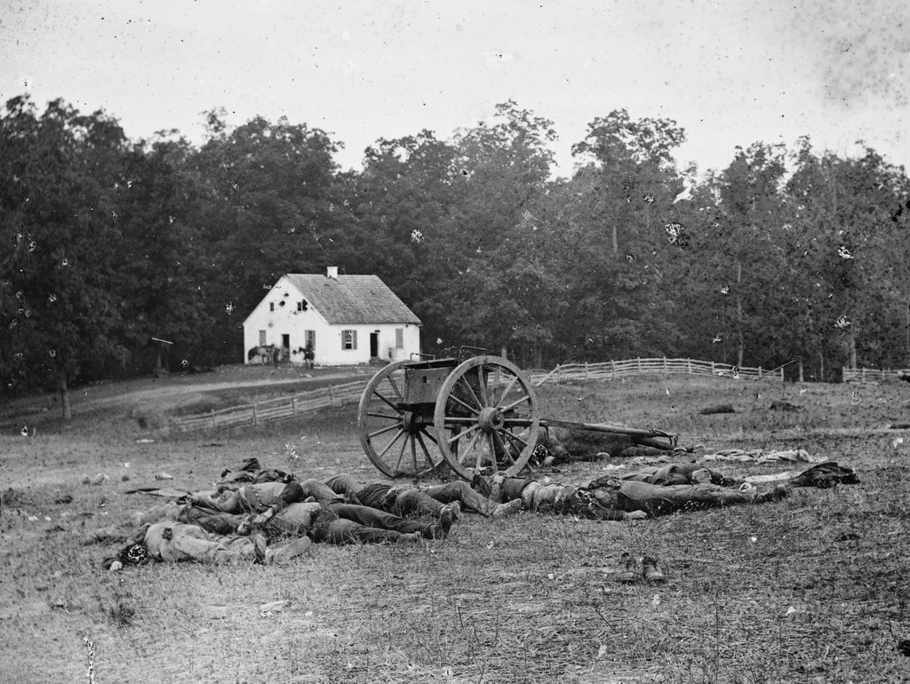
Dead Confederate soldiers in the Bloody Lane at the Antietam battlefield in Sharpsburg, in September 1862. Photographed by Alexander Gardner; image courtesy of the Library of Congress, Civil War collection.
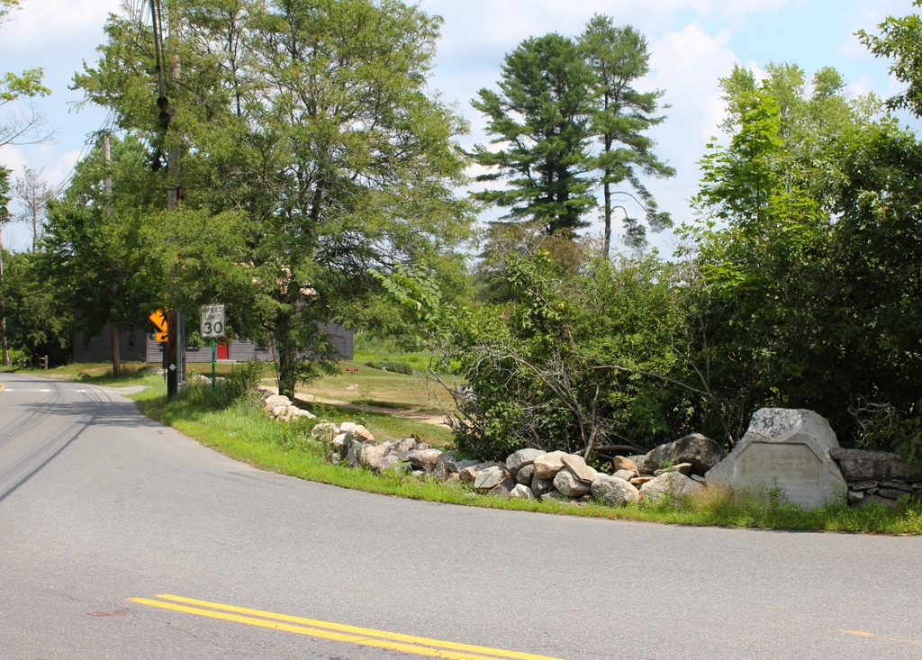
The scene in 2021:

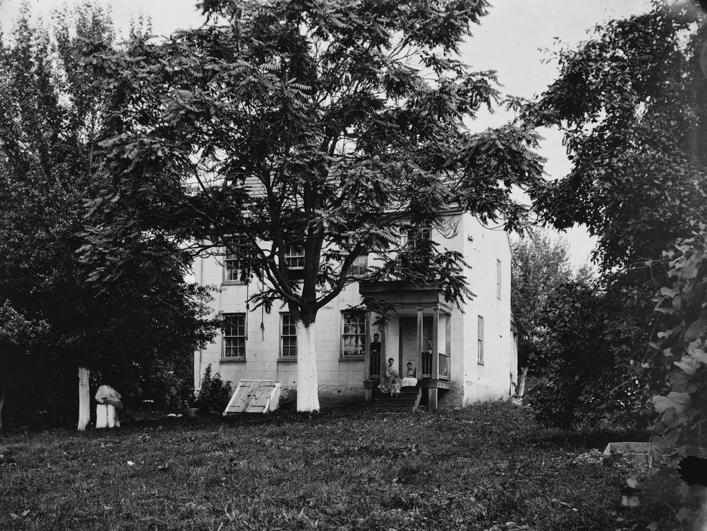
The Battle of Antietam was fought on September 17, 1862, and it remains the bloodiest single day in the history of the U.S. military, with over 3,500 killed and over 17,000 wounded during the battle. Many of these casualties occurred here on this road, which became the main focal point of the battle during the midday period of the fighting.

At the start of the battle, the Confederates had arranged themselves in a defensive position around the town of Sharpsburg, Maryland. This was a part of General Robert E. Lee’s first major offensive campaign into northern territory, and he hoped that a successful invasion would weaken the Union’s resolve to fight. Opposing Lee was the Army of the Potomac under Union General George B. McClellan, and he began his attack on the Confederate forces in the early morning hours of September 17.

The Union attack initially concentrated on the Confederate left flank, in the vicinity of the Dunker Church. However, this advance ultimately stalled. Later in the morning, Union efforts shifted to the middle of the Confederate line. Here, Confederate soldiers under General Daniel H. Hill were positioned in the Sunken Road, a road that had been worn down by many years of traffic and weathering. This made it ideal as a trench, and Confederates also stacked up fence rails along the road as a further barricade.

The ensuing fight was some of the fiercest of the battle, and in some ways it was a preview of the trench warfare that would later appear in World War I. Despite being heavily outnumbered, Hill’s soldiers fended off repeated waves of Union assaults. Finally, in the early afternoon, Union forces managed to break through the defenses here at the Sunken Road, forcing the Confederates to fall back. However, the Union had sustained such heavy losses in the fighting that McClellan was unwilling to seize on this opportunity to strike a decisive blow at the Confederate army.

Much of this hesitancy was due to McClellan’s tendency to be overly cautious. As was often the case, he vastly overestimated the size of Lee’s army, believing that Confederate forces vastly outnumbered Union forces when in reality the opposite was true. He also failed to develop a coordinated plan of attack, instead opting for a piecemeal approach with only a small portion of his army engaged at any given time, making it easy for the outnumbered Confederates to defend against them. And, when the Union had finally gained the Sunken Road after hours of hard-fought combat, McClellan became unwilling to commit his reserve troops to an aggressive assault that he feared could lead to defeat.

In reality, the Confederates were in an extremely vulnerable state following the Sunken Road portion of the battle, and a more aggressive approach could have turned Antietam into one of the greatest Union triumphs of the war. Instead, it was nearly a draw, with the Union only able to claim victory because, at the end of the day’s fighting, Lee abandoned his position and returned south. But even then, McClellan faced criticism for failing to pursue Lee’s army and trap them in northern territory. It marked the end of his career as a general, with Lincoln dismissing him less than two months later.

In the aftermath of the battle, photographer Alexander Gardner arrived here at the scene several days later, and began capturing images of the carnage. The Civil War was the first major war to be extensively documented with photographs, which allowed the general public to see the true realities of the war. This photograph at the top of this post is one of the most iconic images of the battle, and it shows a number of dead Confederate soldiers lying alongside each other in their makeshift trench. In total, about 5,500 soldiers on both sides were killed or wounded here at the Sunken Road, which came to be known after the battle as the Bloody Lane.

Aside from Gardner’s photograph, one of the most famous descriptions of the scene here was provided by war correspondent Charles Carleton Coffin, who wrote:

The hillside was dotted with prostrate forms of men in blue, but in the sunken road, what a ghastly spectacle! The Confederates had gone down as the grass falls before the scythe. They were lying in rows, like the ties of a railroad; in heaps, like cord-wood, mingled with the splintered and scattered fence rails. The terrible volley had flamed in their faces, more deadly than the simoon of the desert. Words are inadequate to portray the scene. There were prostrate forms, that had been vigorous with resolute life, and the next moment were motionless forever, resolution and energy still lingering in the pallid cheeks, in the set teeth, the gripping hand. I recall a soldier with the cartridge between his thumb and finger, the end of the cartridge bitten off, and the paper between his teeth when the bullet pierced his heart, and the machinery of life—all the muscles and nerves—came to a standstill. A young lieutenant had fallen while to trying to rally his men; fixed determination was visible in every line of his face. His hand was still firmly grasping his sword. I counted fourteen bodies lying together, literally in a heap, amid the corn rows on the hillside. The broad green leaves were sprinkled and stained with blood.

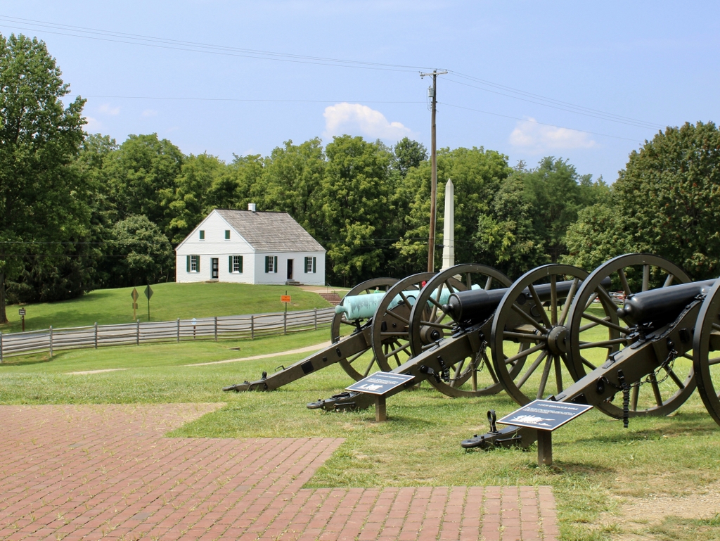
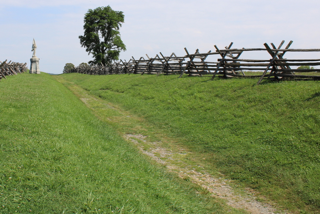
In the years that followed, many major battlefields became sites of monuments to the soldiers who fought here. Most were dedicated in the late 19th and early 20th centuries, in order to honor the aging veterans and their fallen comrades. Here at Antietam, nearly all of the monuments are for Union states or regiments, including the one that stands in the distance on the left side of the scene. It memorializes the 132nd Pennsylvania Volunteer Infantry Regiment, which had 30 men killed, 114 wounded, and 8 missing here at Antietam, and it was dedicated here in 1904.

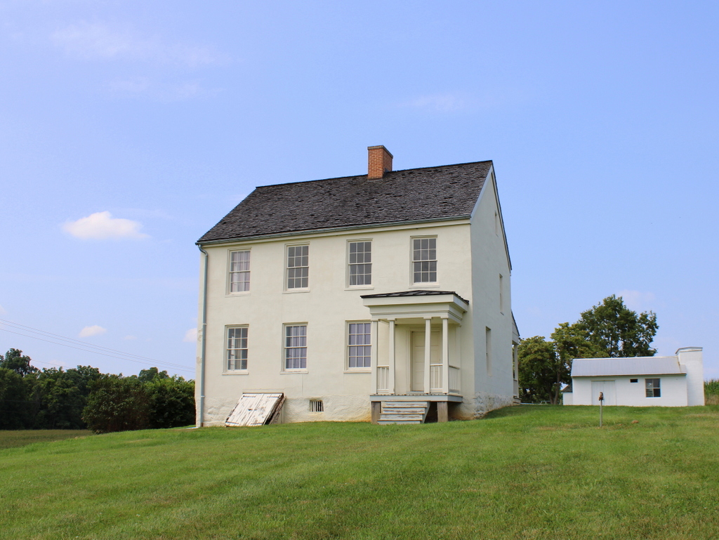
Today, aside from the presence of the monument, there is no visual evidence in this scene of the horrors that Alexander Gardner had captured in the first photograph. The Bloody Lane has been maintained in its wartime appearance, and the only other sign of modernity here is the observation tower, which is partially visible in the distance behind the monument. The Bloody Lane, along with the surrounding battlefield, is now owned by the National Park Service, and it is one of the major landmarks here at the Antietam National Battlefield.

Miller Farmhouse, Sharpsburg, Maryland

The Miller farmhouse in Sharpsburg, in the aftermath of the Battle of Antietam in 1862. Image courtesy of the Library of Congress, Civil War Glass Negatives and Related Prints collection.

The scene in 2021:

These two photos show the farmhouse of David R. Miller, which stands as a major landmark on the Antietam battlefield. This house was near the epicenter of some of the most intense fighting during the deadliest single-day battle in American history, yet it survived remarkably unscathed, as shown in the first photo shortly after the end of the battle.

The house was apparently built around 1800, and it was purchased by John Miller in 1844. His son David subsequently lived here, with the 1860 census showing him here with his wife Margaret and seven children. From oldest to youngest, they were: William, age 13; Harriett, age 12; Mary, age 11; Eleanor, age 10; James, age 8; Nettie, age 3; and Clarence, age 3 months. According to the slave schedules of the 1860 census, the Miller family also lived here with a 20-year-old enslaved woman.

Miller’s occupation on the census was listed as a farmer, and he owned a considerable amount of property, amounting to $13,500 in real estate and $1,200 in his personal estate. Aside from the house itself, there were a number of outbuildings here on the property, including a barn, a blacksmith shop, and a separate kitchen. In total, his property consisted of about 200 acres of farmland and woodlands, extending along both sides of the Hagerstown Pike as far south as the Dunker Church.

At the time of the census, Miller was just another rural farmer in western Maryland, but within a few years his property would achieve national attention for the bloody fighting that occurred here during the Battle of Antietam on September 17, 1862. In the process, the descriptive names of locations on his property, like the West Woods and the Cornfield would become etched into the annals of the Civil War.

The Battle of Antietam occurred as a result of Confederate General Robert E. Lee’s first attempt to invade northern territory. Following victories in Virginia in the summer of 1862, he moved his army across the Potomac and into Maryland, where he hoped to weaken northern morale and their will to fight. He fought several smaller battles, and then took up a defensive position here in the vicinity of Sharpsburg, just a little to the south of Miller’s farm.

The fighting began in the early morning hours of September 17. By this point, the Miller family had abandoned their home to seek refuge in Sharpsburg, and Union soldiers marched through the property in an attempt to attack the left flank of the Confederate line. In the process, though, they met resistance in the Miller cornfield, located just to the south of the house. Over the next few hours, the two sides would go back and forth in the cornfield, alternately gaining and losing ground, without any side making much progress.

With the cornfield becoming a stalemate, Union General Edwin Sumner attempted to flank the Confederates by moving into the West Woods. This was also part of Miller’s property, and it was located to the west of the cornfield on the other side of the Hagerstown Pike. However, as was the case in the cornfield, they faced heavy resistance in the West Woods and suffered massive casualties. Out of a force of about 5,300 men, around 2,200 were killed or wounded in just 20 minutes of fighting there. This, combined with around 8,000 killed or wounded in the cornfield, meant that Miller’s property accounted for a significant portion of the loss of life that occurred during the battle.

Over the course of the day, the fighting eventually shifted further to the south, away from Miller’s property. What remained was a scene of devastation that was perhaps best described by Union General Joseph Hooker, who later wrote:

Every stalk of corn in the northern and greater part of the field was cut as closely as could have been done with a knife, and the slain lay in rows precisely as they stood in their ranks a few moments before. It was never my fortune to witness a more bloody, dismal battle-field.

Oddly enough, however, despite being immediately to the north of this cornfield, the Miller house managed to survive the battle with minimal damage. Unlike most other photos that were taken in the immediate aftermath of the Battle of Antietam, the first photo here shows hardly any signs of the fighting that had occurred around the house. Without any other context, it would appear to be a typical 19th century photograph of a farmhouse, complete with the family posing on the front porch. Although not identified in the caption of the photograph, the five people on the porch are likely the Miller children. There is also a sixth person in the photo, seated on a stump on the far left, but this figure is too blurry to identify.

The Miller family would continue to live here for many years after the battle, before ultimately selling the property to Euromus Hoffman in the mid-1880s. The federal government established the Antietam National Battlefield Site in 1890, but it did not initially include the Miller property, which remained in private hands for the next century. Finally, in 1989 it was purchased by the Conservation Fund, and a year later it was donated to the National Park Service.

The house underwent a major restoration starting in 2008, and it has since been returned to its 1862 appearance, as shown in the present-day photo. The grounds look very different from the first photo, with very little vegetation, but overall the house looks very much the same as it did in the aftermath of the battle, and it stands as an important landmark here on the Antietam battlefield.

Confederate Dead at Dunker Church, Sharpsburg, Maryland

Bodies of Confederate soldiers in front of the Dunker Church in the aftermath of the Battle of Antietam, photographed in September 1862 by Alexander Gardner. Image courtesy of the Library of Congress, Civil War Glass Negatives and Related Prints collection.

The scene in 2021:

The first photo is one of the most iconic images from the Civil War, showing the aftermath of the Battle of Antietam. It was taken by renowned war photographer Alexander Gardner, who captured a small glimpse of the deadliest single-day battle in American history. In the foreground are dead Confederate soldiers lined up in front of an artillery limber, with a dead horse beneath the cart. An assortment of debris is scattered around the field, including a pair of shoes in the lower right side of the scene. Further in the distance is the Dunker Church, with whitewashed walls that bear the scars that the battle had inflicted two days earlier.

The Battle of Antietam was fought on September 17, 1862, between Union forces led by General George B. McClellan and Confederates led by General Robert E. Lee. It was part of Lee’s first major offensive campaign into northern territory, which was undertaken with the hopes of undermining northern morale and support for the war. After a series of smaller battles in the area, Lee took a defensive position here at Sharpsburg, Maryland. The left flank of his army was located here in this scene, in the area around the Dunker Church, and it was here that Union forces launched their attack early in the morning of the battle.

The Dunker Church had been built in 1852 as the meeting house of the German Baptist Brethren. One of the core teachings of this Christian denomination was pacifism, but ironically their church would become the scene of some of the fiercest fighting of the battle. Because of its visibility on the battlefield, Union forces used the church as a landmark to focus their attacks. Throughout the morning, the ground near the church frequently changed hands, with both sides sustaining heavy casualties without making significant progress. Over the course of the battle, the fighting eventually shifted further to the south, but not before leaving the area around the church “literally carpeted with dead and dying men,” as Confederate General Thomas “Stonewall” Jackson would later describe it.

By the end of the day, over 2,000 Union soldiers were dead and nearly 10,000 wounded, along with 1,500 Confederates dead and over 7,7000 wounded, making it the bloodiest day in the history of the American military. From a tactical perspective it was essentially a draw, but it was a strategic victory for the Union, since it forced Lee to abandon his invasion plans and return south to Virginia. However, the victorious McClellan faced heavy criticism. Despite having significantly more soldiers than Lee, McClellan failed to exploit this advantage during the battle, nor did he pursue Lee’s vulnerable army during their retreat to Virginia. This was characteristic of McClellan’s overly cautious methods, and it ultimately led to his dismissal by Abraham Lincoln on November 5.

In the meantime, the aftermath of the battle was extensively documented by photographers such as Alexander Gardner. The Civil War was the first major American conflict to be photographed, enabling the general public to see, for the first time, the harsh realities of war. Gardner arrived at Antietam two days later on September 19, and he spent the next few days photographing the battlefield, including scenes of dead soldiers scattered along roads and in fields. He took several different photographs of this scene in front of the Dunker Church, and it became one of his most memorable photographs of the war, perhaps because of the stark contrast between the white church in the background and the carnage in the foreground.

Following the battle, the church was repaired, as shown in the photograph in the previous post, which was taken by Alexander Gardner’s younger brother James at the end of the war. It remained in use as a church until 1899, but it subsequently fell into disrepair, in part because of souvenir hunters who damaged the vacant building by removing bricks from the walls. It ultimately collapsed in a windstorm in 1921, and the site eventually became a gas station, lunch counter, and souvenir shop.

In 1951, the Washington County Historical Society purchased the property, and then gave it to the National Park Service. It became part of the Antietam National Battlefield, and a replica church was reconstructed here on the original foundation in 1962, as part of the centennial of the battle. It still stands today, as shown in the 2021 photo, and it remains one of the most distinctive landmarks on the battlefield. Where the dead Confederate soldiers once rested is now a row of cannons, representing the Confederate artillery position here at this location. In the distant center, in front of the church, is a monument to the 5th, 7th, and 66th Ohio Infantry Regiments, which was dedicated here in 1903. Overall, the Antietam battlefield is one of the best-preserved of all the Civil War battlefields, and this scene is easily recognizable from the first photo, some 160 years later.

Dunker Church, Sharpsburg, Maryland

The Dunker Church near Sharpsburg, Maryland, around 1862-1865. Photo by James Gardner, courtesy of the Library of Congress, Civil War Glass Negatives and Related Prints collection.

The church in 2021:

The first photo was taken by James Gardner, and it was published in 1865 in his brother Alexander’s Photographic Sketch Book of the War. It shows the Dunker Church, which had been a major landmark during the Battle of Antietam on September 17, 1862. The original church survived the battle only to be destroyed by a windstorm in 1921, but a replica was later built on the same site, as shown in the present-day scene.

The church was built in 1852 for the German Baptist Brethren, who were also known as the “Dunkers” because of their practice of baptism by immersion. Their beliefs were related to other Anabaptist churches like the Amish and the Mennonites, and one of their core values was pacifism. In light of that, it is particularly ironic that their meeting house here would become a focal point in the bloodiest single-day battle in American history.

The Battle of Antietam was the culmination of the first major Confederate offensive campaign into Union territory. Emboldened by recent victories such as the Second Battle of Bull Run, Robert E. Lee hoped to bring the war to the north. In doing so, one of his goals was to weaken the northern morale and their willingness to fight the war. To that end, Lee marched northwest from Virginia into Maryland. Along the way, he fought battles at Harpers Ferry, South Mountain, and Crampton’s Gap, before ending up in Sharpsburg, Maryland. There, he took a defensive position just outside of the town, with his left flank positioned here in the vicinity of the Dunker Church.

The battle began early in the morning of September 17, with a Union assault on the left flank led by General Joseph Hooker. Because of its visibility on the battlefield and its location in the midst of the Confederate defenses, the church became the focal point of the Union attack. However, despite having a small numerical advantage, Union soldiers made little progress in their advance, leading to a particularly bloody scene in a corn field about a half mile to the north of the church, where both sides suffered heavy casualties.

Reflecting on the events of the battle, Confederate General Thomas “Stonewall” Jackson described the scene here, writing:

The carnage on both sides was terrific. The hottest fight seemed to center about Dunker Church, where there were no less than four charges and counter-charges. Each army had taken and retaken the ground until it was literally carpeted with dead and dying men.

Over the course of the morning, the battle shifted away from the church. Much of the fighting in the middle stages of the battle centered around the “sunken road” to the southeast of the church, and later in the day the fighting was even further south, in the vicinity of Burnside’s Bridge. Throughout this, neither side made significant progress. The fighting was over by early evening, leaving over 2,000 Union soldiers dead and nearly 10,000 wounded, compared to 1,500 Confederates killed and over 7,700 wounded.

Although both sides suffered similar losses, the Battle of Antietam is generally regarded as an important strategic victory for the Union. In the aftermath of the battle, General Lee abandoned his attempts to invade the north, and instead brought his army back to Virginia. He would eventually attempt one more large-scale invasion of the north less than a year later, but he suffered an even more decisive loss at Gettysburg in July 1863.

In the meantime, the Dunker Church sustained significant damage during the battle, from bullets as well as artillery fire. Photographs taken in the immediate aftermath show a number of holes in the roof and in the brick walls. However, this damage was soon repaired, and the church was back in use by 1864. The first photo was taken about a year later, showing the exterior of the repaired building. The photo was taken by James Gardner, the younger brother of prominent Civil War photographer Alexander Gardner, and it was published in Gardner’s Photographic Sketchbook of the War after the end of the war.

Following the war, the church continued to be one of the most important symbols of the battle, but it also continued to be used as a church until 1899, when the congregation moved to a new building. Now vacant, the old building deteriorated over the next few decades, assisted by souvenir hunters who helped themselves to bricks from the walls. In the end, the humble brick church that had survived one of the deadliest battles of the Civil War was destroyed by a windstorm in 1921.

The site of the church later became a gas station, lunch counter, and souvenir stand, but in 1951 the property was purchased by the Washington County Historical Society and then transferred to the National Park Service. It became part of the Antietam National Battlefield, and in 1962 the church was reconstructed on the original foundation as part of the centennial of the battle.

Today, despite the church being a modern reconstruction with very little original material, this scene still has largely the same appearance as it had in the 1860s. Antietam is one of the best-preserved Civil War battlefields, and the reconstructed church remains one of its most distinctive landmarks. The building is open to the public, and its design is based on what the interior of the original church would have looked like in 1862.

Stone House, Manassas, Virginia

The Stone House on the Warrenton Turnpike (present-day US Route 29) just north of Manassas, Virginia, in March 1862. Image taken by George N. Barnard, courtesy of the Library of Congress, Civil War Glass Negatives and Related Prints collection.

The house in 2021:

These two photos show the Stone House, which is located on the Warrenton Turnpike just to the north of Manassas, Virginia. This house is a famous Civil War landmark because of its role in the First Battle of Bull Run in 1861, and also in the Second Battle of Bull Run a year later. Despite being in the midst of the fighting during both battles, the house survived the war, and it has been preserved in its Civil War-era appearance.

The exact date of construction is uncertain, but the evidence seems to suggest that it was built around 1848. Two years later, the house was sold to Henry P. Matthews, along with 137 acres of land. He and his wife Jane were living here ten years later, with the 1860 census listing Henry as a farmer. His property was valued at $1,600, and he also had a personal estate of $600. His farm included a variety of livestock, such as horses, cattle, sheep, and pigs, and he primarily produced rye, corn, oats, and hay. Henry’s name does not appear in the slave schedules for that year’s census, although Jane was listed as enslaving a 10-year-old boy.

Just a year later, the Matthews family’s quiet farming lifestyle was disrupted by the outbreak of war. The Civil War had begun with the capture of Fort Sumter in April 1861, but the next few months were relatively uneventful, with each side gathering forces and preparing for war. For the Union, one of its major goals was capturing the Confederate capital of Richmond, located just a hundred miles south of Washington, DC. To that end, on July 16, 1861, General Irvin McDowell marched about 35,000 soldiers south from Washington to Manassas, Virginia, where General P. G. T. Beauregard was encamped with a large force of Confederate soldiers.

The ensuing battle occurred on July 21, and it was generally termed the First Battle of Bull Run by northerners, and the First Battle of Manassas by southerners. This was the first major battle of the war, and it gave a preview of things to come. Going into the battle, the Union had been confident of victory. But, by the end of the day it was apparent that this war would be much longer and bloodier than either side had anticipated.

Ahead of the battle, Confederate forces had taken a defensive position on the south side of Bull Run, a small river near Manassas. McDowell’s Union forces attempted to outflank the Confederates by crossing Bull Run to the north of the Stone House. The Confederates countered this move by occupying Buck Hill, the small hill in the distance of this scene behind the house. The Union then occupied Matthews Hill, located a little further to the north beyond Buck Hill. Confederates attacked this Union position, but they were ultimately unsuccessful, and the Union drove them southward off Buck Hill, past the Stone House, and onto Henry Hill, located about a half mile to the south of the Stone House.

Henry Hill was the site of the most intense fighting of the battle, and it was there that Confederate General Thomas Jackson earned the moniker “Stonewall Jackson.” During this stage of the battle, the Stone House was behind the Union lines, so it soon became a makeshift hospital, with its stone walls affording some measure of protection from the ongoing fight. Many wounded Union soldiers made their way here or were brought here, but over the course of the afternoon the Union lines began to crumble, eventually forcing a retreat. Unable to retreat, many of the wounded men were still here when the Confederates regained the Stone House, and they were subsequently taken prisoner.

In the meantime, the Union retreat had become a disorganized rout, as soldiers fled in the direction of Washington. It was a disastrous start to the war for the Union, which was increasingly realizing the enormity of the task at hand. The next day, Abraham Lincoln signed a bill to enlist a half million soldiers for the next three years, and on July 25 General McDowell was relieved of his command as a result of the debacle.

The Confederates would occupy the Manassas area until March 1862, when they withdrew south to defend Richmond from the anticipated Peninsular Campaign. The first photo was taken around this time, showing some of the battle damage from the previous summer. Many of the window panes were still broke, while other windows were boarded up, and there appears to have been some damage to the masonry walls, particularly in the area to the right of the front door.

As it turned out, this would not be the last time that the Stone House would see combat. General George McClellan’s attempt to take Richmond from the east had stalled by the summer, so the Union sent General John Pope into northern Virginia. Knowing that McClellan was no longer a serious threat to Richmond, Confederate General Robert E. Lee moved some of his forces north in order to counter Pope’s advance.

The two armies ultimately clashed here in the vicinity of Manassas, just to the north of where the original battle had been fought. As had been the case during the first battle, the Stone House was in the rear of the Union lines for much of the Second Battle of Bull Run, so it again served as a hospital for wounded Union soldiers. The battle was fought over the course of three days, from August 28 to 30, 1862. But, just like a year earlier, the battle ended in defeat for the Union army, which was again plagued by poor leadership.

In another repeat of the previous year, the wounded soldiers here at the Stone House were captured by the Confederates, although they were paroled rather than being held as prisoners. Part of the reason for this was because, in the wake of his victory, Lee had greater ambitions. Following his success here, he north into Union territory, and just over two weeks later he fought Union forces in Maryland at the Battle of Antietam, on September 17, 1862. In that battle, however, Lee’s advance was halted. He was forced to return south into Virginia, and Lincoln used the victory as an opportunity to issue the Emancipation Proclamation.

There was no further combat here at the Stone House for the remainder of the war, and at some point the battle damage was repaired. However, Henry and Jane Matthews did not remain here for much longer, as they sold the house in 1865, shortly after the end of the war. The house would change ownership a few more times during the late 19th century. Mary Starbuck owned it from 1865 to 1879, followed by George Starbuck until 1881 and then Benson Pridmore until 1902. The next owner was Henry J. Ayers, and the house was owned by his family for nearly 50 years before it was acquired by the National Park Service in 1949.

With this change in ownership, the house and 80 acres of land became part of the Manassas National Battlefield Park, which had been established in 1936. During the 1950s, the house was used as a residence for park employees, but in the early 1960s it was restored to its Civil War appearance. It has remained this way ever since, standing as an important landmark from the two major battles that had been fought here.

Meriam’s Corner, Concord, Mass

The view looking northeast at Meriam’s Corner in Concord, with Old Bedford Road to the left and Lexington Road on the right, around 1900. Image courtesy of the Library of Congress, Detroit Publishing Company Collection.

The scene in 2020:

The battles of Lexington and Concord on April 19, 1775 marked the start of the American Revolution, when colonial militiamen resisted British attempts to seize military supplies in Concord. However, the fighting did not consist of a single battle, but rather a series of skirmishes spread out across several towns between Boston and Concord. It began at dawn in Lexington, when about 80 of the town’s militiamen gathered on the town common to confront the advancing British. A tense standoff led to both sides exchanging gunfire, killing eight colonists before the British continued their march to Concord. There, they seized some of the colonial supplies, but their advance was halted at Old North Bridge, where militiamen fired the famous “shot heard ’round the world” and forced three companies of redcoats to retreat.

Up until this point, the day was relatively bloodless for the British, who had one soldier wounded at Lexington, three killed at Old North Bridge, and nine wounded there. They had partially succeeded in their objectives, having destroyed some of the colonial cannons and supplies, but they now found themselves deep in hostile territory, with an ever-increasing number of militiamen streaming in from the surrounding towns. Facing a 17-mile march back to the safety of Boston, the redcoats ate lunch in Concord before leaving the town around noon.

Lt. Colonel Francis Smith, the commander of the British soldiers here, ordered a flank guard to protect the column of redcoats as they marched out of Concord. However, just beyond this intersection the road crosses a small stream, requiring the flank guard to return to the road in order to cross the bridge. At the same time, militiamen from Reading, Chelmsford, and Billerica arrived on scene. Observing that the British were vulnerable to attack without a flank guard, Captain John Brooks of the Reading minutemen ordered his soldiers to open fire, beginning what would soon turn into a long and bloody struggle for the British as they made their way back to Boston.

This intersection is known as Meriam’s Corner because it was the longtime home of the Meriam family, who had lived here since the mid-1600s. By 1775 there were three different houses here that belonged to members of the family, including the one on the left side of these photos. Built around 1705 by Joseph Meriam, it was subsequently owned by his son Nathan, who was living here with his wife Abigail and their children in 1775. Nathan was 54 years old at the time, and he was serving as one of the three town selectmen in Concord. He does not appear to have participated in the fighting here, but accounts of the battle suggest that his house and outbuildings were probably among the structures that the militiamen used for cover when they opened fire on the British column.

Contemporary descriptions of the day’s fighting lack specific details about how the fighting unfolded here at Meriam’s Corner, but several later accounts provide more information. Among these is a letter, written in 1825 by Reverend Edmund Foster, who had been one of the Reading minutemen who fought here a half century earlier. In this letter, he wrote the following, which is quoted from the National Park Service’s Historic Structure Report on the Meriam house:

We rendezvoused near the middle of the town of Bedford; left horses, and marched forward in pursuit of the enemy. A little before we came to Merriam’s hill, we discovered the enemy’s flank guard, of about 80 or 100 men, who, on their retreat from Concord, kept that height of land, the main body [being] in the road. The British troops and the Americans, at that time, were equally distant from Merriam’s corner. About twenty rods short of that place, the Americans made a halt. The British marched down the hill with very slow, but steady step, without music, or a word being spoken that could be heard. Silence reigned on both sides. As soon as the British had gained the main road, and passed a small bridge near that corner, they faced about suddenly, and fired a volley of musketry upon us. They overshot; and no one, to my knowledge, was injured by the fire. The fire was immediately returned by the Americans, and two British soldiers fell dead a little distance from each other, in the road near the brook. The battle now began, and was carried on with little or no military discipline and order, on the part of the Americans, during the remainder of that day. Each one sought his own place and opportunity to attack and annoy the enemy from behind trees, rocks, fences and buildings, as seemed most convenient.

As noted in the letter, the brief exchange of fire here at Meriam’s Corner was only the beginning of what would become an afternoon of guerilla warfare and ambushes on the part of the colonial militiamen. They inflicted particularly heavy casualties less than a mile to the east of here, at a spot now known as the Bloody Angle, where 30 British soldiers were killed or wounded. By the time the column reached Lexington the retreat had turned into a rout, and only the timely arrival of reinforcements from Boston saved the British from total disaster.

The British retreat marked the beginning of the Siege of Boston, which lasted until they evacuated the town 11 months later in March 1776. In the meantime, no further fighting occurred here in Concord for the rest of the war, and life in the town largely returned to normal. Nathan Meriam continued to live here in this house until his death in 1782. His son Ephraim subsequently acquired the property, and it would remain in his family until the death of his son Rufus in 1870. Rufus was a bachelor with no children, and the family sold the house a year later, ending two centuries of Meriam family ownership of this lot.

In 1871, the house was purchased by Thomas and Rose Burke, two Irish immigrants who lived here with their four children. He was a farmer, and he and Rose were still living here when the first photo was taken around 1900. According to that year’s census, all four of their children, who were now adults, were also still here, along with a hired hand who worked on the farm and lived with the family.

The first photo shows the scene looking northeast from the intersection. From here, the road on the left is Old Bedford Road, the route that the Reading minutemen took to get here. Out of view on the right is Lexington Road, which the British took on their way to and from Boston on the day of the battle. In the foreground on the right side of the scene is an inscribed boulder, which was installed in 1885 as part of the commemoration of the 250th anniversary of Concord’s founding. It reads: “Meriam’s Corner. The British troops retreating from the Old North Bridge were here attacked in flank by the men of Concord and neighboring towns and driven under a hot fire to Charlestown.”

Today, around 120 years after the first photo was taken, this scene has not changed substantially, except for the paved roads and increase in vegetation. The commemorative boulder is still there, as is the Meriam House in the distance, although it is now mostly hidden by trees from this angle. This site, along with much of the land surrounding the historic Battle Road, is now preserved and administered by the National Park Service as part of the Minute Man National Historical Park, which was established in 1959.