National Mall from the Washington Monument

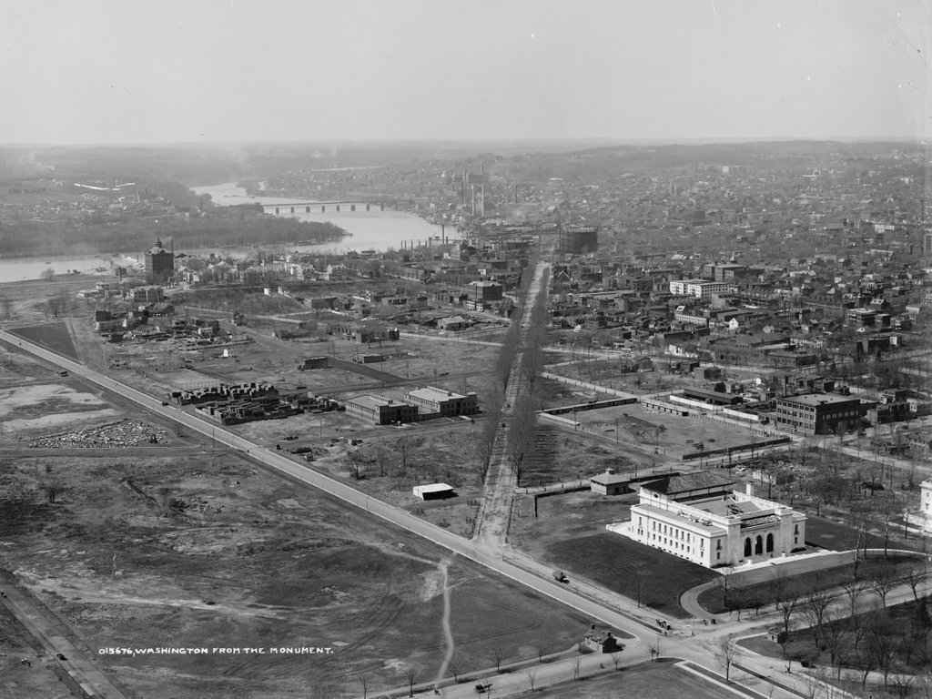
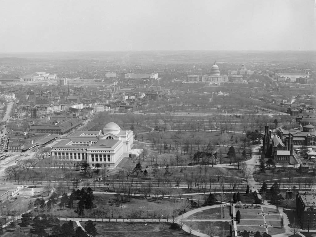
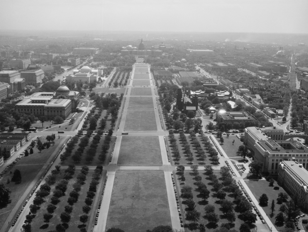
The National Mall, looking toward the Capitol Building, as seen from the Washington Monument between 1906 and 1915:

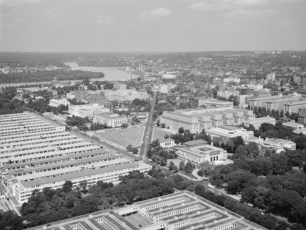
The scene in 1945. Image taken by Reginald Hotchkiss, courtesy of the Library of Congress, FSA/OWI Collection.
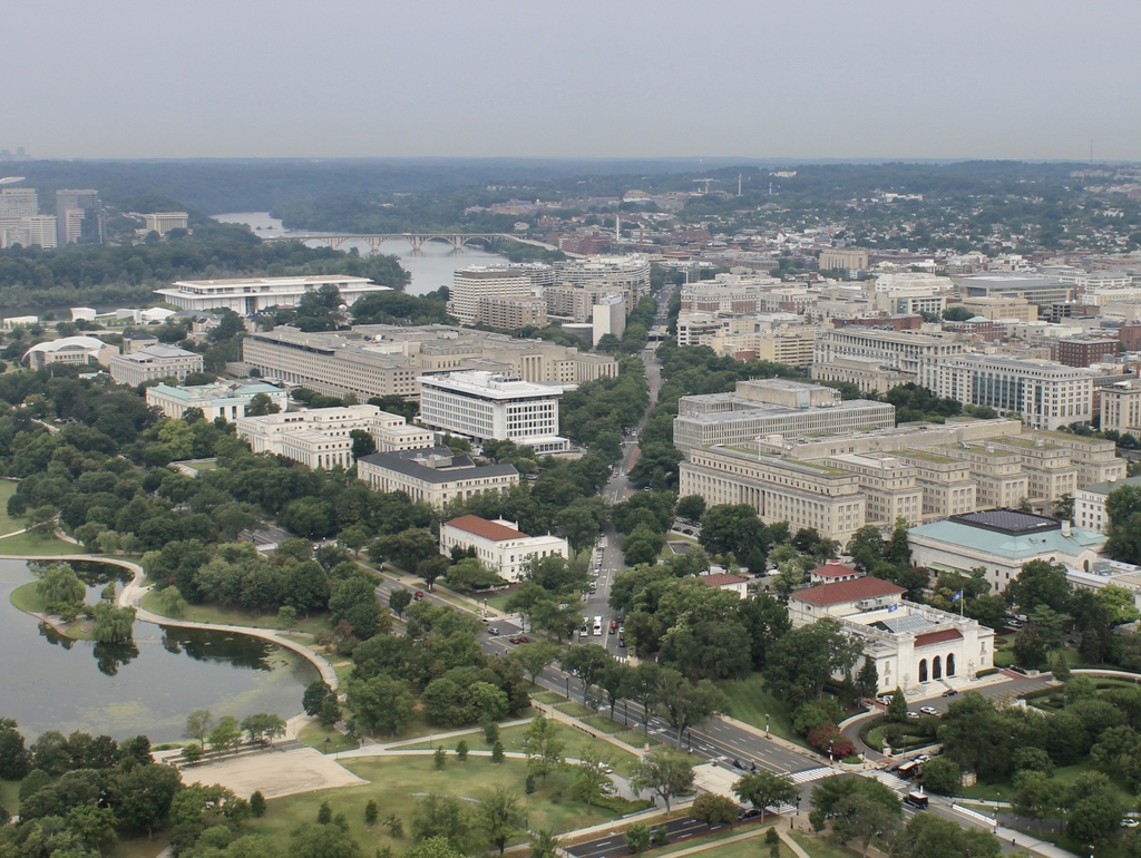
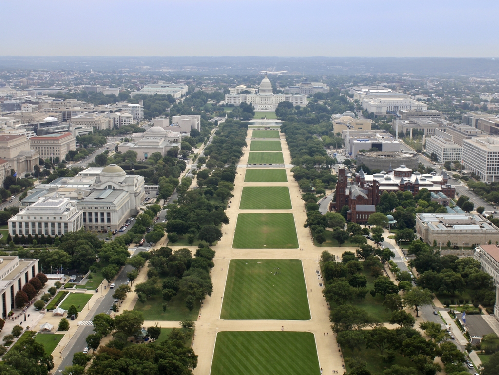
The scene in 2021:

The National Mall is one of the most-visited places in Washington DC, yet it did not always have its carefully-manicured appearance, as shown in the first photo. Several major landmarks were already standing here along the Mall, most notably the National Museum of Natural History on the left and the Smithsonian Castle on the right, with the Arts and Industries Building just beyond it to the right. Further in the distance of the first photo is the Capitol, with the Library of Congress behind it. However, most of the Mall was still vacant at this point, and it would be many more decades before all of the current Smithsonian museums were constructed here.

The second photo, taken in 1945, shows several newer buildings in this scene, including the National Archives on the far left, the National Gallery of Art just beyond the Museum of Natural History, and the Supreme Court Building behind the Capitol. Aside from these major institutional buildings, though, the Mall area also became the site of many temporary War Department buildings during World War I and II. Some of these can be seen in the second photo, particularly in the lower left and upper middle of the photo. During the first half of the 20th century, the landscaping of the Mall also changed significantly, and in the 1930s a number of elm trees were planted in rows along the Mall, as shown in the second photo.

Today, more than 75 years after the second photo was taken, the Mall is home to even more museums, many of which were constructed on the sites of the temporary wartime buildings. In the lower left corner of the scene is the Museum of American History, and in the upper right is the Hirshorn Museum, the National Air and Space Museum, and the National Museum of the American Indian. Further in the distance on the left, the National Gallery of Art has since expanded, and now has a second building to the east of its original facility. Despite these additions, though, the scene is still easily recognizable from the second photo, and even many of the elm trees are still standing, despite being threatened by Dutch Elm Disease.

Looking northeast from the Washington Monument

The view looking northeast from the top of the Washington Monument, between 1906 and 1915. Image courtesy of the Library of Congress, Detroit Publishing Company Collection.

The scene in 1945. Image courtesy of the Library of Congress, FSA/OWI Collection.

The scene in 2021:

Much has changed in more than a century since the first photo was taken, including the massive complex of government buildings in the foreground, which now house the US Department of Commerce and the Environmental Protection Agency. However, some of the landmarks from the first photo are still standing, including most prominently the Old Post Office just to the left of center, which is now the Trump International Hotel. Further in the distance is the Pension Building, which is now the National Building Museum, and in the upper right corner is Union Station. Much closer to the foreground, on the far right side of both photos, is the back corner of the National Museum of Natural History.

White House from the Washington Monument

The view of the White House, as seen from the top of the Washington Monument between 1906 and 1915. Image courtesy of the Library of Congress, Detroit Publishing Company Collection.

The scene in 1945. Image courtesy of the Library of Congress, FSA/OWI Collection.

The same view in 2021:

Unlike the view looking slightly northwest of here, there have not been many dramatic changes between these three photos. The White House is there, as are the two wings (although both the main building and the wings have been extensively gutted and remodeled in the intervening century), and the Old Executive Office Building (left of the White House) and the Treasury Building (right of the White House) are still there, as are the landscaping features such as the Ellipse in the foreground.  Otherwise, the appearance of the city, given skyscrapers are not permitted, remains much the same as it did 100 years ago.

Looking northwest from the Washington Monument

The view from the top of the Washington Monument, taken between 1906 and 1915. Image courtesy of the Library of Congress, Detroit Publishing Company Collection.

The scene in 1945. Image courtesy of the Library of Congress, FSA/OWI Collection.

The same view in 2021:

All three of these photos are taken looking almost directly down Virginia Ave., but other than the street network, not much remains from the early 1900s photo.  As least two buildings are identifiable in both that photo and the 2021 scene: the white building in the lower right, and the building to the right of it (which is barely visible in the first photo).  They are the Organization of American States and the Daughters of the American Revolution buildings, respectively.

Otherwise, the area looks remarkably sparse in the first photo, primarily because most of the land in the foreground did not exist before the 1880s, when the Potomac River was dredged, and the dredged material used to fill in this area to address flooding issues.  The Constitution Gardens, visible in the lower left of the 2021 photo, would not exist for another 70 years.  Shortly after the first photo was taken, the Navy built temporary offices during World War I.  These “temporary” offices, which are shown in the 1945 photo, lasted into the 1970s, when they were demolished to create the pond and parkland visible today.

Brooklyn Bridge, New York

The Brooklyn Bridge from the south, as it appeared around 1904. The towers of the Williamsburg Bridge are barely visible in the distance. Image courtesy of the Library of Congress, Detroit Publishing Company Collection.

016_1904c-2Bloc

The same view in February, 2012:

016_2012

The Brooklyn Bridge hasn’t changed much in the past 108 years, but its surroundings have.  In addition to the Manhattan Bridge behind it, the skyline of the Lower East Side has also substantially changed, with high-rises covering much of the shoreline in this area.

Lower Manhattan

The view of Lower Manhattan in 1900, as seen from the water looking towards the Staten Island ferry terminal. Image courtesy of the Library of Congress, Detroit Publishing Company Collection.

015_1900c-2Bloc

A very similar view, taken in 2012:

015_2012

The angles here aren’t perfect: the first photo was taken a little closer to Manhattan and a little further to the east of where this one was taken – the ferry terminals on the right hand side of the 2012 photo are (as far as I can tell) in the same spot as the foreground of the 1900 photo. Still, the two photos capture the same general idea – that Lower Manhattan has changed a lot in the past 100+ years.  One of the challenges in identifying exactly what view the 1900 picture shows is that I cannot identify a single building that still exists today.  Several notable buildings are visible, such as the Manhattan Life Insurance Building (the tall tower in the distance, almost in the exact center of the photo), which is roughly in the same spot as 1 Wall Street, a rather unassuming light brown tower visible on the left-hand side of the 2012 photo.