
Looking down Milk Street, with Old South Meeting House on the left, following the Great Boston Fire of 1872. Photo courtesy of Boston Public Library.
The same location in 2014:
The first photo really illustrates just how close the historic Old South Meeting House came to being destroyed in the Great Fire of 1872. However, firefighters managed to save the building, which survived with minimal damage, including some broken windows as seen in the photo. This scene shows the upper limit of the fire, which started several blocks south of here on Summer Street and extended all the way up to Milk Street. A similar view of this scene, taken around 1911, can be seen in this post; the photo was taken a little further down the road, about where the three people are standing on the far right-hand side of the 2014 photo here.
Landscapes
Great Boston Fire (3)
Looking south on Summer Street with High Street on the left, after the Great Boston Fire of 1872. Photo courtesy of Boston Public Library.
The scene in 2014:
Taken facing just to the right of the photos in this post, this angle shows the view looking south on Summer Street. The first photo shows some of the absolute devastation that Boston suffered in the wake of the 1872 fire, which burned about 65 acres of land and 776 buildings. By way of comparison, the Great Chicago Fire, which occurred a year earlier, burned over 2,000 acres and destroyed 17,50 buildings. However, like Chicago, Boston recovered well. The second photo shows a very different Boston nearly a century and a half later; this area is a major center for business and transportation, with South Station in the distance, and many banks and other institutions having offices here.
Great Boston Fire (2)
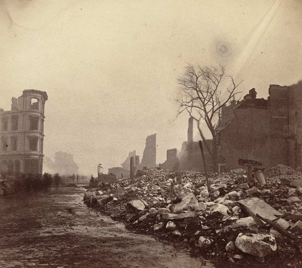
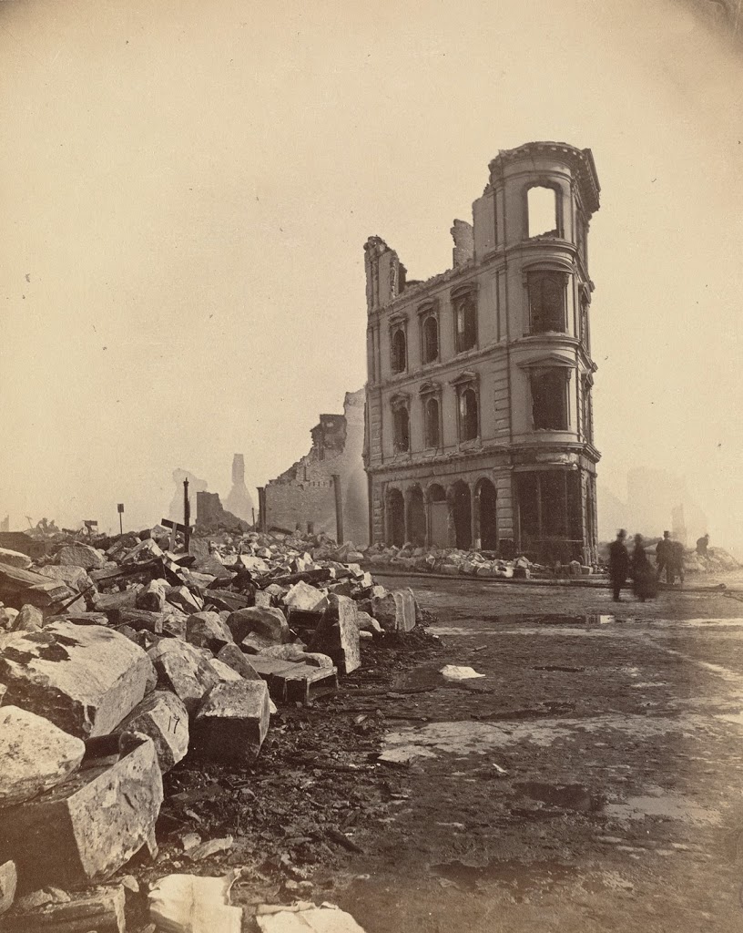
Facing south at the corner of High Street (to the left) and Summer Street (to the right), following the Great Boston Fire of 1872. Photo courtesy of Boston Public Library.
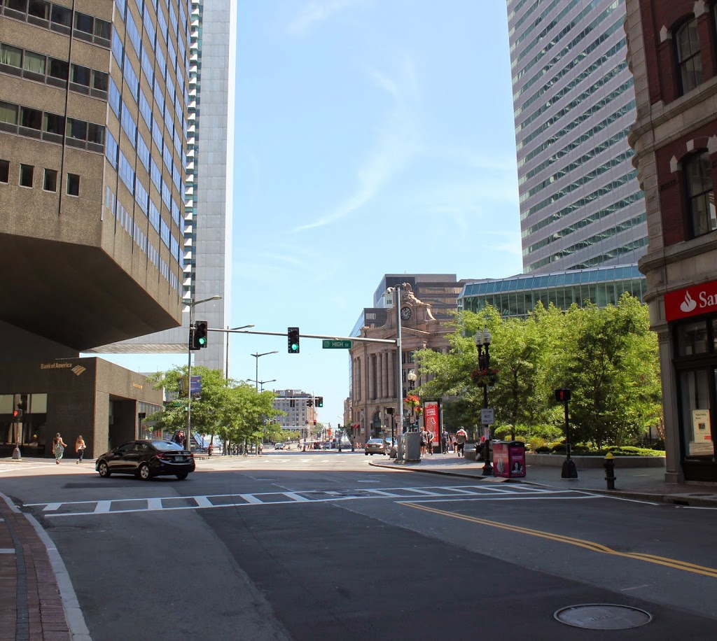
The scene in 2014:
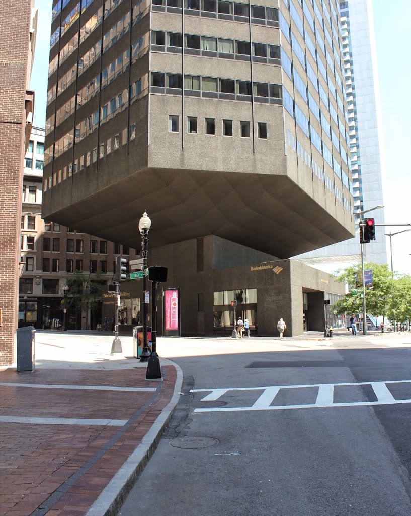
The Great Boston Fire of 1872 was one of the most devastating urban fires in American history, and this photo shows the scene near the epicenter on Summer Street. The fire began just a few blocks behind the photographer, leaving very little standing in the southern part of downtown Boston. The city recovered, though, and today this location is part of Boston’s financial district. However, while the buildings were rebuilt, Boston’s convoluted street network remained unchanged. Unlike many other major cities in America, and unlike even some other sections of Boston, downtown Boston does not have a regular street grid. The result is small, non-rectangular building lots like this one, a triangle bounded by Summer, High, and Federal Streets. In the 1970s, however, architects got creative and built the Fiduciary Trust Building, a hexagonally-shaped building that appears to be precariously balanced atop a much smaller base.
Great Boston Fire (1)
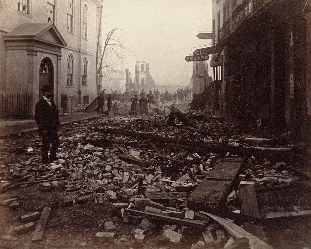
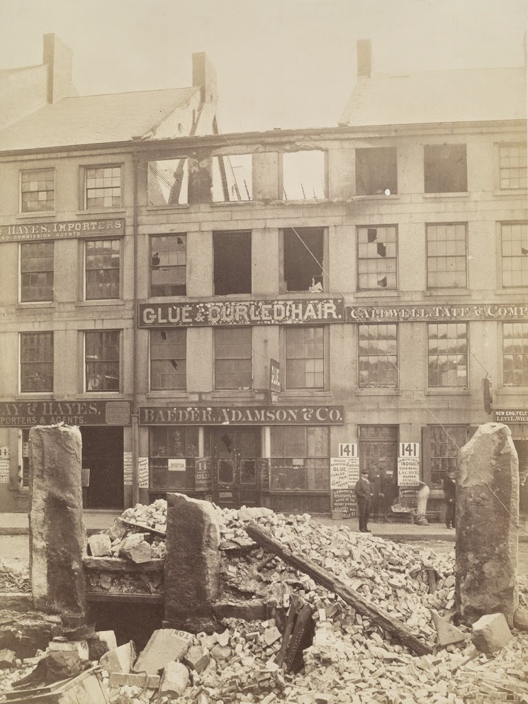
Fire-damaged building on Milk Street, between Batterymarch and Oliver Streets, following the Great Boston Fire of 1872. Photo courtesy of Boston Public Library.
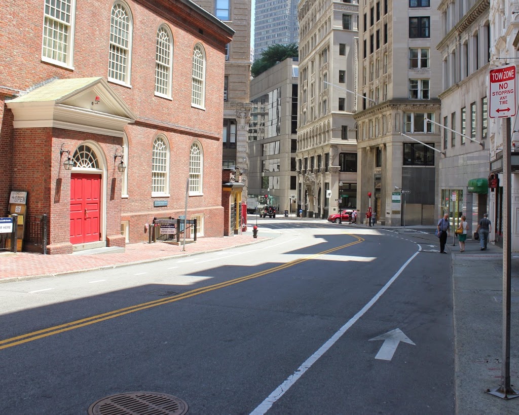
The scene in 2014:
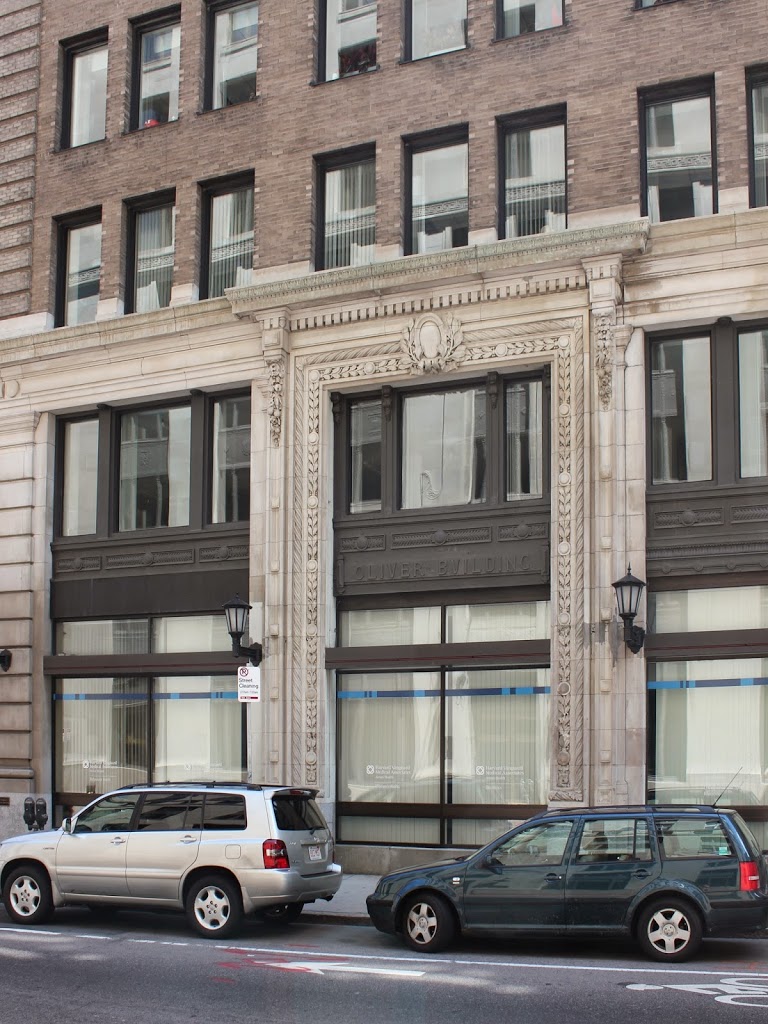
Only a year after the far more well-known fire in Chicago, Boston suffered a similarly disastrous fire of its own. It devastated much of the southern part of Boston’s downtown, reaching all the way up to Milk Street, where this photo was taken. The building in the 1872 photo advertises “glue, curled hair, and sandpaper” which seems like an odd combination to today’s readers. But, “curled hair” in this case referred not to a hairstyle but to some sort of industrial product made with animal hair. As to its specific use, I am not sure, but today neither the buildings nor the glue, curled hair, and sandpaper industry are still at this location. Today, the building at the site is identified above the ground floor windows as the Oliver Building, and was built in 1903, suggesting that at least one other building occupied this spot after the 1872 photo was taken.
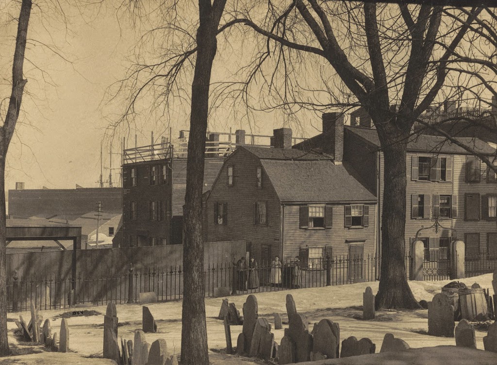
Copp’s Hill Burying Ground, Boston (3)
Another view from Copp’s Hill Burying Ground in the North End, around the 1880s or early 1890s. Photo courtesy of Boston Public Library.
The cemetery in 2014:
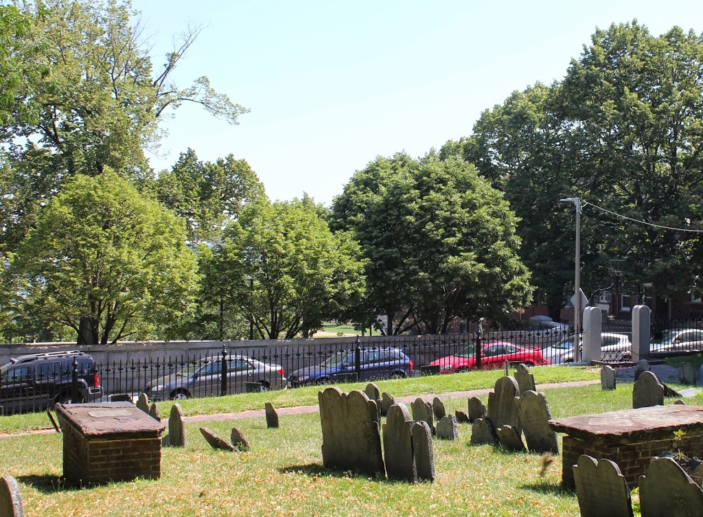
The house in the background is the Johnson-Singleton House, and was built in the mid 1700s. Located on Charter Street, it and the surrounding buildings were demolished in the 1890s to create Copp’s Hill Terrace, a public park between Charter Street and Commercial Street. Boston Harbor is in the background, but it is obscured by buildings in the first photo and trees in the present-day photo; the only hint of its presence is the tip of the masts of a sailing ship in the first photo.
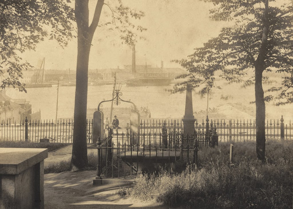
Copps Hill Burying Ground, Boston (2)
The view looking toward Boston Harbor and the Charlestown Navy Yard from Copp’s Hill Burying Ground in the North End, around 1898. Photo courtesy of Boston Public Library.
The same scene in 2014:
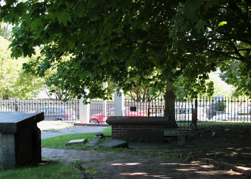
Aside from the missing wrought-iron railing around the tomb in the foreground, not much has changed in the cemetery in the past century or so. Even the gate and the fence around the cemetery are the same. The background is different, but it’s hard to tell with the tree blocking the view. Most of the navy yard buildings are still there, although it is no longer an active military facility.
See this post for another scene in Boston’s second oldest cemetery.