Fort Rodman, New Bedford, Massachusetts

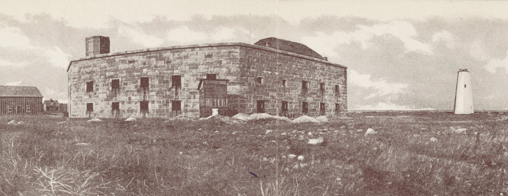
Fort Rodman on Clark’s Point in New Bedford, around 1906. Photographed by Blanchard, Young & Co., courtesy of the Library of Congress.

The scene in 2022:

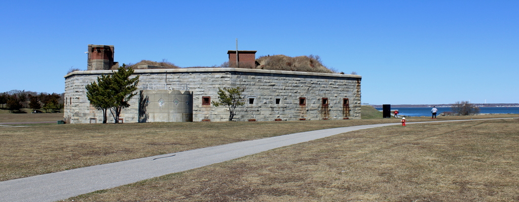
These two photos show the old stone fort at Ford Rodman, located on Clark’s Point at the entrance to New Bedford Harbor. Construction of the fort began in 1857, using granite from nearby Fall River and also from Sullivan, Maine, but it was still incomplete in 1861, at the outbreak of the Civil War. Concerned about the threat of marauding Confederate ships attacking the city’s whaling fleet, local officials took it upon themselves to build a small earthwork fort, which they named Fort Taber in honor of the current mayor. It was located directly to the west of the stone fort, in the distance on the left side of this scene. Fort Taber remained in use for about two years, until the stone fort was was completed enough to be usable.

As it turned out, the fort was never needed to fend off Confederate raiders, and the construction work was not completely finished before the end of the war. The work was halted, but then in the late 1800s the Army began to expand the facility by adding newer artillery batteries on the grounds near the stone fort, along with additional buildings. Although the stone fort did not officially have a name, it was often referred to as Fort Taber, since that name had been assigned to the earlier earthwork fort. However, in 1899 the entire facility was named Fort Rodman in honor of Lieutenant Colonel William Logan Rodman, the highest-ranking New Bedford native who was killed in the Civil War.

The first photo was taken soon after this, around 1906, and it shows the view of the fort from the south, facing toward the entrance to New Bedford Harbor. On the right side of the first photo is the old Clarks Point Light, a stone lighthouse tower that had been built more than a century later in 1804. It had been use until 1869, when a new lighthouse was constructed directly atop the walls of the fort. By the time the first photo was taken the lantern at the top of the tower had been removed, but the tower itself stood here until it was demolished in 1906, probably soon after the photo was taken.

Fort Rodman never saw any combat, but it remained in use as a coastal defense facility throughout World War I and World War II. It was later used as an Army Reserve site, before eventually being sold to the city of New Bedford in the 1970s. Many of the old fort buildings are gone now, and a wastewater treatment plant now occupies a portion of the grounds, but the original stone fort is still standing here. The area around it is now a public park, known as Fort Taber Park.

Old Third District Courthouse, New Bedford, Massachusetts

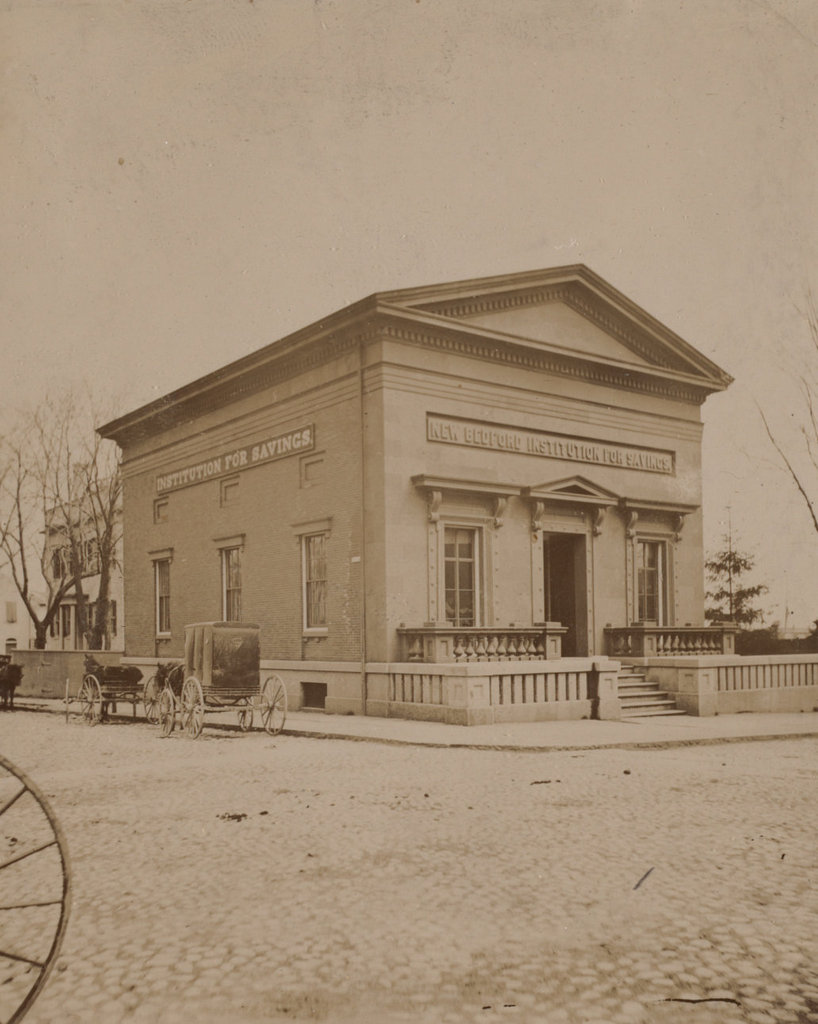
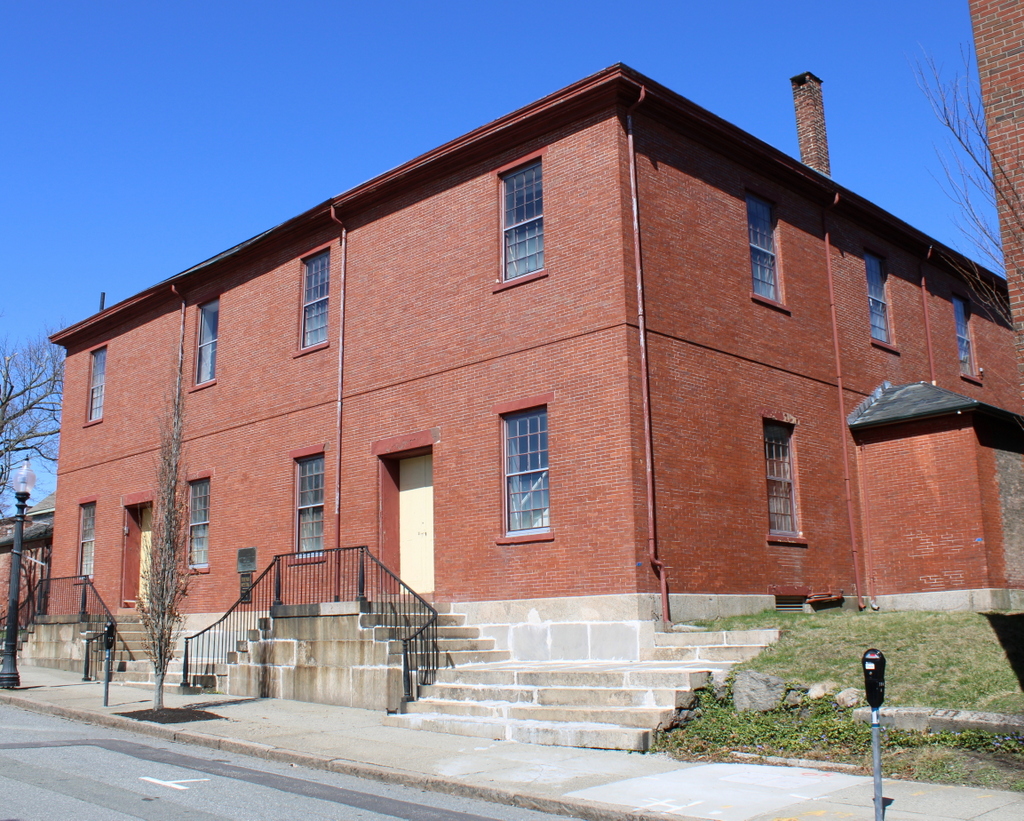
The building at the northeast corner of William and North Second Streets in New Bedford, around the 1870s. Image courtesy of the New Bedford Free Public Library.

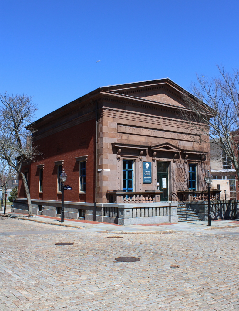
The building in 2022:

This small brick and brownstone building was constructed in 1853, and it has seen a variety of uses over the years. It was originally built for the New Bedford Institution for Savings, as shown on the signage in the first photo, which was taken around 1870. The bank would remain here throughout most of the 19th century, before relocating to a different building in 1897. This building here on William Street was then converted into a courthouse, and it was used by the Third District Court of Bristol County.

As it turned out, its time as a courthouse would be relatively brief. The court left the building around 1914, and over the years it was occupied by a variety of commercial tenants, including an auto parts store by the second half of the 1900s. However, it was eventually reacquired by its original owner, the New Bedford Institution for Savings, and subsequently operated as a branch bank. The Institution for Savings would later be merged into Fleet Bank, and in 1995 Fleet donated the historic building to the Waterfront Historic Area League (WHALE), a preservation organization that was focused on revitalizing downtown New Bedford.

A few years later, WHALE in turn donated the building to the National Park Service, following the establishment of the New Bedford Whaling National Historical Park. It now serves as the park visitor center, and despite the many changes in use over the years the exterior has remained well preserved throughout all of this, as shown in these two photos. It is one of several buildings that comprise the National Historical Park, where they stand as important reminders of New Bedford’s heyday as a prosperous 19th century whaling port.


Seamen’s Bethel, New Bedford, Massachusetts

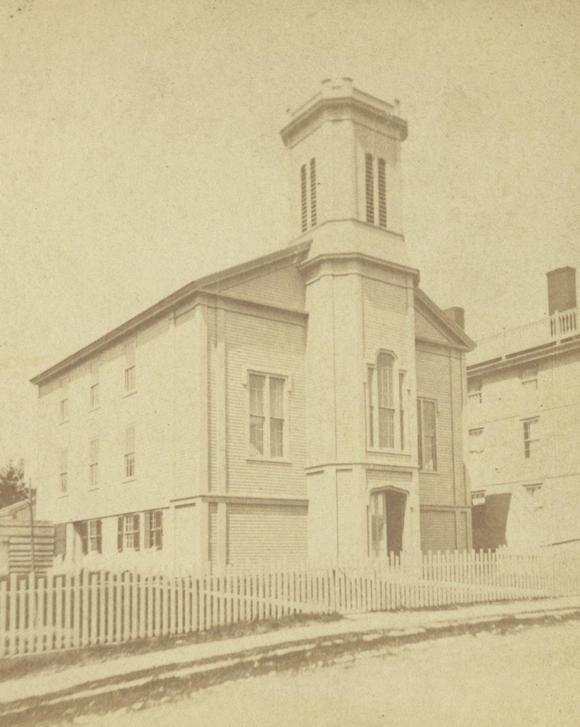
The Seamen’s Bethel on Johnny Cake Hill in New Bedford, around the 1860s-1880s. Image courtesy of the New Bedford Free Public Library.
The scene in 2022:
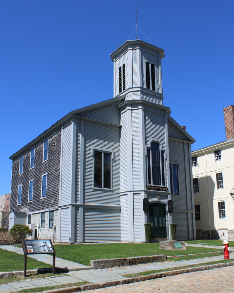
These two photos show the Seamen’s Bethel, perhaps the most famous whaling landmark in New Bedford. Its fame is derived largely from Herman Melville’s description of it in Moby Dick, but it also played an important role in the New Bedford whaling community. During much of the early 19th century, New Bedford was the world’s leading whaling port. From here, ships would embark on multi-year voyages around the world, and would—hopefully—return with their cargo holds filled with whale oil, spermaceti, and whalebone.

Whaling was inherently dangerous, not only because of the risks associated with long sea voyages in general, but also because of the dangers involved in trying to kill whales from small, easily swamped boats in the middle of the ocean. Crews were often a diverse mix of different ethnicities and nationalities, including former slaves who saw whaling not only as a means of employment, but also as a way to avoid recapture by their enslavers.

However, as was the case in any major port city, there were many in New Bedford who were concerned about how these whaling crews spent their leisure time when they were ashore. Sailors were typically paid a certain percentage of the profits at the end of the voyage, which meant that they returned to New Bedford flush with cash. And, after several years at sea, many sailors saw the city’s saloons, brothels, and gambling houses as ideal places to spend that hard-earned money.

In an effort to combat these vices, some residents took to vigilante action and occasionally destroyed notorious brothels. Others, however, took a more proactive approach, establishing the New Bedford Port Society for the Moral Improvement of Seamen in 1830. Two years later, in 1832, the organization constructed the Seamen’s Bethel on Johnny Cake Hill, which is shown here in these two photos. The goal was to provide a nondenominational chapel that would welcome a diverse population of sailors and meet their spiritual needs.

The building was dedicated on May 2, 1832, with a ceremony led by the Reverend Edward Taylor of the Seamen’s Bethel in Boston. A former sailor with little formal education, Taylor was nonetheless a popular preacher who was known for his engaging and colorful sermons. His ministry in Boston focused primarily on sailors, but he was also highly regarded by the literary elite of the 19th century, including those who tended to take a dim view on organized religion, such as Charles Dickens, Ralph Waldo Emerson, and Walt Whitman.

The first chaplain here at the Seamen’s Bethel in New Bedford was the Reverend Enoch Mudge. He was a Methodist minister, but in keeping with the nondenominational goals of the organization, he respected the various beliefs of the sailors of New Bedford. Among the sailors who heard him preach here was 21-year-old Herman Melville, who attended Sunday services on December 27, 1840, a week before he departed on the whaling ship Acushnet. He would spend the next few years at sea, and his experiences as a crewman on a whaling ship would help form the basis for his famous novel Moby-Dick, which was published in 1851.

The Seamen’s Bethel features prominently in the beginning of Moby-Dick, and it is the subject of chapters seven through nine, which are titled “The Chapel,” “The Pulpit,” and “The Sermon.” At the beginning of chapter seven, the narrator Ishmael enters the building on a stormy winter day, and provides the following description of the Bethel:

In this same New Bedford there stands a Whaleman’s Chapel, and few are the moody fishermen, shortly bound for the Indian Ocean or Pacific, who fail to make a Sunday visit to the spot. I am sure that I did not.

Ishmael goes on to describe the interior, including the marble monuments to various New Bedford sailors who were lost at sea. Such monuments do in fact exist here at the Seamen’s Bethel, but other interior features were completely fictional, including a pulpit that was shaped like the bow of a ship. Ishmael then describes Father Mapple, the fictional chaplain of the Bethel. His character is often considered to be based on Edward Taylor, but it also seems plausible that Melville based at least some of it on Enoch Mudge and the sermon that he heard here in 1840.

Over the years, the Port Society expanded its activities beyond just the Seamen’s Bethel. In 1851, Sarah Rotch Arnold donated her late father’s house to the society. It was then moved to the lot directly to the left of the Bethel, as shown in these two photos. It became the Mariners’ Home, a boarding house that offered accommodations to sailors. It was run by the Ladies Branch of the Port Society, and it provided an alternative to the city’s less reputable boarding houses, which were often located alongside the saloons and brothels in the red light districts.

The Bethel sustained significant damage in a fire in 1866, but it was subsequently repaired, and the first photo was likely taken at some point afterwards. It would continue to serve the spiritual needs of sailors for many years, but the decline in the New Bedford whaling industry helped to shift the society’s focus to some extent. As noted in the 1918 History of New Bedford, “[w]ith the decline of New Bedford as a port of entry, the society became more general in its character as mission, as at present.”

In the meantime, the popularity of Moby-Dick helped to draw attention to the Seamen’s Bethel, and over the years it became a major New Bedford landmark, especially after the 1956 film adaptation of the novel. So famous was Melville’s description of the chapel that, in 1961, the Port Society even altered the interior to make it conform with the novel by installing a bow-shaped pulpit. This wasn’t necessarily the best move from a historic preservation perspective, but it is certainly an example of the concept of life imitating art.

Today, very little has changed here in this scene. The Port Society is still an active organization, and still owns both the Seamen’s Bethel and the adjacent Mariners’ Home. Both buildings are well preserved overall, and they are located within the New Bedford Whaling National Historical Park, where they stand as reminders of the city’s heyday as a whaling port.

Union and North Water Streets, New Bedford, Massachusetts

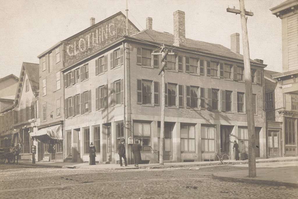
The northwest corner of Union and North Water Streets in New Bedford, in November 1893. Image courtesy of the New Bedford Free Public Library, Gilbert D. Kingman Photograph Collection.

The scene in 2022:

These two photos show the northwest corner of Union and Water Streets in downtown New Bedford. The most prominent building in the scene, and the only one that appears in both photos, is the three-story brick building here in the foreground at the corner. It was built around 1820, and it is known as the Sundial Building because of the vertical sundial between the second story windows on the left side. To the left of it in the first photo are several other early 19th century buildings, including the Macomber-Sylvia House, which was built in 1816 and later embellished with Italianate-style details.

During the 19th century, the Sundial Building had a variety of different commercial tenants. In the 1840s these included the merchant tailor firm of C. Ricketson & Son and the grocer Edward Bourne. By the 1850s there was another tailor here, C. W. Chapman & Co., followed by hair dresser A. G. Jourdain in the 1860s. Then, in the 1870s the building became a restaurant, with Steven’s Dining Rooms occupying two floors here. The first photo was taken in 1893, but by this point it does not appear to have had any commercial tenants on the ground floor, as evidenced by the shuttered windows on the right side and the lack of signage above any of the storefronts.

Overall, the buildings here in this scene would remain largely unchanged until January 18, 1977, when a gas explosion caused considerable damage here at this intersection. The explosion was caused by a leaking gas pipe in the basement of O’Malley’s Tavern, which occupied the building just to the left of the Sundial Building. That building was completely destroyed, as was the Macomber-Sylvia House to the left of it, which had just finished undergoing a major restoration. As for the Sundial Building, it was gutted by the subsequent fire and was nearly demolished, but it was ultimately saved and restored to its original appearance. The building  is now part of the New Bedford Whaling Museum, which occupies most of the block between North Water Street and Johnny Cake Hill.

Custom House, New Bedford, Massachusetts

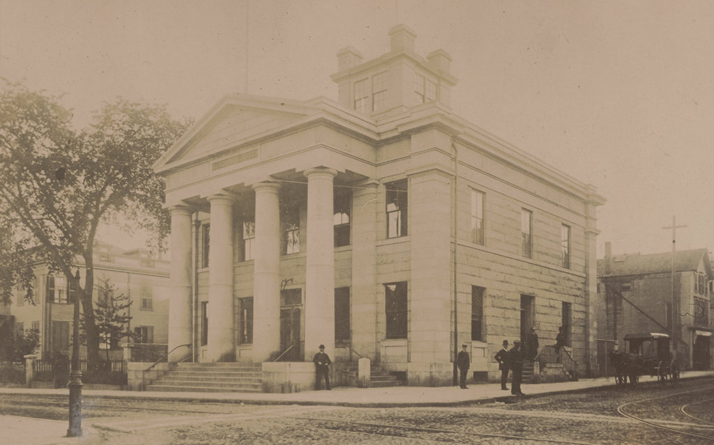
The New Bedford Custom House at the corner of William Street and North 2nd Street in 1886. Image courtesy of the New Bedford Free Public Library, Gilbert D. Kingman Photograph Collection.

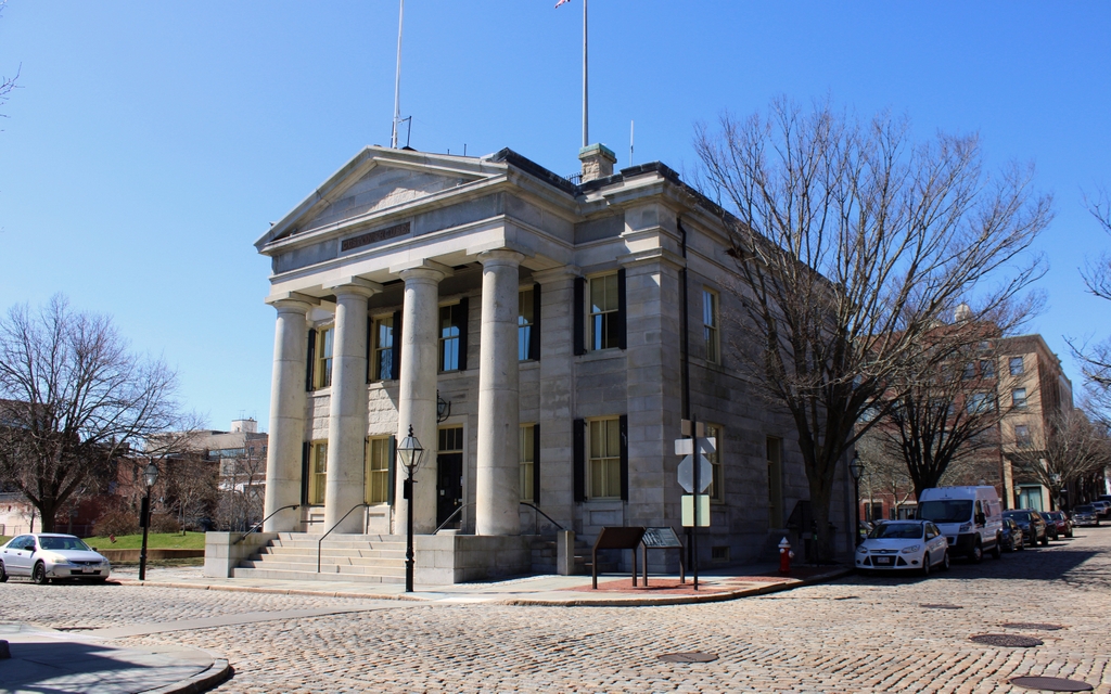
The scene in 2022:

During the first half of the 19th century, New Bedford was a major whaling port. It grew prosperous from the industry, leading to the construction of many historic buildings that still stand today. Among the most architecturally significant of these is the Custom House, shown here in these two photos. The building was designed by noted architect Robert Mills, and it was completed in 1836. Although relatively small in size, the building is a good example of Greek Revival architecture, which was a popular style for public buildings of this era.

The Custom House played an important role during New Bedford’s heyday. It was here that whaling captains, along with those of other incoming merchant vessels, would register their cargoes with customs officials. It was also here that sailors could obtain protection certificates. At the time, British warships would often stop American vessels and force sailors into the Royal Navy. These certificates could be presented as proof of American citizenship, which would, in theory, serve as a deterrent to Royal Navy ships that were searching for sailors.

This building served as the main offices for the District of New Bedford, which was responsible not only for the port of New Bedford, but also for the nearby ports of Fairhaven, Rochester (modern-day Mattapoisett and Marion), Wareham, Dartmouth, and Westport. In short, this district covered the communities along the northeastern shore of Buzzards Bay. By the mid 19th century, this was one of 11 customs districts in Massachusetts, some of which were centered around major seaports such as Boston, Salem, and New Bedford. However, there were also customs districts that were much smaller, including Fall River, Plymouth, and Edgartown.

In general, the more important the district was, the larger the number of customs officials appointed to it. For example, by the 1850s the District of Boston and Charlestown employed over 175 men. At the top of the hierarchy was the collector, and he was assisted by a variety of clerks, measurers, inspectors, appraisers, and other officials. However, by contrast the districts of Marblehead, Gloucester, Nantucket, and Edgartown were each staffed by just a single inspector.

Compared to these two extremes, New Bedford was somewhere in the middle. When this building first opened in 1836 it had a collector, a deputy collector, a clerk, an inspector/boarding officer, and an inspector/gauger/weigher. Each of the other five ports also had either one or two inspectors assigned to it, and there was also a revenue cutter, the McLane, that was assigned to the district. Here at the New Bedford custom house, the building was open six days a week, from 9:00 a.m. to noon, and then from 2:00-4:00 p.m. It was closed on Sundays, and also on July 4.

At the time, the collectors of each district earned a percentage of all import duties that were collected, along with a percentage of the fines that were imposed. This gave the collector an incentive to do his job well, and it also made these positions highly sought after. And, in the days of the spoils system, an appointment as collector of a major port was a way for newly-elected presidents to reward their loyal supporters with lucrative federal offices. Here in New Bedford, for example, the collector when this building was completed was Lemuel Williams Jr. He had been appointed by Andrew Jackson in 1829, replacing an earlier collector, Russell Freeman. This sparked considerable controversy, and the two men are said to have ended up in a fistfight in the streets of New Bedford.

The first photo was taken 50 years after the building was completed, in 1886. By this point, New Bedford’s whaling industry was in decline, but it otherwise remained a busy port. This would remain the administrative headquarters of the customs district until 1913, when the federal government consolidated the many different districts around the country. As a result, all of the districts in Massachusetts were combined into a single one, although some of the customs offices, including this one in New Bedford, would remain open as satellite offices.

Today, the surrounding buildings from the first photo are gone, but the custom house itself is still standing. It has seen a few changes over the years, including the removal of the cupola, which had been added around 1850. Overall, though, it is well preserved in its historic appearance, and it is still actively used as offices for U.S. Customs and Border Protection. It is a contributing property in the New Bedford Historic District, which was designated as a National Historic Landmark district in 1966, and it is also a part of the New Bedford Whaling National Historical Park.

New Bedford Friends Meeting House, New Bedford, Massachusetts

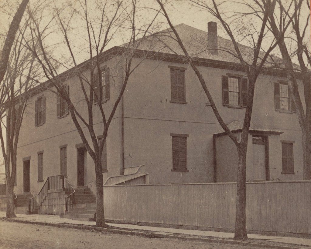
The New Bedford Friends Meeting House at 83 Spring Street, around 1865-1885. Image courtesy of the New York Public Library.

The building in 2022:

These two photos show the Friends Meeting House, which was built in 1822 by the large community of Quakers who lived in New Bedford. At the time, the town was a prosperous whaling port, and many of its leading citizens were members of the Religious Society of Friends, better known as Quakers. As part of their beliefs, Quakers generally rejected religious rituals and ceremonies, and this idea extended to the architecture of their meeting houses, which were generally plain, modest structures. The meeting house here in New Bedford is a typical example of this, showing an unadorned brick exterior that looks more like a house than a conventional place of worship.

This meeting house was built on the site of an earlier wooden one, which had been built in 1785. When the new one was built, the older one was moved diagonally across the street and converted into a residence at 17-19 Seventh Street. That building, which is still standing, was later owned by Nathan and Mary Johnson, an African-American couple who housed Frederick Douglass after his escape from slavery. It was there that he took on the surname of Douglass, at the suggestion of Nathan Johnson.

The first photo was taken sometime in the second half of the 1800s, probably around 1865 to 1885. Very little has changed since then, and the building remains in use as an active Quaker meeting house more than 200 years after it was completed. It is one of the many surviving historic buildings from New Bedford’s heyday as a major whaling center, and it is a contributing property in the County Street Historic District, which was added to the National Register of Historic Places in 1976.