Harpers Ferry, West Virginia

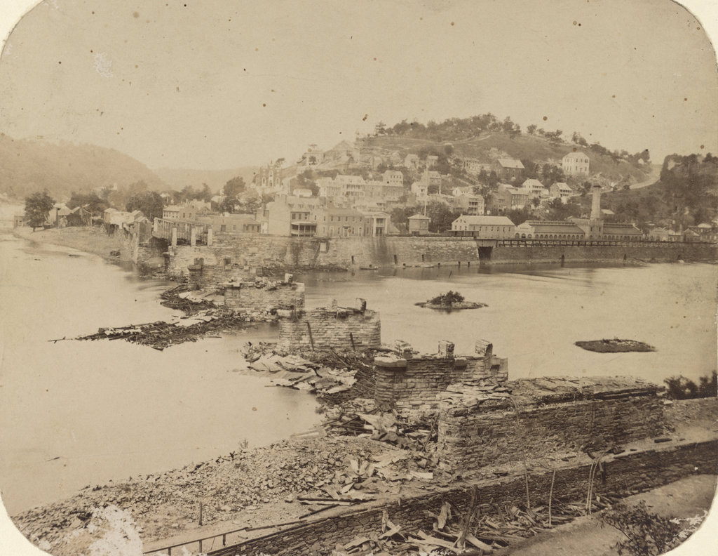
Looking across the Potomac River towards Harpers Ferry from the Maryland side of the river, around June 14, 1861. Image courtesy of the Library of Congress, Civil War Collection.

728_1861 loc

The same view in 2015:

728_2015 loc
The town of Harpers Ferry had only about 1,300 residents at the start of the Civil War, and its land area was just a half a square mile, but it became among the most contested places of the war.  It was literally located on the border of the Union and the Confederacy, changing hands eight times during the war and ending up in a different state by the time it was over.

As its name implies, this area was first settled as a ferry crossing.  Originally part of Virginia, it is located at the confluence of the Potomac and Shenandoah Rivers, and beginning in 1733 colonist Peter Stevens operated a ferry across the Potomac here, enabling settlers from Maryland and Pennsylvania to access the Shenandoah Valley of Virginia.  The town isn’t named Stevens Ferry, though, because around 1748 he sold his land and ferry to Robert Harper, who operated it until his death in 1782.

Because of its transportation connections and relatively defensible position, Harpers Ferry was one of two locations, along with Springfield, Massachusetts, selected by George Washington for federal armories.  Further transportation developments came in the 1830s: the Chesapeake & Ohio Canal (seen in the lower foreground of both photos) was completed as far as Harpers Ferry in 1833, several stagecoach lines were opened in 1834, and the Baltimore & Ohio Railroad reached the Maryland (foreground) side of the river later in 1834.  The first railroad bridge was completed in 1837, allowing a direct connection from the armory to the rapidly growing national rail network.

By 1850, this small town had grown to over 1,700 people thanks to the armory (visible along the waterfront to the right in the first photo), but before the end of the decade it would become the center of one of the major precursors to the Civil War.  In October 1859, abolitionist John Brown led a raiding party of 22 men in an attempt to capture the arsenal and start a slave rebellion.  The raid ultimately failed, and most of the raiders were either killed or were captured and executed, including John Brown, whose December 2 execution was seen as a martyrdom by many northern abolitionists.

The Civil War began just a year and a half after the raid, and Virginia’s state legislators voted to secede on April 17, 1861.  One of the state’s first objectives was to take the Harpers Ferry arsenal, which at the time was guarded by just 65 men.  Led by Lieutenant Roger Jones, they destroyed the arsenal and its 15,000 guns before evacuating the town ahead of the Confederates.  The Confederates didn’t occupy the town for long, though.  They left on June 14, and burned the Baltimore & Ohio bridge as they left.  The remains of the bridge can be seen in the foreground of the first photo, which according to the caption was “photographed immediately after its evacuation by the rebels.”

When the first photo was taken, the town was still relatively intact, but as the war progressed it became somewhat of a no man’s land.  Despite the loss of the armory, it was still a vital transportation corridor for armies on both sides, so between 1861 and 1863 it changed hands several more times.  West Virginia became a state on June 20, 1863, with Harpers Ferry citizens voting 196 to 1 to leave Virginia and join the union.  The town was briefly occupied by the Confederates in early July, but they soon evacuated for the last time and Union solders returned on July 13, finally bringing stability to Harpers Ferry for the rest of the war.

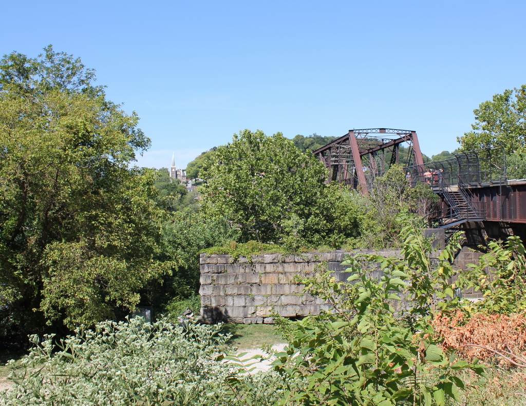
In terms of population, Harpers Ferry never fully recovered from the Civil War.  The armory never reopened, and the population has steadily fallen to less than 300 as of the 2015 census.  However, it has become a major tourist destination, with the Harpers Ferry National Historic Park now comprising much of the historic town.  Although the Chesapeake & Ohio Canal has not operated in nearly a century, there are still several railroad lines that pass through here.

One of the bridges, seen to the right in the 2015 photo, also carries the Appalachian Trail over the Potomac River on a pedestrian walkway on the left side of the bridge.  The bridge pier in the foreground is from an earlier railroad bridge that had been built on the spot of the one that was destroyed in 1861.  This bridge, in turn, was washed away in a 1936 flood, and it was never rebuilt.  Today, the modern railroad bridge, as well as trees along the river, help to hide the view of Harpers Ferry, with only a few buildings visible in the 2015 scene.

(Much of the information for this post came from “To Preserve the Evidences of a Noble Past”: An Administrative History of Harpers Ferry National Historical Park (2004).  For further reading, it and other resources are available online here at the National Park Service website.)

Aftermath of the Halifax Explosion (3)

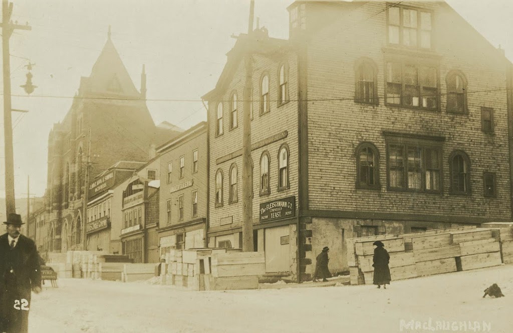
Looking down Argyle Street from George Street in downtown Halifax, Nova Scotia, in December 1917. Photo courtesy of the Nova Scotia Archives.

357_1917-2Bnsarchives

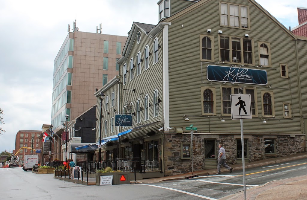
The scene in 2014:

357_2014

Out of the photos that I’ve posted about the Halifax Explosion, this is the only one that doesn’t show an area affected by the blast.  However, what the 1917 photo does show is far more powerful.  At first glance, nothing seems out of the ordinary, except for the stacks of wooden boxes on the street.  Except they’re not just wooden boxes; the sign on the second building from the right reads “Undertakers,” and the coffins outside were just a sampling of what was needed for the approximately 2,000 victims of the disaster.

Incidentally, this wasn’t the first time that the building dealt with a major tragedy – just five years earlier the recovery operation for the bodies of Titanic victims was operated out of the city, as it was the closest major port to the disaster.  During that time, the mortuary here was used to care for the remains of some of the victims, including John Jacob Astor and Charles M. Hayes.

Today, the building is still there, and is nearly 200 years old; it was built in 1817 and has served a variety of uses ever since.  Today, it is home to the Five Fishermen, which is perhaps the only fine dining restaurant in the world that advertises the fact that its facilities were once used as a mortuary.  (if you don’t believe me, check out their website – they even have the same 1917 photo there)

Aftermath of the Halifax Explosion (2)

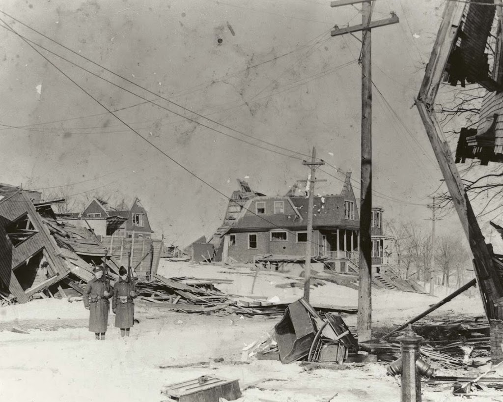
Looking east down Kaye Street from Gottingen Street in Halifax, Nova Scotia, in December 1917 or early 1918, following the Halifax Explosion. Photo courtesy of the Nova Scotia Archives.

355_1917-2Bnsarchives

The scene in 2014:

355_2014

This neighborhood is located just up the hill from the epicenter of the Halifax Explosion, and its appearance is typical of what much of this part of the city looked like after the disaster. Here, two soldiers are standing guard to keep looters out – residents needed a pass in order to gain entry to the affected areas. Today, the neighborhood is entirely reconstructed, with no sign of the disaster that hit here almost 97 years ago.

Aftermath of the Halifax Explosion (1)

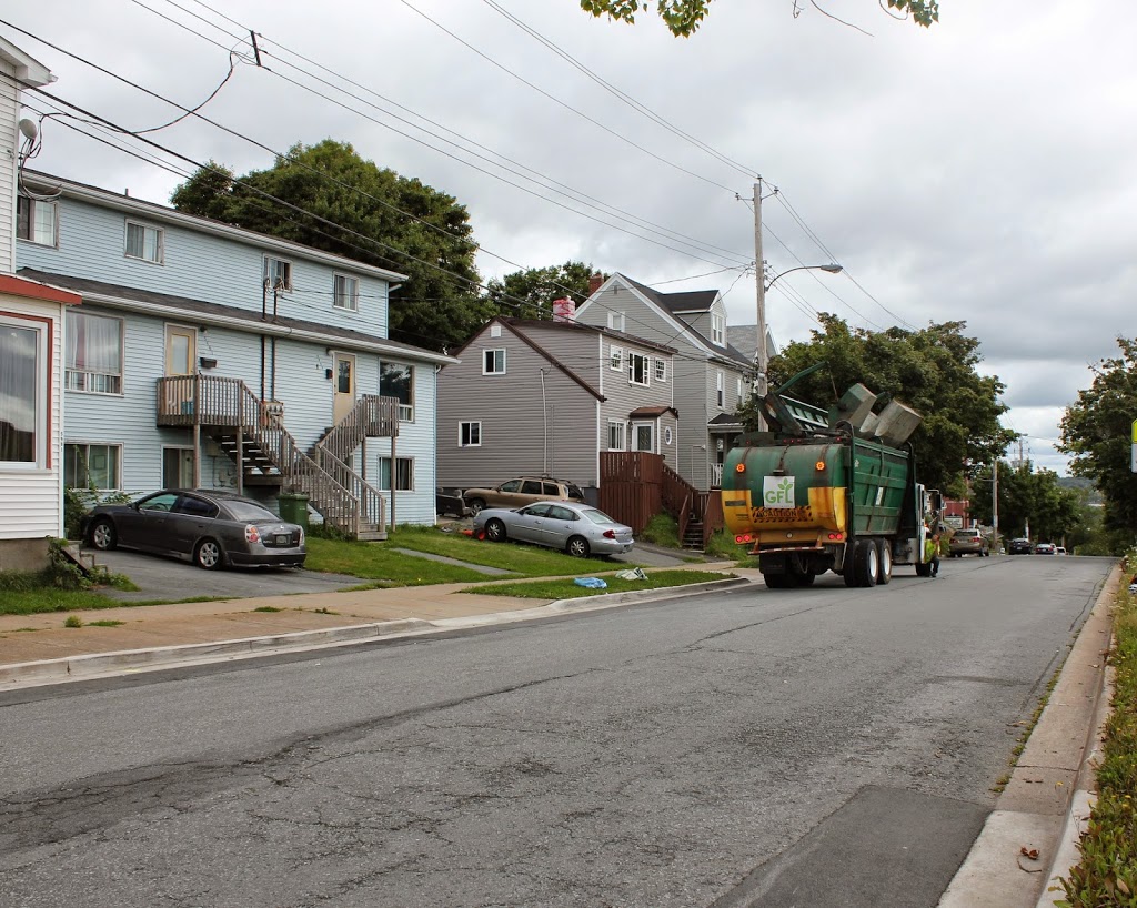
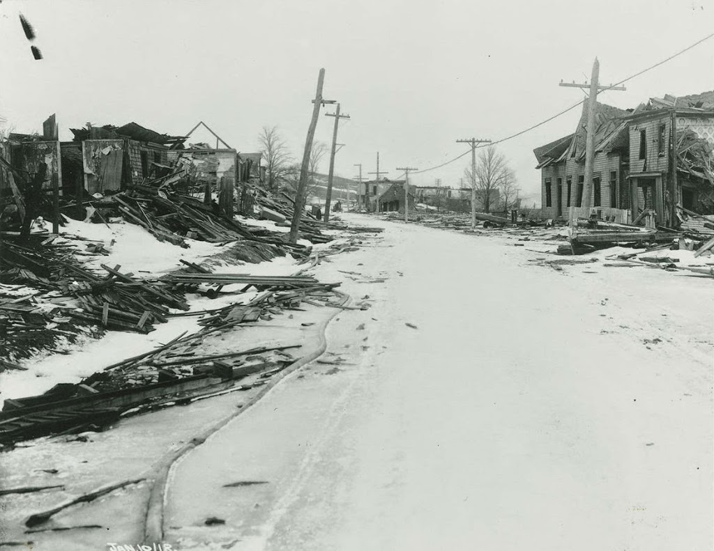
Looking north on Campbell Road (today Barrington Street) in Halifax, Nova Scotia, on January 10, 1918, following the Halifax Explosion. Photo courtesy of the Nova Scotia Archives.

354_1917-2Bnsarchives

Barrington Street in 2014:

354_2014

These photos were taken just north of the intersection of Barrington and Rector Streets, and they show the scene near the epicenter of the Halifax Explosion, not far up the road from where the photos in this post and this post were taken prior to the explosion.

The disaster occurred after an ammunition ship was involved in a collision and caught fire. The ship was abandoned and drifted over to the Halifax shoreline, where it exploded, damaging or destroying over 12,000 buildings and killing nearly 2,000 people. The disaster was further complicated by secondary fires, caused by overturned stoves, and to make matters worse a blizzard dropped 16 inches of snow the next day, hampering the rescue effort and delaying much needed supplies from reaching the city.

Today, no trace of the explosion remains – nor does any trace of the neighborhood that was once located here. However, the disaster is not forgotten, especially by residents of Nova Scotia. Every year, Nova Scotia sends a Christmas tree to Boston, where it is displayed at the Prudential Center, in recognition of the contributions that Massachusetts made to the relief efforts in the immediate aftermath of the disaster.

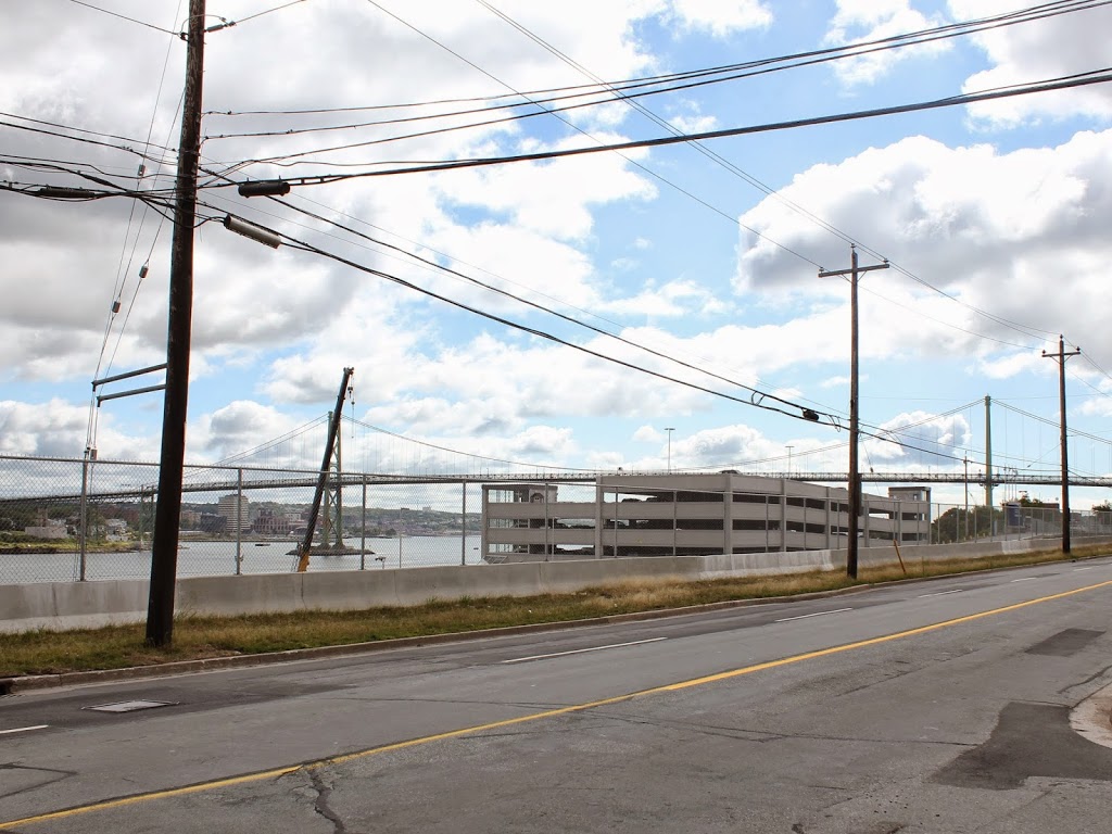
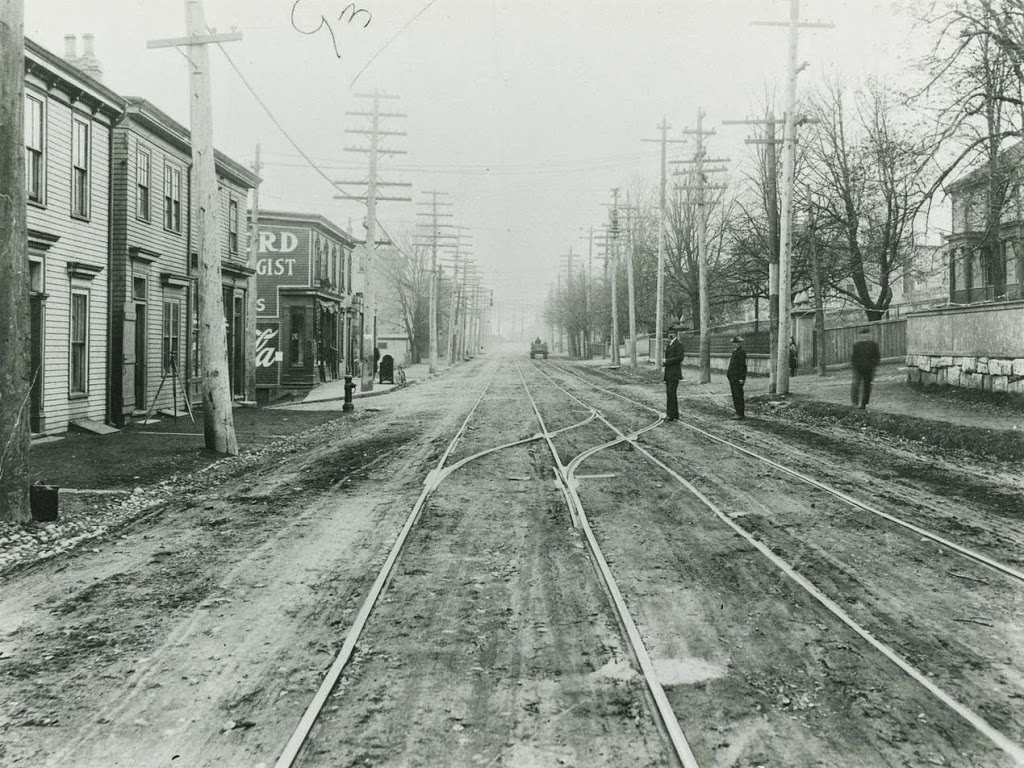
Barrington Street, Halifax, Nova Scotia (2)

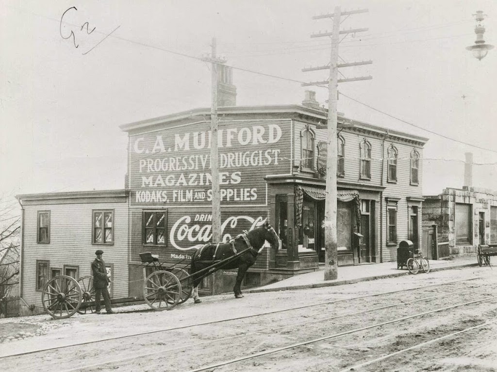
Another scene on Campbell Road (today’s Barrington Street) in Halifax, Nova Scotia, before the 1917 Halifax Explosion. Photo courtesy of the Nova Scotia Archives.

Canada

The scene in 2014:

353_2014

The first photo is undated, but the absolute earliest date would be 1888, although it is probably a little later than that, perhaps around 1900.  A few clues give it away, with one being fairly obvious: the Coca Cola advertisement on the side of the building.  Coca Cola was established in 1886, but it is unlikely that it would have made its way to Canada so quickly.  Perhaps less obvious of a clue is the bicycle leaning against the mailbox; this now-ubiquitous style of bicycle, known as the “safety bicycle” – because it was safer than a penny farthing – was not developed until the late 1880s.  Finally, the reference to “Kodaks” in the drugstore sign indicates that it must be 1888 or later, and probably later.  Kodak was founded in 1888, but the sign seems to indicate that people were already familiar with it by then, which suggests a somewhat later date.

These photos were taken from almost the same spot as the ones in this post, just from a slightly different angle, at the corner of Barrington and Young Streets.  As mentioned in the other post, this entire area would be leveled by the 1917 Halifax Explosion, and today the scene looks entirely different.  In the distance is the Angus L. MacDonald Bridge, one of two that cross the Narrows of Halifax Harbour, the same area where the explosion occurred.

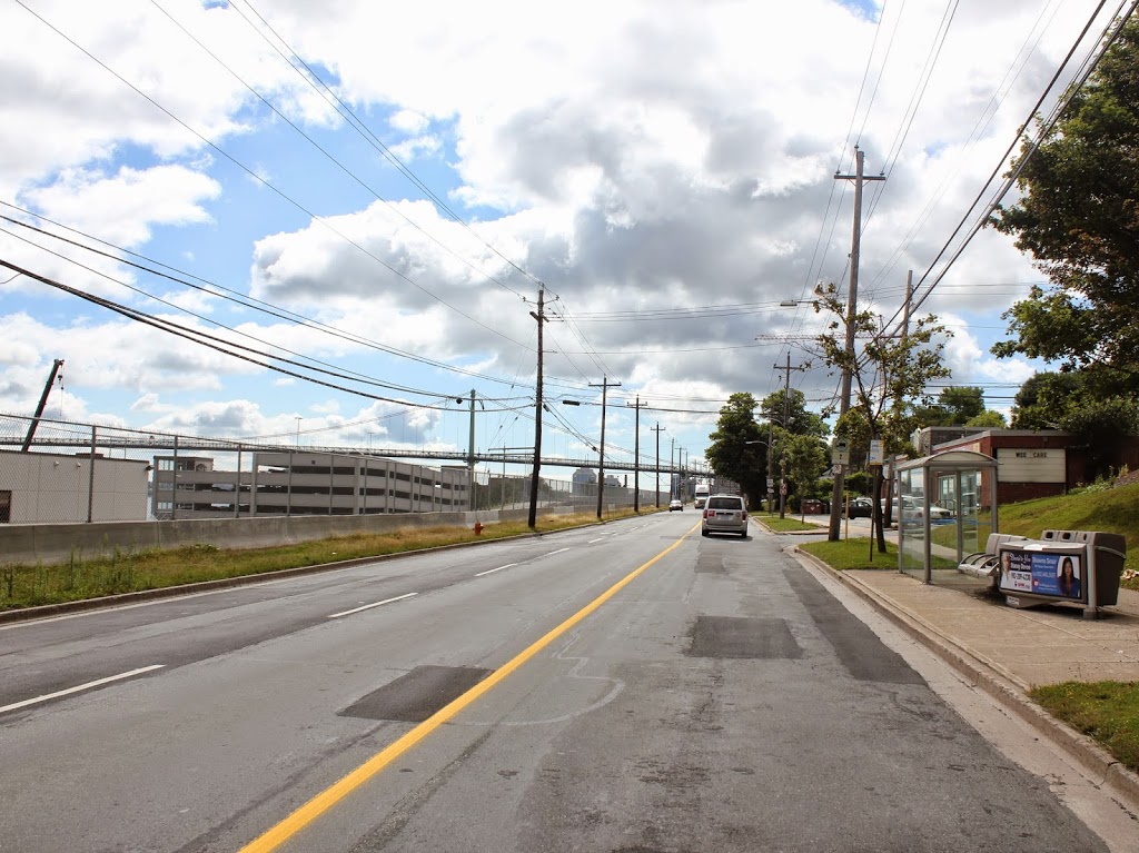
Barrington Street, Halifax, Nova Scotia (1)

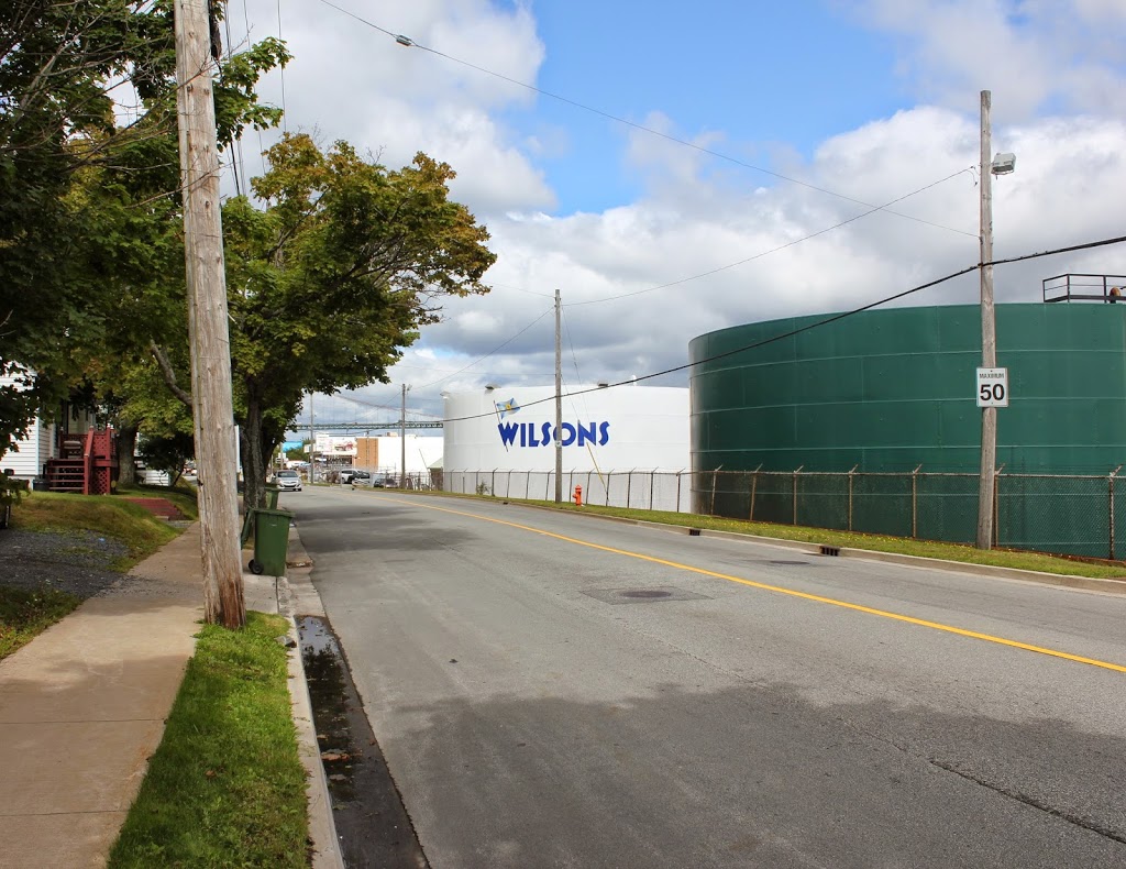
The view looking south on Campbell Road (today Barrington Street) sometime before the 1917 Halifax Explosion. Photo courtesy of the Nova Scotia Archives.

352_1860-1917-2Bnsarchives

The scene in 2014:

352_2014

It’s not in New England, but Halifax has historically had close ties with New England, particularly in the aftermath of the Halifax Explosion, when an ammunition ship exploded in the harbor on December 6, 1917, leveling much of the city and killing several thousand people.  This section of road was right near ground zero, and the buildings in the first photo, if they were still standing before the explosion, were certainly not standing afterward.  The first photo was probably taken around 1900, in what was at the time a mix of residential and commercial uses.  Today, the waterfront (left) side of the road is primarily industrial, with some commercial development to the right.  Overall, the c.1900 scene is entirely unrecognizable today.