Lost New England Goes West: Chinatown, San Francisco (2)

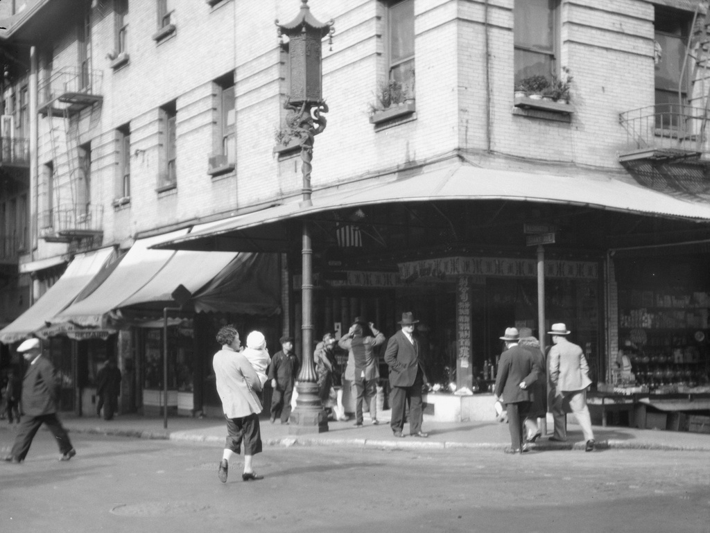
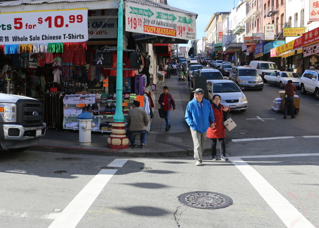
The corner of Grant Avenue and Washington Street in San Francisco, around 1920-1930. Image courtesy of the Library of Congress, Arnold Genthe Collection.

886_1920-1930c loc

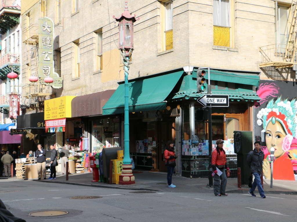
The view in 2015:

886_2015
While the Arnold Genthe photo in the previous post showed San Francisco’s Chinatown before the 1906 earthquake, this view a block away shows the neighborhood some 20 years after it was rebuilt. By this time, though, Chinatown was seeing the effects of many years of anti-Chinese immigration policies, such as the Chinese Exclusion Act of 1882, which made it almost impossible for Chinese women or families to immigrate to the United States. When the first photo was taken, the neighborhood’s population was at an all-time low, and this would not begin to rise again until after World War II, when the Exclusion Act was repealed due to American alliances with China during the war.

Today, it is the largest Chinese community in the world outside of Asia, and in the past 90 years or so this particular view has hardly changed. The building is still standing, as are the ones in the distance to the left, and even minor details such as the fire escapes and the lamppost are the same as they were in the 1920s. The influence of Chinese culture is still very apparent, and Grant Avenue in particular, as shown here, is a major tourist destination in San Francisco.

This post is part of a series of photos that I took in California this past winter. Click here to see the other posts in the “Lost New England Goes West” series.

Lost New England Goes West: Chinatown, San Francisco (1)

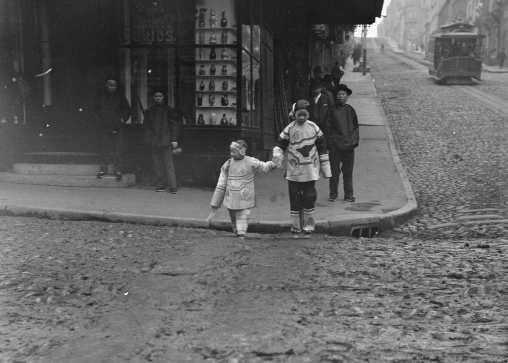
The corner of Jackson Street and Grant Avenue in San Francisco, around 1896-1906. Image courtesy of the Library of Congress, Arnold Genthe Collection.

885_1896-1906c loc

The scene in 2015:

885_2015
San Francisco’s Chinatown is the largest Chinese community in the world outside of Asia, and it was also America’s original Chinatown. Immigrants from China arrived here around the same time that almost everyone else did, during the Gold Rush of the late 1840s and early 1850s. Later on, many other Chinese people came to find work on projects such as the Transcontinental Railroad, and this neighborhood became an ethnic enclave within the city.

Photographer Arnold Genthe was primarily known for his portrait work, and his clients included many notable politicians, writers, and entertainers. In addition, he photographed the immediate aftermath of the 1906 earthquake, including the one in the previous post, but his works also included hundreds of photos of Chinatown that were taken beginning in the 1890s. His collection, which includes the first photo here, provides the only real glimpse into everyday life in Chinatown before the earthquake.

This scene, along with the rest of Chinatown, was completely destroyed in the earthquake, and some politicians sought to use the disaster to rebuild Chinatown further from the center of the city. However, the plans ultimately failed, and Chinatown was rebuilt here, where it continues to be a vibrant community as well as a popular tourist destination in the city.

This post is part of a series of photos that I took in California this past winter. Click here to see the other posts in the “Lost New England Goes West” series.

Lost New England Goes West: Sacramento Street, San Francisco

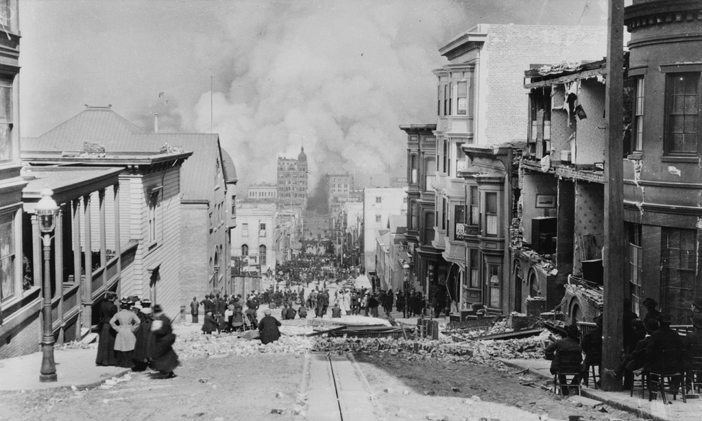
Looking down Sacramento Street from near Powell Street in San Francisco, on April 18, 1906. Image courtesy of the Library of Congress, Arnold Genthe Collection.
884_1906 loc

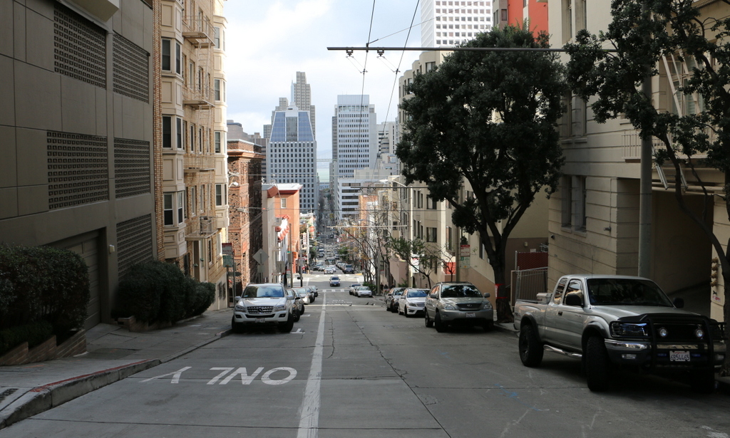
Sacramento Street in 2015:

884_2015
The first photo is probably the most famous image from the 1906 San Francisco earthquake, and it was taken by noted photographer Arnold Genthe in the hours that immediately followed the earthquake, before the fires spread across the city. Most of the other post-earthquake images that I have featured here show the city days or weeks after the fires had been put out, when the city was beginning to rebuild. However, this scene shows the disaster as it was still unfolding, as residents stood in the streets and watched the city burn below them.

Years later, Genthe mentioned the photograph in his autobiography, commenting on the almost surreal nature of the scene, with the city burning in the distance and spectators sitting in chairs on the sidewalk, calmly watching as the fire moved closer. He wrote,

“Of the pictures I had made during the fire, there are several, I believe, that will be of lasting interest. There is particularly the one scene that I recorded the morning of the first day of the fire [along Sacramento Street, looking toward the Bay] which shows, in a pictorially effective composition, the results of the earthquake, the beginning of the fire and the attitude of the people. On the right is a house, the front of which had collapsed into the street. The occupants are sitting on chairs calmly watching the approach of the fire. Groups of people are standing in the street, motionless, gazing at the clouds of smoke. When the fire crept up close, they would just move up a block. It is hard to believe that such a scene actually occurred in the way the photograph represents it.”

Perhaps the people in the photo assumed that the fire was too distant to threaten them, but as they were watching the fire department was struggling with broken water mains and limited manpower, and the city government was making poor decisions that, in the coming days, would enable the fire to spread far further than it otherwise may have. By the next day, the fire had moved up the hill, and all of the buildings in the foreground were destroyed.

When the first photo was taken, the bay was not visible because of the dense smoke in the distance. Over a century later, it still isn’t visible from here, because of the tall skyscrapers that have since been built in the Financial District. The cable car line in the first photo was eliminated years ago, and the street is now served by a bus line that runs off of the overhead wires at the top of the 2015 photo. While the buildings from the first photo may be gone, at least one pre-earthquake organization is still here. The brick building partway down the hill on the left side of the photo was the Presbyterian Mission House, a Christian organization that worked to rescue Chinese girls from slavery and sex trafficking. After the earthquake, the organization rebuilt on the same site, and today it is still operated as the Cameron House, named in honor of Donaldina Cameron, who was the superintendent at the time of the earthquake.

This post is part of a series of photos that I took in California this past winter. Click here to see the other posts in the “Lost New England Goes West” series.