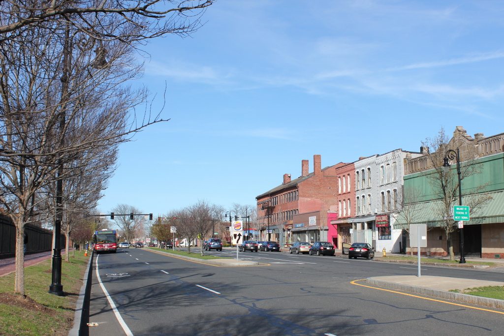
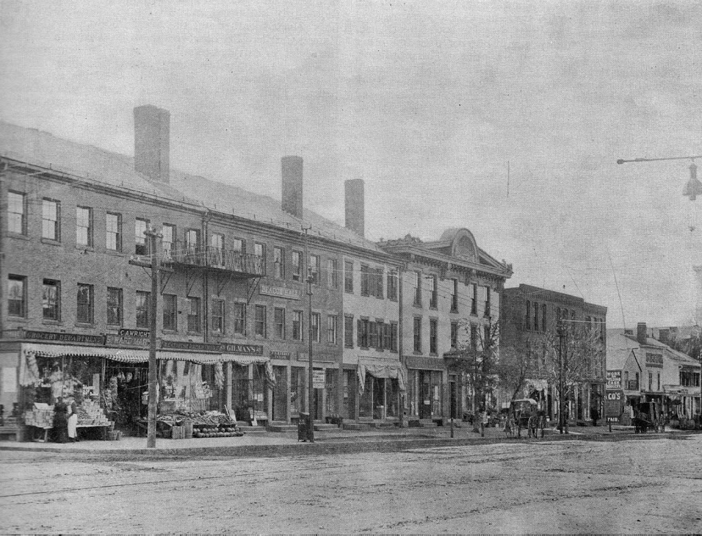
State Street from Walnut Street, Springfield, Mass

State Street looking west from Walnut Street, around 1895. Photo courtesy of James Ward Birchall Collection.

212_1895-smugmug

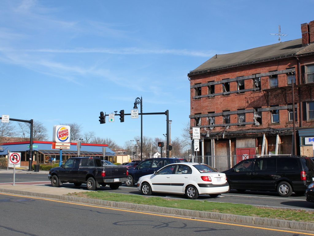
The view in 2019:

As with the photos in this post, the historic Gunn Block (far left) is visible, along with the other two adjacent buildings, which also date back to the 1830s, making them among the oldest commercial buildings in Springfield; only Byers Block at Court Square and the Guenther & Handel’s Block on Stockbridge Street are of similar ages.  Further down State Street is another historic block of buildings; I couldn’t find specifics on these buildings, but based on the architecture they likely date to around the 1860s.

Corner of State and Walnut Streets, Springfield, Mass

The corner of State Street and Walnut Street, looking east, sometime around 1892. Photo from Picturesque Hampden (1892).

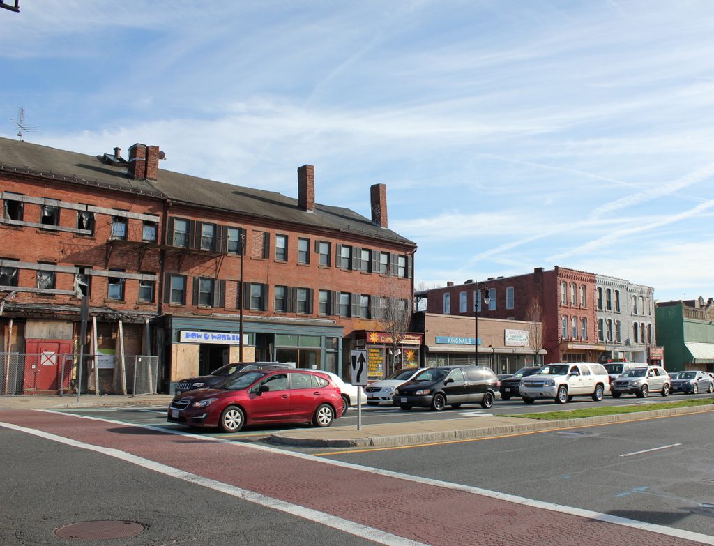
The scene in 2019:

The building on the left in the first photo is the Rockingham House, which is discussed in this post. To the right is the Gunn Block, which was built in 1836 and has served a variety of purposes over the years, originally as a store selling “West Indies Goods” but later as a meeting place, offices, a bar, and apartments. The building is now vacant, but it is owned by the organization Develop Springfield, and will hopefully be restored in the near future.


Rockingham House, Springfield, Mass

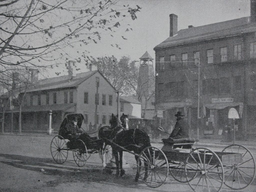
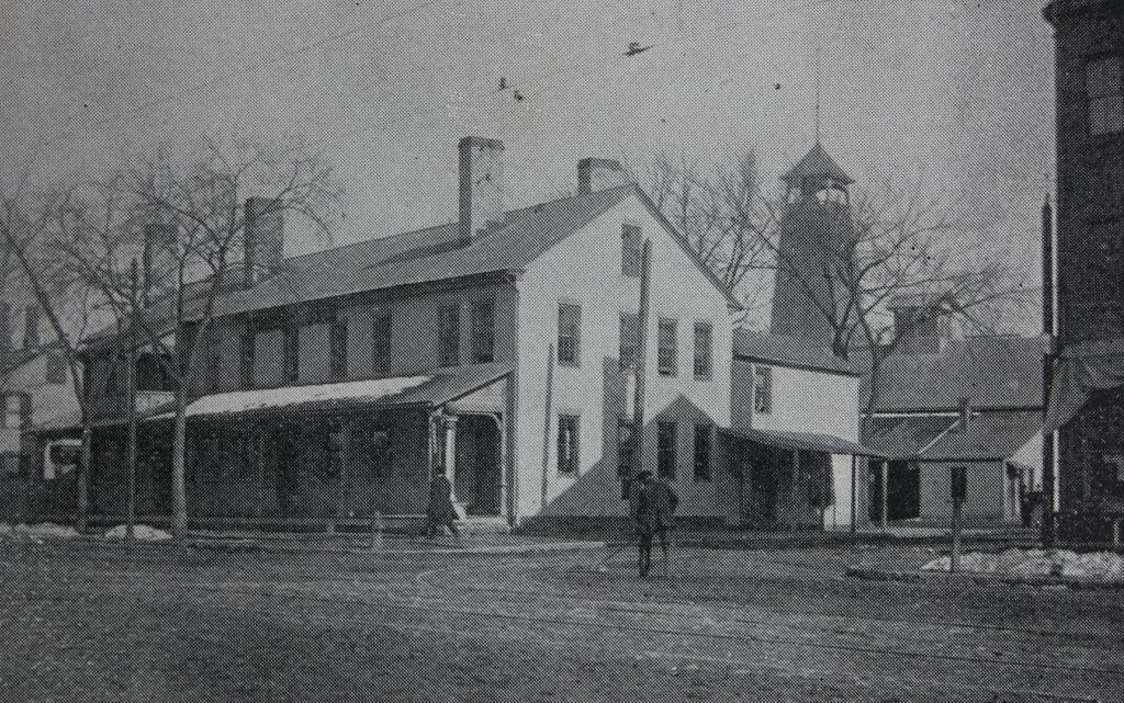
The Rockingham House, on the southeast corner of State Street and Walnut Street, sometime around 1892. Photo from Picturesque Hampden (1892).

The scene in 2019:

Built in 1796 diagonally across from the Armory, the Rockingham House was originally called the Armory House, for obvious reasons.  Along with being used as a lodging place for people associated with the Armory, it was primarily used by teamsters in the early part of the 19th century.  Long before railroads and Jimmy Hoffa, teamsters were the primary means of overland transportation from Springfield to Boston.  It was common for them to bring loads from riverboats up the hill.  The inn was conveniently located right at the top of the hill, so they would often stay overnight there before heading out the next morning.

Once the railroads linked Springfield to Boston in 1839, this part of the inn’s business declined, and it began to be used instead as a boarding house.  As mentioned in the 1884 King’s Handbook of Springfield, “It ceased to be a stopping-place for transient guests some time ago, but is still a pleasant home for some residents who do not care to keep house.”

Obviously, the Rockingham House no longer exists, although it wasn’t demolished to build a Burger King.  Rather, it was replaced by a gas station – a 1974 article from the Springfield Republican indicates that it was demolished “several years ago.”

Mulberry Bend, New York City

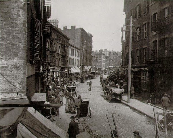
Mulberry Bend, around 1896. Photo from Out of Mulberry Street: Stories of Tenement Life in New York City by Jacob Riis.

205_1896-riis

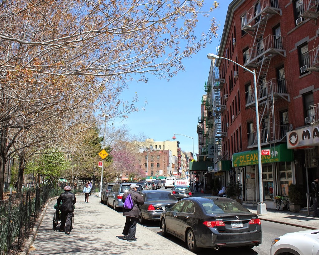
The same view in 2014:

205_2014

Throughout much of the 19th century, the Five Points neighborhood of Manhattan was one of the worst slums in the United States.  At the heart of it was Mulberry Bend, named after the curve in Mulberry Street which is visible in the two photos.  In part because of the work of social reformers like Jacob Riis, efforts began at the end of the century to clear out the worst of the slums and tenements.  Shortly after the first photo was taken, the tenements on the left were demolished, and replaced by Columbus Park.  Several of the buildings on the left survive, though, and are now a part of Manhattan’s Chinatown neighborhood.

This photo was taken just south of the intersection of Mulberry and modern-day Mosco Streets, just north of where this photo was taken a few years later.  If the photographer in that photo had turned left, this is approximately the view that he would have looking up Mulberry.

Corner of Main & State Streets, Springfield

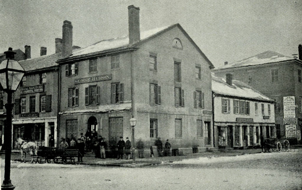
The northeast corner of Main and State in Springfield, sometime in the 19th century.  Photo from Picturesque Hampden (1892).

122_1800s picturesquehampden

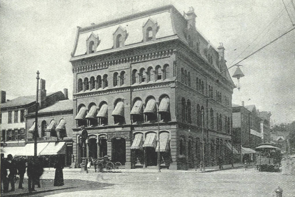
The same location, around 1892. Photo from Picturesque Hampden (1892).

122_1892c picturesquehampden

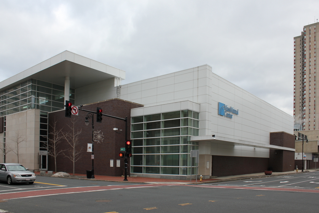
The corner in 2014:

122_2014

Many of these Springfield street scenes follow a predictable pattern over the past 150 years or so – first, a pre-Civil War Federal style commercial block, followed by a larger, more ornate building in the latter part of the 19th century, and finally some sort of modern, 20th century structure.  In this case, we clearly see all three generations of commercial development at the corner of Main and State, culminating with the MassMutual Center of the 1970s.  Of particular interest is the building in the second photo – above the entrance is a sign that reads “G. & C. Merriam & Co Publishers,” the publishers of the Merriam-Webster Dictionary. Today, the company is still headquartered in Springfield, just up the hill on Federal Street.  See this post and this post for a few other angles of the neighborhood that is now the MassMutual Center.

Chicopee Bank Building, Springfield

The Chicopee Bank Building, at the corner of Main and Elm, sometime before 1889.  Photo from Springfield Present and Prospective (1905).

121_1870s-1880s spp

The same location, between 1889 and 1895. Photo courtesy of James Ward Birchall Collection.

121_1889-1895 jwb

The scene in 2014:

121_2014

The original building was built in 1835, at the same time as the other three-story commercial buildings on and around Court Square. It was demolished in 1889 and replaced by the current structure, which survives with minimal changes. The building to the left, however, has been trimmed down in height. On the other side, along Elm Street, the 1835 Byers Block survives as a remnant of what the old Chicopee Bank building once looked like.