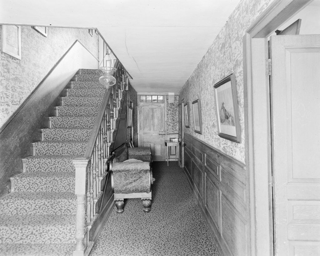
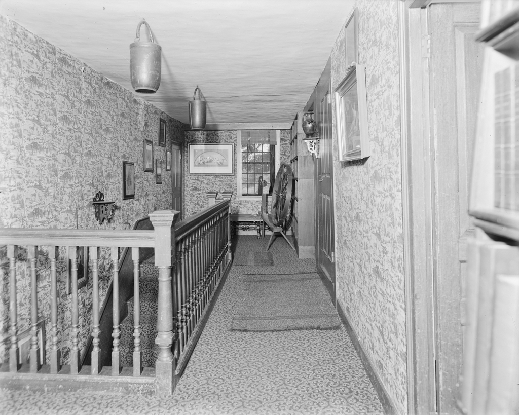
The second floor hallway and staircase at the Old Manse in Concord, probably around 1890-1910. Image courtesy of the Phillips Library at the Peabody Essex Museum, Frank Cousins Glass Plate Negatives Collection.
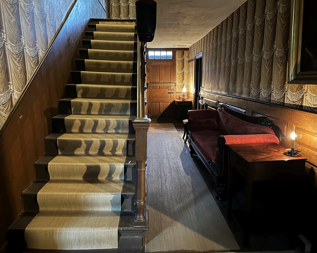
The scene in 2023:
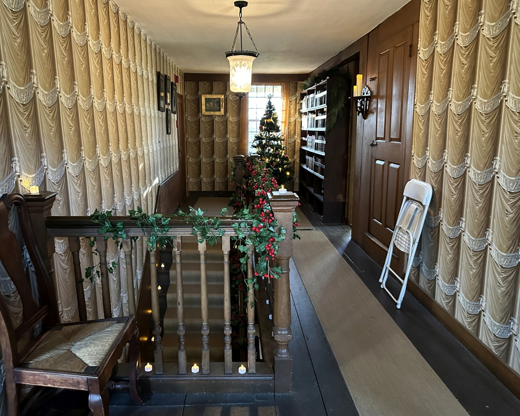
These two photos were taken directly above the spot where the ones in a previous post were taken. The photos in the other post show the scene on the first floor, while these two photos show the stairway from the second floor, looing west. As discussed in more detail in other posts, this house was built in 1770 as the home of William and Phebe Emerson. The Emerson family was here when the Battle of Concord occurred in their backyard, and they witnessed the battle from the room on the right side of this hallway, in the northwest corner of the house. However, the house is perhaps best remembered for having briefly been the home of their grandson Ralph Waldo Emerson, and later as the home of Nathaniel Hawthorne.
Ralph Waldo Emerson lived here for about a year from 1834 to 1835. At the time he was a young widower and former pastor who had abandoned the ministry after the death of his first wife. Although he spent a relatively short time here, this was a formative period in his life as he began to develop his Transcendentalist philosophy. His study was located in the same room where his grandparents had watched the battle, and it was there that he wrote his famous essay “Nature,” which had a strong influence on the subsequent Transcendentalist movement.
Emerson moved out of the house after his marriage to his second wife Lidian in 1835. His step grandfather Ezra Ripley, who had owned the house, died in 1841, and starting in 1842 Ezra’s son Samuel rented the house to another young aspiring writer, Nathaniel Hawthorne. Hawthorne and his wife Sophia spent their wedding night here in the house in 1842, and they lived here for the next three years, with Hawthorne likewise using the same room as Emerson for his study. While living here, he wrote a number of short stories that were later published as a book, titled Mosses from and Old Manse.
The top photo was taken at some point around the turn of the 20th century by photographer Frank Cousins, who used his camera to document the interiors and exteriors of many historic New England homes. The house was still owned by descendants of the Ripley family, and it remained in the family until 1939, when Ezra and Phebe Ripley’s great granddaughter Sarah Ames died.
After Sarah Ames’s death, her husband donated the house and its contents to the Trustees of Reservations, which continues to operate the house as a museum. It remains well-preserved, and it is still furnished with the Ripley family’s belongings, including many of the items shown here in these photos. The furnishings are not all in the same spot as they were when the top photo was taken, but otherwise the only significant difference is the wallpaper. The current wallpaper, with its trompe l’oeil drapery, is based on the wallpaper that was in the hallway earlier in the 19th century, before the wallpaper in the top photo was installed.