Cornhill from Washington Street, Boston

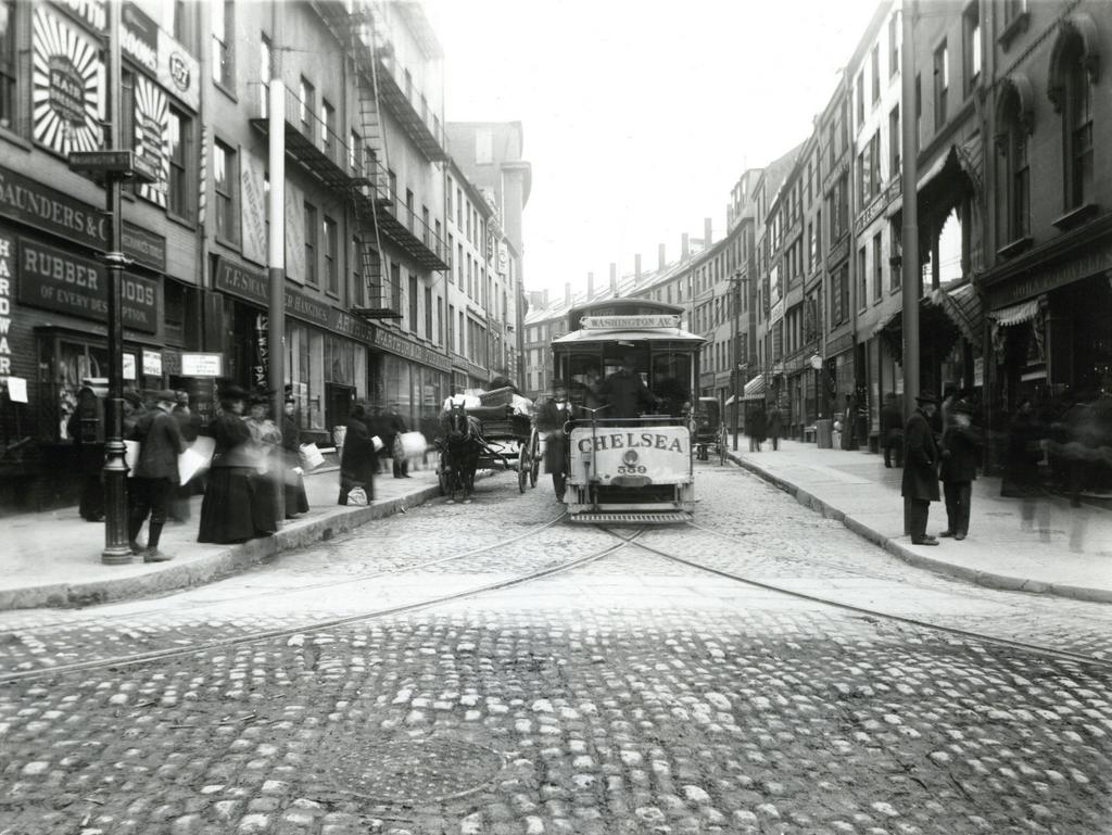
Looking up Cornhill from Washington Street, on April 14, 1897. Image courtesy of the City of Boston Archives.

964_1897-04-14 coba

The scene in 2016:

964_2016
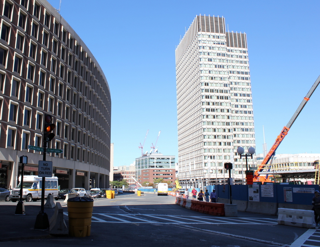
This narrow cobblestone street in downtown Boston connected Adams Square with nearby Scollay Square, and it was once a major literary center of the city, with many bookstores and publishers. When the first photo was taken, the early 19th century buildings here had a variety of businesses, with signs advertising for carpets, furniture, wallpaper, signs, trunks, and rubber goods. The first photo also shows a trolley coming down the street from Scollay Square, but this would soon change with the opening of the Tremont Street Subway in less than five months. Part of it was built under Cornhill, and it was the nation’s first subway, allowing trolleys to avoid the congested streets between Boston Common and North Station.

Nearly all of the buildings in the first photo were demolished in the early 1960s to build the Government Center complex. City Hall is just out of view on the right side of the 2016 photo, and the only building left standing in this scene is the Sears’ Crescent, partially visible in the distance on the left side of the street in both photos. Built in 1816 and renovated around 1860, this building still follows the original curve of Cornhill, serving as a reminder of what the neighborhood looked like before one of Boston’s most controversial urban renewal projects.

Scollay Square, Boston

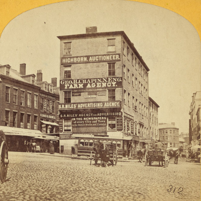
Scollay Square, looking north from the corner of Tremont and Court Streets, sometime in the 1860s. Image courtesy of the Boston Public Library.
823_1860-1869c bpl

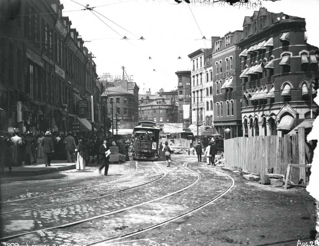
Scollay Square on August 26, 1897. Image courtesy of the City of Boston Archives.
823_1897_08_26 coba

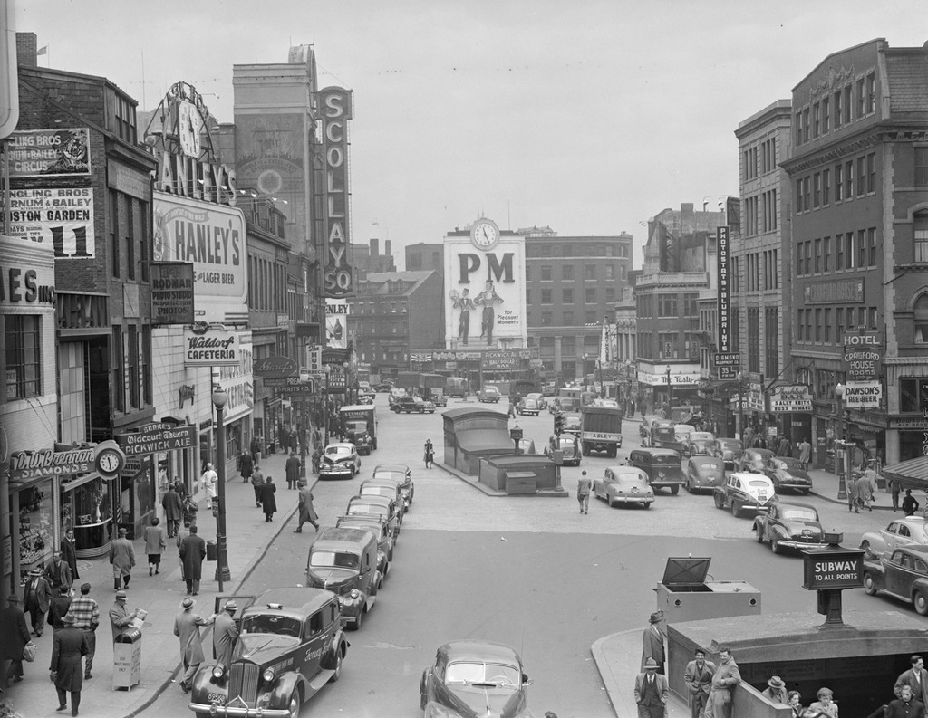
Scollay Square around 1942. Image courtesy of the Boston Public Library, Leslie Jones Collection.
823_1942c bpl

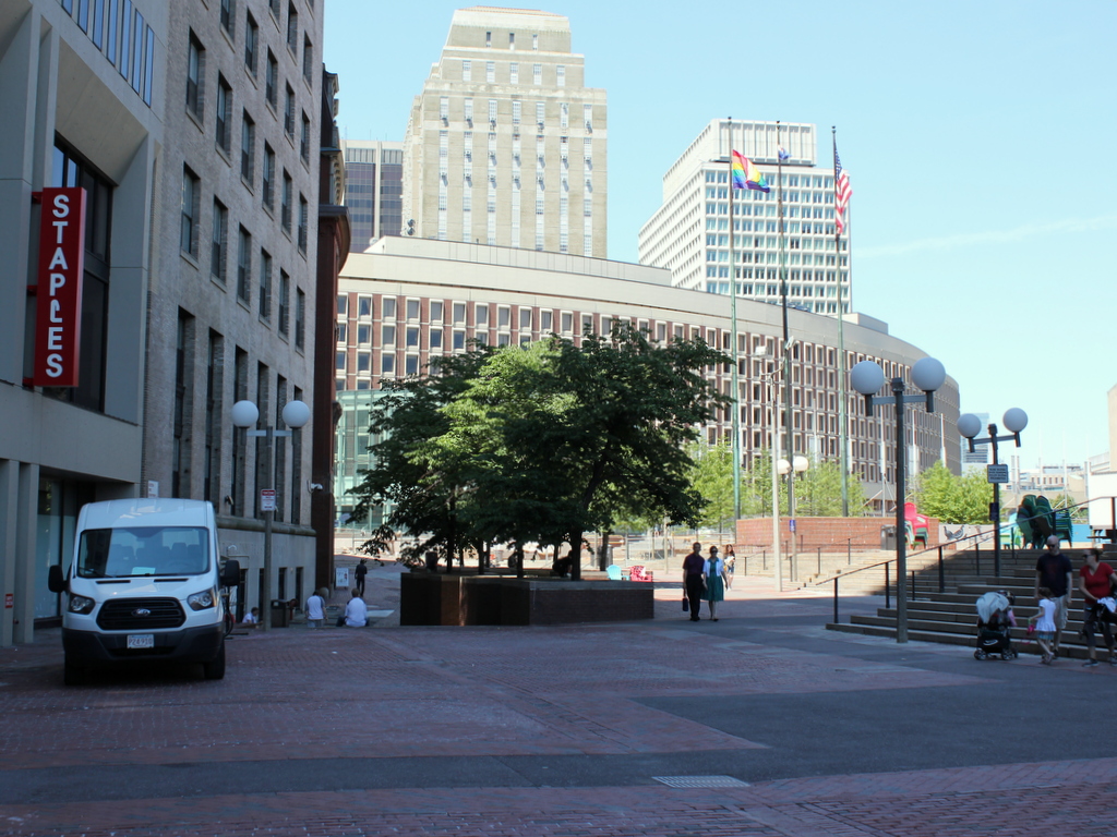
The scene in 2015:

823_2015
These four photos reveal the dramatic transformations that have occurred at Boston’s Scollay Square over the past 150 years. The square once included a long, narrow row of buildings in the middle, which appear on city maps as early as the 1720s. The construction date for the building in the first photo is unknown, but it was once at the southern end of this row, and in 1795 it was purchased by William Scollay, a real estate developer for whom the square would eventually be named. By the time the first photo was taken, all of the other buildings in the middle of the square had been demolished, and Scollay’s building was taken down soon after, around 1870.

The second photo shows a very different scene. Some of the buildings along the square are still standing, but the Scollay Building is gone, as are the horse-drawn trolleys from the first photo. Instead, they have been replaced by electric trolleys, like the one shown in the photo. However, these would not last long, at least not on the surface. The second photo was taken only about a week before the Tremont Street Subway opened, and the photo shows some of the construction activity as the workers prepared the Scollay Square station for its opening day on September 3. The station itself is not visible, but its ornate entrance can be seen in this post, which shows the scene from a slightly different angle.

Scollay Square had long been a major commercial center in the city, but by the time the third photo was taken in the 1940s, it had seen a dramatic decline. Many of the old buildings were still standing, but the businesses had become seedier. The 1942 photo shows a number of bars, liquor stores, cheap restaurants, and burlesque theaters, and the area was particularly popular among sailors on leave from the Boston Navy Yard and college students from the many nearby schools. One prominent hotel and theater in both the second and third photos was the Crawford House on the far right. It was built in 1865 and underwent several renovations, including one in 1926 that completely altered the front. The building burned in 1948, and all but the first two floors were demolished a few years later.

By the 1950s, the area was being targeted for urban renewal. Looking to replace the area with something more respectable, the Boston Redevelopment Authority demolished over a thousand buildings in the vicinity to build the Government Center complex, which includes the Center Plaza to the left, the John F. Kennedy Federal Building in the center, and the Boston City Hall, just out of view to the right. The old Scollay Square subway station was also extensively renovated and renamed Government Center. When the last photo was taken, the station was undergoing a another renovation, so if there is one thing that the second and fourth photos have in common, it is subway station construction.
Scollay Square, Boston

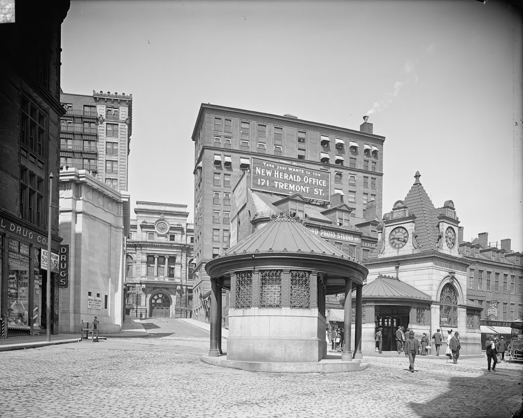
Scollay Square in Boston, around 1906. Image courtesy of the Library of Congress, Detroit Publishing Company Collection.

266_1906c-loc

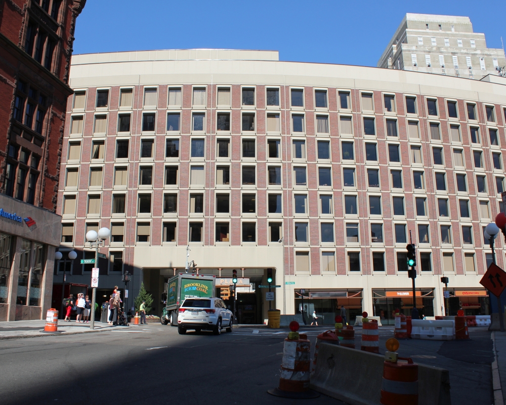
The same scene in 2014:

Scollay Square is one of the more dramatic, and perhaps infamous examples of urban renewal in Boston.  Located at the corner of Tremont and Court streets, it was a busy commercial center for several centuries.  However, by the 1950s it was a seedy neighborhood with low-income residents, so the entire area was demolished in the 1960s and replaced with Government Center, which included City Hall and City Hall Plaza (just to the right of where the 2014 photo was taken).

The two small buildings in the center of the square in the 1906 photo are two different subway stations; the one in the foreground is Court Street on the East Boston Tunnel (present-day Blue Line), and the larger, more ornate one in the background is the Scollay Square station on the Tremont Street Subway (today’s Green Line).  This was the original terminus of the East Boston Tunnel when it opened in 1904; it extended from Maverick Station in East Boston, and ran under Boston Harbor and up State Street to here.  In 1916, the line was extended to Bowdoin, and the Court Street Station was closed, and a new station was opened under the Scollay Square station; not surprisingly, it was called Scollay Under.

Today, very little remains from the 1906 photo.  Only two buildings survive; the one on the far left (modern-day Bank of America), and the Suffolk County Courthouse, visible in the distance in left-center (and no longer visible from this spot today, although it’s still there).  Even the subway station has changed; the Blue and Green lines still meet here, but it is now the Government Center station, and the entrance is further to the right, at City Hall Plaza.  The station itself was reconstructed in the 1960s, and is currently being reconstructed again.  It was closed earlier this year, and is not scheduled to reopen until 2016.