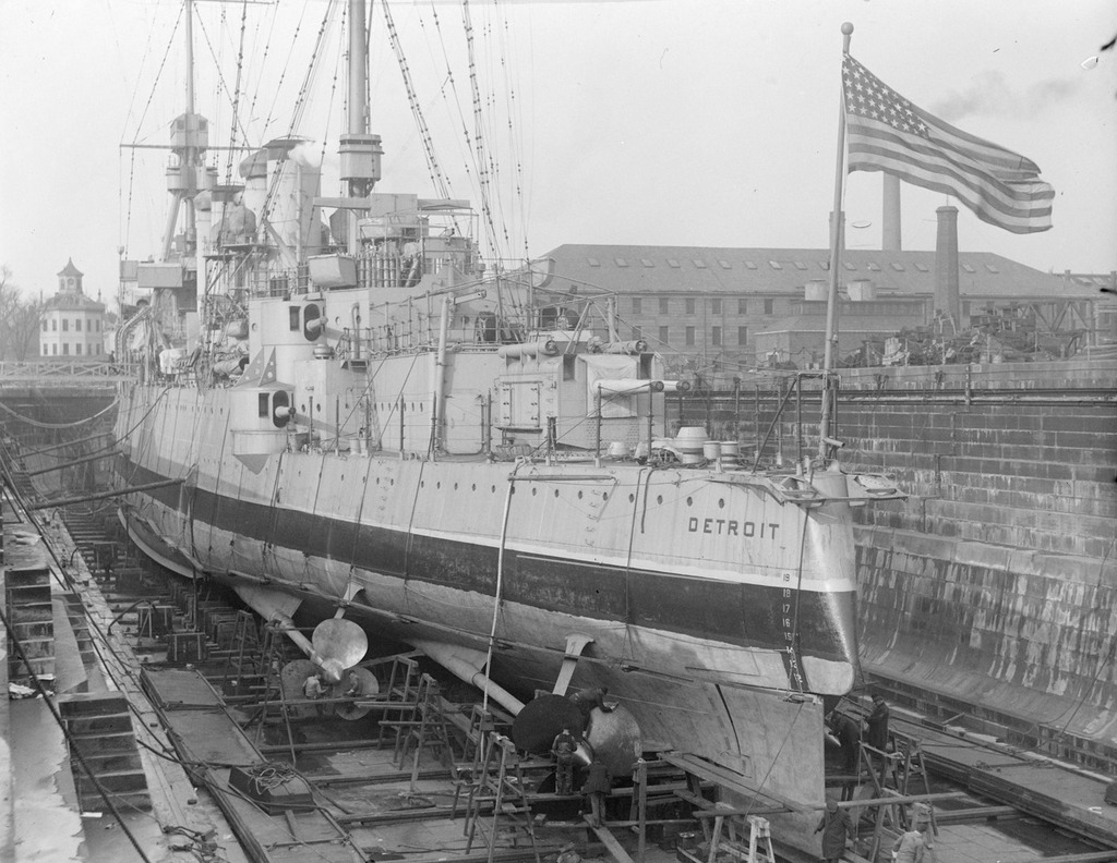
USS Detroit at Boston Navy Yard

The cruiser USS Detroit in Dry Dock 2 at Boston Navy Yard, on December 16, 1928. Image courtesy of the Boston Public Library, Leslie Jones Collection.

835_1923-1934c bpl

The scene in 2015:

835_2015
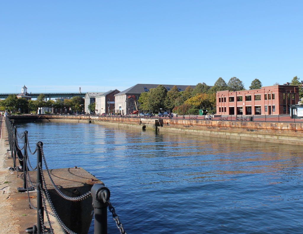
Taken about 23 years after the photo in the previous post, this view of Dry Dock 2 shows the USS Detroit (CL-8), an Omaha-class light cruiser, undergoing work at the Boston Navy Yard. The Detroit had been built in nearby Quincy, Massachusetts, and was commissioned in 1923. Several years after the first photo was taken, she was transferred to the Pacific, and was based out of San Diego before being moved to Pearl Harbor in 1941. She was present during the attack on Pearl Harbor on December 7, and survived the battle without any damage, and went on to see extensive service in World War II, including being present in Tokyo Bay for the surrender in 1945. Following the war, though, the Detroit was sold for scrap in 1946, along with many other obsolete surplus ships.

The Boston Navy Yard, as mentioned in the previous post, closed in 1974, and part of it was taken over by the National Park Service. Today, many of the historic buildings and other structures have been preserved, including Dry Dock 2 and some of the buildings in the distance. One of the most distinctive buildings in the yard is the octagonal Muster House, which can be seen just to the left of the ship. It was built in the 1850s, and it is still standing today, partially hidden by trees in the distance. The long building in the center of the photo has also been preserved and repurposed; it is now the MGH Institute of Health Professions.

Scollay Square, Boston

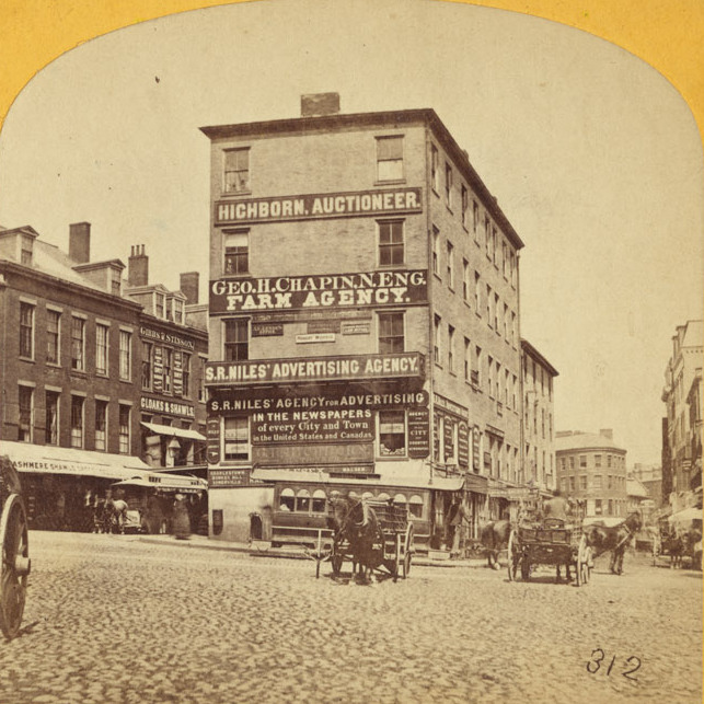
Scollay Square, looking north from the corner of Tremont and Court Streets, sometime in the 1860s. Image courtesy of the Boston Public Library.
823_1860-1869c bpl

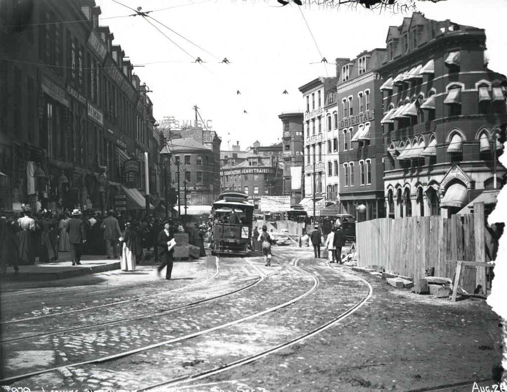
Scollay Square on August 26, 1897. Image courtesy of the City of Boston Archives.
823_1897_08_26 coba

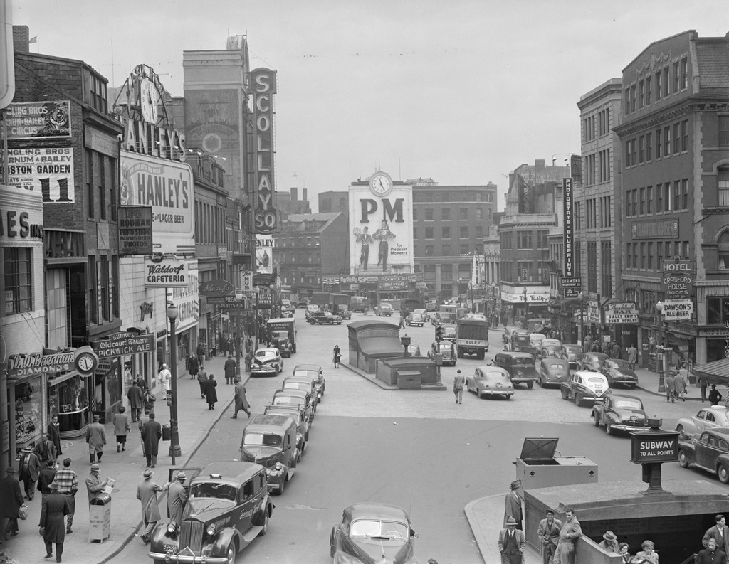
Scollay Square around 1942. Image courtesy of the Boston Public Library, Leslie Jones Collection.
823_1942c bpl

The scene in 2015:

823_2015
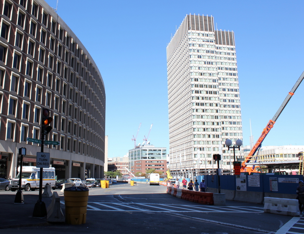
These four photos reveal the dramatic transformations that have occurred at Boston’s Scollay Square over the past 150 years. The square once included a long, narrow row of buildings in the middle, which appear on city maps as early as the 1720s. The construction date for the building in the first photo is unknown, but it was once at the southern end of this row, and in 1795 it was purchased by William Scollay, a real estate developer for whom the square would eventually be named. By the time the first photo was taken, all of the other buildings in the middle of the square had been demolished, and Scollay’s building was taken down soon after, around 1870.

The second photo shows a very different scene. Some of the buildings along the square are still standing, but the Scollay Building is gone, as are the horse-drawn trolleys from the first photo. Instead, they have been replaced by electric trolleys, like the one shown in the photo. However, these would not last long, at least not on the surface. The second photo was taken only about a week before the Tremont Street Subway opened, and the photo shows some of the construction activity as the workers prepared the Scollay Square station for its opening day on September 3. The station itself is not visible, but its ornate entrance can be seen in this post, which shows the scene from a slightly different angle.

Scollay Square had long been a major commercial center in the city, but by the time the third photo was taken in the 1940s, it had seen a dramatic decline. Many of the old buildings were still standing, but the businesses had become seedier. The 1942 photo shows a number of bars, liquor stores, cheap restaurants, and burlesque theaters, and the area was particularly popular among sailors on leave from the Boston Navy Yard and college students from the many nearby schools. One prominent hotel and theater in both the second and third photos was the Crawford House on the far right. It was built in 1865 and underwent several renovations, including one in 1926 that completely altered the front. The building burned in 1948, and all but the first two floors were demolished a few years later.

By the 1950s, the area was being targeted for urban renewal. Looking to replace the area with something more respectable, the Boston Redevelopment Authority demolished over a thousand buildings in the vicinity to build the Government Center complex, which includes the Center Plaza to the left, the John F. Kennedy Federal Building in the center, and the Boston City Hall, just out of view to the right. The old Scollay Square subway station was also extensively renovated and renamed Government Center. When the last photo was taken, the station was undergoing a another renovation, so if there is one thing that the second and fourth photos have in common, it is subway station construction.
Public Garden, Boston

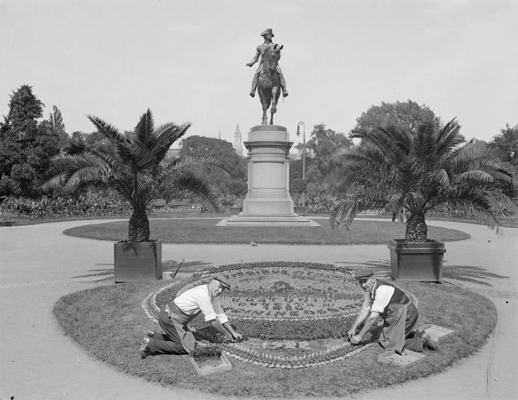
Looking east in the Public Garden from the Arlington Street entrance, facing the statue of George Washington, around 1917-1934. Image courtesy of the Boston Public Library, Leslie Jones Collection.

783_1917-1934c bpl

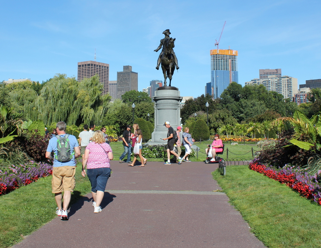
The view in 2015:

783_2015
Boston Common was established in 1634 as the first public park in the country, and just over 200 years later, in 1837, the Boston Public Garden was created just to the west of it, as the first public botanical garden in the United States. The carefully-landscaped garden includes a pond, a bridge, a wide variety of plants, and several statues, including one of George Washington seen in these two photos.  The bronze statue has stood here since 1869, and it was designed by noted Boston sculptor Thomas Ball, whose other works include the Emancipation Memorial at nearby Park Square.

Some of the landscaping has changed at this entrance to the garden, and there are no floral arrangements like the one the men are working on in the first photo, but the most dramatic change in the past 80 or so years is the city skyline in the distance. When the first photo was taken, height restrictions prevented large skyscrapers from being built in the city, and the only one visible was the Custom House Tower, which, as a federal building, was immune to the city’s restrictions. Today, though, the restrictions are long gone, and Boston’s skyline continues to grow; the Millennium Tower, under construction to the right in the 2015 scene, will become the third-tallest in the city and the tallest in downtown when it is completed later in 2016.

Railroad Station, Chatham Mass (2)

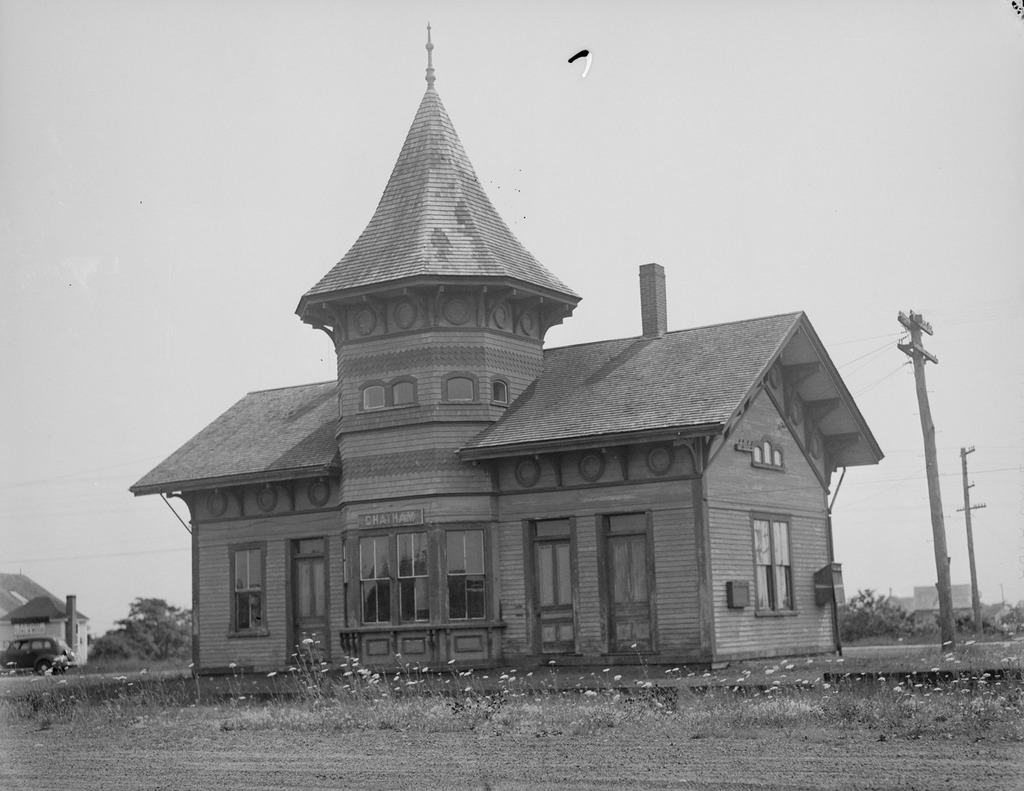
Another view of the railroad station in Chatham, probably taken around the 1940s. Image courtesy of the Boston Public Library, Leslie Jones Collection.

543_1934-1956c bpl

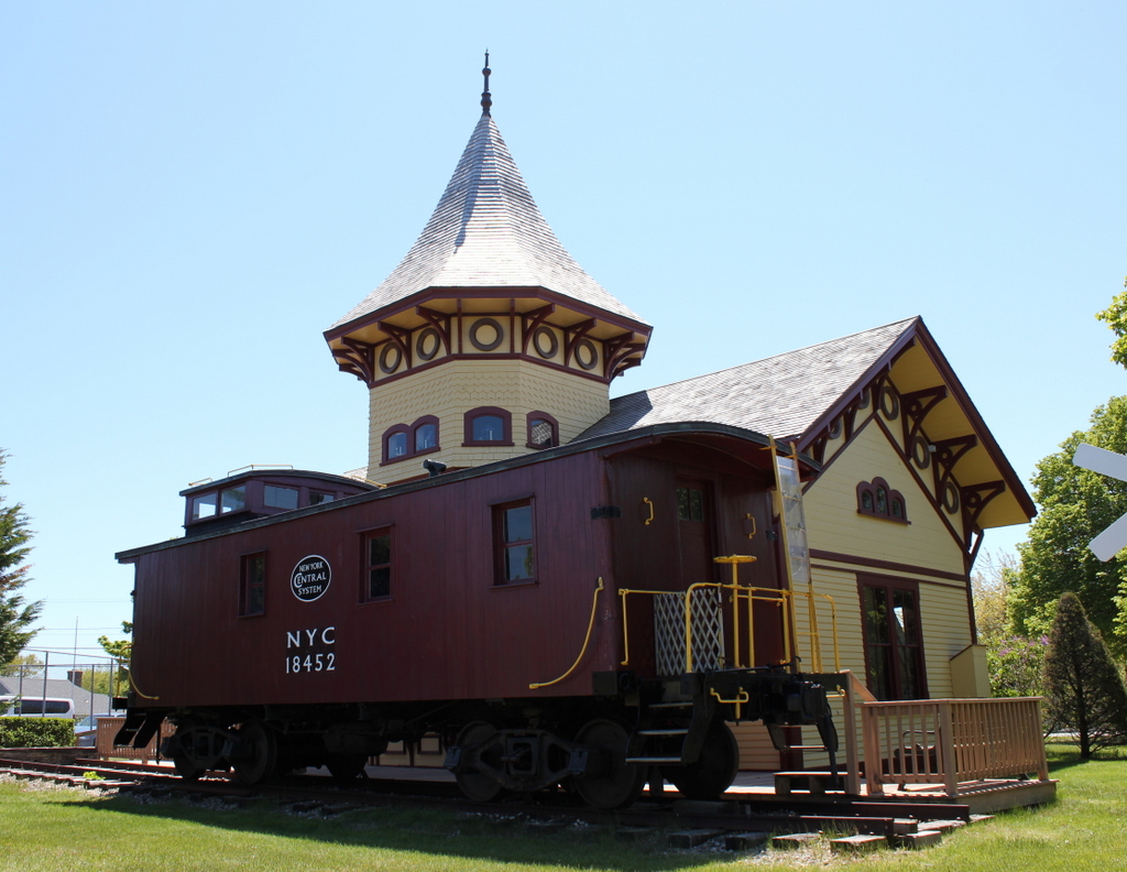
The station in 2015:

543_2015
These two photos show the opposite side of the station from the ones in this post, and as mentioned there, this is the only original train station remaining on Cape Cod.  The station was built in 1887 for the Chatham Railroad Company, which was later acquired by the Old Colony Railroad, which was in turn purchased by the New York, New Haven and Hartford Railroad.  The branch line to Chatham closed in 1937, and the station was abandoned for several decades, as seen in the first photo.  However, it was later restored and converted into the Chatham Railroad Museum, and a historic 1910 caboose now sits on the spot where trains once stopped to pick up passengers coming to and from Chatham.

Railroad Station, Chatham Mass (1)

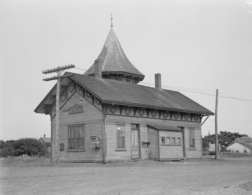
The former railroad station in Chatham, probably around the 1940s. Image courtesy of the Boston Public Library, Leslie Jones Collection.

542_1934-1956c bpl

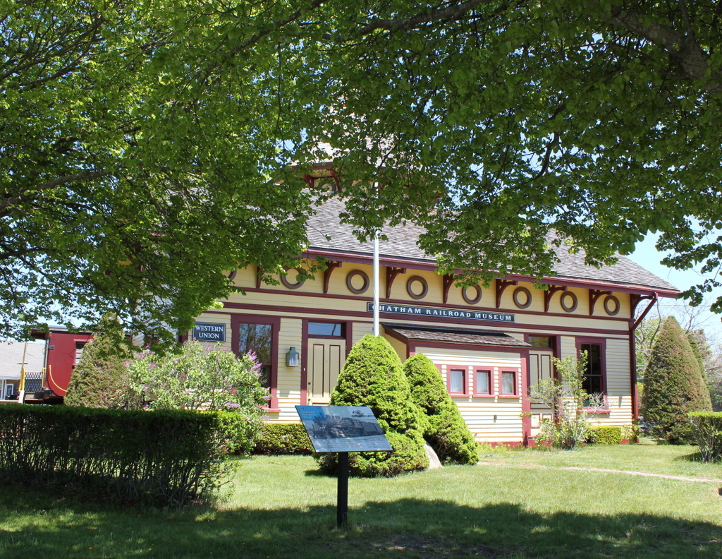
The station in 2015:

542_2015
The former railroad station in Chatham is the only original railroad station left on Cape Cod, which is a little unusual given that today it is over 12 miles from the nearest active rail line. Built in 1887, the station was once the terminus of a 7.1 mile-long spur that was operated by the Chatham Railroad Colony, and connected the town of Chatham to the Old Colony Railroad, which ran the entire length of Cape Cod.  The line was later acquired by the New York, New Haven, and Hartford Railroad, who operated it until 1937.  The Boston Public Library estimates that Leslie Jones took the first photo between 1934 and 1956, but I’m guessing it was probably sometime in the 1940s or early 1950s, given that the building looks like it has been abandoned for some time.  However, it wouldn’t stay like that for long, and in 1960 the old station became the home of the Chatham Railroad Museum.  Today, it looks far better than it did when Leslie Jones visited around 70 years ago, and it is listed on the National Register of Historic Places.

Calvin Coolidge and Allen Treadway at Plymouth, Vermont

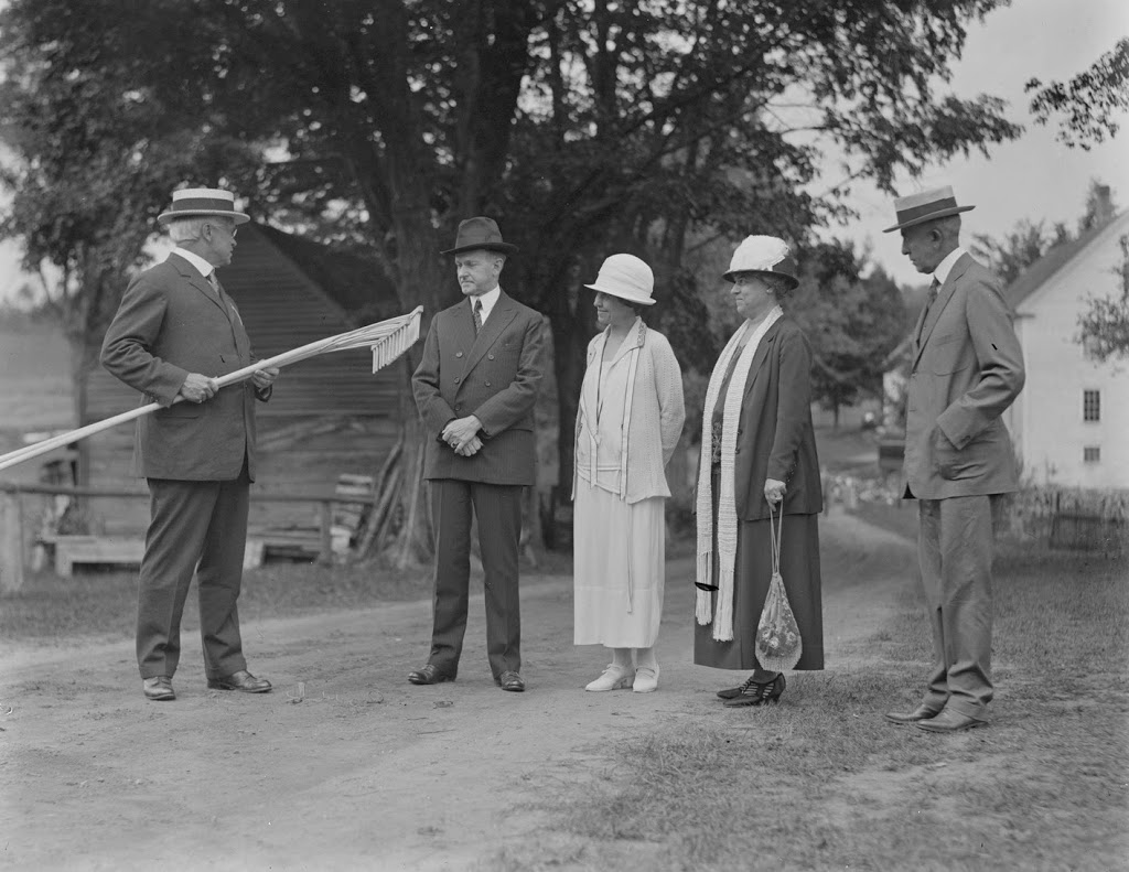
Congressman Allen T. Treadway presenting two rakes to President Calvin Coolidge at the Coolidge Homestead in Plymouth, Vermont on August 19, 1924.  Photo courtesy of Boston Public Library, Leslie Jones Collection.

434_1924-08-2Bbpl

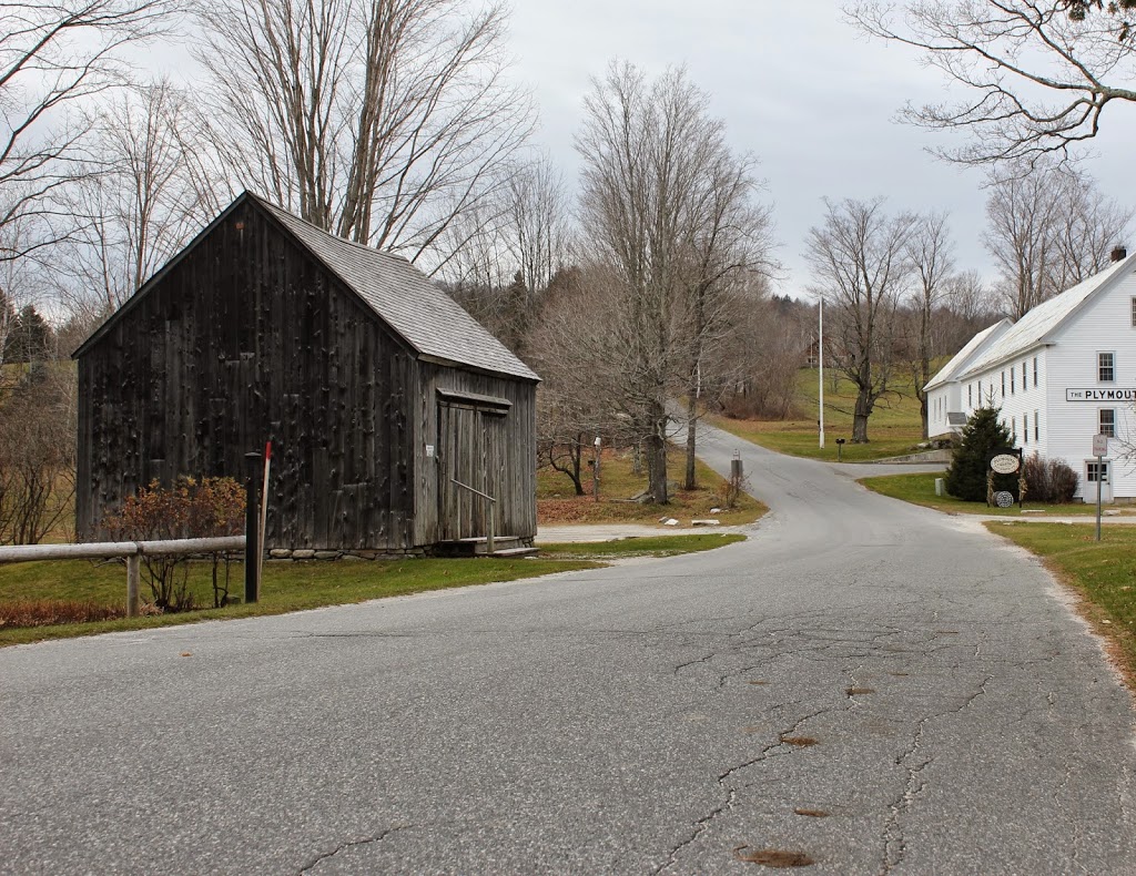
The scene in 2014:

434_2014

I’m not quite sure what’s going on in this first scene.  I understand that Congressman Allen Treadway is giving two hand-carved rakes to President Coolidge, but I’m not entirely sure why.  Film of this ceremony can be seen at the beginning of this video.

Congressman Treadway represented the First Massachusetts District from 1913 until 1945, and before that he was the President of the Massachusetts Senate from 1909-1911, three years before Coolidge himself would hold the same position.  They never actually served together in the Senate; Treadway left just before Coolidge started, but like Coolidge he was a Republican from Massachusetts and fellow graduate of Amherst College.