Sutton House, Center Harbor, NH

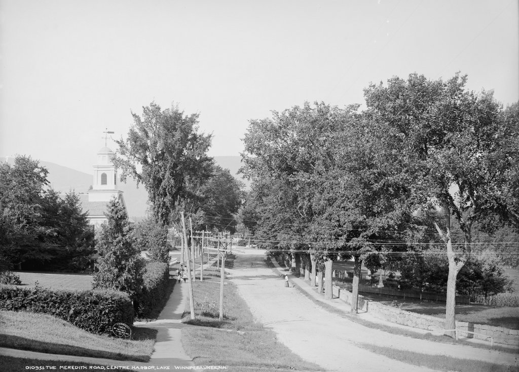
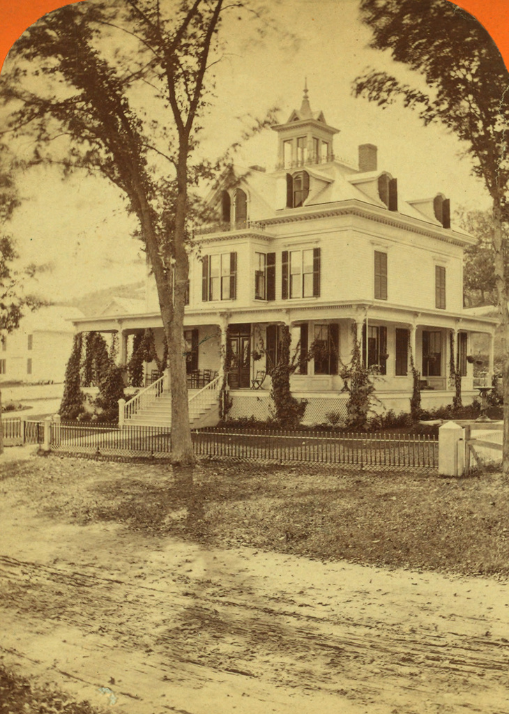
The home of Eliza Sutton in Center Harbor, around 1865-1885.  Image courtesy of the New York Public Library.
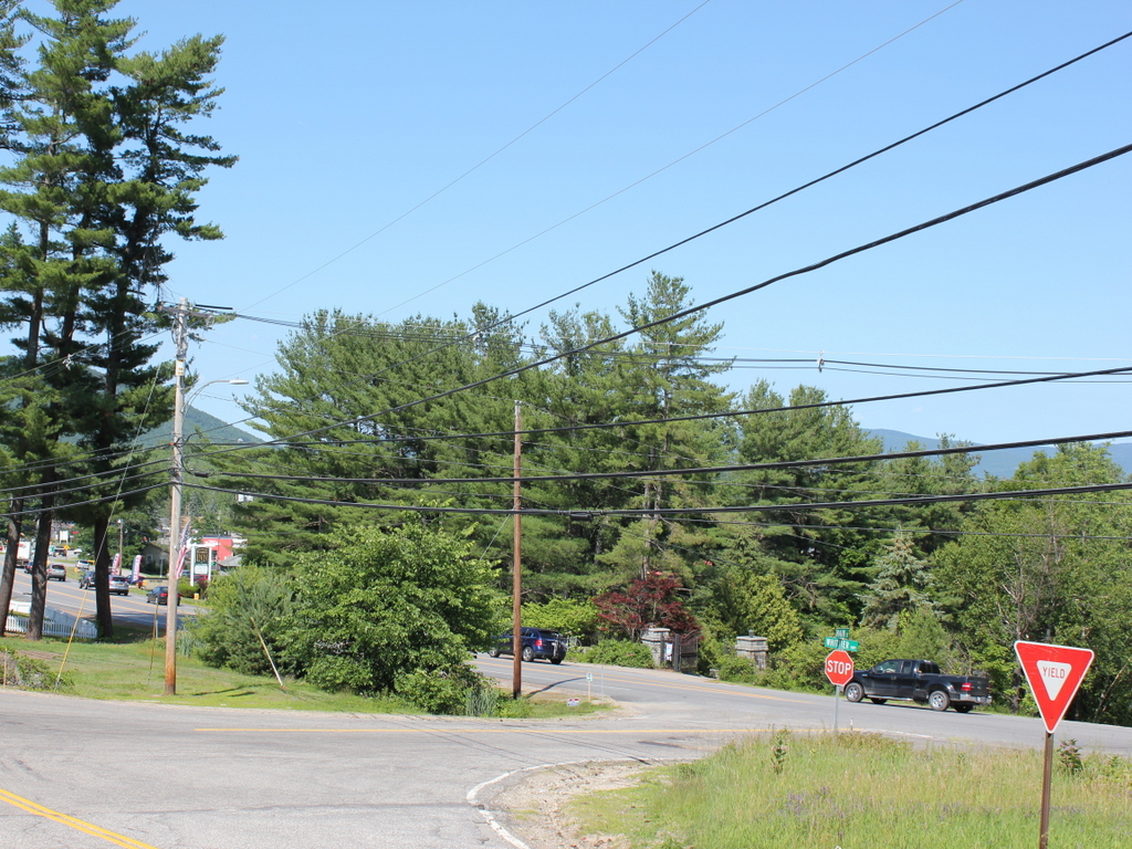
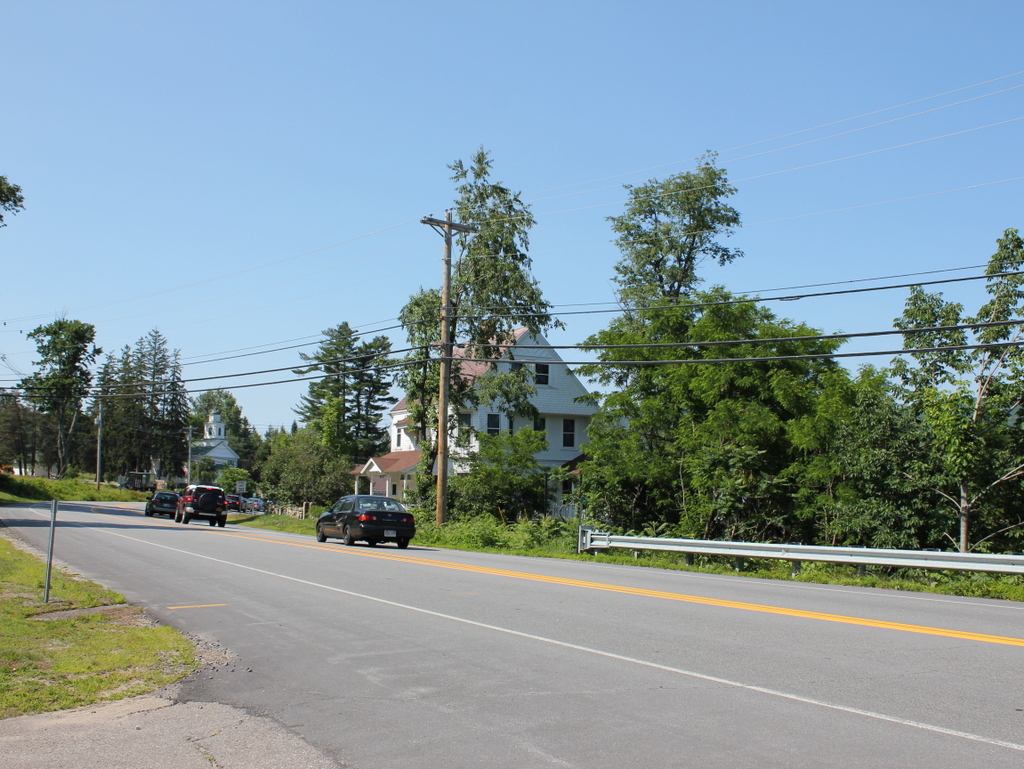
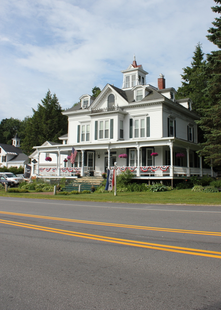
594_1863-1885c nypl charles bierstadt

The house in 2015:

594_2015
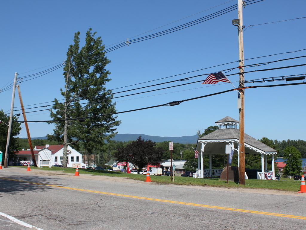
This house on the present-day Whittier Highway was built in 1865 for Eben Sutton, a wool merchant in Peabody Mass., and his wife Eliza.  Eben died before the house was finished, but Eliza lived here for 24 years.  She ran a dairy farm here, using the fields across the street as pastureland.  The photo in this post, taken about 17 years after her death, shows the view from in front of her house looking across the street.  In addition to her agricultural pursuits, she was also a philanthropist, and in 1869 she donated funds to build the Eben Dale Sutton Reference Library at the Peabody Institute Library in her hometown.

The first photo was taken during the time when Eliza Sutton lived there, and the photographer was Charles Bierstadt, a 19th century photographer who specialized in stereoscopic views.  He is probably best known, though, as the older brother of landscape artist Albert Bierstadt. Most of the younger Bierstadt’s paintings were of the American west, but he did several of the White Mountains, not too far from where his brother Charles took this photograph.

The house was damaged by a fire in 1993, but it has since been restored to its original 19th century appearance and operates as the Sutton House bed and breakfast.

Lakefront at Center Harbor, NH

Looking east toward Lake Winnipesaukee from Main Street in Center Harbor, around 1906. Image courtesy of the Library of Congress, Detroit Publishing Company Collection.

593_1906c loc

The same view in 2015:

593_2015
These photos were taken from the same spot as the ones in the previous post, just a little to the right.  The original photos were probably intended to form a panoramic view, because the right side of the other photo and the left side of this one fit together seamlessly.  Center Harbor has long been a popular vacation spot, and the 1906 photo shows cottages and boathouses along the lake.  However, it is also interesting to see corn growing on prime lakefront real estate. Today, this property has been developed, and the Whittier Highway now passes through part of the former cornfield.  The stone wall, which can be seen here and also in this post, once ran along the road for a considerable distance to the south.  Today, much of it is gone, including the section here, which was removed to build the short cross street that connects the Whittier Highway with Main Street.  Further south there are some surviving remnants of the stone wall, although the farmland that it once enclosed has long since disappeared.

Main Street, Center Harbor, NH

Looking northeast on Main Street in Center Harbor, with Red Hill in the distance, around 1906. Image courtesy of the Library of Congress, Detroit Publishing Company Collection.

592_1906c loc

Main Street in 2015:

592_2015
This scene was taken just up the road from the photos in this post; note the Center Harbor Congregational Church, which can be seen in the distance there and on the left here.  The church was built in 1838 and has stood there ever since, overlooking Lake Winnipesaukee.  The cemetery across the street is also still there, and if it wasn’t for the trees in the first photo, the Colonial Hotel would be visible beyond the cemetery on the right.  In the background of both photos is Red Hill, which rises 1500 feet above Lake Winnipesaukee and offers dramatic views of the surrounding landscape.

Over the years, the roads here have changed a bit.  In the 1906 photo, Main Street was the primary route from Meredith to Center Harbor, Moultonborough, and points north.  Today, most of this traffic travels on Route 25, which can be seen on the far right of the 2015 photo.  It is named the Whittier Highway, after poet John Greenleaf Whittier, who used to vacation in Center Harbor in the late 1800s.  Built parallel to Main Street, it cuts across the area where the Colonial Hotel once stood and allows through traffic to bypass much of the center of the village.

Center Harbor, NH

Looking north on present-day Route 25 toward Center Harbor, around 1906. Image courtesy of the Library of Congress, Detroit Publishing Company Collection.

591_1906c loc

The scene in 2015:

591_2015
As mentioned in some of the earlier Lake Winnipesaukee posts, when the first photo was taken the primary method of transportation to and around the lake was by railroad and/or steamboat.  In 1906, automobile ownership was still fairly rare, and the roads were not particularly well-suited for them, especially here in northern New England.  This road actually doesn’t look too bad, although at this point nearly all of the road traffic would have been horse-drawn carriages.  The Colonial Hotel is visible in the distance, and most of its guests would have arrived by the S.S. Mount Washington; the steamboat landing was just out of sight on the far right of the photo.

Today, the road is now Route 25, and it is a major route around the western end of Lake Winnipesaukee.  The Colonial Hotel has been gone for nearly a century, having been completely destroyed in a 1919 fire.  The house in the foreground must have been built soon after the first photo was taken, because its architectural style was common in the early 1900s.  The house and the trees now obscure the view of Red Hill from here, so only two identifiable features are visible in both photos: the Center Harbor Congregational Church, which is visible in the distance on the left, and parts of the old stone wall, which can barely be seen in the distance between the last two vehicles.

Colonial Hotel, Center Harbor, NH (2)

Another view of the Colonial Hotel, taken around 1906. Image courtesy of the Library of Congress, Detroit Publishing Company Collection.

590_1906c loc

The scene in 2015:

590_2015
As mentioned in the previous post, the Colonial Hotel was built as the Senter House around 1890, and in 1904 it was sold and renamed.  The hotel offered commanding views of Lake Winnipesaukee and the mountains beyond it, and was a popular destination in New Hampshire’s era of grand hotels in the late 19th and early 20th centuries.  However, like many of its contemporaries, the Colonial House was destroyed by a fire on June 20, 1919.  Today, Route 25 passes through part of what was once the hotel’s property, and the only structure on the site is the bandstand, seen on the far left of the 2015 photo.

Colonial Hotel, Center Harbor, NH (1)

The Colonial Hotel in Center Harbor, around 1906. Image courtesy of the Library of Congress, Detroit Publishing Company Collection.

589_1906c loc

The site in 2015:

589_2015
The northwestern half of Lake Winnipesaukee is divided into three long, narrow bays, each of which has a town center at the end.  The southwestern bay ends at Meredith, the northwestern one ends at Moultonborough, and the center one ends at the appropriately-named Center Harbor.  The town became a popular destination in the 19th century, and around 1830 the Senter House opened on the site of the present-day library.  According to an 1876 travel guide, the hotel had 150 rooms,  and offered such amenities as billiards, bowling, croquet, and “a flotilla of dainty row-boats.”  A night’s stay cost $4, compared to $3 per night at the nearby Moulton House, which didn’t have as much of a view of the lake and presumably lacked dainty rowboats for guests.

The old Senter House was replaced around 1890 with a new building directly across the street, as seen in the first photo.  It was sold in 1904 for over $30,000, and renamed the Colonial Hotel.  It lasted until 1919 when, like so many other grand hotels of its era, it was destroyed in a fire.  Today, the site of the hotel is now a rectangular plot of land between Main Street and Route 25, where the Center Harbor Bandstand is located.  From this angle, the lake is visible to the right of the bandstand, and the mountains to the north of the lake can be seen in the distance, giving some idea of what sort of view the hotel once offered to its guests.