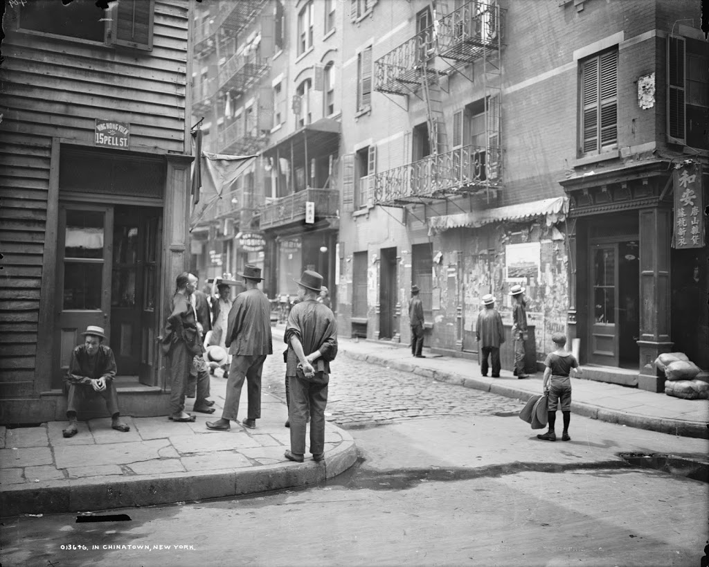
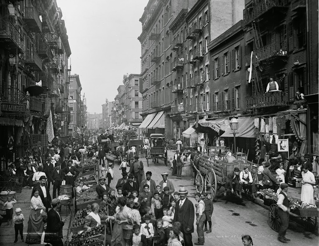
The view looking north on Mulberry Street, about half a block above Bayard Street, around 1900. Image courtesy of the Library of Congress, Detroit Publishing Company Collection.
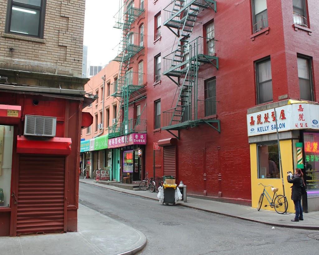
The view in 2014:
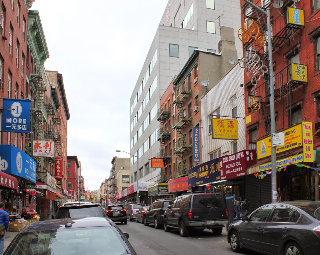
In 1900, this part of Mulberry Street was a part of Little Italy, and as evidenced by the picture was a bustling commercial center. Today, however, Little Italy has shrunk, and this block is now a part of Chinatown. Little Italy is still there – the “Little Italy” sign over the street is barely visible in the distance of the 2014 photo, across Canal Street, but it now occupies only a few blocks along Mulberry Street. This section of Mulberry Street is just a block away from the infamous Mulberry Bend, which was at the heart of the Five Points slum in the 19th century, and which author/muckraking journalist Jacob Riis described in 1896 as being “the foul core of New York’s slums.” All seems well on the outside of the 1900 photo, although I’m sure it was a different story inside many of the tenement buildings. Many of the buildings are still there – it’s tough to tell on the left side, but most of them seem to bet the same, and the first four buildings on the right all appear to be the same, although with some changes along the way.