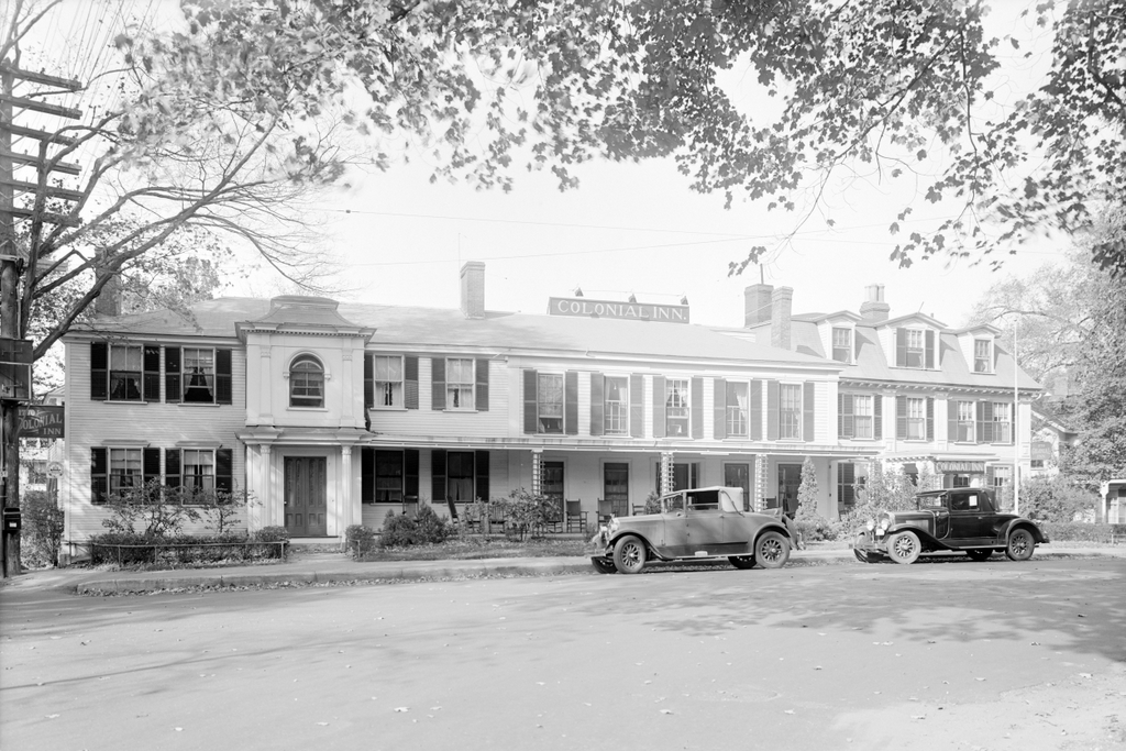
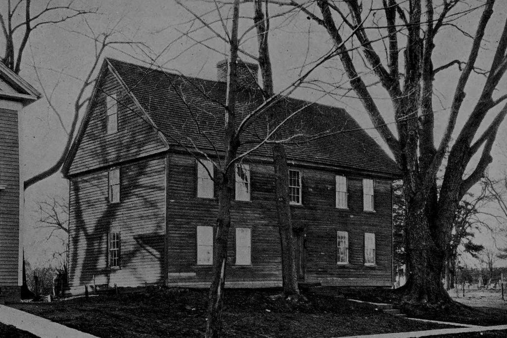
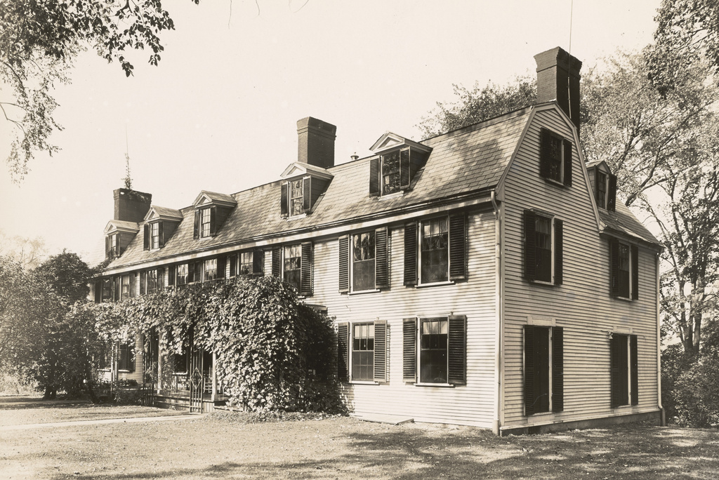
Peacefield, the former home of John Adams and John Quincy Adams, at 135 Adams Street in Quincy, on October 10, 1929. Image courtesy of the Boston Public Library, Leon Abdalian Collection.
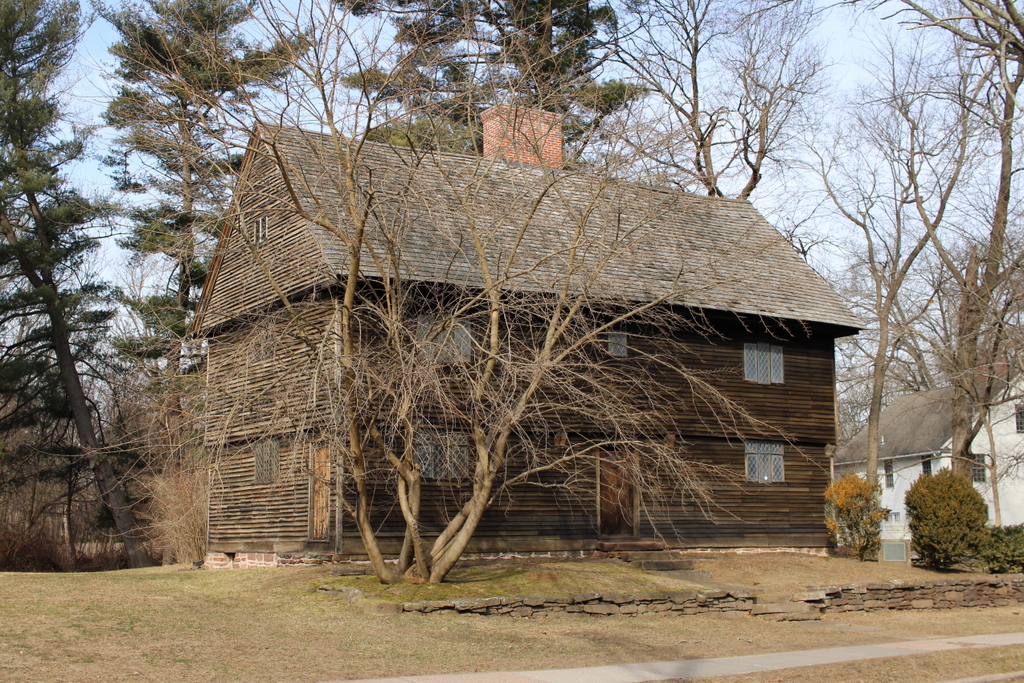
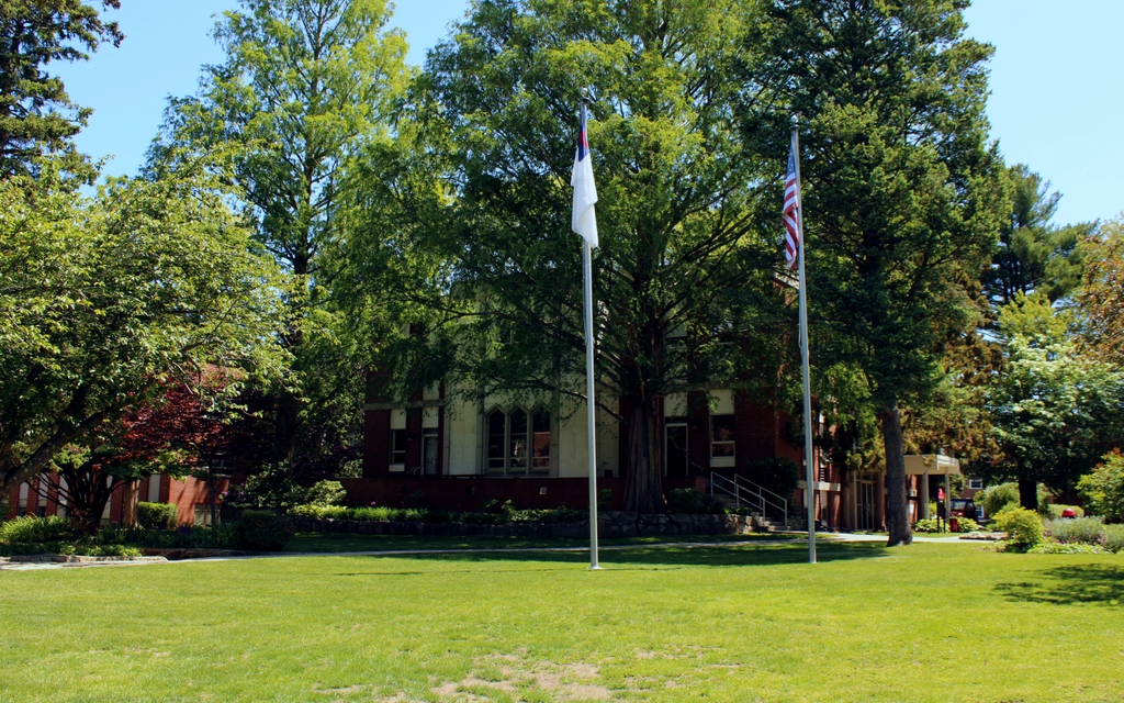
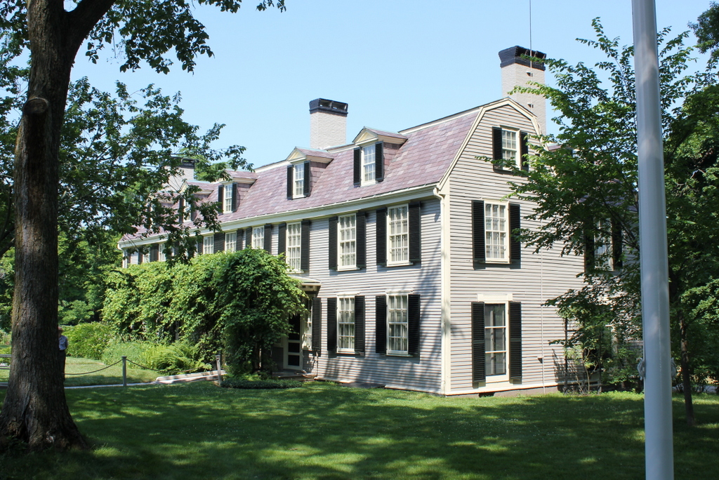
The house in 2019:
As explained in more detail in an earlier post, this house was the home of John Adams, John Quincy Adams, and several more generations of the Adams family from the late 18th century into the early 20th century. The house was built in 1731, and it was originally owned by Leonard Vassall, a sugar plantation owner from Jamaica. His daughter Anna later inherited the property, but she and her husband were Loyalists, so they fled to England at the start of the Revolution, leaving the house vacant.
This text is plagiarized from Lost New England
John and Abigail Adams purchased the house from the family in 1787. At the time, the house was much smaller, consisting of the portion on the left side in these photos. It was also in poor condition, from having sat vacant for so long. They had bought it sight-unseen, as they were living in England at the time, where John was serving as the first U.S. Minister to Great Britain. They were disappointed by the condition of the house when they returned here to live, but they soon set about repairing and expanding it. This work included a large addition on the right side, which was built in the 1790s. Abagail oversaw much of this work, since John Adams was away most of the time during the 1790s, serving as the first vice president and then as the second president of the United States.
John Adams retired from politics after losing reelection to Thomas Jefferson in 1800. He spent the last few decades of his life here at this house, which he named Peacefield. Abigail died in 1818, and John died here on July 4, 1826. In one of the most remarkable coincidences in American history, he died on the same day as his friend and political rival Jefferson, which also happened to be the 50th anniversary of the signing of the Declaration of Independence.
John Quincy Adams then inherited the house. At the time of his father’s death he was serving as president, and after losing re-election in 1828 he returned here to Quincy. However, unlike his father, he did not have a quiet retirement. Instead, he returned to politics and served in the U.S. House of Representatives from 1831 until his death in 1848. During that time, he was particularly vocal in his opposition to slavery, and became one of the leading abolitionists of his era.
During the second half of the 19th century, Peacefield was owned by several more generations of the Adams family. John Quincy Adams’s son, Charles Francis Adams, owned it until his death in 1886, and Charles’s sons Henry and Brooks subsequently inherited it. Brooks ended up being the last member of the family to live here at Peacefield, and he remained here until his death in 1927.
The top photo was taken only two years later, in 1929. By this point, the other members of the Adams family had formed the Adams Memorial Society, and this house was preserved as a museum. The property was later transferred to the National Park Service in 1946, becoming the Adams National Historic Site.
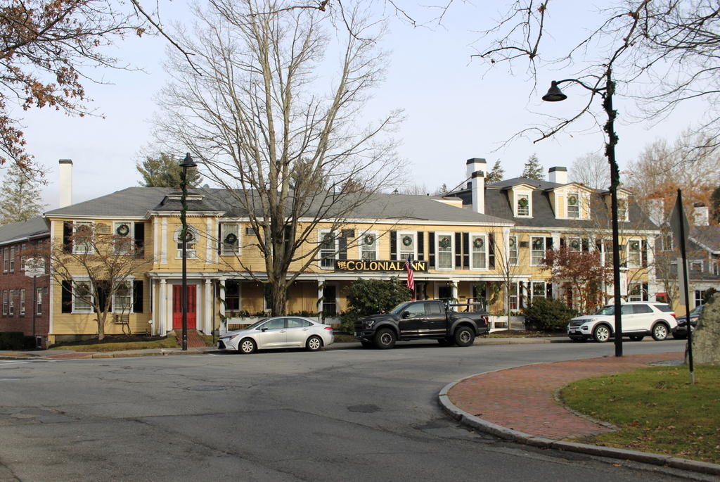
Today, the exterior of the house has seen very few changes since the top photo was taken almost a century ago. The house is still operated by the National Park Service, and it is open to the public seasonally for tours. The name of the Park Service unit is now the Adams National Historical Park, and it includes Peacefield along with the nearby birthplaces of John Adams and John Quincy Adams, which stand side-by-side on Franklin Street in Quincy.