Henchman Street, Boston

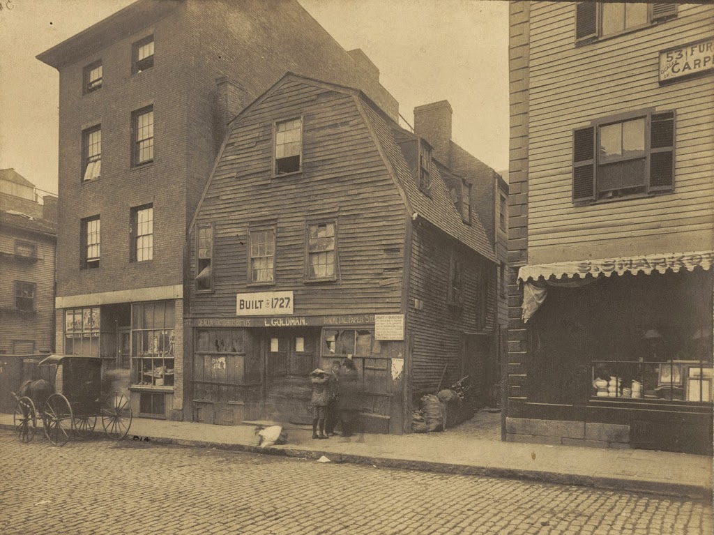
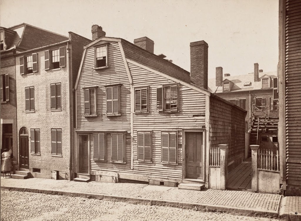
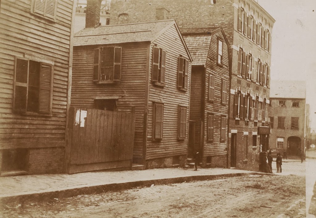
Looking down Henchman Street in Boston’s North End, toward Commercial Street, in 1893. Photo courtesy of Boston Public Library.
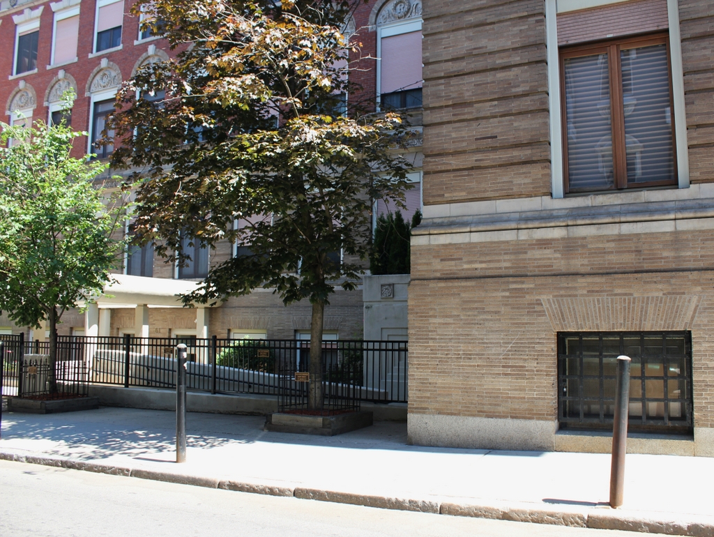
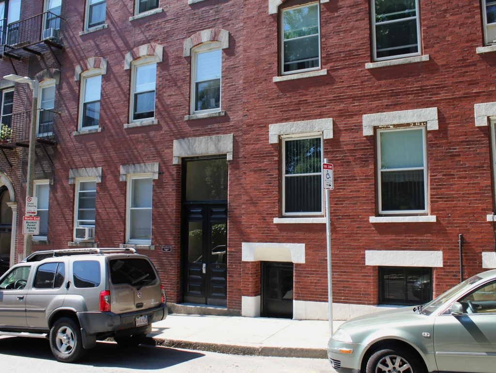
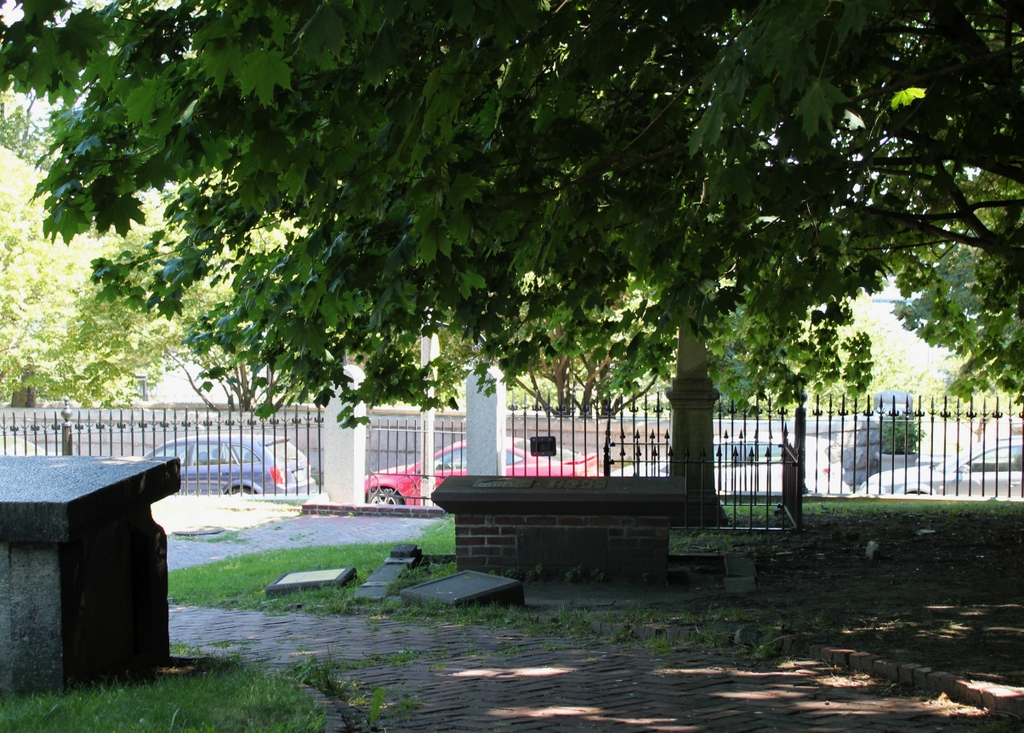
281_1893-2Bbpl

The street in 2014:

281_2014

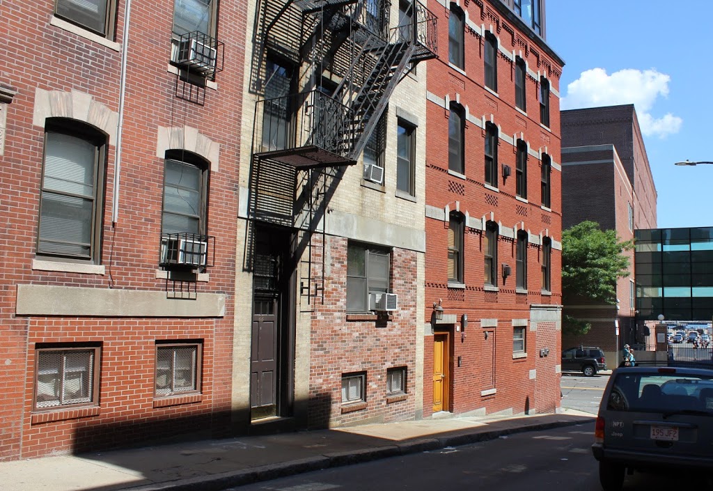
The brick building at the corner of Henchman and Commercial Streets hasn’t changed much, aside from the bricked-up storefront at the corner and a newly-added fifth floor.  The rest of the area is very different, though.  In the intervening years, the older wooden homes were replaced with early 20th century tenement buildings, and on Commercial Street the Atlantic Avenue Elevated Railway came and went.  The North End is very different today than it was 120 years ago, although much of the area retains its old street network, including the curiously-named Henchman Street, which today is a narrow one-way street connecting Charter Street with Commercial Street.  As an etymological aside, when this street was named, the word “henchman” did not carry the same negative connotations that it does today about people who carry out the bidding of an evil person.  Instead, a henchman was simply a member of a royal court – the negative usage didn’t come until the 19th century.

Thoreau House, Boston

The Thoreau House on Prince Street, near Salem Street, probably in the 1890s. Photo courtesy of Boston Public Library.

280_1898c-2Bbpl

The location in 2014:

Although most commonly associated with Concord, some of Henry David Thoreau’s family was from Boston.  This house was in his family for several generations, starting with his great-great grandfather David Orrok in 1738.  After Thoreau’s grandfather died, ownership of the house was split among the eight children, including Henry David Thoreau’s father John Thoreau, although I don’t know that he or his children ever lived here.  In any case, the house, which was built in 1727, remained in the Thoreau family until 1881, and was demolished in 1896, a year before the completion of its present-day replacement, the Paul Revere School.


Galloupe House, Boston

The Galloupe House on Hull Street in Boston, around 1898. Photo courtesy of Boston Public Library.

279_1898c-2Bbpl

The site in 2014:

Supposedly, this house on Hull Street was General Gage’s headquarters during the Battle of Bunker Hill, fought just across the Charles River from here.  The accuracy of that is somewhat questionable, but regardless, this building was very old.  It was built around 1724, and was home to a succession of owners, including several members of the Galloupe family, hence the name.  It was demolished sometime around 1905-1910, and was replaced with the present-day buildings.


Edmund Hartt House, Boston

The Edmund Hartt House on Hull Street in Boston, sometime in the 1800s. Photo courtesy of Boston Public Library.

Houses

The scene in 2014:

The house in the first photo was built sometime in the 1700s; I have seen three different accounts that give three different dates.  Regardless, it is best known as the home of Edmund Hartt, a shipbuilder whose yard constructed some of the US Navy’s first ships.  Most significantly, his yard was one of the six around the country chosen to build the first Congressional-authorized naval ships.  Completed in the late 1790s, five of the six ships are long gone, but Hartt’s work – the USS Constitution – is still around, just across the harbor from the place where his house once stood.  His house was probably demolished sometime in the first decade of the 20th century, but his gravesite can still be visited, directly across the street at Copps Hill Burying Ground.


Copp’s Hill Burying Ground, Boston (3)

Another view from Copp’s Hill Burying Ground in the North End, around the 1880s or early 1890s. Photo courtesy of Boston Public Library.

277_1898c-2Bbpl

The cemetery in 2014:

277_2014

The house in the background is the Johnson-Singleton House, and was built in the mid 1700s.  Located on Charter Street, it and the surrounding buildings were demolished in the 1890s to create Copp’s Hill Terrace, a public park between Charter Street and Commercial Street.  Boston Harbor is in the background, but it is obscured by buildings in the first photo and trees in the present-day photo; the only hint of its presence is the tip of the masts of a sailing ship in the first photo.

Copps Hill Burying Ground, Boston (2)

The view looking toward Boston Harbor and the Charlestown Navy Yard from Copp’s Hill Burying Ground in the North End, around 1898. Photo courtesy of Boston Public Library.

276_1898c-2Bbpl

The same scene in 2014:

Aside from the missing wrought-iron railing around the tomb in the foreground, not much has changed in the cemetery in the past century or so.  Even the gate and the fence around the cemetery are the same. The background is different, but it’s hard to tell with the tree blocking the view.  Most of the navy yard buildings are still there, although it is no longer an active military facility.

See this post for another scene in Boston’s second oldest cemetery.