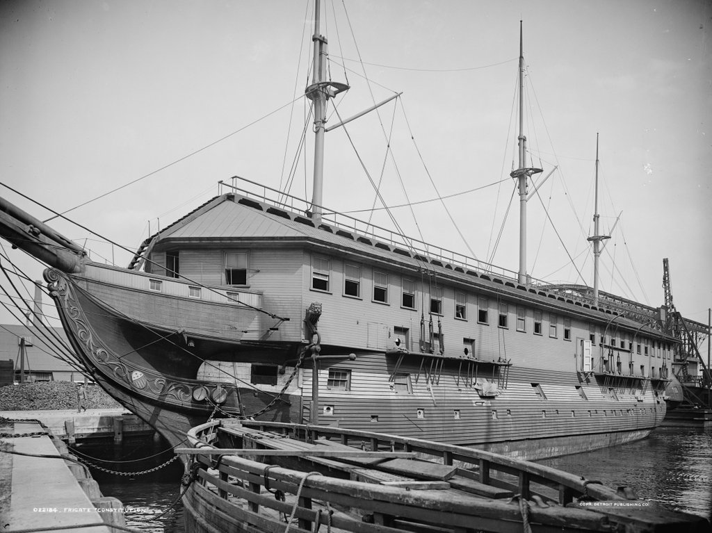
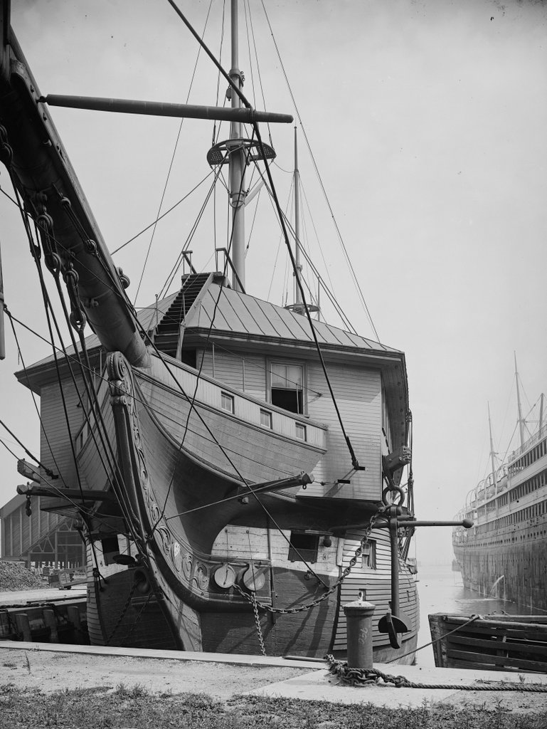
The USS Constitution at Charlestown Navy Yard in Boston, around 1905. Image courtesy of the Library of Congress, Detroit Publishing Company Collection.
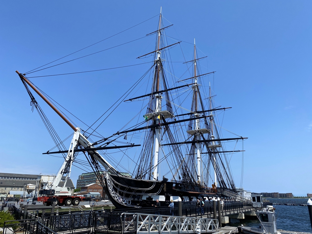
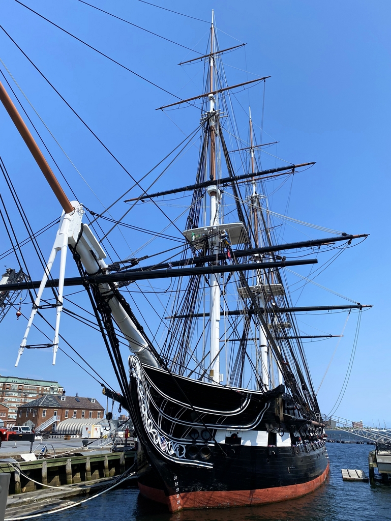
The Constitution at the same dock in 2022:
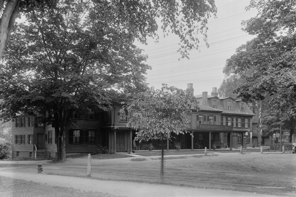
As explained in more detail in the previous post, the frigate USS Constitution has a long history with Boston, dating back to its construction in the North End in 1797. The ship served with distinction in many American conflicts, most notably in the War of 1812, when it captured or sank five British warships and earned the nickname “Old Ironsides.”
The Constitution remained in active service for nearly a century, but by the end of the 19th century it had been converted into a receiving ship, with a large barracks structure that was constructed atop its deck, as shown in the top photo. In this role, the ship served as temporary housing for new recruits and other sailors who were not currently assigned to a crew. It was in use as a receiving ship at Portsmouth Naval Shipyard in the late 19th century, before being moved to the Charlestown Navy Yard in Boston in time for its centennial in 1897.
When the top photo was taken, its future was uncertain. it was in need of major repairs, and there was a possibility that the navy might choose to sink it for target practice. However, it was ultimately restored, including the removal of the barracks, and it became a museum ship. It underwent several other major restorations over the course of the 20th century, and also embarked on a three-year tour of the country, including visiting ports along the Atlantic, Gulf, and Pacific coasts.
Another ship is also visible in the top photo, on the right side. It is the passenger liner SS Arabic of the White Star Line, the same company that would later construct the Titanic. The Arabic was built in 1903, so it was only a few years old in the top photo, providing a dramatic contrast to the Constitution. Ironically, though, despite being more than a century older, the Constitution would outlive the Arabic by more than a century. The Arabic was ultimately torpedoed and sunk by a German submarine in 1915 during World War I, in an incident that caused a diplomatic crisis similar to the sinking of the Lusitania several months earlier.
Today, the Constitution is still moored at the same dock in Charlestown Navy Yard, although it now much more closely resembles its appearance in its fighting days, when compared to its appearance in the top photo. It remains a commissioned United States warship with its own officers and crew, and it is the oldest commissioned warship afloat in the world. Only Britain’s HMS Victory is older, although it has been in drydock since 1922.