View looking north from the Mount Tom Summit House, Holyoke, Mass.

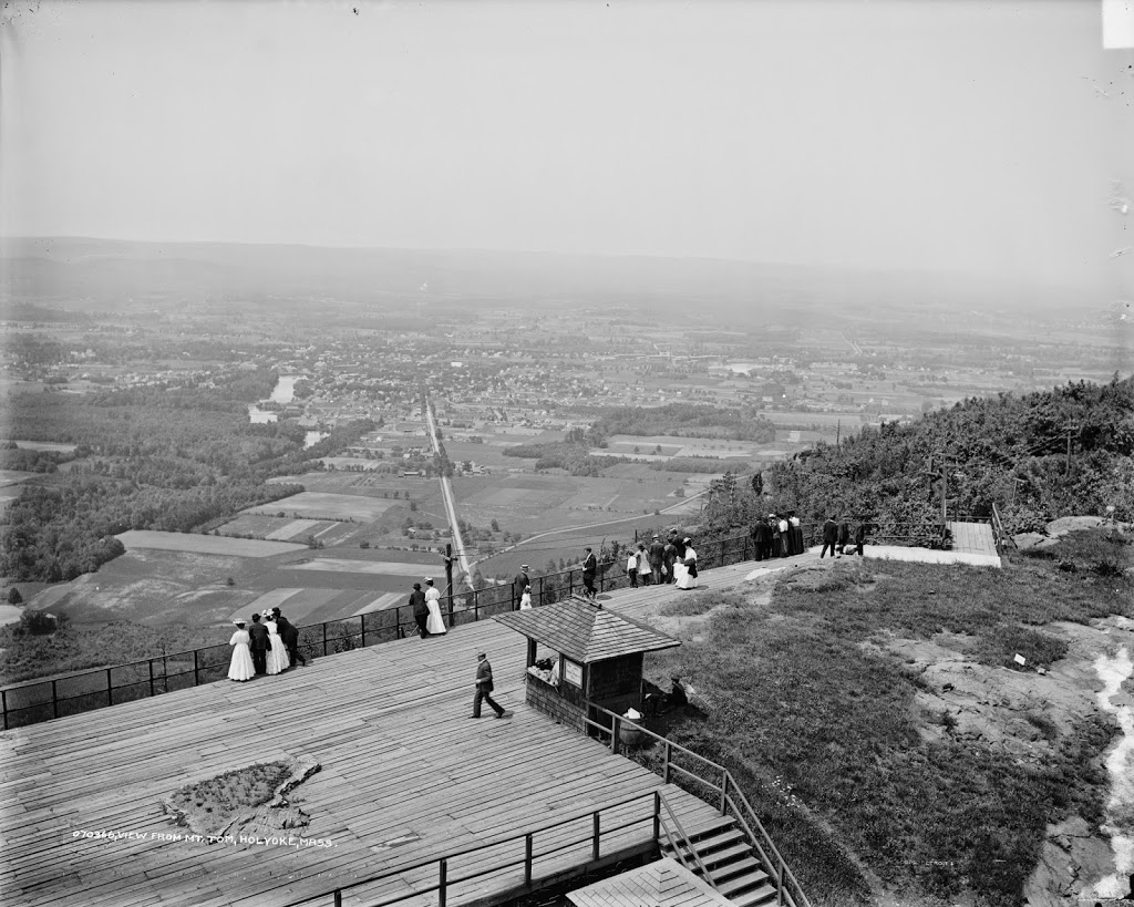
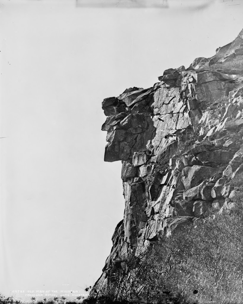
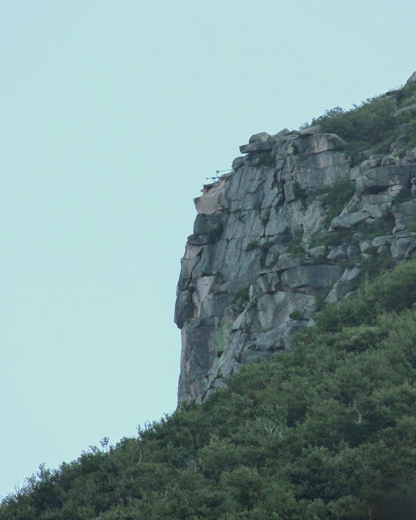
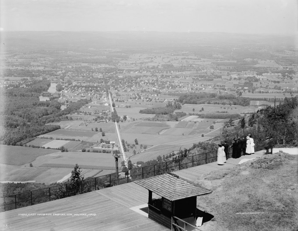
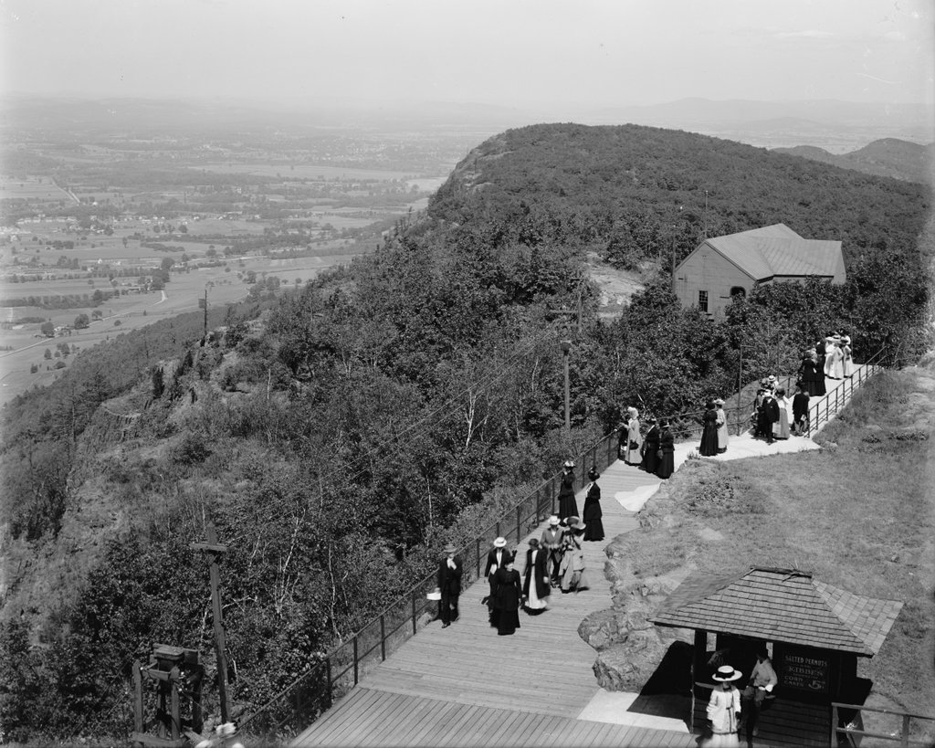
The view looking north from the Mount Tom Summit House, between 1900 and 1915. Image courtesy of the Library of Congress, Detroit Publishing Company Collection.
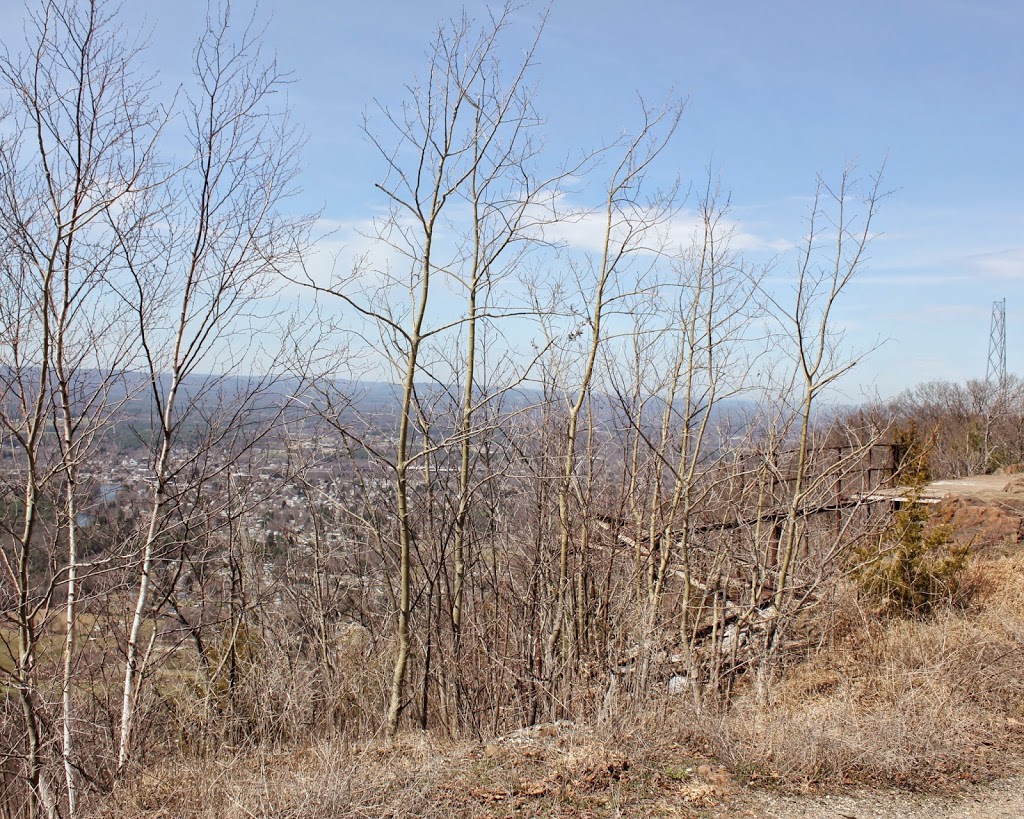
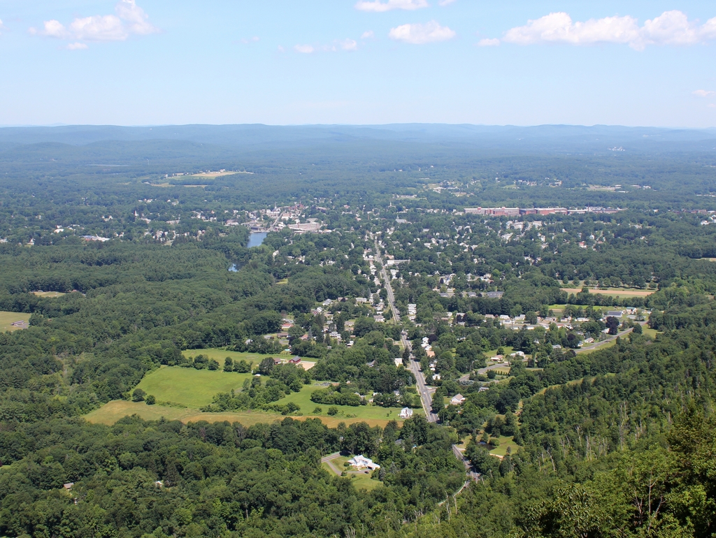
The scene in 2019:

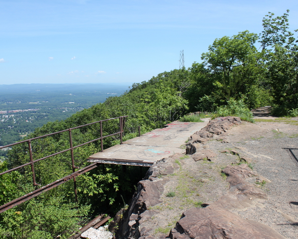
As with the previous photo, it wasn’t possible to perfectly re-create the original image, because it was taken from atop a building that no longer exists. However, the 2019 photo shows the same general view, although from ground level.  I took the photo from around the same spot as the concession stand in the lower right corner of the first photo.  According to the sign on the building, they offered “Salted Peanuts and Kibbe’s Corn Cakes” for five cents.  The building further away on the right-hand side of the photo is the upper station of the railway, which ran trolleys up and down the mountain, carrying passengers for 25 cents per ride.  The boardwalk in the first photo leads down to the station, where the people in the photo most certainly arrived at the summit – I can’t imagine any of them climbing up in such clothing.

Mount Tom Summit House View, Holyoke, Mass.

The view of Easthampton from the Summit House on Mount Tom, around 1908. Image courtesy of the Library of Congress, Detroit Publishing Company Collection.

157_1908c-loc

Approximately the same view in 2014:

157_2014

It’s almost impossible to get an identical view, because the Summit House no longer exists, and the actual site of it has radio towers that are behind fences.  However, these two photos both show the same general section of the boardwalk that once went across the summit. The 2014 photo was probably taken around the spot in the lower left of the 1908 photo where a flat rock protrudes above the boardwalk. Compare to a similar “before” view, and a 2010 view of the location.

Summit of Mt. Washington

The summit of Mt. Washington, around 1860. Photo courtesy of New York Public Library.

Mt. Washington

The summit in 2013:

086_2013

I don’t know if the two photos were taken from the same angle – it’s impossible to tell without any landmarks – but they clearly show how popular the northeast’s tallest mountain has become.  On the day that we went, there was literally a line of people waiting to ascend the pile of rocks that form the summit.  Some climbed to the top, while others took the Cog Railway or, like us, drove to he top.  If the 1860 date is correct, however, neither of these options were available to the individual standing on the top – the carriage road was not completed for another year, and the railway not until 1868.

Old Man of the Mountain

The Old Man of the Mountain, between 1890 and 1910. Image courtesy of the Library of Congress, Detroit Publishing Company Collection.

New Hampshire

The same view in 2013:

052_2013

“Discovered” by surveyors in 1805, New Hampshire’s famous rock formation lasted for almost 200 more years, before collapsing in May 2003 as a result of centuries of freezing and thawing.  Concern over the figure’s eventual collapse began even before the first photo was taken.  Frederick Wilkinson Kilbourne wrote in Chronicles of the White Mountains in 1916 that “Professor Hitchcock’s fear, expressed more than forty years ago, that, owing to the friability of the granite of which the ledges are composed and its consequent rapid disintegration, the ledges might soon disappear, has so far not been realized”  Kilbourne went on to write, “Sad will be the day (may it never come!) when that marvel of Nature shall be marred or be no longer to be seen.”

Concerns about the stability of the rocks continued through the 20th century, and in 1958 steel rods and other equipment were used in an attempt to secure the rocks.  Several of the rods are still visible at the top of the cliff.  The Old Man of the Mountain also influenced the construction of Interstate 93 through Franconia Notch; the segment of highway is one of the few two-lane Interstate highways, and was built that way partially because of concerns that construction of a wider highway could damage the rock formation.  Regardless of these efforts, though, the rocks collapsed in May 2003.

View from Summit House, Mount Tom, Holyoke, Mass.

The view of Easthampton from the Summit House atop Mount Tom, between 1905 and 1915.  Image courtesy of the Library of Congress, Detroit Publishing Company Collection.

The scene in 2019:

The Summit House no longer exists, so I wasn’t able to perfectly re-create the early 20th century photo, but the 2019 photo shows the remains of the promenade that is in the foreground of the older photo.  President William McKinley once walked along it, but now all that remains is the concrete that once supported the wooden boardwalk and the rusty metal railings that tourists once admired the view from alongside.  The Summit House from the older photo was built in 1901, replacing the 1897 structure that had burned just three years later.  The 1901 building also burned, in 1929, and the third one was closed in 1938.  The site of the summit houses is now off-limits; it is the site of numerous radio and TV antennas for the Springfield area.

Easthampton from Mount Tom, Holyoke, Mass

The view of Easthampton from Mount Tom, between 1900 and 1910.  Image courtesy of the Library of Congress, Detroit Publishing Company Collection.

The scene in 2019:

Not much has changed in Easthampton in 100 years, at least nothing that it particularly noticeable from the summit of Mount Tom. President William McKinley would’ve seen a very similar view during his visit in 1899, but another famous visitor to the mountain, Jonathan Edwards, would’ve seen a very different view in the 1730s.