
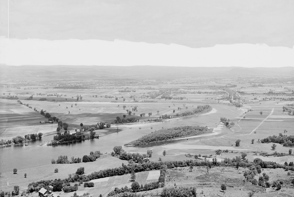
Looking north toward the Connecticut River from the summit of Mount Holyoke around 1900. Image courtesy of the Library of Congress, Detroit Publishing Company Collection.
The scene in 2015:
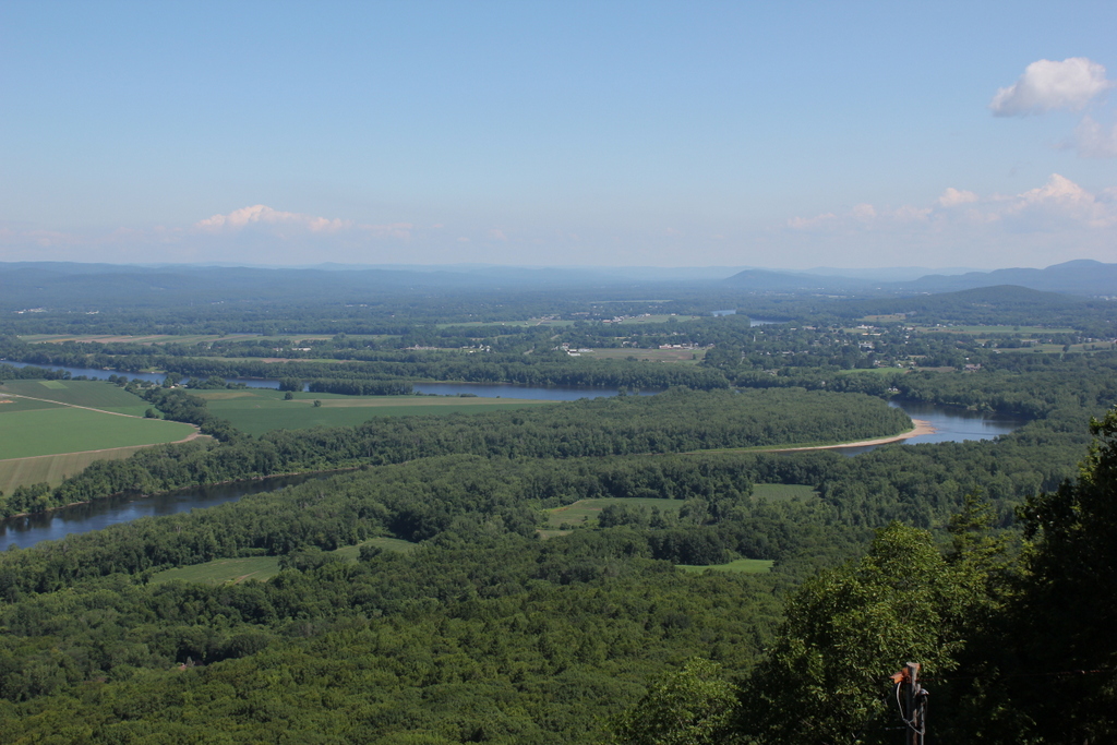
One of the things that amazes me about then and now landscapes of New England is the difference in trees. It seems counterintutitive, but in most cases the present-day scenes are substantially more forested than they were in the past. In part, this is because of agricultural changes over the past century. This section of the Connecticut River Valley has some of the best farmland in New England, and there are still plenty of active farms today, but New England’s short growing season and limited land has prevented the area from being used for large-scale farming. Today, some of the former farms have been developed into residential neighborhoods, but much of the land, especially in the floodplains along the river, has reverted to forest over the course of the past century.
Just below the forested island in the historic image you can see the small covered bridge that used to serve old Route 9. It survived the hurricanes/floods and was torched in the 1960s.