Old Hadley Cemetery, Hadley, Massachusetts

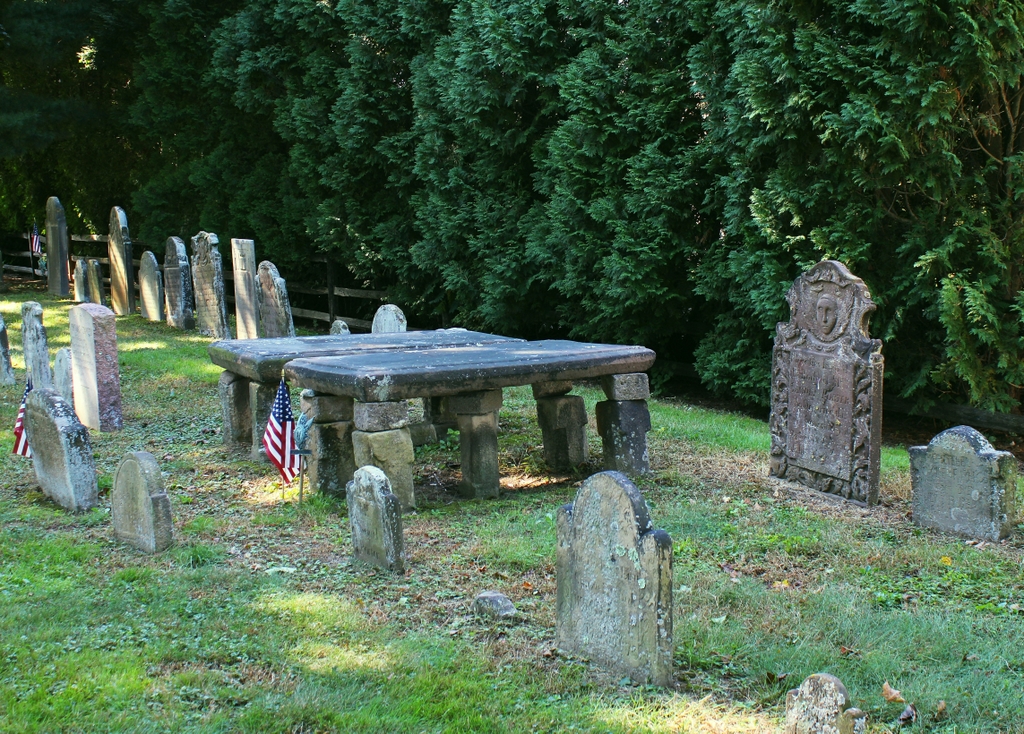
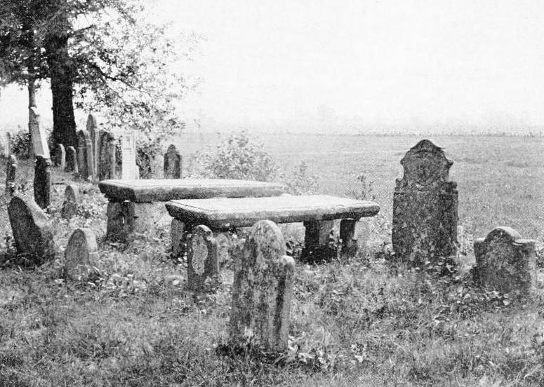
Gravestones at Old Hadley Cemetery, around 1905. Image from History of Hadley (1905).

The scene in 2021:

Hadley was settled by European colonists in 1659, and incorporated as a town in 1661. Around the same time, this burying ground was laid out in a meadow just to the northwest of the town center, with the earliest known burials dating back to 1661. Among these was John Webster (1590-1661), who had served as governor of Connecticut before relocating to Hadley. As was the case for most of the other 17th century burials here, his grave was not marked by a stone, although a monument to him was installed in the cemetery in 1818 by his great-great-great grandson Noah Webster, the famous lexicographer and dictionary author.

The earliest surviving gravestones in the cemetery are two matching tablestones for Rebecca and John Russell. They died in 1688 and 1692, respectively, and their stones were installed in 1693, although they are not visible in this particular scene. Otherwise, though, gravestones were rare here until the 1710s, when Hadley resident Joseph Nash began carving gravestones. He used tan sandstone, and his gravestones were typically small, irregularly shaped, and with crudely-cut lettering. Despite the primitive appearance of the stones, he was evidently popular because his work appears in most of the early burying grounds in the Connecticut River Valley of Massachusetts. Several of his stones are visible in this particular scene, including those of Mehetebel Marsh (1694-1739) on the far right, and Aaron Cook (1641-1716) and Sarah Cook (1644-1730) near the foreground on the far left side.

The two large tablestones in the center of this scene are for Joanna Porter (1665-1713) on the left and her husband Samuel Porter Jr. (1660-1722) on the right. Joanna was the daughter of Aaron and Sarah Cook, and she was also the mother of Mehetebel Marsh, so this was evidently their family plot. Tablestones were relatively uncommon because of the high cost, and were typically only used for clergymen and other prominent town residents. In this case, Samuel Porter was a wealthy merchant, and he also served as a representative in the colonial legislature, and as a judge and county sheriff. The Porter tablestones were not carved by Joseph Nash, as this was likely seen as too costly of a job to leave to a rather amateurish local stonecutter. Instead, these stones appear to have been carved by the Stanclift family in Middletown, Connecticut, who specialized in monuments such as these.

The Mehetebel Marsh gravestone was likely one of the last that Joseph Nash carved before his own death in 1740. By this point, gravestones in Western Massachusetts were starting to become more refined, in part because of an increased number of stones brought up the river from the skilled Middletown-area carvers. Among these was the gravestone of Samuel Porter III (1685-1748), the tall stone just to the right of the tablestones. He was the son of Samuel and Joanna, and although he died less than a decade after his sister Mehetebel, their two gravestones show the vast differences in skill level between local carvers like Nash and the professionally-trained carvers of Middletown. His gravestone was carved by the prominent Johnson family of Middletown, and its design suggests that it may have been carved somewhat later, perhaps in the 1750s or early 1760s.

The carvers from the Johnson family dominated the gravestone business along the Connecticut River Valley during the mid-1700s, but there were also some skilled local carvers who emerged in Western Massachusetts during this period. Foremost among them was Nathaniel Phelps of Northampton, who was active from the 1740s until the 1780s. Aside from Joseph Nash, perhaps no other 18th century carver is better represented here in Hadley, and one of his gravestones stands in the lower center of this scene, marking the grave of Joanna Porter’s brother Samuel Cook (1672-1746). This stone is a close imitation of the Johnson family’s style, but Phelps would subsequently develop his own style, and he occasionally carved highly ornate gravestones that featured full-body figures of angels. Among these was the gravestone of Sarah Porter (1741-1775), the wife of Samuel and Joanna’s grandson Elisha Porter. Her gravestone is visible in the background of this scene; it is the fourth one from the left in the back row.

By the early 19th century, gravestone styles had shifted away from the ornate carvings of the 18th century. Instead, these gravestones tended to either have generic designs of willows and urns, or no images at all. And, rather than sandstone, these 19th century stones were typically carved in slate or marble. Most of these burials were further to the east of the original section of the cemetery, but there are several 19th century marble stones here in the old section, including one in the back row in the distance for Nathaniel Porter (1709-1779). Although he died in 1779, the style of his gravestone suggests that it was probably carved at some point in the first half of the 1800s.

Aside from Nathaniel Porter’s backdated gravestone, perhaps the most recent gravestone in this particular scene is that of Elisha Porter (1742-1796). Like his grandfather Samuel had done many years earlier, Elisha served as sheriff of Hampshire County, and he was also a colonel in the state militia during the American Revolution. His gravestone is carved in marble, and it has a fairly plain design that is decorated only with an urn in the upper part of the stone.

More than a hundred years would pass between Porter’s burial in 1796 and when the first photo was taken at the turn of the 20th century. It is hard to say to what extent this scene changed during that time. Colonial-era burial grounds were often laid out in a somewhat haphazard manner, and during the 19th century many were rearranged into orderly rows of gravestones, often with little concern for whether the stones on the surface corresponded to the remains underground. This was often done for aesthetic reasons or to make maintenance easier, but it seems unclear whether it happened here in Hadley. However, the 18th century gravestones here are all arranged in parallel rows, suggesting that perhaps their positions may have been adjusted at some point.

Today, nearly 120 years after the first photo was taken, the background of this scene has changed significantly. Rather than the open meadows of the first photo, there is now a house directly to the west of the cemetery, with a tall hedge marking the property line. However, here in the foreground the cemetery has remained remarkably unchanged during this time. Sandstone gravestones are often vulnerable to weathering and erosion, and many in the river valley are badly deteriorated, especially those from the Middletown area. Here in Hadley, though, the stones have generally remained well-preserved, and this cemetery is one of the finest colonial-era burial grounds in Western Massachusetts.

Joseph Hooker Birthplace, Hadley, Massachusetts

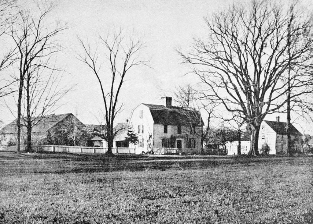
The birthplace of General Joseph Hooker on West Street in Hadley, Massachusetts, around the 1890s. Image from History of Hadley (1905).

The scene in 2021:

The house in the center of the first photo was likely built at some point during the 1700s, and it stood on the west side of West Street, just north of Cemetery Road. It is best remembered for having been the birthplace of General Joseph Hooker, who was born here on November 13, 1814. Hooker’s father, who was also named Joseph, purchased the house from the Porter family in 1805, shortly before his marriage to Mary Seymour. They had four children who were born here, including Joseph and his three older sisters: Nancy, Mary, and Sarah.

The family would only live here in this house for a few more years, before selling it in 1817 and moving to a house nearby on Middle Street, where Joseph Hooker spent much of his childhood. He attended Hopkins Academy here in Hadley, and he lived with his family in several other houses on West Street before entering West Point in 1833. He graduated in 1837, and that same year his parents left Hadley and relocated to Watertown, New York.

Upon graduating from West Point, Hooker was commissioned as a second lieutenant in the army. He served throughout the Mexican-American War, and after the war he was stationed in California. In 1853, he resigned from the army and took up farming in Sonoma County in California, and from 1859 to 1861 he served as a colonel in the California state militia.

Like many of his fellow West Point peers who had entered civilian life in the 1850s, Hooker returned to the army following the outbreak of the Civil War in 1861. He was appointed as brigadier general, and he served in the Peninsula Campaign, where he earned his nickname, “Fighting Joe Hooker.” The nickname originated because of an error in a newspaper dispatch that was intended to have read “Fighting – Joe Hooker Attacks Rebels.” However, perhaps because of his reputation for aggressive fighting on the battlefield, the name stuck with him.

Hooker would subsequently serve in the Second Battle of Bull Run, and at Antietam, where he was wounded early in the fighting. Then, in January 1863, President Lincoln appointed Hooker as commander of the Army of the Potomac, replacing General Ambrose Burnside. After the failures of both Burnside and his predecessor, George B. McClellan, Lincoln hoped that a more aggressive commander like Hooker would have greater success against Robert E. Lee. As it turned out, though, Hooker’s one major battle as commander was Chancellorsville, where he suffered a severe concussion and was ultimately defeated in one of Lee’s most decisive victories of the war.

Despite the loss, Hooker retained command of the Army of the Potomac, but he ultimately resigned in late June 1863, after a falling out between him and Lincoln. However, he remained in the army, and served with distinction in the western theater, including at the Battle of Lookout Mountain and during the Atlanta Campaign. Again, though, he had disagreements with his superiors, including General William T. Sherman, and in 1864 he was transferred to Cincinnati, where he commanded the Northern Department. He held this position until the end of the war, and he would continue to serve in the army until 1868, when he retired with the rank of major general.

Aside from his actions on the battlefield, Hooker would become the subject of an oft-repeated myth that his name was the origin of the term “hooker” for a prostitute. As the story goes, Hooker was a hard-drinking, hard-partying womanizer during the war, to the point where his prostitutes were referred to as “Hooker’s Brigade,” which became the origin of the term. In reality, while Hooker was a bachelor for most of his life including during the war, it seems unclear as to exactly what kinds of drunken debaucheries, if any, he was involved in. And, in any case, the word was being used in reference to prostitutes for at least a few decades prior to the war, although it is certainly plausible that his reputation—whether deserved or not—may have helped popularize the already-existing term.

In the meantime, Hooker’s birthplace here in Hadley changed hands several times over the course of the 19th century. His father had sold the house to John Hopkins in 1817, and it was later owned by Hiram Thayer. He died in 1854, and the house was subsequently owned by two of his sons, Ezra Thayer (1827-1895) and Chesmin Miller Thayer (1829-1882). The brothers evidently lived here together, and the 1860 census showing Ezra here with his wife Rebecca (1831-1916) and their 2-year-old son Charles (1858-1932), along with Chesmin and his wife Julia (1831-1912).

Hooker’s 1863 appointment as commander of the Army of the Potomac drew attention to the house. A February 8, 1863 article in the New York Times, which had originally appeared in the Northampton Free Press, described the house as “an old-fashioned, two-story house, with the gambrel-roof so peculiar to olden times, and altogither [sic] is a fit place for the early home of genius, whether it be an embryo Poet, President, or Major-General.”

The Thayer family would continue to live here for many years. Charles seems to have been the only child of Ezra and Rebecca, and Chesmin and Julia evidently did not have any children of their own, so the size of the family remained the same in the 1870 and 1880 censuses. Hooker apparently visited his birthplace at least once after the war, but otherwise he does not seem to have had much of a connection with his old hometown in his later years. He died on Long Island in 1879, at the age of 64, and he was buried alongside his wife in Cincinnati.

Here in Hadley, Hooker’s birthplace would find itself in the spotlight in 1895, when it became the focal point for a large reunion of soldiers from the III Corps in honor of their general. The festivities were held on May 7, 1895, starting early in the morning with a parade in Northampton. The veterans, guests, and spectators then boarded a train for Hadley, and about 3,500 people gathered here on the town common, in a tent in front of Hooker’s birthplace.

Among the many distinguished speakers at the event was General Daniel Sickles, who presented the town with a portrait of Hooker. He had served with Hooker in the III Corps and two men had been friends, but Sickles was a controversial figure whose debaucheries exceeded even Hooker’s supposed reputation. Prior to the war, Sickles had become the first person in the country to successfully use the temporary insanity defense for murder, after he killed his wife’s lover, Philip Barton Key II, the son of the Star Spangled Banner author. During the war, probably his most controversial action came at the Battle of Gettysburg, when he defied orders and moved his unit into a highly exposed position, losing his right leg in the process. Despite this, his wartime service was enough to earn him the post of U.S. Minister to Spain, which he held from 1869 to 1874. There, in addition to his diplomatic work, he also had an affair with the recently-deposed Queen Isabella II, and he then married one of her attendants, Carmina Creagh.

By the time he arrived here in Hadley for the ceremony in 1895, he was 75 years old and had been estranged from his second wife for many years. Citing his poor health, his speech was moved to an earlier spot in the program of events so that he could leave early. Notwithstanding these health issues, he spoke at length about Hooker, highlighting his military accomplishments while also defending him against accusations of drunkenness. In his address he also explained how meaningful it was to visit Hooker’s birthplace, comparing it to a visit to Napoleon’s tomb. He went on to explain:

I have never been assigned to a more pleasant duty than the one which calls me here to-day. The birthplace of the most brilliant soldier given to the late war by Massachusetts has an interest for all her citizens. To the survivors of the 3d army corps this spot has peculiar attractions. Our loyalty to the memory of Hooker is a sentiment in which affection and admiration are blended. His comrades loved him because he gave them confidence in themselves; because he hade them soldiers. They loved him because he was proud of them, and jealous of their honor and fame. We admired him as the intrepid brigade and division commander whose plume was always in the front of the battle. We admired his fearless bearing, his picturesque figure in the saddle, at the head of a column or in line of battle—the type of the soldier who shared every peril to which his command was exposed. We admired his thorough knowledge of his profession—from the duty of a soldier to the responsibility of a commander.

Aside from Sickles’s address, other speakers included state auditor and Civil war veteran John W. Kimball, Medal of Honor recipient General Henry E. Tremaine, and Worcester poet John Howard Jewett, who recited a poem for the event. Lunch came after the speeches, followed by other festivities here in Hadley, such as a concert, a cadet drill exercise, and a baseball game. Aging veterans relaxed in the shade and shared stories about General Hooker, and many people in the crowd visited his birthplace, which was decorated for the occasion.

At the time of the event, the house was still owned by the Thayer family, but neither of the brothers lived long enough to see it. Chesmin died in 1882 and Ezra in January 1895, only a few months before the Hooker celebration here. Their widows would continue to live here for a few more years, but the house was ultimately destroyed by a fire on April 6, 1898. The fire started around 3:00 p.m. in a barn on a neighboring property, and it soon spread to the Hooker birthplace. High winds, combined with a lack of sufficient firefighting equipment in Hadley, helped contribute to the spread of the fire, and several other barns and outbuildings were also destroyed.

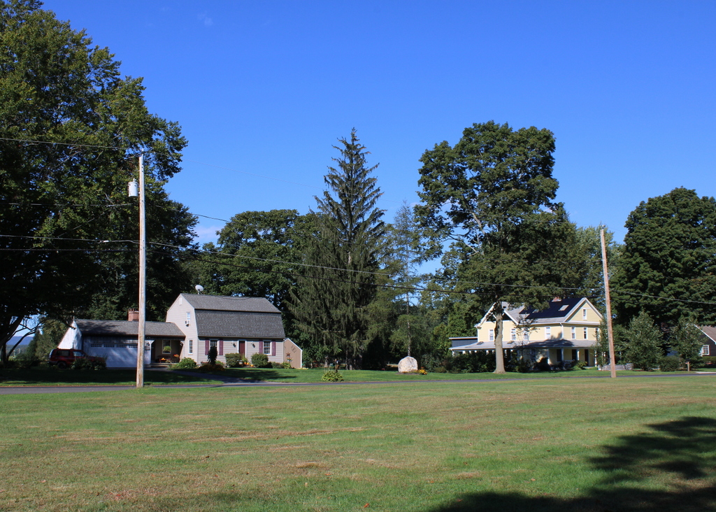
Although the Hooker birthplace is gone, its location is commemorated by a large boulder that is visible in the center of the second photo. It was installed here in 1908, and it has an inscription that reads “Birth-place of / Maj. Gen. Joseph Hooker / Born Nov. 13, 1814 / Erected by the D.A.R. / 1908.” Just to the left of the boulder is a much more modern house that now stands on the lot. Although built in the late 20th century, it has an exterior that—whether intentional or not—echoes the appearance of its predecessor here.

Middle Street, Hadley, Mass

The view looking north on Middle Street towards Russell Street in Hadley, around 1900. Image from History of Hadley (1905).

The scene in 2021:

Hadley is one of the oldest towns in western Massachusetts, having been first settled by European colonists in 1659 and incorporated as a town two years later. Its terrain is mostly flat, and it is situated on the inside of a broad curve in the Connecticut River, giving it some of the finest farmland in New England. The main settlement developed in this vicinity, with a broad town common on what is now West Street. This common was the town center during the colonial period, and it was the site of three successive meetinghouses beginning in 1670.

The third meetinghouse, which is shown here in these photos, was completed on the town common in 1808. This location was a matter of serious contention, as by the turn of the 19th century much of the town’s development had shifted east toward what is now Middle Street. Tradition ultimately prevailed, and the third meetinghouse was built on the common. However, this proved to be only temporary, because in 1841 it was relocated. The intended location was to be a compromise, located halfway between the common and Middle Street, but the movers ignored this and brought the building all the way to Middle Street, to its current location just south of Route 9.

Architecturally, this meetinghouse reflects some of the changes that were occurring in New England church designs. Prior to the late 18th century, the region’s churches tended to be plain in appearance. Many did not have steeples, and those steeples that did exist tended to rise from the ground level on the side of the building, rather than being fully incorporated into the main section of the church. This began to change with prominent architects like Charles Bulfinch, who drew inspiration from classical architecture when designing churches and other buildings. Bulfinch’s churches tended to feature a triangular pediment above the main entrance, with a steeple that rose from above the pediment, rather than from the ground.

Bulfinch does not appear to have played a hand in designing Hadley’s church, but its builder was clearly influenced by his works. It has a pediment with a steeple above it, and it also has a fanlight above the front door, and a Palladian window on the second floor. Other classically-inspired decorative elements include pilasters flanking the front entrance and dentils around the pediment. As for the steeple itself, it does not bear strong resemblance to the ones that Bulfinch designed, but the builder likely took inspiration from other 18th century New England churches. In particular, it bears a strong resemblance the steeples of churches such as Old North Church in Boston and the First Church of Christ in Wethersfield, Connecticut.

Aside from moving the church to this site, the other major event of 1841 that solidified Middle Street as the town center was the construction of a town hall here. Prior to this point, town meetings were held in the church, as was the case in most Massachusetts towns in the 18th and early 19th centuries. Massachusetts was slow to create a separation between church and state, and not until 1833 did the state outlaw the practice of taxing residents to support local churches. Here in Hadley, this soon led to a physical separation between the church and the town government, although as shown in this scene the two buildings stood side-by-side on Middle Street.

While the church features Bulfinch-inspired architecture, the design of the town hall reflects the Greek Revival style of the mid-19th century. This style was particularly popular for government and other institutional buildings of the period, as it reflected the democratic ideals of ancient Greece. The town hall is perhaps Hadley’s finest example of this style, with a large portico supported by four Doric columns, along with Doric pilasters in between the window bays on all four sides of the building.

The first photo shows Middle Street around the turn of the 20th century, looking north toward the church, the town hall, and Russell Street further in the distance. The photo also shows a house on the foreground, just to the right of the church. Based on its architecture, this house likely dated back to about the mid-18th century, but it was gone by 1903, when the current house was built on the site. This house was originally the home of Dr. Frank Smith, and it was designed by Springfield architect Guy Kirkham.

Today, the town of Hadley is significantly larger than it was when the first photo was taken more than 120 years ago. Russell Street is now Route 9, a major east-west thoroughfare that has significant commercial development thanks to Hadley’s position at the center of the Five Colleges region. Likewise, Middle Street is far from the dirt road in the first photo, and it is now Route 47. However, much of Hadley has retained its historic appearance, including its extensive farmland and its many historic buildings. Here on Middle Street, both the church and the town hall are still standing. They have seen few major exterior changes during this time, and the church is still an active congregation, while the town hall remains the seat of Hadley’s town government. Both buildings are now part of the Hadley Center Historic District, which was added to the National Register of Historic Places in 1977.

Mount Holyoke Summit, Hadley, Mass

A group of visitors sitting on the rock ledges near the summit of Mount Holyoke in Hadley, around the 1860s or 1870s. Image courtesy of the New York Public Library.

The scene in 2019:

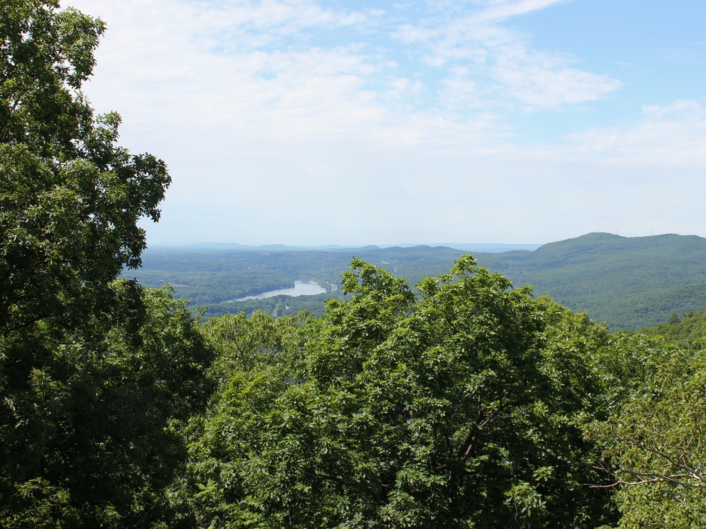
As discussed in the previous post, Mount Holyoke is a traprock mountain on the Metacomet Ridge, which runs roughly south to north from Long Island Sound to near the Massachusetts-Vermont state line. Although relatively low in elevation compared to the mountains of the nearby Berkshires, the ridge runs through the middle of the Connecticut River Valley providing dramatic views from atop the steep rocky cliffs. At 935 feet in elevation, Mount Holyoke is a few hundred feet lower than the highest peaks on the ridge, but it offers perhaps the most impressive views of any mountaintop in southern New England. Here, the Connecticut River flows through a narrow gap between Mount Holyoke to the east and Mount Nonotuck to the west, and the river is visible for miles in both directions.

The river takes a meandering course through the flat river valley to the north of Mount Holyoke. The most famous of these meanders is the Oxbow, a three-mile-long U-shaped bend in the river at the base of the mountain. This prominent natural feature was the focal point of Thomas Cole’s 1836 painting The Oxbow, which portrays the scene from near this spot at the summit. His work went on to become one of the most important 19th century American landscape paintings, but the actual view here from Mount Holyoke changed dramatically only a few years later. In 1840, a flood cut through the narrow neck of land in the middle of the bend, and the main current of the river shifted to the new shorter route, turning the Oxbow into a side channel.

The first photo was taken only a few decades later, and it shows the wide river passing through the lower right side of the scene, with the circular Oxbow beyond it in the distance. By this point, Mount Holyoke was a popular destination for visitors, including the well-dressed group of women sitting on the rocks in the foreground. Directly behind them, barely visible on the far left side, is the corner of the Summit House, also known as the Prospect House. This hotel was built in 1851, replacing an earlier building on the site, and it provided accommodations and refreshments for guests who either hiked up or took the inclined railway to the summit. The man in the center of the photo could very well be hotel owner John French or one of his employees, as the hotel provided telescopes for mountaintop visitors.

The hotel steadily expanded during the second half of the 19th century, and at some point a porch was added to the northern side of the building, as shown in the present-day photo. However, by the early 20th century mountaintop hotels had passed their heyday. Thanks to modernization efforts of Holyoke silk manufacturer Joseph Skinner, the Summit House remained viable for many years, but it ultimately closed after sustaining heavy damage in the 1938 hurricane. A large wing of the building, which had been added in 1894, was demolished after the hurricane, and in 1939 the property was donated to the state, becoming the Joseph Allen Skinner State Park.

Today, this scene at the summit of Mount Holyoke is still easily recognizable from the first photo, despite a conspicuous lack of women in hoop dresses. The Summit House is still standing, after having been restored in the 1980s, and it is now open seasonally as a museum. Further in the distance, the Oxbow is still there, although somewhat less prominent than in the first photo.

Part of the reason for this might be because of the increased tree growth along its banks, but also because the Oxbow has been heavily altered in the 20th century. It is now closed off from the upstream side, with only a narrow channel on the downstream side to link it to the Connecticut River. Along with this, Interstate 91 now passes directly over it, and a large chunk of the land inside the curve has been carved out to create a marina. As a result, it bears little resemblance to the undisturbed natural feature that Cole painted nearly 200 years ago, but it remains an important landmark that has long been associated with this view from Mount Holyoke.

Connecticut River and Mount Tom from Mount Holyoke, Hadley, Mass

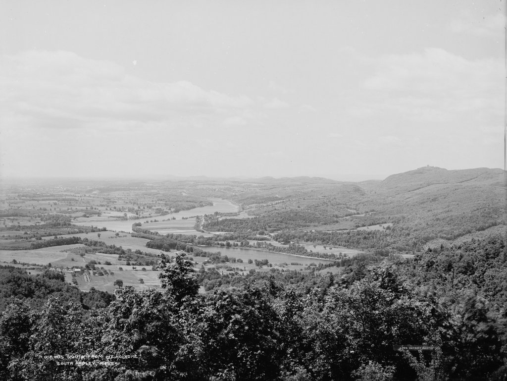
The view looking south from the Mount Holyoke Summit House in Hadley, around 1900. Image courtesy of the Library of Congress, Detroit Publishing Company Collection.

The scene in 2019

One of the most important geological features in the Connecticut River Valley is the Metacomet Ridge, a long narrow traprock formation that runs roughly parallel to the river. It passes through central Connecticut and western Massachusetts, running from Long Island Sound to just south of the Vermont border. Its peaks are relatively low in elevation compared to the mountains of the Berkshires further west, with few reaching above a thousand feet, but the ridge stands out in the landscape because it rises so high above the surrounding low-lying river valley.

Because of this prominence, the Metacomet Ridge offers expansive views from atop its steep traprock ledges. However, perhaps none of these views are as celebrated as those from Mount Holyoke, which sits on the border of Hadley and South Hadley, Massachusetts. The 935-foot mountain is in the middle of a ten mile section that features some of the highest elevations of the entire ridgeline. This section is bookended by the two highest peaks of the Metacomet Ridge, with the 1,200-foot Mount Tom at the southern end and the 1,106-foot Mount Norwottuck to the east.

Although Mount Holyoke is comparatively lower in elevation, it has a unique position. Here, the ridge takes a sharp 90-degree turn across the Connecticut River, forming two perpendicular ranges bisected by the river. Mount Holyoke is located directly east of the river, so the top of the mountain provides dramatic views of the river as it winds its way through the surrounding farmland. Most famously, these scenes inspired 19th century artist Thomas Cole to paint The Oxbow, one of the most iconic landscape paintings in the history of American art.

The view captured in The Oxbow is not the same direction as the two photos shown here in this post. Cole’s painting faces almost due west, while these two photos were taken facing south, looking downstream on the river with the city of Holyoke in the distance on the left and Mount Holyoke on the right. Unlike the views to the west or north from the summit, this southern view is not nearly as celebrated in paintings or photographs. Part of this might be because the viewer is typically facing into the sun in this direction, creating a backlit scene. Another reason might be because the mountain has a much more gradual southern slope, so the landscape seems more distant when compared to the views from atop the steep northern and western cliffs.

Either way, the scene in the first photo shows some interesting contrasts. The jagged spine of the Metacomet Ridge runs across the horizon of the photo, parallel to the gently curving Connecticut River in the center of the scene. Further to the left, the prosperous industrial city of Holyoke in the distance contrasts with the open fields and scattered farmhouses of the foreground. The view is somewhat different in the present-day scene, as the trees now obscure most of the foreground, but both the river and the ridgeline remain dominant features in the landscape.

Both of these photos were taken from the porch of the Summit House, which was built in 1851 and expanded several times in the second half of the 19th century. At the time, mountaintop resorts were particularly popular, and the Summit House here on Mount Holyoke was just one of three in the vicinity; the others included the Eyrie House atop Mount Nonotuck, and the Summit House on Mount Tom, which is visible in the distance on the right side of the first photo.

It is difficult to tell, but the Mount Tom building in the photo appears to have been the first of three successive ones at the summit. This one burned in 1900, probably soon after the photo was taken, and it was subsequently rebuilt twice in the early 20th century. The Eyrie House likewise burned in 1901 and was never rebuilt, yet the Mount Holyoke hotel has managed to avoid such a fate, and the building is still standing today as a museum.

More than a century after the first photo was taken, and nearly two centuries after Thomas Cole made the mountain famous, much has changed in the view from Mount Holyoke. The land is actually far more forested now than it was at the turn of the 20th century, so in some ways there are actually fewer obvious signs of human development. However, the abundance of trees also makes very clear the swath that Interstate 91 cuts across the modern-day landscape, about halfway between the river and the mountains.

Despite these changes, though, the view from Mount Holyoke remains perhaps the most impressive landscape view in southern New England. Although overnight guests no longer stay at the Summit House, the mountain remains a popular destination, with visitors driving up the auto road or climbing the relatively short hike from the base. In 1939, the summit and the surrounding land became the Joseph Allen Skinner State Park, after its namesake donated the land to the state. Much of the remaining land along the Holyoke and Mount Tom ranges has similarly been preserved, and the area affords some of the best hiking and other outdoor recreation opportunities in the Connecticut River Valley.

Mount Holyoke Summit House and Inclined Railway, Hadley, Massachusetts

The inclined railway leading up to the Summit House on Mount Holyoke, around 1867 to 1885. Image courtesy of the New York Public Library.

The scene in 2019:

As discussed in the previous post, the summit of Mount Holyoke was the site of one of the first mountaintop hotels in the United States. At just 935 feet in elevation, it is not a particularly tall mountain, yet it rises high above the surrounding landscape in the otherwise low, flat Connecticut River valley. It is part of the Holyoke Range, a narrow ridgeline that runs east to west for about eight miles. This, in turn, is a sub-range within the much longer Metacomet Ridge, a traprock ridge that extends from Long Island Sound in Connecticut to just south of the Massachusetts-Vermont border.

Mount Holyoke is not the highest peak in the Holyoke Range, as it stands nearly 200 feet lower than Mount Norwottuck. However, it forms the western end of the ridge, with the Connecticut River passing through a narrow gap between Mount Holyoke and the Mount Tom Range. This prominent location makes it a major landmark for travelers in the river valley, and it also means that the summit has nearly 360-degree views of the surrounding landscape.

The combination of dramatic views and proximity to large large population centers made Mount Holyoke a popular destination in the 19th century, and the first building at the summit was built in 1821. In the spirit of a traditional barn raising, it was built with the help of nearly 200 townspeople who climbed to the summit to lend a hand. Consuming, as one 19th century account described it, “a little water with a good deal of brandy in it,” the group completed the summit house in just two days. It was a modest structure, measuring just 18 by 24 feet, but it was dedicated with much fanfare, including a speech by Northampton native and U. S. Senator Elijah H. Mills.

This first building was soon joined by a rival establishment nearby, but the two buildings were consolidated under the same ownership in 1825. The business operated here for several more decades, and during this time the view from the top of the mountain was made famous by Thomas Cole’s 1836 painting The Oxbow, long regarded as a masterpiece of 19th century American landscapes.

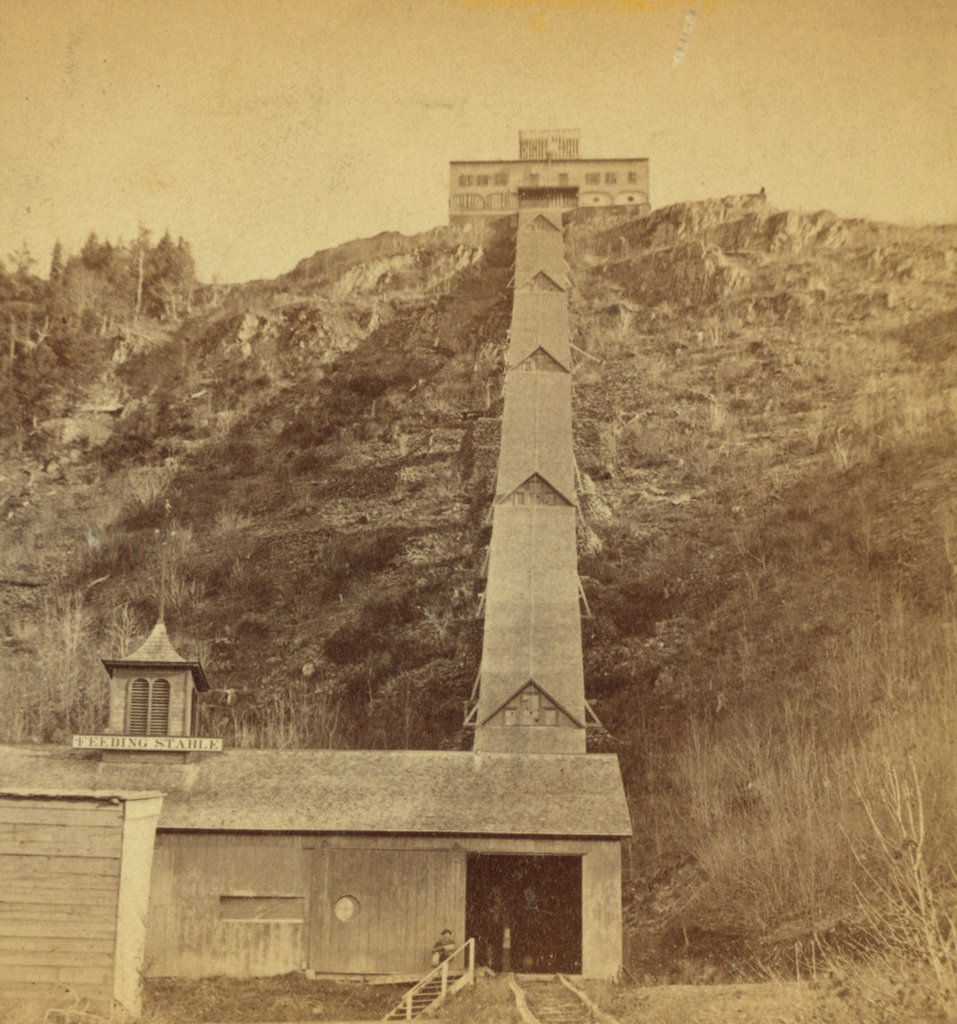
However, despite the mountain’s growing popularity, the accommodations at the summit remained primitive until mid-century. This began to change in 1849, when Northampton bookbinder John French and his wife Frances purchased the property. They soon began making improvements, most significantly a new hotel at the summit, which was completed in 1851. It was named the Prospect House, and it had two stories, with a dining room, sitting room, and office on the first floor, and six guest rooms on the second floor. Above the second floor was a cupola, which was equipped with a telescope. The hotel was later expanded several times, but this original 1851 structure still survives as part of the present-day building.

In addition to constructing a more substantial building, French also improved access to the summit. Prior to his ownership, it was relatively easy to reach the spot where these two photos were taken, whether on foot or by carriage. In terms of elevation, this spot is more than halfway up the mountain, but from here the slope becomes significantly steeper, as is made particularly evident in the first photo. The only options for visitors during the first half of the 19th century were either to take the long, winding, narrow carriage road to the summit, or hike the short but steep path up the mountainside, gaining over 350 feet in elevation in just 600 horizontal feet.

Neither option was ideal for most visitors, and the situation also made it difficult for French to bring supplies up the mountain. Even water had to be either carted or carried up to the summit, requiring him to sell it for around three to five cents per glass, or about $1.00 to $1.50 today. However, in 1854 he solved both problems with the construction of an inclined railway. It began here at this spot, next to French’s residence, which was known as the Halfway House, and it rose to the top of the mountain. It was originally powered by a stationary horse here at the base, although in 1856 French switched to steam power. The railway itself was rebuilt several times, but it had largely assumed its final form by 1867, as shown in the first photo. By then, the railway had two tracks, was completely enclosed, and brought its passengers directly into the basement of the hotel.

In the meantime, the hotel also grew, with the first major addition coming in 1861, when it was expanded to ten rooms. Then, in 1871 French sold the property to South Hadley businessman John Dwight. However, John and Frances French remained here to manage the hotel, and they continued in that role until their deaths in the 1890s. Then, the hotel was expanded even further in 1894, with the addition of a large wing on the south side of the building. This increased the hotel’s capacity to 40 guests, along with a dining room that could seat 200 people.

By then, the hotel had several local competitors on the nearby Mount Tom Range, with the Eyrie House atop Mount Nonotuck, and the Summit House on Mount Tom. However, both of these were plagued by fires, which was a constant danger for wood-frame buildings on isolated mountaintops. The Eyrie House, built in 1861 and later expanded, burned in 1901, and the same fire also destroyed the partially-built structure of what would have been a new hotel. The Summit House on Mount Tom faced similar problems, with the original 1897 one burning in 1900, and its replacement suffering the same fate in 1929.

However, although older than the other nearby summit houses and built of similar materials, the hotel here on Mount Holyoke managed to avoid catastrophic fires. It faced different challenges, though, most significantly the declining popularity of mountaintop hotels in general. John Dwight died in 1903, the property was subsequently acquired by a group of prominent locals, including Holyoke silk manufacturer Joseph Skinner. The new owners made significant improvements, including electricity and modern plumbing. The railway was also electrified, and the first automobile road to the summit opened in 1908.

Skinner would ultimately acquire full ownership of the hotel, and he continued to modernize it throughout the early 20th century. It continued to face challenges though, particularly with the onset of the Great Depression, but the hotel was ultimately closed after the September 1938 hurricane. The older section of the building survived, but the storm destroyed the large 1894 addition. A year later Skinner donated the property to the state, and it became the Joseph Allen Skinner State Park.

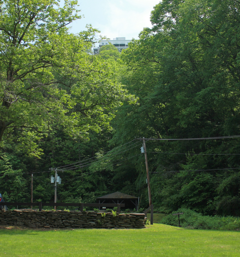
Both the hotel and the inclined railway deteriorated after the park was established, and much of the roof over the railway was destroyed in a heavy snowstorm in 1948. The remains of the railway were removed in 1965, and the hotel itself was also threatened with demolition around this time. Despite many years of neglect, though, the building was ultimately restored in the 1980s, and it is now a museum.

Today, nearly all of the historic 19th century mountaintop hotels in the northeast are gone, most having been lost to fire, neglect, or both. However, the Summit House on Mount Holyoke is still standing as one of the few surviving examples. This scene has changed considerably since the first photo was taken around 150 years ago, including the loss of the railway and the significant tree growth on the previously bare slopes, but the Summit House is still visible from this spot.