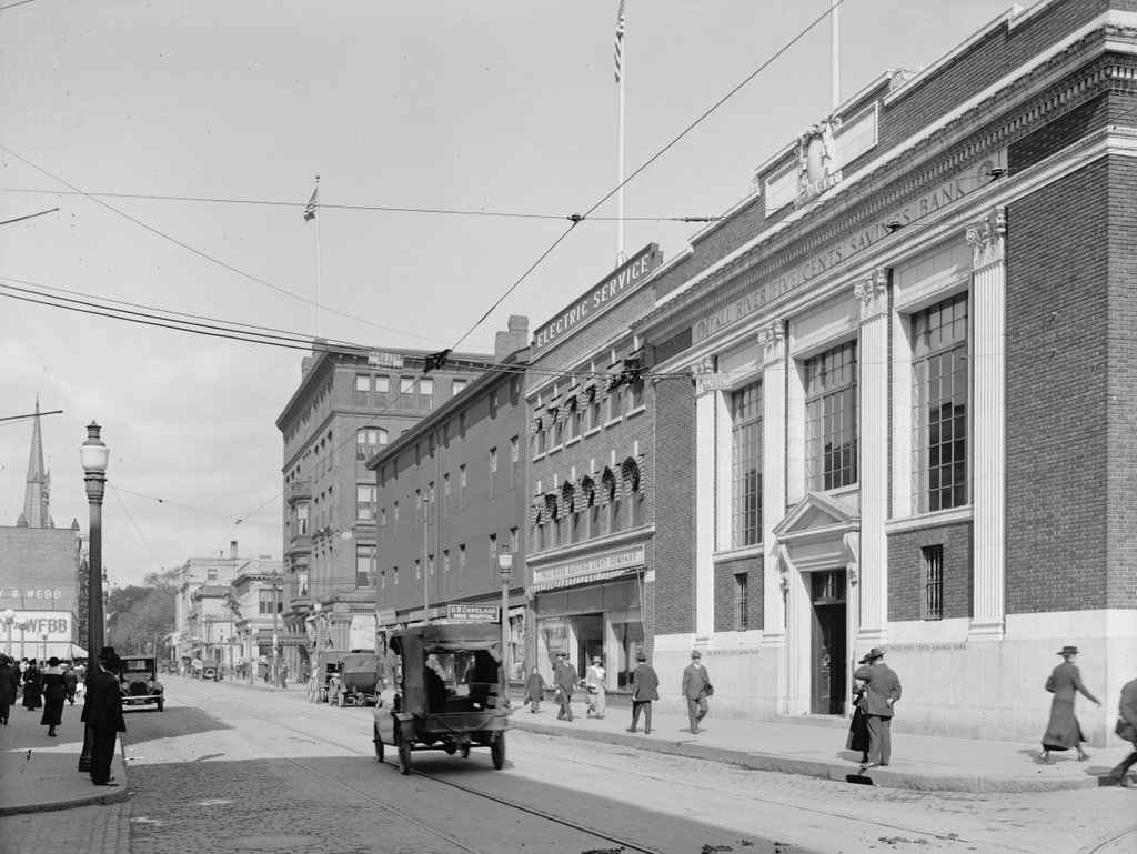
North Main Street, Fall River, Mass

Looking north on North Main Street from the corner of Bank Street in Fall River, around 1914-1920. Image courtesy of the Library of Congress, Detroit Publishing Company Collection.

The scene in 2020:

Throughout the 19th century, Fall River was a prosperous textile manufacturing center. The city saw dramatic population growth during this time, particularly in the post-Civil War period. Between 1860 and 1900, the city grew nearly eightfold, from 14,000 to nearly 105,000, and by the turn of the century it was the third-largest city in Massachusetts, behind only Boston and Worcester.

However, the same textile industry that had brought such prosperity also led to the city’s decline, as mills closed and businesses relocated to the south starting in the 1920s. This, combined with a catastrophic fire that destroyed much of the downtown area in 1928, both hurt the local economy, and these problems were only exacerbated by the stock market crash at the end of the decade.

The first photo was taken in the final years of the textile industry’s heyday in Fall River, probably sometime between 1914 and 1920. The earliest possible date is 1914, when the Fall River Five Cents Savings Bank building was built on the far right side of the scene, at the corner of North Main and Bank Streets. The neighboring building to the left of it was also built in 1914, and in the first photo it was occupied by the Fall River Electric Light Company.

Just beyond the electric company building is the Mount Hope Block, which was perhaps the oldest building in the first photo. It was built in 1845, in the aftermath of a large fire two years earlier, and it was originally known as the Mount Hope House. At the time, it was one of two hotels in Fall River, and in 1847 a state gazetteer declared that “in the erection and furnishing no pains have been spared to make it a desirable place for any one disposed to spend a few days.” Later in the 19th century it was known as the Narragansett Hotel, and by the early 20th century it was the Evans House. The building initially occupied the entire length of the block between Bank and Franklin Streets, but the southern portion was demolished to build the bank and the electric company buildings, leaving only the northern half as shown in the first photo.

Beyond the Mount Hope Block, on the other side of Franklin Street, the largest building in the first photo is the Hotel Mellen. It opened in 1888, and was the city’s finest hotel throughout the first half of the 20th century. The building survived the 1928 fire, but it was subsequently gutted by a fire in 1943, leaving only the brick walls still standing. The hotel was rebuilt inside the brick shell of the old building, although the new one was six stories in height, rather than five.

Today, more than a century after the first photo was taken, there is very little that survives from the first photo, especially in the foreground. The bank is still standing at the corner, but the former electric company building and the Mount Hope Block are both gone. Both of these buildings were here when the Downtown Fall River Historic District was created in 1983, but they were demolished at some point after that, and the site is now occupied by a large wing of the bank building. This facility still serves as the main offices of the Fall River Five Cents Savings Bank, which is now branded as BankFive.

Further in the distance, the reconstructed Hotel Mellen is also gone. The hotel closed around the early 1960s, and the building was converted into a temporary city hall after the old city hall building was demolished to build Interstate 195. The current Brutalist-style city hall was completed in 1976, and the old hotel was then demolished soon after. Beyond the Hotel Mellen, there are several surviving buildings from the first photo, but for the most part this side of North Main Street has undergone signficiant changes, unlike the right-hand side of the street, which has been better-preserved over the years.

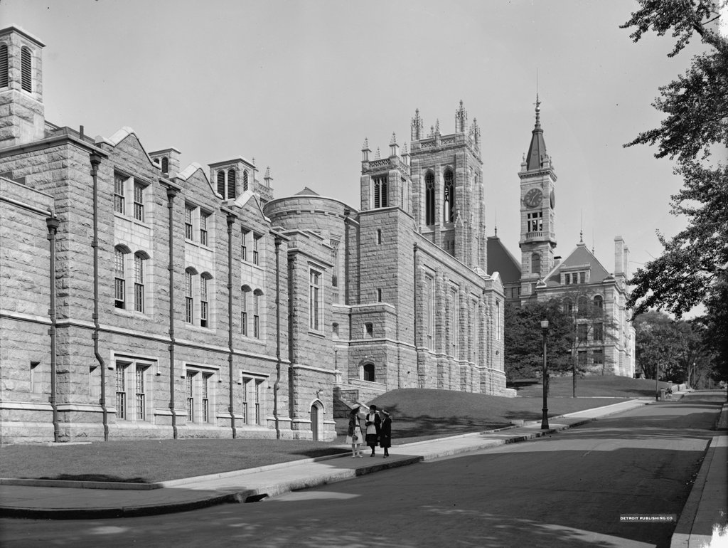
First Congregational Church, Fall River, Mass

The First Congregational Church, seen looking up Cherry Street from the corner of June Street, around 1913-1920. Image courtesy of the Library of Congress, Detroit Publishing Company Collection.

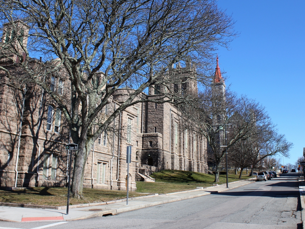
The church in 2020:

The First Congregational Church of Fall River was established in 1816, and throughout most of the 19th century the church worshipped in a building at the northwest corner of North Main and Elm Streets. However, in 1913 the church moved into this new building, which was donated by one of its parishioners, Sarah S. Brayton. The building was designed by the prominent Boston architectural firm of Shepley, Rutan & Coolidge, and it features a granite, Gothic Revival exterior. It was formally dedicated on January 9, 1913, on the 97th anniversary of the church’s founding. Among those in attendance was Sarah Brayton, who was 78 years old at the time, and the dedication sermon was delivered by the Rev. Nehemiah Boynton of the Clinton Avenue Congregational Church in Brooklyn.

The first photo was taken within a few years after the building was completed. It is a rather strange angle, because it shows the rear and side of the church, with the parish house in the foreground on the left. Further up in the distance, on the other side of Rock Street, is the B.M.C. Durfee High School, which was built in 1886. The three girls on the sidewalk are likely students at the school, and are apparently walking home at the end of the school day. During the early 20th century, the Durfee High School ended at 1:25 p.m., and the photo was taken ten minutes later at 1:35, according to the school’s clock tower.

Today, more than a century after the first photo was taken, almost nothing has changed in this scene except for the trees, which now partially hide the buildings. The church is still an active congregation, and the exterior of the building has remained well-preserved. Further up the hill, the old high school building was converted into a family and probate courthouse in the 1990s, but it has retained its historic exterior appearance. The high school building was added to the National Register of Historic Places in 1981, and two years later both it and the church were designated as contributing properties in the Highlands Historic District.

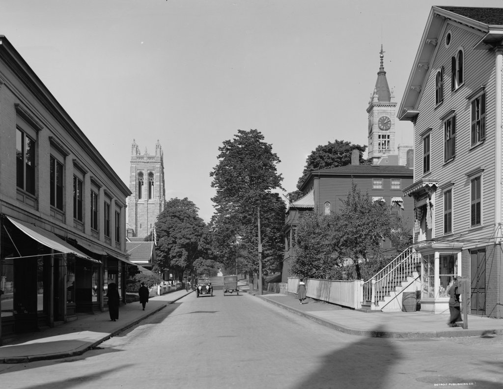
Rock Street from Pine Street, Fall River, Mass

Looking north on Rock Street from the corner of Pine Street in Fall River, around 1913-1920. Image courtesy of the Library of Congress, Detroit Publishing Company Collection.

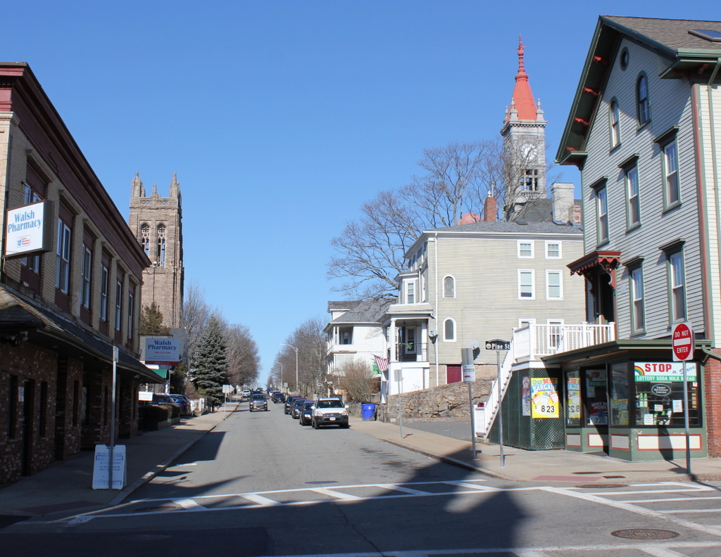
The scene in 2020:

The first photo shows a street scene in Fall River with an interesting assortment of commercial storefronts, single-family homes, and multi-family homes, along with a church and a school. The buildings also vary widely in age; some date back to the 1840s, while others were built just a few years before the photo was taken. Remarkably, though, all of the buildings from the first photo are still standing today, and this scene does not look substantially different from its appearance more than a century ago.

The city of Fall River developed into a major textile manufacturing center during the early 19th century, and some of the oldest buildings in this scene were built during that time. In the distance, on the left side of the street, is a group of four houses, located at 222, 232, 242, and 254 Rock Street. The oldest of these, number 222, is hidden from view by the building in the foreground, but it was built around 1815. Just beyond it, and also hidden here, is number 232, built around 1848. Both of these buildings have had significant exterior alterations, but the two that are visible in the distance of this scene, at 242 and 254 Rock Street, were built in the mid-1840s and have remained well-preserved over the years. In particular, 254 Rock Street survives as an excellent example of Carpenter Gothic architecture.

On the right side of the street, the oldest building here is at 223 Rock Street, which is the three-story building just beneath the clock tower. It was built around 1845, but it was originally located at 151 Rock Street. It was moved to its current location in 1913, so its presence here in the first photo establishes the earliest possible date for the photo.

Closer to the foreground, on the far right side of the scene, is 201-203 Rock Street. It was built around 1861, and its original owner was Albert Winslow, a former New Bedford whaling ship captain who retired to Fall River. According to the 1861 city directory he ran a grocery store here at the house, presumably in the basement storefront, and the 1870 census shows him living here with his wife Permela, their five children, and his sister Rowena. By 1900 both Albert and Permela were still living here, as were their three daughters: Hope, Amelia, and Ella. Permela died in 1902, and Albert in 1908, but the three sisters were still here when the first photo was taken. They evidently rented a portion of the house, because both the 1910 and 1920 censuses show a second family living here.

Until the late 19th century, this section of Rock Street primarily consisted of small wood-frame houses. However, in 1886 the city constructed the B.M.C. Durfee High School a block to the north of here. Most of the building is hidden from view in this scene, but its prominent clock tower is visible in the distance on the right side of the photos.  Another major addition to this scene is the First Congregational Church, which stands opposite the high school building in the distance on the left side of Rock Street. The church was designed by the prominent architectural firm of Shepley, Rutan & Coolidge, and it was dedicated in January 1913, probably only a few years before the first photo was taken. Aside from the school and church, the other new building in the first photo was the Gee Building, the two-story commercial building in the foreground on the left side. It was built in 1910, at the northeast corner of Rock and Pine Streets.

Today, more than a century after the first photo was taken, some of the buildings here have undergone changes, but overall this section of Rock Street remains well-preserved. In the foreground, probably the most visible difference is the ground floor of the Gee Building, which has been completely altered from its early 20th century appearance. The storefront on the Winslow house across the street has also changed, but not to the same extent. Further in the distance, both the church and the high school are still standing, although the high school has since been converted into a probate and family courthouse. The only building in this scene that was constructed after the first photo was taken is the house in the distance at 253-255 Rock Street, which was built in 1923. Because of their preservation and historic significance, all of the buildings on this block of Rock Street are now part of the Lower Highlands Historic District, which was added to the National Register of Historic Places in 1984.

Five Mile Point Light, New Haven, Connecticut

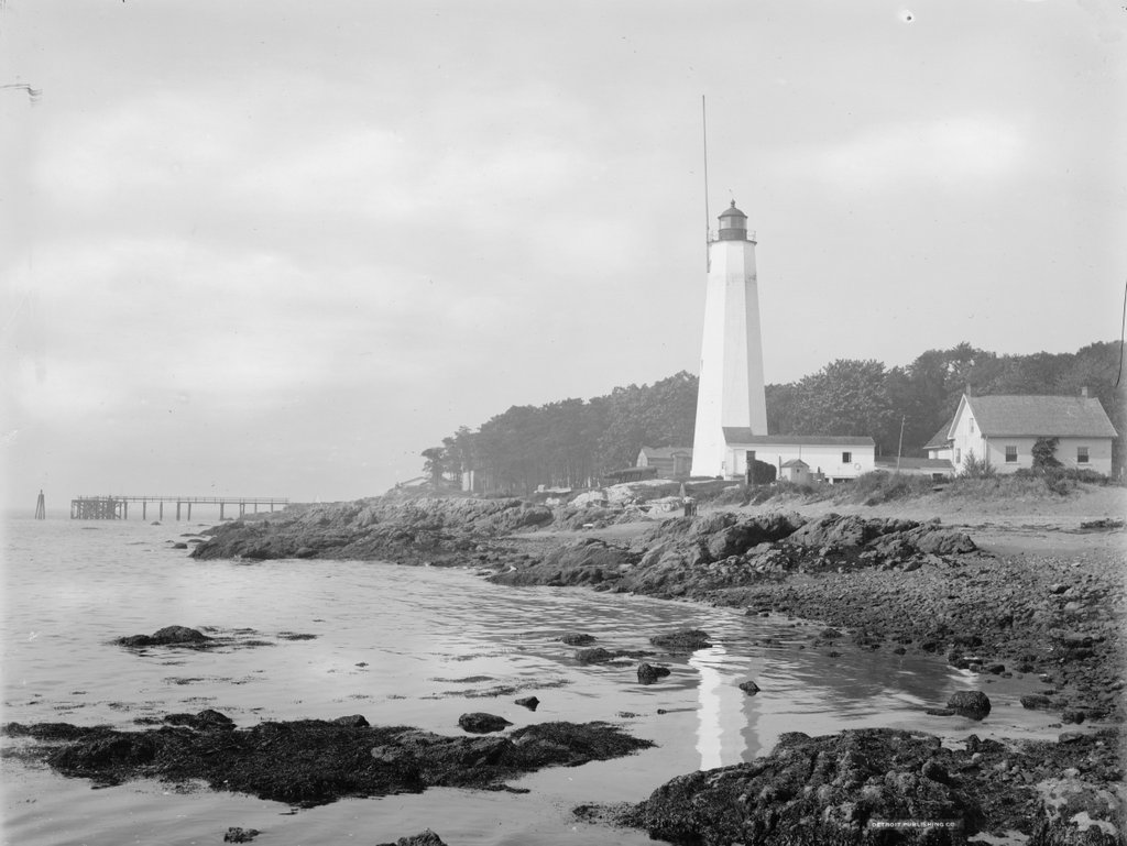
The Five Mile Point Light at the entrance to New Haven Harbor, around 1900. Image courtesy of the Library of Congress, Detroit Publishing Company Collection.
The scene in 2021:
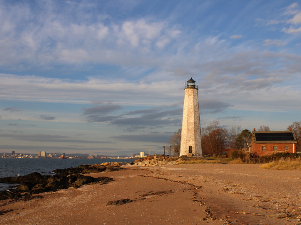
New Haven Harbor has been marked by a lighthouse since 1805, when the first one was constructed here on this site at the southeast edge of the harbor. It was commonly known as Five Mile Point Light, because of its distance from downtown New Haven. The original tower was 30 feet tall and built of wood, but by the late 1830s both it and the keeper’s house were badly deteriorated. Both buildings were replaced in 1847, and the new lighthouse was substantially larger than the older one. As shown in these two photos, it is octagonal in shape and constructed of local brownstone, and it stands 80 feet above the ground. Its design is very similar to many of the other early 19th century lighthouses in Connecticut, including New London Harbor Light, Lynde Point Light, Black Rock Harbor Light, and Falkner Island Light.

The new lighthouse was constructed by local builder Marcus Bassett, and the work evidently progressed quickly. Congress appropriated funds for it on March 3, 1847, and it was nearly completed by September, when an article appeared in the New Haven Journal, praising the new lighthouse:

New-Haven harbor during easterly storms, is the refuge of an immense number of craft, but its entrance from the east has always been difficult, if not dangerous, because the light-house cannot be seen until near the rocks upon which it stands. The government erected a new house for the keeper recently, but the new light-house, which is nearly ready for use, is the object of special admiration. Standing but a few rods from the old one, it rises in towering majesty by its side, and now may be seen in every direction where the other was wholly concealed. It will be of immense benefit to New-Haven harbor and also add to the security of the navigation of the Sound.

As was the case with most other American lighthouses of the era, Five Mile Point Light was maintained by a keeper who resided here on the property. Lighthouse keepers were primarily responsible for lighting and extinguishing the lantern, but other routine duties included maintenance and repairs to the buildings and equipment. However, because of their locations at hazardous points along shipping routes, keepers were also occasionally called upon to assist sailors in distress. Here at Five Mile Point, keeper Merritt Thompson, who served from 1853 to 1860, was often involved in such rescues, with his 1884 obituary noting that “when he was keeper of the lighthouse it was his good fortune to be instrumental in saving lives on a number of occasions when boats would be upset in the harbor,” and that “many stories are told of his daring and humanity in emergencies calling for personal risk and quick action.” 

The 1860 census shows Thompson living here at the lighthouse with his wife Julia and their six children, who ranged in age from 11 months to 14 years. However, he was subsequently dismissed from the post, and went on to work as a harbor pilot here in New Haven. An 1861 letter to the editor, published in the Columbian Register, suggested that this was a political move, and that he was replaced by a Republican partisan because of Abraham Lincoln’s electoral victory in 1860. The writer questioned the qualifications of any replacement, and observed that “the removal has caused a burst of indignation among all our citizens,” and concluded the letter with some sarcasm, saying “I trust none of our citizens will allow themselves to be capsized in the vicinity of the light house, for the next four years.”

The new lighthouse keeper was Elizur Thompson, who was not related to his predecessor. Despite this anonymous writer’s doubts about his abilities, he go on to serve here for many years, first as a keeper and later as an employee of the United States Signal Service. His family also helped maintain the lighthouse, including his wife Elizabeth and two of their sons, each of whom received assistant keeper salaries at various times over the years. He was dismissed in 1867 by the Andrew Johnson administration, for reasons that were evidently as political as his initial appointment had been, but he was subsequently reappointed in 1869, after Republican Ulysses S. Grant became president.

During the 1870 census, Elizur and Elizabeth were 61 and 59 respectively, and they lived here at the lighthouse with their 24-year-old son George and their 18-year-old daughter Ella. However, Elizabeth died a year later, and in 1877 Elizur remarried to Ellen Pierce, a widow who was about 30 years younger than him. She had a son, Burton, from her first marriage, and he was 13 years old and living with them during the 1880 census.

In the meantime, in 1873 the federal government began construction of Southwest Ledge Light, located on a rocky ledge about a mile offshore from here. Because this new lighthouse was much closer to the main shipping channel, it rendered Five Mile Point Light obsolete, and the light was deactivated after Southwest Ledge was completed in 1877. Elizur Thompson was then appointed as the first keeper of the new lighthouse, and his son Henry became the assistant keeper. He remained there for four more years, until his retirement in 1881, and Henry then became the main keeper of Southwest Ledge.

Following his retirement, Elizur and Ellen returned to the old Five Mile Point Light, where he was allowed to live, rent-free, for the rest of his life. During this time, he worked for the United States Signal Service, displaying flags from the old lighthouse to provide weather reports for passing merchant vessels. Both Elizur and Ellen faced health scars in the mid-1880s, beginning with a head injury that the elderly Elizur suffered in 1884, when he slipped and hit the back of his head on a rock while trying to launch a boat here on the beach. Then, in June 1885 Ellen underwent major surgery in New York to remove a large tumor. Newspaper reports described her as being in critical condition and doubted whether she would survive, but she ultimately recovered and returned to New Haven in early August.

Elizur carried out his duties here at the lighthouse until his death in 1897, when he was 87 years old. Ellen had taken over these responsibilities during his final illness, and after his death she was formally appointed as his successor. As described in the Morning Journal and Courier following her appointment, the signal station “has been a great boon to the sailors, since it has warned them of impending storms and furnished them the opportunity to come within the shelter of the harbor.” The article described how the weather reports arrived in downtown New Haven and were then telephoned to the lighthouse, where Ellen would hoist the appropriate flags. The article then concluded by remarking that “the task is anything but an easy one for a woman, especially in stormy weather.” She would retain this post until her death in 1901, at the age of 60.

The first photo was taken around 1900. Assuming this date is accurate, Ellen Thompson would have still been living and working here, and the tall pole atop the lighthouse was likely where she hoisted the flags. The photo also shows the keeper’s house on the right side, connected to the lighthouse by an enclosed wooden walkway. On the other side of the lighthouse, in the center of the photo, are four Civil War-era Rodman cannons that were installed here during the Spanish-American War in 1898. These obsolete guns were evidently more for show than anything else, and were likely more effective at reassuring locals than at dissuading Spanish warships. In any case, these guns were never tested in combat during the short-lived war, and within a few years they were removed and incorporated into several different local Civil War memorials.

No longer necessary for either navigational aids or civil defense measures, this area around the old lighthouse subsequently became an amusement park, known as Lighthouse Point Park. Like many other early 20th century amusement parks, it was developed by a local trolley company as a way of increasing ridership on otherwise quiet weekend trolleys. The park featured attractions such as a carousel, along with a beach and fields for athletic events. Even prominent baseball stars such as Babe Ruth and Ty Cobb made appearances here at Lighthouse Point and participated in exhibition games.

The amusement park was subsequently acquired by the city, but it began to decline after the 1920s, and most of the park buildings were demolished by the mid-20th century. The site has continued to be used as a public park, though, and it continues to be a popular destination for its beach and for other recreational activities, including its restored carousel. However, the most prominent landmark here at the park continues to be the historic lighthouse. Despite not having been used as a lighthouse for nearly 150 years, both the tower and the keeper’s house are still standing, with few major changes since the first photo was taken, aside from the loss of the covered walkway.

Franklin and Armfield Office, Alexandria, Virginia

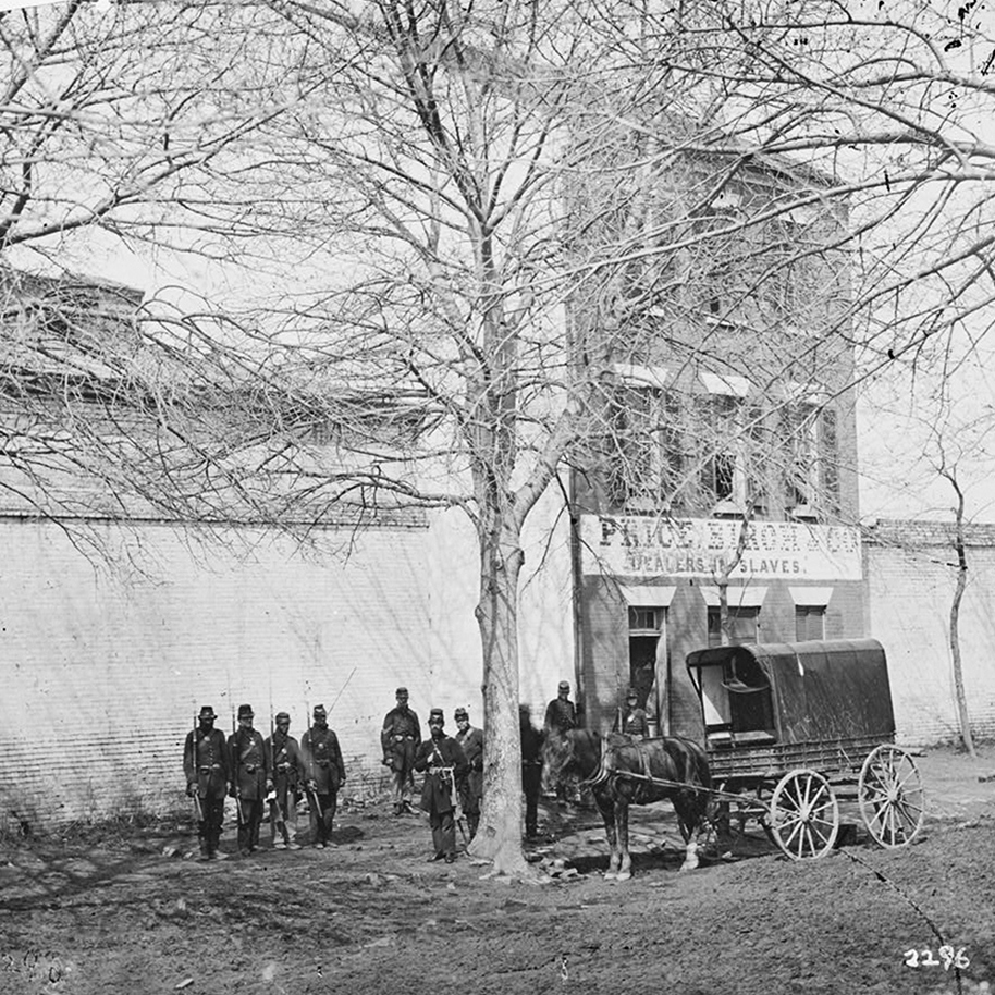
The Franklin and Armfield Office at 1315 Duke Street in Alexandria, around the early 1860s. Image courtesy of the Library of Congress, Civil War Collection.

The scene in 2021:

The Franklin and Armfield Office at 1315 Duke Street in Alexandria, Virginia was built in 1810. It was originally built as a private residence for Brigadier General Robert Young of the Second Militia of the District of Columbia, but he was forced to sell the home in 1820 due to financial problems. By 1828, the home was leased, and eventually bought by infamous slave traders, Isaac Franklin and John Armfield. Franklin and Armfield were the largest slave traders in the United States between 1828 and 1836, and the Duke Street home was turned into their main office.

Since the transatlantic slave trade was banned in 1808, Franklin and Armfield would send agents across Virginia, Maryland, and Delaware in search of slave owners who were willing to part with their slaves for relatively cheap prices. The enslaved people would then be shipped back and held in the high-walled courtyards surrounding the offices (Seen to the left and right of the house in the top picture). In these courtyards, the enslaved people were subject to brutal beatings, rapes, and countless other forms of cruel control. Rapes were so frequently done by Franklin and Armfield to their slaves, that they bragged about them in letters between each other, and both men would father children to enslaved women in their captivity. Franklin would later go on to sell the woman he raped and the child he fathered with her. A two-story extension was added to the back of the building to serve as jail cells. These cells could be used to isolate certain slaves but were more often rented out by travelling slave owners who wanted to keep their slaves on the Virginia side of the Potomac.

Due to a surplus of enslaved people in the Upper South, slaves did not fetch high prices in Alexandra. The enslaved people were typically kept in the home’s courtyards until enough of them were bought for them to all be shipped together or marched to their offices in Natchez and New Orleans. Once in the Deep South, they could be sold at much higher prices than they were bought for in Virginia. It’s estimated that Franklin and Armfield sold between 1,000-2,000 people each year, transporting all of them by way of cramped slave ships or forced marches across the South.
By 1836, Franklin decided to retire, and his partner Armfield decided to sell off most of the business. He sold the Duke Street offices to another slave trader, George Kephart. He would continue the practice of selling slaves until he sold it to yet another slave trading firm, Price, Birch & Co. in 1858.

Price, Birch & Co. would become infamous not for their volume of slaves sold, but rather for one particular man that they enslaved. Solomon Northup, a freed slave from Saratoga Springs, New York was kidnapped in Washington, DC in 1841. He was shipped down to New Orleans where we was bought by a planter and re-enslaved. It would take Solomon 12 years before he would once again gain his freedom with the help of Samuel Bass. A Canadian working on the plantation, Samuel was able to get word back to New York about Solomon’s re-enslavement. After an appeal to the Governor of New York, Solomon was granted his freedom in 1853. Solomon would later go on to write his famous memoirs, 12 Years a Slave. In his memoirs, Solomon named his kidnapper as “Burch”, but it’s largely been accepted that the man he was talking about was James H. Birch, of Price, Birch & Co. in Alexandria. It should be noted though that Solomon Northup does not appear to have actually passed through the Alexandria slave pens, only that Birch used the building as his offices. Price, Birch & Co. would go on to own the building until the Civil War, when it was occupied by Union Forces in 1861. During the Civil War the slave pens were ironically, used as jail cells for captured Confederate soldiers.

After the Civil War, a railroader by the name of Thomas Swann bought the property in 1870 and tore down the slave pen extension. The buildings exterior also underwent changes that give it its modern appearance, such as the fourth story windows being added as well as the arches over the windows on the front façade. The property changed hands multiple times over the last century, serving as apartments for most of that time before being sold in 2017 to the Northern Virginia Urban League. Today, the building has been re-named the Freedom House, and features a museum to the building’s history on the first floor, and offices for the Northern Virginia Urban League on the upper floors.

The Pavilion, Montpelier, Vermont

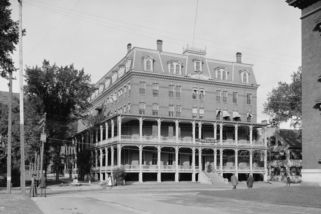
The Pavilion on State Street in Montpelier, around 1904. Image courtesy of the Library of Congress, Detroit Publishing Company Collection.

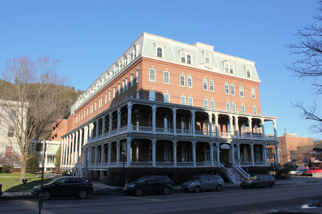
The scene in 2019:

Throughout the 19th and early 20th centuries, one of the major landmarks in Montpelier was the Pavilion Hotel, which stood on the north side of State Street, just east of the Vermont State House. The original Pavilion was built in 1808, the same year that the first state house was built next door. At the time, Montpelier had just recently been designated as the capital of Vermont, and it was still a small town, with under 900 residents during the 1800 census. As a result, the Pavilion was built, in part, to meet the anticipated need for accommodations, especially during legislative sessions. Over time, the hotel would come to be closely identified with the state government, and despite being privately owned it was unofficially regarded as the “third house” of the legislature.

The first Pavilion Hotel stood here until 1875, when it was demolished to build a new, larger Pavilion. Work on the new hotel began with the groundbreaking on February 22, 1875, and it opened for guests exactly 11 months later, on January 22, 1876. The formal dedication ball occurred a month later, on February 22, and it was attended by over 250 couples. The event lasted well into the night, and did not wrap up until 6:00 the following morning.

Upon completion, the new hotel consisted of four floors, with a low roof atop the building; the fifth floor with its Mansard roof would not be added until 1888. The main entrance was located here on the State Street side of the building, with the ladies’ entrance on the left side facing the state house. The first floor of the building featured the hotel offices, along with a reception room, reading room, two dining rooms, the kitchen, and some of the guest rooms. On the second floor there were more guest rooms, along with three parlors and the hotel proprietor’s living quarters, and the two upper floors were entirely comprised of guest rooms. In total, the hotel had 90 guest bedrooms. The basement was primarily utility space, but it also included a billiards room and barber shop.

The first photo was taken around the turn of the 20th century, after the 1888 expansion that added 35 guest rooms to the building. At the time, the hotel was still popular among Vermont legislators, and it also enjoyed steady business from tourists who sought the relatively quiet, rural setting of Montpelier. According to a 1906 advertisement in a travel guide, rooms cost $2 per night, or about $58 in today’s dollars, which made it the most expensive of the three Montpelier hotels that had prices listed.

By mid-century, though, these trends had changed. Across the country, historic downtown hotels were suffering from declining business, and the Pavilion was no exception. The explosion of car owner0hips, along with the Interstate Highway System, made it easier for travelers to stay at convenient new motels right off the highway, rather than driving into a downtown area and trying to find parking in order to stay at an aging hotel. Here in Montpelier, this was compounded by the fact that many legislators no longer needed to stay overnight in the city during legislative sessions. With travel times drastically reduced, commuting became a more attractive option for those who lived within easy driving distance of the capital.

As a result, the Pavilion declined to the point where it was in poor repair, and was generally seen as a low-budget alternative to newer motels. In the meantime, the state became interested in acquiring the property, given its highly visible location next to the state house. The state ultimately purchased it in 1966, and the hotel closed for good later in the year.

Over the next five years, the building became the topic of debate between state officials who wanted to demolish the old hotel and construct a new state office building, and preservationists who wanted to see the historic building renovated into offices. The reasoning behind the demolition was that it would cost more to renovate the building than to construct a new one. In the end, the state struck a sort of compromise that involved demolishing the hotel and constructing an exact replica on the same spot. This maintained the visual effect from the street, but it was hardly a win for preservationists, who argued that complete demolition could in no way be considered a type of historic preservation.

The building was demolished during the winter of 1969-1970, and the replica state office building was completed in early 1971. Among the occupants of the new building was the governor. The formal governor’s office remained in the state house, and continues to be used during legislative sessions, but the governor’s working office has been in the new Pavilion ever since. Initially, the governor’s office was located on the fifth floor, in the corner on the right side of the building, but it was subsequently relocated to a modernist addition, located in the rear of the building.

Today, these two photos give the appearance that very little has changed, although in reality there is almost nothing left from the first photo. Aside from a few pieces of the old Pavilion façade that were incorporated into the new one, the only survivor in this scene is the former offices of the Vermont Mutual Insurance Company, the corner of which is visible on the right side of the first photo. Although it is not shown in the 2019 photo, it is still standing today, and it is now used as offices for the state’s attorney and the sheriff’s department. The other government building visible in this scene is the one on the far left of the 2019 photo, which was completed in 1918 and houses the state library and the state supreme court.