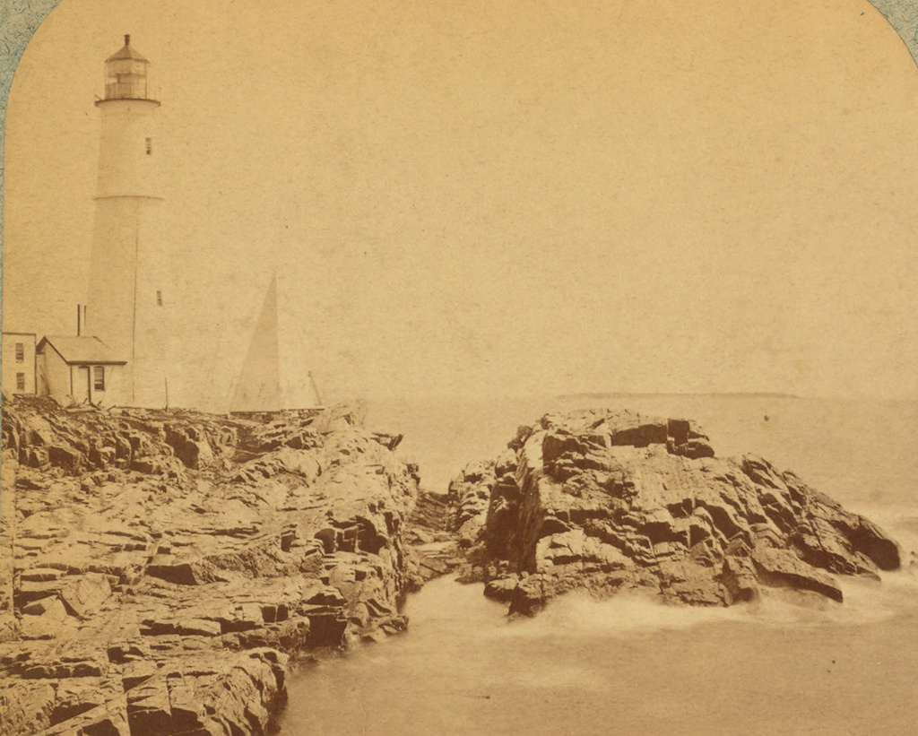
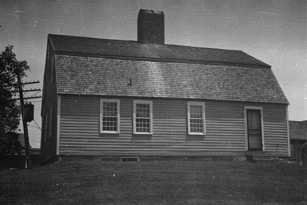
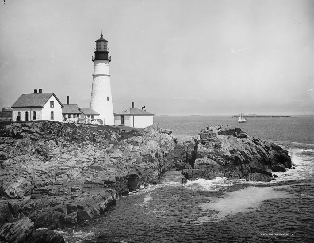
The view of Portland Head Light, possibly around 1890. Image courtesy of the Library of Congress, Detroit Publishing Company Collection.
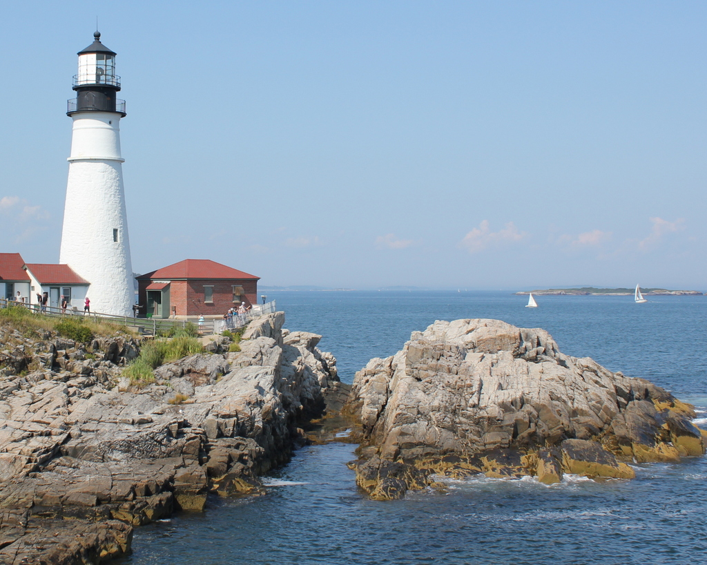
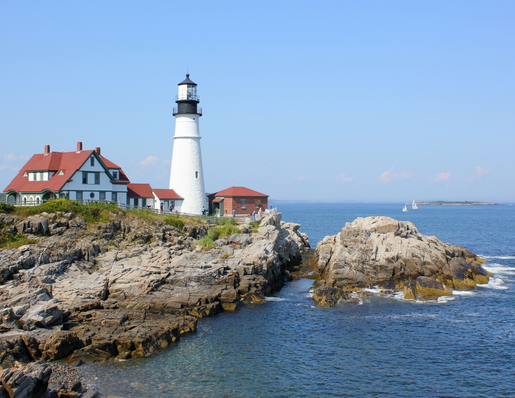
The lighthouse in 2015:
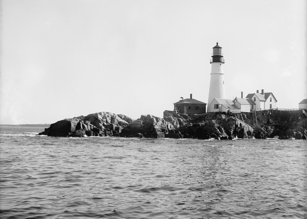
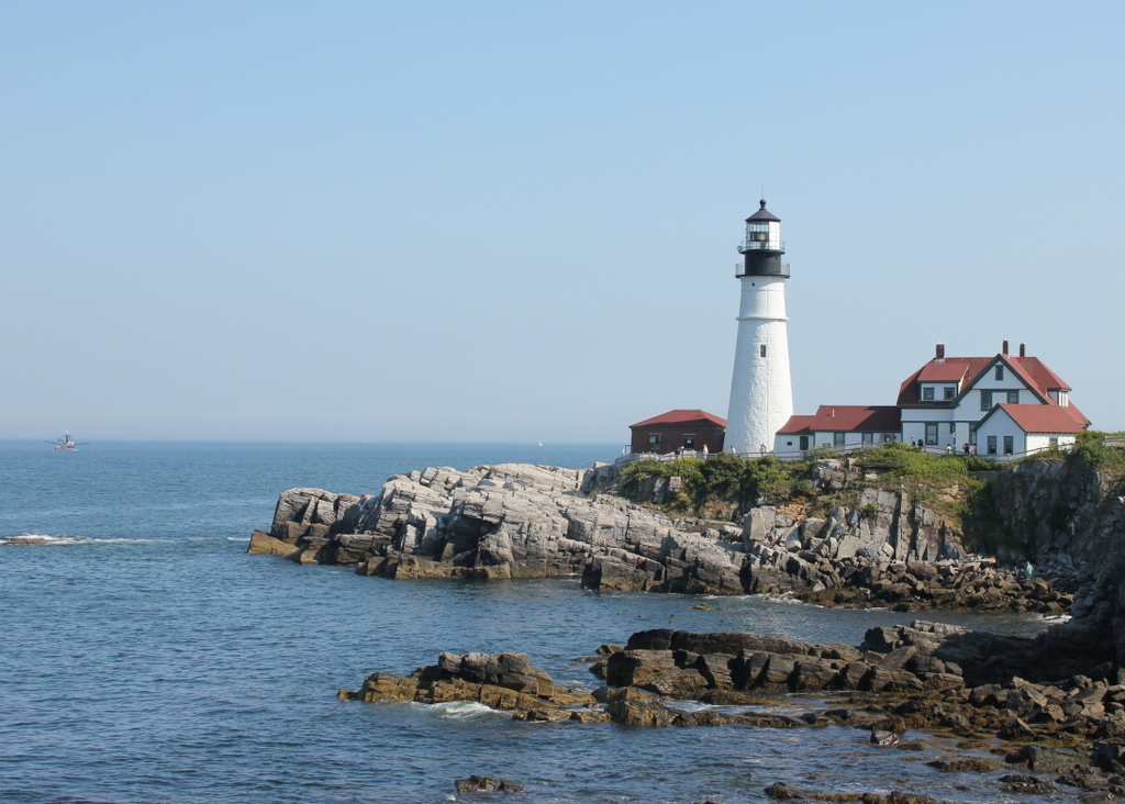
Aside from perhaps lobsters and pine trees, Portland Head Light is one of Maine’s most recognizable symbols. The iconic lighthouse is among the most famous in the world, and in the past few years it has been featured in lists such as USA Today’s “10 best lighthouses around the USA“, The Weather Channel’s “11 Amazing Lighthouses of the World“, and Mental Floss’s “10 of the Most Beautiful Lighthouses in the World.” However, this is not a recent phenomenon; the picturesque lighthouse overlooking Portland’s Casco Bay has attracted generations of photographers, as seen in the photo from the Detroit Publishing Company over a hundred years earlier.
The lighthouse was completed in 1791, in what was at the time part of Massachusetts. As its name suggests, Portland was, and still is, one of New England’s major commercial ports, so a lighthouse was needed to mark the southern edge of the main shipping channel into the harbor. It was the first lighthouse to be built by the United States government (all earlier lighthouses were built prior to the Revolution or prior to the federal government assuming control over lighthouses), and it was also the first of many lighthouses in present-day Maine.
As built, Portland Head Light looked very different from today. It was only 72 feet tall, but poor construction of both the tower and the keeper’s house became evident within 20 years. The leaking lighthouse was lowered by 20 feet in 1812, and the keeper’s house was replaced in 1816 by the one seen in the first photo. This website provides more details, along with a few historic photos of the lighthouse, including one from 1859 that is barely recognizable compared to the two views shown above.
The tower’s height continued to fluctuate throughout the 19th century. In response to a deadly 1864 shipwreck, it was raised 20 feet for better visibility, only to be reduced again in 1883. Two years later, though, the third and final height change gave the tower its present appearance. This is still noticeable today; the ring around the upper section of the tower separates the 1885 addition from the original 1791 structure.
The only obvious difference between the two photos above is the keeper’s house to the left, and this is where there is somewhat of a discrepancy with the date of the photo. The Library of Congress estimates that the first photo was taken around 1902. However, the records indicate that the present-day keeper’s house was built in 1891, and assuming this is correct, it would make that the earliest that this photo could have been taken. This is far earlier than most of the other photos in the Detroit Publishing Company collection, though, so the exact date seems to be questionable.
Date questions aside, the lighthouse is still an active aid to navigation for one of the busiest ports on the east coast, although the keeper’s house is no longer used as a residence. The light was automated in 1989, eliminating the need for a full-time lighthouse keeper. so today the house is owned by the town of Cape Elizabeth, and is operated as a maritime museum as part of Fort Williams Park.