Town Center, Montgomery, Massachusetts

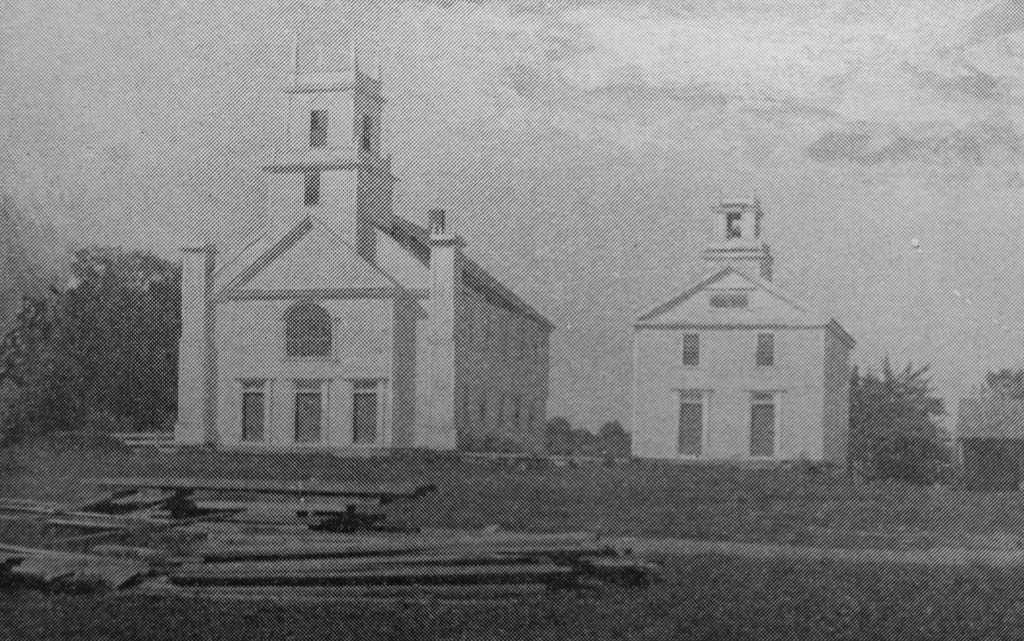
The town center on Main Road in Montgomery, Massachusetts, around 1892. Image from Picturesque Hampden (1892).

The scene in 2024:

Throughout its history, Montgomery has been one of the smallest towns in Hampden County, with a population that has never even reached 900 at any point. It is nestled in the hills to the northwest of Westfield, and it was first settled b European colonists around the 1760s, before becoming an incorporated town in 1780. Its population fluctuated during the 19th century, reaching as high as 740 by 1840, before plummeting to 393 a decade later. It steadily diminished in population over the next century, reaching as low as 141 in 1930 before seeing steady population growth during the second half of the 20th century. Nonetheless, the town remains small and rural, as shown in these two photos.

This site is usually referred to as the town center, mainly because it is the site of the meeting house and the town hall. However, this was never a true village or population center, as historically the town’s development consisted primarily of farms that were scattered across the landscape. But, because this spot is near the geographic center of the town, it was a logical place to gather for church services and town meetings

The town center consists of three Greek Revival-style buildings, as shown in the top photo. On the right side is the Montgomery Community Church, which appears to have been built in 1848 on the site of an earlier 1797 meeting house. The property had been owned by the town until 1848, when a new town hall was built immediately to the west of it, as shown in the distance to the left of the church in the top photo. The old meeting house was then sold to the town’s Congregational church, which subsequently built the current Greek Revival structure. A year later, in 1849, the town’s Methodist society constructed their own church building across the street, as shown on the left side of the scene.

Despite this late 1840s construction boom here in the town center, the town’s population was by this point on a downward trend. The 1850 census showed 393 inhabitants, and it would continue to decline for many decades afterwards. Both churches struggled to sustain themselves, with the Methodists only holding services in the summer and fall. The Congregational church eventually closed in the late 1860s, and the building was later used by a Second Adventist group.

By the time the top photo was taken around the early 1890s, the town’s population had dropped to under 300 residents. All three of the buildings from the 1840s were still standing here, and they were joined by a carriage shed, which was built around 1890 in the distant center of the scene.

Today, more than 130 years after the top photo was taken, not much has changed in this scene. The landscape is more forested, making it difficult to get the exact same angle as the top photo. The trees also hide the buildings on the right, but they are still standing, although their uses have changed over time. On the left side, the former Methodist church is now the town hall, and it has been expanded to include space for the town offices, library, and senior center. On the right side, the old town hall is now the historical society, and the former congregational church is now the Montgomery Community Church. The late 19th century carriage shed is also still standing, and collectively these buildings stand as a well-preserved example of a rural town center.

Church and Academy, West Granville, Massachusetts

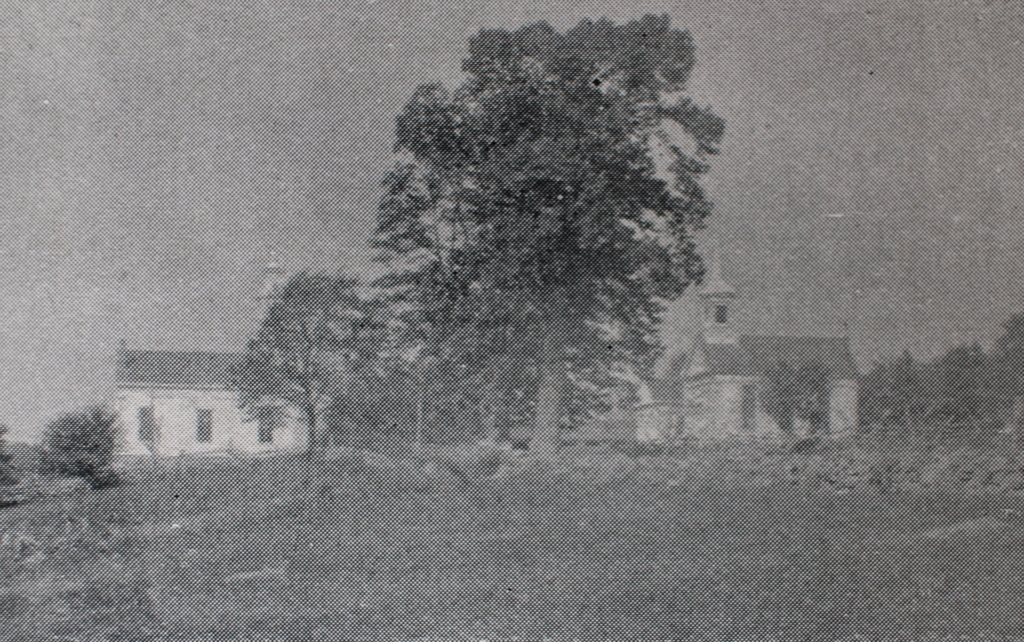
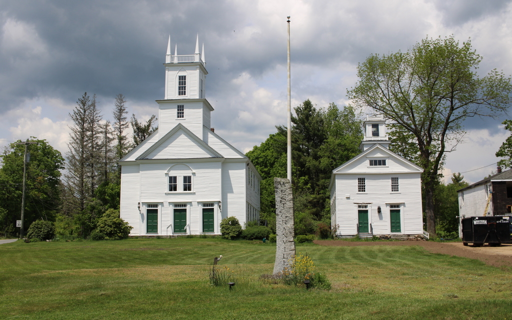
The Second Congregational Church and the West Granville Academy at the corner of Main Road and Beech Hill Road in Granville, around 1892. Image from Picturesque Hampden (1892).

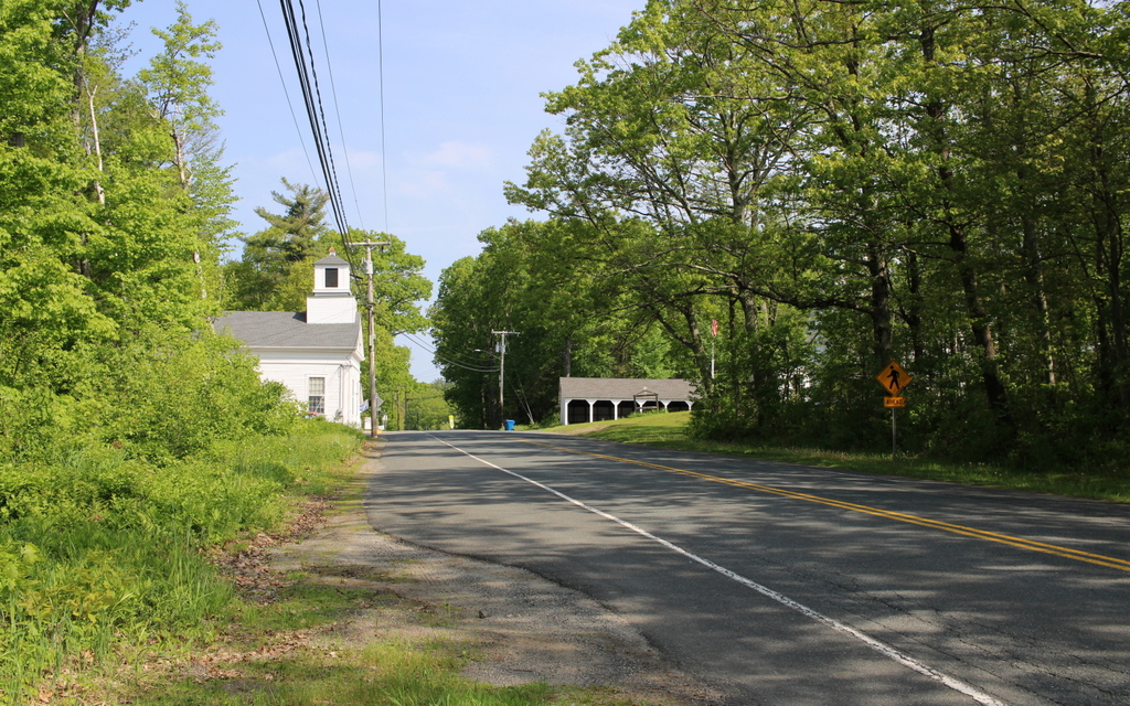
The scene in 2024:

These two photos show the church and school in the village of West Granville. The town of Granville was incorporated in 1754, and it originally included the modern-day town of Tolland, which is located immediately to the west. Geographically, it is a large town, and even more so in the 18th century, when the combined area of modern Granville and Tolland was over 70 square miles. It was also one of the largest towns in Western Massachusetts in terms of population; during the first federal census in 1790, it had 1,979 residents, making it the seventh-largest town in the region, ranking higher than places like Springfield and Northampton. A decade later, the population had risen to 2,309, which was the third-highest in Western Massachusetts, behind only West Springfield and Springfield.

Because of the geographic size and population growth of the town, it soon led to the need for more than one meeting house. The original meeting house was located at the main village in the eastern part of the town, but in 1778 a second meeting house was built here in the western part of the town, as shown on the left side of these photos. At the time, it was known as the Middle Parish, because Tolland was at the time the western part of Granville, but it later came to be known as the West Parish after Tolland became a separate town.

The building is perhaps best known for its association with the Rev. Lemuel Haynes, the first ordained black minister in the United States. He was born in 1753 to a white mother and black father, and they were evidently unwilling or unable to raise him, because when he was five months old he was indentured to David Rose, a resident of Granville. Haynes grew up in the town, and he remained here after the end of his term of indenture at the age of 21. He went on to serve in the American Revolution, and he also developed a talent for preaching.

In 1780, Haynes was licensed to preach. Then, when the the church here at Middle Granville was formally organized in 1781, Haynes was invited to serve as the supply pastor, acting in an interim role in the absence of a permanent minister. He remained in this role for four years, until he was formally ordained in 1785. Newspaper accounts of the event indicate that his ordination occurred in Granville, but they do not specify which meeting house, although the event likely occurred here in this building. Haynes subsequently became the pastor of the church in Torrington, Connecticut, before moving to West Rutland, Vermont and then South Granville, New York, where he preached until his death in 1833.

In the meantime, the meeting house here in West Granville underwent some changes during the 19th century. According to the building’s MACRIS inventory form, the projecting front part of the building, with the three doorways, was probably added around 1837, while the Gothic-style details were added later in the 19th century. The Gothic style is evident in the four small spires atop the tower, along with the pilasters on the front corners of the building.

The smaller building just to the right of the meeting house is West Granville Academy, which was built in 1837. At the time, public high schools were rare, and instead many towns had private academies instead. Here at West Granville, tuition cost around $3.00 to $4.00 per term, plus $1.50 per week for board. The school attracted not only students from Granville, but also from other communities in the region. Among the teachers here was Russell H. Conwell from the town of Worthington. He taught here around 1863, and he later went on to become the founder and first president of Temple University. The academy closed later in the 19th century, as public high schools and larger private academies became more prevalent, and the building was subsequently acquired by the church for use as a parish hall.

The top photo was taken around the early 1890s, showing the view of the meeting house and academy building from the south. By this point Granville was, like most of the other rural hilltowns of Western Massachusetts, in the midst of many years of population decline. These towns generally followed a similar trend of rapid population growth in the late 18th and early 19th centuries, followed by a slow but steady decrease in population in the mid to late 19th century, as new generations of residents moved to industrial cities for greater opportunities, or moved westward to more productive farmland. After the separation of Tolland from Granville in 1810, Granville’s population reached as high as 1,649 residents in 1830. However, this number dropped to 1,061 by 1890, and would reach as low as 655 by 1920.

Granville would again see population growth in the post-World War II era, as widespread car ownership made it more practical to live in rural towns and commute to cities for work. However, with 1,538 residents as of 2020, the town is still smaller now than it was two centuries ago.

As a result, Granville retains much of its historic rural character, including the meeting house and old academy building here in West Granville. As shown in the bottom photo, both buildings are still standing. The academy is essentially unchanged on the exterior, while the meeting house has seen only minimal changes, primarily the removal of the Gothic pilasters on the corners, which were evidently taken down around the 1970s or 1980s. It stands as one of the oldest surviving church buildings in Western Massachusetts, and both the meeting house and the academy are part of the West Granville Historic District, which was added to the National Register of Historic Places in 1991.

Chester Center, Chester, Massachusetts

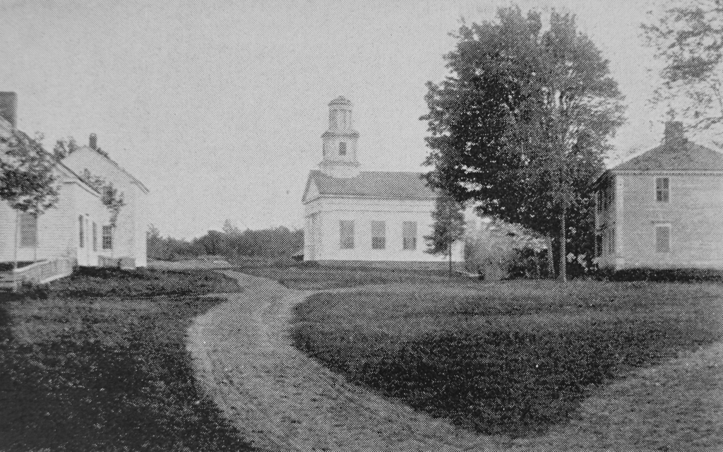
The original town center of Chester, Massachusetts, seen looking south on modern-day Skyline Trail from the corner of Bromley Road around 1892. Image from Picturesque Hampden (1892).

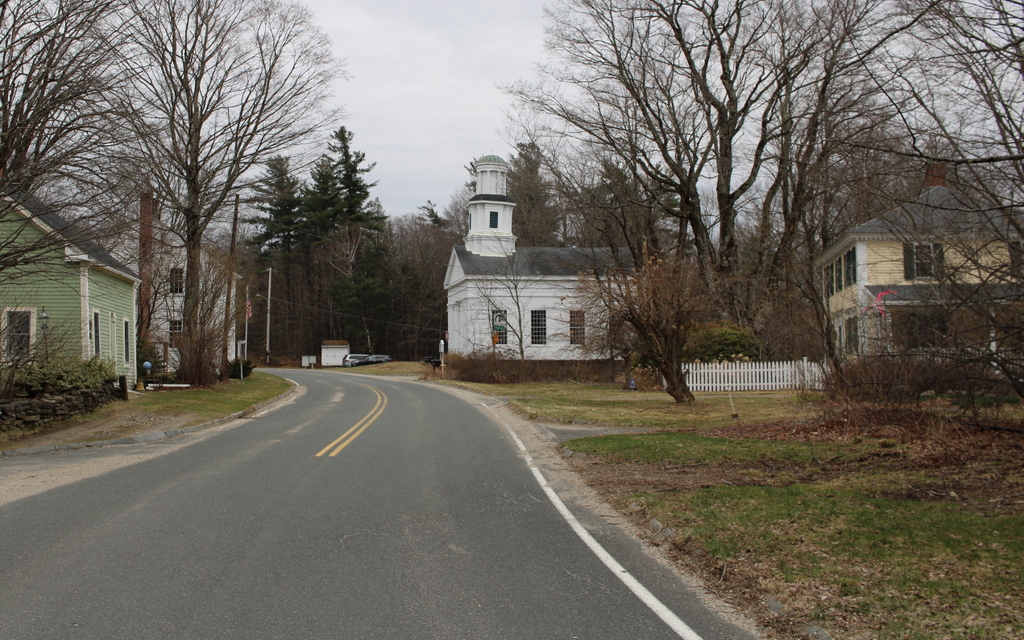
The scene in 2024:

These two photos show the old town center of Chester, which was incorporated in 1765 and was originally named Murrayfield. Located in the far northwestern corner of Hampden County, Chester is one of the many hilltowns in the uplands region between the Connecticut River valley to the east and the Housatonic River valley to the west. Two of the branches of the Westfield River flow through Chester, with the West Branch in the western part of the town and the Middle Branch in the eastern section. The branches flow through narrow valleys, and in between them is a plateau of rolling hills.

It was this plateau that initially drew colonial settlers to Chester. The river valleys provided only a limited amount of potential farmland, but the hills were suitable for agriculture, particularly for raising livestock. As a result, the late 18th century development in the town was concentrated around this area on modern-day Skyline Trail, with this spot becoming the town center.

One of the first houses built here by colonists was the home of the town’s first pastor, the Reverend Aaron Bascom. Built in 1769, it is just out of view on the far right side of this scene, and it is still standing today, although it is vacant and badly deteriorated. The village here also included the town meetinghouse, along with a burial ground that is located in the distance on the left side of the road.

The population trends in Chester were consistent with what happened in many of the other hilltowns in this part of Western Massachusetts. It saw significant growth in the early 19th century, but subsequently declined in population as residents either moved west for better farmland or moved to industrial cities for greater opportunities. In Chester, the town’s population grew from 1,119 in 1790 to 1,542 in 1800, but it stagnated over the next few decades. The 1850 census marked the last time that the town ever recorded a population above 1,500, and since then it has generally fluctuated between about 1,000 and 1,400 residents.

Aside from the general decline in population during the mid-19th century, the town also saw changes in where people lived within the town. In 1841, the Western Railroad was built along the West Branch of the Westfield River. It passed through the southern and western parts of Chester, which helped to spur development in the river valley. This included the village of Chester Factories, which soon eclipsed the original town center here on what became known as Chester Hill.

The top photo was taken around 1892, showing the view looking south in the old town center. By this point the town’s population stood at about 1,300, and this was largely concentrated in the area around the railroad depot in the valley. Here on Chester Hill, the lack of population growth meant that things stayed essentially the same as they had been in the first half of the 19th century, with a handful of homes and other buildings clustered around the meeting house and burying ground.

The most prominent building in the top photo is the meetinghouse of the First Congregational Church. It was built in 1840, although it was constructed in part from timbers that had originally been used in the 1769 meetinghouse. It features a Greek Revival design, which was fashionable for church buildings of the period, and it was modeled after the meetinghouse in New Marlborough. As was often the case in small towns in Massachusetts at the time, it functioned as a house of worship but also as a space for town meetings, which were held in Chester Center through 1855, before the town meetings shifted to the settlement in the valley.

Across the street from the meetinghouse is the cemetery, with gravestones that date as far back as the 1760s. Next to the cemetery is the two-story district schoolhouse, which can be seen in the distance on the left side of the photo. It was built in 1796, and it was still in use as a school when the top photo was taken nearly a century later.

Aside from the meetinghouse and school, there are also two houses visible in the photo. On the far left side in the foreground is the Searle House, which was built in 1787 as the home of Zenas Searle. Across the street, on the far right side, is the Boies House, an elegant Federal-style house that was built in 1810 for the Rev. Bascom’s daughter Charlotte and her newlywed husband Dr. Anson Boies.

Today, more than 130 years after the top photo was taken, very little has changed in this scene, aside from the paved road in place of the dirt path. All four buildings are still standing with few alterations, and the village is a well-preserved example of a rural early 19th century town center. Along with the nearby Bascom House, these buildings are part of the Chester Center Historic District, which was added to the National Register of Historic Places in 1988.

John C. Lee House, Salem, Massachusetts

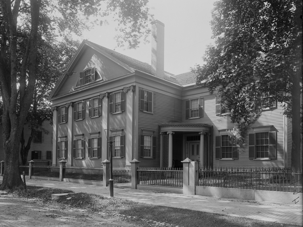
The house at 14 Chestnut Street in Salem, probably around 1890-1910. Image courtesy of the Phillips Library at the Peabody Essex Museum, Frank Cousins Glass Plate Negatives Collection.

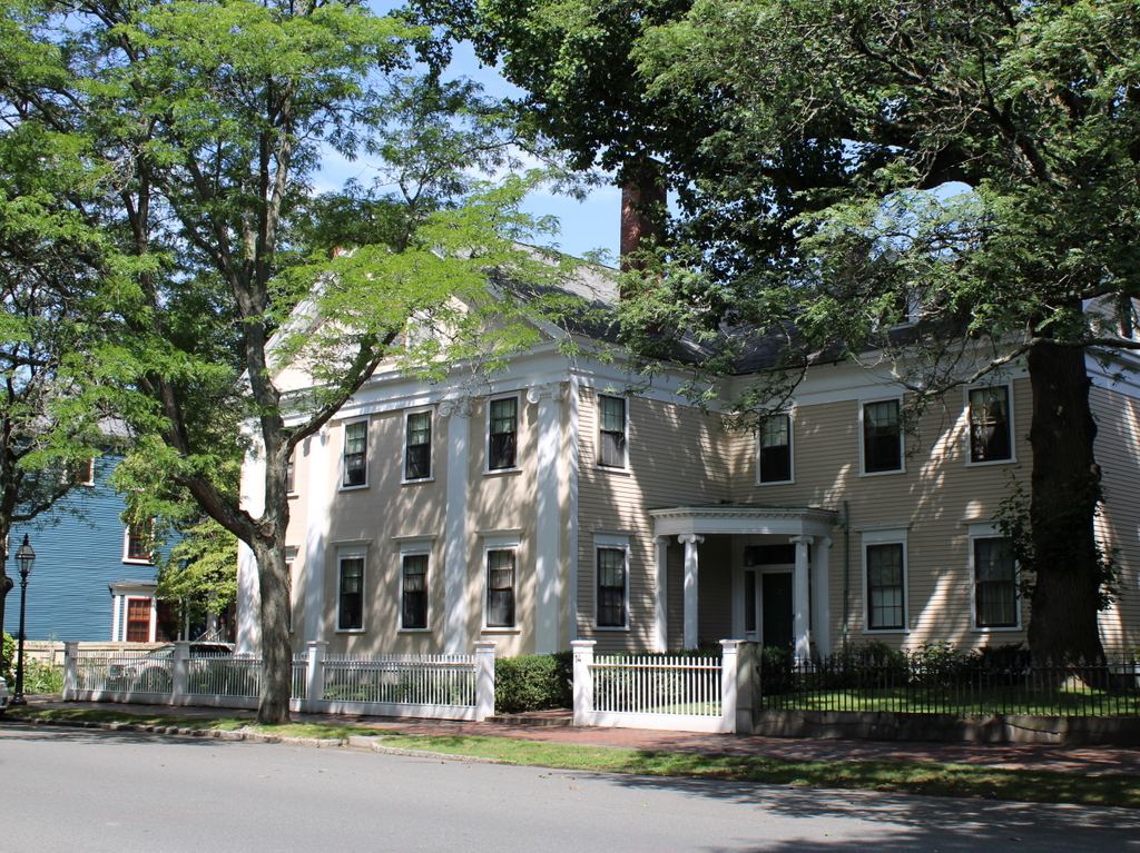
The house in 2023:

These two photos show the house at 14 Chestnut Street in Salem, which was built in 1834-1835 as the home of John Clarke Lee. It is one of the newer houses on Chestnut Street, as most of the other homes were built in the first few decades of the 19th century. As a result, it is architecturally different from most of the other homes. While the rest of the street consists primarily of symmetrical, three-story Federal-style homes with hipped roofs, this house is an early example of Greek Revival architecture. It features a gabled roof, and the front façade is decorated with four pilasters that give the house something of the appearance of an ancient Greek temple.

John Clarke Lee was a prominent merchant and banker who later became a partner in the Boston-based investment banking firm of Lee, Higginson & Co. He was about 30 years old when he moved into this house, and by this point he and his wife Harriet already had a large and growing family, with five young children. They subsequently had five more children, and in total all but one of their children lived to adulthood. Among their children was George Cabot Lee, whose daughter Alice Hathaway Lee became the first wife of Theodore Roosevelt.

The house remained in the Lee family for nearly a century. John died in 1877 and Harriet in 1885, but their son Francis inherited the house. He was living here when the top photo was taken around the turn of the 20th century, and he was responsible for adding the porch at the front door, as shown in the two photos. He died in 1913, and his widow Sophia subsequently sold the house in 1924.

The next owner of the house was Frank W. Benson, a prominent Impressionist painter from Salem. He was in his early 60s when he purchased the house, and by this point he had established himself as one of the leading American painters of the early 20th century. Benson was known for his portraits, along with en plein air landscapes of the seacoasts and mountains of New England. He lived here in this house until his death in 1951, at the age of 89.

Today, the house is still standing, with few exterior changes since the top photo was taken more than a century ago. Even the tree on the far right side of the scene appears to be the same one in both photos. Along with the rest of the street, the house is now part of the Chestnut Street District, which was added to the National Register of Historic Places in 1973.

Custom House, New Bedford, Massachusetts

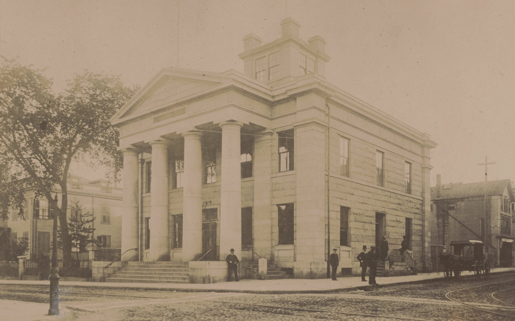
The New Bedford Custom House at the corner of William Street and North 2nd Street in 1886. Image courtesy of the New Bedford Free Public Library, Gilbert D. Kingman Photograph Collection.

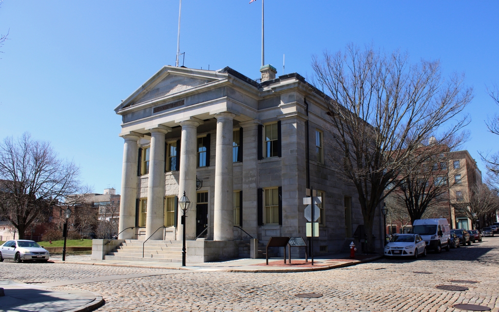
The scene in 2022:

During the first half of the 19th century, New Bedford was a major whaling port. It grew prosperous from the industry, leading to the construction of many historic buildings that still stand today. Among the most architecturally significant of these is the Custom House, shown here in these two photos. The building was designed by noted architect Robert Mills, and it was completed in 1836. Although relatively small in size, the building is a good example of Greek Revival architecture, which was a popular style for public buildings of this era.

The Custom House played an important role during New Bedford’s heyday. It was here that whaling captains, along with those of other incoming merchant vessels, would register their cargoes with customs officials. It was also here that sailors could obtain protection certificates. At the time, British warships would often stop American vessels and force sailors into the Royal Navy. These certificates could be presented as proof of American citizenship, which would, in theory, serve as a deterrent to Royal Navy ships that were searching for sailors.

This building served as the main offices for the District of New Bedford, which was responsible not only for the port of New Bedford, but also for the nearby ports of Fairhaven, Rochester (modern-day Mattapoisett and Marion), Wareham, Dartmouth, and Westport. In short, this district covered the communities along the northeastern shore of Buzzards Bay. By the mid 19th century, this was one of 11 customs districts in Massachusetts, some of which were centered around major seaports such as Boston, Salem, and New Bedford. However, there were also customs districts that were much smaller, including Fall River, Plymouth, and Edgartown.

In general, the more important the district was, the larger the number of customs officials appointed to it. For example, by the 1850s the District of Boston and Charlestown employed over 175 men. At the top of the hierarchy was the collector, and he was assisted by a variety of clerks, measurers, inspectors, appraisers, and other officials. However, by contrast the districts of Marblehead, Gloucester, Nantucket, and Edgartown were each staffed by just a single inspector.

Compared to these two extremes, New Bedford was somewhere in the middle. When this building first opened in 1836 it had a collector, a deputy collector, a clerk, an inspector/boarding officer, and an inspector/gauger/weigher. Each of the other five ports also had either one or two inspectors assigned to it, and there was also a revenue cutter, the McLane, that was assigned to the district. Here at the New Bedford custom house, the building was open six days a week, from 9:00 a.m. to noon, and then from 2:00-4:00 p.m. It was closed on Sundays, and also on July 4.

At the time, the collectors of each district earned a percentage of all import duties that were collected, along with a percentage of the fines that were imposed. This gave the collector an incentive to do his job well, and it also made these positions highly sought after. And, in the days of the spoils system, an appointment as collector of a major port was a way for newly-elected presidents to reward their loyal supporters with lucrative federal offices. Here in New Bedford, for example, the collector when this building was completed was Lemuel Williams Jr. He had been appointed by Andrew Jackson in 1829, replacing an earlier collector, Russell Freeman. This sparked considerable controversy, and the two men are said to have ended up in a fistfight in the streets of New Bedford.

The first photo was taken 50 years after the building was completed, in 1886. By this point, New Bedford’s whaling industry was in decline, but it otherwise remained a busy port. This would remain the administrative headquarters of the customs district until 1913, when the federal government consolidated the many different districts around the country. As a result, all of the districts in Massachusetts were combined into a single one, although some of the customs offices, including this one in New Bedford, would remain open as satellite offices.

Today, the surrounding buildings from the first photo are gone, but the custom house itself is still standing. It has seen a few changes over the years, including the removal of the cupola, which had been added around 1850. Overall, though, it is well preserved in its historic appearance, and it is still actively used as offices for U.S. Customs and Border Protection. It is a contributing property in the New Bedford Historic District, which was designated as a National Historic Landmark district in 1966, and it is also a part of the New Bedford Whaling National Historical Park.

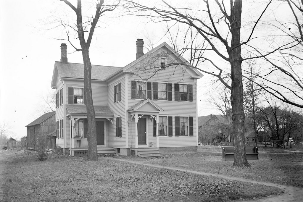
Levi Lincoln Jr. House, Worcester, Massachusetts

The former home of Governor Levi Lincoln Jr. on Elm Street in Worcester, around 1895. Image from Picturesque Worcester (1895).

The scene in 2021:

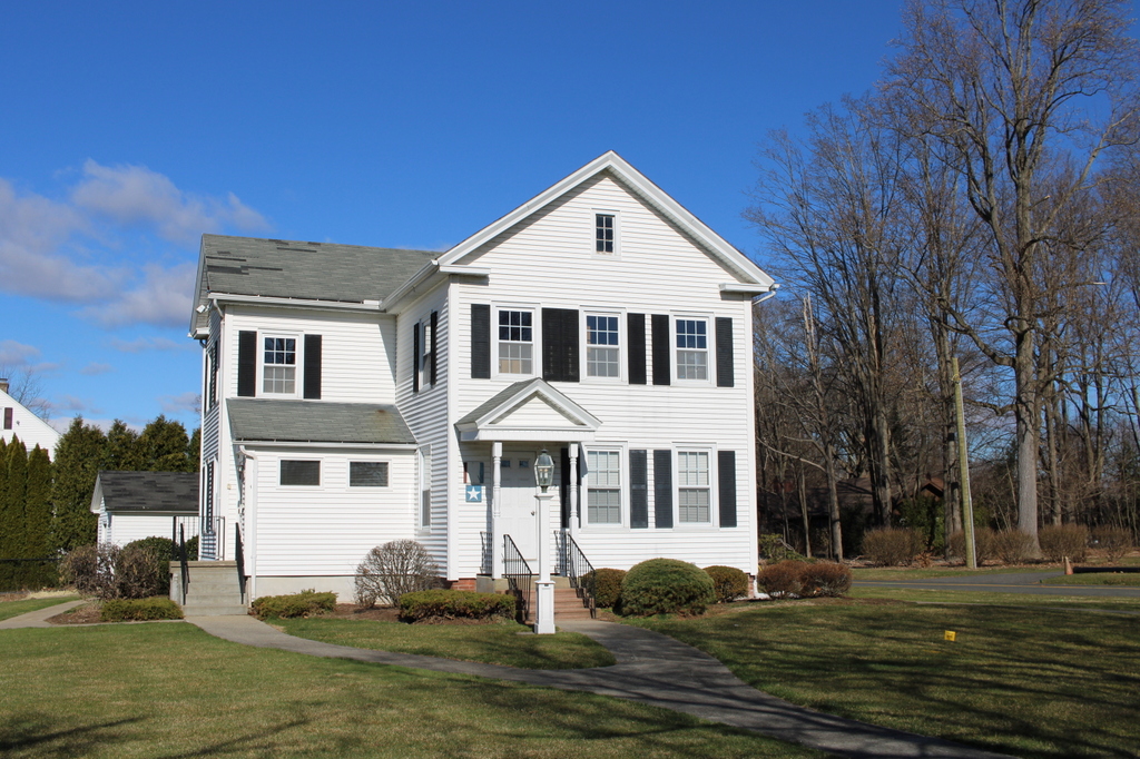
The house, now located in Sturbridge, Massachusetts, in 2021:

The house in the first photo was built in 1836 as the home of Levi Lincoln Jr., who served as governor of Massachusetts from 1825 to 1834. His nine years in office is still a record for the longest consecutive governorship in the history of the state, and it occurred at a time when governors were elected annually, meaning that he won nine consecutive elections. He came from a prominent political family; his father, Levi Lincoln Sr., served as U.S. Attorney General under Thomas Jefferson and later as lieutenant governor and acting governor of Massachusetts, and his brother Enoch was a congressman who subsequently served as governor of Maine. He was also much more distantly related to Abraham Lincoln, who was his fourth cousin once removed.

Lincoln built this Greek Revival house shortly after the end of his final term as governor. By this point he was serving in Congress, where he represented the 5th Massachusetts district from 1834 to 1841. He would later serve as collector of the port of Boston, and then as a state senator, before concluding his time in elected office as the first mayor of Worcester, from 1848 to 1849. However, he would remain active in politics over the next few decades, including serving as a presidential elector in 1864, when he cast his vote for his distant cousin Abraham Lincoln.

The 1864 election would not be the first time that Levi Lincoln would cross paths with his more famous cousin. The first time that the two men met was in Worcester in 1848, when the future president visited Massachusetts while campaigning for Whig presidential candidate Zachary Taylor. At the time, Abraham Lincoln was not a particularly noteworthy political figure. While Levi Lincoln came from a well-connected family, Abraham had a much more modest background. When he arrived in Worcester in September 1848, he was a small town lawyer from Illinois who was in the midst of his only term in Congress, and it would be another decade before he would begin to gain significant national attention for his speeches and debates.

Abraham Lincoln came to Worcester for the Whig state convention, and while here he delivered a speech at city hall in support of Zachary Taylor. Although Taylor was a southern slave owner, he was opposed to the expansion of slavery into newly-acquired territory. Here in Massachusetts, many Whigs were inclined to support the newly-formed Free Soil Party, which took a stronger stance against slavery. However, the Free Soil Party’s candidate, former President Martin Van Buren, had no chance of carrying the election, so in his speech Lincoln argued that a vote for Van Buren would effectively just be a vote for Democrat Lewis Cass, who supported the expansion of slavery. Instead, Lincoln believed that it was best to vote for Taylor, who had a realistic chance of winning and who shared many of the same beliefs as the Free Soilers when it came to limiting the spread of slavery.

On the same night that Lincoln delivered this speech, he was invited to dine here at Levi Lincoln’s house on Elm Street. The dinner included a number of other dignitaries, among them Henry Gardner, who would later serve as governor. He recalled the events of that evening many years later, as quoted by Abraham Lincoln’s former law partner, William Henry Herndon, in his biography Abraham Lincoln: The True Story of a Great Life:

Gov. Levi Lincoln, the oldest living Ex-Governor of Massachusetts, resided in Worcester. He was a man of culture and wealth; lived in one of the finest houses in that town, and was a fine specimen of a gentleman of the old school. It was his custom to give a dinner party when any distinguished assemblage took place in Worcester, and to invite its prominent participants. He invited to dine, on this occasion, a company of gentlemen, among them myself, who was a delegate from Boston. The dining-room and table arrangements were superb, the dinner exquisite, the wines abundant, rare, and of the first quality.

I well remember the jokes between Governor Lincoln and Abraham Lincoln as to their presumed relationship. At last the latter said: “I hope we both belong, as the Scotch say, to the same clan; but I know one thing, and that is, that we are both good Whigs.”

Gardner later went on to describe how, in 1861, he visited Abraham Lincoln in the White House. During this visit, the president remembered the dinner in Worcester, and according to Gardner, Lincoln told him:

You and I are no strangers; we dined together at Governor Lincoln’s in 1848. . . . I had been chosen to Congress then from the wild West, and with hayseed in my hair I went to Massachusetts, the most cultured State in the Union, to take a few lessons in deportment. That was a grand dinner—a superb dinner; by far the finest I ever saw in my life. And the great men who were there, too! Why, I can tell you just how they were arranged at table.

In the meantime, Levi Lincoln continued to live here in this house on Elm Street throughout Abraham Lincoln’s presidency, and he died here in 1868, at the age of 85. The 1860 census, the last federal census to be taken during his lifetime, shows him living here with three generations of Penelopes: his wife, their widowed daughter Penelope Canfield, and her 14-year-old daughter, who was also named Penelope. The family also had two live-in domestic servants, Mary Johnson and Angeline Rich, along with a coachman, Philip O’Conell. Five years later, the same people were living here during the 1865 state census, with the exception of a different coachman, Patrick Harmon.

This house was later owned by Levi Lincoln’s son, Daniel Waldo Lincoln, who was living here during the 1880 census with his wife Frances and two servants. He was an accomplished horticulturalist, but he was also involved in politics, serving as mayor of Worcester from 1863 to 1866. In addition, he was the vice president of the Boston and Albany Railroad for many years, and he became president of the company in 1878. However, he had a relatively short tenure as president, because he was killed in a railroad accident in 1880. He had been in New London for the Harvard-Yale Regatta, and was watching the race from the platform of an observation car on a train. At one point during the race, a mishap caused Lincoln and another spectator to be thrown from the car and onto the tracks, where they were both fatally crushed by the wheels.

The house was subsequently inherited by his son, Waldo Lincoln, who would live here for the rest of his life. Waldo was involved in several different manufacturing companies, but he retired from active business at a relatively young age and spent much of his life as a historian and genealogist. For many years he served as president of the American Antiquarian Society, which is headquartered in Worcester, and he also researched and wrote about a wide variety of topics, with publications ranging from family genealogies to a history of American cookbooks, to a history of newspapers in Bermuda.

Waldo Lincoln was living here when the first photo was taken around the 1890s, and the 1900 census shows him here with his wife Fanny, their five children who ranged in age from 10 to 25, and two servants. By 1920, the household had grown even more, and the Waldos were living here with their daughter Josephine, her husband Frank Dresser, their four young children, and four servants.

Frank Dresser died in 1924, but the rest of the family was still living here in 1930, with the exception of Fanny Lincoln. That year’s census lists her as being a patient at McLean Hospital, a psychiatric hospital in Belmont. She appears to have eventually returned to Worcester, though, because her 1939 obituary indicates that she died here at her Elm Street home at the age of 87. In the meantime, her husband Waldo Lincoln died here in 1933 at the age of 83.

Their daughter, Josephine Dresser, continued to live here until as late as 1950, but by this point the location of the old house was being eyed for commercial development. It was acquired by the Worcester Mutual Fire Insurance Company in the early 1950s, in order to build a new office building on the site. However, rather than demolish the historic house, the company offered it to Old Sturbridge Village. The house was moved and reassembled there in 1952, although it was not placed in the village itself. Such a large mansion would have been vastly out of place in the recreated rural village, so it was instead rebuilt at the entrance to the village on Route 20. It has stood there ever since, as shown in the third photo, and over the years it has been occupied by a variety of commercial tenants.