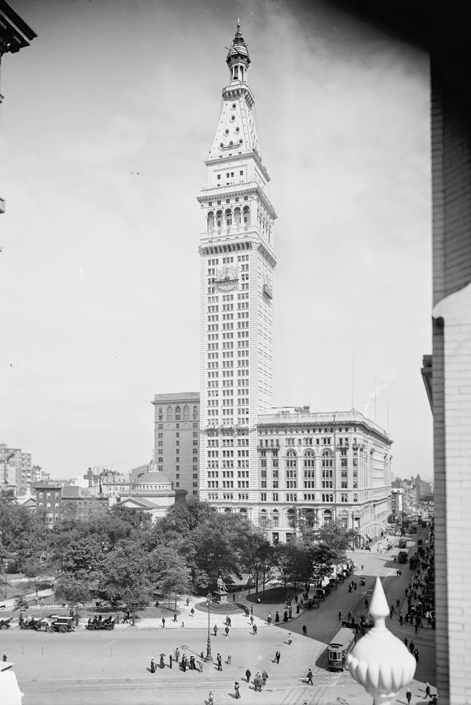
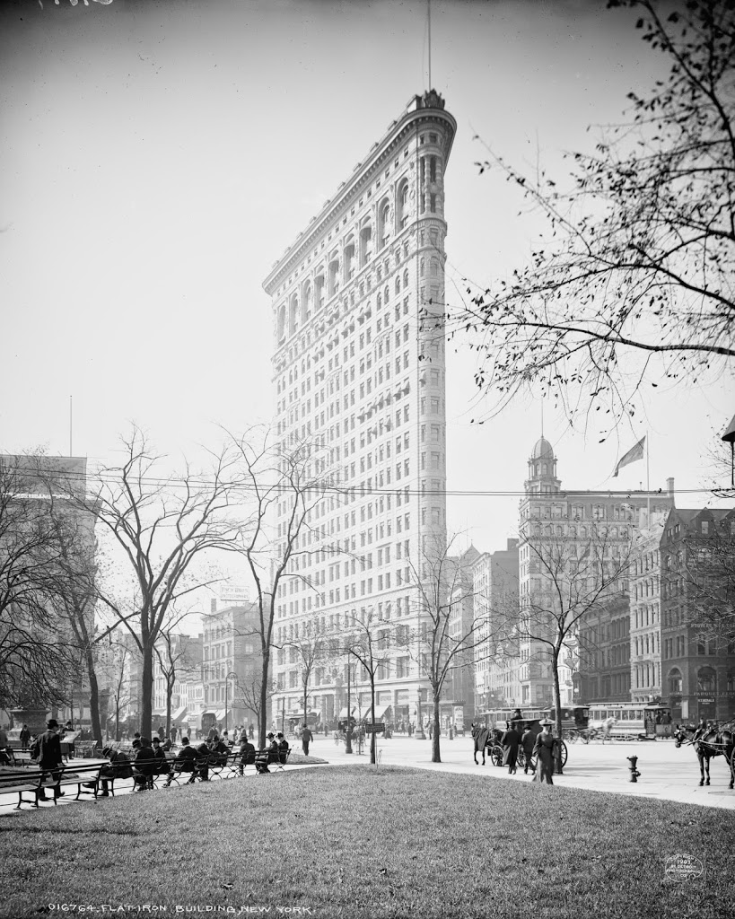
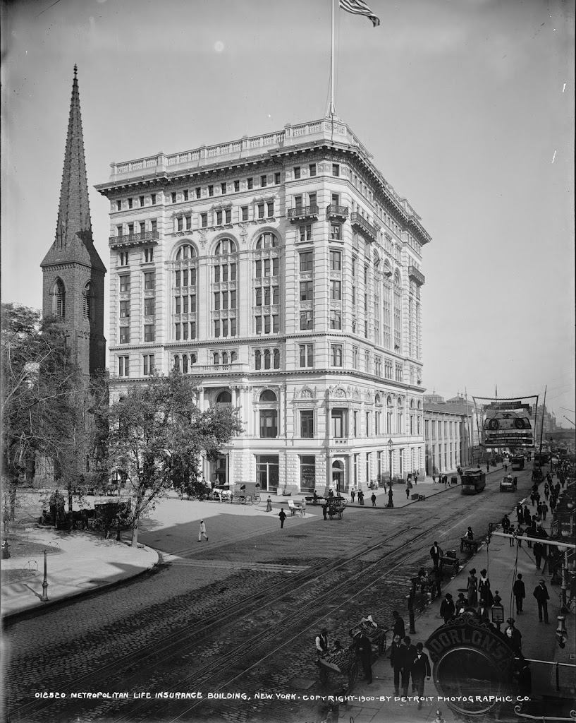
Flatiron Building, New York City

The view of the Flatiron Building around 1902. Image courtesy of the Library of Congress, Detroit Publishing Company Collection.

181_1902c-loc.tif

The same scene in 2014:

181_2014

Another view of the Flatiron Building, looking south with Broadway on the left and Fifth Avenue on the right.  Besides the Flatiron Building, a few other ones still exist from the 1902 photo, including the  building with the gold dome to the right, and the short, yellow brick building just beyond the Flatiron Building along Broadway.  Notice the horse-drawn cabs along the side of Broadway – this photo was taken from almost the same location as this one, except in the road instead of along the sidewalk.

Flatiron Building from Madison Square Park, New York City

View of the Flatiron Building around 1903. Image courtesy of the Library of Congress, Detroit Publishing Company Collection.

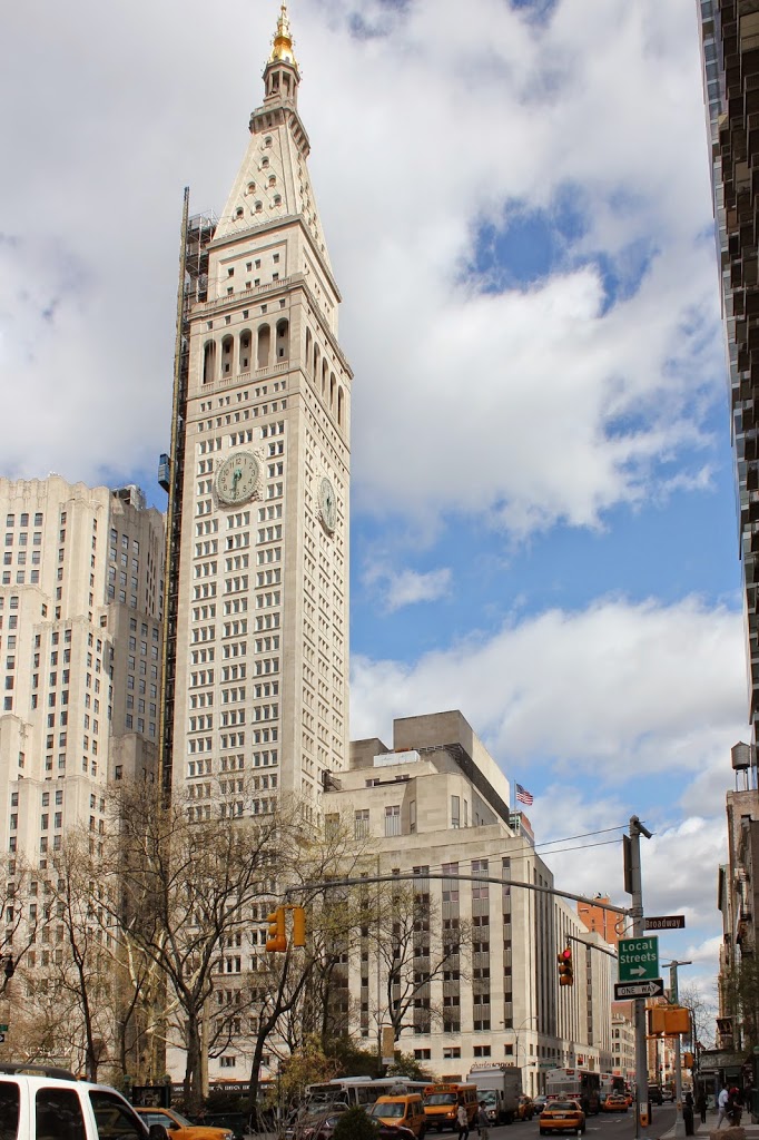
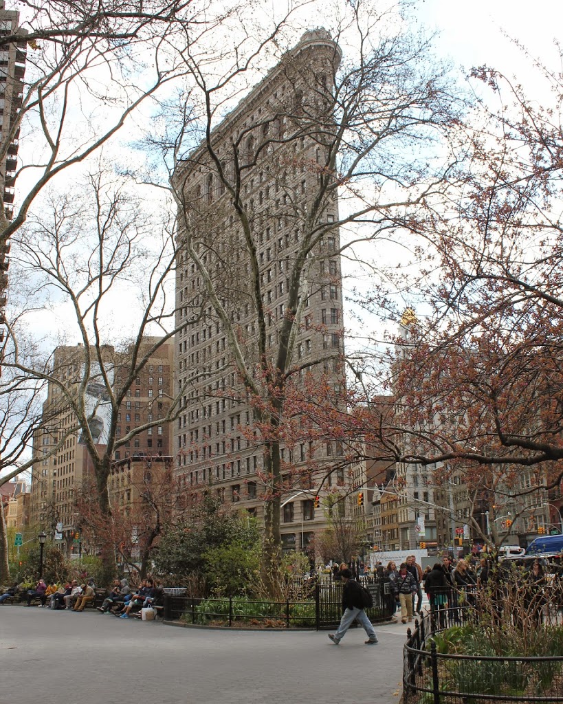
The same view in 2014:
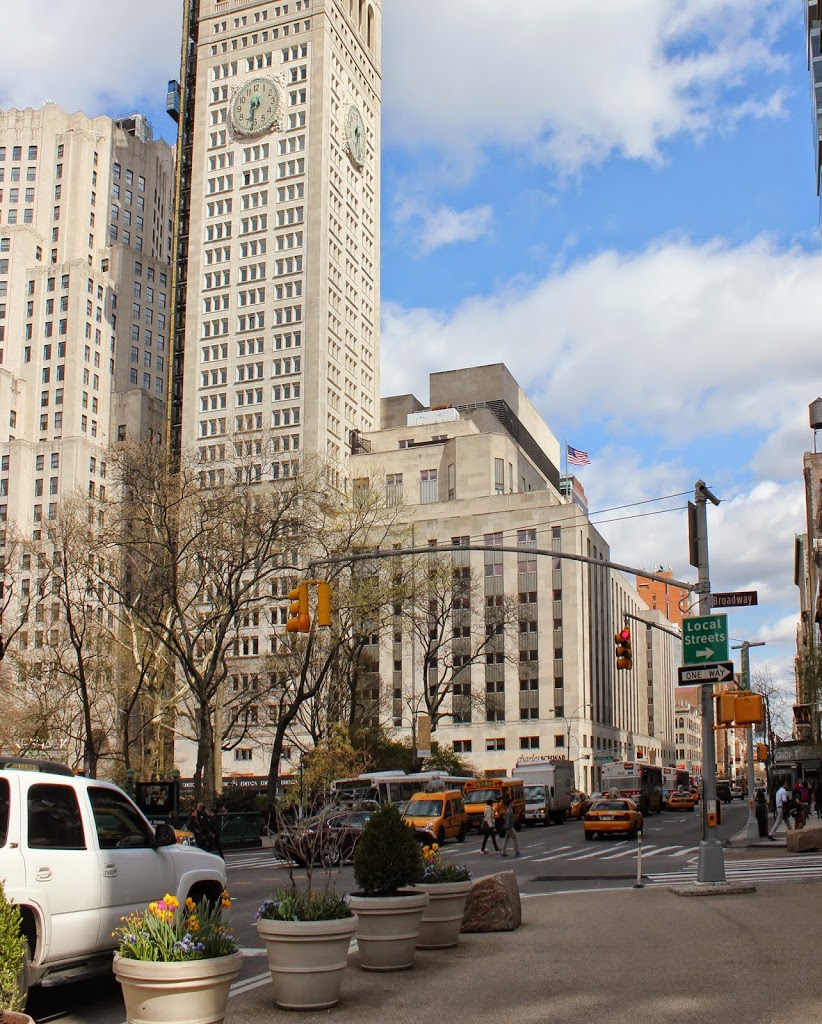
182_2014

Built in 1902 on a triangular plot of land between Broadway and Fifth Avenue at Madison Square, the Flatiron Building remains one of New York’s most distinctive skyscraper.  At the time of its completion, it was one of the first skyscrapers outside of the downtown area, and the first north of 14th Street, which set the stage for subsequent skyscrapers that now dominate the midtown skyline.

Fraunces Tavern, New York City

Fraunces Tavern at the corner of Broad and Pearl Streets in New York City, between 1900 and 1906. Image courtesy of the Library of Congress, Detroit Publishing Company Collection.

173_1900-1906-loc

After its reconstruction, around 1907-1915. Image courtesy of the Library of Congress, Detroit Publishing Company Collection.

173_1907-1915-loc

In 2014:

173_2014

Claimed to be the oldest building in Manhattan, the building was constructed in 1719, and was used as a tavern in the second half of the 18th century and well into the 19th century.  However, the building suffered some serious fires in the mid 19th century, and was consequently reconstructed several times.  By the turn of the century, it looked nothing like its original appearance.  In fact, when it was finally “restored” in 1907, it was redesigned based on what was presumed to be colonial appearance; its actual 18th century configuration is unknown.  I don’t know how much of the original structure is left, but I would hazard a guess that it is an architectural equivalent to the ship of Theseus, with the question being, if a building has, over time, had every single part of it replaced, is it still the same building? And if not, at what point did it cease to be the same building? But, if it is the same building, what would happen if, theoretically, all of the original pieces were recovered and reconstructed, say, across the street. Which would be the “real” building? Inquiring minds want to know.

Memorial Square, Springfield, Mass

Memorial Square and Memorial Congregational Church in Springfield, Mass., around 1908. Image courtesy of the Library of Congress, Detroit Publishing Company Collection.

146_1908c.tif

The scene in 2014:

146_2014

Built in 1869, the former Memorial Congregational Church has been home to St. George Greek Orthodox Church (now Cathedral) since 1940.  In the foreground is a monument to Massachusetts veterans from the Spanish-American War.  Neither the church nor the statue have changed much in appearance, although the quiet elm-lined streets have changed; Memorial Square is now the intersection of Routes 20 (left) and 116 (right), and the on-ramp for Interstate 91 is visible just beyond the church, on Route 20.

Union Station, Springfield, Mass

Union Station in Springfield, Mass, around 1905. Image courtesy of the Library of Congress, Detroit Publishing Company Collection.

145_1905c loc.tif

The scene in 2014:

145_2014

Prior to 1890, trains passing through Springfield on the Boston & Albany Railroad had to cross Main Street at street level; this resulted in significant traffic issues as the city grew, so in 1890 a stone arch was built over Main Street, and an elevated stone viaduct carried the railroad through downtown.  As part of this, the old Union Station was opened in 1889.  Designed by Shelby, Rutan and Coolidge in the style of Henry Hobson Richardson, the station consisted of buildings on both the north and south sides of the tracks (as seen in this photo, taken around the same time).  The 1905 photo shown above shows the south side, looking east along Lyman Street.  This station was demolished in 1925 and replaced with the present-day Union Station.  This station, located on the other side of the tracks, has been closed since 1974, but is in the process of being renovated.  In the meantime, rail travelers today use the Lyman Street entrance to access the modern Amtrak station, which is a far cry from Richardson’s original design.

Corner of Dwight and Sanford Streets, Springfield

The building that once stood at the corner of Dwight and Sanford Streets. Photo from Springfield Present and Prospective (1905).

120_1800s spp

The location in 2014:

120_2014

As seen in today’s photo, the buildings in the first photo don’t exist anymore, and in fact neither does the street on the right, Sanford Street. The first photo shows two different 17th century houses: the old Nathaniel Ely Tavern in the foreground, built in 1660, and the Margaret Bliss House just beyond it, built around 1695. Obviously both buildings are long gone. I don’t know when they were demolished, but it is safe to say they were gone before the MassMutual Center was built in the 1970’s.