104-108 State Street, Springfield, Mass

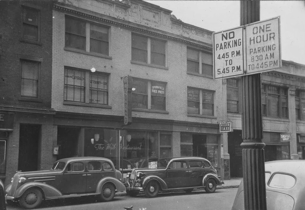
The buildings at 104-108 State Street in Springfield, around 1938-1939. Photo courtesy of the Springfield Preservation Trust.

388_1938-1939-2Bspt

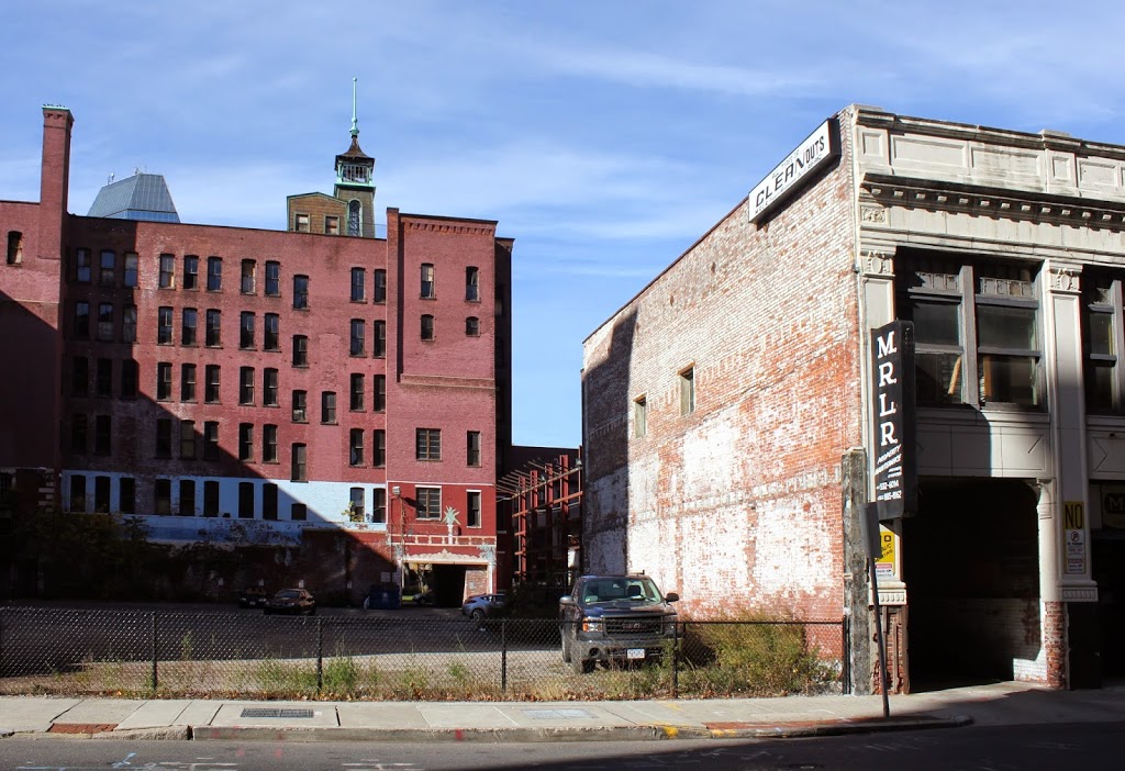
The scene in 2014:

388_2014

These photos were taken facing just to the right of the ones in this post, and the 1930s photo shows the building once occupied by The Hub Restaurant.  As mentioned in the other post, this building was probably taken down around the same time as the Court Square Theater to make room for the present-day parking lot, although the building to the right of it still survives; this is the Shean Block, which was built in 1927 at the corner of Main and State Streets.

Notice the “No Parking” sign in the foreground – I’m not quite sure why parking was restricted from 4:45 to 5:45; perhaps this was to accommodate rush hour traffic?  At the time, State Street was part of Route 20, so this section of road was probably pretty busy in the pre-interstate days.  There is also a clue as to the date of this photo – a sign in the second floor window reads “Springfield Free Press,” which was published starting in September 1939.  If the estimated date range of 1938-1939 is accurate, then the photo was most likely taken in the fall of 1939.

102 State Street, Springfield, Mass

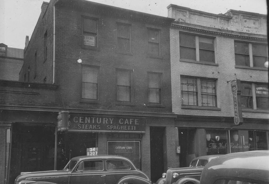
The building at 102 State Street in Springfield, around 1938-1939. Photo courtesy of the Springfield Preservation Trust.

387_1938-1939-2Bspt

The scene in 2014:

387_2014

Both the Century Cafe and The Hub Restaurant are long gone, as are the buildings that they once occupied.  In the 1930s photo, these buildings fronted State Street, and behind them was the Court Square Theater, which was part of the Court Square Hotel.  The hotel part of the building is still there, to the left and in the background of the 2014 photo, but the theater itself was demolished in 1956 to make room for the parking lot.  It was probably around this time that the buildings on State Street were demolished.

Springfield Institution for Savings, Springfield, Mass

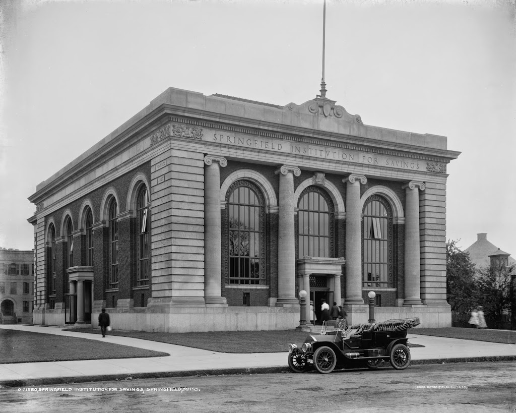
The Springfield Institution for Savings building on Elm Street in Springfield, around 1910. Image courtesy of the Library of Congress, Detroit Publishing Company Collection.

Banks

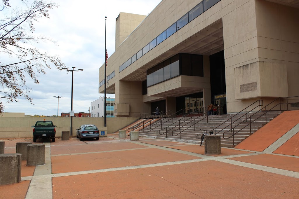
The site in 2014:

370_2014

The first photo shows the former home of the Springfield Institution for Savings, one of Springfield’s first banks.  Today, the building no longer exists, and neither does the company.  SIS is now part of TD Bank, and the site of the building is now part of the Hampden County Courthouse.  Even the street that the bank was once on, Elm Street, no longer really exists.  It used to extend from Main Street to present-day East Columbus Avenue, but the construction of the new courthouse in the 1970s caused the street to be truncated, and today it is a street in name only, as the section along Court Square is gated off, and the section next to Old First Church is essentially a parking lot for courthouse employees.

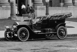
What really interested me in this picture, though, is the car parked outside.  Here is a close-up of it:

4a23747a.tif

Along with giving us a clue as to the date (the license plate appears to read “1910”), it also shows an intriguing and long-forgotten part of Springfield history.  The car was made by Springfield-based Knox Automobile Company, who made cars in the city from 1900 until 1914, and trucks until 1924.  Their factory was on Wilbraham Road in the Mason Square neighborhood, right across the street from the Indian Motorcycle factory.  The Knox building is still there, although it is in pretty rough shape and was included in the 2014 list of Springfield’s most endangered buildings.

I am fairly certain that the car in the photo is a 1909 Model “O,” although I am no expert on early 20th century automobiles, so if someone more knowledgeable than me knows otherwise, let me know. Assuming it was a Model “O,” though, it would’ve been $3,000 car 1909.  Adjusted for inflation, that would be over $75,000 in 2014 dollars, so the owner would’ve been a fairly wealthy person.  Today, though, cars don’t look like that, as the pickup truck and station wagon bear witness to in the 2014 photo.  However, at least one 1909 Knox Model “O” still exists today; this article explains the process of restoring the car and includes plenty of post-restoration photos.

Aftermath of the Halifax Explosion (3)

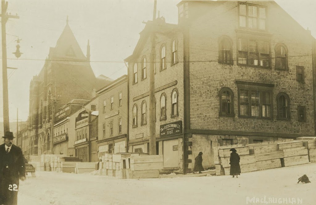
Looking down Argyle Street from George Street in downtown Halifax, Nova Scotia, in December 1917. Photo courtesy of the Nova Scotia Archives.

357_1917-2Bnsarchives

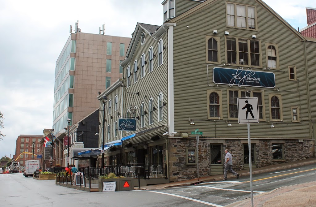
The scene in 2014:

357_2014

Out of the photos that I’ve posted about the Halifax Explosion, this is the only one that doesn’t show an area affected by the blast.  However, what the 1917 photo does show is far more powerful.  At first glance, nothing seems out of the ordinary, except for the stacks of wooden boxes on the street.  Except they’re not just wooden boxes; the sign on the second building from the right reads “Undertakers,” and the coffins outside were just a sampling of what was needed for the approximately 2,000 victims of the disaster.

Incidentally, this wasn’t the first time that the building dealt with a major tragedy – just five years earlier the recovery operation for the bodies of Titanic victims was operated out of the city, as it was the closest major port to the disaster.  During that time, the mortuary here was used to care for the remains of some of the victims, including John Jacob Astor and Charles M. Hayes.

Today, the building is still there, and is nearly 200 years old; it was built in 1817 and has served a variety of uses ever since.  Today, it is home to the Five Fishermen, which is perhaps the only fine dining restaurant in the world that advertises the fact that its facilities were once used as a mortuary.  (if you don’t believe me, check out their website – they even have the same 1917 photo there)

Brattleboro, Vermont (3)

Looking north from the corner of Main & Canal Streets in Brattleboro, Vermont, around 1917. Image courtesy of the Library of Congress.

349_1917c-2Bloc

The scene in 2014:

349_2014

Taken from across the street from the photos in this post, the 1917 scene shows some of the industrial development along the Whetstone Brook near its confluence with the Connecticut River just to the east (right) of this scene. Many of the buildings still exist, with the oldest one in this scene being the 1850 Van Doorn/Culver Block, in the foreground with the tall gabled roof.

The top photo is part of a panoramic view; the other parts can be viewed here:

Part 1
Part 2
Part 4

Brattleboro, Vermont (2)

Facing northwest from the corner of Main & Canal Streets in Brattleboro, Vermont, around 1917. Image courtesy of the Library of Congress.

Brattleboro

The scene in 2014:

348_2014

The building in the right-center of these two photos is the Wilder Building, which was built in 1875.  It is at the southern end of Main Street, and is directly adjacent to the Whetstone Brook.  In 2004, the top two floors of the building were heavily damaged by a fire, but the historic building was able to be restored, and today it continues to be used for mixed-use residential and commercial purposes.  Further up Main Street to the right is the 1936 Latchis Hotel, which replaced the three-story commercial building in the 1917 photo.  On the far right is the Barber Building, located at the corner of Main Street and Flat Street.  It was built in 1915, so it was brand new in the 1917 photo, and today it is home to Sam’s Outdoor Outfitters.

The top photo is part of a panoramic view; the other parts can be viewed here:

Part 1
Part 3
Part 4