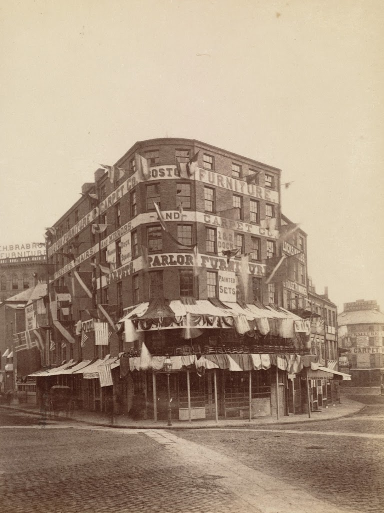
Dock Square toward Union Street, Boston

Dock Square looking toward Union Street in Boston, in 1865. Photo courtesy of Boston Public Library.

316_1865-2Bbpl

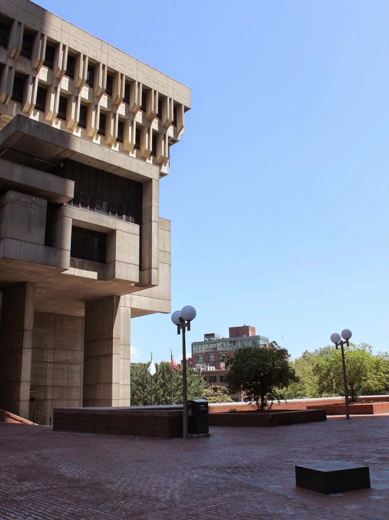
The scene in 2014:

316_2014

These photos were taken from almost the same spot as the ones in this photo, just slight ahead and to the right.  The first one shows the variety of businesses that were located in Civil War-era downtown Boston, ranging from feathers and furniture to hardware and whips.  The tracks in the foreground are for a horse-drawn trolley line; this was an early version of Boston’s present-day subway network, before the trolleys were electrified and put underground.

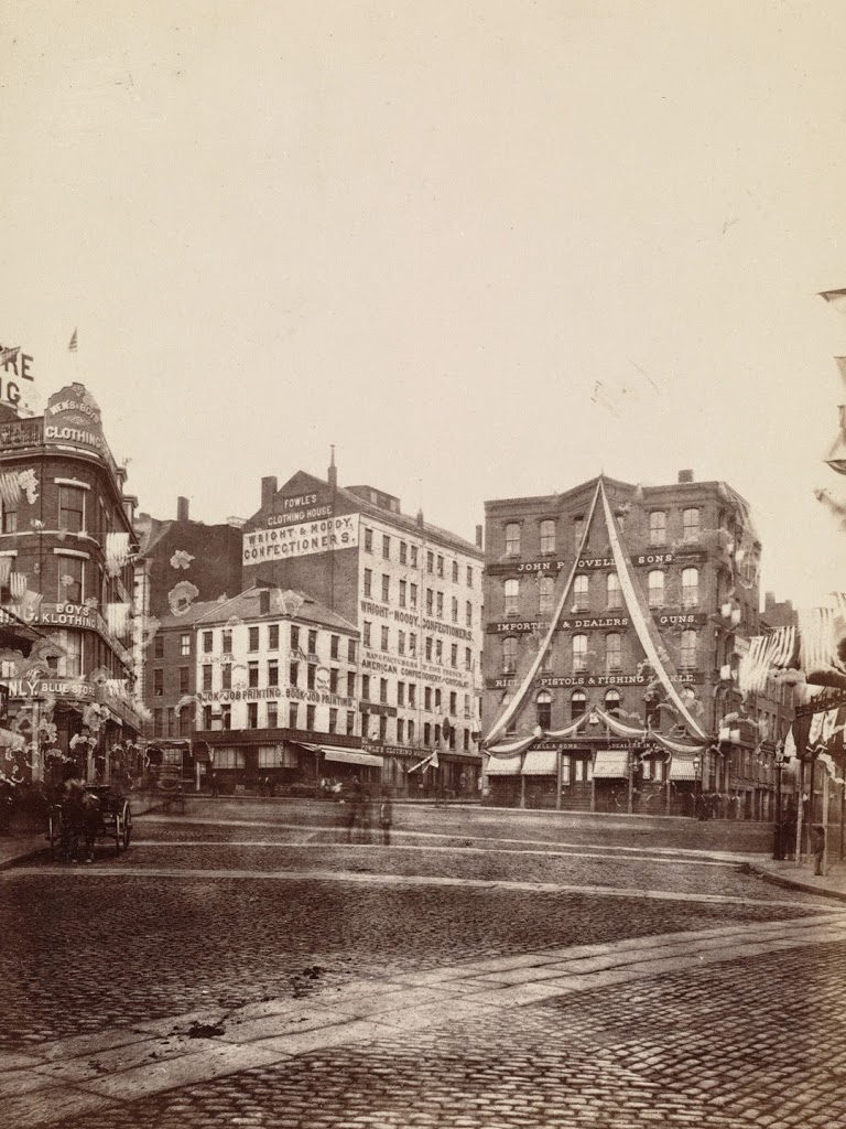
Washington Street and Dock Square, Boston

The corner of Washington Street and Dock Square in Boston, on June 17, 1875. Photo courtesy of Boston Public Library.

315_1875-06-17-2Bbpl

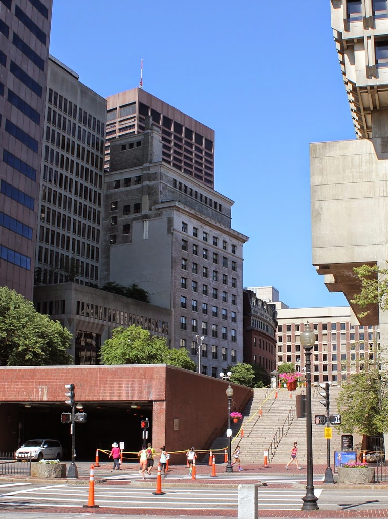
The scene in 2014:

315_2014

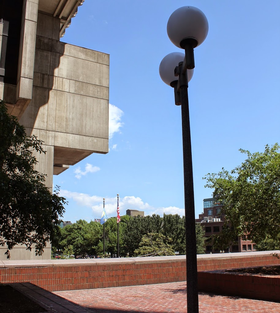
Taken on the same day as the photo in this post, the first photo is taken from a different angle, but shows the Dock Square area as it once looked, long before the urban renewal projects of the 1960s During this time, the neighborhood was replaced with Boston City Hall, which can be seen on the left-hand side of the 2014 photo.

Dock Square, Boston

Dock Square in Boston, taken on June 17, 1875. Photo courtesy of Boston Public Library.

314_1875-06-17-2Bbpl

The same location in 2014:

314_2014

The first photo was taken when Dock Square was adorned for the celebration of the 100th anniversary of the Battle of Bunker Hill.  Probably none of the buildings in the photo existed 100 years earlier, and 100 years later they would be all gone, replaced by the bunker-like City Hall that was built on the firmer site of Scollay, Adams, and Dock Squares.

Hancock Tavern, Boston

The Hancock Tavern on Corn Court, Boston, around 1898. Photo courtesy of Boston Public Library.
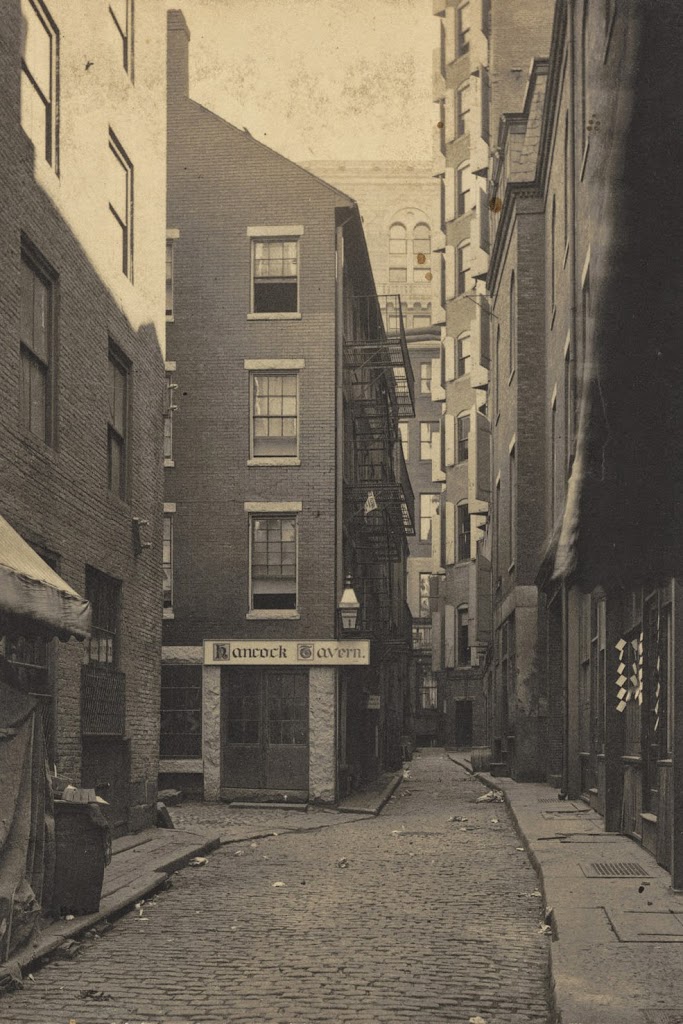
313_1898c-2Bbpl

The same site in 2014:

313_2014

Throughout the 19th century, rumors abounded that this building, known as Hancock Tavern, was the meeting-place prior to the Boston Tea Party.  However, while old, this building was not that old – a 1917 estimate put its date of construction between 1807 and 1812. Even the site has no direct connection to the Tea Party – the previous building had been a four room house, with no record of any tavern existing there in the 1770s. In short, as one historian put it in 1903, “As an old landmark the Hancock Tavern is a failure.”

The first photo is intriguing, however, because it shows a glimpse of what 19th century Boston looked like, with narrow, winding cobblestone streets that seem to literally vanish into the city blocks.  The scene wouldn’t last for much longer after the first photo was taken, though.  It was demolished by 1903 and replaced with a more modern building; the narrow Corn Court alley went with it as well.  Today, the site has been completely redeveloped again, and is located just south of Faneuil Hall, between Faneuil Hall, State Street, Congress Street, and the South Market building.

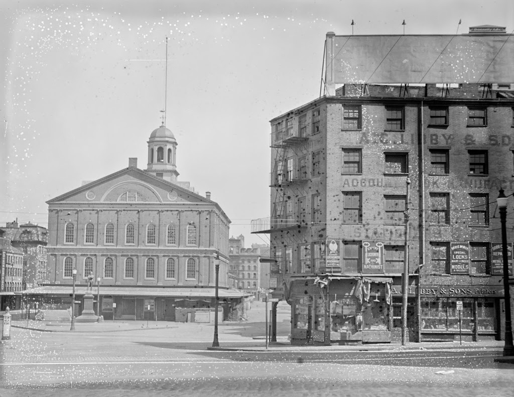
Sun Tavern, Dock Square, Boston

The Sun Tavern at Dock Square, across from Faneuil Hall in Boston, sometime in the 1800s. Photo courtesy of Boston Public Library.

Taverns

Dock Square and the Sun Tavern around 1898. Photo courtesy of Boston Public Library.

312_1898c-2Bbpl

The scene in 2014:

312_2014

According to the sign above the building in the first photo, the Sun Tavern was built in 1690, although some estimates that I have seen have dated its construction even earlier.  In either case, the building was extremely old by the time it was photographed in 1898,  It was a tavern by the first decade of the 18th century, although possibly earlier, and was at the time located right next to the town dock, hence the name of Dock Square.  It wouldn’t be until over 50 years after it opened that its familiar neighbor, Faneuil Hall, was built, and another 80 years after that before Quincy Market was built atop what was once Boston Harbor.

The building survived until about 1910 (it appears in the 1908 atlas, but is gone by the 1912 one), and sometime in the 1920s or 1930s a good portion of Dock Square was torn down.  The rest would come down in the 1960s, when the area that once made up Dock Square, Adams Square, and Scollay Square was demolished to build Boston City Hall, seen on the right-hand side of the 2014 photo.

Central House, Boston

The Central House on Brattle Square, Boston, in 1860.  Photo courtesy of Boston Public Library.

306_1860-2Bbpl

The scene in 2014:

306_2014

Located next to the Quincy House, immediately to the right of the building in the 1860 photo of this post,  the Central House was at one point its own hotel, but was later absorbed into the Quincy House.  Eventually, like the rest of the Quincy House, this section was expanded to seven stories in the 1880s, although it isn’t apparent whether the existing floors were added on to, or if the brick section was entirely demolished.  In any case, the entire neighborhood is gone, along with the street network, so this photo and the other one of the Quincy House are recreated based on estimates from comparing historic and modern maps; no landmarks remain from either of the two 1860 photos.