Lyman Street Bridge, Holyoke, Mass

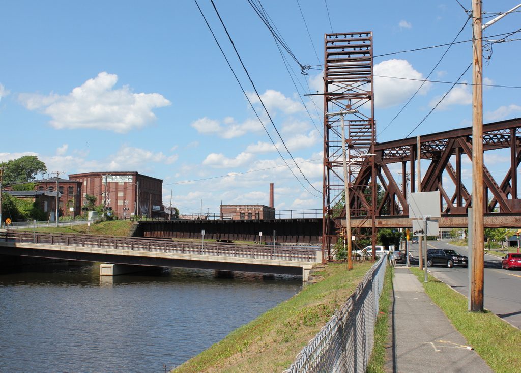
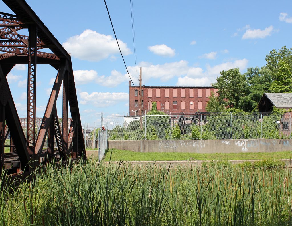
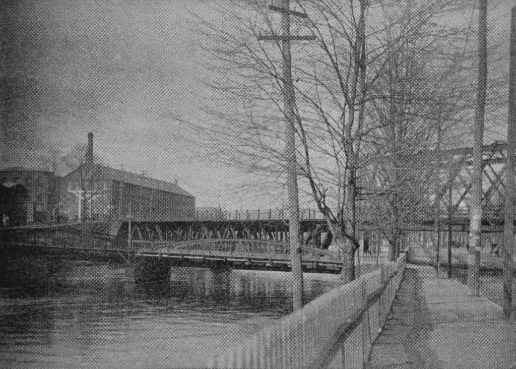
Looking north toward the Lyman Street bridge over the Second Level Canal in Holyoke, around 1892. Image from Picturesque Hampden (1892).

The scene in 2017:

Holyoke was developed in the mid-19th century as one of the first planned industrial cities in the country, and was powered by a network of canals that were constructed starting in 1847. The Second Level Canal, seen here, runs parallel to the city’s street grid, and it is crossed by six of the major streets in downtown Holyoke. The northernmost of these is Lyman Street, which crosses the canal here, and the first photo shows a low, two-span bridge that was probably constructed of iron. The railroad bridge just beyond it was also iron, and carried the Connecticut River Railroad through Holyoke, passing diagonally across both the canal and the intersection of Lyman and Canal Streets on the right side of the photo. This lattice truss bridge was built in 1887, and later became part of the Boston and Maine Railroad after the company acquired the rail line in 1893, soon after the first photo was taken.

Today, this scene is still easily recognizable from the first photo, although both of the 19th century bridges are gone. The old railroad bridge was replaced in 1928 by a steel Warren truss bridge, which is still in use today, and the current Lyman Street bridge was built in 2011. Further in the distance, several of the 19th century mill buildings are still standing on Gatehouse Road. The long building on the left side of the photo, once the home of the Whiting Paper Company, is still there. It was heavily altered at some point after the first photo was taken, and the right side of the building collapsed during a severe thunderstorm in 2011. However, the left side is still standing, along with the small, two-story brick building on the far left side of both photos.

Mosher Street from Main Street, Holyoke, Mass

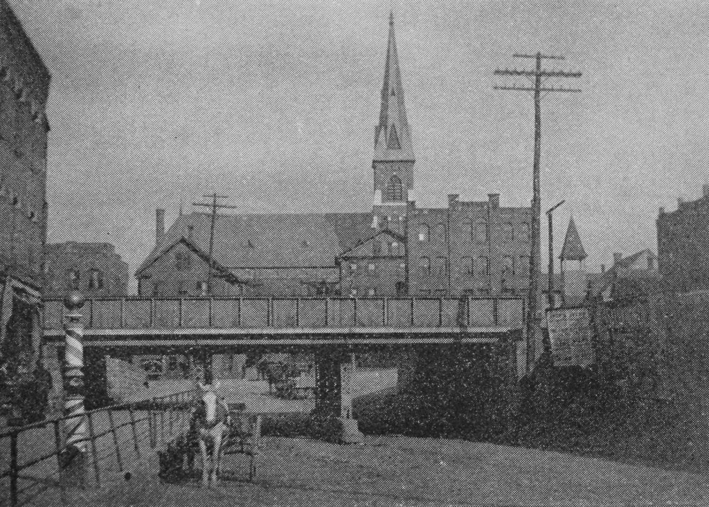
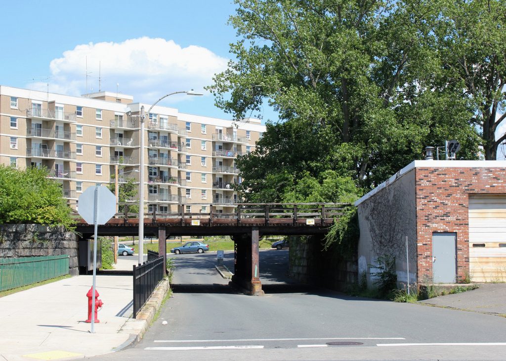
Looking east on Moster Street from the corner of Main Street in Holyoke, around 1892. Image from Picturesque Hampden (1892).

The scene in 2017:

The railroad bridge in the foreground is located just south of Holyoke’s historic railroad station, and carries the Connecticut River Railroad over Mosher Street. This railroad line, which was acquired by the Boston and Maine Railroad soon after the first photo was taken, is the primary north-south railroad route through western Massachusetts, linking the major cities and towns of the Connecticut River Valley with Vermont to the north and Connecticut to the south.

Several blocks away in the distance of the first photo is the Church of Our Lady of the Rosary, which was built in 1887 at the northeast corner of Mosher and West Streets. It was one of many Catholic churches built in Holyoke during this time, and both the church and its parish school served the large numbers of Catholic immigrants who came to Holyoke as mill workers in the late 19th and early 20th centuries. The first pastor of the church, Michael J. Howard, died in 1888, only a year after the church building was completed, and he was succeeded by Thomas D. Beaven, who served the parish until 1892, when he became bishop of the Diocese of Springfield.

Today, only the railroad itself still exists from the first photo. The church was demolished in 1976, and the rest of the buildings between the railroad and the church are also gone. A large apartment building now dominates the left side of the 2017 photo, and the surrounding streets now consist primarily of modern duplexes, interspersed by occasional historic buildings. The old railroad station, just out of view to the left, is still standing, although it has been vacant for many years. Passenger rail was recently restored to Holyoke, with Amtrak’s Vermonter now running through the city, although it currently uses a small platform located a block south of here at Dwight Street, instead of the abandoned 19th century station.

Main Street from Dwight Street, Holyoke, Mass

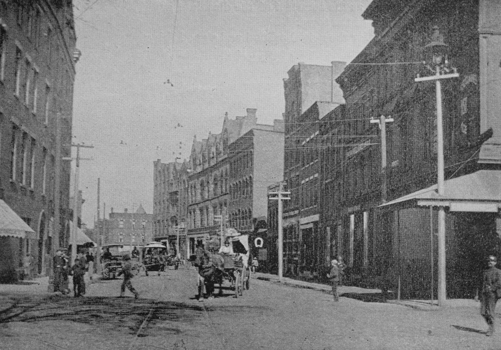
Looking north on Main Street from the corner of Dwight Street in Holyoke, around 1892. Image from Picturesque Hampden (1892).

The scene in 2017:

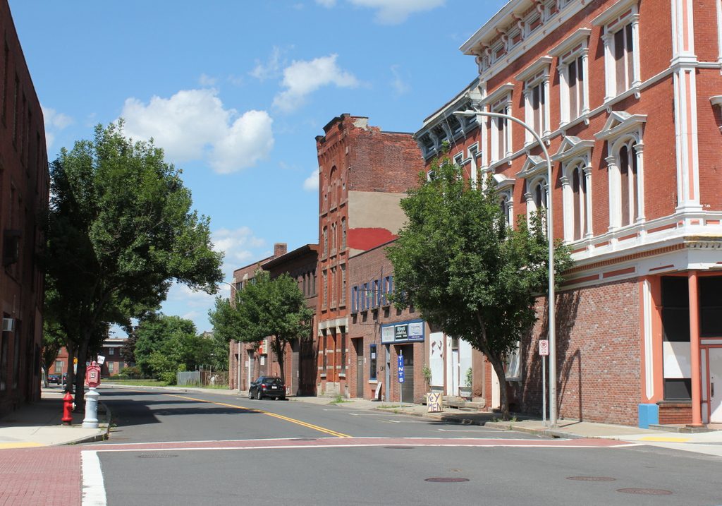
These two photos, taken 125 years apart, show some of the dramatic changes that the city of Holyoke has experienced in the intervening years. When the first photo was taken, Holyoke was among the world’s leading producers of paper, and at its peak the city had more than two dozen paper mills along its extensive canal system. The resulting influx of factory workers led to a dramatic increase in the city’s population, from under 5,000 in 1860 to over 35,000 in 1890, and the first photo shows a busy Main Street, filled with trolleys, horse-drawn carriages, and pedestrians.

The commercial buildings on the right side of Main Street show a mix of late 19th century architectural styles, and are predominantly brick with three or four stories. Probably the oldest building on the right side of the first photo is the Perkins Block, which dates back to about 1870 and was, in later years, known as the Hotel Jess. Its Italianate design was typical of the era, and it includes cast iron ornamentation that has remained well-preserved over the years. Just beyond it is another, somewhat shorter Italianate building, which was built in the mid-1880s. It lacks the cast iron on the exterior, but it has a similar bracketed cornice at the top of the building. The only other building still standing on the right side of the street from the first photo is the narrow, four-story building in the center, which was built around 1883 and has seen few exterior changes since then.

Otherwise, all of the other buildings on this side of the street have either been replaced by newer ones or are now vacant lots. Perhaps the most notable of these lost buildings is the Whiting Street Building at 32 Main Street, the four-story granite building just to the left of the center of the first photo. Completed in 1885, it was owned by Whiting Street, a prominent landowner for whom the Whiting Street Reservoir is named. By the time the first photo was taken, the building was the home of the recently-established American Pad and Paper Company. Now known as Ampad, this company is still a major producer of writing pads and other paper products, although it has long since relocated its headquarters out of Holyoke.

The only building visible on the left side of the first photo is the Holyoke House, which was later known as the Hotel Hamilton. Built in the early 1850s, it was significantly expanded over the years and is still standing, although it has lost its top floor. Like many of the buildings across the street, it is now abandoned, and today the scene of boarded-up storefronts, vacant lots, and a deserted Main Street contrasts sharply with the photo taken at the same site in the 1890s.

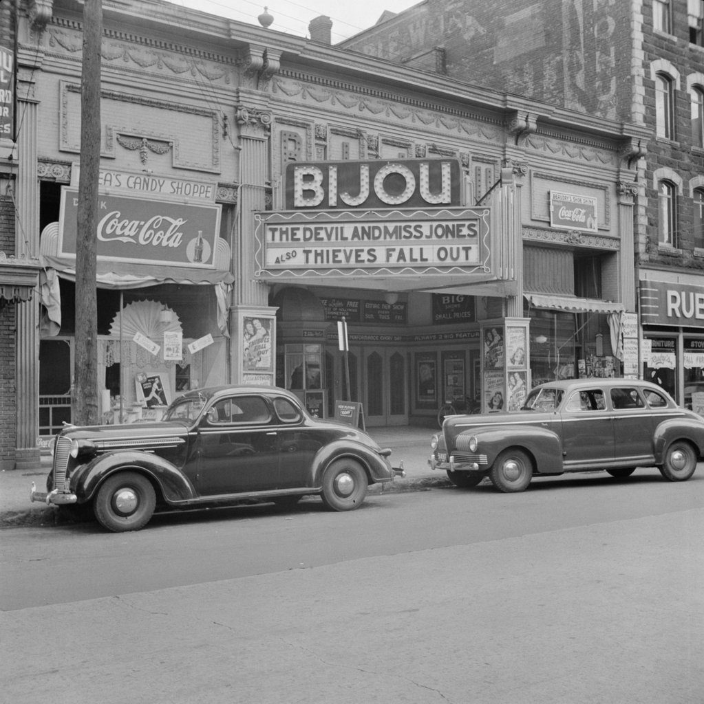
Bijou Theater, Holyoke, Mass

The Bijou Theater on Main Street in Holyoke, in October 1941. Image taken by John Collier, Jr., courtesy of the Library of Congress, FSA/OWI collection.

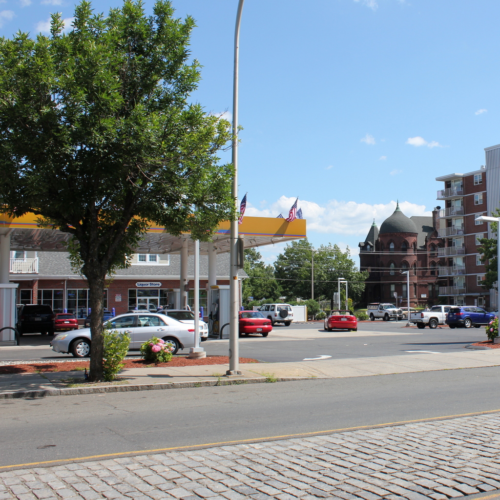
The scene in 2017:

The Bijou Theater was one of several early 20th century theaters in Holyoke, and was built around 1913. Located on Main Street in the Flats neighborhood, it primarily catered to the city’s large population of factory workers, and it had one screen, with a seating capacity of nearly 1,300. The original caption of the first photo was “Theatre in workers’ section at Holyoke, Massachusetts”, and it was taken by John Collier, Jr., a prominent photographer and anthropologist. At the time, he was working with the Farm Security Administration, a New Deal agency that, among other projects, hired photographers to document life in America during the Great Depression.

The first photo shows the entrance to the theater, with a “candy shoppe” in the storefront on the left and a shoe shine business on the right. Both stores display the seemingly-ubiquitous Coca-Cola signs of the 1940s, and the theater marquee advertises for a double feature of The Devil and Miss Jones, starring Jean Arthur, Robert Cummings, and Charles Coburn; and Thieves Fall Out, starring Eddie Albert, Joan Leslie, Jane Darwell, and Alan Hale, Sr. These films were both released in the spring of 1941, more than five months before the first photo was taken, suggesting that the Bijou was, at least by this point, a second-run theater. One sign under the marquee promises “Big Shows at Small Prices”, while another sign indicates that the theater offered “Entire New Show Every Sun. Tues. Fri.”

The first half of the 20th century was the heyday of downtown movie theaters, but in later years they were increasingly replaced by large multi-screen theaters in the suburbs, which offered greater options as well as ample parking. Here in Holyoke, the decline was only exacerbated by the loss of the city’s industrial base, which caused a significant drop in population. The Bijou appears to have closed sometime in the 1950s, and was subsequently demolished. Today, none of the surrounding buildings are standing either, and the site is now a gas station. Holyoke’s other historic downtown theaters suffered similar fates, and today only the long-abandoned Victory Theater is still standing.

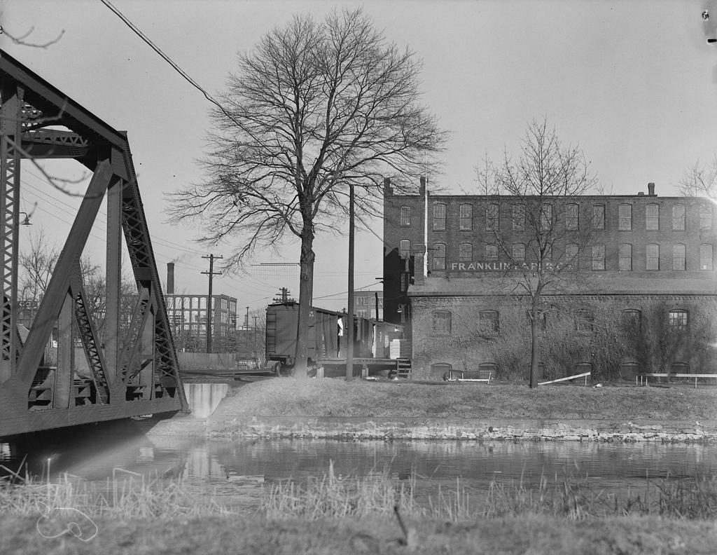
Franklin Paper Company, Holyoke, Mass

The Franklin Paper Company on Middle Water Street, seen from across the waste canal in Holyoke, sometime in 1936. Image photographed by Lewis Hine, courtesy of the U.S. National Archives.

The scene in 2017:

Long known as “Paper City,” Holyoke was once among the world’s leading producers of paper, with several dozen paper mills located along the city’s extensive canal system. One of the first of these paper mills was the Franklin Paper Company, which was established in 1866 by prominent industrialist James H. Newton and his father-in-law Calvin Taft. With Taft as president and Newton as treasurer, the company initially specialized in producing collar paper. Disposable paper collars enjoyed a heyday in the 1860s and 1870s, but they were also uncomfortable, easily damaged, and also toxic, since the paper was bleached using arsenic. As a result, cellulose soon replaced paper in detachable collars, and by the late 1870s the Franklin Paper Company switched to producing writing paper, as well as paper for books and envelopes.

The Franklin Paper Company was located here along the third level canal, and was served by a railroad spur that ran along Water Street. In the foreground of this scene is the waste canal, which emptied excess water from the canals into the Connecticut River, and on the left side is a short railroad bridge over the canal. The first photo was taken in 1936, when the Franklin Paper Company was still in operation 70 years after it was established. The photographer was Lewis Wickes Hine, a prominent photographer and social reformer who, several decades earlier, had traveled around the country documenting child labor conditions. By the 1930s he was doing similar work, documenting the effects of the Great Depression, and he took a number of photographs during his 1936 visit to Holyoke. His original caption reads:

Mt. Holyoke [sic], Massachusetts – Scenes. A very old independent paper mill, wood pulp, not rags, continuing site and ownership in relatively straight line, once connected with a wood pulp mill near to Hoosie [sic] Tunnel; the type of near-to-mill transportation; the canal; glimpse of most modern mill type in background. Franklin Paper Company. Farr Alpaca – No. 4, 1936

More than 80 years after Hine’s Depression-era visit to Holyoke, the city has undergone significant changes. Most of the major paper companies have since relocated, as have most of the city’s other industries, and today Holyoke faces high poverty rates and many vacant, deteriorating factory buildings. The Franklin Paper Company is long-gone, but the buildings themselves are still standing on the right side of the photo, although the one-story building in the foreground has partially collapsed. Otherwise, not much has changed in this scene, and the canal is still there, as is the railroad bridge on the left side.

St. Jerome’s Church, Holyoke, Mass

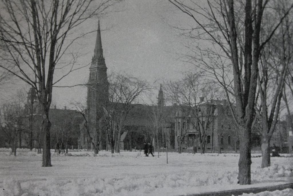
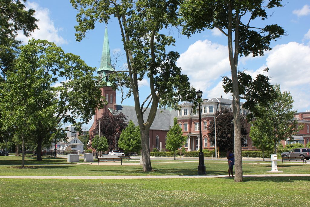
St. Jerome’s Church and Rectory on Hampden Street in Holyoke, around 1892. Image from Picturesque Hampden (1892).

The scene in 2017:

During the mid-19th century, Holyoke was developed into a major industrial center. Many factories were built along the city’s network of canals, and were powered by water from the Connecticut River, which drops 58 feet at the falls between Holyoke and South Hadley. The factories led to a dramatic population growth, particularly with immigrant groups such as the Irish and the French Canadians, who came to Holyoke in search of work, and this led to an abundance of Catholic churches to serve these two predominantly Roman Catholic communities.

The first of these Catholic churches was St. Jerome’s Church, which was established in 1856. The church building, seen here in the center of both photos, was constructed two years later, diagonally opposite Hampden Park at the corner of Hampden and Chestnut Streets. It features a brick, Gothic Revival-style design and, like many other Catholic churches of the era, was designed by prominent Irish-born architect Patrick Keely.

As the Catholic population of Holyoke continued to grow, a number of additional buildings were added around St. Jerome’s Church. The St. Jerome Institute was established as a school for boys in 1872, and was located in a building just to the left of the church, on the far left side of the first photo. Then, in 1879, a Second Empire-style church rectory was built to the right of the church, on the opposite side of Chestnut Street, and is visible on the right side of both photos. Other buildings constructed during this time included the Sisters of Notre Dame Convent (1870), the Convent of the Sisters of Providence  (1886), and the School of the Immaculate Conception (1883), all of which were located across Hampden Street opposite the church, just out of view to the left.

St. Jerome’s Church was significantly damaged by a fire in 1934 that left only the exterior brick walls still standing. However, the building was reconstructed a year later, and it remains in use today as an active Roman Catholic parish. Most of the other 19th century buildings nearby are still standing, aside from the St. Jerome Institute, which was demolished in the late 20th century. Today, these remaining buildings, including St. Jerome’s Church, now form part of the Hampden Park Historic District, which was added to the National Register of Historic Places in 2012.