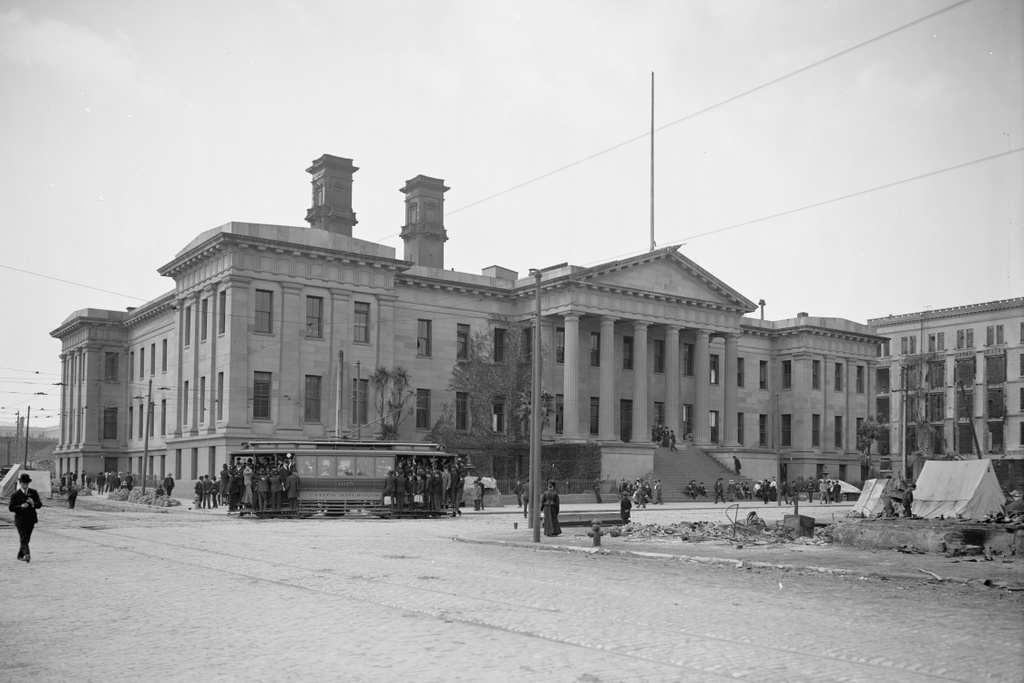
Lost New England Goes West: US Mint, San Francisco

The old San Francisco Mint, located at the corner of Mission and Fifth Streets, in the aftermath of the April 18, 1906 earthquake. Image courtesy of the Library of Congress, Detroit Publishing Company Collection.

877_1906c loc

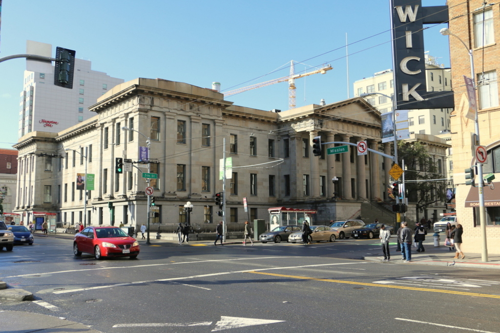
The building in 2015:

877_2015
Amid the rubble and burned-out buildings left behind in the aftermath of the 1906 earthquake, the San Francisco Mint was one of the few buildings in the affected area that survived both the earthquake and the subsequent fires, as the first photo shows. The San Francisco branch of the US Mint was established in 1854 to handle the gold that was mined during the California Gold Rush, and this building opened 20 years later, in 1874.

At the time of the earthquake, the building was one of four US Mint facilities, and in addition to making coins it also held around $200 million in gold, which was a significant portion of the nation’s entire gold reserves. Because of this, its survival in the disaster was of vital importance, and as the fires spread across the city, the mint employees used a well on the property to fight the flames and quickly extinguish any fires that ignited on the building.

Part of the reason for the fire’s destruction across the city was the inept response of the city government, who ordered widespread evacuations instead of using every able-bodied person to assist in the firefighting efforts. This allowed entire neighborhoods to burn almost unopposed, but here at the mint it was a different situation. As a federal building, it was immune from the city’s evacuation order, and because of that its employees were able to save the building even as the city burned around them.

This building functioned as the San Francisco Mint until 1937, when the present-day mint opened on Hermann Street. Today, the old building is still standing. It was sold to the City of San Francisco for one dollar in 2003, and it is now periodically open to the public for different events.

This post is part of a series of photos that I took in California this past winter. Click here to see the other posts in the “Lost New England Goes West” series.

Lost New England Goes West: Call Building, San Francisco

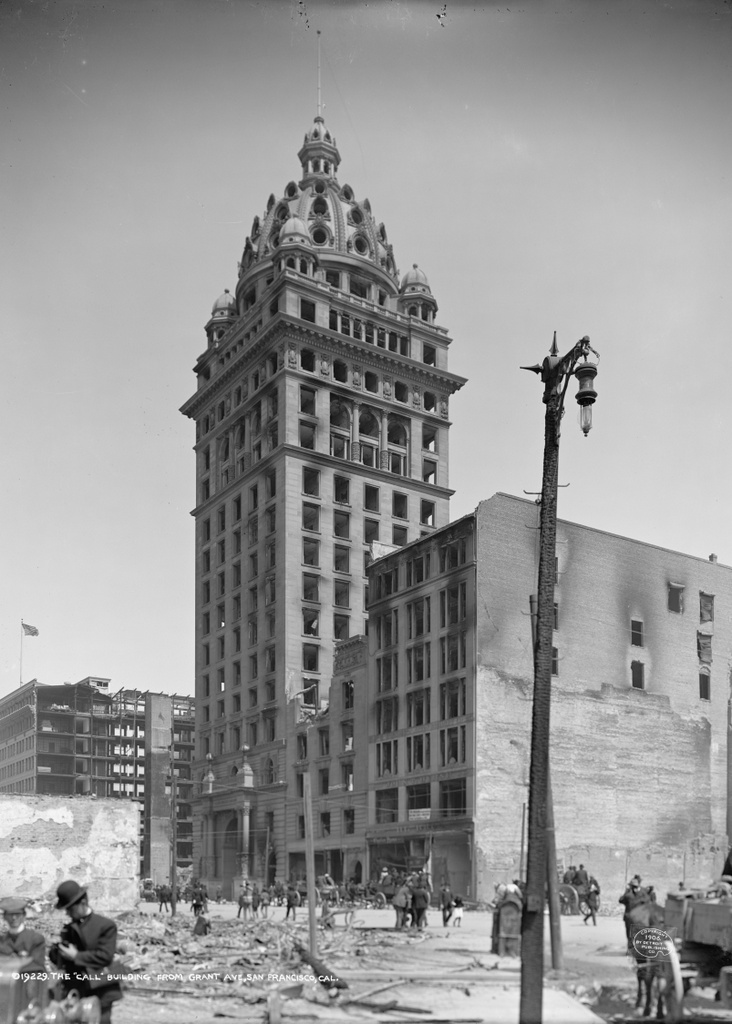
The San Francisco Call Building at the corner of Market and Third Streets, in the aftermath of the April 18, 1906 earthquake. Image courtesy of the Library of Congress, Detroit Publishing Company Collection.

876_1906c loc.tif

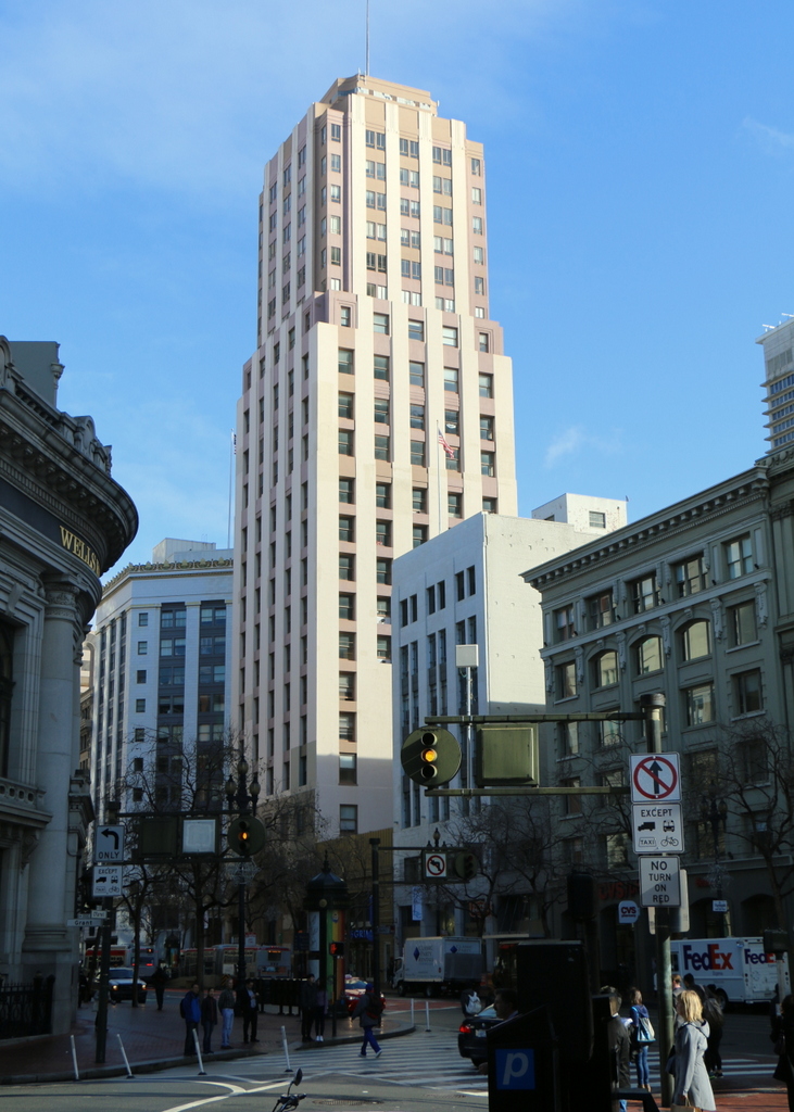
The building in 2015:

876_2015
This building has been mentioned in previous posts, such as this one, and it appears prominently in many post-earthquake images of the city. Also known as the Spreckels Building, this skyscraper was completed in 1898 by Claus and John Spreckels, the owners of the San Francisco Call newspaper. At the time, it was the tallest building west of the Mississippi River, although some were concerned that its height put it at risk for earthquakes in a very earthquake-prone city, and also a fire hazard because, in the event of a fire on the upper floors, it would be difficult for the fire department to fight.

To reduce the risk of earthquake damage, the building was anchored to a slab of concrete 25 feet below the surface, and to address fire concerns each floor was separated from the others by concrete, and the brick exterior walls were built nearly two feet thick. Ultimately, the earthquake-proofing worked, because it survived the 1906 earthquake with minimal damage, but no amount of fireproofing could have saved it from the massive fires that spread across the city in the aftermath. The building was completely gutted, as the first photograph shows, but structurally it remained intact, and was soon repaired.

The San Francisco Call later left the building, and in 1938 it was significantly altered to its present-day appearance. Its Beaux-Arts ornamentation was stripped off, the dome at the top was removed, and the exterior was modernized to give it an Art-Deco appearance. It is virtually unrecognizable in its current appearance, and there is probably little, if anything, left from its original 1898 construction, but it is still standing today as a major landmark along Market Street.

This post is part of a series of photos that I took in California this past winter. Click here to see the other posts in the “Lost New England Goes West” series.
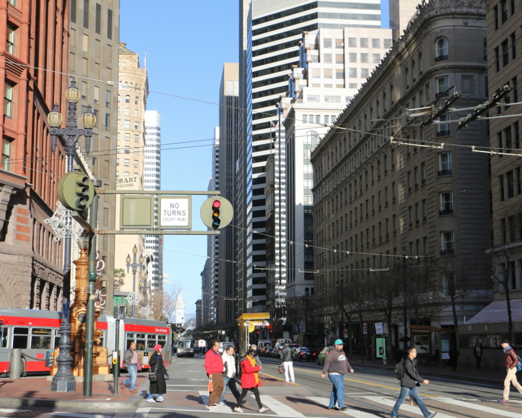
Lost New England Goes West: Market Street, San Francisco (3)

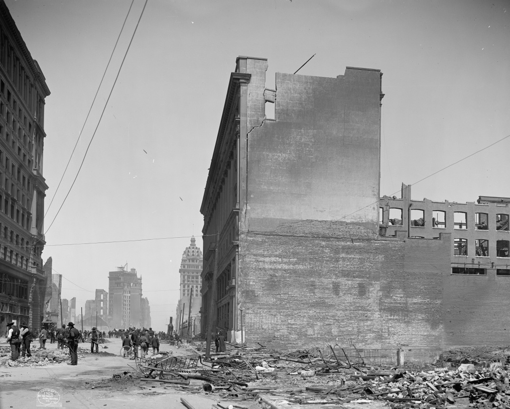
Another view looking northeast on Market Street, from near the corner of Fifth Street, in the aftermath of the April 18, 1906 earthquake. Image courtesy of the Library of Congress, Detroit Publishing Company Collection.

875_1906c loc.tif

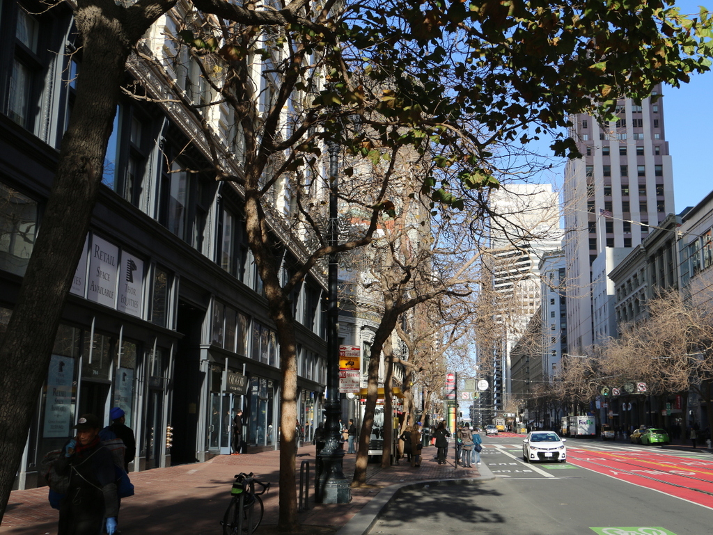
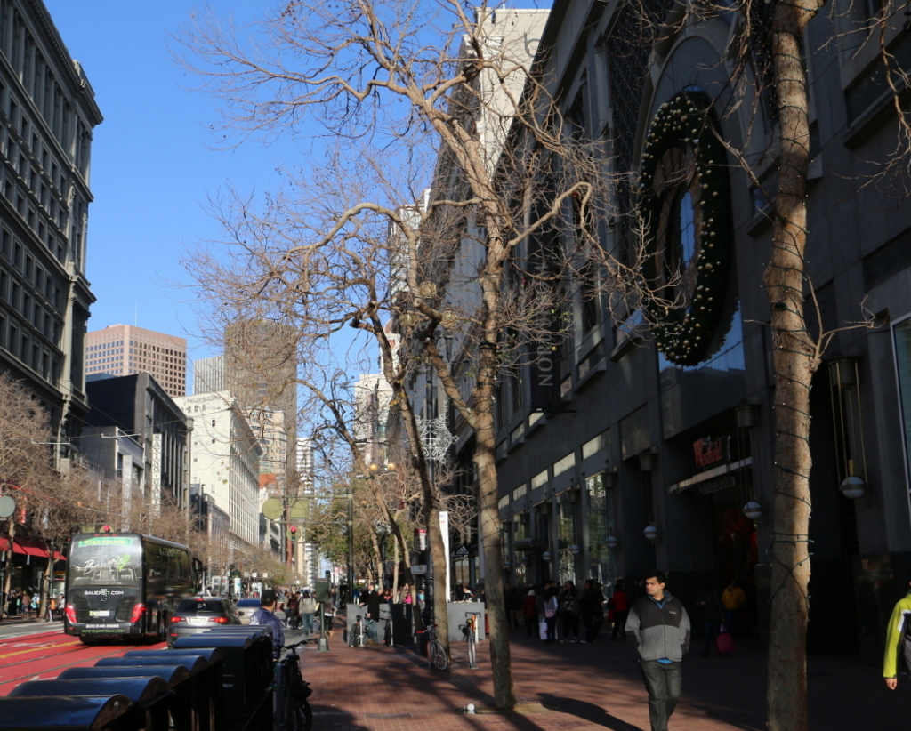
Market Street in 2015:

875_2015
These photos were taken about a block west of the ones in the previous post, and some of the same buildings are visible in both, including the Mutual Savings Bank Building in the distance on the left side of the street, and the Call Building in the distance on the right. Although heavily altered, both survived the earthquake and are still standing today, although they are mostly hidden from view in the 2015 scene here.

The first photo shows the city in the process of cleaning up after the earthquake. Many of the other photos of Market Street shows large crowds walking down the street, apparently inspecting the damage, but most of the people in this scene are working. Some are picking up debris with shovels, while others are hauling it away in wheelbarrows. In the distance, some sort of a steam engine appears to be assisting the workers as well. In the foreground, the piles of bricks, twisted metal, and charred wood give an indication of the work that was still to be done.

In the aftermath of the disaster, the city rebuilt, and a few of the buildings in the foreground were restored, including the 1904 Flood Building to the left and the 1896 Emporium department store to the right. Today, not much is left of the pre-earthquake department store building, though. The entire building had to be rebuilt except for the Market Street facade, which was preserved. Nearly a century later, in the early 2000s, the building was again gutted and rebuilt, and converted into Westfield San Francisco. It is now occupied by Bloomingdale’s, and everything in the building is new except for the facade and a glass dome from the 1908 reconstruction.

This post is part of a series of photos that I took in California this past winter. Click here to see the other posts in the “Lost New England Goes West” series.
Lost New England Goes West: Market Street, San Francisco (2)

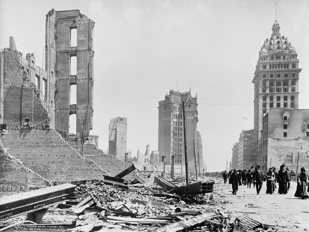
Looking northeast down Market Street in San Francisco near Fourth Street, in the aftermath of the April 18, 1906 earthquake. Image courtesy of the Library of Congress, Detroit Publishing Company Collection.

874_1906c loc

The view in 2015:

874_2015
As mentioned in this earlier post, Market Street was and still is largely the commercial center of San Francisco. However, much of the street was either leveled by the 1906 earthquake or destroyed by the fires that were started by the earthquake. The first photo shows a number of completely destroyed buildings, but there were some left standing, a few of which were repaired and still exist today.

The tall building in the center of the first photo stands relatively unscathed amid the rubble on the left side of the street. This was the Mutual Savings Bank Building, which had been built just four years earlier. This twelve-story building survived the earthquake, and despite a major addition in 1964 it is still standing today at the corner of Market and Geary Streets.

The most prominent building in the first photo is the Call Building, also known as the Spreckels Building, on the right side. When it was built in 1898, it was the tallest building west of the Mississippi River, and was the home of the San Francisco Call newspaper. It was designed to be both earthquake proof and fireproof, and both of these were put to the test just eight years later. It survived the earthquake itself, but like so many other buildings in the city it was gutted by the fires that followed. However, it was still structurally sound, and it was repaired. Today, it is still standing as the Central Tower, but it is completely unrecognizable from its 1906 appearance. In 1938 the exterior was completely remodeled to match the popular Art Deco style, which brings up the Ship of Theseus question: if the interior was replaced in 1906, and the exterior replaced in 1938, is it still the original 1898 building?

This post is part of a series of photos that I took in California this past winter. Click here to see the other posts in the “Lost New England Goes West” series.
Lost New England Goes West: Palace Hotel, San Francisco (2)

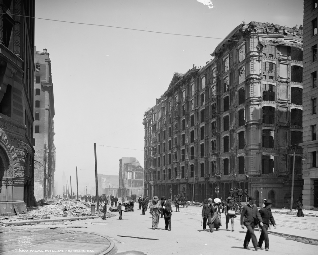
Another view of the burned-out Palace Hotel, taken from Market Street in the aftermath of the April 18, 1906 earthquake. Image courtesy of the Library of Congress, Detroit Publishing Company Collection.

873_1906c loc

The view in 2015:

873_2015
This view shows the opposite side of the Palace Hotel from the photos in this earlier post, which were taken from New Montgomery Street. As mentioned in that post, the Palace Hotel opened in 1875 as the city’s largest, most elegant hotel, and over the years it hosted many prominent visitors to San Francisco. It was specifically built to withstand earthquakes, and the structure did survive it even as many of the surrounding buildings crumbled, but it was later engulfed in the fires that spread throughout the city.

The first photo was probably taken soon after the disaster, and many of the pedestrians on Market Street are looking up, probably surveying the damage for the first time. However, there are also signs that the city was starting to recover. The street itself has been cleared of debris, and there are even stacks of fresh lumber next to the piles of brick and charred wood on the sidewalk.

Most of the burned-out buildings in this scene were demolished, including the Palace Hotel, which was rebuilt on the same spot in 1909. However, at least two of the buildings from the first photo are still standing today. On the far left is the old Chronicle Building, which was built in 1890. It was repaired after the fire, and today it is a Ritz-Carlton residential skyscraper. On the opposite side of the photo, the Monadnock Building was under construction when the earthquake hit. Only a small section of the building is visible in the photo, but this large office building was completed in 1907 and was restored in the 1980s.

This post is part of a series of photos that I took in California this past winter. Click here to see the other posts in the “Lost New England Goes West” series.
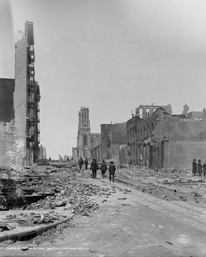
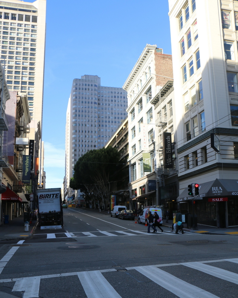
Lost New England Goes West: Sutter Street, San Francisco

Looking west on Sutter Street from Grant Avenue in San Francisco, in the aftermath of the April 18, 1906 earthquake. Image courtesy of the Library of Congress, Detroit Publishing Company Collection.

872_1906c loc

Sutter Street in 2015:

872_2015
The scene in the first photo is typical of what so much of San Francisco looked like after the 1906 earthquake and the subsequent fires. All of the buildings in this scene were completely destroyed, and the photo was probably only taken a few days after the disaster, because the street is still covered in debris. The people in the photo are walking carefully along the cable car tracks in the middle of the street, stepping over bricks and charred pieces of wood. One of the men in the distance is wearing a sailor’s uniform; he was probably one of the many naval personnel who assisted in the firefighting efforts for three days after the earthquake.

The most prominent building in the first photo is the Temple Emanu-El, located in the center of the photo. It was home to the oldest Jewish congregation in the western part of the country, and although the two tall towers survived the earthquake, the building was gutted by fire. The congregation later relocated to the western part of the city, and here on Sutter Street everything was completely rebuilt. Today, nothing pre-earthquake appears to have survived, but some of the buildings in the foreground probably date back to the reconstruction in the immediate aftermath of the disaster.

This post is part of a series of photos that I took in California this past winter. Click here to see the other posts in the “Lost New England Goes West” series.