Lost New England Goes West: Old Saint Mary’s Cathedral, San Francisco

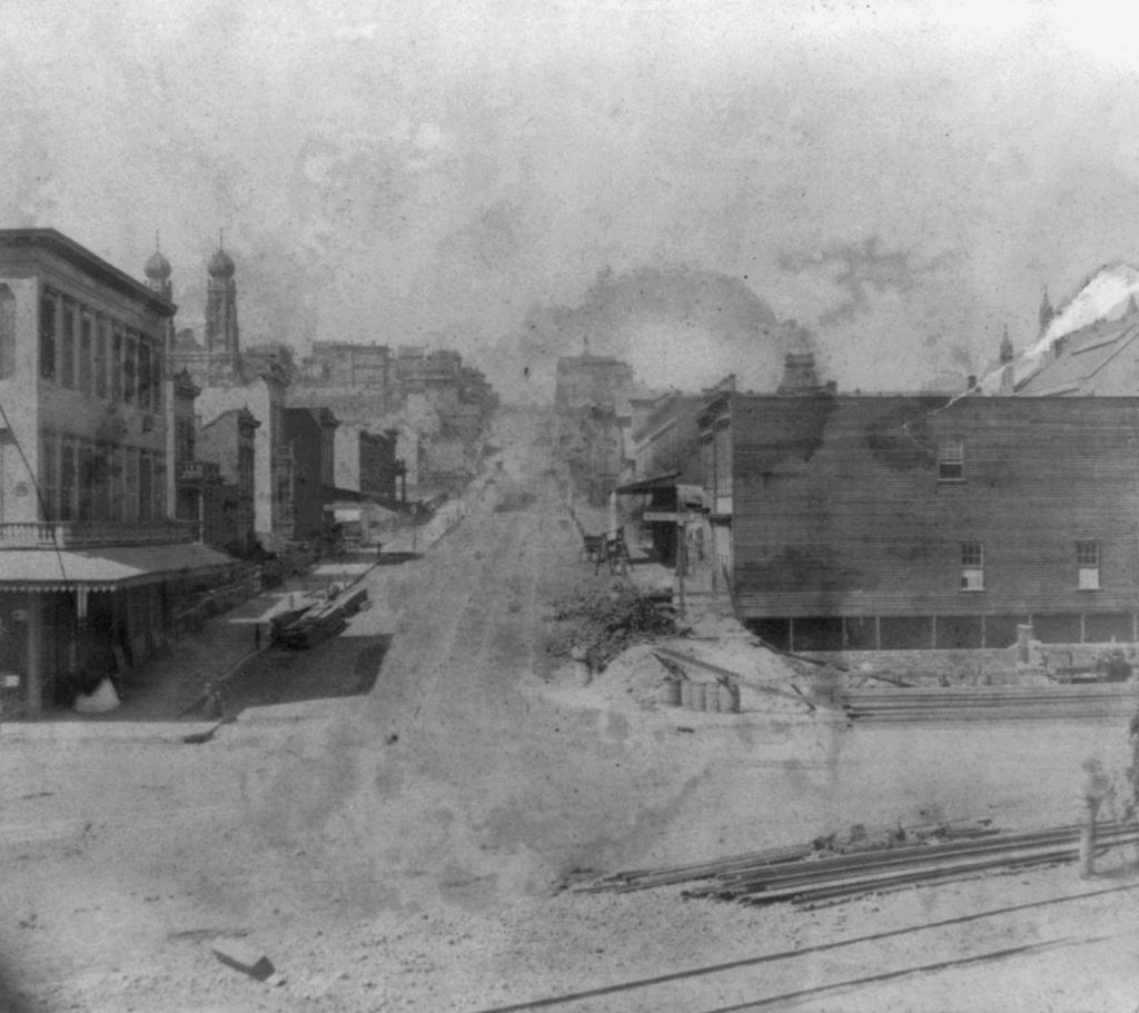
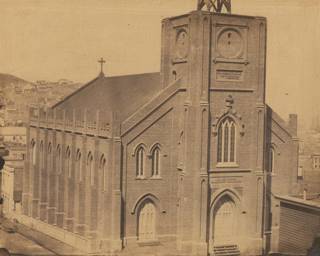
Old Saint Mary’s Cathedral at the corner of California Street and Grant Avenue in San Francisco, around 1856. Image courtesy of the DeGolyer Library, Southern Methodist University.

897_1856c smu

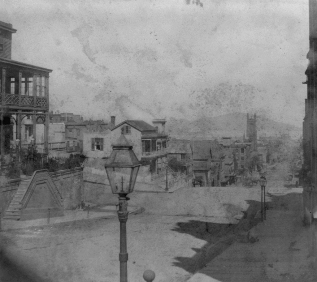
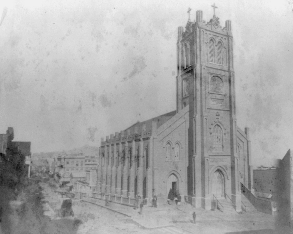
The church around 1866. Image courtesy of the Library of Congress, Lawrence & Houseworth Collection.
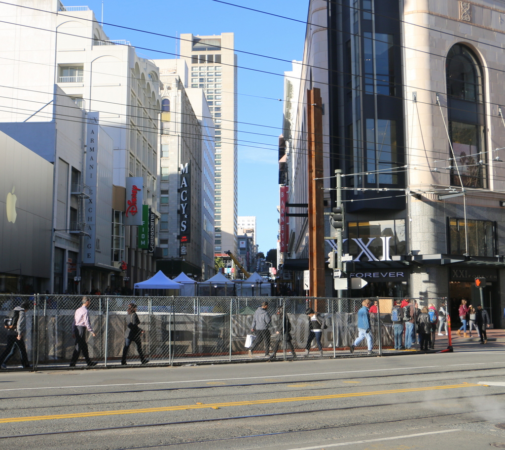
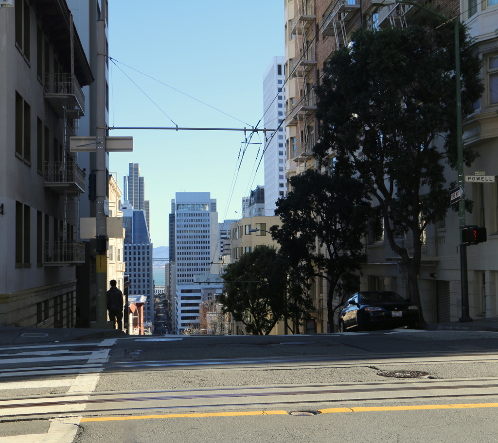
897_1866c loc

The church in 2015:

897_2015
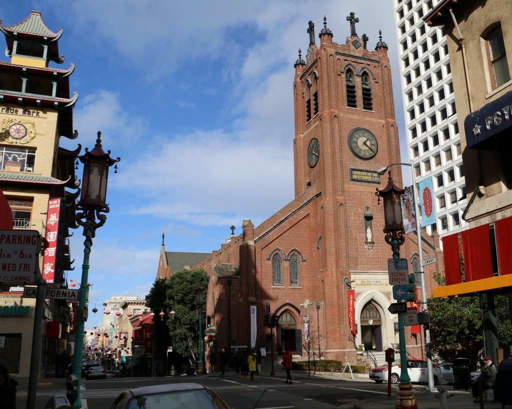
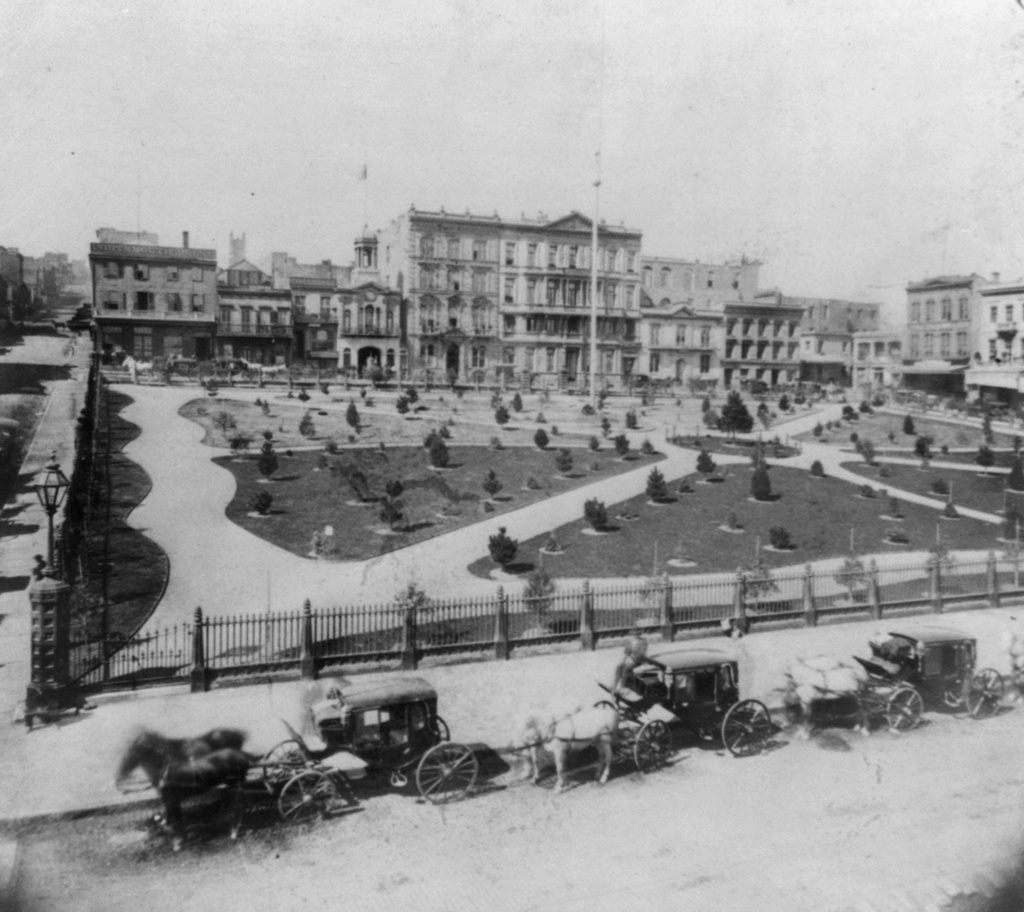
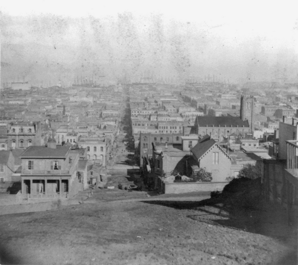
As mentioned in earlier posts, San Francisco of the 1850s was very different from just a decade earlier. When gold was discovered in California in 1848, its population was just a thousand, but by the early 1850s it had jumped to over 30,000, and was rapidly growing. To accommodate the number of Catholics, the city’s first cathedral was built here in 1854, and the building has stood here ever since. At the time, it was located near the fringes of the city, near Chinatown and some of the notorious red light districts, which explains the “Son, Observe the Time and Fly from Evil” inscription just below the clock.

The first photo was taken before the steeple was completed, but by the early 1860s the church looked essentially the same as it does today. It served as the cathedral for the Archdiocese of San Francisco until 1891, and since then it has been a parish church. In 1906, it was one of the few buildings in the area to survive the earthquake, which did no serious structural damage to it. However, the earthquake started fires that gutted the building, so today the only original part of the church is the brick exterior.

The surrounding Chinatown neighborhood was rebuilt after the fires, and today it is home to the largest Chinese population in the world outside of Asia. This section of Grant Avenue in particular is a major tourist attraction, and Old Saint Mary’s Cathedral remains both an active church and also a major landmark that dates back to the city’s early years as a Gold Rush town.

This post is part of a series of photos that I took in California this past winter. Click here to see the other posts in the “Lost New England Goes West” series.

Lost New England Goes West: Stockton Street, San Francisco (2)

Looking north on Stockton Street from Market Street in San Francisco, in the early 1860s. Image courtesy of the Library of Congress, Lawrence & Houseworth Collection.

895_1866c loc

The scene in 2015:

895_2015
The southern end of Stockton Street is here at Market Street, which has been the commercial center of San Francisco since it was first laid out a few years before the first photo was taken. The photo was possibly taken in 1860, because the scene in the foreground appears to show the construction of the Market Street Railway, a horse-drawn trolley system that opened here in 1860. Today, the trolley system is still in place, although this line now operates historic electric streetcars rather than their horse-drawn predecessors.

Today, this section of San Francisco in the vicinity of Union Square is a major shopping district. Nothing is left from the original photo; most of the small two and three story buildings were probably gone before the turn of the 20th century, and anything that would have been left would have been destroyed in the 1906 earthquake. The two photos do have at least one thing in common, though – as in the 1860s view, the 2015 scene also shows a major public transit program in the works. As of 2016, San Francisco is building the Central Subway here, underneath Fourth Street and Stockton Street. The city does not have much in the way of true rapid transit lines, and this subway, which is scheduled to be completed in 2018, will provide much-needed service to the South of Market and Chinatown neighborhoods.

This post is part of a series of photos that I took in California this past winter. Click here to see the other posts in the “Lost New England Goes West” series.

Lost New England Goes West: Stockton Street, San Francisco

Looking north on Stockton Street from California Street in San Francisco, around 1866. Image courtesy of the Library of Congress, Lawrence & Houseworth Collection.

893_1866c loc

Stockton Street in 2015:

893_2015
When the first photo was taken, most of the buildings in the scene were still fairly new. San Francisco did not see dramatic population growth until the 1849 gold rush, and most of this area was probably developed in the mid to late 1850s. However, everything here was destroyed in the fires after the 1906 earthquake, and in 1914 the street itself underwent some major changes when the Stockton Street Tunnel was built. This tunnel starts here directly underneath the foreground, and it carries traffic two and a half blocks through the hill, while the original street still goes up and over the hill. Today, Stockton Street is one of the two main streets in Chinatown, along with Grant Avenue, and this section in the distance of the photo is the neighborhood’s primary commercial center.

This post is part of a series of photos that I took in California this past winter. Click here to see the other posts in the “Lost New England Goes West” series.

Lost New England Goes West: Portsmouth Square, San Francisco (2)

Facing west across Portsmouth Square from Kearny Street in San Francisco, around 1866. Image courtesy of the Library of Congress, Lawrence & Houseworth Collection.

892_1866c loc

The scene in 2015:

892_2015
This earlier post shows Portsmouth Square in 1851, facing the north side of the square. Here, this first photo shows the west side of the square about 15 years later, after it had become a landscaped park. Anything from the first photo that was still standing 40 years later was destroyed in the 1906 earthquake; the photo in this earlier post shows the square, facing the opposite direction, in the aftermath of the disaster, when the square was covered in tents for displaced residents. Today, nothing is left from the original photo except for the square itself, which is still a public park and is located within the city’s Chinatown neighborhood.

This post is part of a series of photos that I took in California this past winter. Click here to see the other posts in the “Lost New England Goes West” series.

Lost New England Goes West: Russian Hill, San Francisco

The view of Russian Hill from the corner of Mason and Sacramento Streets in San Francisco, around 1866. Image courtesy of the Library of Congress, Lawrence & Houseworth Collection.

891_1866c loc

The view in 2015:

891_2015
Today, Russian Hill is probably best known for the zigzag section of Lombard Street between Hyde and Leavenworth Streets, and its excellent views of the city, as seen in this earlier post, also make it one of the San Francisco’s most expensive neighborhoods. However, when the first photo was taken 150 years ago, it was still sparsely populated, mostly with poorer residents who could not afford to live in a more convenient location. This began to change, though, soon after the photo was taken. Cable cars were introduced to San Francisco in 1873, allowing residents to easily move up and down the city’s many hills. As a result, wealthy residents who no longer had to worry about walking up the steep grades now found Russian Hill and nearby Nob Hill, where these photos were taken from, as appealing places to live.

As is the case with most of the other 19th century views of the city, most of this scene was completely destroyed by the fires caused by the 1906 earthquake. Much of Russian Hill now consists of modern condominium buildings, but there are a few surviving pre-earthquake homes near the top of the hill, especially along Green Street. At least one of these, the Feusier Octagonal House, was standing when the first photo was taken. It was built in the 1850s with an unusual octagonal design, and although the photo isn’t clear enough to identify the house, it would be located somewhere near the top of the hill on the left side.

This post is part of a series of photos that I took in California this past winter. Click here to see the other posts in the “Lost New England Goes West” series.

Lost New England Goes West: Sacramento Street, San Francisco (2)

Looking down Sacramento Street from the corner of Powell Street in San Francisco, around 1866. Image courtesy of the Library of Congress, Lawrence & Houseworth Collection.

890_1866c loc

Sacramento Street in 2015:

890_2015
The first photo here was taken just a half block further up the hill from where, 40 years later, Arnold Genthe would take his famous photograph of the earthquake. Much of this view had changed by 1906, but many of the buildings from this 1866 view were still standing up until the fires destroyed this entire scene. One of the few buildings that survives today from the 1866 photo – in fact, it may be the only one left – is the church on the right side. This is the Old Saint Mary’s Cathedral, which was built in 1854 and, although gutted by the fires in 1906, was repaired and is still standing at the corner of California and Grant Streets.

The view of the church from here is now blocked by modern buildings, and the city’s skyline has obviously changed considerably in the 150 years since the first photo was taken. In the distance down Sacramento Street is the Financial District with its skyscrapers, and at the very end of the street, barely visible, is the Ferry Building, which was built over 30 years after the first photo was taken,. It was one of the few historic buildings still standing in this scene, and also one of the few that survived both the earthquake and the fires.

This post is part of a series of photos that I took in California this past winter. Click here to see the other posts in the “Lost New England Goes West” series.