Longmeadow Street and Belleclaire Avenue, Longmeadow, Massachusetts

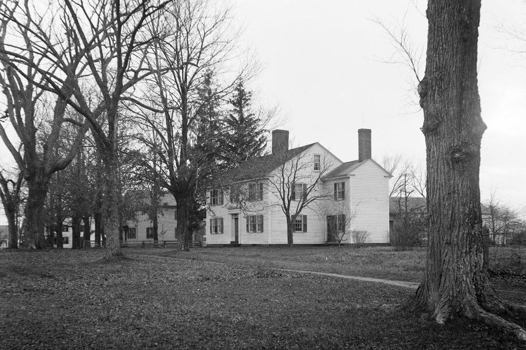
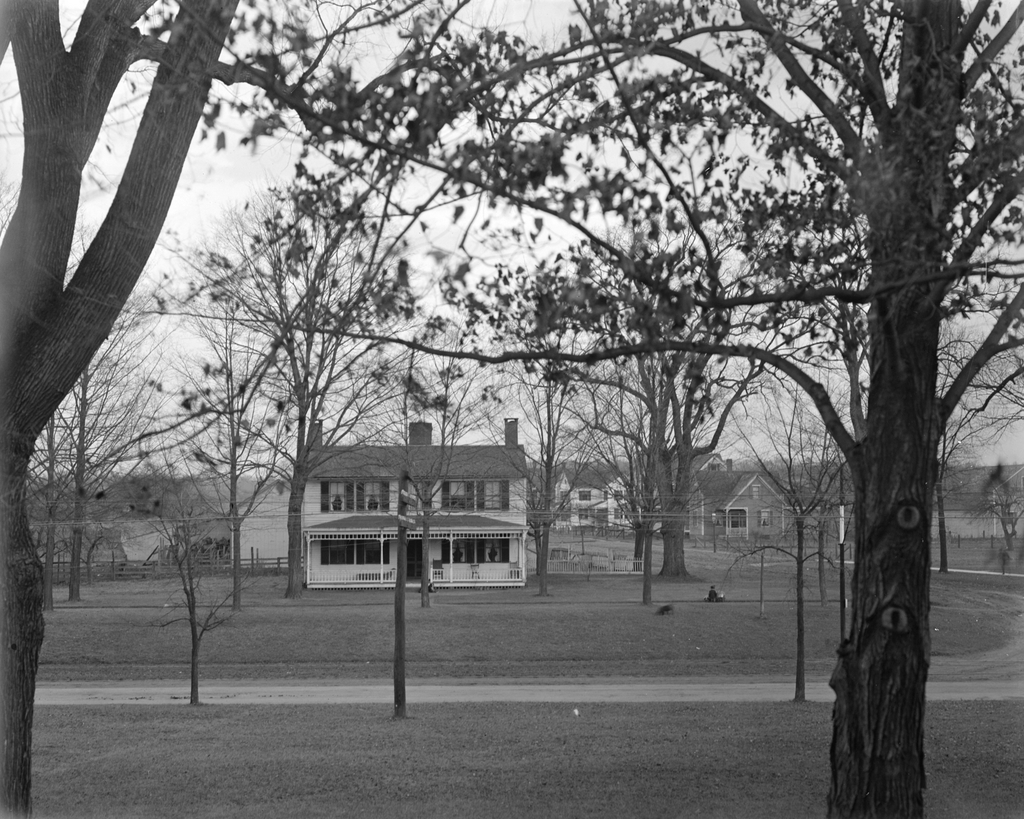
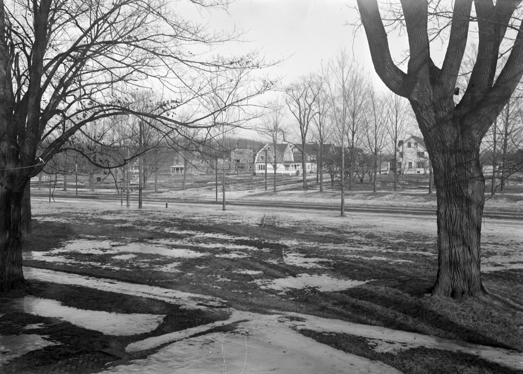
The view looking east toward the corner of Longmeadow Street and Belleclaire Avenue in Longmeadow, in January 1916. Image photographed by Paesiello Emerson, courtesy of the Longmeadow Historical Society.
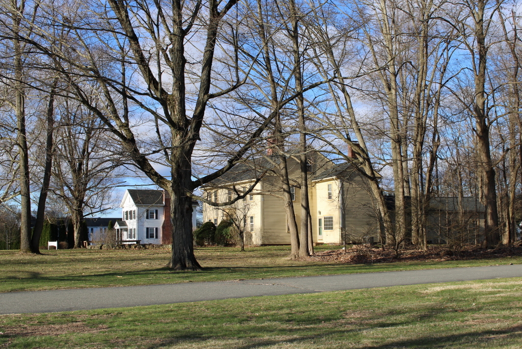
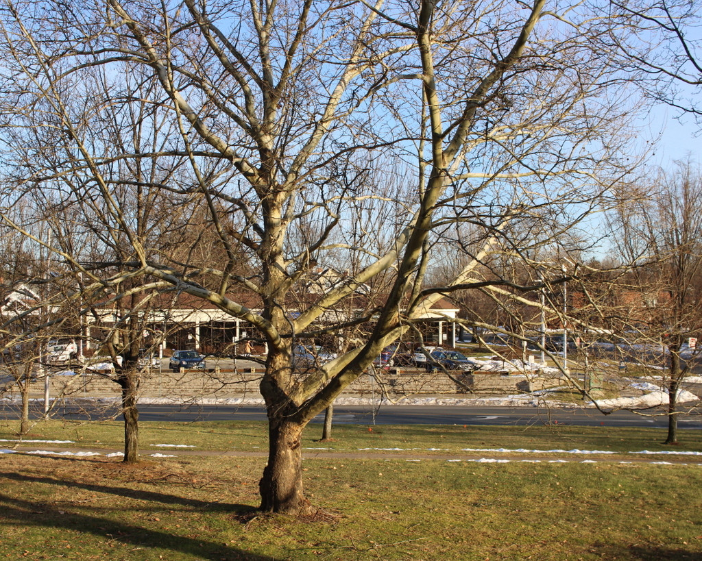
The scene in 2024:
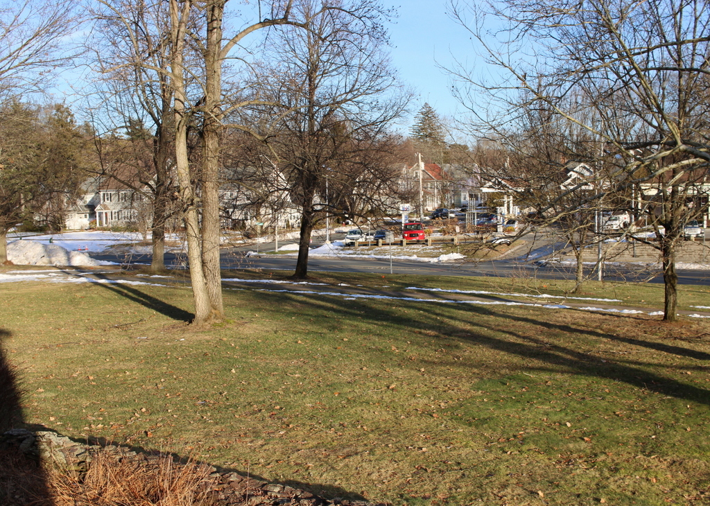
These two photos were taken from the southeast bedroom on the second floor of the Josiah Cooley House. Built around 1760, this house stands at the corner of Longmeadow Street and Emerson Road, and during the early 20th century it was the home of Paesiello Emerson, an amateur photographer who used his camera to document life in Longmeadow.

The top photo shows some of the changes that were happening here in Longmeadow during this period. For much of its history, the town was relatively small. Most of the homes were located along Longmeadow Street, with long house lots that extended to the east and west of the street. There was minimal commercial or industrial development, and the town’s economy relied primarily on farming.

By 1900, the town had a population of just 811, but this would soon change due to the growth of Springfield, which is directly to the north of Longmeadow. A trolley line was built through the town, linking it to Springfield and also to Hartford, and it made it easy for residents to live in the town and commute into the city for work.

Over the next few decades, many of the old house lots were subdivided and developed with single-family homes. This included the land at the northeast corner of Longmeadow Street and Bliss Road, which had long been owned by the Bliss family. Around 1913, the Bliss family sold this land to Edwin H. Robbins, a real estate developer who named the subdivision “Brookline.” This was part of a strategy to market Longmeadow as Springfield’s equivalent to Brookline, which is an affluent suburb of Boston.

The Brookline subdivision consisted of homes along the north side of Bliss Road and east side of Longmeadow Street, along with the development of several new streets. Belleclaire Avenue and Westmoreland Avenue were laid out east to west, running parallel to Bliss Road. These streets were intersected by Dayton Street (later named Cross Street), Rosemore Street, and Lorenz Street, which ran north to south. From this view, Belleclaire Avenue is near the center of the photo, with Westmoreland Avenue farther in the distance on the left side.

Aside from naming it “Brookline,” Robbins also promoted this subdivision through regular advertisements in local newspapers. One such advertisement, published in the May 4, 1913 Springfield Republican, encouraged Springfield residents to move to Longmeadow, specifically to Brookline. He wrote:

You have thought that you would like to live in Longmeadow.

The reasons you had were these:

You would have every advantage you have in Springfield. Emphasis on the “every.”

You would have, in addition, all the delights of the country. These are:

  1. The pure country air, perfumed by the flowers and made vocal by the birds. Did you ever hear the birds’ May Festival?
  2. The absence of the many hideous sights and smells of the city, as well as the profanities and vulgarities you cannot help hearing.
  3. The closeness of the ties of friendships impossible anywhere but in a small community of congenial people. This is not obvious to a city dweller, but is a very real fact to the resident of a village community.

Think what these three advantages mean to growing children. You bring them up physically and morally clean, and you store their hearts with happy memories they will cherish in the strenuous days to come.

Your desire to live in Longmeadow is a true instinct. Follow it.

As to what “Brookline” is and will be, I want to say:—

1st. It has a beautiful location at the corner of Bliss Road, with a frontage of over 700 feet on Longmeadow Street, down to the Town House. It is level and high and perfectly dry, with a fine sand subsoil, and in no part underlaid with clay.

I am going to put in water, sewer, gas, electric lights. Trees now set out in the tree belts, and adequate cement sidewalks. The houses will be 100 feet apart across the streets, and I have restricted it so highly that I GUARANTEE YOU DESIRABLE NEIGHBORS, no matter how high your station in life may be.

I pledge my word to make “Brookline” the highest class development in Longmeadow. My word is good, and has been proved in my former developments, which I invite you to inspect.

Not only do I pledge my word, but I am hard at work to show the goods.

Come down and see what I am doing, as an indication of what I shall do.

BROOKLINE is where you bought melons of Mr. Kempton last year.

As indicated in the advertisement, Robbins placed deed restrictions on the lots, which were set to terminate in 1935. Some of these restrictions were fairly standard physical requirements, including setting standards for setbacks, minimum construction costs, and exterior materials. However, as implied by his guarantee of “desirable neighbors,” he also included racial and ethnic restrictions on the lots that he sold. These deeds stated that “said lot shall not be resold to a colored person a Polander or an Italian.” This was not an uncommon practice during the early 20th century, and it contributed to racial disparities between the predominantly white, high-income suburbs and the much more diverse, lower-income cities. The deed restrictions for this particular subdivision expired in 1935, but racially-based restrictions continued to be used elsewhere until 1948, when the Shelley v. Kraemer Supreme Court case ruled that they were unenforceable.

The top photo was taken in January 1916, during the early years of the subdivision’s development. Some of the houses were already built, and at least one or two on Westmoreland Avenue were under construction at the time. The photo was taken by Paesiello Emerson, from a second-floor bedroom at his house. This was one of the many photos that he took in Longmeadow during the first few decades of the 20th century, many of which showed the evolving landscape as the town evolved from an agricultural community to an affluent residential suburb.

Today, more than a century after Paesiello Emerson took the top photo, the view from the bedroom window shows a scene that is more developed, yet still recognizable from the top photo. The subdivision has long since been built out, and Belleclaire and Westmoreland Avenues are lined with early 20th century homes. Other than these houses, the only significant change in this scene is on the right side, where a small commercial property now stands at the corner of Longmeadow Street and Bliss Road. This was also constructed during the early 20th century development of the area, and it now includes a variety of commercial tenants, including a gas station and auto repair shop.

USS Constitution, Boston (2)

The USS Constitution at Charlestown Navy Yard in Boston, around 1905. Image courtesy of the Library of Congress, Detroit Publishing Company Collection.

The Constitution at the same dock in 2022:

As explained in more detail in the previous post, the frigate USS Constitution has a long history with Boston, dating back to its construction in the North End in 1797. The ship served with distinction in many American conflicts, most notably in the War of 1812, when it captured or sank five British warships and earned the nickname “Old Ironsides.”

The Constitution remained in active service for nearly a century, but by the end of the 19th century it had been converted into a receiving ship, with a large barracks structure that was constructed atop its deck, as shown in the top photo. In this role, the ship served as temporary housing for new recruits and other sailors who were not currently assigned to a crew. It was in use as a receiving ship at Portsmouth Naval Shipyard in the late 19th century, before being moved to the Charlestown Navy Yard in Boston in time for its centennial in 1897.

When the top photo was taken, its future was uncertain. it was in need of major repairs, and there was a possibility that the navy might choose to sink it for target practice. However, it was ultimately restored, including the removal of the barracks, and it became a museum ship. It underwent several other major restorations over the course of the 20th century, and also embarked on a three-year tour of the country, including visiting ports along the Atlantic, Gulf, and Pacific coasts.

Another ship is also visible in the top photo, on the right side. It is the passenger liner SS Arabic of the White Star Line, the same company that would later construct the Titanic. The Arabic was built in 1903, so it was only a few years old in the top photo, providing a dramatic contrast to the Constitution. Ironically, though, despite being more than a century older, the Constitution would outlive the Arabic by more than a century. The Arabic was ultimately torpedoed and sunk by a German submarine in 1915 during World War I, in an incident that caused a diplomatic crisis similar to the sinking of the Lusitania several months earlier.

Today, the Constitution is still moored at the same dock in Charlestown Navy Yard, although it now much more closely resembles its appearance in its fighting days, when compared to its appearance in the top photo. It remains a commissioned United States warship with its own officers and crew, and it is the oldest commissioned warship afloat in the world. Only Britain’s HMS Victory is older, although it has been in drydock since 1922.

USS Constitution, Boston

The USS Constitution at the Charlestown Navy Yard in Boston, around 1905. Image courtesy of the Library of Congress, Detroit Publishing Company Collection.

The Constitution at the same dock in 2022:

These two photos show the USS Constitution, the oldest commissioned warship afloat in the world. Constructed across the harbor in Boston at Edmund Hartt’s shipyard, the Constitution was one of six frigates that were authorized by the Naval Act of 1794. Prior to this act, the United States did not have a standing navy, with the earlier Continental Navy having been disbanded after the end of the American Revolution. The initial motivation for constructing these ships was to protect American shipping from Barbary pirates in North Africa, but they would also see extensive service in the Quasi War against France and in the War of 1812 against Britain.

The Constitution was launched in 1797 and departed on its first patrol in 1798, during the Quasi War. It later served in the First Barbary War, but the Constitution would earn its fame for its role in the War of 1812. Over the course of the war, it sank or captured five British warships, and it earned the nickname of “Old Ironsides” after its August 19, 1812 defeat of the HMS Guerriere. The ship was later further immortalized by Oliver Wendell Holmes’s 1830 poem “Old Ironsides,” which was written in response to a news article that the navy was planning to scrap the Constitution.

The ship would remain in active service throughout most of the 19th century, including being used as a training ship during and after the Civil War. However, by 1881 it was in poor condition, and it was brought to Portsmouth Naval Shipyard and converted into a receiving ship for housing sailors who were not currently assigned to a crew. This conversion included the construction of barracks on the deck of the ship, as shown in the top photo.

In 1897, the Constitution was moved back to Boston, just in time for the centennial of its launch. The top photo was taken about 8 years later, showing the ship moored on the western side of the Charlestown Navy Yard. At this point, the fate of the famous ship was still very uncertain. That year, the secretary of the navy proposed sinking it as a target ship, but it prompted an outcry similar to that which had prompted Holmes’s poem some 75 years earlier.

This sentiment led to the restoration of the ship, including removal of the barracks structure, and it was subsequently opened to the public as a museum ship. However, within a few decades it once again needed significant repairs due to rot. This prompted a campaign in which schoolchildren across the country contributed pennies to raise money to save the ship. The restoration work began in 1927, and it took nearly three years to complete. During this time, about 85% of the ship’s wood was replaced. The Constitution then embarked on a three-year tour of the country, including transiting the Panama Canal and visiting ports on the Pacific coast. However, while the ship was seaworthy enough to make the voyage, it did not actually sail, but was instead towed from port to port.

The Constitution ended up needing additional repairs in the 1970s, and then another major overhaul in the mid-1990s. The latter was completed in time for the ship’s 200th anniversary, which was celebrated with a trip from Boston to Marblehead. Along the way, the Constitution sailed unassisted for part of the voyage, marking the first time that it had done so since before it was retired from active duty in 1881.

Today, more than a century after the top photo was taken, the Constitution is still moored at the same wharf at the former Charlestown Navy Yard, which is now part of the Boston National Historical Park. The ship is still a commissioned warship of the United States Navy, with officers and crew members who are assigned to it. Thanks to the many restorations over the years, the ship now looks much more like its historic appearance than it did when the first photo was taken. The Constitution is one of the many famous historic landmarks along Boston’s Freedom Trail, and it is open to the public for tours.

Boston Skyline from Boston Harbor

The view of Boston from Boston Harbor, around 1928-1938. Image photographed by Samuel Chamberlain; courtesy of the Phillips Library at the Peabody Essex Museum.

The same scene in 2021:

These two photos show the view of Boston from the northeast, from near the waterfront of the North End. The most visible landmark in the top photo is the Custom House Tower, which was completed in 1915. It was the tallest building in the city by a considerable margin, with a height of 496 feet. At the time, the city had a height limit of 125 feet for buildings, but as a federal building the Custom House was exempt from the limit. This restriction was eventually lifted, but the Custom House Tower would dominate the city’s skyline throughout much of the 20th century, and it remained the tallest building in the city until the construction of the Prudential Tower in 1964.

Today, the Custom House Tower is still here, although it is a much less prominent part of the skyline, due to the many other tall buildings in and around the Financial District. Aside from the skyline, other major changes to this scene include the waterfront, which was primarily comprised of commercial wharves in the top photo. Over the years, the port facilities in Boston have moved out of the North End area, and most of the wharves have been redeveloped with hotels, condominiums, and marinas, as shown in the 2021 photo.

Laundry Wagon, Longmeadow, Massachusetts

A horse-drawn wagon for Scott’s Laundry, seen on Emerson Road near the corner of Longmeadow Street in Longmeadow, Massachusetts in 1914. Image courtesy of the Longmeadow Historical Society, Paesiello Emerson Collection.

The same scene in 2023:

These two photos were taken from near the same spot as the ones in the previous post, but just a little farther to the east. But, unlike the older image in that post, the main subject of the 1914 photo here is not the house, but rather the people and the wagon in the foreground. The wagon bears the name of L. Dorenbaum, who was an agent for Scott’s Laundry, and the image shows a man, presumably Dorenbaum, standing next to the horse, with a young woman seated in the carriage.

Louis Dorenbaum was born in Russia in 1878. He was Jewish, and he came to America as a child in 1887, likely to escape the antisemitic pogroms that were happening in Russia at the time. He lived in Springfield’s Forest Park neighborhood, which had a large Jewish population at the turn of the 20th century, and by the time the top photo was taken he was about 36 years old and was living at 810 Belmont Avenue in Springfield, along with his wife Agnes and their children Myron, Pauline, and Blanche. It seems unclear if the person in the carriage was a relative, but she seems too young to have been Agnes (who was 31 at the time), but too old to have been either of his daughters (who were 8 and 6).

The photo shows Dorenbaum’s laundry wagon in Longmeadow, on Emerson Road (or Depot Road, as it was known at the time) near the corner of Longmeadow Street. The house in the background is the Josiah Cooley house, which was built around 1760 and is described in more detail in an earlier post. The photographer, Paesiello Emerson, lived in this house with his half siblings Annie and Henry Emerson, and the house was often a subject of his photos. This photo is somewhat unusual for him, though, because he typically did not photograph people, instead preferring buildings, trees, and landscapes. It’s hard to say why Emerson chose to take this photo. It is possible that he knew Dorenbaum, but it also seems possible that he may have wanted to capture this image of a more of transportation that, by 1914, was rapidly vanishing in favor of motor vehicles.

Louis Dorenbaum lived in Springfield until the early 1940s. The 1940 census shows him at a house on Blodgett Street, and his occupation was listed as delivery driver for a laundry, although he was probably no longer using horse-drawn wagons by that point. He later moved to Milton, where his son Myron was working as a dentist. Louis died there in 1947, at the age of  70.

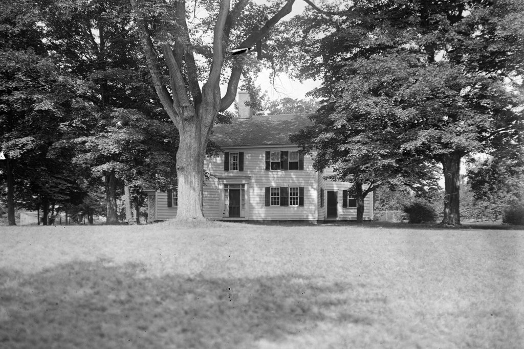
Today, the house that Dorenbaum posed in front of in the top photo is still standing. It has seen some changes over the years, including the removal of the so-called “coffin door” that is partially visible on the south side of the house behind the horse’s head in the top photo. Overall, though, it has remained well preserved in its historic appearance, and it is one of the oldest surviving homes in Longmeadow.

Josiah Cooley House, Longmeadow, Massachusetts (5)

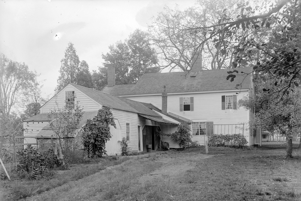
The house at the corner of Longmeadow and Emerson Streets in Longmeadow, Massachusetts, on September 12, 1917. Image courtesy of the Longmeadow Historical Society, Paesiello Emerson Collection.

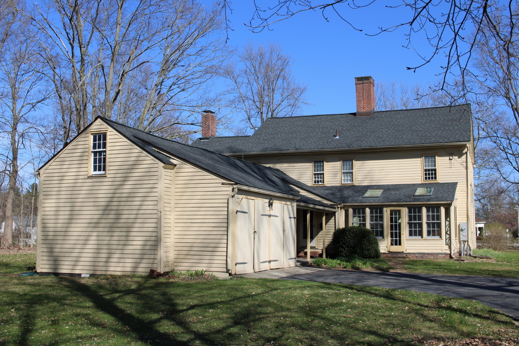
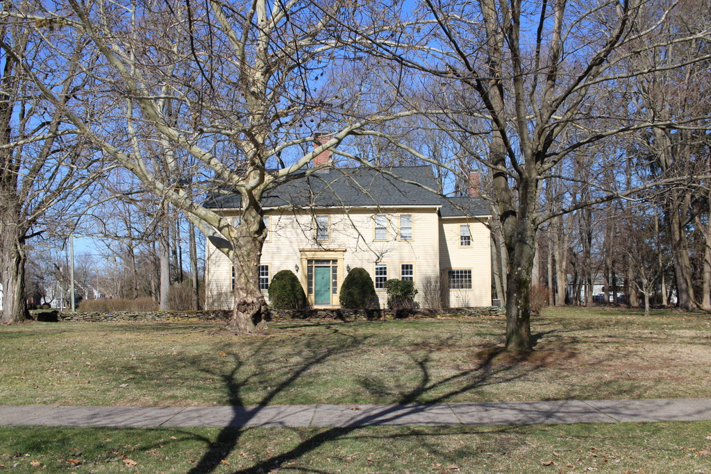
The house in 2023:

This house has been featured in previous posts, and there are many early 20th century images of it thanks to Paesiello Emerson, an amateur photographer who lived here during that period. As explained in more detail in an earlier post, the house is believed to have been built around 1760 as the home of Josiah and Experience Cooley. An earlier house, belonging to Josiah’s father Eliakim, had stood here on this same spot earlier in the 18th century, and it is possible that the current house may have been built in part on the foundation of Eliakim’s house.

These two photos show the view of the back of the house from the southwest, on what is now Emerson Road. From this angle, the house would have looked very different when it was initially constructed. It was built as a saltbox, with a second floor on the front part of the house and a long sloping roof here on the back of the house. However, when Josiah and Experience’s granddaughter Lucy Colton inherited the house in the late 1820s, she modernized and expanded the house.

Some of this work included raising the roof to create a full second story, along with additions on the north and west sides of the house. The two-story northern addition, which is visible in the distance on the far side of the house, included living space for Lucy’s son Luther Woolworth Colton and his newlywed wife Abigail. The western addition, shown on the left side of these photos, was one story in height, and it appears to have been used for storage and workshop space, rather than as living space

Aside from these structural changes, Lucy also made some interior and exterior design changes, in keeping with early 19th century trends. On the exterior, this included removing the original 12-over-12 windows from the front of the house and replacing them with new 6-over-6 windows. However, rather than discarding the old windows, they were installed here on the back part of the house and in the back addition, likely because they would not be as visible from the street.

The house would remain in the Cooley-Colton family for several more decades, but in 1869 Lucy’s son Josiah Cooley Colton sold the house and 20 acres of land to Bradford W. Palmer for $4,500. The Palmer family, however, would only stay here for a few years before selling it to William G. Emerson, a carpenter who was originally from eastern Massachusetts. His family included his wife Lovina and their children William, Annie, and Henry. The elder William died in 1887, Lovina died in 1897, and at some point the younger William moved into a house of his own in Longmeadow, but Annie and Henry would live here for their entire lives.

Neither Annie nor Henry ever married, but in 1907 they were joined here by their older half brother Paesiello Emerson. He was a widower in his mid-70s, and he had worked for much of his life as a boot maker. However, when he was in his 70s he took up photography as a hobby. He tended to prefer photographing landscapes and old buildings, and he captured several thousand images, including many here in Longmeadow. He continued his photography into his 90s, creating a valuable photographic archive of the town’s early 20th century development.

Paesiello Emerson died here in the house in 1927 at the age of 95. At some point in the 1920s, William Emerson also returned to live here, and he died in the house in 1930 at the age of 81. The two younger siblings, Annie and Henry, remained here until their deaths in 1941 and 1943, at the age of 81 and 77 respectively. Henry was a farmer who grew raspberries and asparagus here, along with raising poultry. Annie was a teacher, but she was also the town historian. She conducted extensive research on the historic homes in Longmeadow, including her own, and much of the information about this house is based on her notes.

The house was sold by the Emerson heirs after Henry’s death in 1943, and subsequent owners did some restoration work as well as modernization of the house. Here on the back part of the house, this included adding an enclosed porch to the back of the house and adding an open porch to the back addition. The garage was also extended outward by a few feet to accommodate cars, and a second garage door was added. Other changes, which are hard to notice from this particular angle, included removing the “coffin door” from the south side of the house, and adding another second-story window to the back of the house. The latter was evidently done in the late 1940s, when two new bathrooms were installed in the back part of the second floor.

Overall, though, the appearance of the house is not drastically different from its appearance in 1917 when Paesiello Emerson took the top photo. Aside from the porches and the small addition to the garage, the overall form of the house has not changed. It retains its chimneys, including the large central chimney, and most of the windows appear to either be original or, in the case of the 6-over-6 windows, date to the late 1820s renovation. Many of the 12-over-12 windows can still be found in the back part of the house, and are likely the same ones that had once been installed on the front part of the house in the mid-1700s.