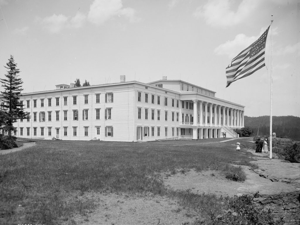
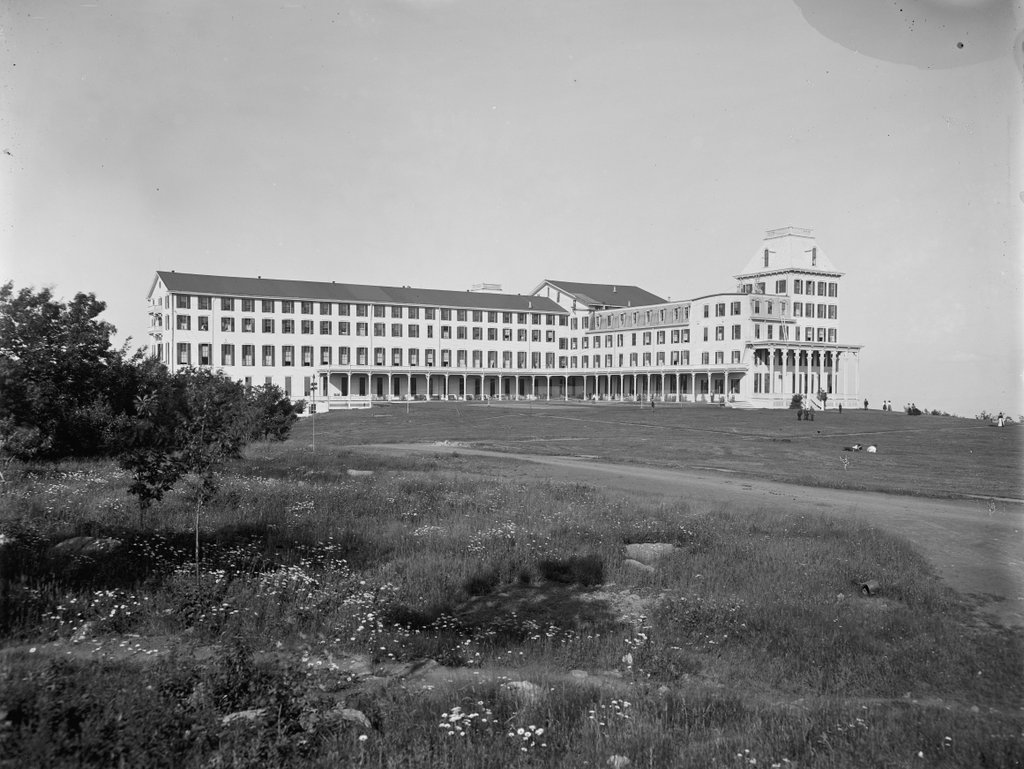
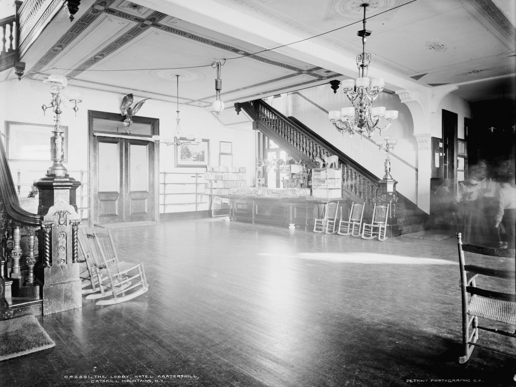
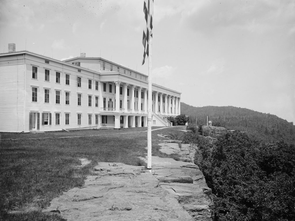
The view of the Catskill Mountain House, around 1900-1910. Image courtesy of the Library of Congress, Detroit Publishing Company Collection.
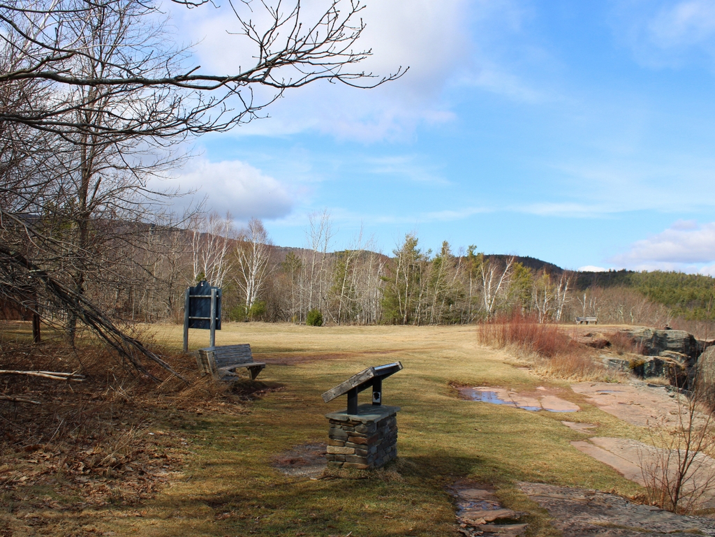
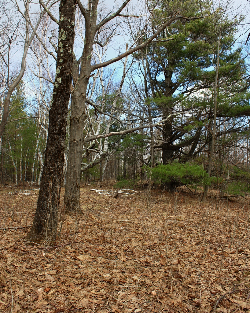
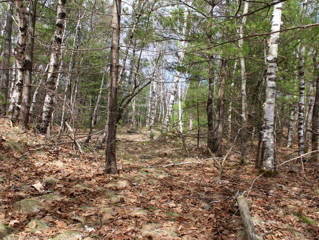
The scene in 2021:
The first photo shows the Catskill Mountain House, which was one of the most famous hotels in America during the 19th century. It opened in 1824 on a rocky ledge atop the Catskill Escarpment, and it was arguably the nation’s first resort hotel. The building steadily expanded over the years, in the process becoming a must-see attraction for any tour of the United States. Its luxurious accommodations, combined with the cool mountain air and expansive views, made it a popular summer destination. Many distinguished guests stayed here throughout the 19th and early 20th centuries, and the hotel also played a crucial role in the first truly American artistic movement, which came to be known as the Hudson River School.
Prior to the early 19th century, Americans did not place a high value on the mountains of the northeast. At best, mountain ranges such as the Catskills were seen as obstacles to transportation with little agricultural value; at worst, they were seen a dangerous, hostile wilderness. However, these ideas started to shift with the rise of the Romantic movement, and popular early 19th century writers such as Washington Irving and James Fenimore Cooper began to extoll the virtues of the American wilderness. Around the same time, artists such as Thomas Cole drew inspiration from the mountains and painted dramatic landscapes of the scenery. Drawn by these descriptions and paintings, the middle and upper classes of the northeast soon began to venture into the wilderness, particularly here in the Catskills.
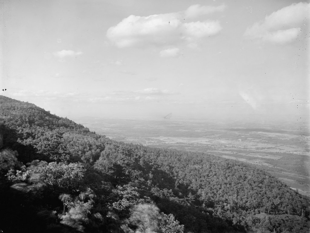
Geologically, the Catskills are the northeasternmost portion of the Appalachian Plateau, a large dissected plateau that runs to the west of the main ridge of the Appalachian mountains. The plateau extends from Alabama to New York, before coming to an abrupt end here at the Catskill Escarpment. The escarpment is more than two thousand feet in elevation, but from here the landscape drops sharply to the east, with rocky cliffs and steep slopes that form a dividing line between the mountains and the Hudson River Valley. The river is less than eight miles away from here, so the escarpment had long provided a dramatic backdrop for travelers heading north and south along the river corridor. And, as a few adventurous visitors had begun to discover by the early 19th century, the top of the escarpment offered even more dramatic views of the landscape.
This particular site, which came to be known as Pine Orchard, is located near the northern end of the escarpment, about nine miles to the west of the village of Catskill. Here, the edge of the escarpment dips slightly, forming a low point between the 2,480-foot South Mountain and the 3,180-foot North Mountain. Just to the west of here are two lakes, North Lake and South Lake, which are drained by a stream that drops down Kaaterskill Falls, one of the most dramatic waterfalls in the Catskills. This stream then passes through Kaaterskill Clove, a scenic ravine that separates South Mountain from Kaaterskill High Peak further to the south. So, in short, this area around Pine Orchard formed a sort of microcosm of Catskill scenery; it had mountains, lakes, waterfalls, and ravines, along with rocky cliffs with scenic views of both the narrow, wild Kaaterskill Clove and the broad, cultivated Hudson River Valley.
One of the earliest published descriptions of this area was written by Timothy Dwight IV, the president of Yale College. He visited the Catskills in 1815 and subsequently wrote about the scenery in Travels in New England and New York, which was published posthumously in 1822. In this book, he described the two lakes, along with the “stupendous and awful grandeur” of Kaaterskill Clove, which he believed was second only to Niagara Falls among the many scenic places that he visited. He then described the escarpment itself, and the expansive views of the Hudson River Valley and beyond. Although he did not mention it by name, his vantage point on the escarpment was likely here in the vicinity of Pine Orchard, and he declared that “[a] more distinct and perfect view of a landscape cannot be imagined.”
Just a year after the publication of Travels of New England and New York, made an appearance in James Fenimore Cooper’s 1823 novel The Pioneers. The book is a work of fiction, and like Dwight’s book it does not mention the site by name, but Cooper’s protagonist Natty Bumpo was clearly describing this spot when he spoke of a place in the Catskills,
where one of the ridges juts out a little from the rest, and where the rocks fall, for the best part of a thousand feet, so much up and down, that a man standing on their edges is fool enough to think he can jump from top to bottom.
Further in the narrative, he describes how one can see “all creation” from here, and how,
If being the best part of a mile in the air and having men’s farms and houses your feet, with rivers looking like ribbons, and mountains bigger than the ‘Vision seeming to be hay-stacks of green grass under you, gives any satisfaction to a man, I can recommend the spot.
Natty Bumpo then goes on to describe several other nearby landscape features, including the lakes, the waterfall, and Kaaterskill Clove.
While writers such as Dwight and Cooper were using their literary talents to capture the scenic wilderness here in the Catskills, other more entrepreneurially-minded individuals were working to make this scenery more accessible to the general public. By 1822, the Catskills were described in the New York Spectator as a place that was “becoming an extensive place of fashionable resort.” The article went on to explain how “for the public accommodation a house of entertainment has lately been erected at what is called the Pine Orchard.” This was the site of a grand ball in September 1822, and the following spring a group of investors formed the Catskill Mountain Association in order to build a hotel here at Pine Orchard.
Early records indicate that there were “old buildings” at Pine Orchard prior to the Catskill Mountain Association purchasing this property in 1823, although it seems unclear as to whether this refers to the 1822 “house of entertainment,” or whether there were buildings here even before 1822. Either way, the hotel was operational during the 1823 season, using temporary quarters while construction was underway on a permanent hotel.
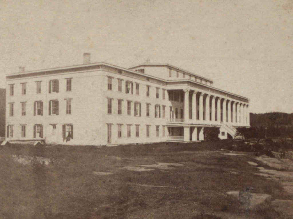
The new hotel was opened in the spring of 1824, and it would stand here atop the precipice for nearly 140 years, although it would undergo a number of alterations and expansions along the way. The original 1824 building was 60 feet long, 24 feet wide, and three stories high, and it featured a columned piazza here on the eastern façade. It had just 10 rooms, but a successful 1824 season prompted the owners to embark on a large addition for the next year, which added 50 rooms to the hotel. This project involved building two new wings, with one to the north of the 1824 structure and another in the rear to the west. Like the main section, the north wing had a columned piazza, although this wing was set back a little further from the cliff.
After 1825, the appearance of the building remained largely unchanged until the mid-1840s, when Charles L. Beach purchased the hotel. His father, Erastus Beach, was a livery company owner who operated stagecoaches from the village of Catskill to the Mountain House. As a 15-year-old boy, Charles Beach had worked for his father during the summer of 1823, bringing guests up the mountain to the temporary hotel here at this site. Charles would subsequently go on to have a successful business career, including owning several stagecoach lines of his own, before leasing the Catskill Mountain House in 1839. He then purchased the property in 1845, and soon set about improving both the building and the grounds.
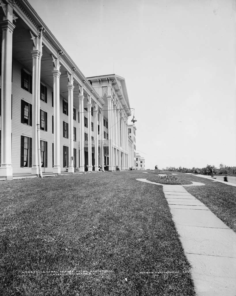
Among the changes that Beach made was a large wing on the north side of the building, along with a smaller addition to the east side of the 1825. The latter made the building’s main facade longer, which enabled Beach to construct a large piazza here, with 13 large Corinthian columns. These columns, which were joined by four matching ones on the west side of the hotel, would become the hotel’s most distinctive architectural feature, and they would remain a part of its design for more than a century. Along with these improvements to the building, Beach also made changes to the surrounding land. The hotel’s holdings eventually grew to about 3,000 acres, with a network of trails that led to scenic overlooks and other points of interest. By the mid-19th century, the hotel also offered recreational opportunities like carriage and horseback rides through the grounds, and boating and fishing on the nearby lakes.
During these early years, guests reached the hotel by way of the Old Mountain Road, which linked the hotel to the steamboat landings on the Hudson River in Catskill. It was on this road that the teenaged Charles Beach had transported guests during the summer of 1823, and it would remain in use throughout most of the 19th century, until the stagecoaches were finally replaced by railroads. During the 1820s and 1830s, fare from Catskill to the Mountain House was a dollar, and there were generally two daily trips up the mountain, with stagecoaches taking about four hours to make the 12-mile trip. The first two-thirds of this journey was over relatively flat ground, but the last portion was a strenuous climb, with the road gaining about 1,500 feet of elevation in four miles. Partway up this section of road was the Rip Van Winkle House, located alongside a stream at a place known as Sleepy Hollow. First constructed around the mid-1820s, and later expanded into a boarding house, this establishment offered rest and refreshment to travelers and horses on their journey up the mountain, while also making the dubious claim of having been the setting for Washington Irving’s short story “Rip Van Winkle.”
Over the years, the Catskill Mountain House was a popular summer resort destination for the upper classes of New York, Philadelphia, and elsewhere in the northeast, along with being a stop on the American equivalent of the Grand Tour. Many distinguished guests came to the hotel during this time, including presidents Ulysses S. Grant and Chester A. Arthur. However, perhaps the single most significant visit to the Mountain House occurred in the fall of 1825, when a young artist named Thomas Cole traveled to the Catskills. He subsequently produced five paintings of the scenery in the vicinity of the Mountain House, and these were put on public display in New York City. Cole had been only a marginally successful artist up to this point, producing a mix of portraits, landscapes, and genre paintings. With his Catskill paintings, though, he soon gained attention as one of the nation’s leading landscape artists, and he helped to popularize the Catskills as a scenic destination.
Cole would make many more visits to the Catskills over the years, eventually moving to the village of Catskill, and the mountains—including the Mountain House itself—became a common subject in his paintings. Many other artists followed his lead in painting the Catskills, along with other scenic landscapes in the northeast. The result was what became known as the Hudson River School, an artistic movement that emphasized dramatic, romanticized landscapes of the American wilderness. This was generally regarded as the first distinctly American art movement, and its name is based on its origins in the vicinity of the Hudson River, particularly here in the Catskills. Aside from Cole, many other prominent landscape artists spent time in the Catskills and featured the mountains in their paintings, including Frederic Edwin Church, Asher Durand, Sanford Robinson Gifford, and John Frederick Kensett.
For the first half century of its existence, the Catskill Mountain House was indisputably the premier resort in the region. The rooms here were priced accordingly, and by the mid-19th century it cost guests $2.50 per night to stay here. This was a considerable amount of money at the time, and part of the reason for the high rates was to cover the hotel’s operating expenses, particularly the cost of transporting food and other supplies up the mountain. However, these rates also helped maintain a level of exclusivity to the hotel, and the Mountain House did not face any serious competition here in the Catskills until late in the 19th century.
This period of hegemony came to an abrupt end in 1881, when two new resort hotels opened in the Catskills. The Mountain House had long been the largest in the region, but it now found itself only the third-largest, with an aging facility that could only be accessed via a bumpy uphill stagecoach ride. One of the two new resorts was the Grand Hotel, located about 25 miles west of here in the village of Highmount. However, a far more serious threat to the Mountain House was the Hotel Kaaterskill, which was practically built in the older hotel’s backyard. As the story goes, Philadelphia patent attorney George Harding was visiting the Mountain House during the summer of 1880, and he requested chicken for his daughter, who had dietary restrictions. However, the kitchen refused to prepare a meal that was not on the menu, and Charles Beach challenged Harding to build his own hotel if he wanted chicken. There are many variations of this story, but regardless of the details, Harding went on to do just that, sparing no expense to construct a massive hotel in time for the 1881 season.
Despite this new competition, the Mountain House still benefitted from its long history and tradition, which the new hotels could not replicate. However, nostalgia could only do so much, and the building’s age also worked against it. The hotel had been constructed piecemeal over the course of many years, and its guest rooms were small and corridors narrow compared to the modern competitors. The new hotels benefitted from direct railroad service, while Mountain House guests still arrived via the same route that Charles Beach and his father had operated some 60 years earlier.
Beach had come a long way since his first trip up the mountain as a teenaged stagecoach driver, but he was still operating the hotel throughout the late 19th century, and still introducing innovations. He had expanded the hotel several more times, including a south wing, which was built in the 1860s and stands on the left side of the first photo. Then, in the 1870s, he added a much larger wing on the southwestern side of the building, creating an enclosed courtyard within the building. At some point after that, a smaller addition on the west side created a second courtyard. The last major additions appear to have been completed by the early 1880s, giving the hotel a capacity of around 400 guests, and by the time the first photo was taken, the building had largely assumed its final appearance.
To address the transportation issue, Beach constructed the Catskill Mountain Railroad, a narrow gauge railroad that connected the village of Catskill to the base of the mountain. He also reached an agreement with George Harding, and built a road connecting the railroad station at the Hotel Kaaterskill with the Mountain House. This arrangement was mutually beneficial, as it made the Mountain House more accessible while also increasing ridership on Harding’s railroad. However, the most ambitious of Beach’s improvements was the Otis Elevating Railway, a 1.3-mile funicular railroad that ascended the steep Catskill Escarpment to the east of the Mountain House, providing direct access from the Catskill Mountain Railroad to the hotel. By making use of this railroad connection, guests could now make the journey from the Hudson River to the Mountain House in 40 to 50 minutes, in contrast to the thee or four hours that it had previously taken by stagecoach.
The first photo was taken sometime during the first decade of the 20th century. The Mountain House was still a prosperous hotel at this point, but it would soon enter a dramatic decline, as would the other grand resorts in the Catskills. There was an element of foreshadowing in the fall of 1902, when longtime rivals George Harding and Charles Beach both died within a month and a half of each other. Beach’s death occurred just shy of 80 years after he had brought his first stagecoach full of passengers to the Mountain House, and nearly 60 years after he had acquired ownership of the hotel.
His death certainly marked the end of an era here in the Catskills, but there were also more subtle changes that would soon affect the hotel, including the increasing trend of automobile ownership. The Catskills had long benefitted from its proximity to New York City and its many railroad and steamboat connections, but automobiles changed the way that Americans vacationed, now that they were no longer restricted to places within easy access of railroads. The Catskills also saw changing demographics here at the old resort hotels. Once the domain of upper-class Protestants, by the early 20th century the region had become popular among immigrants, including Italians, Jews, and other ethnic minorities.
The Beach family continued to own the Catskill Mountain House throughout the 1910s and 1920s, although by this point it would enter a decline that it would never recover from. In the mid-1910s the Otis Elevating Railway closed because of low ridership, and the tracks were removed in 1918 as scrap metal for the war effort. The nearby Hotel Kaaterskill burned in September 1924 and was never rebuilt, but this loss of its greatest rival did little to improve business here at the Mountain House. While the Kaaterskill had been destroyed by a spectacular blaze in a matter of hours, the demise of the Mountain House would prove much more prolonged and anticlimactic.
As bad as the 1920s were here at the Mountain House, the Great Depression of the 1930s proved even more challenging. In 1930, the family of Charles Beach sold more than 2,100 acres of the surrounding land to the state of New York. Soon after, they sold the hotel itself, with its dramatically reduced acreage. It would continue to operate throughout the 1930s, under the ownership of Milo Moseman and Clyde Gardiner. They, in turn, leased it to the Andron family, who renamed it Andron’s Mountain House and catered primarily to Jewish tourists, serving kosher meals in the dining room.
The Mountain House managed to limp through the Depression years, but the start of World War II proved to be the final blow for the old hotel. The Androns chose not to renew their lease for the 1942 season, leaving it to Moseman—by this point the sole owner—to attempt to run the hotel by himself in 1942. As a young man, Moseman had worked as a bellboy here during the hotel’s glory days, and as owner he tried in vain to preserve the building that he had fallen in love with. However, his 1942 season proved to be a failure, and the Mountain House closed its doors for the last time at the end of the season.
The fate of the historic building remained in limbo for the next two decades. The state was very interested in acquiring the property and incorporating it into the surrounding Catskill Park, but they had no intent to preserve the hotel, so Moseman rebuffed their offers in the hopes of restoring and reopening it himself. These plans were seriously hampered, though, by a hurricane that hit the area in the fall of 1950, destroying many of the iconic columns here on the main façade. Then, a year later, Moseman decided to sell the north and south wings to a demolition company for $70,000. These wings were dismantled in 1952 and 1953, resulting in the loss of about two-thirds of the building. Moseman only retained the central 1820s section of the hotel, including the remaining columns in the portico.
Moseman had hoped to use the income from the sale of the wings to fund the restoration of the remaining section, and he floated a variety of plans for the reuse of the building. However, he died in 1958 at the age of 70, ending the last real hope of saving the hotel. His heirs subsequently sold the property to a real estate company that, in turn, sold it to the state in 1962. By this point, the badly-deteriorated structure had become an attractive nuisance to hikers and other curious visitors who ventured into the ruins, so during the summer of 1962 the state demolished the piazza and its remaining columns. Then, in the early morning hours of January 25, 1963, the state deliberately burned the remaining portion of the nearly 140-year-old building.
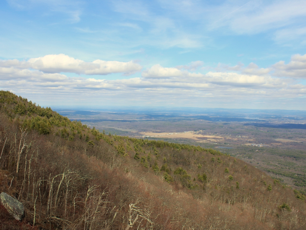
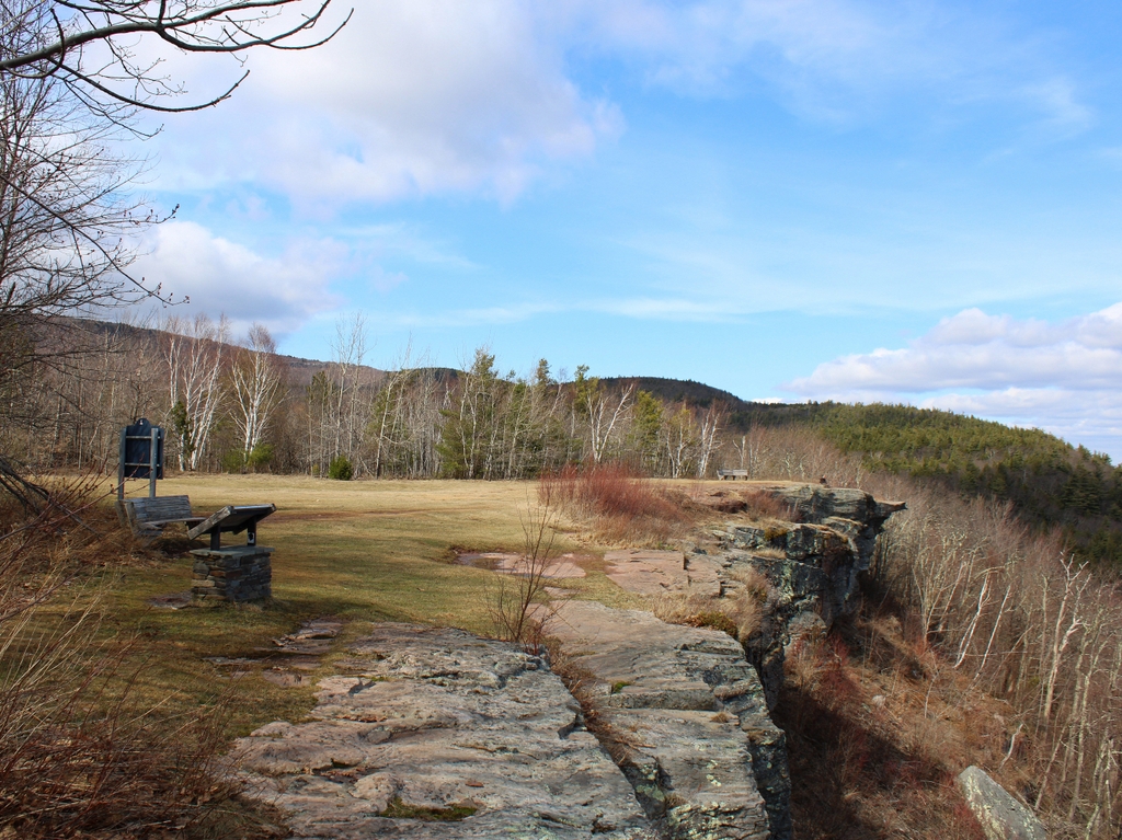
Today, more than a century after the first photo was taken and nearly two centuries after the Mountain House was built here, there is little evidence of its existence here. The site of the hotel is now an open field, and perhaps the only real signs of its longtime prosperity are the many names and initials scrawled into the rocks here along the cliff. However, while there are no longer any grand 19th century resort hotels here, this area remains a popular destination for visitors to the Catskills, who continue to visit places like Kaaterskill Falls, the lakes, and the many scenic overlooks along the escarpment. The only overnight accommodations are campsites at the nearby North-South Lake Campground, which is a very different experience from staying at the Mountain House, yet it is perhaps more in keeping with the way that early visitors like Timothy Dwight would have seen this area in the early 19th century.
For further information, I would highly recommend The Catskill Mountain House by Roland Van Zandt, published in 1966. This book is well-researched and well-written, and contains detailed information about the Mountain House, the surrounding landscape, and its role in influencing the artists of the Hudson River School, along with many images of the abandoned hotel taken by the author in the early 1960s. It was a valuable resource for writing this blog post, and I would recommend it to anyone interested in the history of the Catskills.