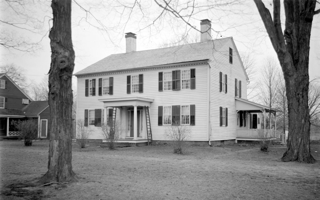
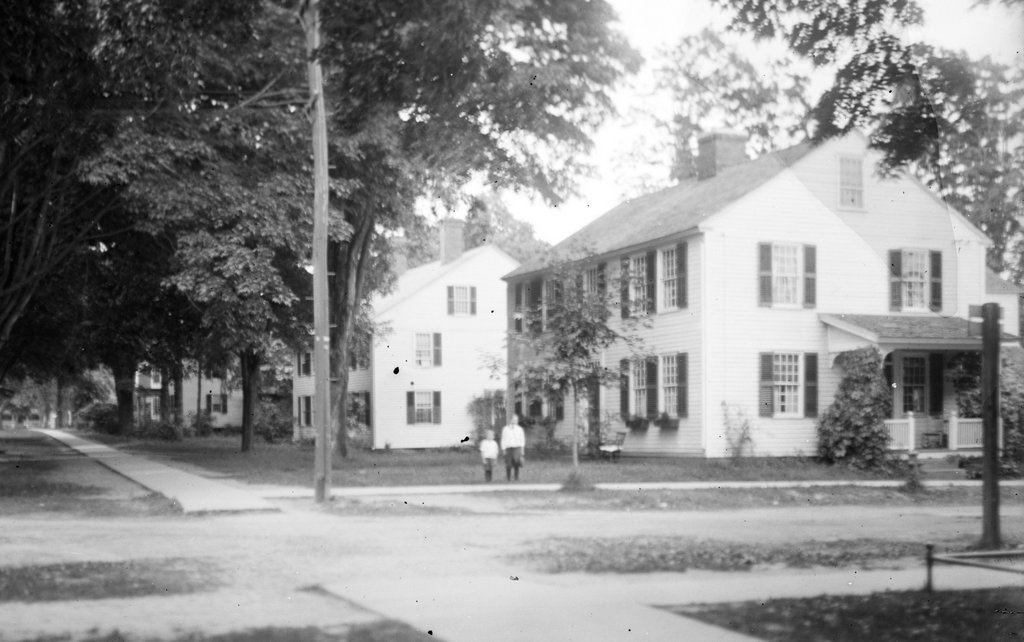
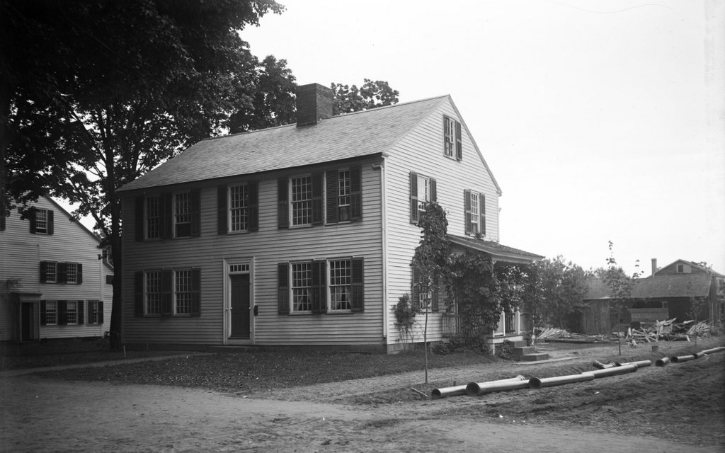
The house at 787 Longmeadow Street in Longmeadow, around 1883. Image from Proceedings at the Centennial Celebration of the Incorporation of the Town of Longmeadow (1883).
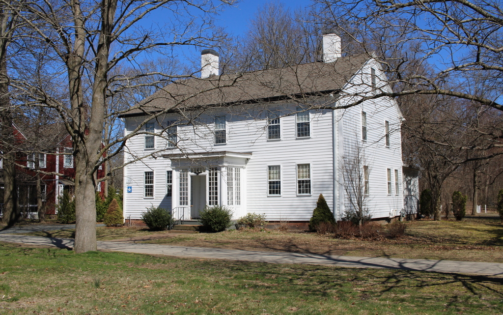
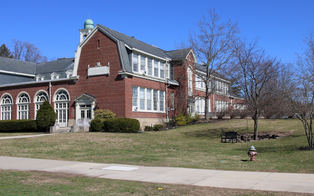
The house in 2024:
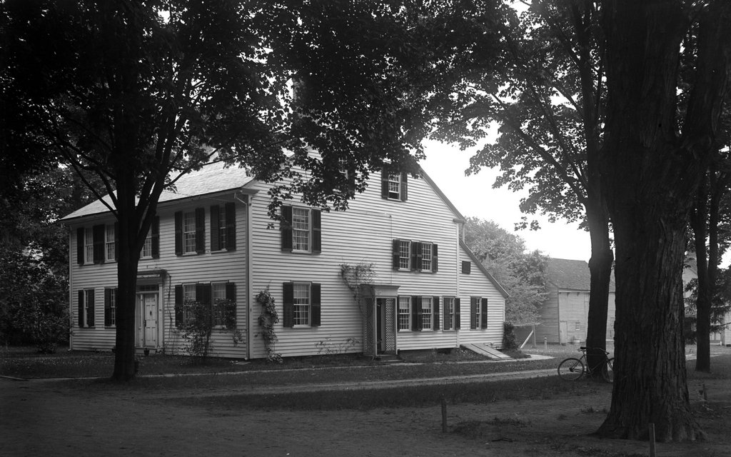
This house was built in 1735 as the home of Captain Simon Colton (1709–1796), shortly before his 1736 marriage to Abigail Burt (1714–1760). Its design was typical for homes of this period, including a front facade with four windows on the first floor and five on the second floor, a central chimney, and a saltbox-style roof in the back of the house. Simon and Abigail had 12 children, 7 of whom lived to adulthood, and after Abigail’s death in 1760, Simon remarried to Rebecca Hale (1717–1803).
Simon and Abigail’s son, Major Luther Colton (1756–1803), subsequently inherited the house. He lived here with his wife, Thankful Woolworth (1759–1797), and they had 9 children, one of whom died in infancy. After Thankful’s death in 1797, Luther remarried to Mehitable Deming (1763–1856) in 1799. She was a widow from Rocky Hill, Connecticut, and she had four children of her own. They would have two more children of their own, before Luther’s death in 1803.
Mehitable lived here for the rest of her life, and it would remain in her family throughout the 19th century. Her granddaughter, Elizabeth Parker Colton (1823–1898), later inherited the house, and she owned it when the top photo was taken in the early 1880s. Also visible in this photo is a massive elm tree in the front of the house, which may have been even older than the house itself.
In 1906, Elizabeth’s brother Simon Parker sold the house to T. W. Leete, who briefly owned it before selling it in 1908 to Julia Colton Allen, a granddaughter of Major Luther Colton. At some point in the early 20th century, the wing on the south side of the house was significantly expanded. The 1880s photo shows a one-story wing on the right side, but photographs from the 1910s (such as a 1918 photo that was featured in a previous post) show a two-story wing.
The Colton descendants continued to own the house until 1935, when they transferred it to the Society for the Preservation of New England Antiquities. This organization, which is now known as Historic New England, has since sold the house, and it is once again privately owned. However, the sale includes several stipulations, including that the front facade cannot be changed and that it must always be painted red.
Today, the house stands as perhaps the oldest surviving house in Longmeadow, and it is a good example of the saltbox style that was popular in the Connecticut River Valley during the mid-18th century. It is one of the many historic homes that line the Longmeadow Green, and it is an important town landmark that is featured on the town’s official seal. Along with the other homes on the Green, it is part of the Longmeadow Historic District, which was added to the National Register of Historic Places in 1982.